

LONDON — The current typhoon season in the Northwest Pacific Ocean is rapidly shaping up to be one of the most violent and intense meteorological periods on record. Driven by a strengthening El Niño climate system and unusually elevated ocean temperatures, major forecasting agencies have significantly revised their seasonal projections upward, warning of an “exceptionally active” cycle that poses severe threats to coastal economies across East and Southeast Asia.
According to the latest outlook published by London-based commercial forecaster Tropical Storm Risk (TSR), typhoon development across the Northwest Pacific is now expected to run a staggering 60% above the historical 30-year norm. The dramatic recalibration highlights an escalating climate volatility that is beginning to manifest in real-time across regional shipping lanes, agricultural belts, and densely populated coastal mega-cities from Shanghai to Manila.
Main Facts
The overarching narrative of the 2026 Northwest Pacific typhoon season is defined by extreme statistical anomalies and powerful thermodynamic drivers. TSR’s updated forecast presents a sobering outlook for nations in the path of these tropical systems, which include China, Japan, the Philippines, and Vietnam.
Key metrics defining the current outlook include:
- Total Projected Typhoons: Forecasters predict a total of 20 typhoons will form within the basin during the active season.
- Intense Systems: Out of those 20 projected storms, 13 are expected to reach "intense" classifications, packing destructive winds and torrential rainfall.
- Historical Comparisons: These figures mark a substantial upward revision from May and July projections, and sit well above the 10-year historical averages of 14.2 total typhoons and 8.4 intense systems.
- Catastrophic Precursors: The region has already experienced extraordinary early-season intensity, having recorded three rare Category 5 typhoons as of August 1.
- Atmospheric Drivers: The primary catalysts for this hyper-active season are a rapidly developing and intensifying El Niño event, combined with the weakest trade winds observed in the Pacific basin in over six decades.
These meteorological forces have created a dangerous synergy between warming ocean waters and atmospheric circulation, dramatically lowering the friction and wind shear that typically disrupt fledgling storm systems.
Chronology of the 2026 Season
While Asia’s tropical cyclone season traditionally runs from June through October—though destructive systems can occasionally form outside these windows—the 2026 timeline has exhibited unusual aggression from its earliest phases.
Pre-Season and Early Summer (May – June)
Initial long-range models released in late spring pointed toward an active season, primarily due to rising sea-surface temperatures across the equatorial Pacific. However, as trade winds faltered far below historical baselines, forecasters began registering unprecedented thermal energy retention in the upper ocean layers. By the time June arrived—the traditional onset of the season—the stage was set for rapid cyclogenesis.
Mid-Summer Escalation (July – Early August)
The intensity of the season became starkly apparent by mid-summer. As of August 1, the Northwest Pacific had already spawned three Category 5 equivalent typhoons—an alarming frequency for so early in the cycle.
Over the first weekend of August, Typhoon Dolphin made a high-profile landfall along the Chinese coast, bringing torrential rains and gale-force winds before quickly dissipating over rugged terrain. Despite Dolphin’s demise, the breathing room for regional emergency services was short-lived. By Tuesday, two named tropical storms were actively churning across the open waters of the Pacific. One of these systems was projected to make a direct and hazardous strike on Japan later that same day, prompting immediate disaster-preparedness protocols. Concurrently, the United States Joint Typhoon Warning Center (JTWC) reported that it was closely tracking yet another developing tropical depression in the eastern reaches of the basin, signaling that the assembly line of storms shows no signs of slowing down.
Supporting Data and Meteorological Analysis
The scientific consensus underpinning these grim forecasts revolves around a complex coupling of oceanic and atmospheric phenomena. Adam Lea, manager at Tropical Storm Risk, detailed the mechanics behind the severe outlook in the group’s August report.
“A strong El Niño event has developed and is forecast to intensify further through the rest of summer and autumn,” Lea wrote, emphasizing that this climatic shift would exert “a strong enhancing effect” on the entirety of the typhoon season.
The El Niño Factor
El Niño is characterized by the warming of surface waters in the central and eastern tropical Pacific Ocean. In the Northwest Pacific, a strong El Niño typically alters atmospheric pressure patterns, shifting the primary areas of deep convection and tropical storm formation further east and south. This provides storms with broader expanses of warm ocean water to traverse, fueling their intensification before they make landfall.
Ocean-Sky Coupling and Trade Winds
Compounding the El Niño effect is an unusual breakdown in atmospheric circulation. According to meteorological data cited by TSR, the region has recently experienced the weakest trade winds recorded in more than sixty years.
Trade winds normally act as a natural brake on developing tropical systems, introducing friction and upper-level wind shear that can tear apart the organized convection required to form a typhoon. The absence of these winds indicates that the atmosphere is deeply synchronized with record-breaking Pacific Ocean temperatures. This "ocean-sky coupling" removes natural atmospheric barriers, allowing moisture and heat to feed continuous, unchecked storm growth.
A Tale of Two Basins
Interestingly, the meteorological factors making the Pacific a powder keg are having the exact opposite effect on the other side of the globe. While the Northwest Pacific braces for a record-shattering season, the Atlantic basin is tracking for a comparatively quiet hurricane season. In the Atlantic, the same El Niño conditions that supercharge Pacific storms are generating near-record wind shear and dry air masses, systematically suppressing tropical cyclogenesis in the Caribbean and the Gulf of Mexico.
Official Responses and Regional Preparedness
With a high probability of multiple severe strikes looming over the next several months, governments, disaster management agencies, and critical infrastructure operators across East and Southeast Asia have elevated their alert statuses.
National Meteorological Services
- Japan: Meteorological authorities have ramped up public advisories, urging coastal communities to inspect evacuation routes and secure loose outdoor property as incoming storms approach the mainland. Emergency services remain on high alert following warnings that rapid intensification near the coast leaves little warning time.
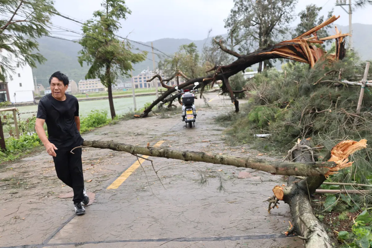
- China: Following the disruptive passage of Typhoon Dolphin in Zhejiang province—where cleanup crews have been working tirelessly to clear downed timber and restore power lines—provincial flood control headquarters have ordered heightened vigilance. Local governments are conducting preventative inspections of seawalls, agricultural drainage systems, and urban stormwater infrastructure.
- Philippines and Vietnam: Disaster management councils in nations frequently battered by western Pacific storms are prepositioning emergency relief supplies, reinforcing shelters, and reviewing evacuation plans for vulnerable low-lying and mountainous communities prone to flash floods and landslides.
The Insurance and Maritime Sectors
Commercial entities are likewise scrambling to adjust to the heightened risk profile. Global re-insurers and maritime logistics firms are re-evaluating route planning for cargo vessels navigating the South China Sea and the Philippine Sea. Marine underwriters are bracing for potential spikes in claims related to port disruptions, cargo damage, and hull losses, referencing warnings that the frequency of Category 5 storms increases the systemic financial exposure across the entire region.
Socio-Economic Implications
The projected surge in intense typhoons carries profound implications for the socio-economic stability of the affected countries. Typhoons—scientifically classified as tropical cyclones, sharing the same underlying physics as Atlantic hurricanes—are among the most destructive natural phenomena on Earth.
Agriculture and Food Security
Prolonged heavy rainfall and high winds during peak harvest seasons threaten vital agricultural outputs across Southeast Asia. Rice paddies, fruit orchards, and aquaculture installations in Vietnam, the Philippines, and southern China are particularly vulnerable to inundation and saltwater intrusion. Crop failures driven by severe weather can trigger localized food inflation and strain regional supply chains.
Infrastructure and Urban Resilience
As urbanization accelerates across coastal Asia, millions of residents now live in mega-cities built on reclaimed land or major river deltas. The combination of intense storm surges, torrential inland downpours, and rising baseline sea levels creates a compounding risk profile. The 2026 season’s high proportion of intense (Category 4 and 5 equivalent) systems means that even modern civil engineering standards will be rigorously tested. Cities will face severe challenges regarding urban drainage capacity, electrical grid resilience, and mass evacuation logistics.
Long-Term Economic Drag
Beyond immediate emergency response costs—ranging from search-and-rescue operations to temporary housing for displaced populations—recurrent natural catastrophes impose a heavy fiscal toll on developing and developed nations alike. Governments are increasingly forced to divert capital expenditures away from long-term infrastructure development and social programs toward disaster recovery and climate adaptation projects.
As the Northwest Pacific moves deeper into the peak months of the 2026 season, the convergence of record ocean warmth, a dominant El Niño, and collapsing trade winds serves as a stark reminder of the mounting volatility within global weather systems. For the millions living in the shadow of these massive tropical engines, the coming months will require unprecedented vigilance, preparation, and international cooperation.
