

Main Facts
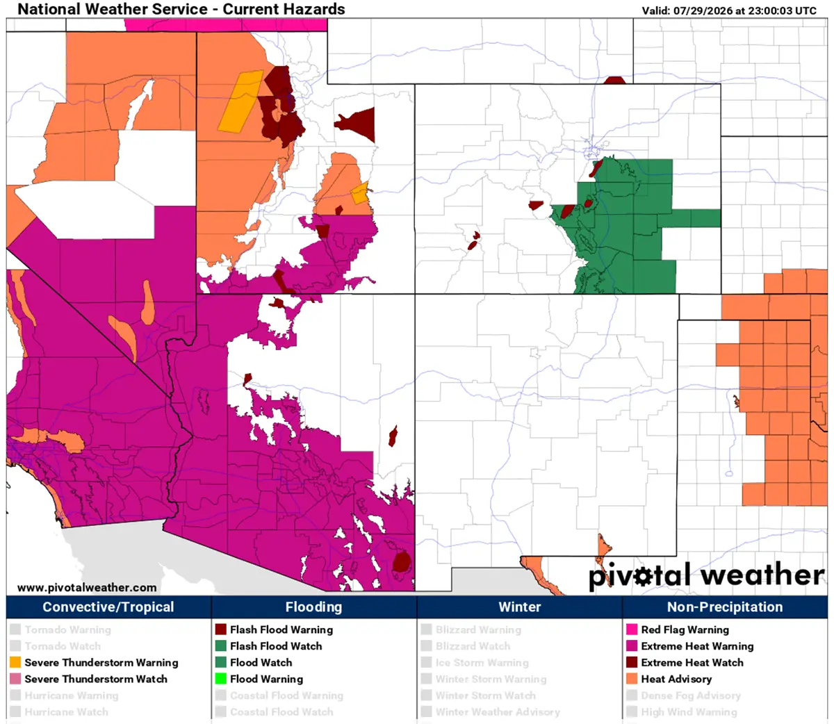
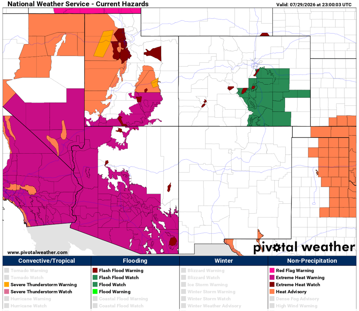
A formidable and high-amplitude upper-level ridge has locked a massive, multi-week Heat Dome across the United States and southern Canada, driving peak afternoon temperatures past 105°F to 110°F through early August. Supported by deep atmospheric compression, this persistent warm plume has sent upper-air thermal anomalies into the 99th percentile, stretching dangerously high heat indices from Southern California across the Great Plains and up into the Mississippi Valley.
The atmospheric engine behind this prolonged thermal spike is a stubborn, slow-moving high-pressure system trapped over the western and central states. Desert basins are bearing the brunt of the extreme conditions, with peak daytime highs forecast to reach a blistering 115°F to 120°F. Meanwhile, major urban corridors face an exhausting lack of nocturnal relief, with overnight lows struggling to drop below 75°F to 80°F.
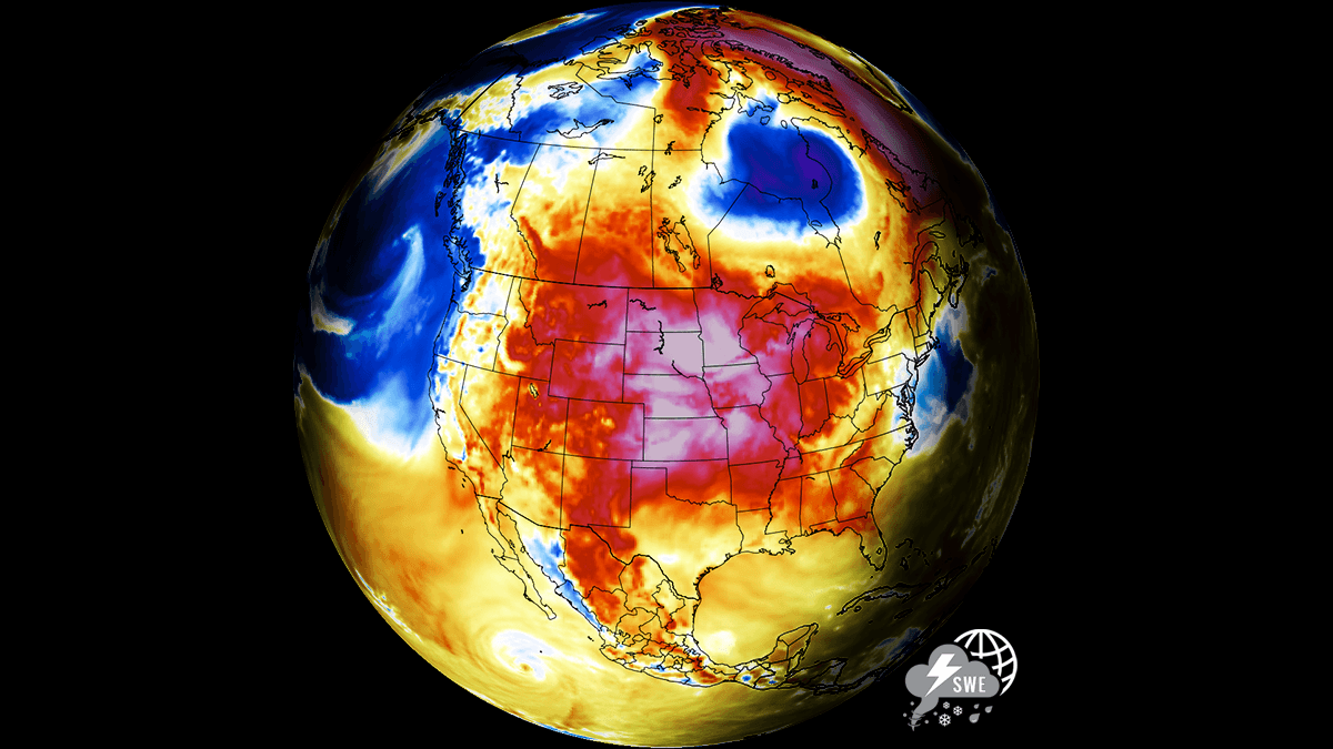
This absence of nighttime cooling compounds physiological strain on vulnerable populations, skyrockets power grid demand, and rapidly accelerates soil moisture depletion across critical agricultural belts in North America.
Atmospheric Dynamics: How High-Pressure Heat Domes Compress and Trap Air
To understand the severity of the current meteorological event, meteorologists look to the mechanics of the heat dome itself—a phenomenon that frequently dictates extreme summer weather patterns across North America and Europe.
The Lid on the Atmosphere
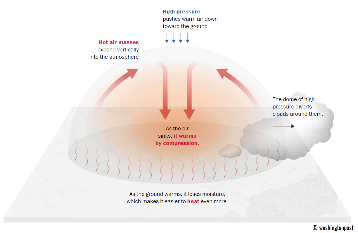
A heat dome forms when a broad, stagnant area of high-pressure air parks itself over a large portion of a continent for an extended period—often lasting several days to multiple weeks. The system functions identically to a lid on a pot of boiling water.
- Upper High Formation: An upper-level ridge pattern (often referred to as a blocking high) develops in the higher altitudes of the troposphere.
- Subsiding Air: Layers of warm air are forced downward toward the ground through a process known as atmospheric compression.
- Surface Heating: As the sinking air is compressed, it warms adiabatically. This trapped air mass becomes anomalously warm at the lowest elevations and exceptionally hot near the surface.
Because the pattern is remarkably stable, it prevents the formation of cooling clouds or rain-producing thunderstorms, creating a self-reinforcing cycle of baking sunshine and surface heating.
Synoptic Setup: A Multi-Week Progression Across the Western and Central U.S.
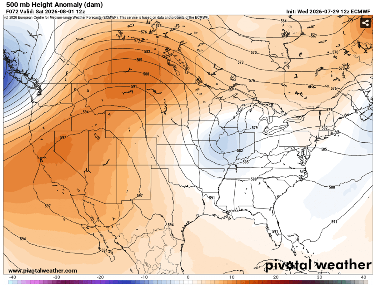
The broader synoptic weather pattern over the contiguous United States through early August highlights a dominant, persistent upper-level ridge sitting squarely over the Western U.S., the Northern Rockies, and extending into southern Canada (including Alberta and Saskatchewan). To the east of this massive atmospheric block, a shallow low-pressure system is currently tracking eastward from the mid-Mississippi Valley toward the Southeast U.S.
Day-by-Day Progression
- Mid-Week (Thursday): The air mass beneath the core of the heat dome begins intensifying across California, Arizona, Nevada, Utah, Idaho, Wyoming, and Montana. Surface readings across the Great Plains climb into the upper 90s to around 103°F, with the most extreme values concentrated from Texas across Oklahoma and into Kansas.
- The Weekend Peak (Saturday & Sunday): The heat dome reaches its maximum strength aloft over Montana, Wyoming, and the western Dakotas. Afternoon peaks in these regions are projected to surge from 103°F to nearly 110°F. In the desert Southwest, daytime highs are locked firmly between 112°F and 120°F. Across the central Plains, temperatures remain stubbornly stuck in the low-to-mid 100s.
- Early Next Week (Monday): The hottest air mass shifts slightly toward the central and southern Plains, sustaining peak temperatures of 100°F to 105°F across New Mexico, Texas, and the Colorado High Plains, while the Southwest continues to bake.
Relief on the Horizon
Global weather forecasting models indicate a potential pattern shift by mid-week. A developing frontal system originating in Canada is projected to move eastward, introducing cooler air masses that will gradually ease temperatures across the northern High Plains.
Supporting Data and Temperature Anomalies
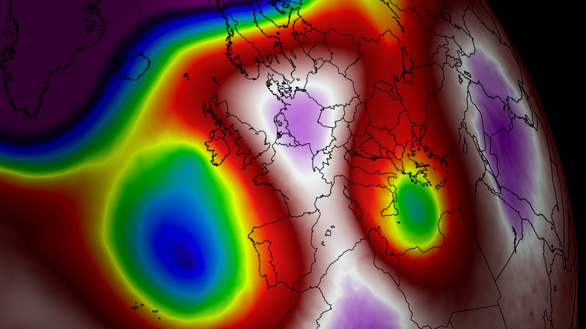
The scale of this heat wave is underlined by stark numerical data tracked by meteorological agencies using tools like 850 hPa temperature anomaly charts:
- 850 hPa Anomalies: Upper-air thermal anomalies are hovering in the 99th percentile, indicating a deeply anomalous air mass that is historically rare for this time of year.
- Surface Temperature Extremes:
- Desert Southwest Valleys: 115°F – 120°F
- Northern High Plains & Montana: 103°F – 110°F
- Southern Plains (Texas, Oklahoma, Kansas): 100°F – 105°F+
- Nighttime Lows: Urban centers in the Southwest and Plains are failing to drop below 75°F to 80°F, preventing human bodies and buildings from shedding accumulated heat.
Health Implications and Vulnerable Populations
The persistence of extreme heat domes carries severe public health ramifications. Prolonged exposure to high temperatures and humidity creates a hazardous environment where the human body can no longer efficiently cool itself through perspiration.
Physiological Risks
- Heat Exhaustion and Heat Stroke: Extended outdoor exposure frequently leads to dehydration, severe dizziness, confusion, and—in acute cases—fatal heat stroke.
- Cardiovascular and Respiratory Strain: Medical studies consistently link multi-day heatwaves to elevated rates of heart attacks, strokes, and exacerbated respiratory illnesses.
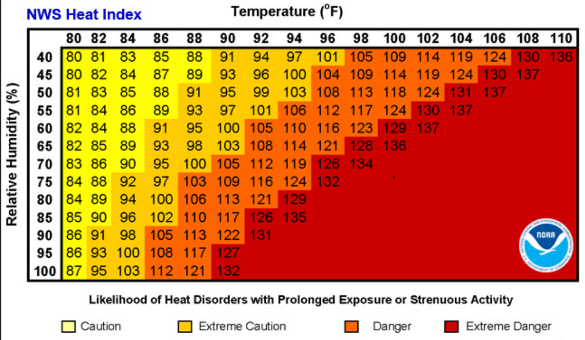
- The Heat Index Factor: High relative humidity dramatically alters how the human body perceives temperature. For instance, when ambient air temperatures reach 90°F with humidity levels exceeding 80%, the human body experiences a "feels-like" heat index of approximately 113°F, rapidly accelerating heat-related illnesses.
Socioeconomic Disparities
Vulnerability to heat domes is not evenly distributed across society:
- Outdoor Workers: Construction workers, agricultural laborers, and delivery personnel face heightened occupational hazards due to long hours exposed directly to solar radiation.
- Urban Heat Islands: Low-income populations living in densely populated urban environments are disproportionately impacted. Their neighborhoods often feature fewer green spaces and are constructed with heat-absorbing materials like concrete, asphalt, and dark roofing (such as asbestos composites), which trap and slowly release heat long after sunset.
Power Grid and Agricultural Implications
Beyond human health, the massive scale of the heat dome threatens vital critical infrastructure and economic sectors:
- Grid Strain: Air conditioning demand spikes exponentially during multi-week heat events. Utilities face severe pressure to prevent rolling blackouts as transformers and power lines operate near or above their thermal capacity.
- Agricultural Stress: The combination of record-breaking daytime temperatures and lack of precipitation is rapidly depleting soil moisture across the major agricultural belts of the U.S. and Canada. Rain-fed crops face premature desiccation, threatening yields for corn, soy, and wheat, while livestock operations must implement emergency cooling protocols to prevent heat stress and mortality among herds.
Meteorologists and emergency management officials continue to monitor the evolution of this historic weather pattern, urging residents in affected zones to heed excessive heat warnings, stay hydrated, and utilize designated cooling centers until the atmospheric block finally breaks down.
