

WASHINGTON — The American construction industry is experiencing a paradoxical boom. Driven by a surge in demand for residential housing, critical national infrastructure, and high-tech industrial facilities—such as semiconductor fabrication plants ("fabs"), advanced battery gigafactories, and reshored manufacturing hubs—builders are busier than ever. Concurrently, federal funding injections via legislative packages like the Infrastructure Investment and Jobs Act have unleashed a wave of capital into highway, bridge, and port development.
Yet, beneath this healthy pipeline of non-residential and civil projects lies a compounding vulnerability: a persistent skilled labor shortage. Construction firms are forced to cover more ground with fewer personnel, operating on tightening margins where the tolerance for costly surprises is virtually non-existent.
This operational squeeze is exposing long-standing vulnerabilities in how projects monitor job site realities. While the industry has aggressively modernized its design, modeling, and management workflows through sophisticated software suites like Building Information Modeling (BIM), the fundamental method of visualizing physical job sites has barely evolved. For generations, project teams have relied on quarterly survey crews or a superintendent walking the perimeter with a smartphone each morning.
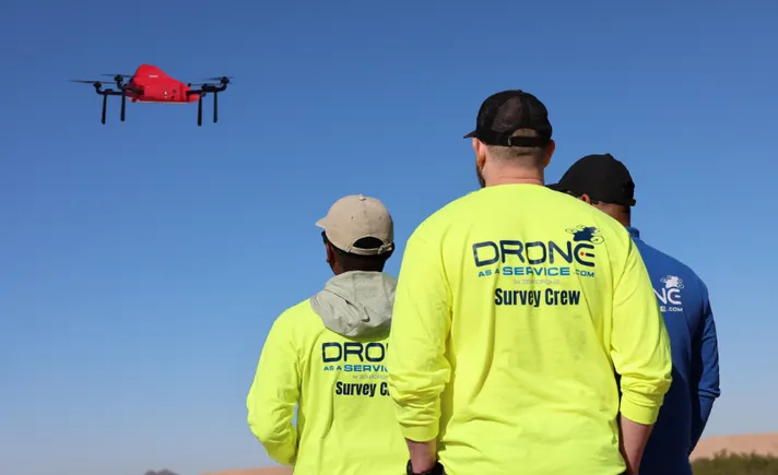
Between these sporadic snapshots, critical errors, unexpected site conditions, and pacing bottlenecks often go completely unnoticed—until they materialize as missed milestones, expensive rework, or on-site safety incidents. To bridge this visibility gap, the industry is increasingly turning to advanced aerial data collection, and specifically, the rising operational model of Drone as a Service (DaaS).
Chronology of Site Visibility: From Manual Chains to Autonomous Skies
Understanding the necessity of modern aerial intelligence requires looking at how job site documentation has transformed over the past century.
- Pre-Digital Era (Mid-20th Century): Surveying relied entirely on optical instruments, physical chain measurements, and manual notebook logs. Capturing a comprehensive topographic profile of a medium-sized civil project could take weeks, making frequent updates financially and logistically impossible.
- The CAD and Total Station Revolution (Late 20th Century): The introduction of Computer-Aided Design and electronic distance measurement (EDM) total stations drastically improved measurement precision. However, these tools remained labor-intensive, requiring dedicated survey specialists on-site for extended periods.
- Early Commercial Drone Adoption (2010s): Unmanned Aerial Systems (UAS) entered the construction market as novelties. Early adopters attempted to build in-house drone programs, buying off-the-shelf hardware, training internal personnel, and navigating complex Federal Aviation Administration (FAA) compliance frameworks. While effective for individual tech-forward firms, the high overhead stalled widespread adoption across mid-sized contractors.
- The Rise of Drone as a Service (Present Day): Recognizing that construction firms want actionable intelligence rather than the administrative headache of managing an aviation fleet, the market has pivoted toward subscription-based, end-to-end aerial data models. DaaS providers manage everything from pilot scheduling and regulatory compliance to cloud-based data processing, turning high-frequency aerial scans into standard operational procedure.
Supporting Data: Speed, Safety, and the Economics of Error
The economic argument for integrating recurring aerial intelligence into construction management rests on three pillars: speed of data turnaround, risk mitigation, and early error detection.
The Mathematics of Rapid Surveying
Traditional ground-based surveying of a 20- to 40-acre development parcel typically requires a field crew anywhere from several days to two weeks to collect sufficient topological data. Conversely, a single commercial drone deployment can map the exact same acreage in less than a day. Combined with cloud-based photogrammetry software, actionable terrain models can be generated, verified, and delivered within 48 hours of flight completion.
This dramatic reduction in cycle time fundamentally changes project oversight. Instead of relying on a monthly or quarterly snapshot, project managers receive recurring digital twins of their job sites. This frequency ensures that if a subcontractor pours concrete out of alignment or grading crews miscalculate a drainage slope, the discrepancy is identified within days—not after weeks of subsequent work have been built on top of the mistake.
Cost Dynamics of Rework
In construction, the cost of an error scales exponentially with the time it takes to discover it. A drainage conflict, a misaligned foundation grade, or a minor discrepancy between as-built conditions and original design documents can often be resolved with minimal friction during early site preparation.
However, if those same errors remain hidden until vertical construction is underway, they trigger a cascade of negative financial consequences:
- Direct Rework Costs: Demolition, material waste, and re-execution labor.
- Contractual Disruption: Formal change orders, administrative overhead, and potential legal disputes between owners, general contractors, and trade partners.
- Schedule Ripple Effects: Delayed downstream milestones that can trigger liquidated damages or push project completion past seasonal weather windows.
- Indirect Costs: Extended equipment rentals, elongated site supervision expenses, and diverted managerial focus.
Hazard Reduction on the Job Site
Beyond financial metrics, the construction sector faces an ongoing crisis regarding worker safety. Traditional surveying and inspection methods routinely place personnel in high-risk environments: navigating open excavations, traversing unstable slopes, walking near heavy earth-moving equipment, climbing scaffolding, inspecting roofs, and entering confined spaces.
By utilizing autonomous or semi-autonomous drone flights configured with LiDAR and high-resolution optical sensors, contractors can capture survey-grade measurements and high-definition visual perspectives from safe vantage points. Removing personnel from hazardous zones directly translates to lower incident frequencies, fewer medical claims, reduced workers’ compensation insurance premiums, and minimized operational downtime resulting from safety investigations.
Industry Perspectives and Official Responses
As DaaS becomes more deeply embedded in commercial, industrial, and civil construction, project stakeholders are noting a cultural shift in how data is utilized across project tiers.
"For decades, construction management has operated on subjective updates and delayed visibility," notes a senior project executive at a national general contracting firm. "When an owner asks for a status report, you traditionally hand them a narrative update accompanied by a few ground-level photos taken on an iPhone. Today, clients, lenders, and corporate executives expect defensible, time-stamped, geo-referenced data. They want to see the 3D point cloud, verify the cut-and-fill volumes themselves, and confirm that the schedule aligns with physical reality."
Engineering firms have similarly welcomed the integration of clean, CAD-ready data produced by modern aerial platforms. Rather than reconciling conflicting field measurements submitted by various trade partners, engineers can pull unified orthomosaic maps and terrain models directly into their design software.
Furthermore, trade associations point out that outsourcing aerial intelligence via a DaaS model democratizes technology access. While massive multinational engineering-construction conglomerates possess the capital to maintain dedicated internal aviation departments, regional and mid-sized contractors often cannot justify the capital expenditure of purchasing enterprise-grade UAV hardware, software licenses, insurance riders, and continuous FAA Part 107 pilot training. Subscription aerial services level the playing field, granting smaller firms enterprise-grade technological capabilities on a predictable, project-by-project operating budget.
Implications for the Future of Building
The transition from periodic ground-level inspections to continuous, high-frequency aerial intelligence marks a watershed moment for the construction sector. As the industry grapples with the macro-challenges of labor scarcity, compressed project schedules, and increasingly complex megaprojects, the margin for operational error is vanishingly small.
1. Unified Stakeholder Transparency
One of the most profound implications of widespread DaaS adoption is the creation of a "single source of truth." When general contractors, specialized trade engineers, and building owners all reference the exact same up-to-date site data, project friction diminishes. Disagreements over progress billing, milestone completions, and site conditions are easily resolved when backed by precise, time-stamped digital records.
2. Evolution of Project Management Skill Sets
As job sites become increasingly digitized, the profile of the modern construction manager is evolving. Proficiency in interpreting 3D point clouds, terrain elevation models, and orthomosaic mapping data is rapidly transitioning from a specialized niche skill to a core competency for field supervisors and project engineers.
3. Sustainability and Precision Earthwork
With environmental regulations tightening and the cost of diesel and heavy machinery rising, precision in earthwork is critical. Accurate cut-and-fill calculations derived from early LiDAR and drone mapping prevent the unnecessary transport of soil, reduce heavy equipment emissions, and optimize site grading from day one.
4. A Competitive Necessity
Reconciling design intent with actual site conditions in real time is no longer merely a technological luxury—it is emerging as a baseline competitive differentiator. Firms that embrace scalable, recurring aerial data collection are successfully outmaneuvering competitors bogged down by traditional, reactive site management workflows.
For construction companies looking to modernize their operational framework, reduce costly rework, and protect their workforce from unnecessary hazards, adopting scalable aerial intelligence represents a logical next step. To explore how subscription-based aerial data collection can elevate project execution, visit droneasaservice.com.
