

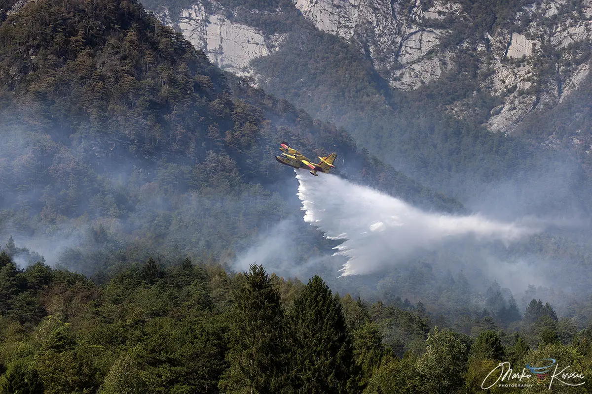
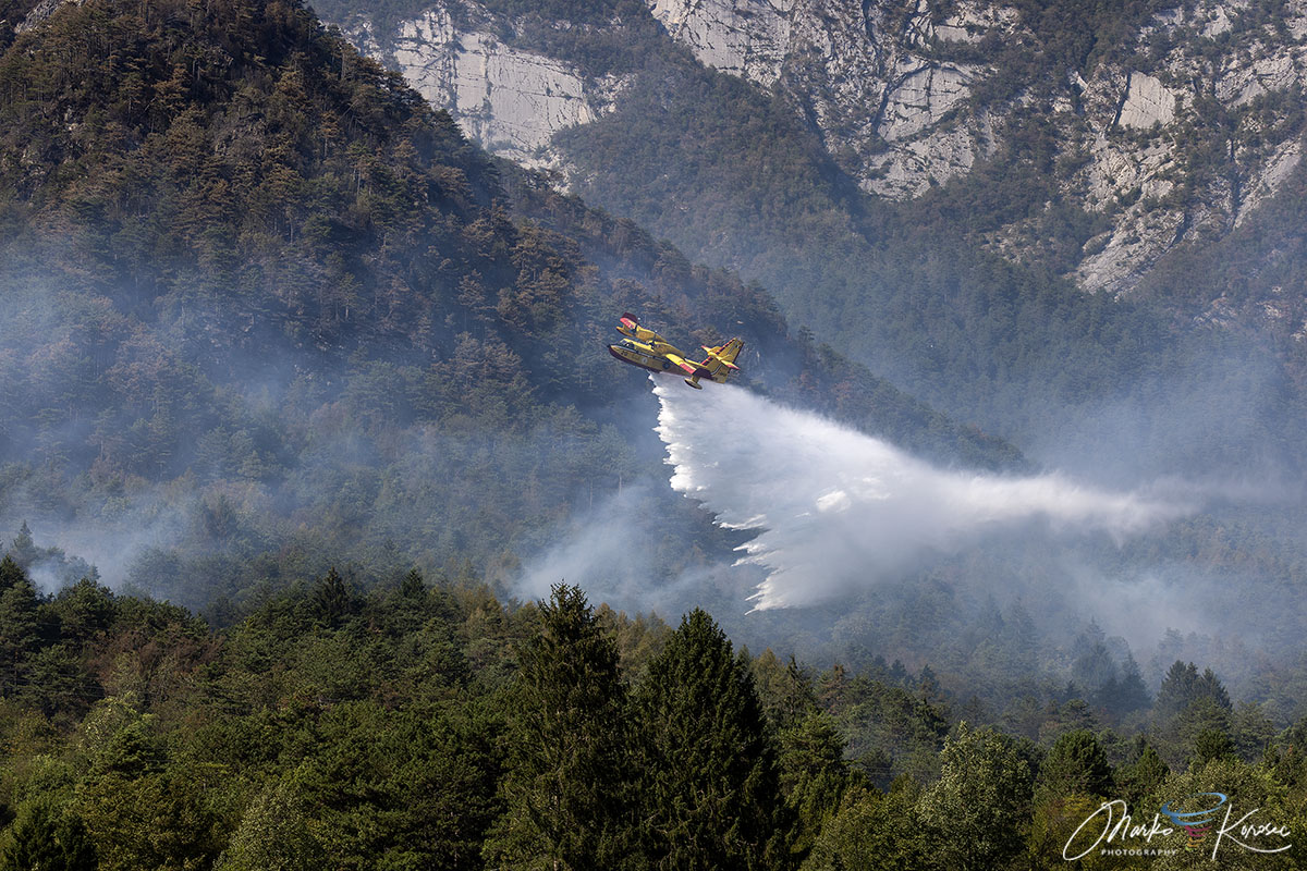
TOLMEZZO, ITALY — After ten days of relentless destruction, emergency responders have finally brought one of the most severe Alpine forest fires of the summer under control. The blaze, which scorched over 600 hectares of rugged terrain across Monte Amariana and Monte Amarianute in northeastern Italy’s Friuli-Venezia Giulia region, pushed dangerously close to residential areas, forced emergency evacuations, and mobilized a massive cross-border aerial firefighting fleet.
The crisis—exacerbated by a persistent regional drought, an unyielding European heat dome, and treacherous vertical limestone topography—was ultimately neutralized only when a long-awaited frontal system delivered over 100 to 150 millimeters of life-saving rainfall to the Tagliamento valley.

As local authorities transition from active suppression to thermal drone monitoring, environmental experts are looking closely at the cascading meteorological and geographical factors that turned a remote lightning strike into a raging, explosive mountain emergency.
Main Facts: Anatomy of an Alpine Disaster
The Monte Amariana wildfire will be remembered as a defining test of Italy’s civil protection framework and regional emergency response capabilities.
- The Scope of Destruction: More than 600 hectares of dense pine forest, brushwood, and historic mountain terrain were turned to ash across the Carnia region.
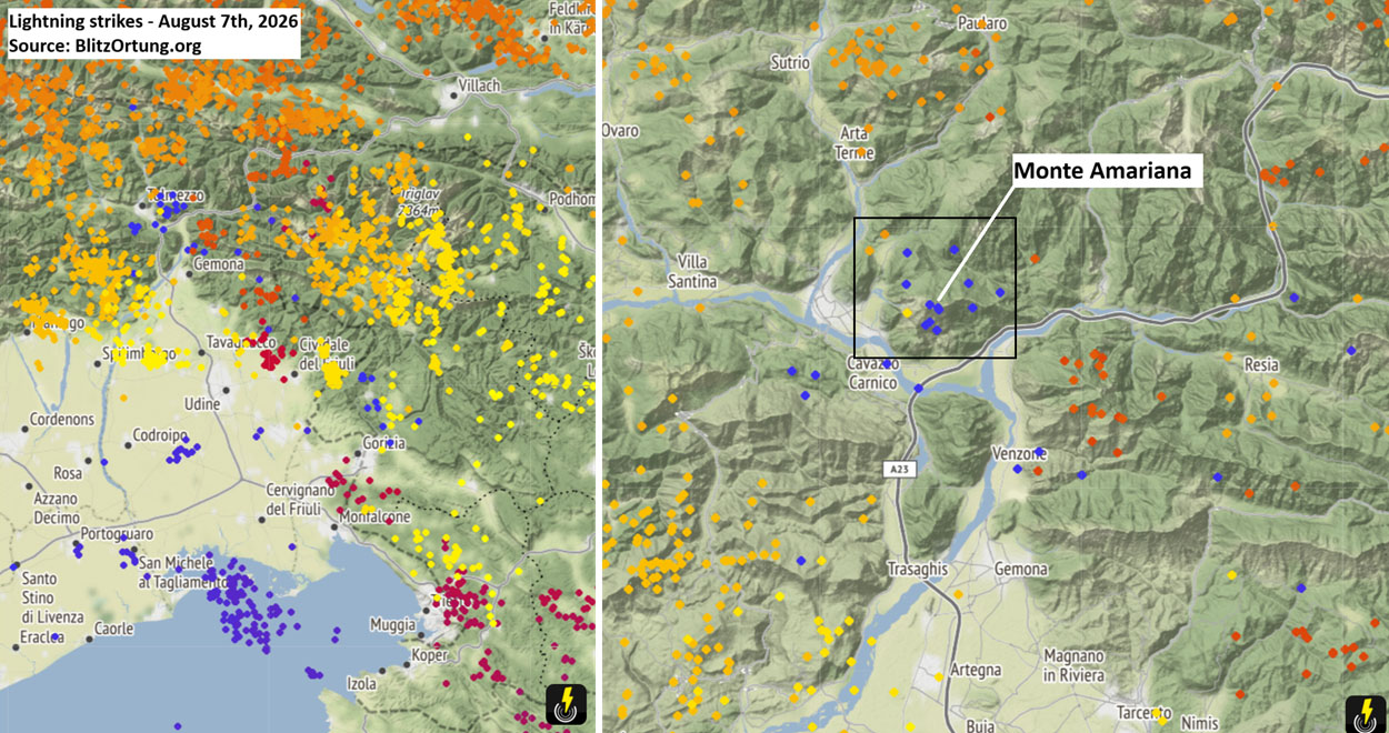
- The Ignition: The fire began as a low-key spark on the upper Cuel Feltron spur on August 7, 2026, triggered by a barrage of lightning strikes accompanying an unstable frontal wave.
- The Escalation: The situation turned critical on Ferragosto (August 15), when severe gusty downslope winds fanned the flames across the Rio Confine ridge, pushing the fire directly into the municipality of Tolmezzo.
- Threat to Communities: Flames advanced to within 50 meters of residential properties in the hamlet of Pissebus, triggering immediate emergency evacuations and the temporary deactivation of high- and medium-voltage power lines for public safety.
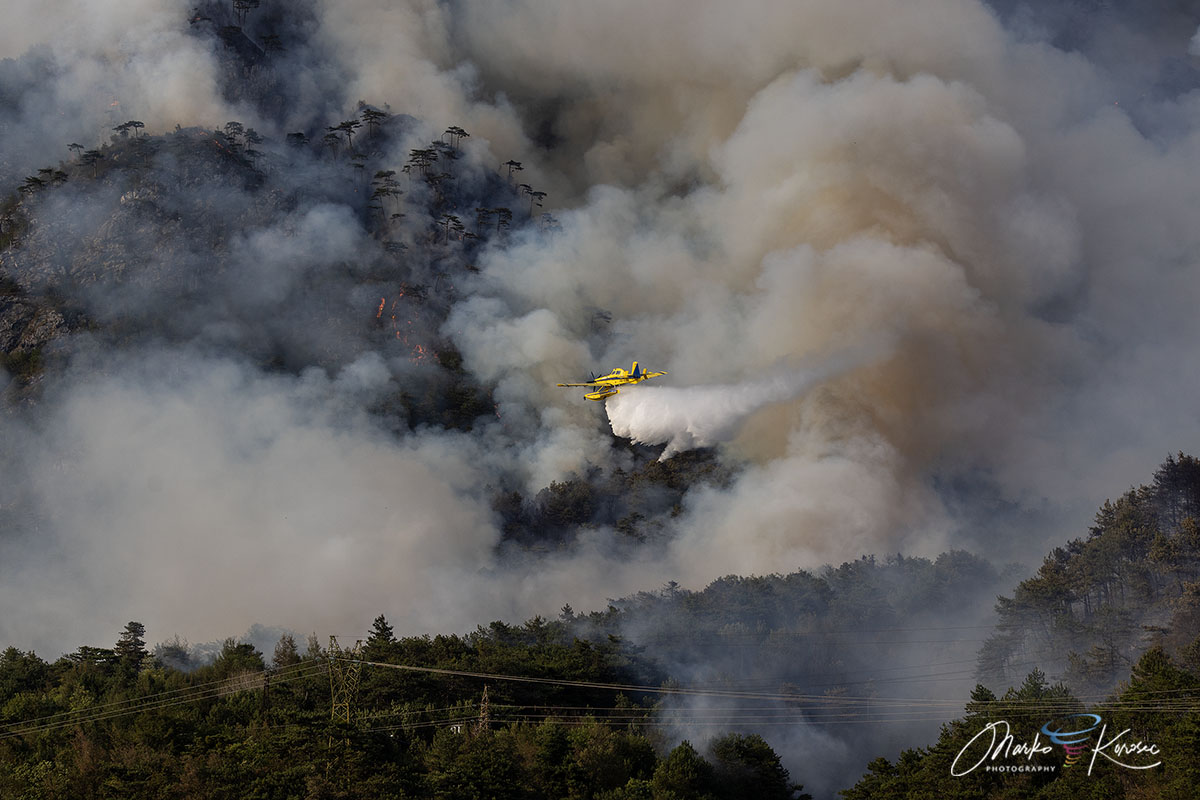
- The Response: A robust international and regional task force—featuring Italian Canadairs, Slovenian Air Tractor water bombers, regional helicopters, the Corpo Forestale Regionale, and the Vigili del Fuoco (Fire Department)—waged a grueling aerial and ground battle.
- The Resolution: A powerful storm system between August 20 and 22 delivered up to 200 mm of rain within 72 hours, completely extinguishing the active flame fronts and providing much-needed relief to the smoke-choked Tagliamento valley.
Geographical Profile & Mountain Topography
To understand why the Monte Amariana wildfire proved so difficult to contain, one must examine the unforgiving landscape of the Eastern Tolmezzo Alps.
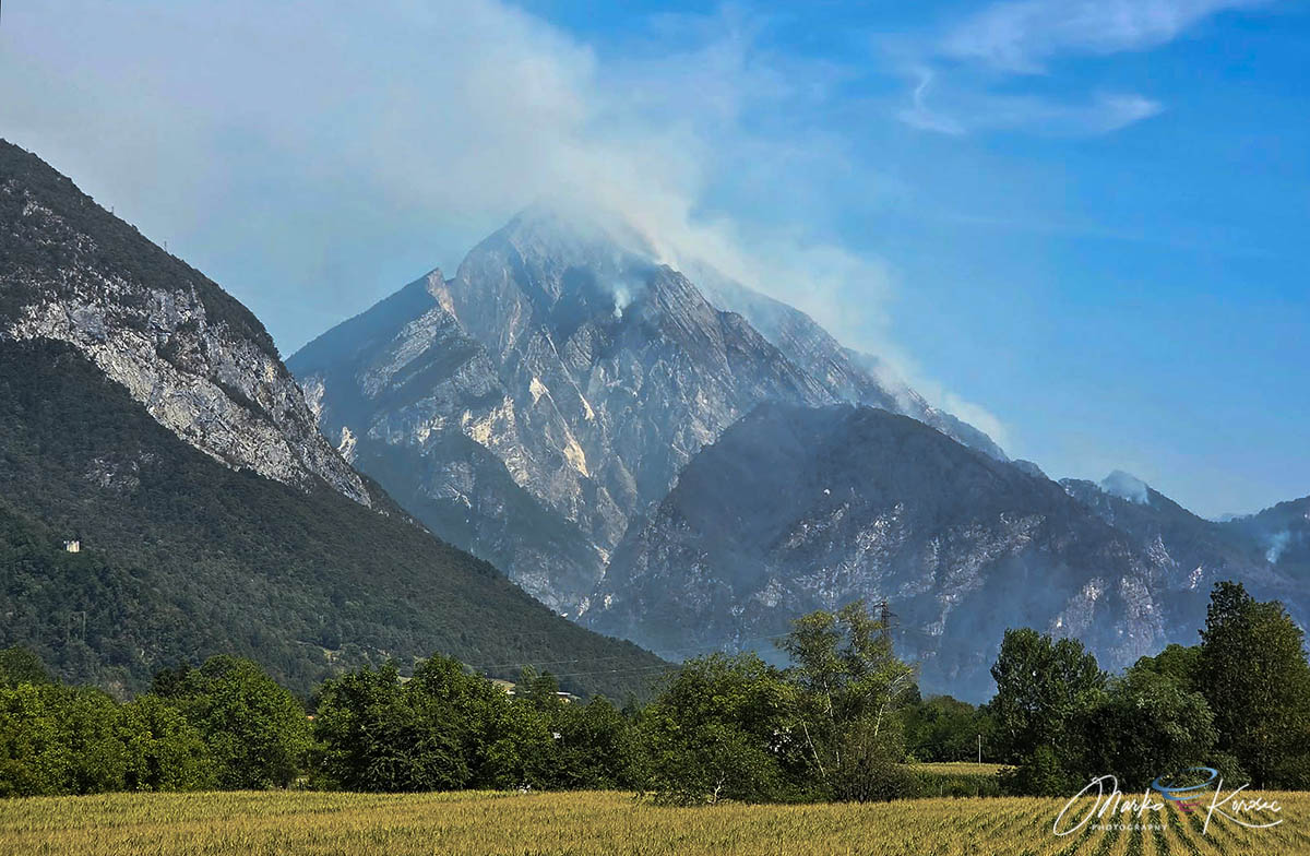
Monte Amariana rises as a distinctive, pyramid-shaped limestone peak reaching an elevation of 1,905 meters in the Carnia region of Friuli-Venezia Giulia. Its complex geography is defined by vertical karst and limestone cliffs, steep gradients, and dry pine needle beds composed predominantly of Pinus nigra (black pine).
The fire initially ignited on Cuel Feltron, a steep, highly elevated spur of Amariana towering directly above the town of Amaro. Because of the sheer verticality of the limestone cliffs, direct ground access to the upper sectors was virtually impossible. Firefighters on the ground were cut off by impassable terrain, forcing total reliance on aerial assets.
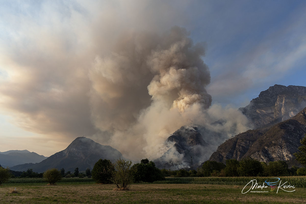
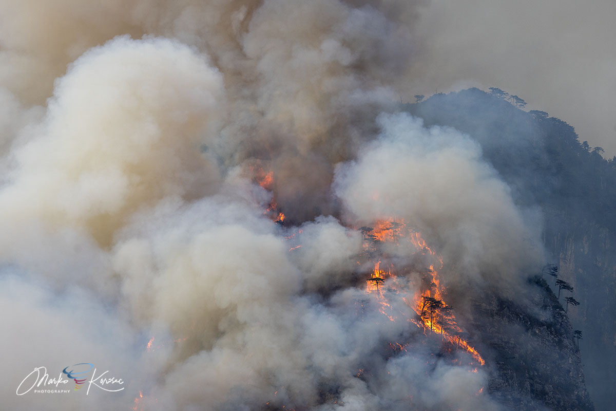
Furthermore, the combination of steep slopes and tinder-dry pine needles created a classic "chimney effect." As heat rose up the mountain, it sucked in oxygen from below, causing the fire to sprint vertically up the cliffs with explosive speed. This intense thermodynamic upward pull generated towering pyrocumulus clouds that could be seen for miles across the horizon, signaling to meteorologists just how much energy the wildfire was releasing into the atmosphere.
Chronology of the Crisis: From Spark to Suppression
The disaster unfolded in distinct phases, transitioning from a localized backcountry flare-up into a major civilian emergency over a ten-day period in August 2026.
Phase 1: The Spark (Early August)
In the opening days of August, Western and Central Europe were gripped by an intense heat dome that shattered seasonal temperature records. On August 7, as an unstable frontal wave passed over northeastern Italy, a series of lightning strikes hit the upper Cuel Feltron. While the strikes initially sparked smoldering fires in remote areas, the extreme dryness of the forest floor set the stage for delayed ignition.
Phase 2: The Ferragosto Explosion (August 15)
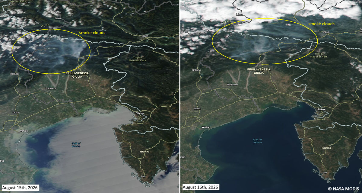
For roughly a week, the fire remained relatively contained in the upper elevations. However, everything changed on August 15—Italy’s major summer holiday of Ferragosto. A surge of gusty downslope winds swept across the region, supercharging the flames. The fire jumped the Rio Confine ridge and aggressively invaded Monte Amarianute, marching downward toward the outer hamlets of Tolmezzo, specifically targeting the Pissebus sector and the areas surrounding Illegio.
As the walls of fire closed in on residential neighborhoods, emergency services ordered immediate evacuations. Plumes of thick, toxic smoke poured into the Tagliamento valley, severely degrading regional air quality and turning the midday sky an apocalyptic orange.
Phase 3: The Aerial and Ground Stalemate (August 16–19)
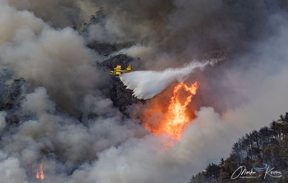
For nearly four days, the fire raged out of control along the cliffs. Because ground crews could not safely scale the upper ridges, the operation relied entirely on a synchronized aerial ballet. Italian Canadairs and specialized water-dropping aircraft performed hundreds of high-risk, precision runs, scooping water from nearby reservoirs and lakes to dump directly onto the advancing fire fronts. Meanwhile, ground units established defensive perimeters at the base of the mountain to protect homes in Pissebus and surrounding communities.
Phase 4: Atmospheric Relief (August 20–22)
The turning point arrived not from human intervention, but from the skies. A robust low-pressure system swept across northern Italy, delivering heavy, persistent rainfall. Between August 20 and 22, meteorological stations across Friuli-Venezia Giulia recorded accumulations ranging from 150 to nearly 200 mm of rain in a 72-hour window. The torrential downpours completely neutralized the remaining active fire fronts, finally bringing an end to the ten-day ordeal.
Supporting Data: Drought and Meteorological Context
The severity of the Monte Amariana wildfire cannot be viewed in isolation; it was the direct byproduct of a severe summer rainfall deficit and unprecedented atmospheric heat across northeastern Italy.
Meteorological data collected across Tolmezzo, Carnia, and the broader Friuli-Venezia Giulia region revealed prolonged dry spells preceding the August crisis. Soil moisture levels had dropped to critical thresholds, turning the underbrush and Pinus nigra forests into a literal powder keg.
This environment was further aggravated by the broader European climate pattern. Throughout mid-August 2026, the fifth major heat dome of the summer expanded across the continent, driving daytime highs consistently above 40°C in various regions and maintaining night-time temperatures that prevented natural cooling and forest recovery.
When the heavy rainfall finally arrived late in the month, it not only extinguished the fires but also abruptly ended a summer marked by extreme fire danger across the entire northeastern Italian alpine corridor.
Official Responses and Operational Mobilization
The scale of the Monte Amariana emergency triggered an unprecedented mobilization of cross-border and national resources.
The Aerial Fleet
Recognizing the extreme hazard to human life and property, Italian civil protection authorities coordinated a multinational aerial response.
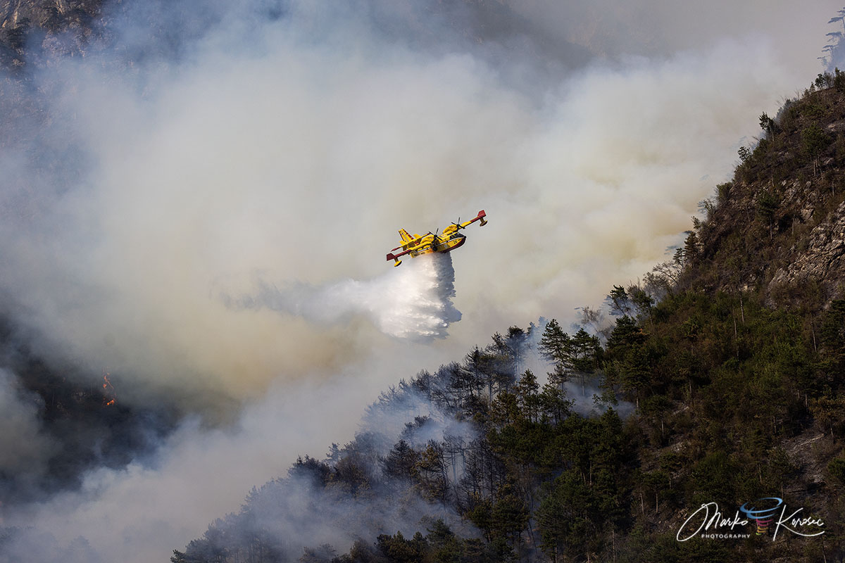
- National Assets: Heavy-duty Italian Canadair amphibious aircraft formed the backbone of the water-dropping operations, executing continuous cycles of scooping and dropping.
- Cross-Border Aid: In a display of international cooperation, Slovenian Air Tractor water bombers were dispatched across the border to assist Italian crews, alongside regional support helicopters equipped with belly buckets.
Ground Operations
While aircraft tackled the inaccessible peaks, ground personnel held the line below.
- The Corps: Teams from the Corpo Forestale Regionale (Regional Forestry Corps) and the Vigili del Fuoco worked around the clock in hazardous conditions.
- Infrastructure Protection: Utility operators proactively deactivated high- and medium-voltage power lines running through the operational zone to prevent electrical sparking and protect firefighters from falling transmission lines.
- Evacuations: Local law enforcement and civil protection volunteers managed the swift evacuation of residents in Pissebus, ensuring zero fatalities or serious injuries were reported during the threat.
Implications and Future Outlook
As the smoke clears over the Tagliamento valley and regional teams transition to thermal drone scanning to hunt down residual underground hotspots, local authorities are left reflecting on the broader implications of the Monte Amariana disaster.
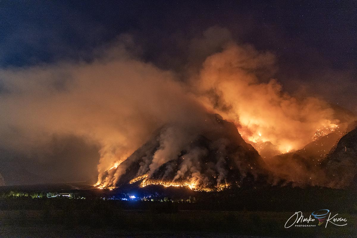
The event highlights the growing vulnerability of traditional Alpine ecosystems to climate change. As heat domes become more frequent, prolonged droughts become the norm, and lightning-induced wildfires strike deeper into fragile, inaccessible mountain terrain, emergency response frameworks must adapt.
The successful containment of the Monte Amariana fire stands as a testament to the bravery of international and regional firefighters, as well as the efficacy of cross-border European cooperation. However, it also serves as a stark warning: without proactive forest management, climate resilience planning, and enhanced early-response infrastructure, Europe’s historic mountain peaks will face an increasingly perilous future.
