

Every autumn, as temperatures drop and the first frosts touch the Northern Hemisphere, a familiar discussion lights up weather forums and social media channels. Meteorologists and amateur enthusiasts alike turn their gaze toward Siberia, asking a singular question: Is snow spreading fast across the Eurasian continent?
For more than a decade, conventional meteorological wisdom held that a rapid October snow advance across Siberia served as an early warning sign—a reliable harbinger of a cold, snowy winter across the United States, Canada, and Europe. However, a comprehensive new empirical analysis of 47 years of climate data suggests that this famous winter forecasting tool may no longer be reliable.
Main Facts
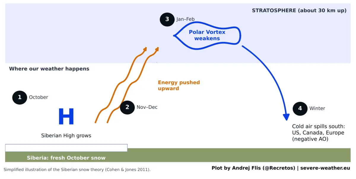
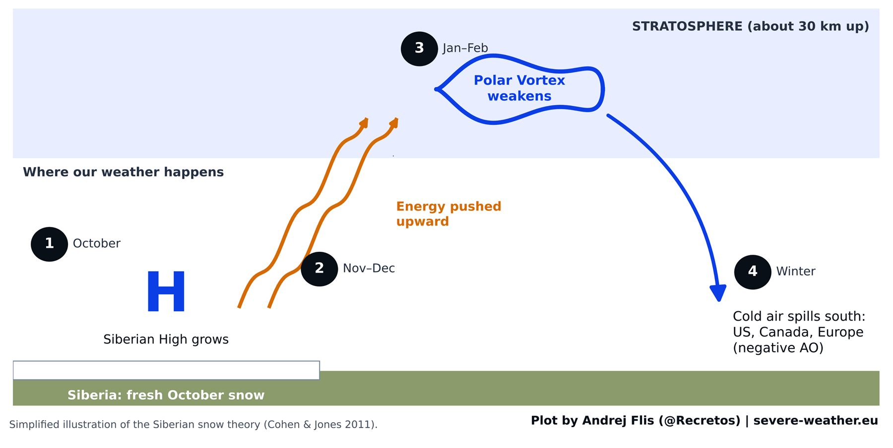
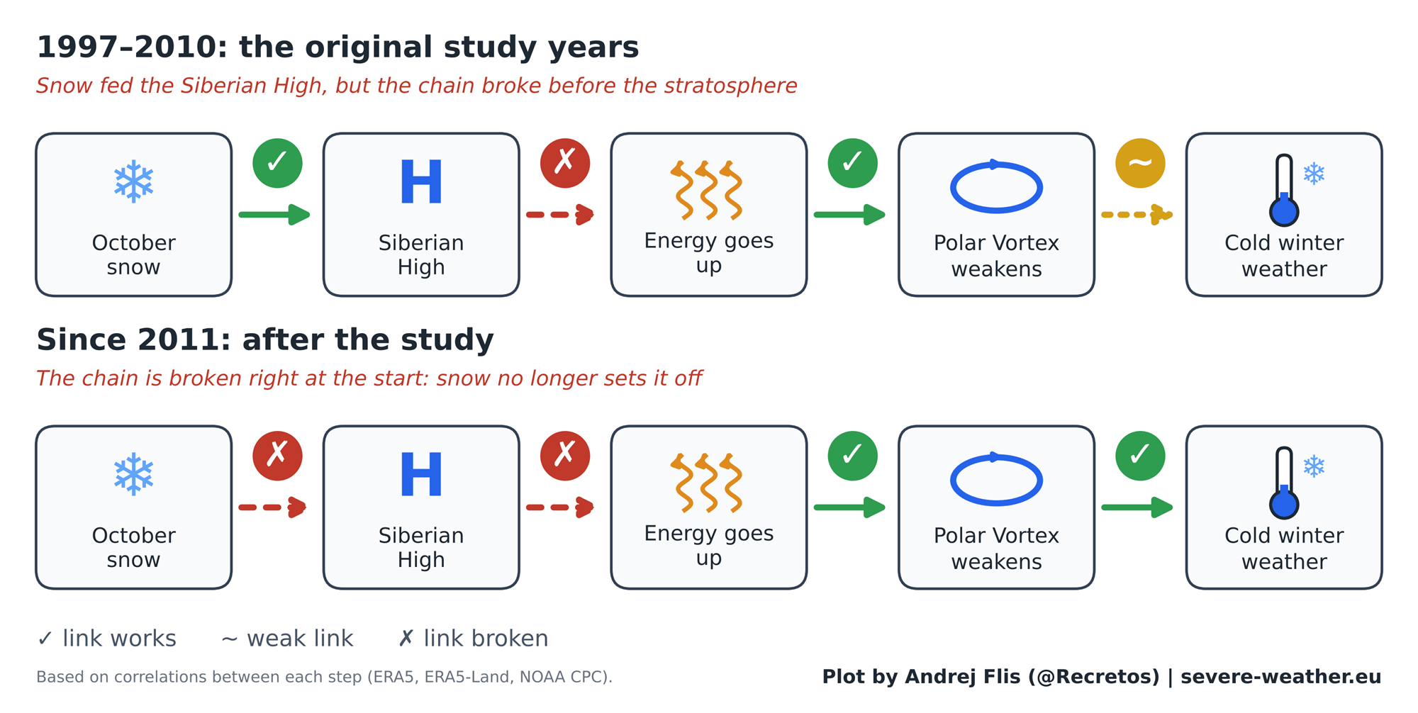
- The Core Theory: First popularized by a landmark 2011 scientific study, the Eurasian snow-advance theory posits that early October snow buildup over Siberia strengthens the Siberian High, sending upward planetary wave energy into the stratosphere to disrupt the Polar Vortex.
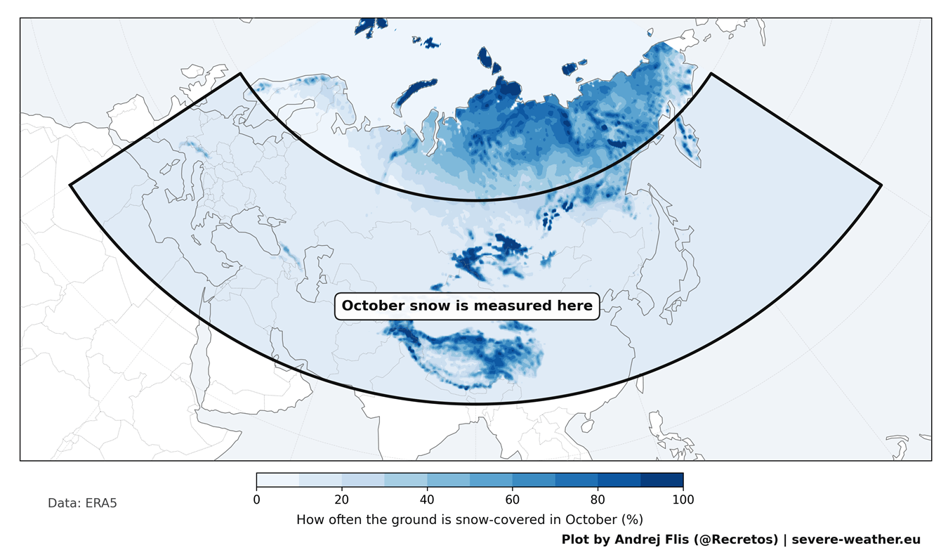
- The New Finding: An evaluation of 47 winters of data (1979–2025) across four independent snow datasets reveals that the predictive link between October Eurasian snow cover and the subsequent winter Arctic Oscillation (AO) has faded significantly since 2011.
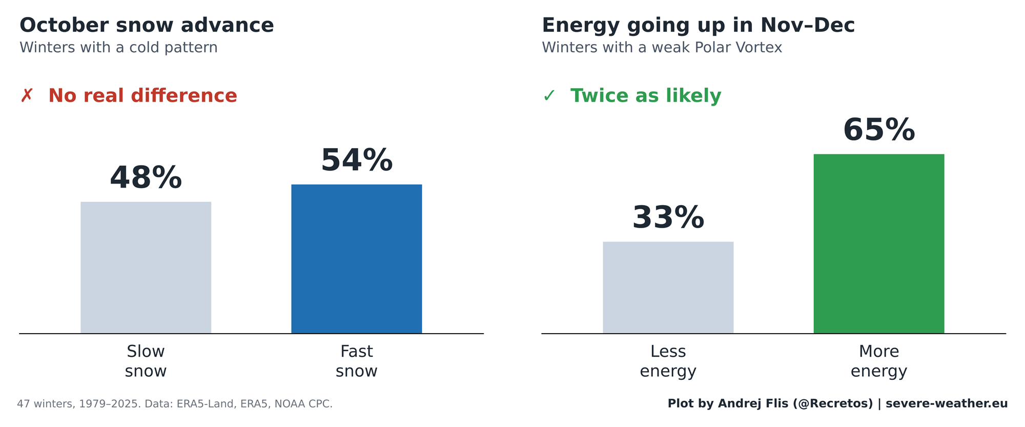
- Statistical Reality: Over the entire 47-year period, the snow signal correctly predicted winter trends 25 times and failed 22 times—performing essentially as a coin flip. In the 15 winters following the 2011 study, it was accurate only 6 times.
- The Real Driver for 2026/2027: While the Siberian snow link has weakened, seasonal forecasters are instead turning their attention to an active Super El Niño in the Pacific, which numerical models suggest will significantly decelerate and potentially destabilize the Polar Vortex in mid-to-late winter.
Chronology: The Rise, Fall, and Re-evaluation of the Snow Theory
The Origin of the Hypothesis (2011)
In 2011, atmospheric scientists Judah Cohen and Justin Jones published a widely cited study identifying a strong statistical connection between the rate of Eurasian snow cover expansion in October and the phase of the winter Arctic Oscillation (AO).
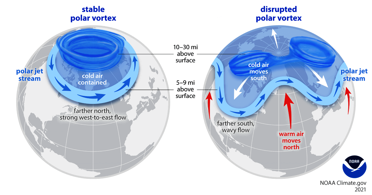
The physical mechanics of the theory were elegant and logically sound:
- Surface Cooling: Fresh, reflective snow cover rapidly cools the ground over Siberia and Central Asia.
- Pressure Strengthening: This cooling helps build and fortify the Siberian High, a massive semi-permanent surface high-pressure system.
- Stratospheric Wave Activity: The energized pressure system sends vertical wave energy high into the stratosphere, reaching altitudes of roughly 30 kilometers (18.5 miles).
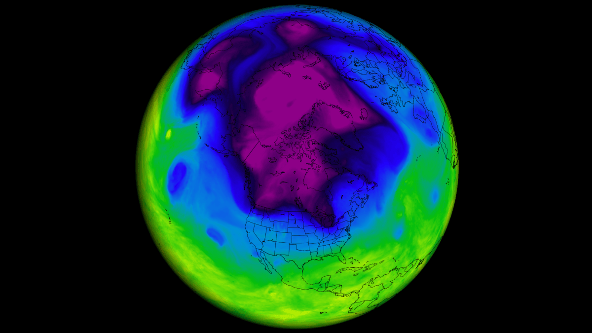
- Polar Vortex Disruption: The influx of energy weakens or distorts the Polar Vortex—the ring of fast-moving stratospheric winds that normally locks bitter Arctic air safely near the North Pole. When the vortex stretches or collapses, lobes of frigid air break free and spill southward into mid-latitudes.
The Golden Era of the Signal (1997–2010)
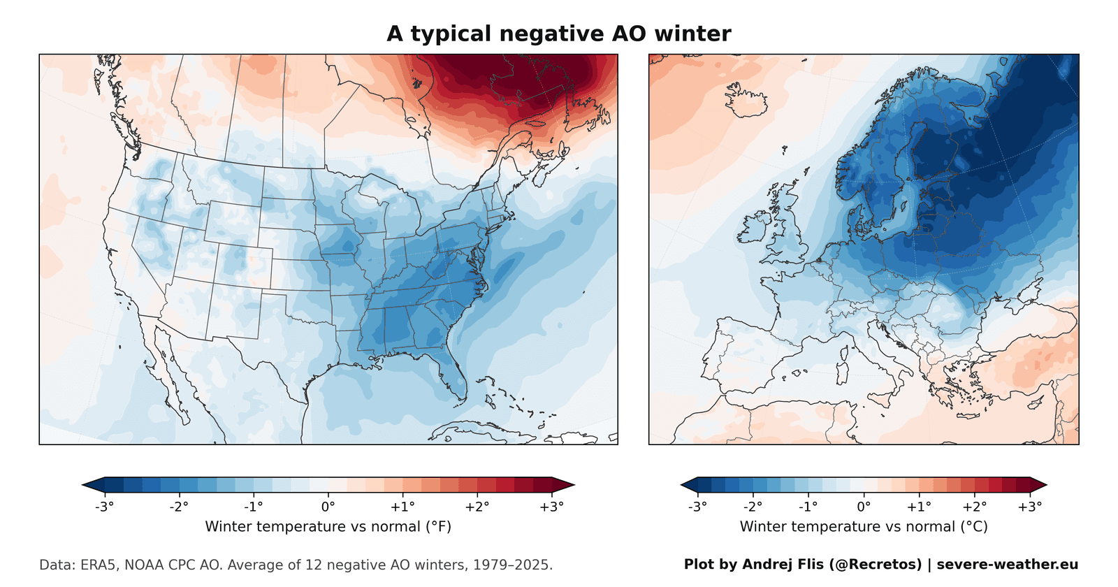
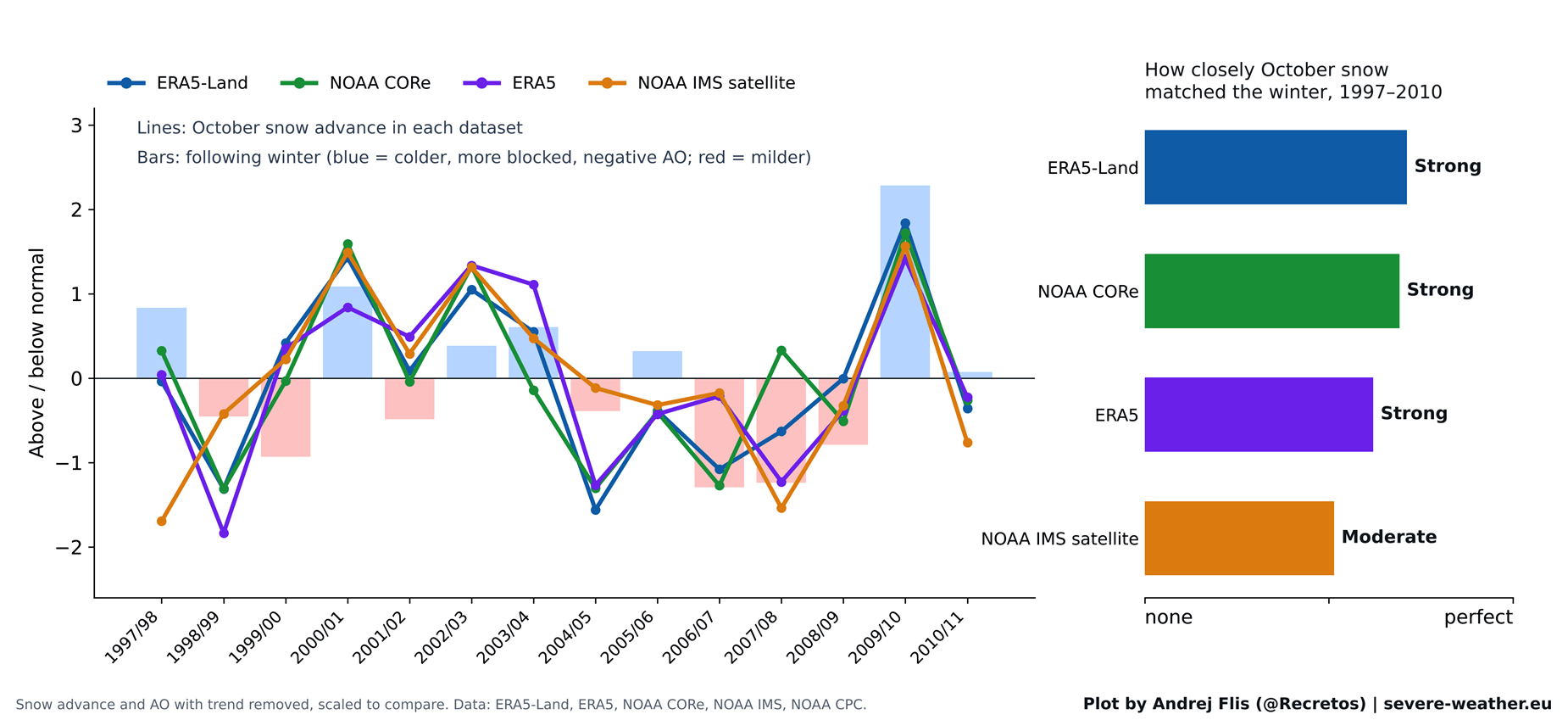
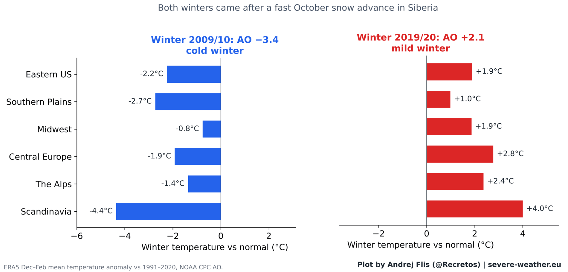
Between the late 1990s and 2010, the theory enjoyed immense popularity. During this window, the statistical signal was robust. A prime example occurred in the winter of 2009/2010, which followed one of the fastest October snow advances on record. That winter delivered an intensely negative AO phase, bringing severe cold to Europe and historic, paralyzing snowstorms to the Eastern United States in February 2010. This high-profile event cemented the theory in the public imagination.
The Decoupling Phase (2011–Present)
Following the publication of the 2011 study, however, the predictive power of the metric began to erode. Counter-examples emerged. For instance, the winter of 2019/2020 also followed a rapid October snow advance, yet it turned out to be one of the strongest positive AO winters on record, bringing exceptionally mild and snow-free conditions to large parts of Europe and the United States.
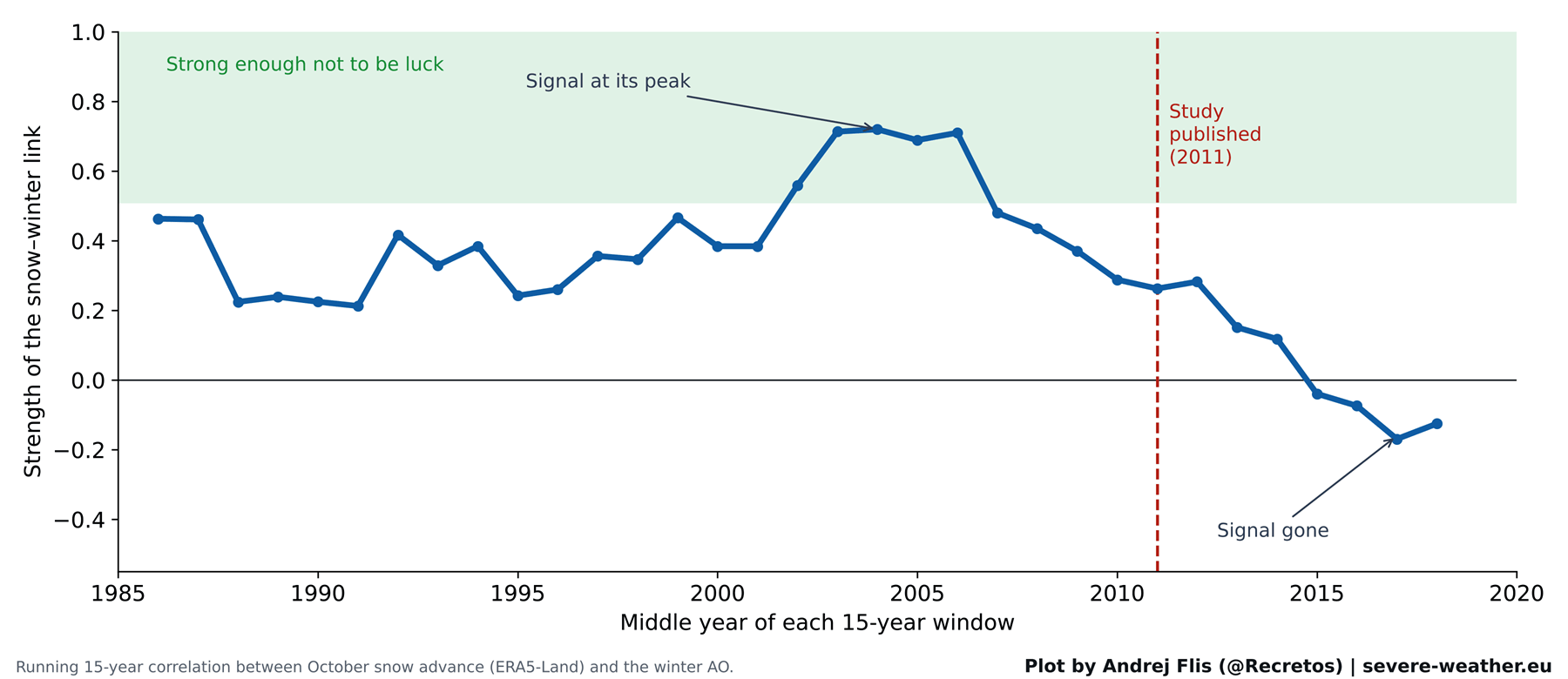
By running tests across 15 winters post-2011, researchers found that the statistical correlation had effectively vanished.
Supporting Data: Putting 47 Winters to the Test
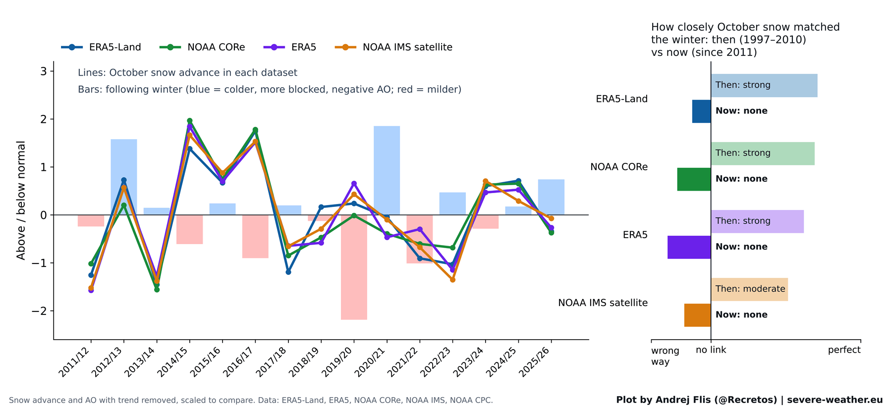
To ensure rigorous validation, researchers analyzed data spanning 1979 to 2025 using four distinct snow datasets:
- ECMWF ERA5 and ERA5-Land reanalysis products
- NOAA IMS 24 km satellite observations
- NOAA CORe historical climate records
- NOAA CPC Arctic Oscillation and Niño 3.4 monthly analyses
Dataset Comparison and Verification
When the historical window from 1997 to 2010 was isolated, all four datasets confirmed the original findings of Cohen and Jones: the correlation between October snow advance and winter AO was undeniably strong.
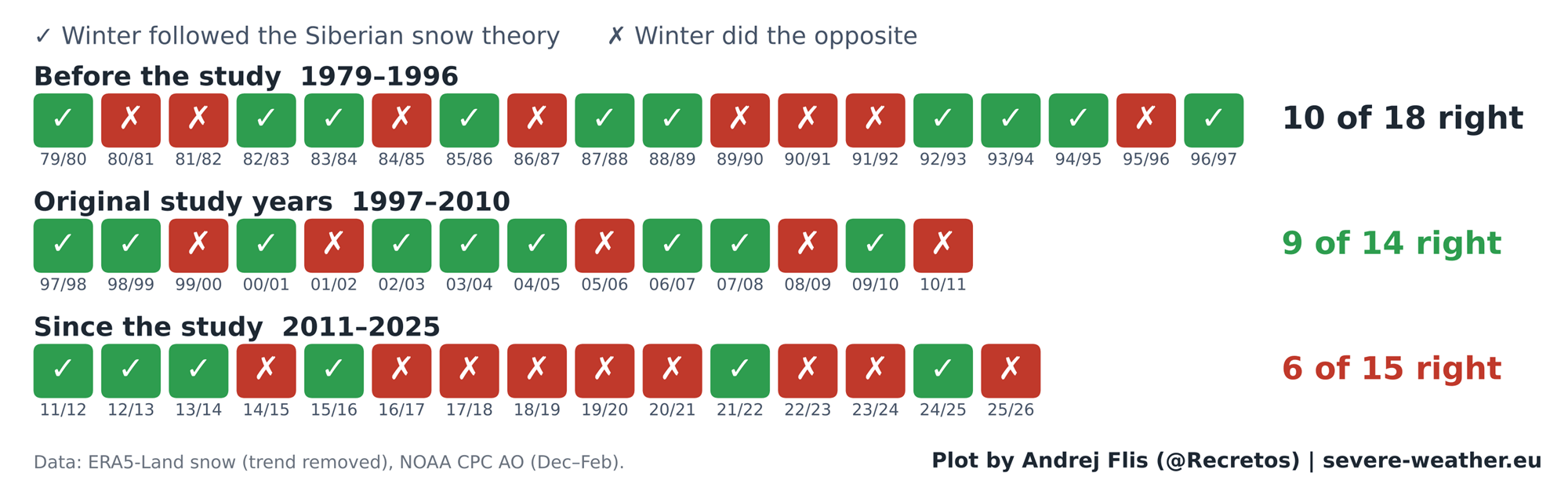
However, when applied to the full 47-year timeline, the scorecard flattened out:
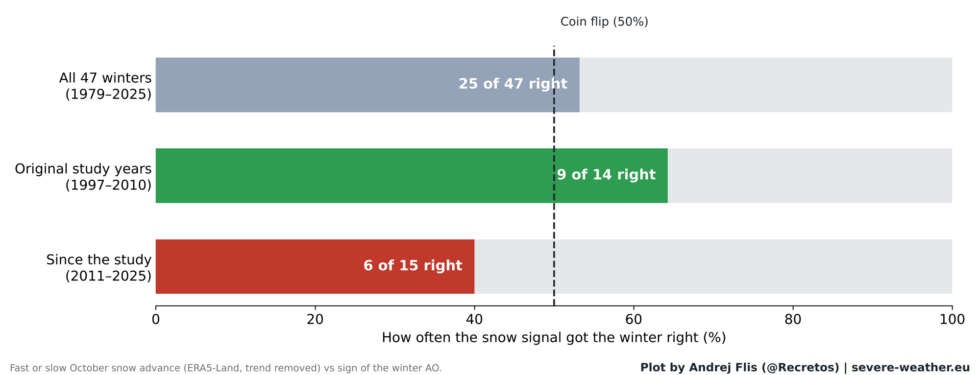
- Total Performance: Correct in 25 out of 47 winters (approx. 53%).
- Post-2011 Performance: Correct in only 6 out of 15 winters (worse than random chance).
Furthermore, step-by-step testing of the atmospheric chain reaction revealed where the process breaks down. While it remains true that energy surges into the stratosphere during November and December will reliably weaken the Polar Vortex in January and February, October Siberian snow no longer reliably triggers that upward energy transfer. The initial surface link has decoupled, even if the stratospheric response mechanism itself remains valid.
Official Responses and Regional Forecast Implications
As meteorologists shift away from relying solely on Eurasian snow cover, operational centers are evaluating regional impacts based on broader macro-climate indicators.
Regional Breakdown for North America and Europe
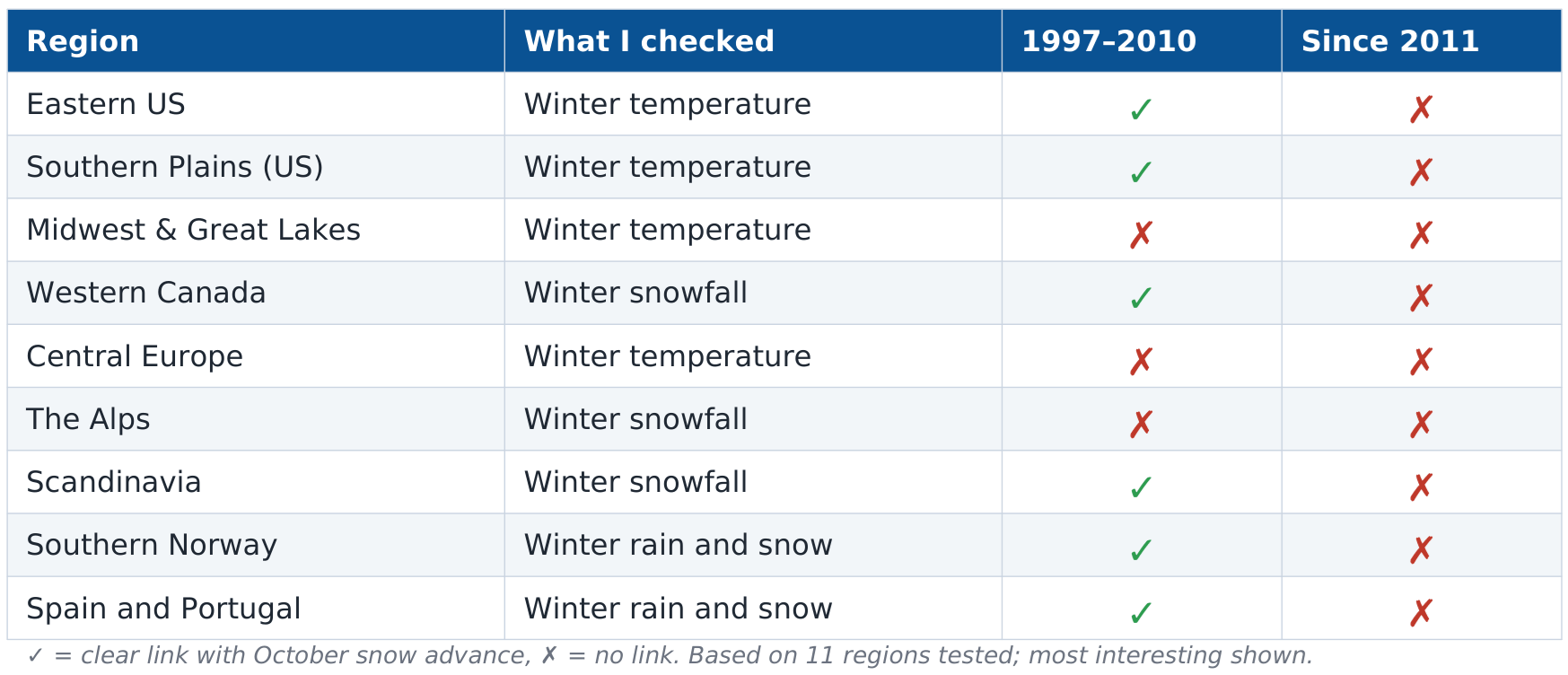
Historically, a strong negative AO triggered by the snow signal favored cold winters in the eastern United States (from the Ohio Valley down to the Southeast) and northern Europe, while leaving western Canada unusually mild.
Regional checks for the post-2011 era indicate that these localized correlations have broken down across nearly all 41 tested sub-regions. Western Canada retains a faint statistical whisper of a long-term link, but it is far too weak to anchor a reliable seasonal forecast.
Outlook for October and Winter 2026/2027
As of October 2026, Eurasian snow cover experienced a slightly slow start during the first week of the month. However, ECMWF ensemble forecasts indicate a sharp snow surge is expected to materialize by late October, placing the final monthly advance roughly in the upper 15% tier for the past three decades.
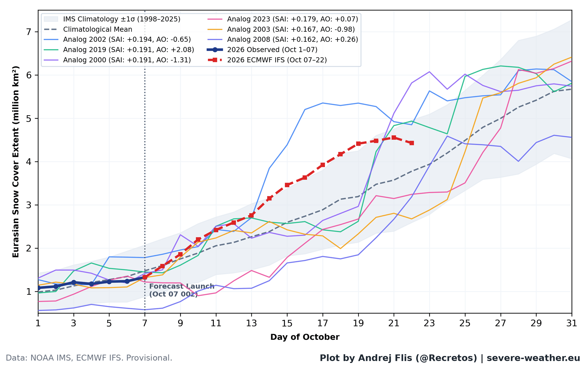
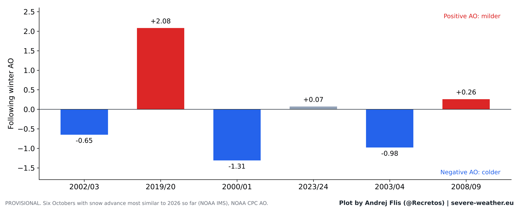
Historically, the six past Octobers most analogous to the projected 2026 snow trajectory produced mixed results: three negative AO winters, one neutral, and two positive AO winters. On its own, the impending Siberian snow surge offers little directional clarity for the upcoming winter.
Implications: The Super El Niño Takes Center Stage
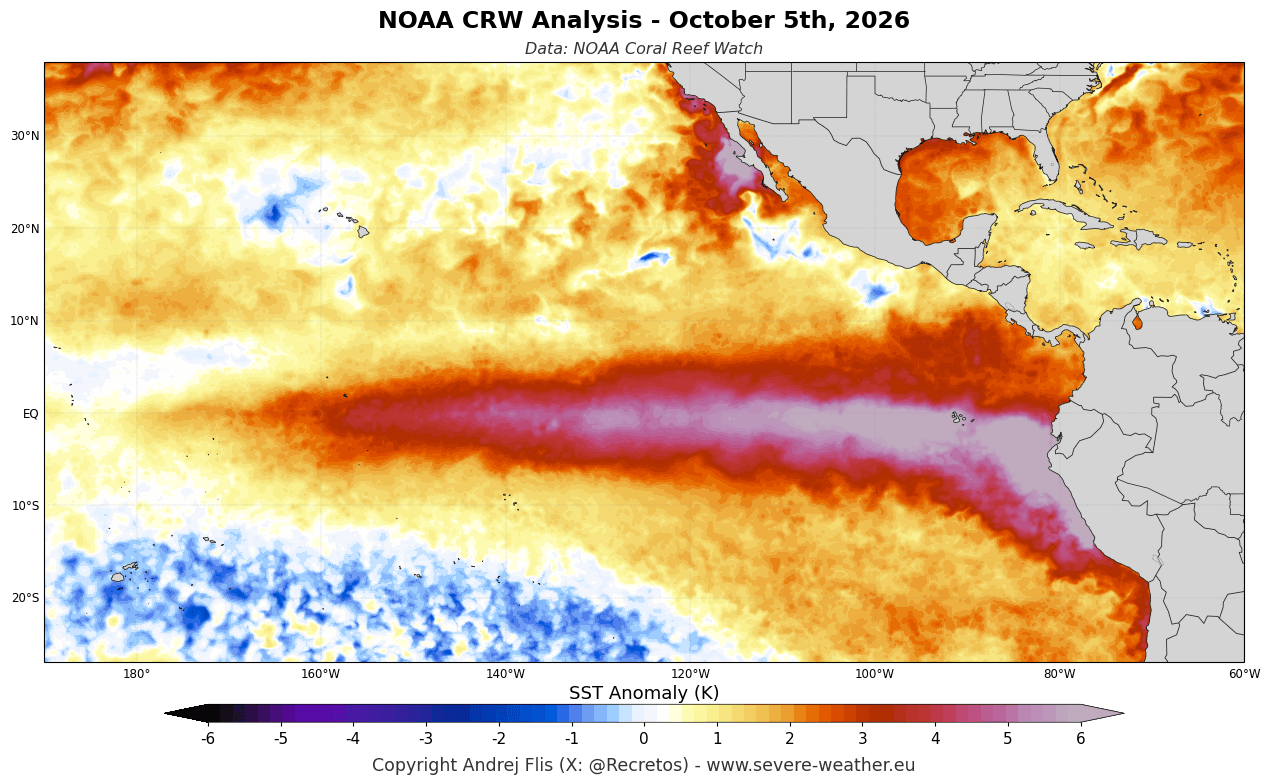
Because the Siberian snow advance can no longer be trusted as a standalone winter barometer, forecasters are looking to a much more powerful driver for the Winter 2026/2027 season: an ongoing Super El Niño.
The Dynamics of a Super El Niño
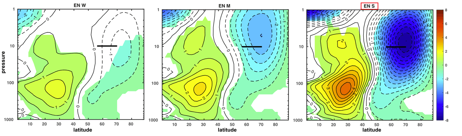
Active Pacific ocean anomalies are reshaping global jet streams and exerting a dominant control over atmospheric circulation patterns. Modern modeling demonstrates that strong El Niño events are consistently associated with significant stratospheric deceleration of the Polar Vortex during the second half of winter.
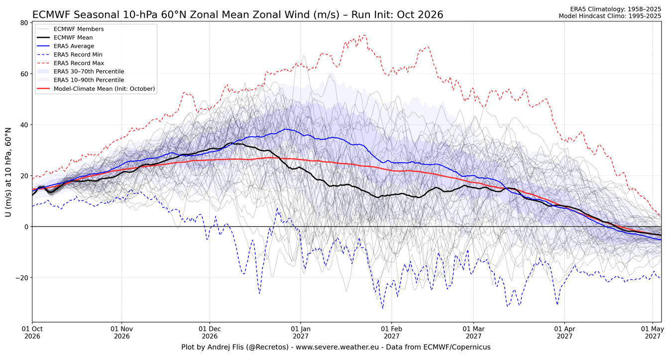
- Stratospheric Projections: ECMWF seasonal outlooks show the Polar Vortex remaining near normal through mid-December, followed by a pronounced wind slowdown into January 2027. Many ensemble members point toward a potential Sudden Stratospheric Warming (SSW) event—a dramatic mid-winter collapse of the vortex.
- Surface Weather Impacts: Historical analogues and pressure anomaly models suggest that a disrupted vortex in a Super El Niño regime favors colder, stormier anomalies across the central, southern, and eastern United States due to an amplified, moisture-laden Pacific jet stream. Conversely, current signals suggest that Europe may experience a predominantly milder zonal flow, with persistent cold anomalies largely restricted to far northern Scandinavia.
Methodological Note: The ERA5 Snow Anomaly
In the process of compiling this multi-decade dataset, researchers uncovered a technical anomaly within the standard ERA5 reanalysis archive: a sudden, artificial 40% drop in Eurasian October snow cover occurring in 2004. Cross-referencing with independent observational datasets (such as NOAA CORe and ERA5-Land) confirmed that this step-change was an artifact of how satellite assimilation was integrated into the model rather than a physical loss of snow in Siberia. Fortunately, because independent datasets verified the broader trends, the core scientific conclusions regarding the fading snow signal remain completely unaffected.
Summary
The long-held belief that a snowy October in Siberia guarantees a harsh winter in the mid-latitudes is a textbook example of a weather relationship that worked brilliantly for a brief historical window, but failed to stand the test of time. As Winter 2026/2027 approaches, forecasters will leave the Siberian snow index behind, focusing instead on real-time stratospheric wave energy and the powerful influence of the reigning Super El Niño.
