

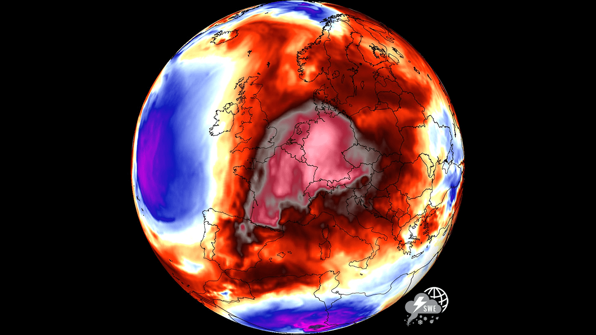
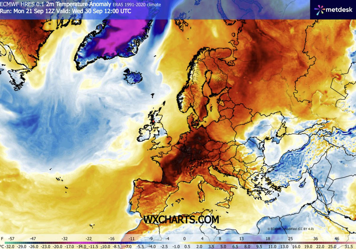
EUROPE — As the calendar prepares to turn from September to October, a staggering and remarkably persistent meteorological phenomenon is making a dramatic comeback across the European continent. A massive, highly anomalous "heat dome" is building northward from the Mediterranean and North Africa, establishing a powerful blocking pattern that will drive unseasonably hot weather across vast swaths of Western, Central, and Northern Europe.
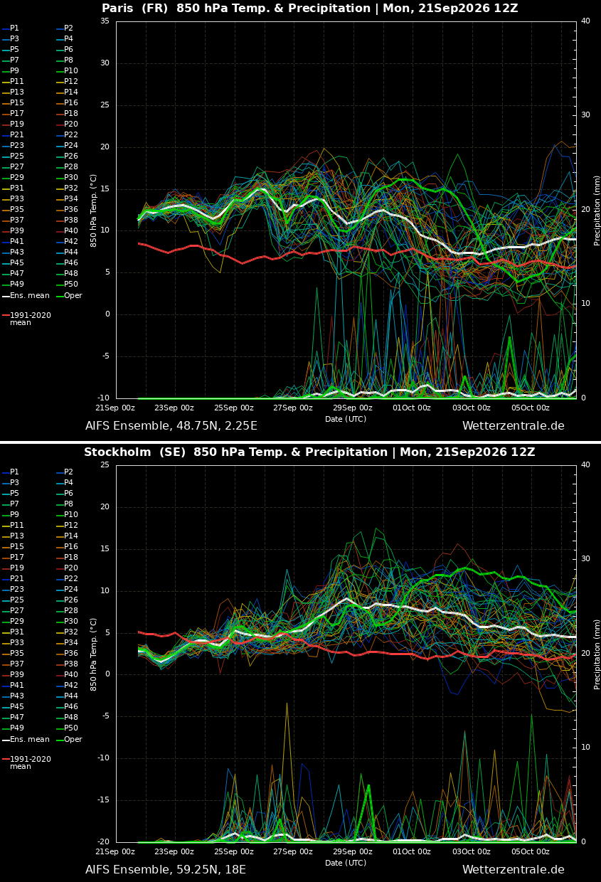
Meteorologists warn that this late-season thermal surge is not merely a brief warm spell; rather, it represents a robust, long-lived atmospheric event. With 850 hPa temperature anomalies projected to climb 8 °C to 12 °C above long-term climatological averages, afternoon surface temperatures are expected to reach well into the upper 20s (°C)—and easily peak above the mid-to-high 30s (°C) in southern regions—challenging historical records as October begins.
Main Facts: The Anatomy of a Continental Heat Dome
The primary driver behind this late-autumn weather anomaly is a classic atmospheric dipole pattern. A deep, high-amplitude upper-level trough has established itself over the North Atlantic, acting in tandem with an intense southerly jet stream plume. This configuration is forcefully advecting warm, tropical air deep into the heart of continental Europe.
The Mechanics of the High-Pressure Lid
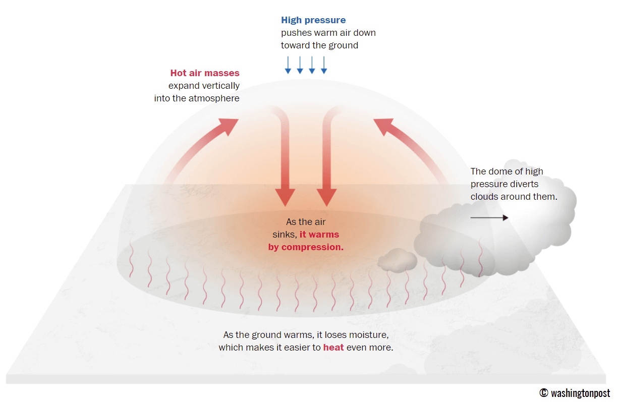
At the core of this expansive blocking ridge lies strong atmospheric subsidence—a downward motion of air that compresses and dramatically warms the lower atmosphere. This process effectively acts as a lid on a pot, suppressing cloud cover, allowing maximum solar insolation, and trapping a reservoir of baking air near the surface.
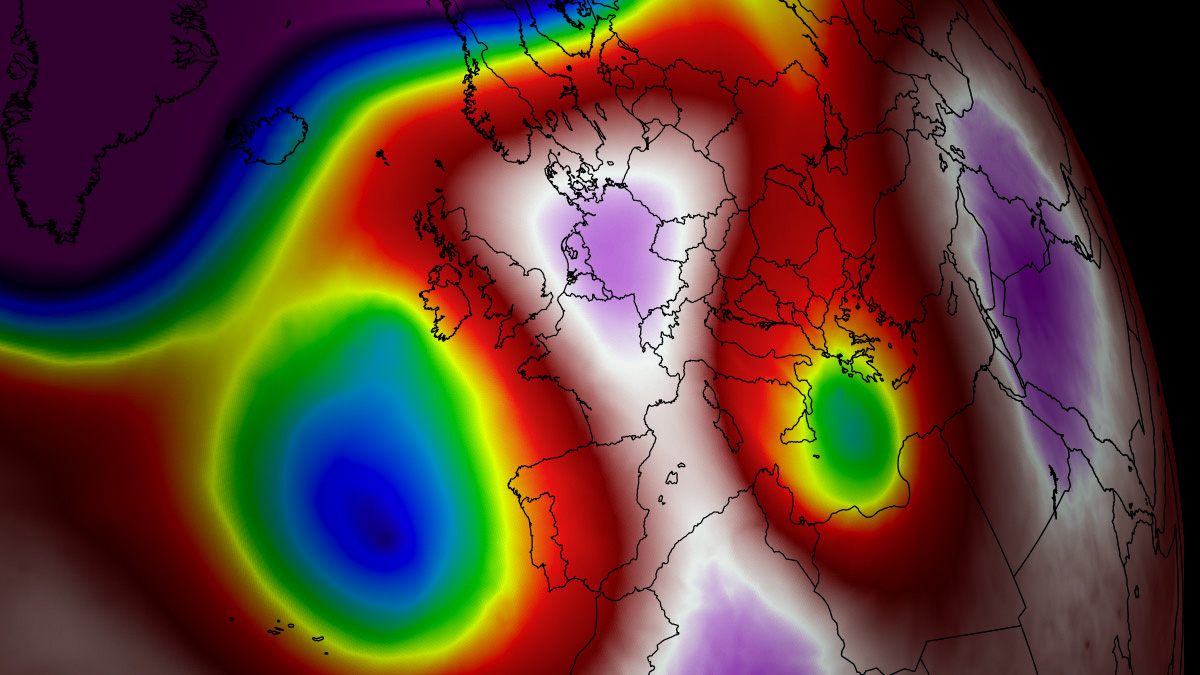
According to weather model analyses from leading forecasting centers, the resulting stable and dry air mass will dominate low-lying agricultural basins and urban valleys alike. This creates a sharp thermal contrast between the deep, stormy troughing anchored over the Atlantic and the baking, sun-drenched expanse covering mainland Europe.
Chronology and Evolution: From Late September into Early October
The progression of this heat wave is characterized by a steady eastward and northward expansion of the upper-level ridge, shifting the core of the thermal anomalies over the course of several distinct phases.
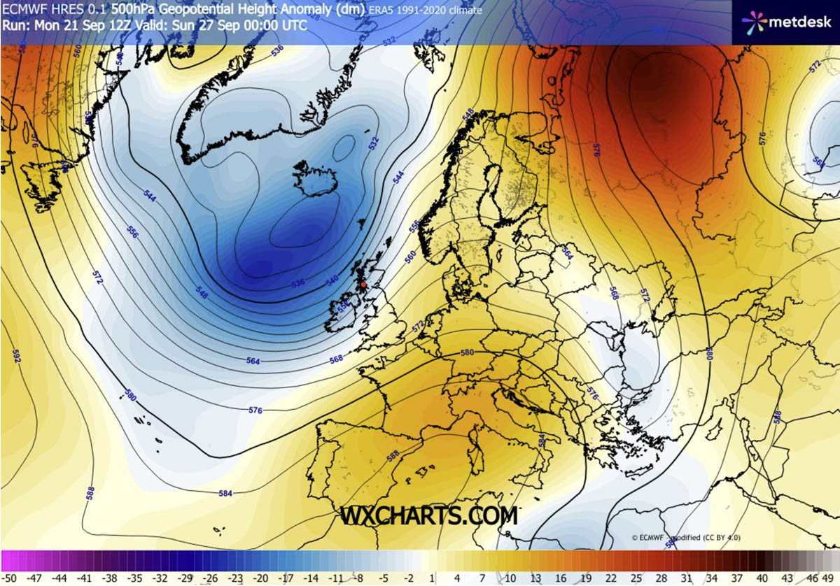
Phase 1: Southwestern Europe Takes the Brunt (Late Week)
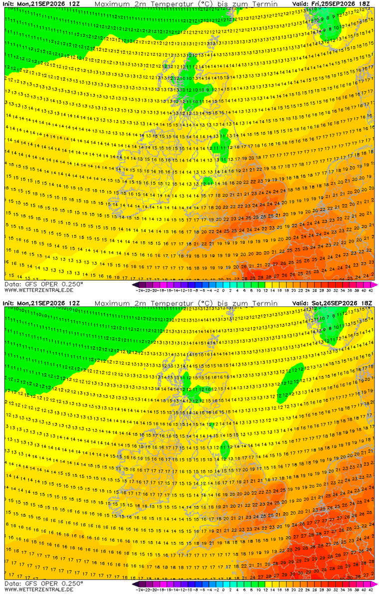
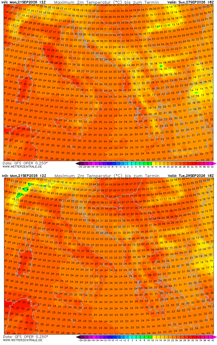
Through the remainder of the week, the most intense anomalies will remain concentrated over the Iberian Peninsula and southwestern France. Peak daytime highs across central and southern Spain, as well as Portugal, are forecasted to relentlessly hover between 34 °C and 38 °C, with localized readings potentially brushing the 40 °C mark in favored interior valleys from Thursday through Saturday.
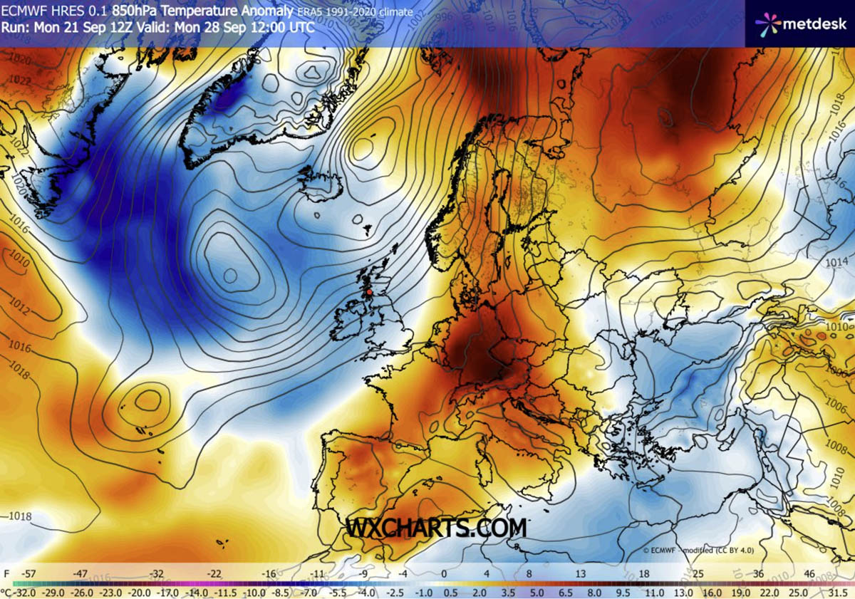
Phase 2: Expansion Across Western and Central Europe (The Weekend)
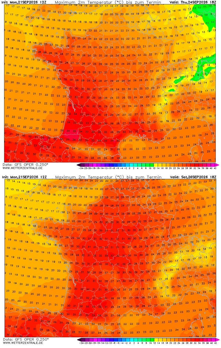
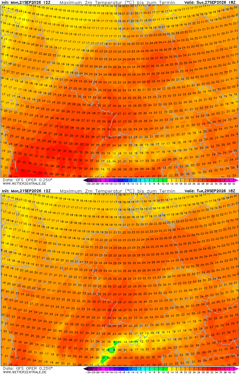
As the weekend approaches, the heat dome aloft expands further northeast. Southern and central France will see temperatures surge toward 36 °C, while northern France, the Benelux union, and western Germany will experience comfortably high, albeit anomalous, readings in the upper 20s to near 30 °C. By Sunday and into early next week, this warm air mass will firmly entrench itself across Germany, Poland, and the Baltic states.
Phase 3: The Northern Surge (Early October)
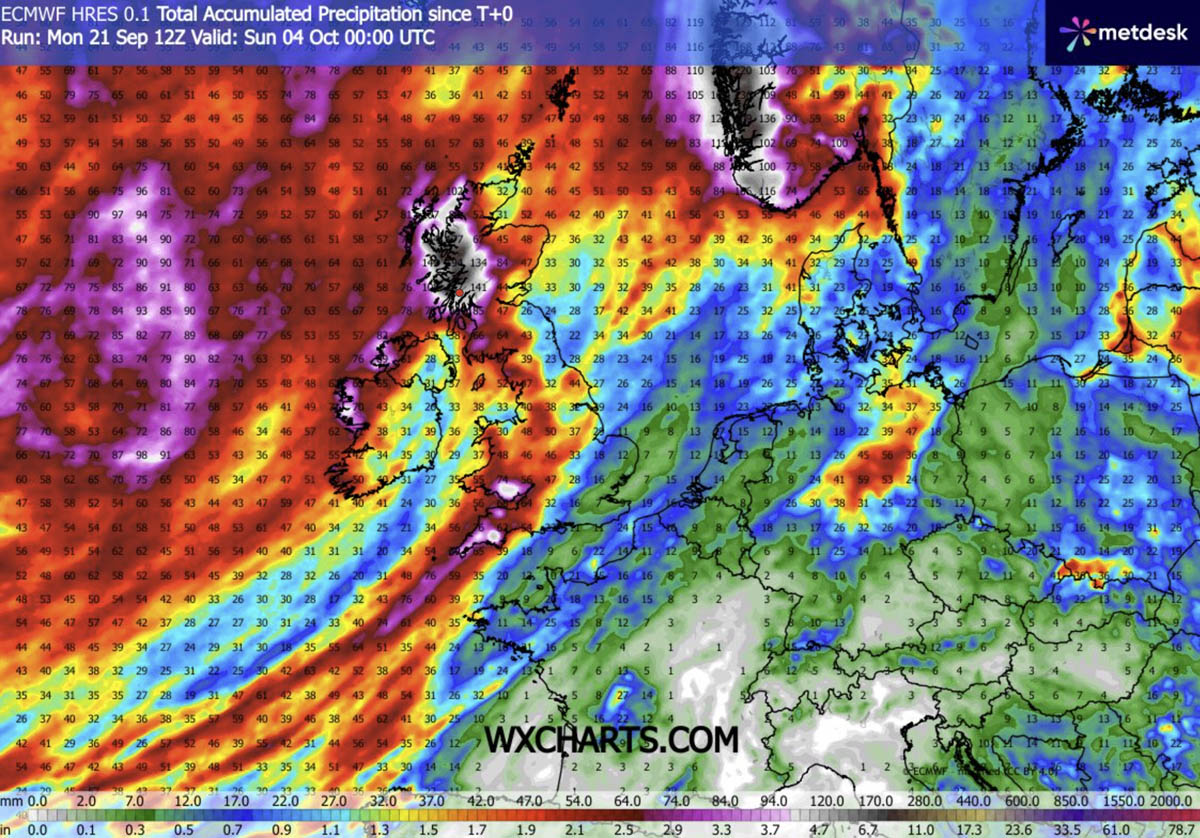
By the time October officially begins, the blocking ridge will shift its focal point toward Northern Europe. Unusually intense thermal anomalies are projected to overspread Scandinavia, with Sweden and Finland experiencing some of the most pronounced deviations from normal for this time of year. Meanwhile, a sharp weather boundary will maintain cooler, wetter conditions—including heavy orographic rainfall totals exceeding 150 mm—restricted strictly to the far western fringes of the continent, from western Ireland to Scotland and southwestern Norway.
Supporting Data: Regional Temperature Breakdown
Meteorological data from ensemble models (including the GFS and ECMWF) outline specific regional impacts expected over the coming days:
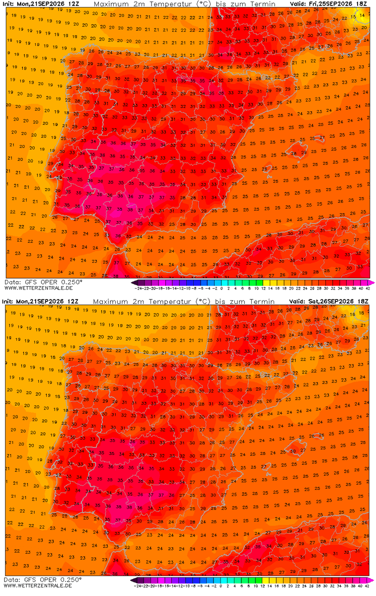
- Southwestern Europe (Spain & Portugal): Persistent highs of 34–38 °C through Saturday under a remarkably dry air mass. Peak values may touch 40 °C in traditional hot-spots.
- Western Europe (France & Benelux): Interior southern and southwestern France will push toward 36 °C. Central France will record mid-30s, while northern regions and the Benelux maintain low-to-mid 20s and high 20s through the weekend.
- The United Kingdom: South-central England will experience a brief, potent spell of mid-to-upper 20s from Thursday through Sunday—exceptionally warm for late September—while Ireland and Scotland remain cooler, topping out in the mid-10s.
- Central Europe (Germany, Poland, & the Baltics): Beginning Sunday and lasting through mid-next week, western and central Germany will peak between 27 °C and 29 °C as warmth bleeds eastward toward Poland.
- Southern Europe & the Balkans: Northern Italy (specifically the Po Valley) and Tuscany, alongside parts of Greece and the north-central Balkans, will see temperatures return to the upper 20s and 30 °C, threatening long-standing late-September records.
Implications: Health Risks, Urban Stress, and Agricultural Pressures
While meteorological records are routinely broken during such blocking events, the human and environmental implications of prolonged late-season heat demand serious attention from public health officials and emergency management agencies.
The Menace of "Tropical Nights"
Beyond punishing daytime highs, forecasters emphasize a particularly insidious hazard: suffocating "tropical nights." When overnight temperatures refuse to drop below 24 °C, the human body is denied its vital biological window to cool down and recover. This cumulative heat stress drastically elevates health risks, particularly for vulnerable demographics such as the elderly, young children, and individuals with pre-existing cardiovascular or respiratory conditions.
Occupational and Urban Vulnerabilities
Outdoor laborers—including agricultural workers harvesting late-season crops and construction crews—face heightened risks of heat exhaustion, dehydration, and potentially fatal heat stroke. Furthermore, urban environments dominated by heat-absorbing concrete, asphalt, and dense housing configurations will trap the thermal mass, exacerbating the urban heat island effect.
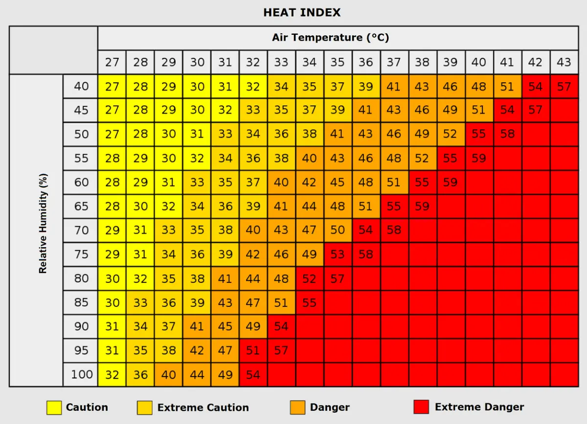
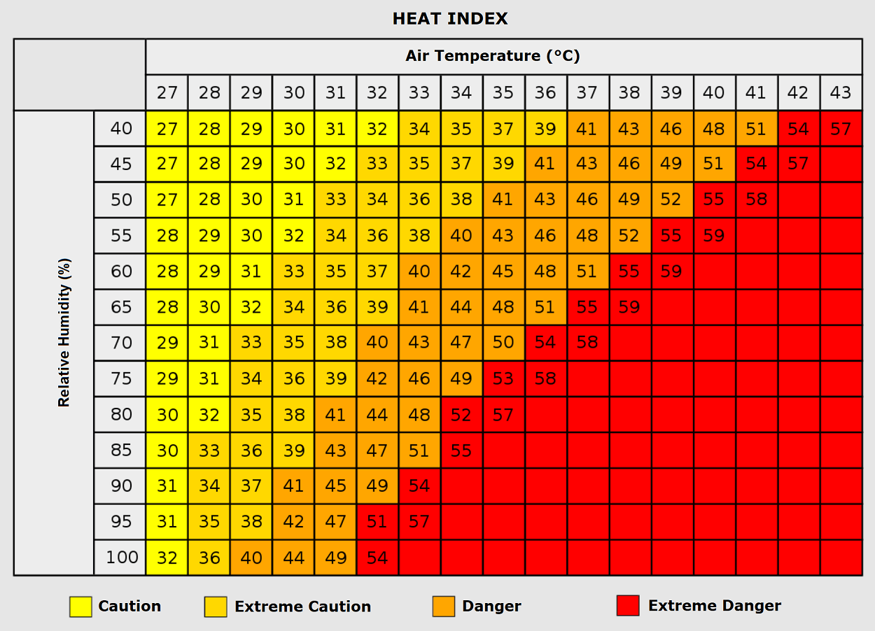
Coupled with high humidity levels in certain sectors, the apparent "Heat Index" can make ambient temperatures feel significantly higher than actual thermometer readings, placing sudden, unexpected strain on regional power grids and emergency medical services as the continent navigates an uncomfortably warm transition into autumn.
Long-range forecasting models suggest that while this blocking pattern will dominate the first week of October, a more dynamic and cooler atmospheric regime may finally return as the month progresses. In the meantime, residents across Western, Central, and Northern Europe are advised to monitor local advisories and prepare for an unusually prolonged taste of mid-summer heat.
