

By Global Geohazards Reporting Desk
Published August 27, 2026
Main Facts
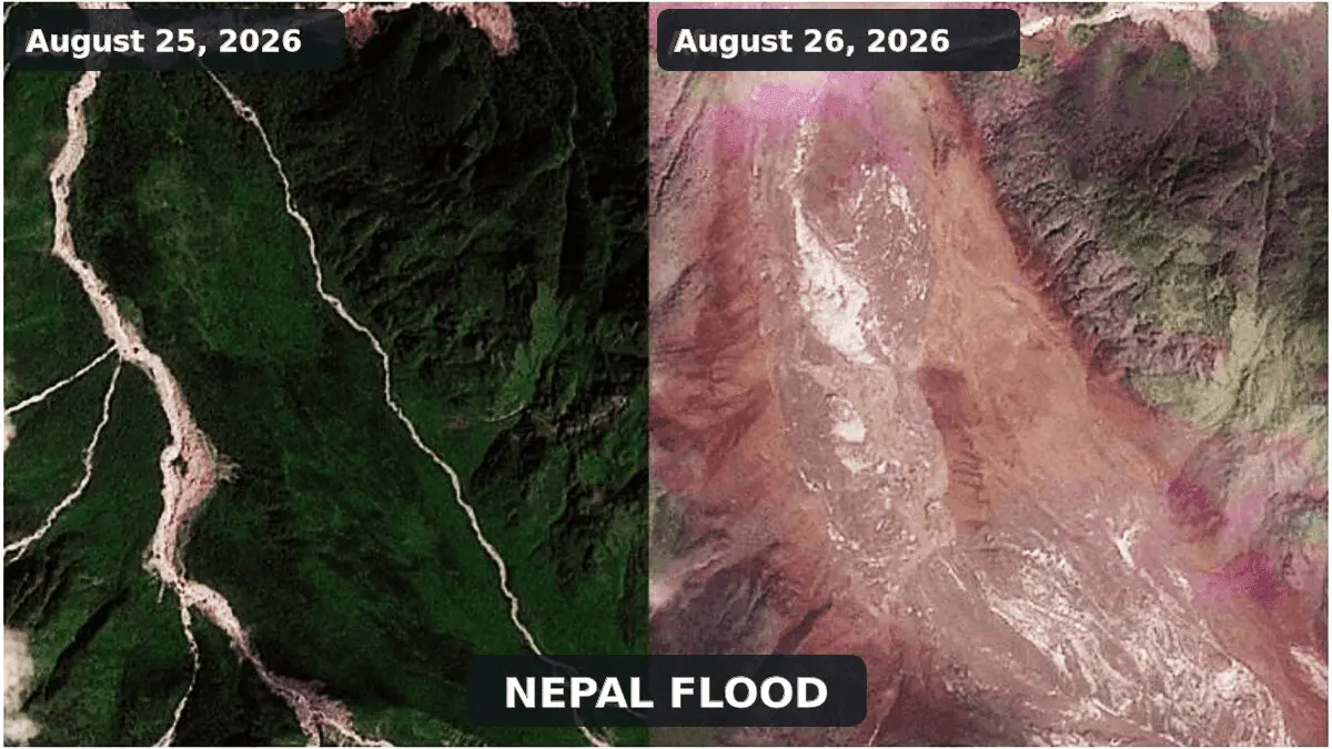
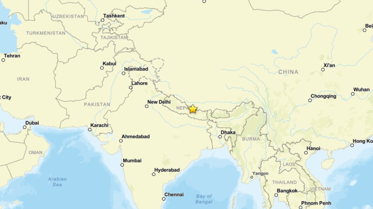
A catastrophic natural disaster struck the transboundary Bhote Koshi-Trishuli river system, leaving a trail of profound devastation across northern Nepal and southern Tibet. Triggered by a massive, high-altitude ice and rock avalanche, a violent torrent of water, mud, and boulders tore down the narrow Himalayan valleys on August 26, 2026.
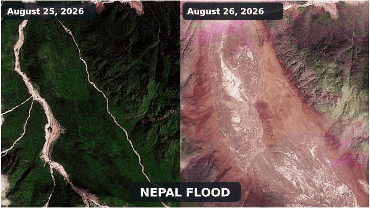
Satellite imagery and remote sensing analyses confirmed that the cataclysm originated in the upper Lhende Khola, a steep tributary of the Bhote Koshi near the international border. The avalanche temporarily blocked the narrow valley, forming an unstable natural dam that eventually failed and unleashed a debris-rich flash flood downstream.
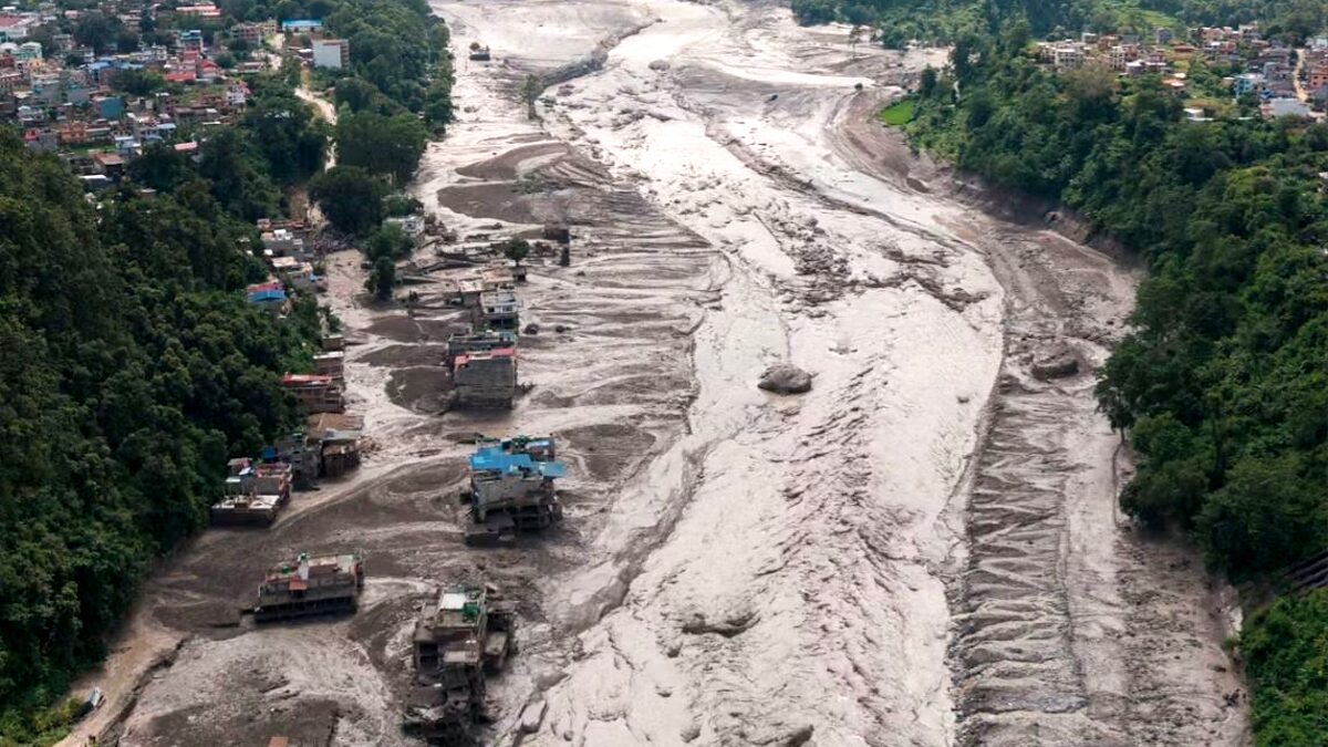
According to preliminary reports from the Associated Press, at least 160 people have been confirmed dead across Nepal and China, while hundreds of locals, migrant workers, and tourists remain unaccounted for. Emergency management agencies warn that the official death toll is likely a significant underestimate, as vast stretches of critical infrastructure—including highways, bridges, remote settlements, and hydropower installations—were completely swept away or buried beneath meters of sediment. Access to the disaster zone remains severely restricted, hindering rescue and recovery operations.
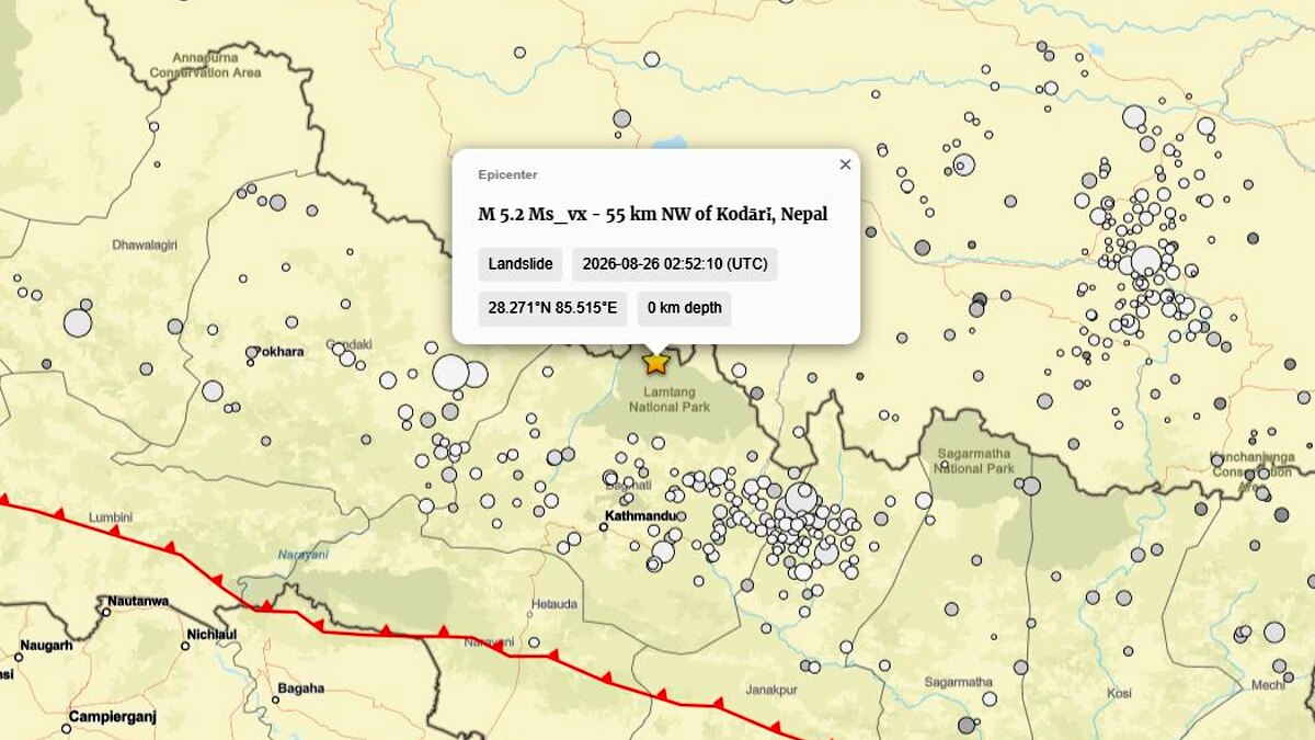
Crucially, scientific analyses have disproved early assumptions regarding the disaster’s trigger. A seismic signal initially logged by the U.S. Geological Survey (USGS) as a magnitude 4.4 earthquake was subsequently reclassified as a magnitude 5.2 landslide. Seismologists confirmed that the ground motion was generated by the catastrophic collapse of the mountain slope itself, rather than acting as a tectonic trigger. Furthermore, glaciologists and international monitoring bodies emphasized that the event was an ice-and-rock-avalanche-induced landslide-dam outburst flood, rather than a classical Glacial Lake Outburst Flood (GLOF), as no pre-existing glacial lake has been identified as the primary source.
Chronology of Events: How the Disaster Unfolded
The Pre-Conditioned Slope (Months to Years Prior)
Long-term environmental factors set the stage for disaster in the upper Lhende Khola. Decades of atmospheric warming in the Hindu Kush Himalaya region have accelerated glacier thinning, permafrost degradation, and snowpack loss. Steep rock walls, previously buttressed by perennial ice, experienced progressive structural fatigue, thermal stress, and internal water pressure accumulation within fractures.
The Failure and Seismic Shock (August 26, 2026 – Morning Hours)
At an elevated, heavily glaciated slope in the upper Lhende Khola, mechanical failure occurred. A massive composite mass comprising fractured bedrock, glacial ice, and snow detached simultaneously. As this ice-rock avalanche accelerated down the precipitous gradient, it generated a seismic signature that registered on regional and global networks. The USGS later categorized this prolonged ground-shaking event as a magnitude 5.2 landslide, documenting the precise moment of mountain collapse.
Valley Obstruction and Temporary Impoundment (August 26, 2026 – Late Morning)
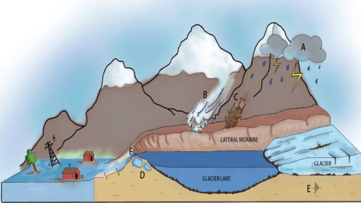
The fast-moving avalanche hurtled into the narrow Lhende Khola valley, striking the river channel with immense kinetic energy. The avalanche debris—a chaotic mixture of massive boulders, shattered ice, and fine sediment—choked the riverbed, creating an irregular, highly permeable natural dam. Behind this unstable barrier, water rapidly accumulated, forming a short-lived landslide-dammed lake.
The Catastrophic Outburst and Downstream Surge (August 26, 2026 – Midday)
Unable to withstand the increasing hydrostatic pressure and internal erosion, the temporary debris dam breached suddenly. The release of impounded water, combined with liquefied avalanche material, transformed into a high-energy debris flow. According to reports compiled by the International Center for Integrated Mountain Development (ICIMOD) and Reuters, water levels on the downstream Trishuli River surged by an astonishing nine meters (nearly 30 feet) within a span of roughly 30 minutes.
The raging torrent propagated rapidly southward through Rasuwa district into Nepal, destroying roads, washing out bridges, and inundating communities before emergency warning systems could sound.
Supporting Data and Geophysical Analysis
The mechanics of the August 26 disaster highlight the complex, cascading nature of high-mountain geohazards. Scientists emphasize that modern catastrophes rarely fit into simple categories like "flood" or "avalanche"; instead, they unfold through a chain of interconnected physical processes.
Seismic Disambiguation
The revision of the USGS seismic data for event us7000tbwb marks a pivotal turning point in understanding the disaster. While early reports hypothesized that a tectonic earthquake had triggered the slope failure—drawing comparisons to the devastating 2015 Gorkha earthquake—seismologists analyzed the frequency content and duration of the waveforms. They concluded that the energy was released by the downward momentum and impact of millions of tons of rock and ice, definitively ruling out a preliminary tectonic rupture.
Cryospheric Mechanics: Ice-Rock Avalanches vs. GLOFs
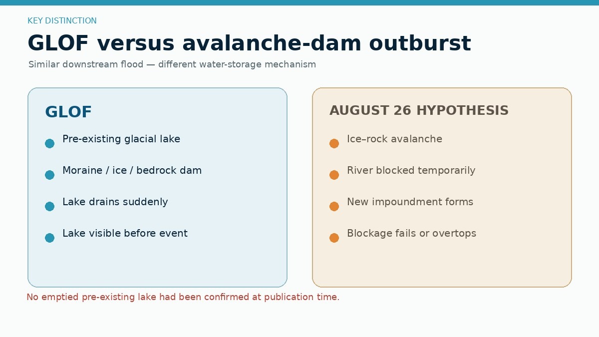
The distinction between an ice-rock avalanche and a Glacial Lake Outburst Flood (GLOF) is critical for hazard assessment:
- GLOFs require the sudden drainage of a pre-existing glacial lake (moraine-dammed or ice-dammed). While a lake may have formed after the August 26 avalanche due to river blockage, no emptied pre-existing lake has been discovered via high-resolution satellite data.
- Ice-Rock Avalanches involve the direct gravitational collapse of glacier ice and bedrock. When such an avalanche obstructs a river channel, it creates a temporary landslide-dammed lake whose eventual breach produces an outburst flood, but not a GLOF in the strict glaciological sense.
Global Analogs: Marmolada and Blatten
Geoscientists evaluating the Nepal-Tibet event have drawn parallels to recent high-altitude disasters in Europe:
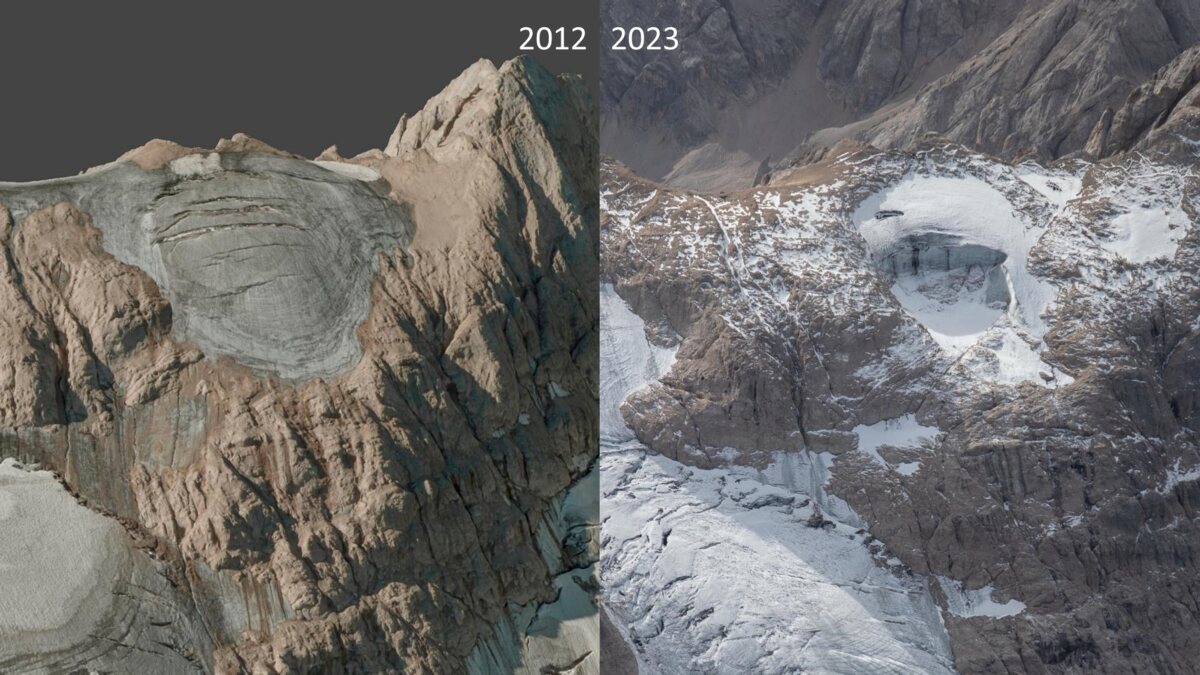
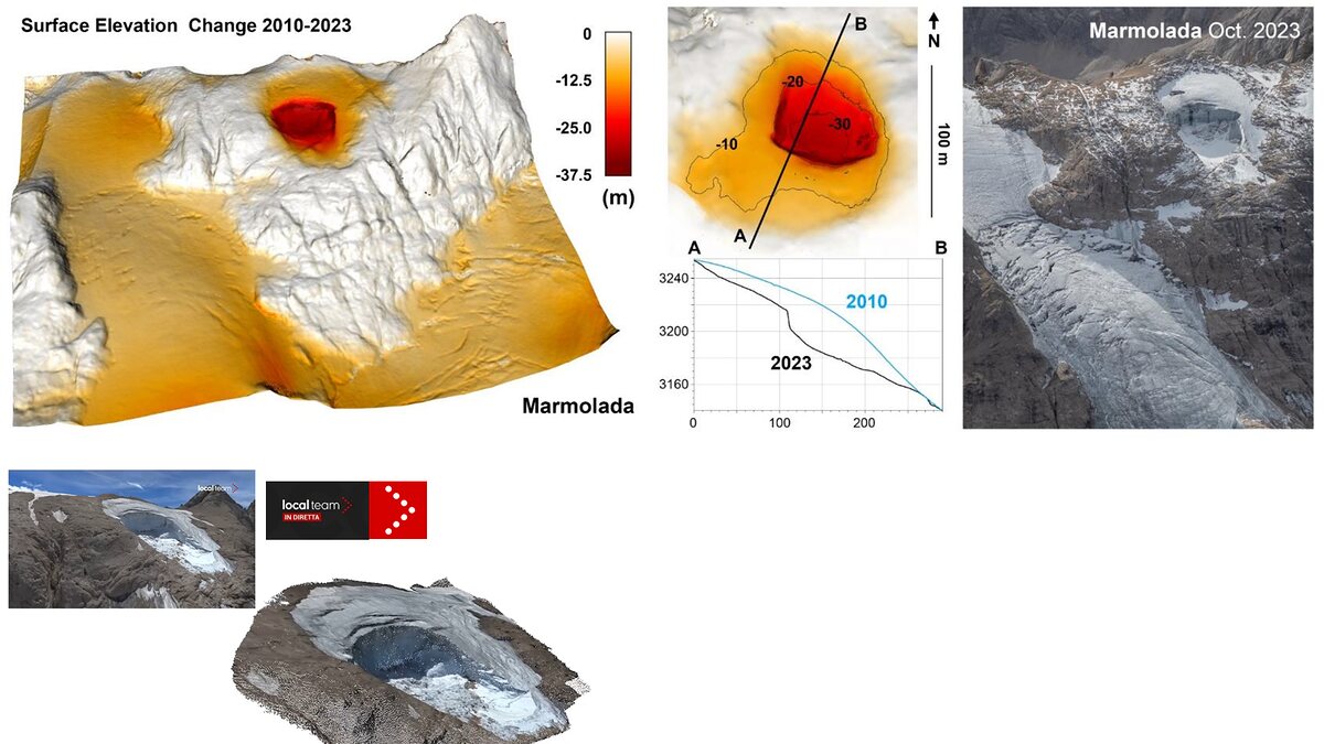
- Marmolada Glacier (Italy, July 2022): A collapse of roughly 70,000 cubic meters of ice and rock killed 11 mountaineers. Research published in Natural Hazards and Earth System Sciences demonstrated that the collapse was driven by internal hydrostatic pressures and warming temperatures, generating its own micro-seismic signature without tectonic triggers.
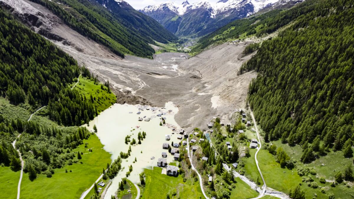
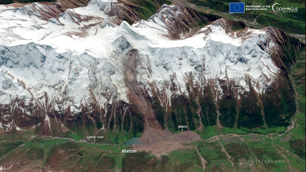
- Blatten (Switzerland, May 2025): A massive domino-style rock and ice avalanche involving the Birch Glacier mobilized 9.5 million cubic meters of material, burying parts of a Swiss village and damming the Lonza River. The Blatten disaster serves as a structural blueprint for how rockfall-loaded glaciers can fail catastrophically and transform into secondary river hazards.
Official Responses and International Action
In the wake of the disaster, governments and international organizations mobilized emergency response protocols, though rescue efforts remain severely hampered by damaged terrain.
- Nepal and Chinese Authorities: Local disaster management teams, military units, and police forces were deployed to search for survivors, clear debris, and deliver emergency rations. However, obliterated road networks in Rasuwa and Tibet forced rescue coordinators to rely heavily on aerial reconnaissance and helicopter deployments.
- ICIMOD and Scientific Agencies: The International Center for Integrated Mountain Development mobilized remote-sensing experts to evaluate satellite data from Planet Labs and Copernicus. Their assessments quickly redirected international attention away from the initial GLOF hypothesis, allowing hydrologists to focus on the stability of remaining upstream blockages.
- Meteorological and Hydrological Warnings: Regional authorities issued urgent advisories urging downstream communities along the Bhote Koshi and Trishuli corridors to remain clear of riverbanks. Scientists warned that secondary hazards—including the potential failure of remaining debris remnants in the upper Lhende Khola—pose an ongoing and active threat.
Implications: Cryospheric Vulnerability and Transboundary Monitoring
The August 26 disaster underscores urgent systemic vulnerabilities in high-mountain regions across the globe.
Changing Environmental Baselines
While researchers caution against directly attributing this single weather-adjacent event to climate change without formal attribution studies, the broader environmental context is undeniable. The Hindu Kush Himalaya region is experiencing accelerated warming. Extended warm seasons, high freezing levels, and early snow loss increase the vulnerability of steep rock walls and degrading permafrost. These shifts heighten the frequency of high-altitude rockfalls and ice detachments.
The Infrastructure Dilemma
Economic development in the Himalayas—particularly the rapid expansion of hydropower plants, roads, and tourism infrastructure along narrow, constricted valley floors—has exponentially increased human exposure to low-frequency, high-magnitude disasters. Engineering standards in these regions must evolve to account for complex, cascading geohazards that outpace standard flood-return calculations.
Transboundary Early Warning Gaps
One of the most glaring takeaways from the Bhote Koshi-Trishuli disaster is the inadequacy of transboundary warning frameworks. Natural hazards do not respect international borders; glacial systems in Tibet can unleash catastrophic floods into Nepal within minutes.
Traditional monitoring programs that focus solely on inventorying and sensor-equipping known glacial lakes are insufficient. Future risk-mitigation strategies must integrate:
- Continuous radar and satellite monitoring of unstable, high-altitude slopes and hanging glaciers.
- Acoustic and seismic sensor networks capable of instantly detecting mass movements at their source.
- Automated downstream river gauges linked to real-time transboundary communication channels.
- Community-based evacuation protocols designed to provide rapid alerts before debris-laden torrents traverse international boundaries.
As recovery efforts continue in the shadows of the Himalayas, the tragedy serves as a stark reminder that understanding the complex physics of mountain collapses is essential not only for scientific accuracy, but for saving lives in an increasingly unstable cryosphere.
