

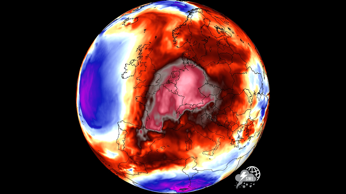
EUROPE — As the calendar transitions from September to October, a staggering and remarkably robust atmospheric phenomenon is making a dramatic comeback across the European continent. A massive, highly persistent "heat dome" is establishing itself over Western, Central, and Northern Europe, paving the way for an unseasonably intense and prolonged warm spell.
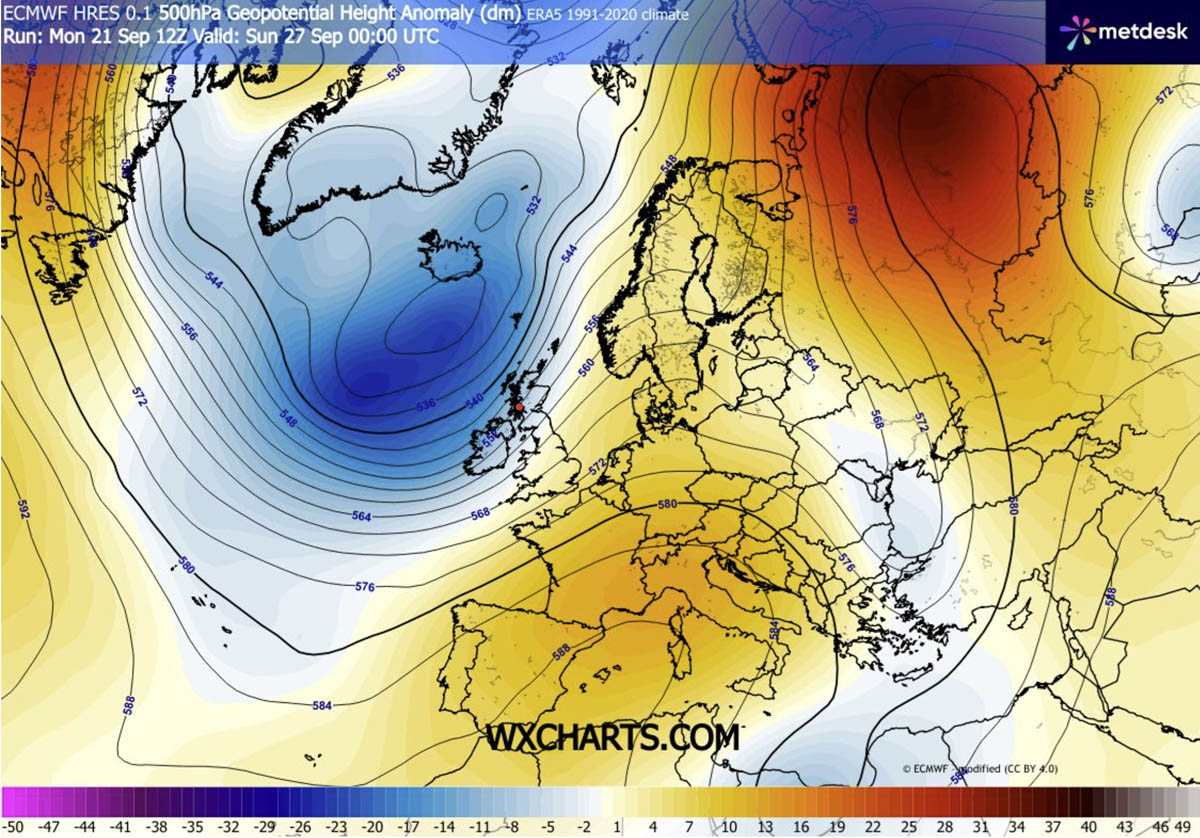
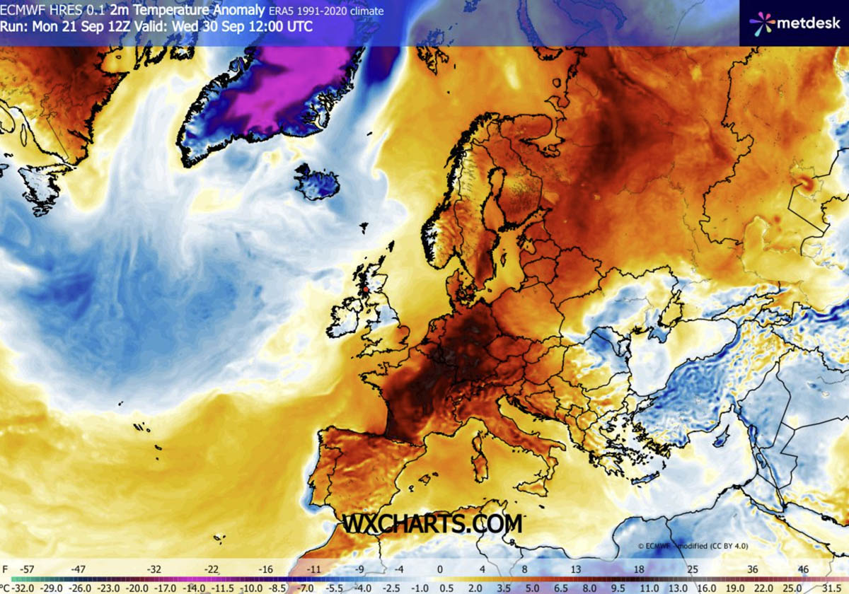
Meteorological models indicate that significant 850 hPa temperature anomalies will locally climb 8 to 12 °C above long-term historical averages. This late-autumn thermal surge is driven by a classic, high-amplitude atmospheric dipole pattern, bringing mid-summer-like heat deep into regions that should already be experiencing crisp, autumn weather.
Main Facts: The Anatomy of the European Heat Dome
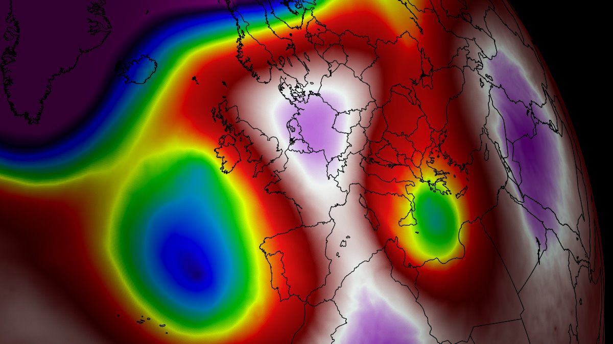
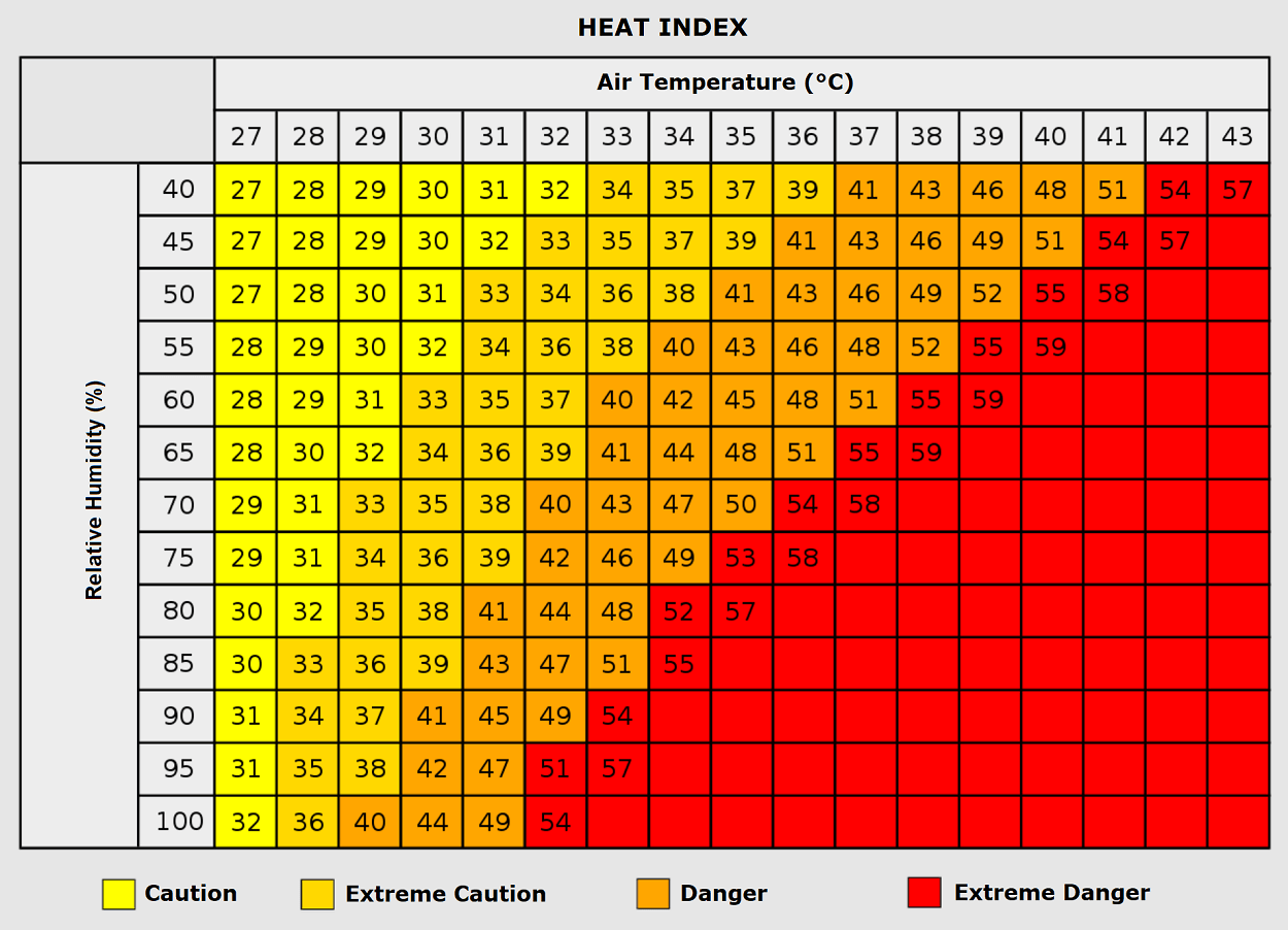
The primary driver behind this late-season heatwave is a powerful upper-level ridge building aggressively northward from the Mediterranean and North Africa. This warm plume is being funneled into continental Europe by a deep, high-amplitude upper-level trough establishing itself over the North Atlantic, which in turn forces an intense southerly jet stream.
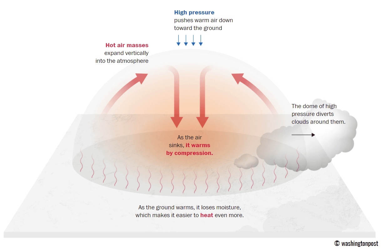
Beneath the core of this expansive blocking ridge, strong atmospheric subsidence is actively compressing and warming the lower troposphere. This process effectively acts as a lid on a pot, suppressing cloud cover, halting precipitation, and trapping scorching air masses near the surface.
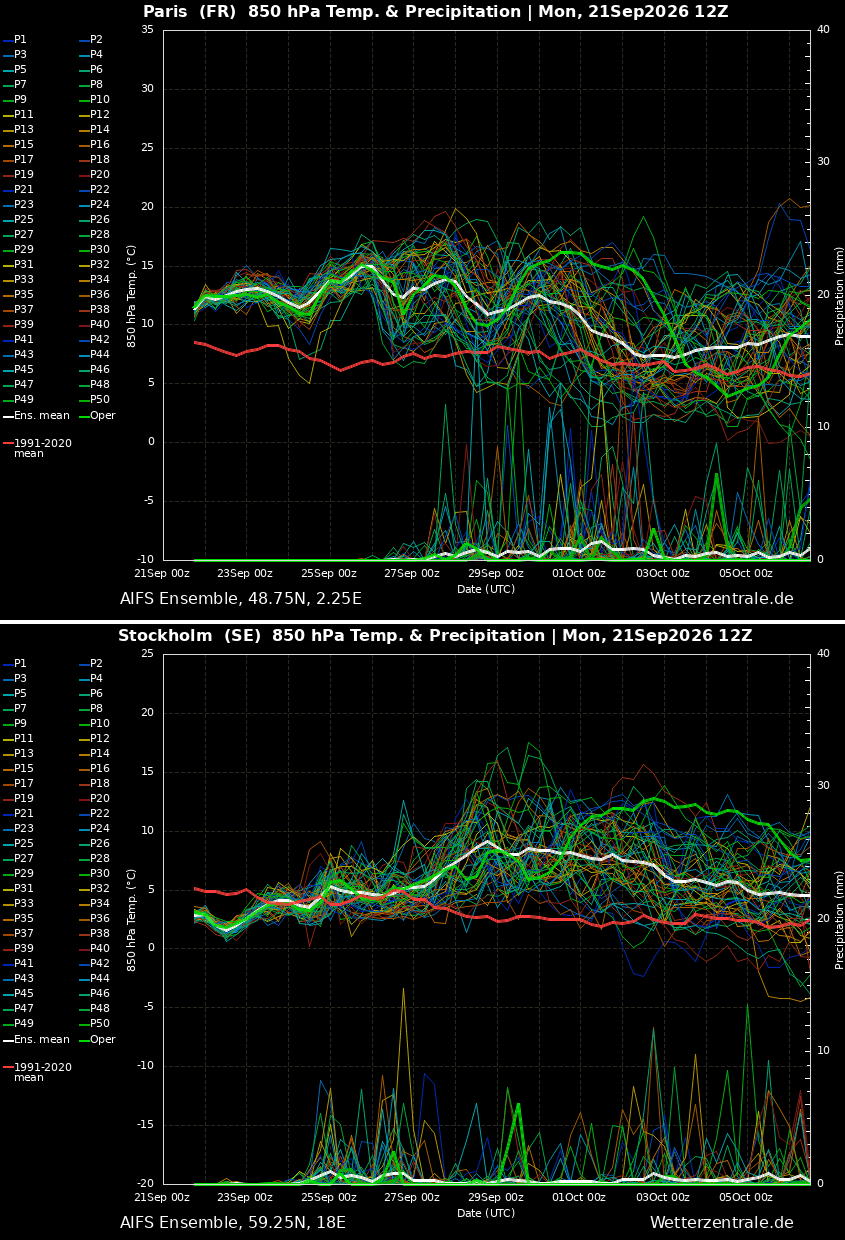
- Temperature Anomalies: 850 hPa levels (approx. 1,500 meters altitude) will see temperatures 8 °C to 12 °C above normal. At the surface (2-meter level), temperatures will range from 10 °C to 14 °C above late-September climatic norms.
- Peak Values: Afternoon surface temperatures are forecasted to soar well into the upper 20s (°C), while peaking in the low-to-mid 30s across parts of France, and surpassing 35 °C—potentially touching 40 °C—across the Iberian Peninsula.
- Geographical Scope: The atmospheric block will restrict Atlantic weather systems to the far western edges of the continent, allowing stable, dry air to dominate low-lying agricultural basins and urban valleys from Spain to Scandinavia.
Chronology: Progression of the Thermal Surge
The evolution of this atmospheric blocking pattern follows a distinct timeline, moving progressively from the southwest of the continent toward the north and east as September gives way to October.
Phase 1: Iberian Peninsula and Southwestern Europe (Mid-to-Late Week)
The initial onslaught of extreme heat targets Spain and Portugal. Driven directly by the North African warm plume, daytime highs through Saturday will consistently range between 34 °C and 38 °C across south-central Spain and Portugal, with localized peaks potentially reaching 40 °C. The air mass here will be exceptionally dry, amplifying the heat stress during peak afternoon hours.
Phase 2: France and Western Europe (Late Week through Weekend)
As the heat dome expands aloft, the thermal boundary shifts northeastward. Southern and central France will bear the brunt of this phase, with internal southern regions pushing toward 36 °C. Northern France and the Benelux union will experience comfortable yet unseasonably high temperatures in the low 30s by the weekend. Meanwhile, the United Kingdom—specifically south-central England—will see a shorter, yet notable, spell of mid-to-upper 20s.
Phase 3: Central Europe, Italy, and the Balkans (Saturday through Early Next Week)
Over the weekend and into the first days of October, the warm air mass will advect further east and northeast. Germany, Poland, and the Baltic region will experience a return of mid-to-upper 20s, with western and central German valleys approaching the 30 °C threshold. Concurrently, northern Italy—particularly the Po Valley and Tuscany—along with the central Balkans and Greece, will challenge late-September record highs with temperatures reaching 28 °C to 30 °C.
Phase 4: Northern Europe and Extended Scandinavian Peak (Early October)
By next week, the upper-level ridge will anchor itself firmly over Northern Europe. Ensemble forecasts from the GFS and ECMWF models project that Sweden and Finland will experience the most significant relative thermal anomalies of the entire event. Early-October temperatures across Scandinavia will run drastically above normal, persisting well into the first week of the new month.
Supporting Data: Meteorological Mechanics and Regional Breakdowns
Understanding the severity of this event requires examining both the macro-scale atmospheric setup and localized metrics.
The Omega Block and Atmospheric Dynamics
Meteorologists categorize this setup as an amplified blocking pattern, frequently resembling an "Omega block." The stationary high-pressure system prevents normal weather systems from moving from west to east, effectively freezing the meteorological map in place.
While continental Europe bakes beneath clear skies and sinking air, the sharp pressure gradient between the Atlantic low and the European high is generating a powerful southwesterly jet stream. This acts as an atmospheric river, funneled directly into the western British Isles and western Norway. Consequently, while France and Germany experience drought-like heat, regions from western Ireland to Scotland and southwestern Norway are facing torrential orographic rainfall, with accumulated totals expected to exceed 150 mm in localized areas through early October.
Regional Breakdown Summary Table
- Iberia (Spain/Portugal): 34 °C – 38 °C (Peaks up to 40 °C); extremely dry.
- France: Mid-30s in the south/center; low 30s in the north.
- United Kingdom: Mid-to-upper 20s in south-central England; mid-10s in Ireland and Scotland.
- Germany & Benelux: 27 °C – 29 °C; peaking early next week.
- Italy & Balkans: 28 °C – 30 °C; highly anomalous values in the Po Valley.
- Scandinavia: Exceptionally high anomalies extending into Sweden and Finland.
Health and Infrastructure Implications
While late-season warmth is often welcomed by tourists and outdoor enthusiasts, a heat dome of this magnitude and temporal persistence carries severe societal risks.
Nocturnal Heat Stress and "Tropical Nights"
One of the most insidious threats posed by prolonged autumn heat domes is the absence of nighttime relief. Forecasters warn of suffocating "tropical nights," where minimum temperatures fail to drop below 24 °C. This continuous heat denies the human body its vital physiological window to cool down and recover, exponentially increasing cumulative heat stress over multi-day periods.
Vulnerable Populations and Occupational Hazards
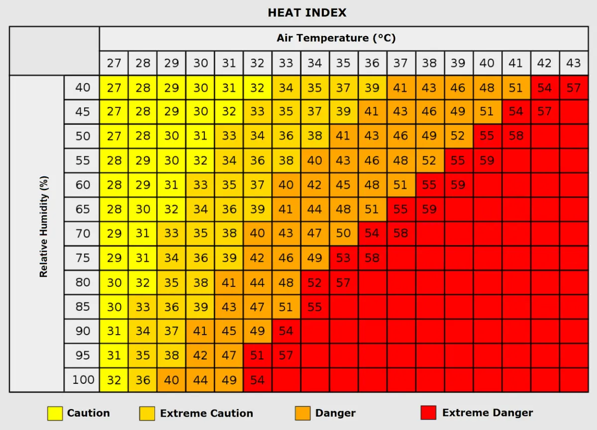
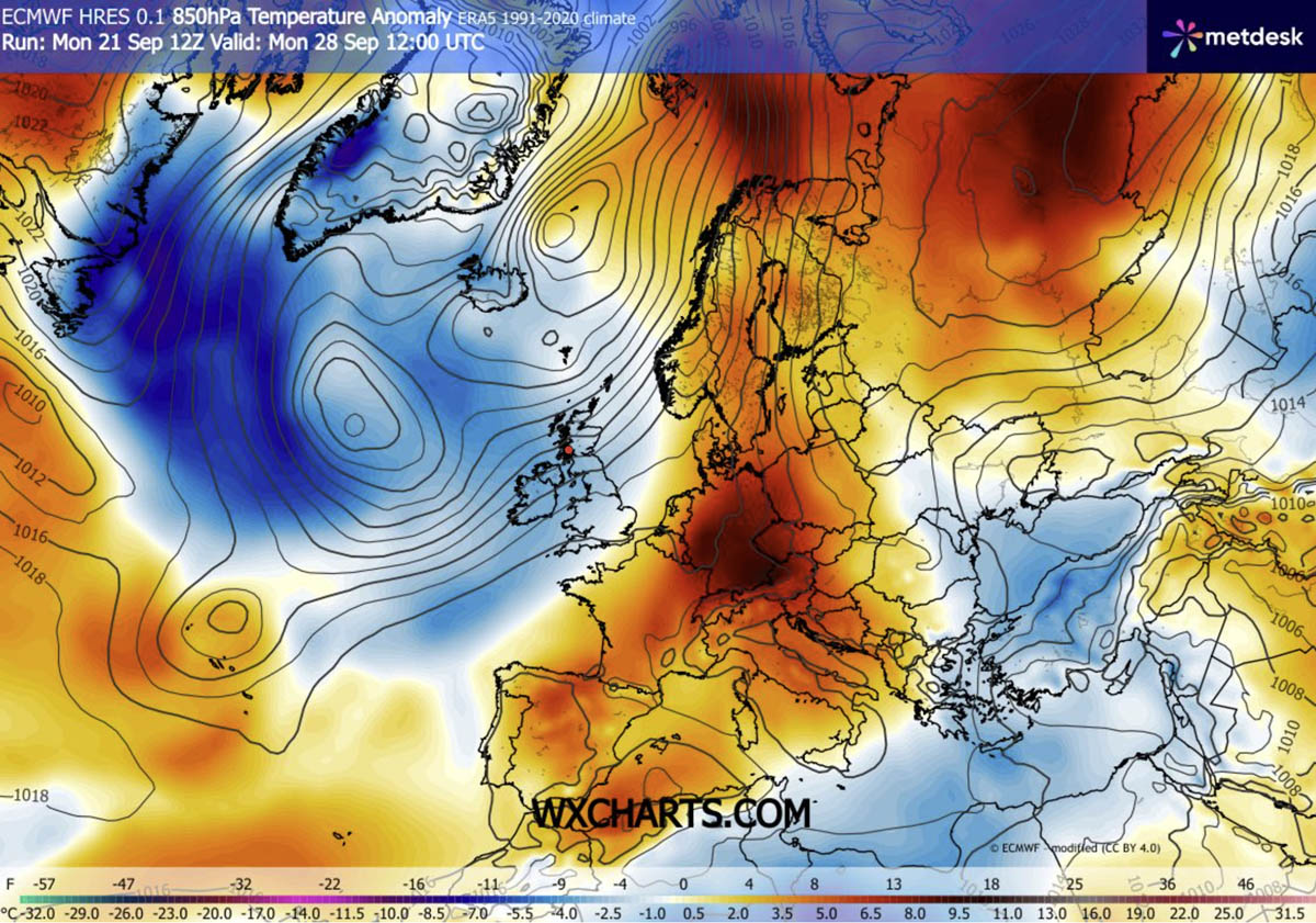
Vulnerable demographics—including the elderly, young children, and individuals with pre-existing cardiovascular or respiratory conditions—face heightened health risks. Furthermore, outdoor workers in agriculture, construction, and urban maintenance are exposed to dangerous heat indices.
The combination of high temperatures and localized humidity elevates the risk of heat exhaustion, dehydration, and heatstroke. Urban areas are particularly susceptible due to the urban heat island effect, where concrete, asphalt, and dense housing infrastructure trap and reradiate thermal energy long after sunset.
Official Responses and Long-Range Outlook
National meteorological services across Western and Central Europe have begun issuing early advisories, urging citizens to monitor local forecasts and heat health alerts. Agricultural sectors are also monitoring soil moisture levels closely, as the extended dry, warm spell threatens to exacerbate late-season dryness in key farming basins.
Looking further ahead into October, long-range ensemble trends suggest that while this specific blocking ridge will eventually break down, the transition back to a dynamic, autumnal weather pattern may not occur until deep into the month. Forecasters and meteorological institutions, utilizing data from providers such as PivotalWeather and WXcharts, will continue to monitor model runs to provide timely updates as the situation evolves.
