

Main Facts
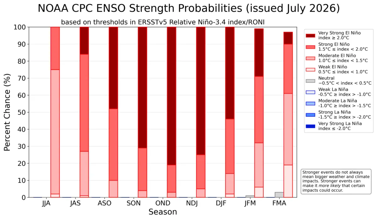
Meteorological agencies and long-range forecasting centers worldwide are tracking the rapid development of a powerful "Super El Niño" across the tropical Pacific Ocean. Current ocean analyses and numerical model projections indicate that this warm-phase El Niño-Southern Oscillation (ENSO) event is tracking toward potential record-shattering intensity as it peaks in late Fall 2026 and early Winter 2026/2027.
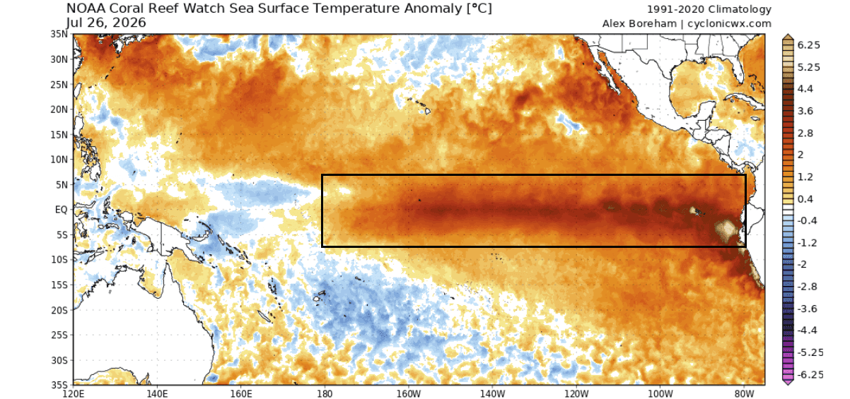
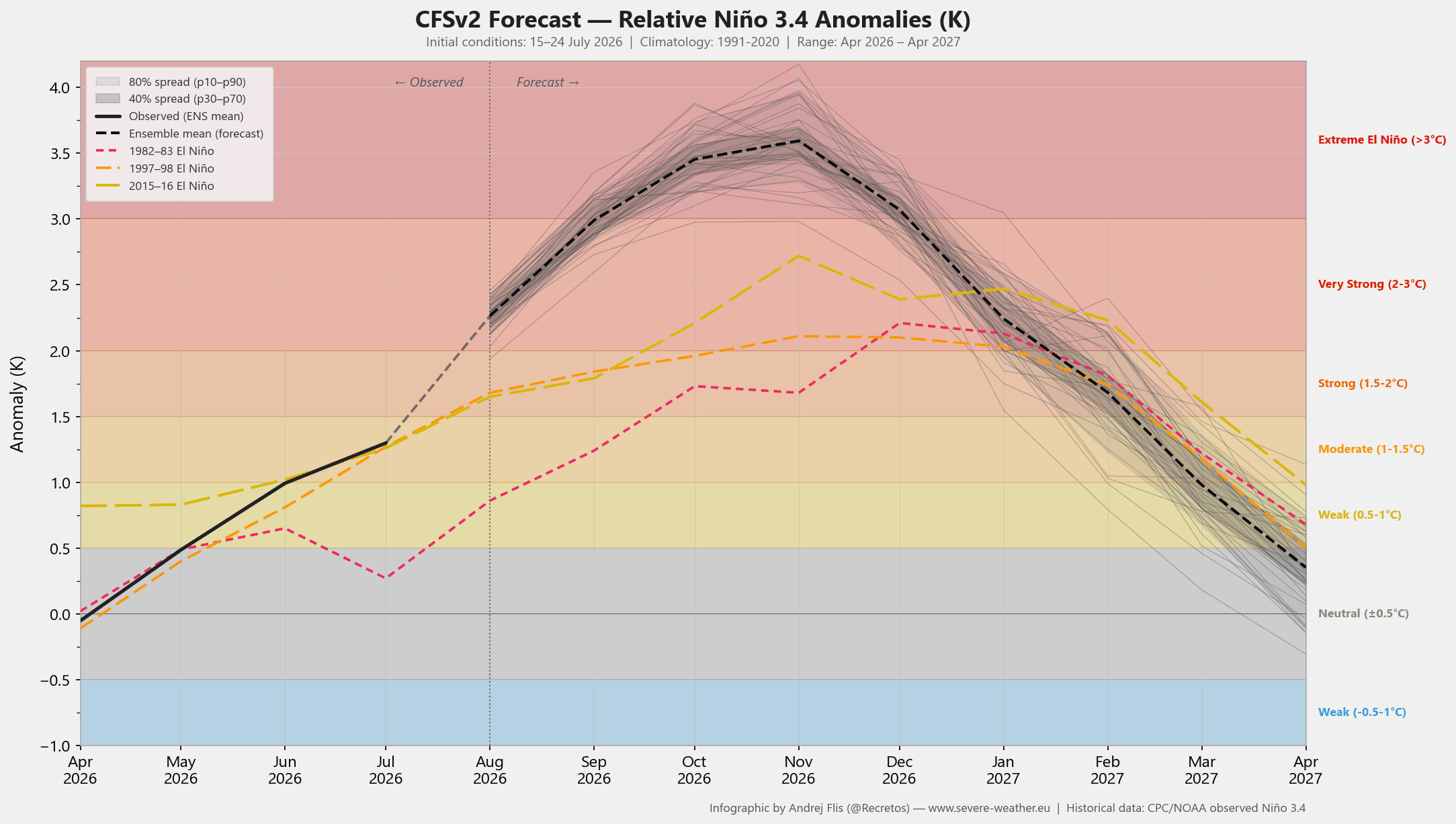
Sea surface temperature anomalies in the main equatorial ENSO regions have surged significantly, with peak deviations projected to breach the +3°C to +5°C thresholds above historical baselines. This places the current event well beyond the threshold required for a "Super El Niño" (+2°C) and on a trajectory that outpaces the development rates of previous historic benchmark events.
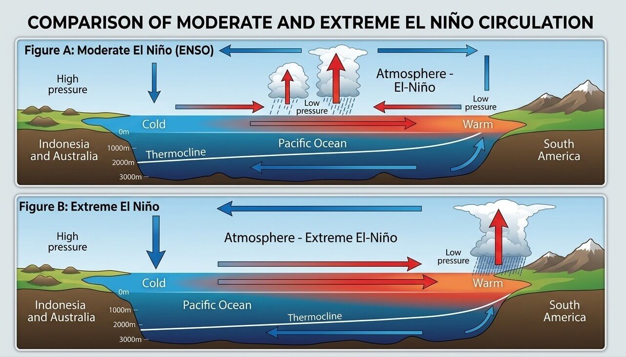
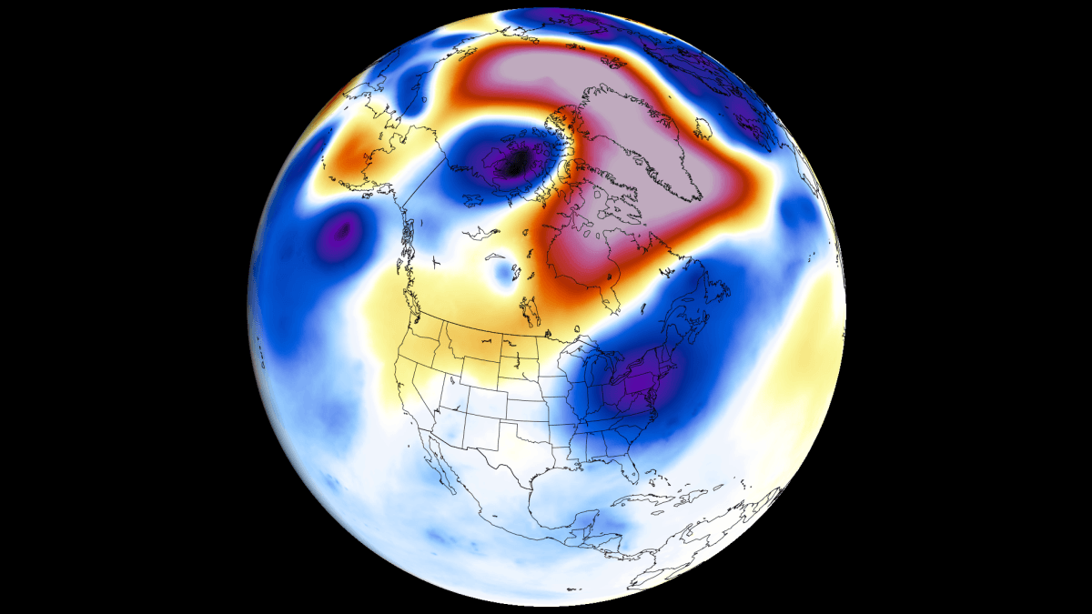
The climatic consequences of this ocean-warming phenomenon are already materializing across the Northern Hemisphere. Driven by an intensified "atmospheric bridge" and a modified Walker Circulation cell, the anomaly is locking an atmospheric standing wave into place over the Pacific Basin.
For North America, this dynamic translates to a pronounced split-flow jet stream, shifting storm tracks southward, and driving atypical weather extremes across the United States and Canada. Meanwhile, Europe is beginning to experience secondary atmospheric responses characterized by dynamic pressure blocking and shifting temperature anomalies. Global forecasting models—including those from the National Centers for Environmental Prediction (NCEP) and the European Centre for Medium-Range Weather Forecasts (ECMWF)—confirm that the atmospheric circulation is rapidly reorganizing under the expanding influence of the Pacific forcing.
Chronology of Development: From Subsurface Kelvin Waves to Global Forcing
The lifecycle of the 2026/2027 Super El Niño is rooted in oceanic dynamics that began months prior to surface manifestations.
Late Spring and Early July 2026: Subsurface Activation
The precursors to the current event were forged deep beneath the surface of the tropical Pacific. Persistent westerly wind bursts triggered massive subsurface warm anomalies known as downwelling Kelvin waves. These subsurface thermal pulses propagated eastward across the Pacific basin over several weeks, eventually breaching the surface in the central and eastern tropical Pacific. By July, surface temperatures reflected an unusual and rapid warming rate, closely mimicking historical analogues of major El Niño events but exhibiting a steeper gradient of intensification.
August 2026: Atmospheric Lockdown and Standing Waves
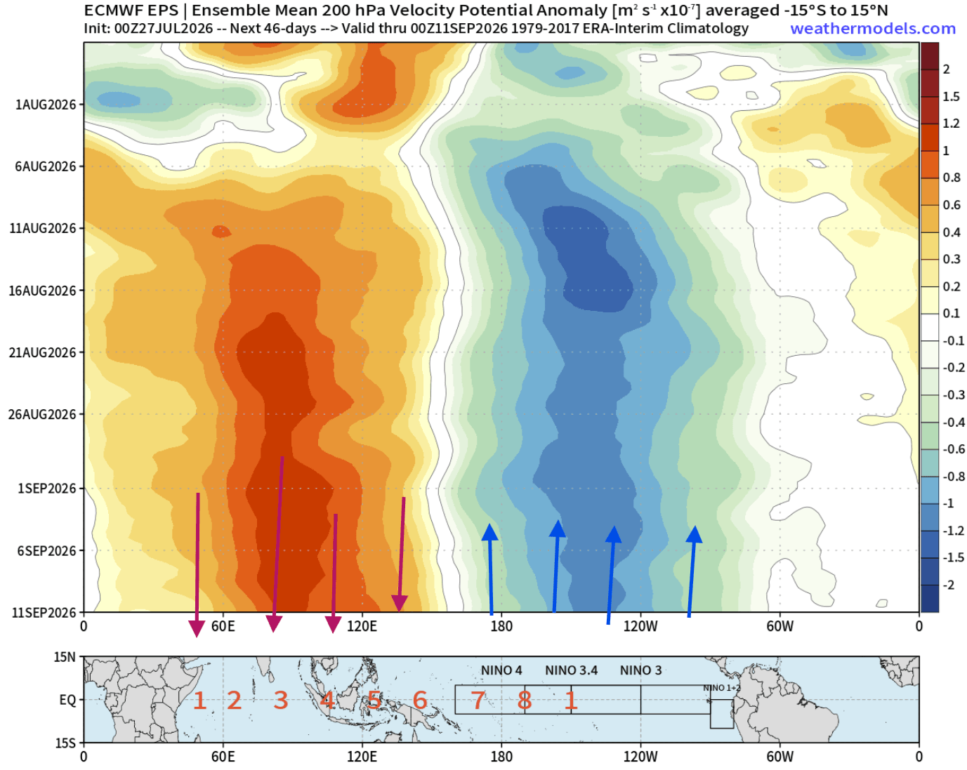
As summer transitions into late August, the persistence of the equatorial warm anomaly has forced a fundamental shift in global atmospheric motion. The Walker Circulation—the tropical system of rising air over the warm Pacific and sinking air over the cooler Indian Ocean—has undergone severe modification. ECMWF ensemble forecasts identify a stationary atmospheric standing wave locked over the central and eastern Pacific. This atmospheric fixture is acting as a primary engine, dictating mid-latitude pressure patterns and beginning to steer the trajectory of the jet stream across North America and into the Atlantic.
Fall 2026 (Projections): Jet Stream Amplification
Moving deeper into the autumn months, seasonal models from the ECMWF and Copernicus multi-model ensembles project a rapid amplification of the Pacific jet stream. The downstream atmospheric response is expected to accelerate, establishing a robust high-pressure ridging pattern across western Canada and the northern United States, juxtaposed against a developing low-pressure trough over the southern tier of the U.S. This configuration signals an exceptionally early transition into a winter-like atmospheric regime.
Winter 2026/2027 (Projections): Peak Split-Flow Regime
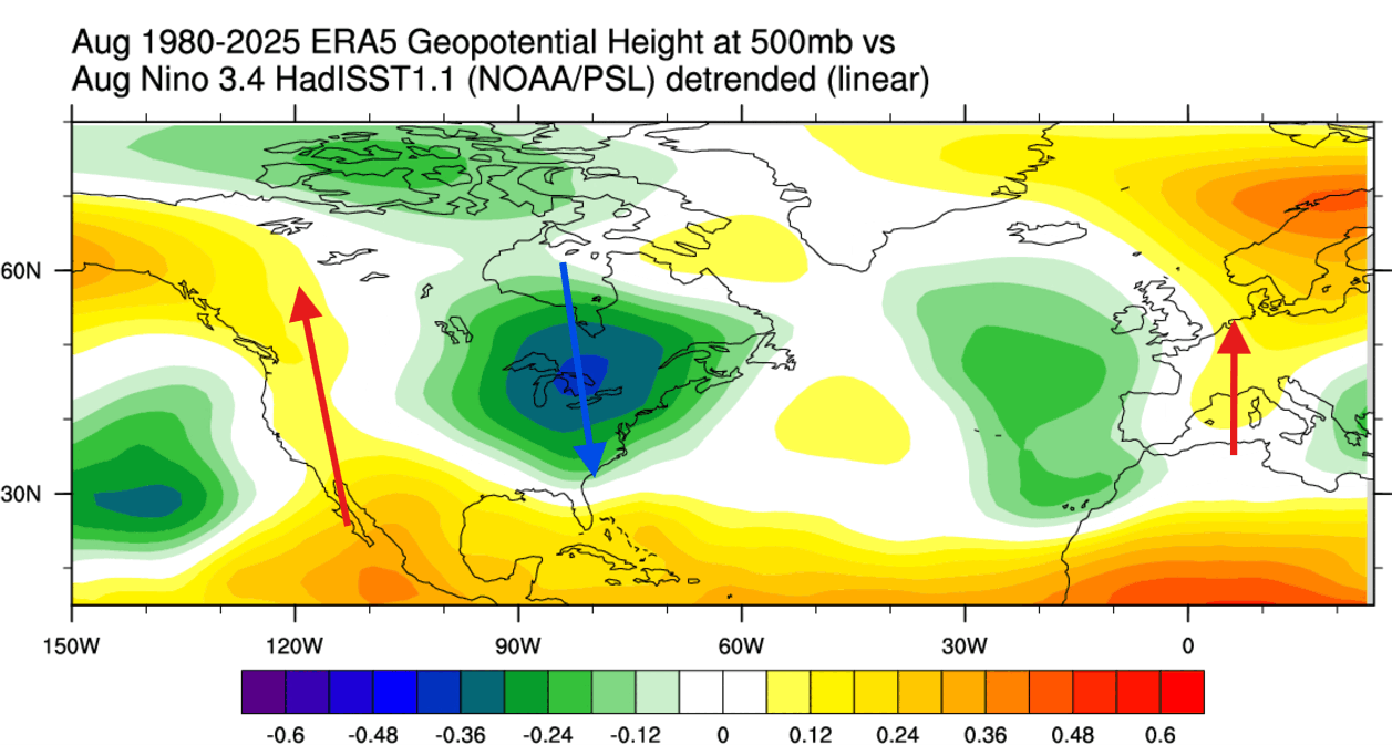
At its anticipated peak in late Fall and early Winter, the Super El Niño will establish a distinct split-flow pattern across the North American continent. The northern branch of the jet stream, reinforced by persistent Canadian high-pressure blocking, will suppress deep Arctic air incursions across the Northern Plains and Great Lakes. Conversely, the southern branch will host an active storm track, steering moisture and frequent cold-air intrusions into the Central, Southern, and Eastern United States through January and February 2027.
Supporting Data and Meteorological Analysis
The confidence among long-range meteorologists stems from a convergence of observational reanalysis data and multi-model ensemble outputs.
Ocean Surface Temperatures and the NCEP CFSv2 Model
Recent updates from the National Oceanic and Atmospheric Administration (NOAA) Climate Prediction Center (CPC) and the NCEP CFSv2 model show unprecedented ensemble support for an extreme El Niño classification. While typical El Niño events exhibit maximum warming in the eastern Pacific, this event displays a hybrid structure with massive anomalies extending from the central Pacific eastward. Current sea surface temperature anomaly charts document localized peaks exceeding +5°C above normal in core ENSO sectors.
[Equatorial Pacific Warm Anomaly]
       │
       ▼ (Kelvin Wave Propagation)
[Surface Temperature Surge (+3°C to +5°C)]
       │
       ▼ (Modified Walker Cell)
[Atmospheric Standing Wave Established]
       │
       ▼
[Jet Stream Reorganization & Split-Flow over North America]
Velocity Potential and Atmospheric Bridges
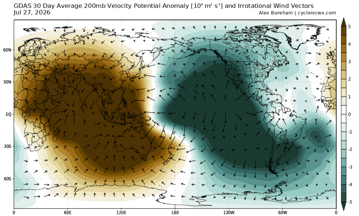
To evaluate the atmospheric response, meteorologists utilize 200mb velocity potential anomalies (measured at an altitude of roughly 12 kilometers or 7.5 miles). GDAS and ECMWF analyses for July and August reveal robust rising air motion (divergence) characterized by strong teal-colored anomalies over the central and eastern Pacific, paired with intense sinking air (convergence) over the Indian Ocean. This configuration confirms that the tropical heat source is successfully coupling with the upper-level flow, establishing a functional atmospheric bridge that transmits Pacific signals to distant mid-latitude regions.
Regional Pressure and Temperature Anomalies
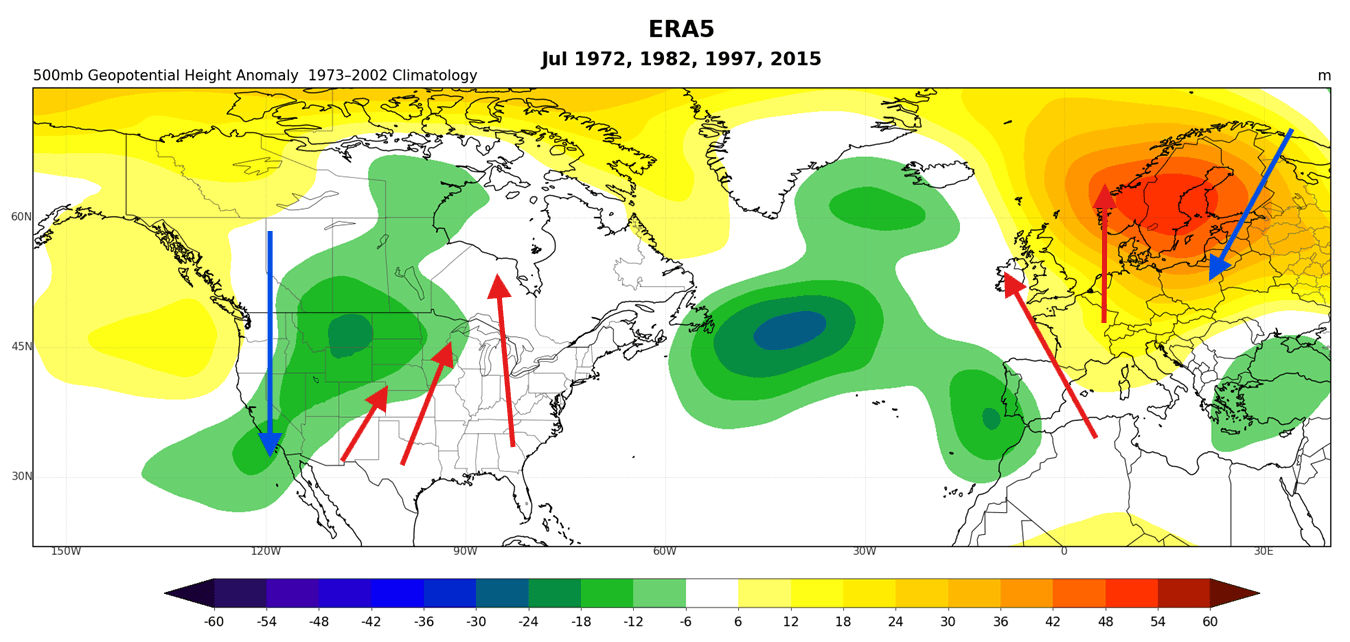
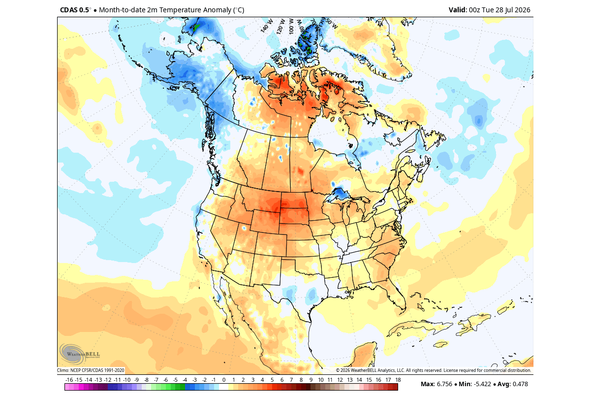
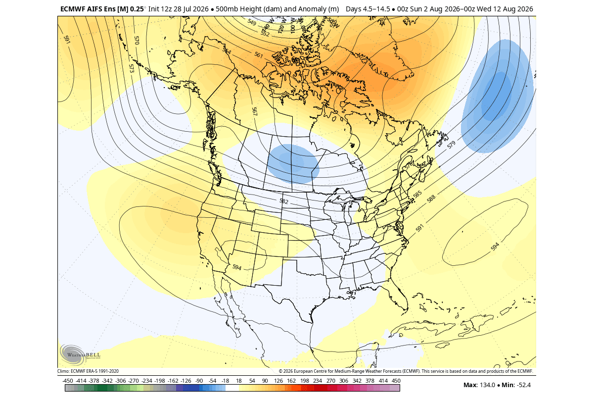
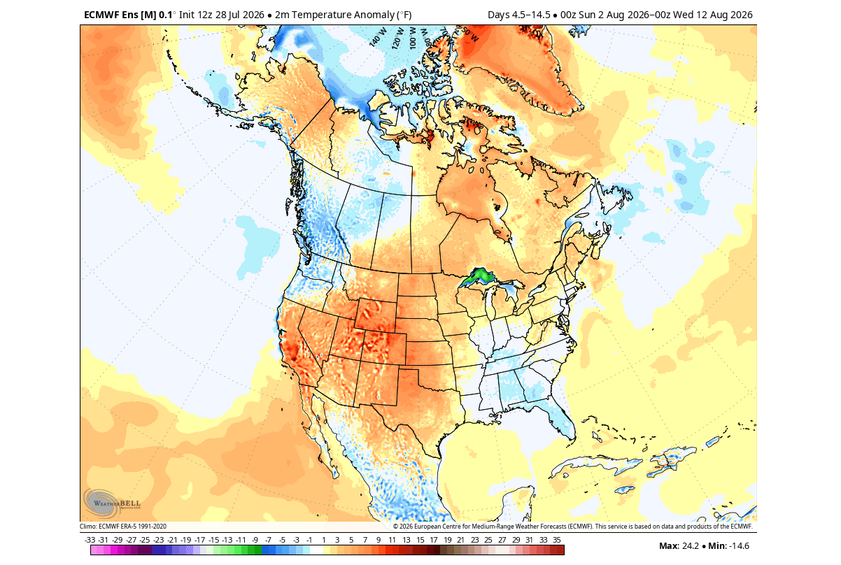
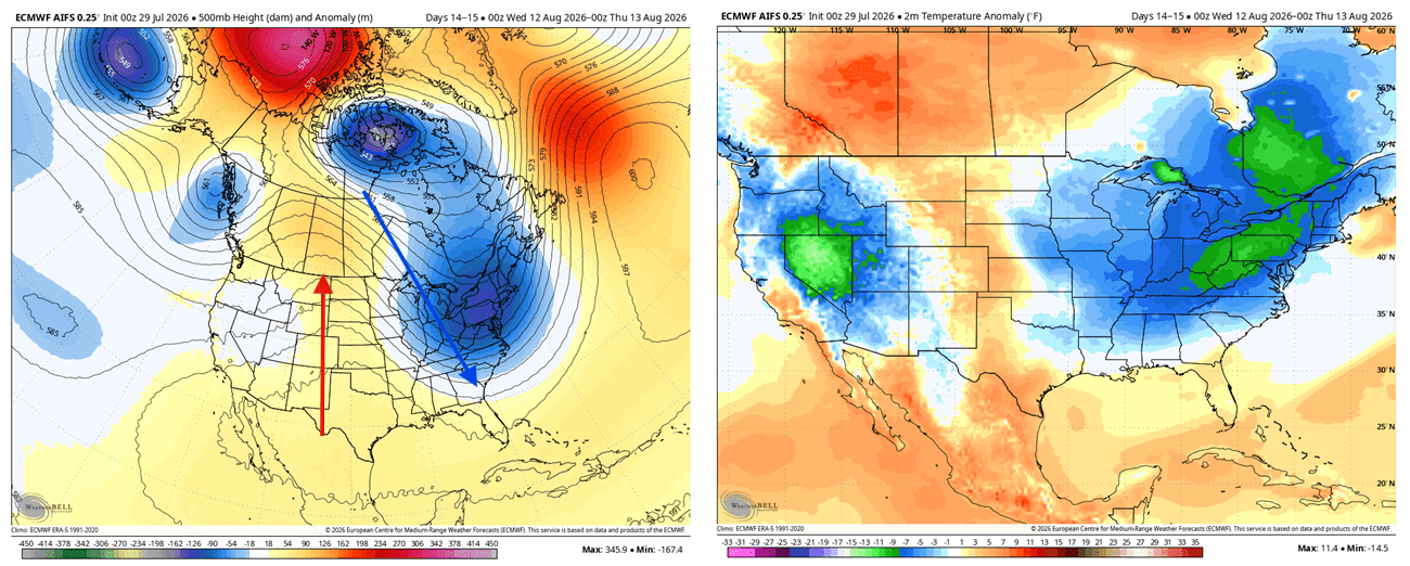
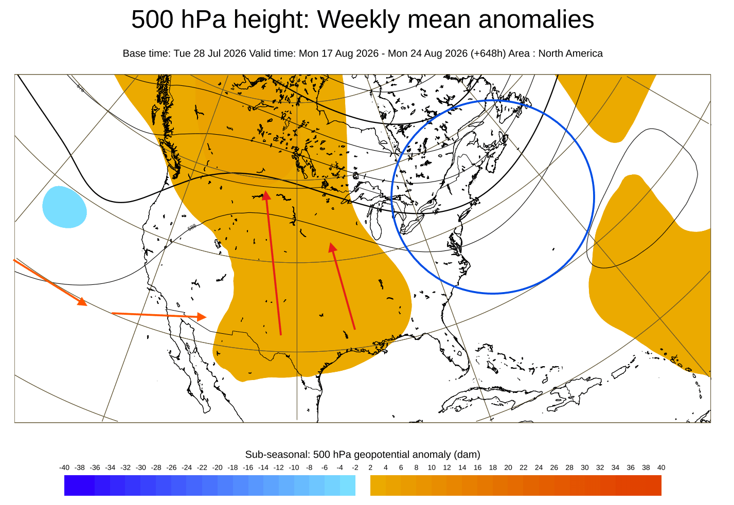
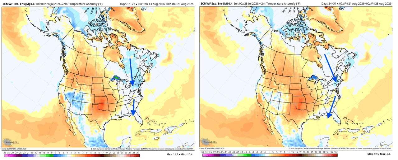
- North America: July reanalysis data demonstrated a western low-pressure anomaly that promoted a warm southerly flow across the central and eastern U.S. and Canada, while the west coast experienced cooler, northwesterly conditions. As August progresses, ensemble runs indicate a shifting trough toward the eastern U.S., driving below-normal temperatures into the Midwest and East by mid-to-late month.
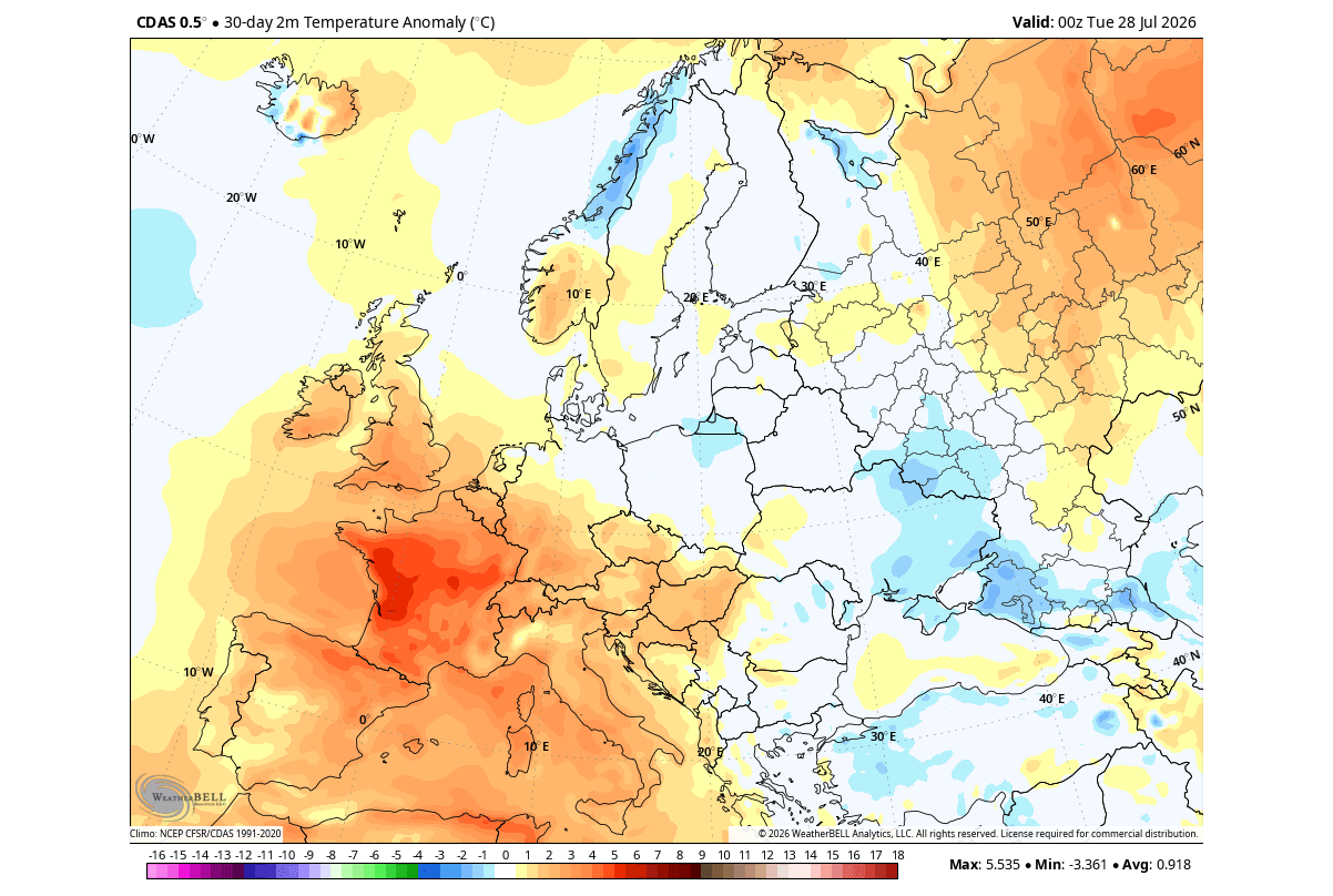
- Europe: While Europe experiences a delayed and more indirect response to ENSO forcing, early August trends highlight alternating high-pressure blocking over central and southern regions, driving above-normal warmth and dry conditions, contrasted by low-pressure activity and cooler, wetter regimes across northern and northwestern Europe.
Official Responses and Outlooks
National and international meteorological institutions have systematically elevated their alert levels in response to the modeling data.
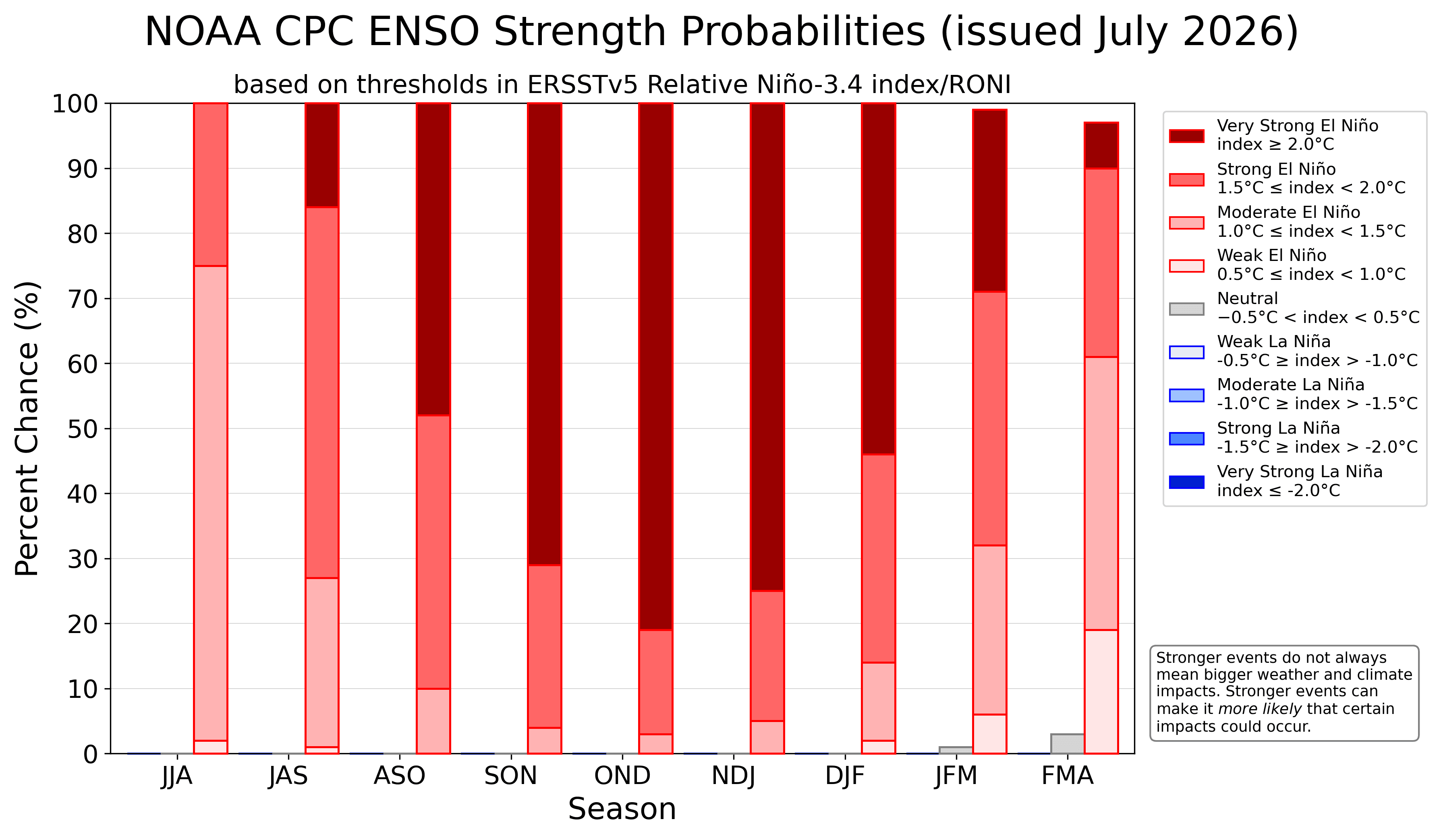
The NOAA Climate Prediction Center has maintained high-probability outlooks favoring the development of a historically strong ENSO event. Official advisories emphasize that the current trajectory surpasses normal operational thresholds, requiring utilities, agricultural planners, and emergency management agencies to prepare for amplified seasonal volatility.
Similarly, the European Centre for Medium-Range Weather Forecasts (ECMWF) and the Copernicus Climate Change Service have incorporated the extreme Pacific forcing into their seasonal baselines. Official briefings stress that because this Super El Niño is developing at an accelerated pace, traditional seasonal transitions are being compressed. Agencies are actively coordinating with transportation, energy, and agricultural sectors to disseminate warnings regarding potential disruptions tied to the forecasted split-flow winter regime, particularly concerning shifting precipitation belts and agricultural drought-to-flood transitions across the Americas.
Global and Regional Implications
The maturation of a Super El Niño of this magnitude carries profound implications across multiple sectors, fundamentally reshaping environmental and socio-economic baselines for the remainder of 2026 and well into 2027.
Agricultural and Hydrological Impacts
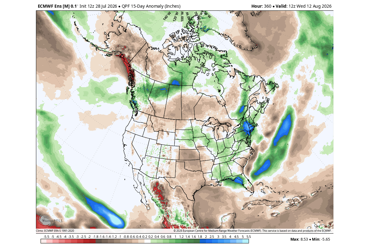
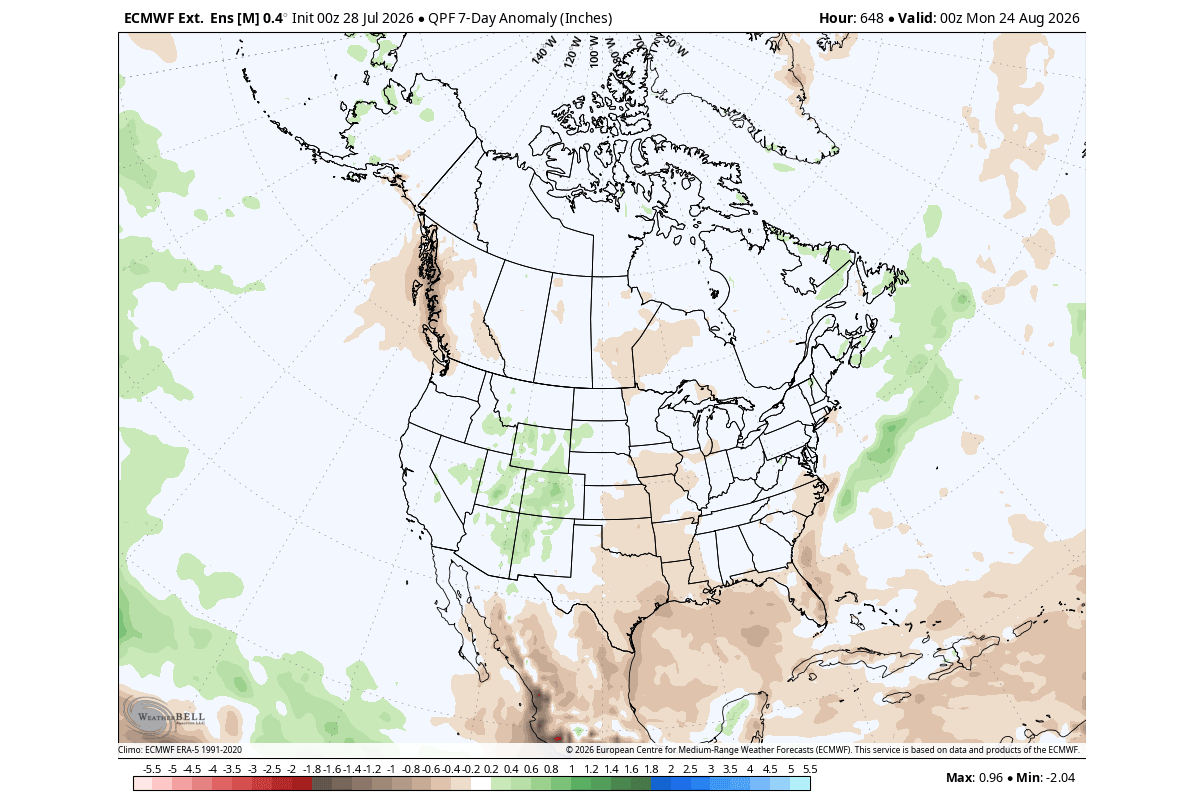
- United States: The projected southward displacement of the storm track during Fall and Winter 2026/2027 will significantly alter precipitation distribution. The Southern Plains, Gulf Coast, and interior Mid-Atlantic face heightened risks of excessive moisture, frequent heavy rainfall, and potential flooding events due to an active subtropical jet stream. Conversely, the Pacific Northwest, upper Midwest, and parts of the northern tier face drier-than-average conditions, raising localized drought concerns.
- Snowpack and Water Resources: Due to Canadian high-pressure blocking suppressing deep Arctic air, snowpack accumulation across the Northern Plains, upper Midwest, and Great Lakes is projected to be notably below normal. This reduction in winter snowpack poses long-term hydrological implications for spring meltwater supplies in northern river basins.
Energy and Infrastructure
The anticipated temperature anomalies—featuring persistent warmth across northern latitudes paired with sharp, frequent cold intrusions into the central and southern United States during January and February—will place unique demands on energy grids. Regional energy providers must prepare for fluctuating load demands driven by southern winter cooling trends and northern winter mildness. Furthermore, infrastructure managers in regions slated for increased storminess must account for heightened risks associated with persistent heavy precipitation and saturated soils.
European Weather Dynamics
Though Europe remains buffered by distance from direct equatorial forcing, the downstream impacts of a modified global jet stream cannot be discounted. The persistence of Atlantic low-pressure systems interacting with continental high-pressure blocking is projected to maintain above-normal surface temperatures across central and western Europe through the autumn months, accompanied by variable precipitation patterns that could impact late-season crop yields and maritime operations.
As the 2026/2027 Super El Niño continues its ascent toward record intensity, meteorological monitoring networks will maintain continuous surveillance. The unprecedented velocity of this event underscores the necessity for adaptive long-range planning across all levels of industry and governance.
