

GLOBAL — As the meteorological community monitors the tropical Pacific Ocean, a massive global weather driver is rapidly taking shape. Latest long-range atmospheric and oceanic forecasts for Fall 2026 and Winter 2026/2027 point to the development of a record-strong Super El Niño.

Unusually evolved patterns are already emerging across the Northern Hemisphere weeks ahead of schedule. Fueled by extraordinary thermal energy reservoirs beneath the ocean surface, this exceptionally powerful warm phase is threatening to rewrite seasonal predictability, bringing early winter-like atmospheric anomalies, a split-flow jet stream over North America, and an increased risk of mid-winter stratospheric disruptions.
Main Facts: The Anatomy of an Emerging Super El Niño
The core driver of the upcoming global weather shift is a rapidly strengthening El Niño event that has already surpassed historical benchmarks for this time of year.
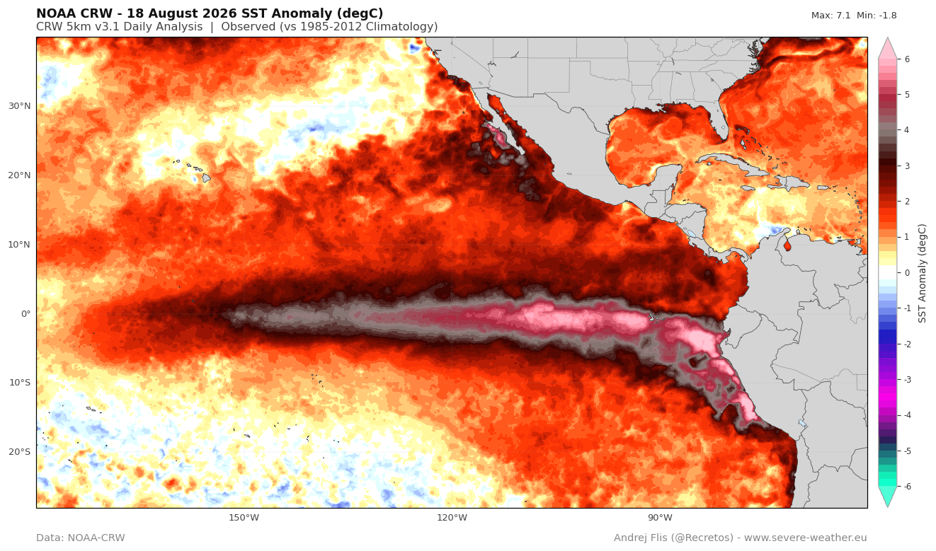
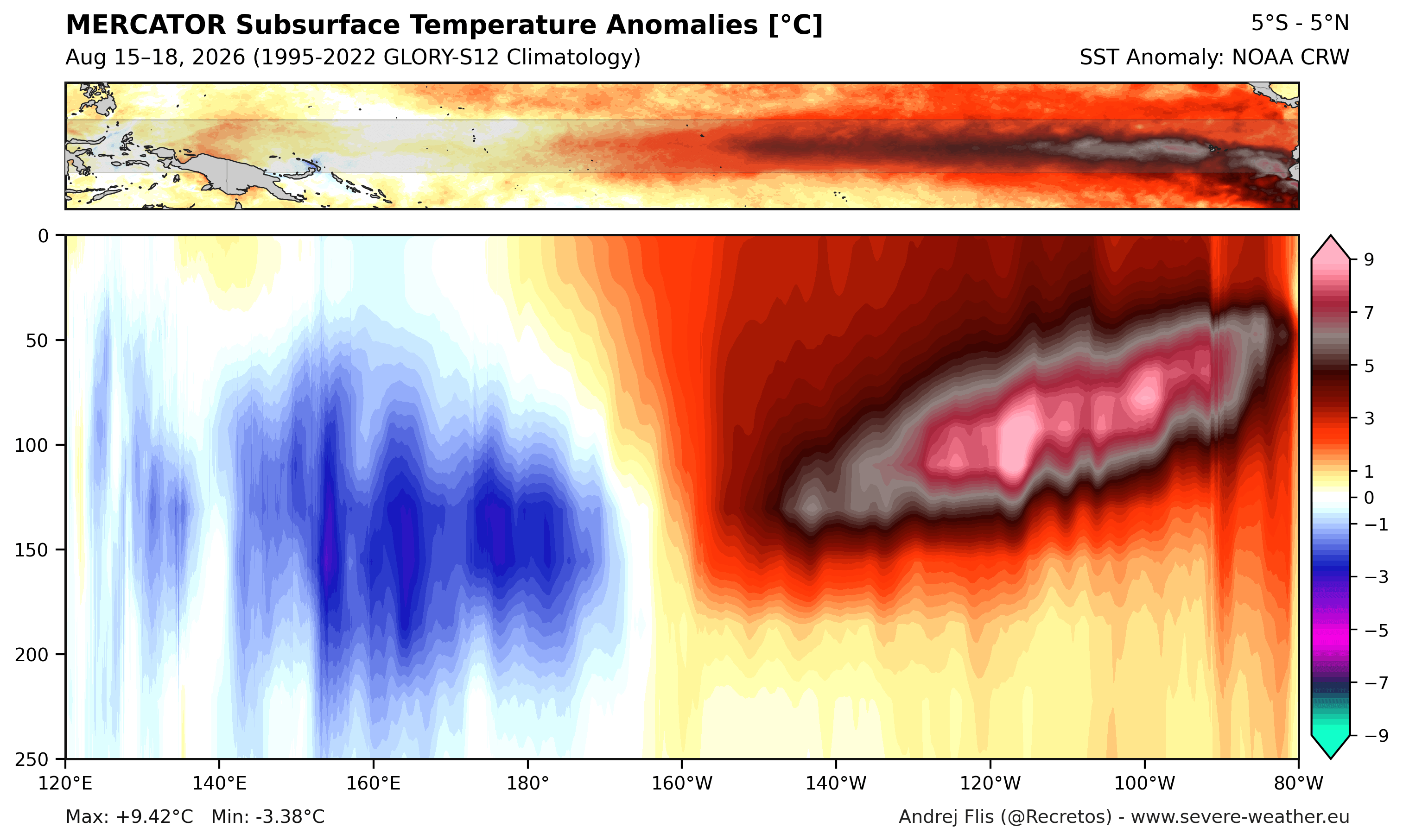
- Unprecedented Ocean Forcing: Subsurface temperature anomalies across the tropical Pacific—driven by a massive downwelling Kelvin Wave—are registering more than 9°C (16°F) above normal within the top 250 meters of the ocean.
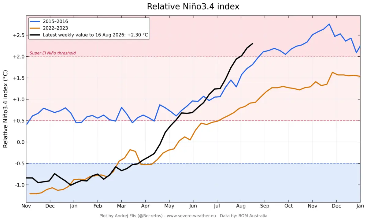
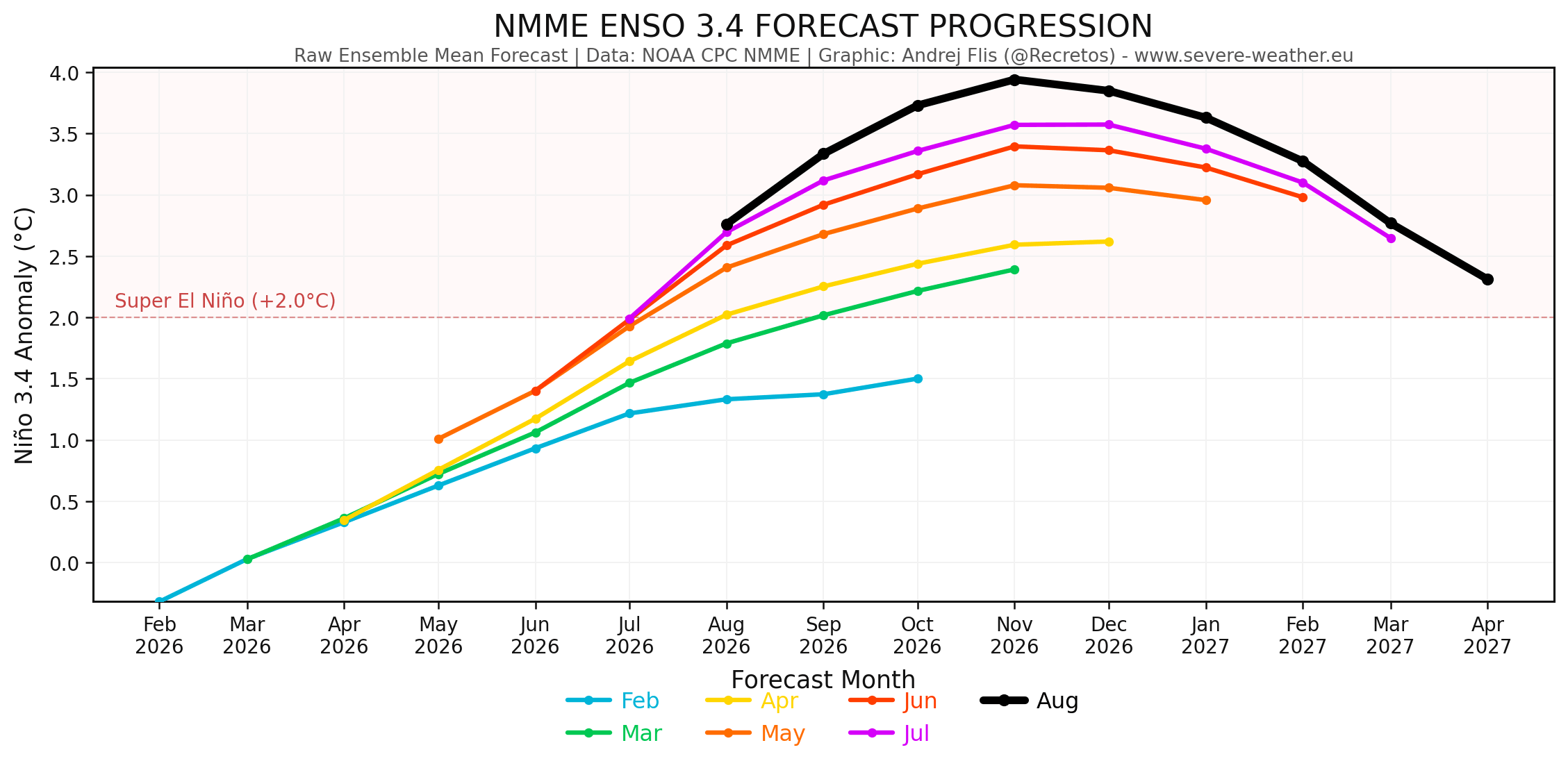
- Record Pace: Current temperature departures in the main ENSO (El Niño-Southern Oscillation) region have outpaced the developmental timeline of the historic 2015-2016 Super El Niño, with August values already exceeding thresholds not reached until late October in previous strong events.
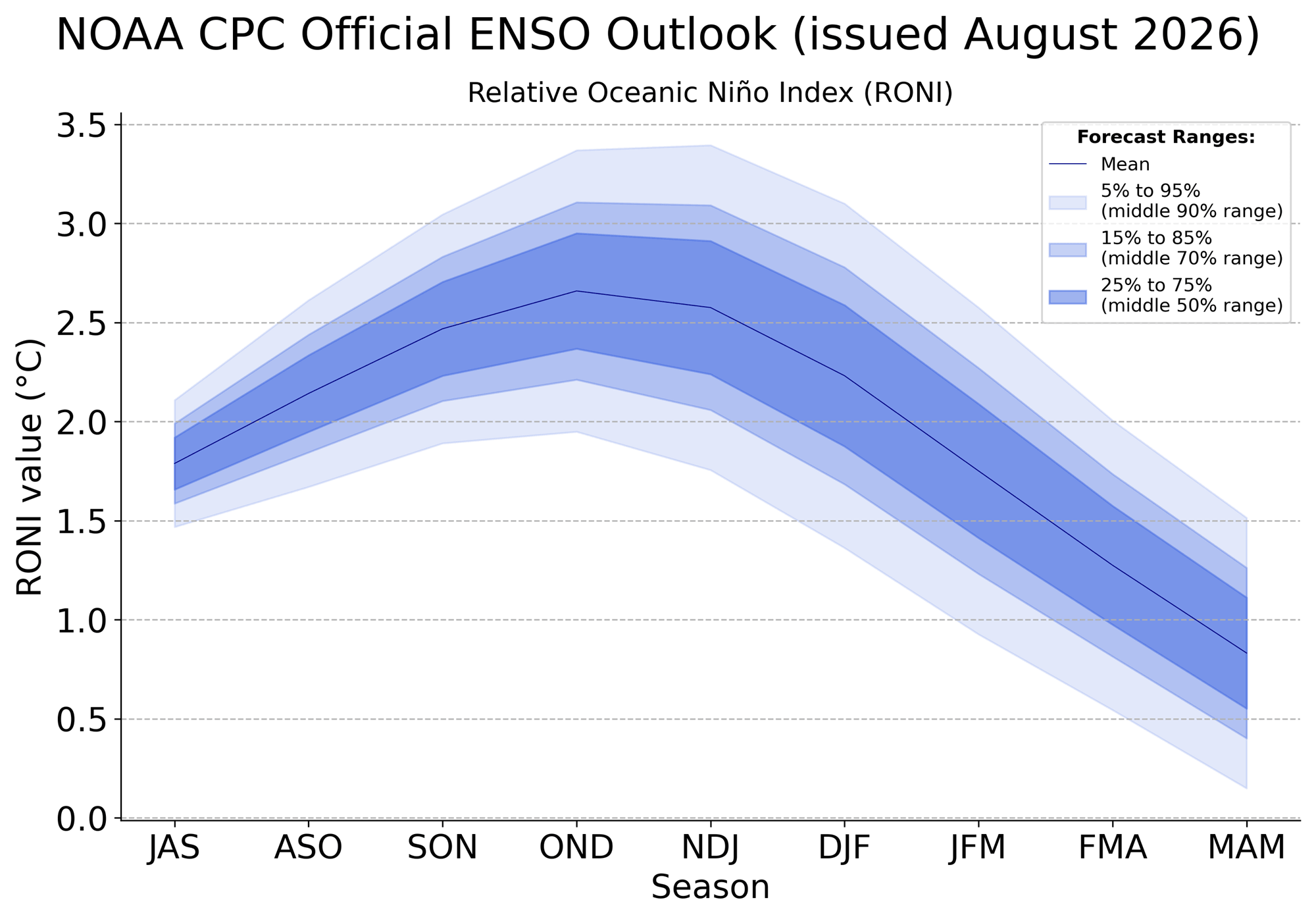
- Model Consensus: Both the official NOAA Climate Prediction Center (CPC) outlook and the North American Multi-Model Ensemble (NMME) project seasonal peaks well above the +2.0°C Super El Niño threshold, with some multi-model runs flirting with anomalies close to +4.0°C.
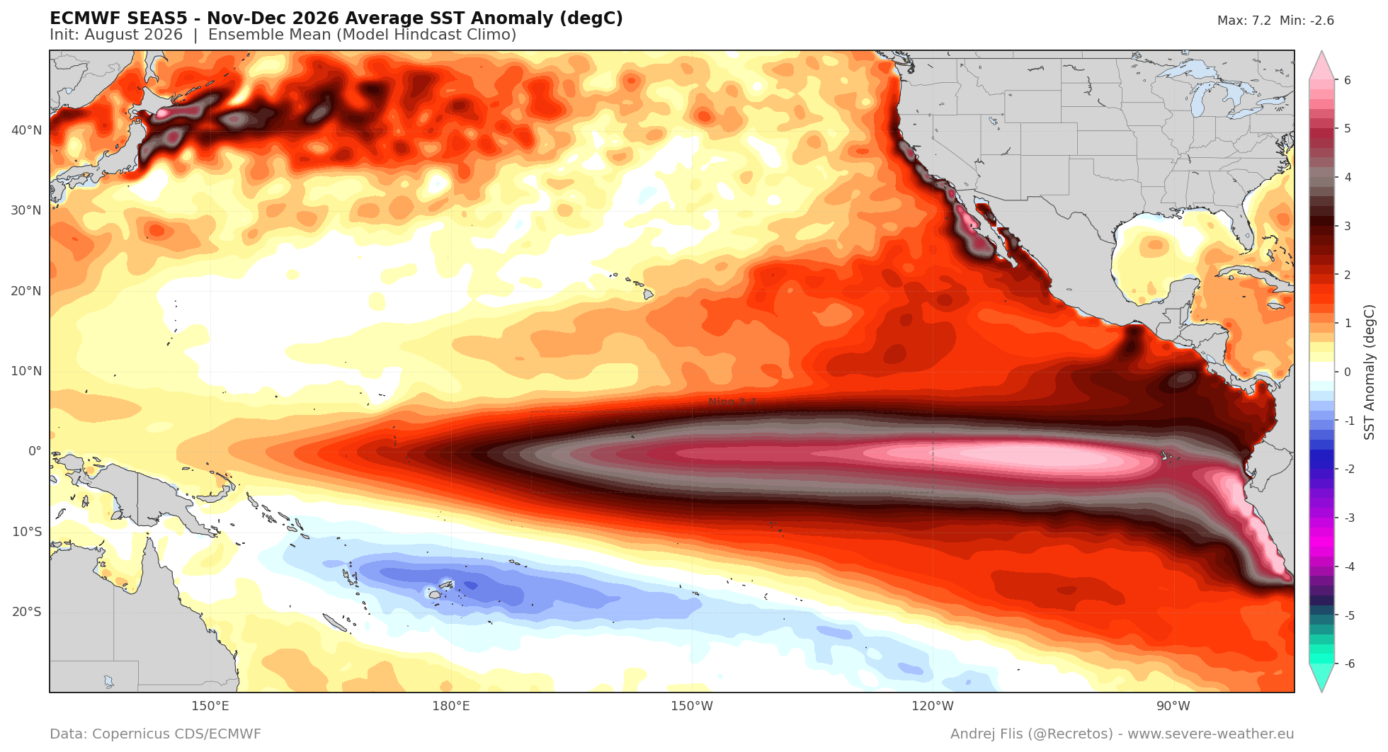
- Global Teleconnections: The event is classified as an Eastern Pacific (EP)-based El Niño, a configuration known to trigger intense North Pacific pressure responses, heavy moisture transport toward the southern tier of the United States, and distinct atmospheric bridges impacting Europe.
Chronology of Development: From Summer Buildup to Winter Projections
Summer 2026: The Subsurface Buildup
The foundation for the current forecast was laid months prior through persistent westerly wind bursts in the western equatorial Pacific. These winds generated a colossal Kelvin Wave—a subterranean pulse of warm water that has steadily migrated eastward. Oceanographic data from NOAA and the Australian Bureau of Meteorology (BOM) confirmed that these warm anomalies breached critical thresholds by mid-summer, providing a continuous thermal engine that guarantees the El Niño will remain robust and self-sustaining well into the core of the cold season.
Fall 2026: An Early Winter-Like Shift
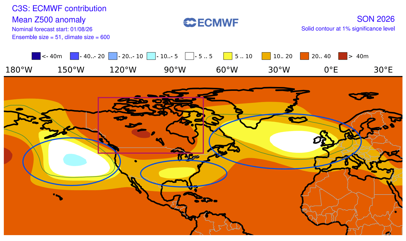
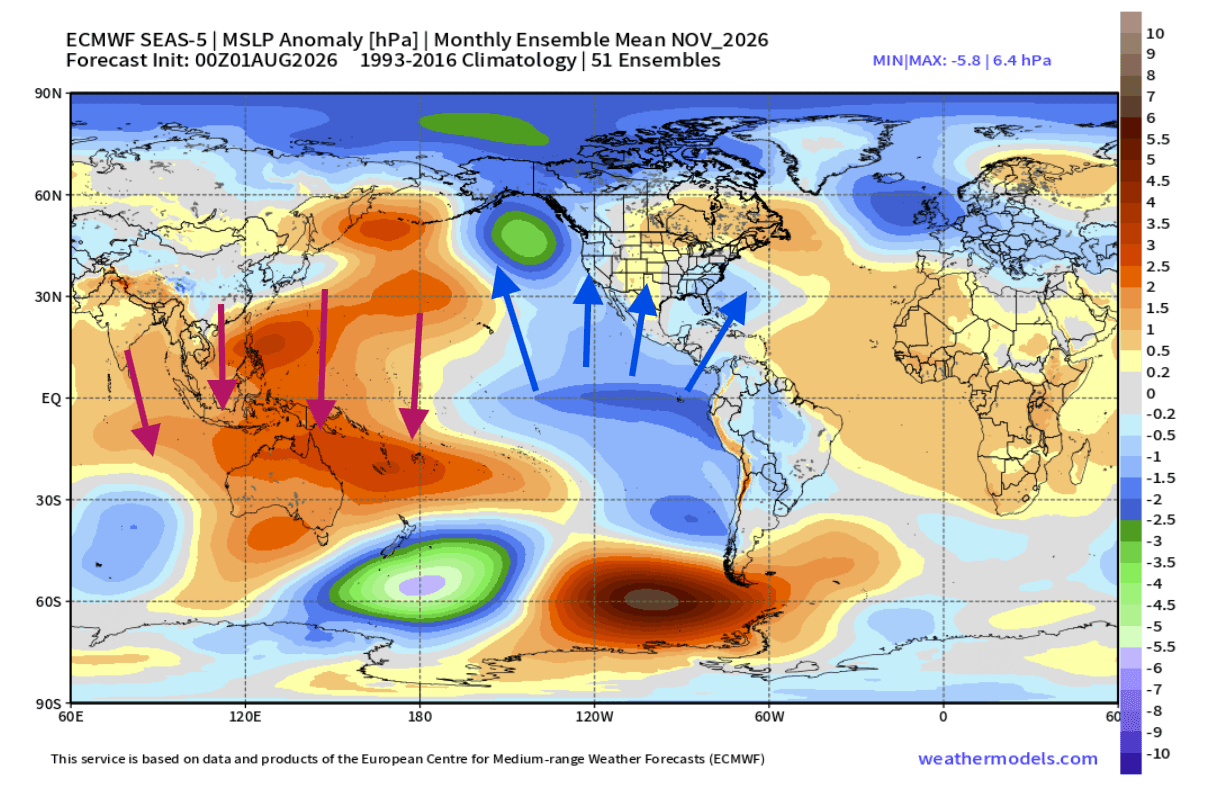
Typically, the transition from summer to autumn involves a gradual shifting of atmospheric pressure belts. However, because of the extreme magnitude of the 2026 forcing, global forecast models—including the European Centre for Medium-Range Weather Forecasts (ECMWF)—reveal an unusually advanced weather pattern.
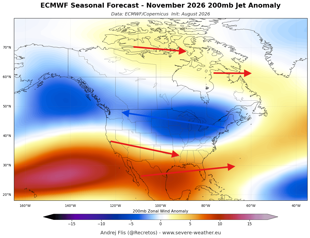
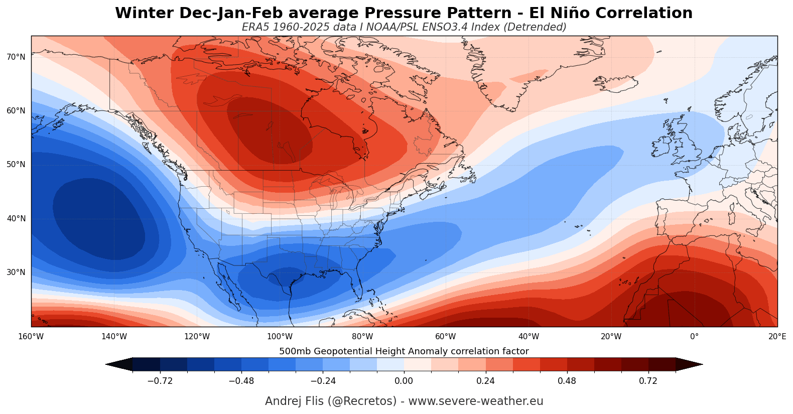
Rather than waiting for mid-winter, a classic El Niño configuration has locked into place early. A formidable high-pressure anomaly has anchored itself over Canada, paired with lower pressure over the North Pacific and an active southern storm track across the United States. This creates a pronounced split-flow regime across North America months ahead of schedule.
Winter 2026/2027: Deepening Amplification
As the calendar turns toward December, January, and February, the persistent anomaly centers are forecast to strengthen rather than shift. Mid-winter projections point to a powerful mid-level blocking high over Canada paired with a supercharged subtropical jet stream. This setup sets the stage for a dramatic, high-contrast winter across the Northern Hemisphere.
Supporting Data and Model Analysis
Forecasters rely on an array of multi-model ensembles to parse out the noise of long-range prediction. For the 2026/2027 cycle, the data streams from ECMWF, NMME, and CFSv2 show striking agreement.
North American Temperature and Precipitation Trends
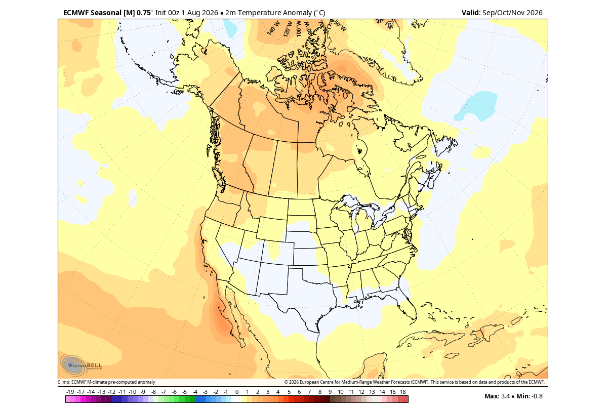
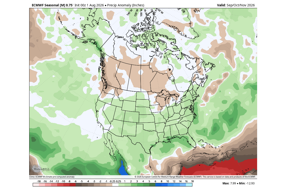
- The North and West: Under the influence of the Canadian high-pressure ridge and the displaced polar jet stream, much of western Canada and the northern tier of the United States are projected to experience warmer-than-average temperatures and below-normal initial snowfall accumulations.
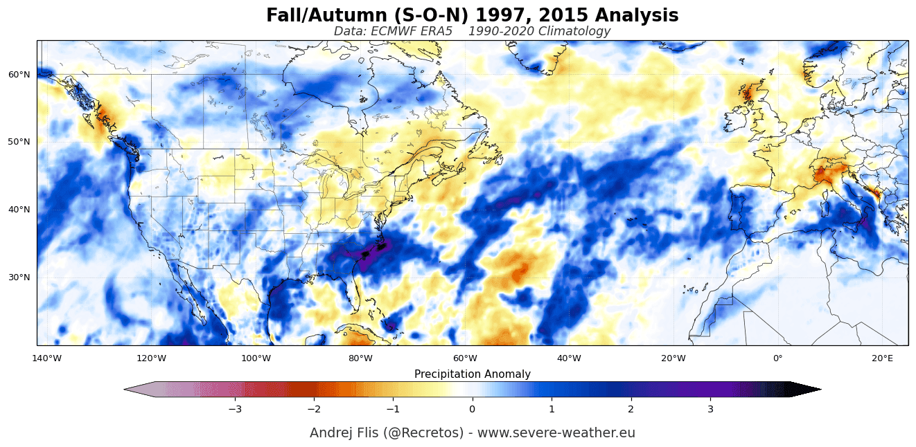
- The South and East: A highly active southern storm track will draw abundant moisture from the Pacific and the Gulf of Mexico. Consequently, the southern, central, and eastern United States face an increased risk of frequent, moisture-rich storm systems, above-normal precipitation, and localized late-season snowfall events over higher elevations and the Northern Plains.
European Impacts
Across the Atlantic, downstream teleconnections are manifesting as a prominent low-pressure anomaly near the North Atlantic. This pattern favors a persistent westerly and southwesterly flow into mainland Europe.
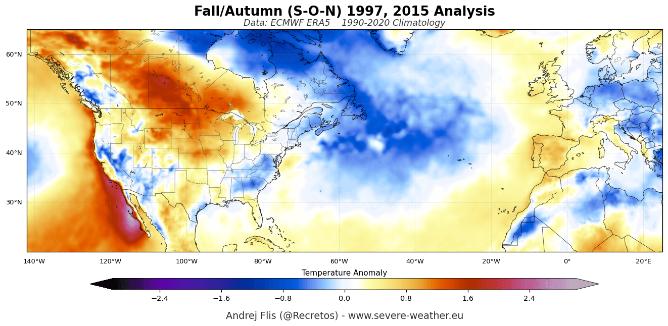
- Temperatures: Central, western, and southeastern Europe are favored to experience milder-than-normal surface temperatures.
- Precipitation & Snow: Increased Atlantic moisture will drive above-normal rainfall across much of the continent. Meanwhile, lower-elevation snow seasons are expected to get off to a sluggish start, though high-altitude regions like the western Alps will retain enough cold air to support heavy snow accumulations during active storm passages.
Official Responses and Expert Consensus
Meteorological agencies worldwide are treating the unfolding 2026/2027 event with heightened vigilance. The NOAA CPC and international climate centers have continuously upgraded their probabilistic outlooks, noting that the sheer velocity of the ocean’s warming phase reduces historical analogues.
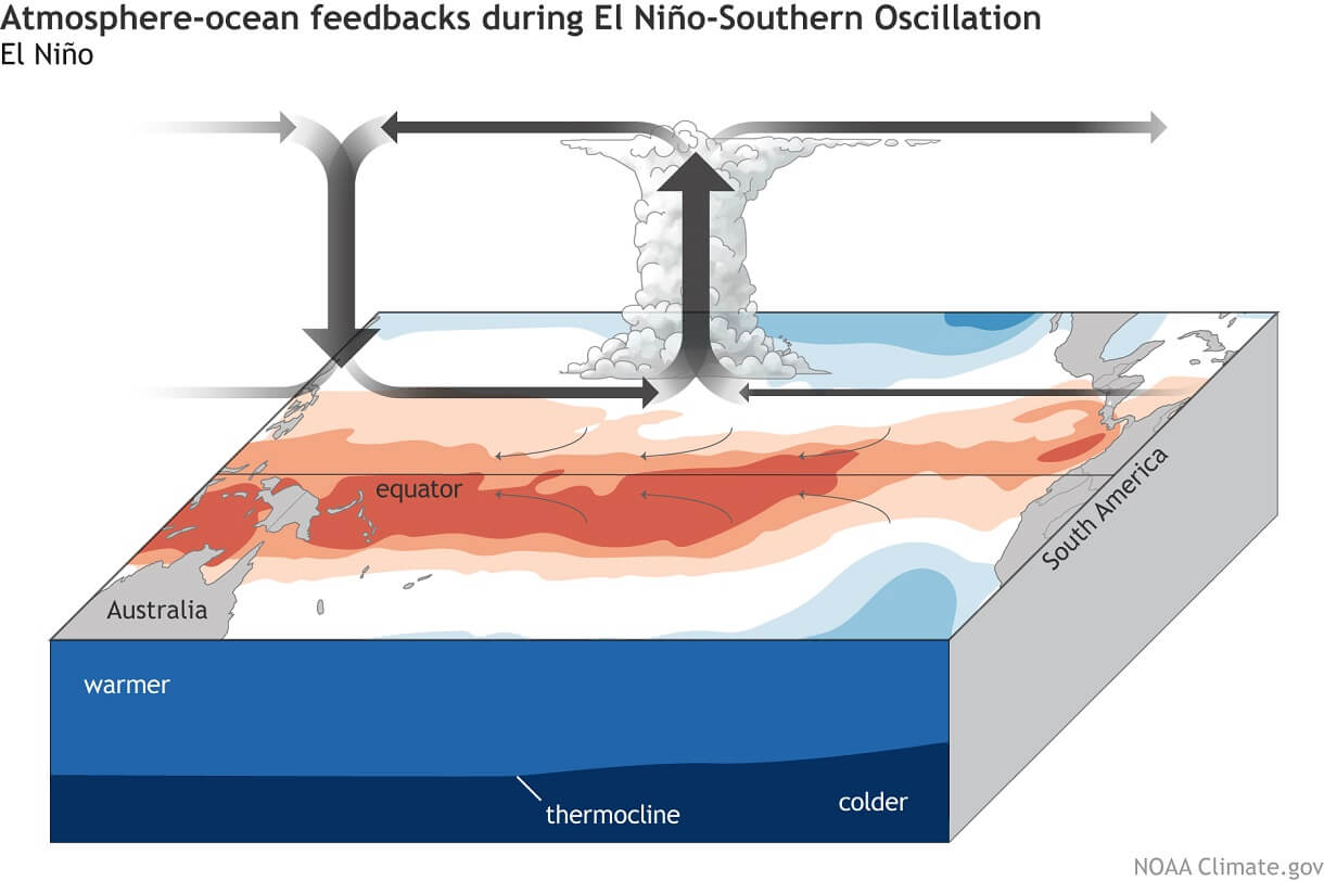
Atmospheric scientists emphasize that while El Niño events share broad statistical similarities, an Eastern Pacific event of this caliber introduces non-linear feedbacks into the climate system. The intensity of the Walker circulation—characterized by rising air and heavy precipitation over the central/eastern Pacific balanced by stable, descending air over the western Pacific—is projected to reach extreme intensities, anchoring global weather anomalies for months.
Implications: The Polar Vortex and Stratospheric Disruption Risk
Beyond surface weather, a Super El Niño carries profound implications for the upper atmosphere. Historically, strong El Niño phases are correlated with an elevated frequency of Sudden Stratospheric Warming (SSW) events and disruptions of the Polar Vortex.
The Stratospheric Connection
The Polar Vortex is a vast cyclonic circulation spanning from the troposphere into the stratosphere (over 50 km / 31 miles high). During an El Niño winter, powerful planetary-scale waves propagating upward from the troposphere (generated by anomalous heating in the North Pacific and North America) crash into the stratosphere.
This energy transfer acts like a brake on the stratospheric winds. Latest forecasts from both the ECMWF and the UK Meteorological Office (UKMO) indicate an unusual deceleration of polar vortex winds slated for late December and January.
What a Disrupted Vortex Means for Mid-Latitudes
A healthy, fast-spinning Polar Vortex generally bottles up frigid Arctic air near the pole. However, when a major SSW event occurs—a scenario heavily favored by current Super El Niño energetics—the vortex can stretch, displace, or entirely collapse.
- The Spillover Effect: A weakened or fractured Polar Vortex loses its ability to contain polar air. This allows deep, unseasonable cold snaps to spill southward into the mid-latitudes, impacting North America and Europe.
- High-Impact Variability: While the overarching seasonal forecast suggests warmth in certain regions, a disrupted stratospheric vortex introduces the probability of severe, high-impact weather shocks (such as major blizzards or historic cold outbreaks) during the peak of January and February.
Outlook and Next Steps
The convergence of a record-setting Super El Niño and a destabilizing Polar Vortex sets the stage for one of the most volatile and closely watched winter seasons in recent history. The unprecedented speed at which atmospheric and oceanic drivers have coupled indicates that routine seasonal expectations must be re-evaluated.
Meteorological institutions will continue to monitor the progression of the subsurface Kelvin Waves and stratospheric wind profiles. Residents across North America and Europe are advised to stay tuned to localized updates as the Fall-Winter transition accelerates into what promises to be a dramatic meteorological season.
