

EUROPE — Meteorological agencies across the continent have raised alarms as a powerful, unseasonably intense "heat dome" begins expanding across Western and Southern Europe. Driving an extreme late-summer thermal surge, the weather pattern is forecast to push surface temperatures well into the upper 30s, with localized peaks threatening to exceed 40°C to 44°C in parts of the Mediterranean, Spain, Portugal, Italy, and the Balkan Peninsula.
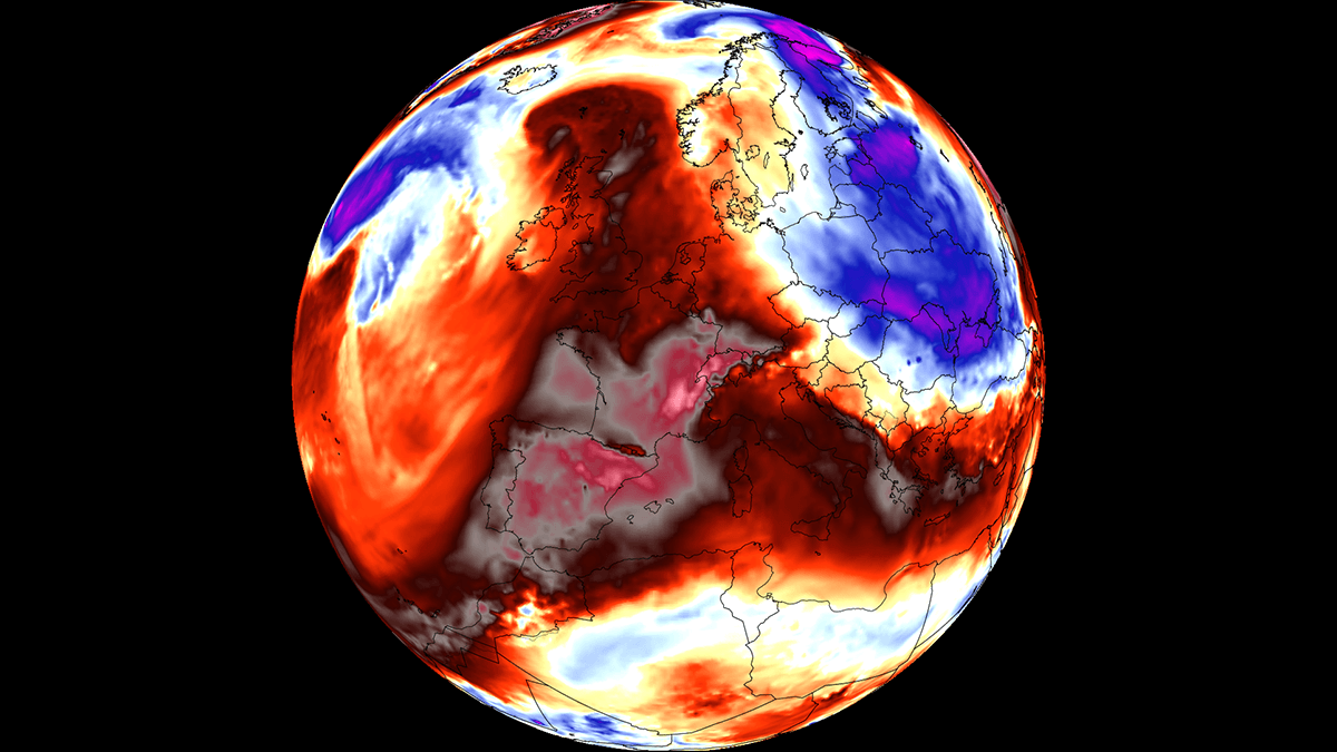
Fueled by a broad, persistent warm plume surging northwards out of North Africa, this weather anomaly is establishing upper-air thermal readings significantly higher than historical seasonal averages. Forecasters warn that the sprawling high-pressure system will lock extreme heat over the continent for several days, testing infrastructure, escalating regional wildfire risks, and posing severe public health hazards before a dramatic pattern shift arrives late next week.
Main Facts: Anatomy of the Early-September Heat Dome
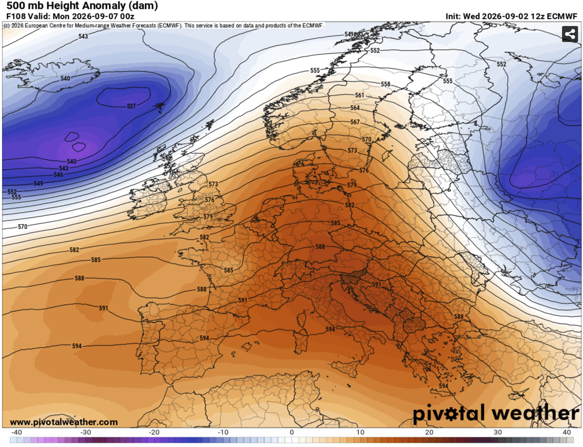
The core driver of this late-season heatwave is an expansive blocking high-pressure system parked squarely over the Mediterranean Basin.
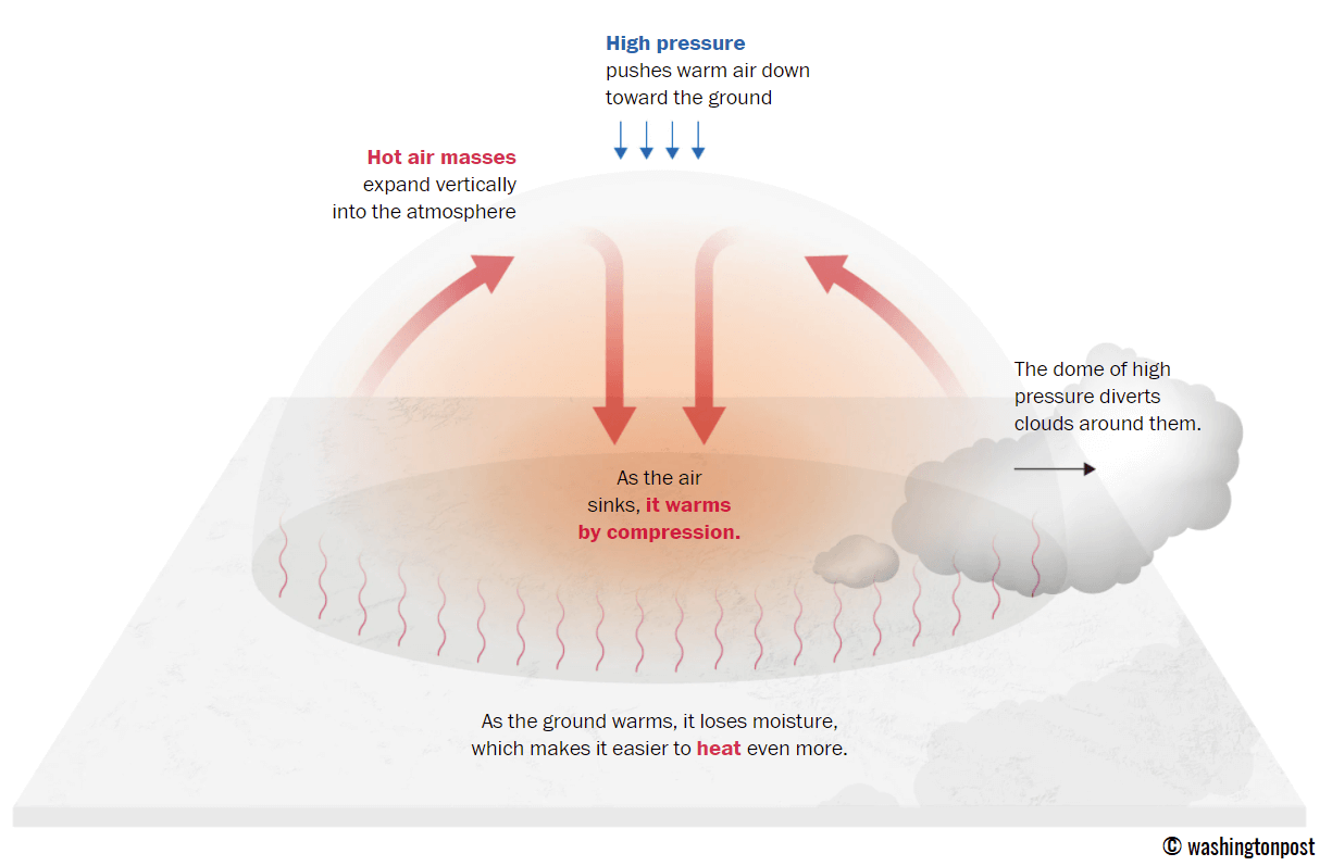
- The Mechanism: Meteorologists describe a heat dome as an atmospheric lid trapping vast amounts of hot air. As high pressure forces air downward, adiabatic compression rapidly warms and dries the lower atmosphere. This process acts like a pressure cooker, creating extreme surface temperatures across low-lying valleys, interior regions, and coastal plains.
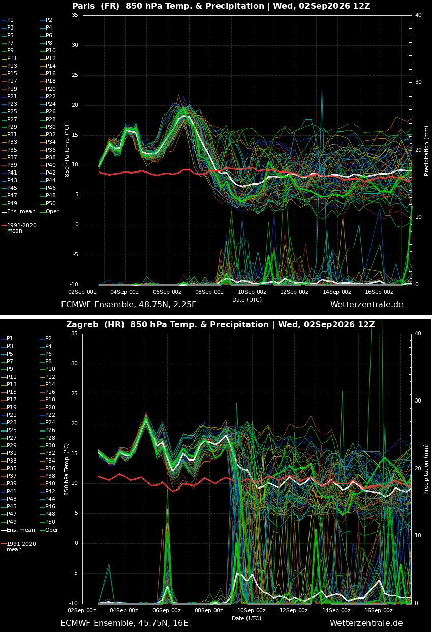
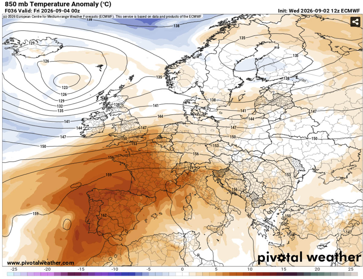
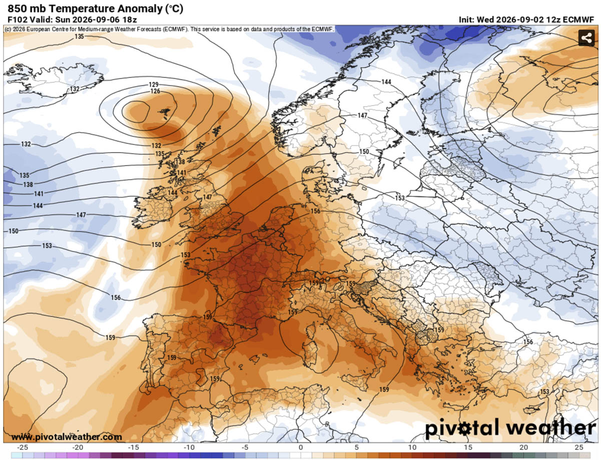
- The Scale: The anomaly is expected to push 850 hPa temperature anomalies 10°C to 14°C above long-term norms for early September. Countries most severely impacted include Spain, Portugal, France, Italy, and various central Balkan nations.
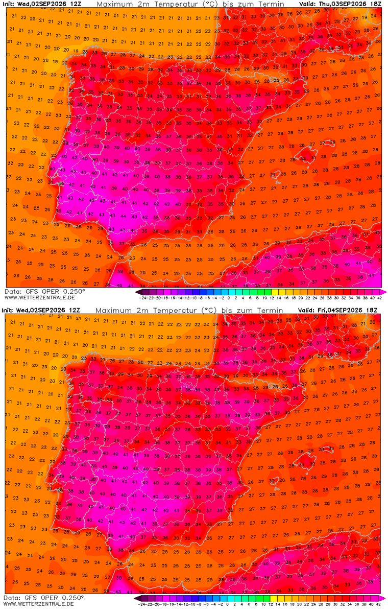
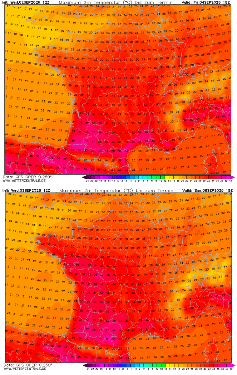
- The Thermal Peak: Daytime highs are expected to reach 38°C to 44°C across parts of the Iberian Peninsula, while Italy, southern France, and parts of Greece and the central Balkans will consistently challenge or shatter early-September temperature records with peaks between 38°C and 41°C.
- The Nocturnal Threat: Perhaps most dangerously, the heat dome offers minimal overnight relief. Urban corridors across the Mediterranean and Western Europe face suffocating "tropical nights," where low temperatures refuse to drop below 22°C to 25°C, compounding physiological stress on human populations.
Chronology of the Event: How the Heatwave Unfolds
The progression of the heat dome across Europe follows a distinct, multi-day trajectory, moving from the Iberian Peninsula northward and eastward into Central Europe.
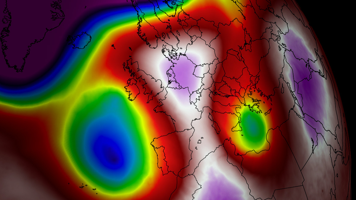
Phase 1: Southwestern Surge (Thursday to Friday)
The phenomenon initiates over the Iberian Peninsula, where the strongest thermal plume from North Africa collides with local geography. Central and southern Spain, along with mainland Portugal, face the brunt of the initial heatwave, recording peak daytime highs between 40°C and 44°C under an extremely dry air mass. Northeastern Spain and southwestern France quickly catch the overflow, pushing temperatures toward the upper 30s.
Phase 2: Expansion into Western and Central Europe (Friday through Sunday)
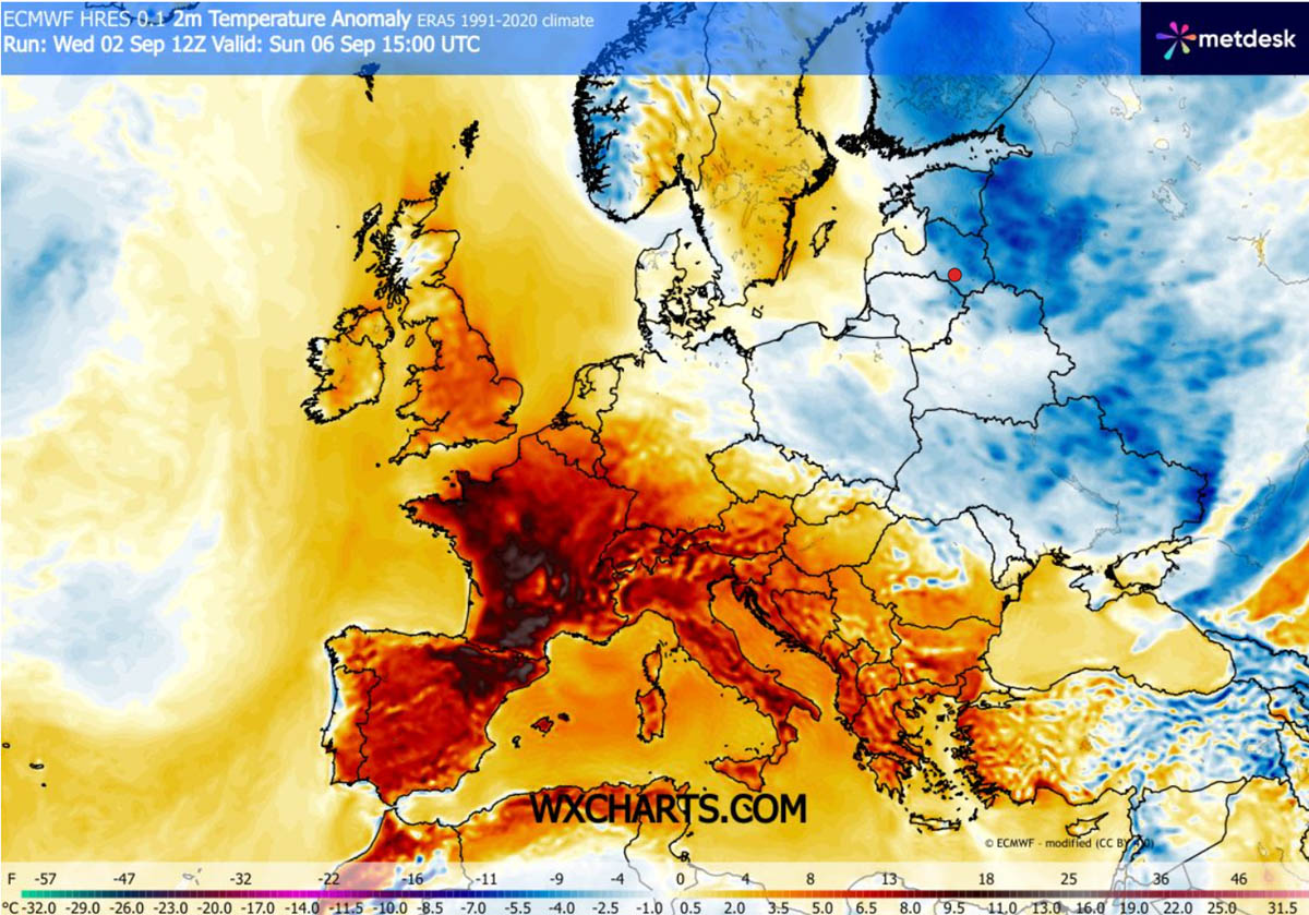
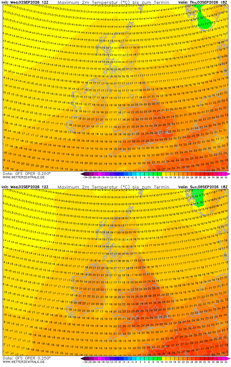
As the upper-level ridge strengthens and expands northward, the core of the heat dome shifts. Southern and central France experience a return of near-40°C temperatures in interior valleys. Simultaneously, the United Kingdom experiences a brief, milder spike, with south-central England and Wales seeing mid-to-upper 20s through the weekend, while Ireland and Scotland remain cooler in the low 20s.
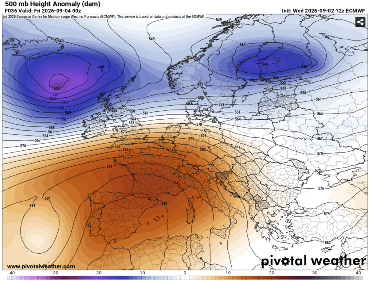
Phase 3: The Mediterranean and Balkan Peak (Friday through Monday)
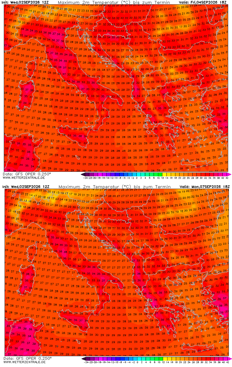
The massive ridge shifts its primary focus toward the central Mediterranean. Italy—specifically the Po Valley and Tuscany—alongside the central Balkans and Greece, experiences maximum thermal stress. Temperatures surge into the mid-to-upper 30s, with localized readings touching 41°C.
Phase 4: The Anticipated Pattern Break (Mid-to-Late Next Week)
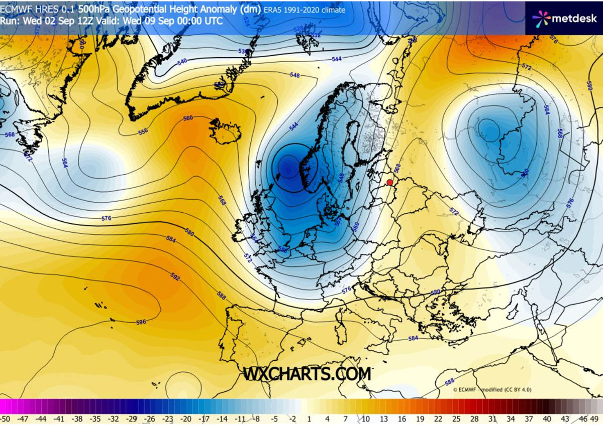
Ensemble models indicate that the blocking high will finally begin to break down by the middle of next week. An upper-level ridge building over the North Atlantic is expected to force a deep, cold-air mass intrusion into Western Europe. This dynamic shift aims to sweep away the stagnant heat dome, replacing it with a dramatic pattern flip characterized by much cooler air, widespread rainfall, and the potential for severe weather events.
Supporting Data and Regional Breakdown
Detailed predictive models from meteorological institutions provide a granular look at how different regions will experience the thermal surge over the coming days:
- Iberian Peninsula (Spain & Portugal): Sustained maximum temperatures between 38°C and 44°C through the weekend and early next week. The exceptionally dry continental winds are rapidly depleting remaining soil moisture, exacerbating drought conditions.
- France: Southern and central interior regions will see temperatures climbing back near the 40°C threshold. Northern France and the Benelux union will experience more moderate, though still warm, conditions in the upper 20s.
- Italy & The Balkans: The Po Valley and Tuscany in Italy, alongside Greece and the central Balkans, will experience persistent daytime readings of 38°C to 41°C. These values represent a stark deviation of 10°C to 12°C above average historical baselines for this time of year.
- The British Isles: Spared the extreme dangers of the continental heat dome, the UK will nevertheless register a warm interlude with mid-to-upper 20s across the south-central regions through Sunday, before maritime air brings seasonal normalization.
Official Responses, Health Implications, and Grid Stress
Public health officials, emergency management agencies, and energy grid operators across Europe have mobilized to address the multi-faceted threats posed by the prolonged heat dome.
Public Health Risks and Heat Stress
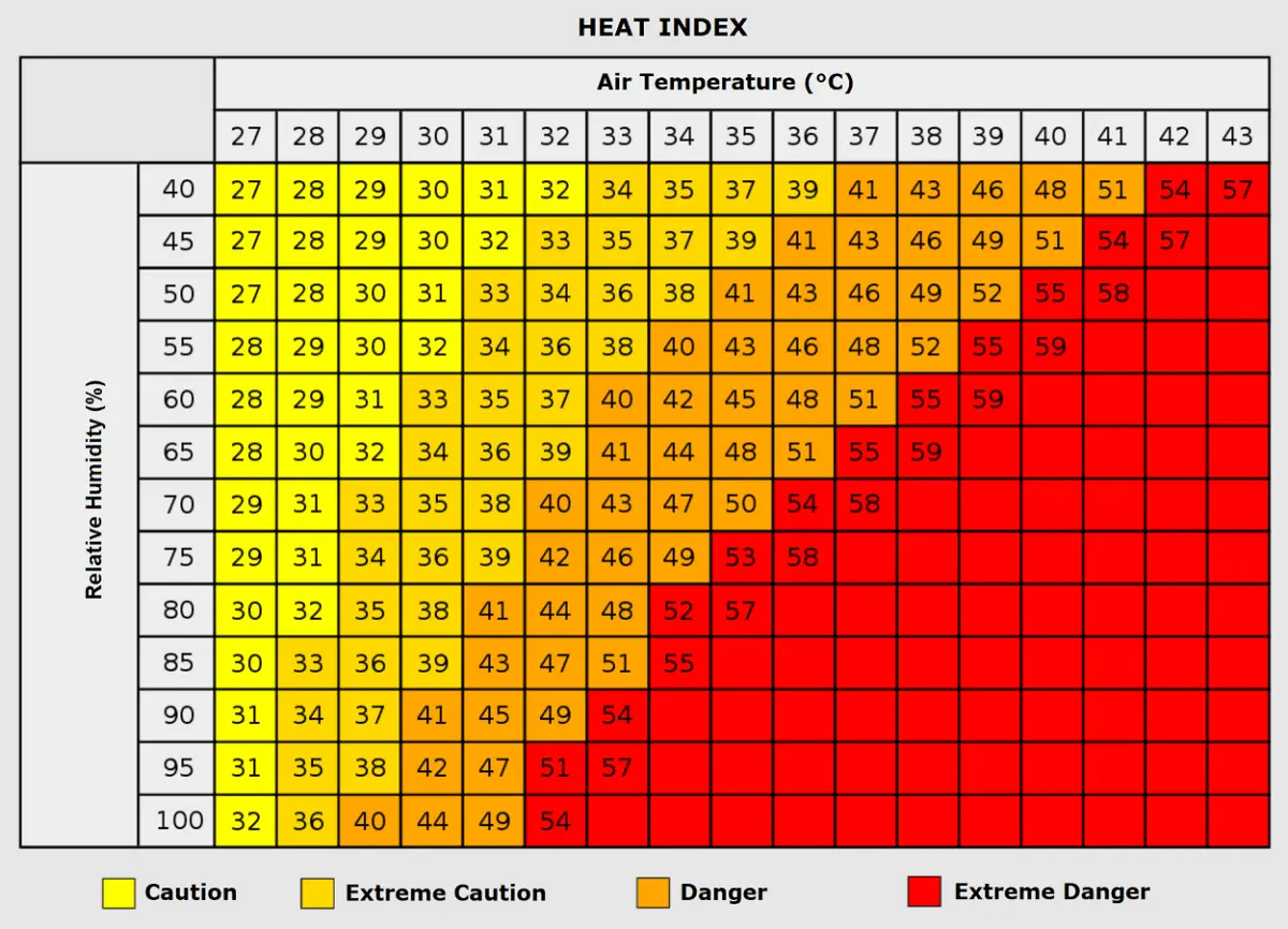
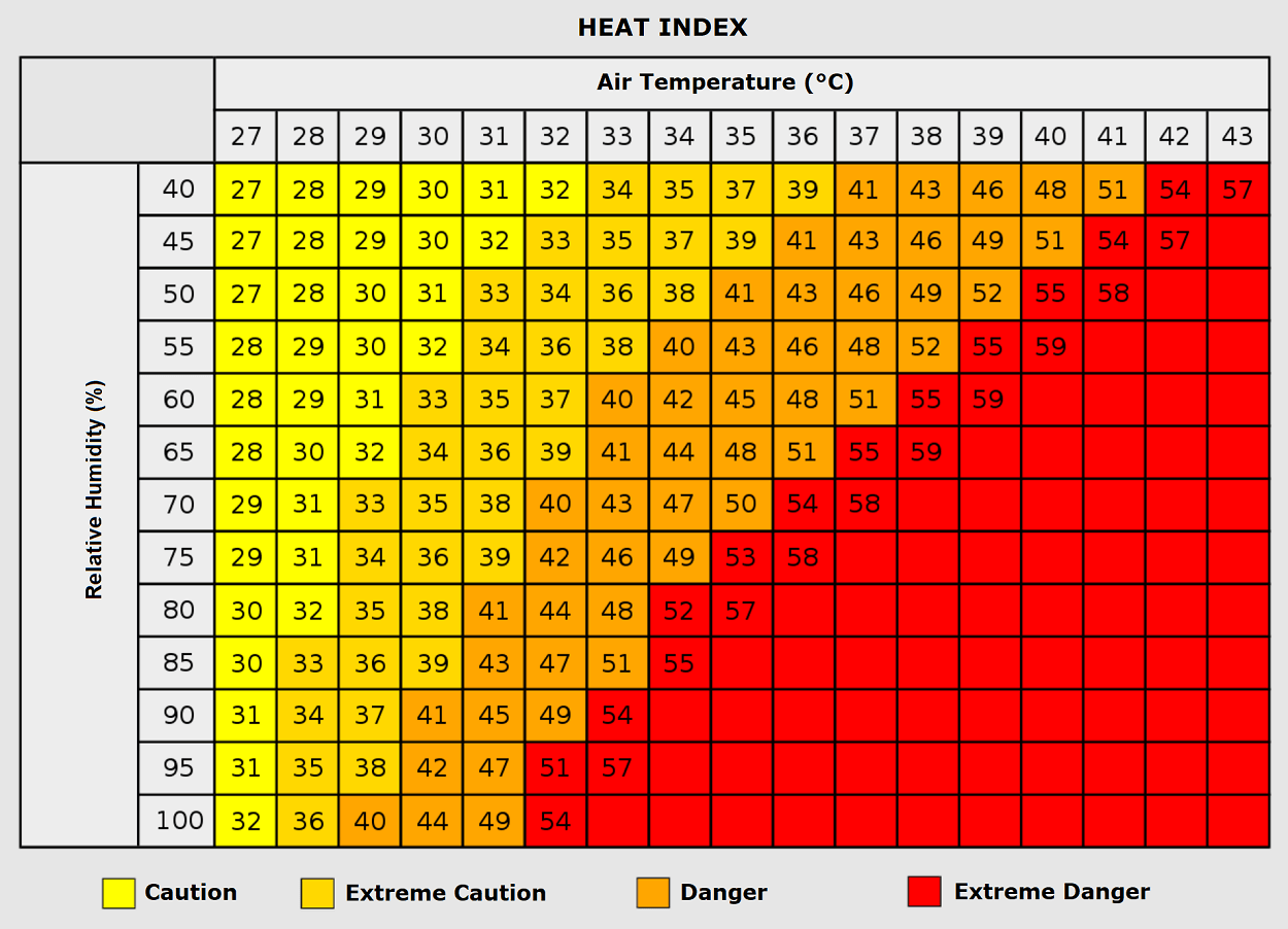
Prolonged exposure to extreme heat—especially when paired with high humidity—significantly increases physiological risks. Health organizations emphasize the concept of the Heat Index, which measures how high temperatures actually feel to the human body when combined with moisture levels. When air temperatures hover around 35°C with high relative humidity, the apparent temperature can soar near 50°C.
- Vulnerable Populations: The elderly, infants, and individuals with pre-existing cardiovascular or respiratory illnesses face elevated mortality and morbidity risks during multi-day heat domes. Urban populations living in concrete-heavy environments are particularly susceptible due to the urban heat island effect.
- Outdoor Laborers: Agricultural workers, construction crews, and sanitation staff face heightened dangers of heat exhaustion, dehydration, and potentially fatal heatstroke.
- Tropical Nights: Medical professionals highlight the danger of "tropical nights," where overnight lows stay above 22°C to 25°C. Without a nighttime window for the human body to cool down, cumulative cardiovascular strain multiplies rapidly over consecutive days.
Infrastructure and Energy Grid Pressures
The relentless nature of the heatwave has triggered a massive surge in energy demand. Residential, commercial, and industrial air conditioning units are running at maximum capacity across Southern and Western Europe. Power grid operators are closely monitoring load capacities to prevent brownouts or localized blackouts, while simultaneously preparing emergency response protocols for potential utility failures.
Furthermore, the combination of exceptionally dry continental winds, depleted soil moisture, and baking daytime temperatures has driven regional wildfire risks to critical levels across dried mountain slopes and rural brushlands in Spain, Portugal, Italy, and parts of the Balkans. Local forestry and firefighting services remain on high alert, with burn bans enacted in multiple high-risk jurisdictions.
Future Outlook: A Dynamic Transition to Mid-September
While the immediate outlook commands extreme caution due to the suffocating conditions of the early-September heat dome, medium-range weather models offer a clear light at the end of the tunnel.
As the blocking high-pressure system degrades next week, the expected injection of maritime air and cooler Atlantic weather fronts will bring a welcome refreshment to heat-fatigued populations. However, meteorologists caution that the transition from a powerful heat dome to a deep trough can trigger severe weather outbreaks, including heavy downpours and localized storms, as the contrasting air masses clash across Western and Central Europe.
Residents across the affected zones are advised to monitor local meteorological alerts, limit outdoor activities during peak afternoon hours, and stay hydrated as Europe navigates one of its most severe late-season thermal anomalies in recent history.
