

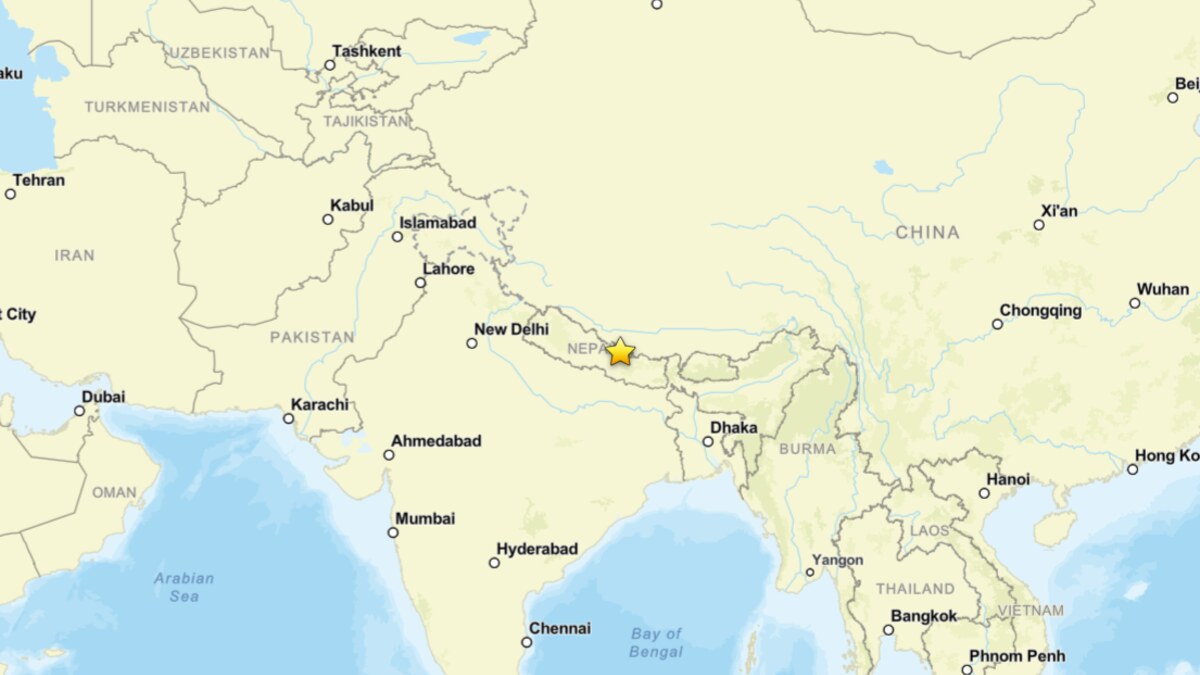
August 26, 2026 — A catastrophic and violent surge of water, mud, and boulders tore through the transboundary Bhote Koshi Trishuli river system, obliterating settlements, critical infrastructure, and vital transport links across northern Nepal and southern Tibet. Driven by a massive high-altitude collapse in the upper reaches of the Himalayas, the disaster caught communities off guard, paralyzing rescue efforts and renewing urgent international debate over the escalating vulnerabilities of mountain ecosystems in a rapidly warming world.
Initial reports from the Associated Press late on August 26 indicated that at least 160 people had lost their lives across Nepal and China, with hundreds more tourists, local residents, and infrastructure workers listed as missing. Emergency management agencies fear these figures represent a severe underestimate, as treacherous terrain, washed-out roads, and completely buried valleys have left extensive stretches of the border zone entirely cut off from the outside world.
Main Facts: Dissecting the Transboundary Disaster
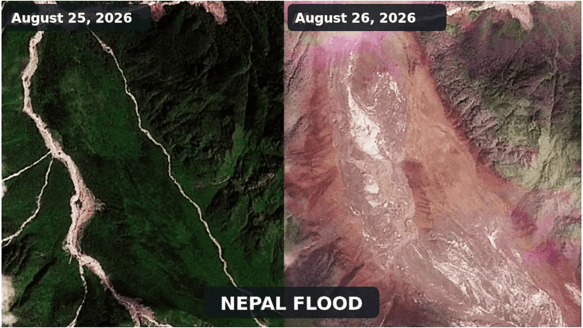
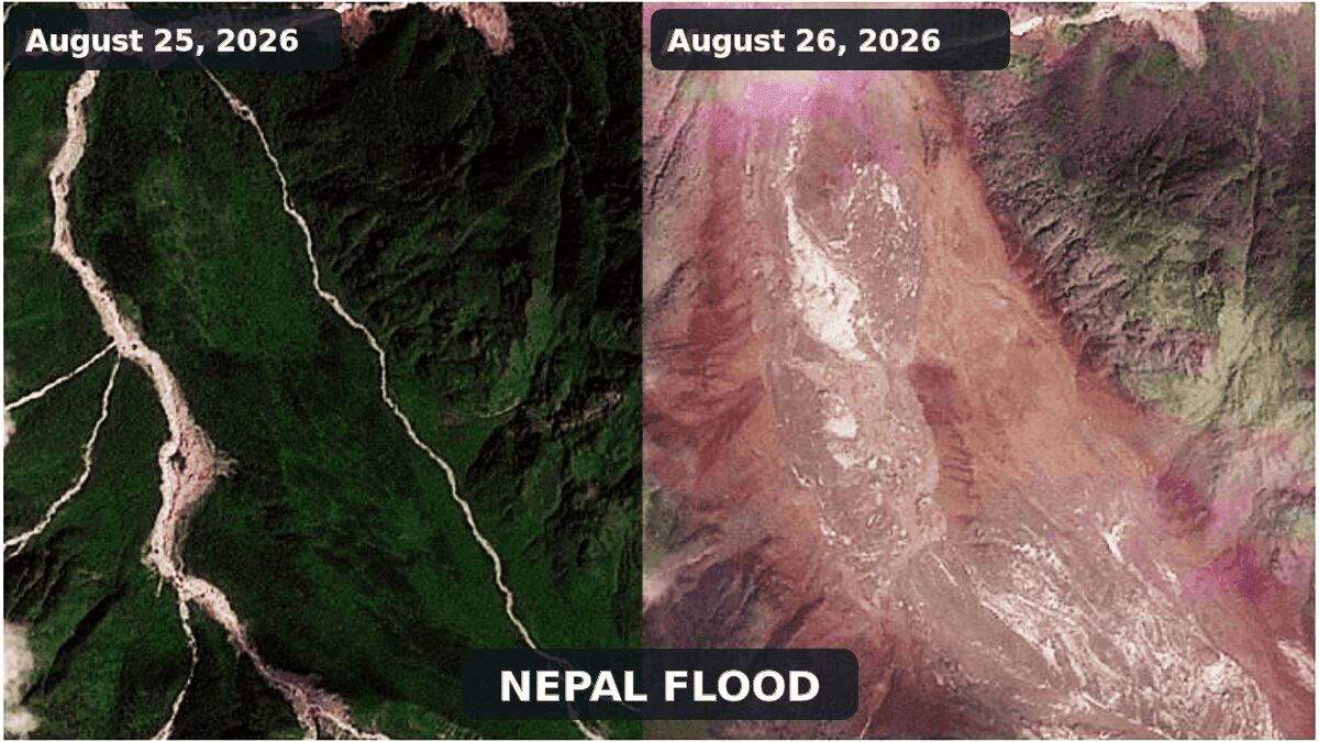
Satellite evidence captured by Planet Labs and analyzed by researchers at the International Center for Integrated Mountain Development (ICIMOD) has provided a clearer, albeit grim, picture of the mechanics behind the catastrophe.
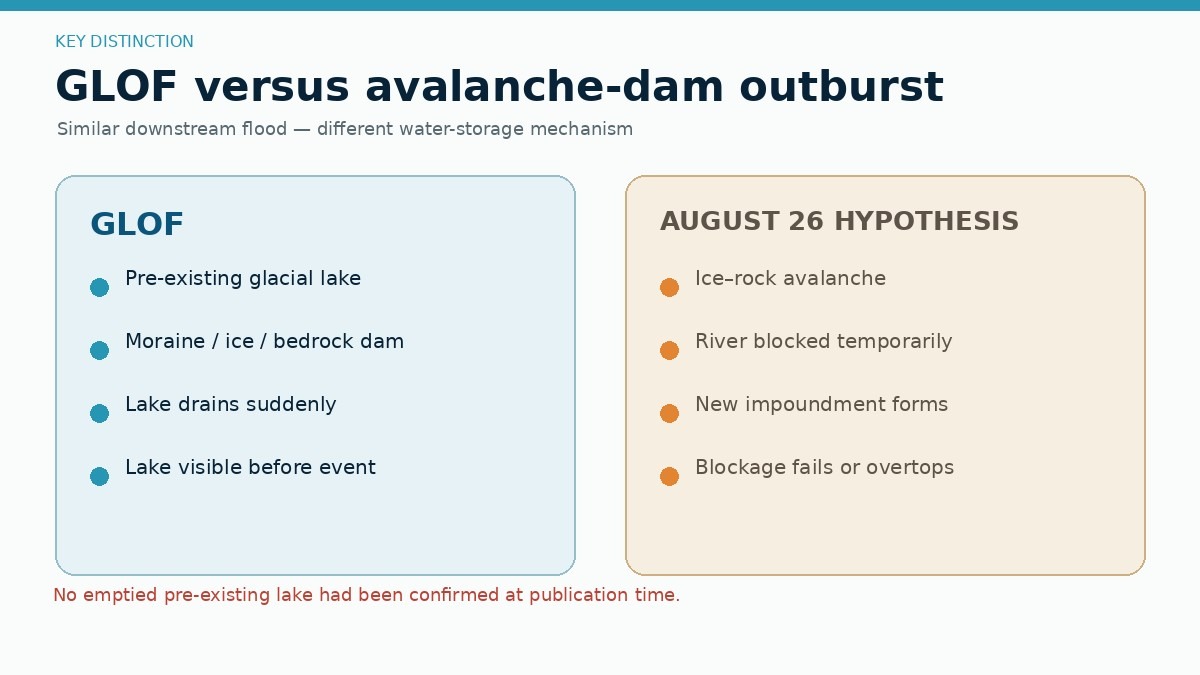
The event did not originate from a traditional glacial lake outburst flood (GLOF), as early field reports suggested. Instead, high-resolution imagery and seismic audits point to a complex, multi-stage physical cascade:
- The Trigger and Source: An immense ice and rock avalanche detached from a steep, glacierized slope in the upper Lhende Khola, a narrow tributary of the Bhote Koshi close to the international border.
- The River Obstruction: The colossal mass of shattered ice, bedrock, and snow slammed into the narrow valley, temporarily damming the Lhende Khola.
- The Outburst Surge: Water accumulated dangerously behind this unstable, permeable natural dam before catastrophically breaching. The resulting flash flood sent a towering wall of debris down the valley, causing the Trishuli River’s water level to skyrocket by an astonishing nine meters (nearly 30 feet) in approximately 30 minutes.
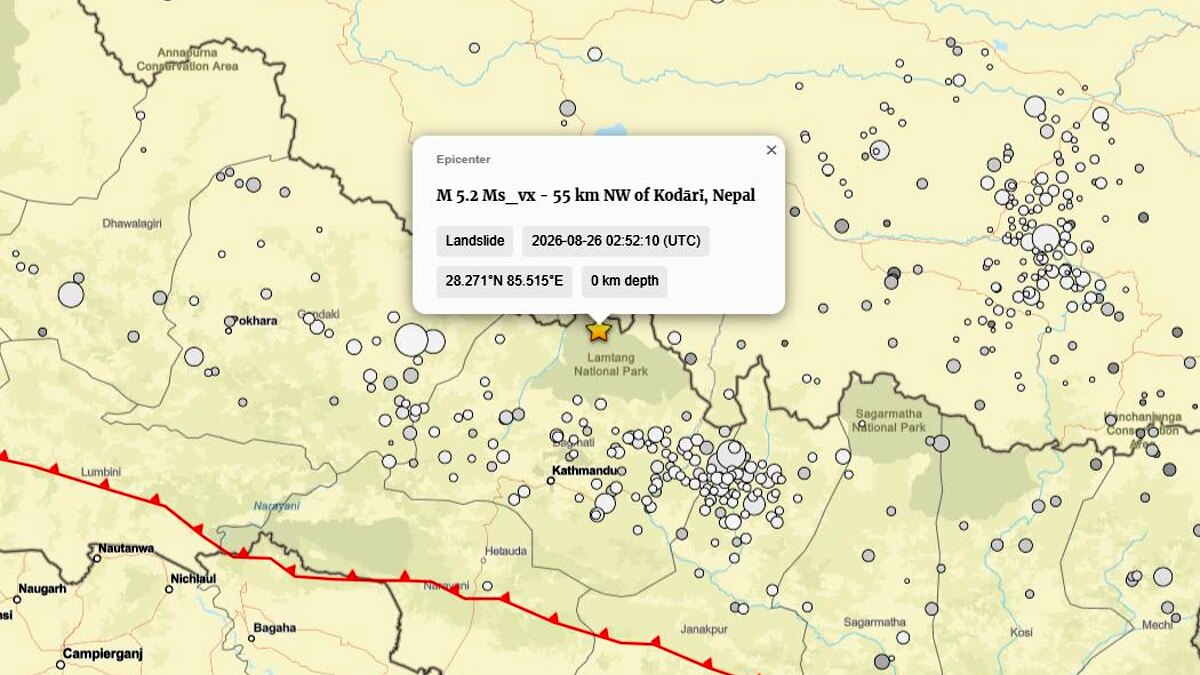
- The Seismic Reclassification: A seismic signal initially logged by the U.S. Geological Survey (USGS) as a magnitude 4.4 earthquake near the border was subsequently reclassified as a magnitude 5.2 landslide. This crucial update confirmed that the tectonic shaking was not the trigger of the disaster, but rather the immense geophysical signature generated by the collapse itself.
Chronology of Events: How the Crisis Unfolded
Phase 1: High-Altitude Failure
The disaster began silently in the high, frost-shattered periglacial zones of the upper Lhende Khola. Years or decades of cumulative thermal stress—driven by warming summer temperatures, early snow loss, and internal meltwater circulation—had pushed a steep, vulnerable rock and glacier face close to its mechanical breaking point. On August 26, the slope lost its structural integrity.
Phase 2: The Avalanche and Seismic Signature
In a matter of seconds, millions of tons of glacier ice and bedrock detached, accelerating downward at velocities reaching tens of meters per second. As the debris-laden mass fragmented, it generated severe ground motion recorded by regional seismic networks. Automated systems initially flagged the rumble as a tectonic earthquake (M4.4), a misinterpretation later corrected by the USGS after analyzing the prolonged, shallow wave patterns characteristic of massive mass movements.
Phase 3: Valley Chokepoint and Temporary Damming
The cascading avalanche collided with the narrow Lhende Khola river channel, choking it with an irregular, highly permeable plug of boulders, ice blocks, and dense sediment. A makeshift, highly unstable lake rapidly formed behind the debris barrier, impounding millions of gallons of water and meltwater.
Phase 4: The Downstream Breach and Flash Flood
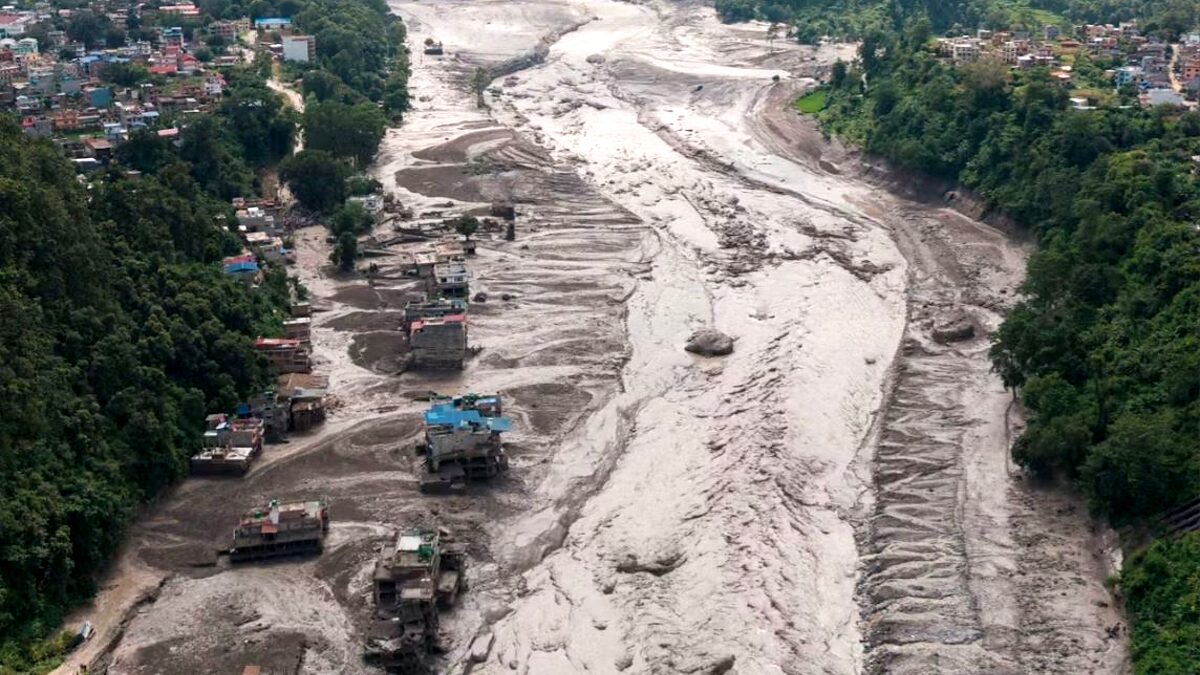
Unable to hold the mounting hydrostatic pressure, the improvised barrier failed catastrophically. The sudden release of impounded water, combined with the scouring of riverbeds and banks downstream, transformed the torrent into a hyper-concentrated debris flow. The surge crossed into Nepal’s Rasuwa district, roaring down the Bhote Koshi and Trishuli river corridors, wiping out bridges, homes, and multi-million-dollar hydropower installations in minutes.
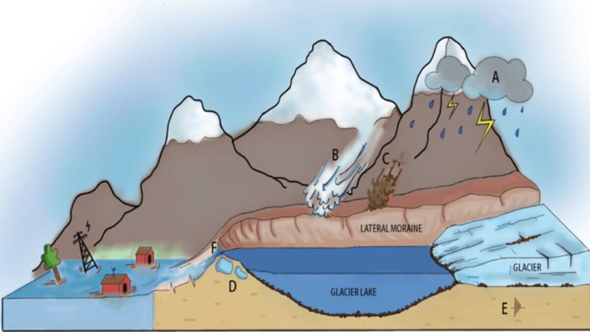
Supporting Data and Scientific Context
To fully grasp the nature of the August 26 disaster, glaciologists and geomorphologists emphasize the need to differentiate between distinct high-mountain hazards that often look identical in their destructive aftermath.
The GLOF Misconception
A Glacial Lake Outburst Flood (GLOF) requires the sudden drainage of a pre-existing lake dammed by a terminal moraine, bedrock, or glacier ice. While a deadly flood in the same broader Bhote Koshi system on July 8, 2025, was successfully traced to a supraglacial lake drainage north of the Langtang Himal, satellite data from the August 2026 event reveals no evidence of a pre-existing emptied lake of significant scale. Instead, the temporary lake formed after the avalanche blocked the channel, making this an ice-and-rock avalanche-induced landslide-dam outburst flood.
Historical Parallels: Marmolada and Blatten
Geomorphologists immediately drew comparisons to recent high-profile European disasters:
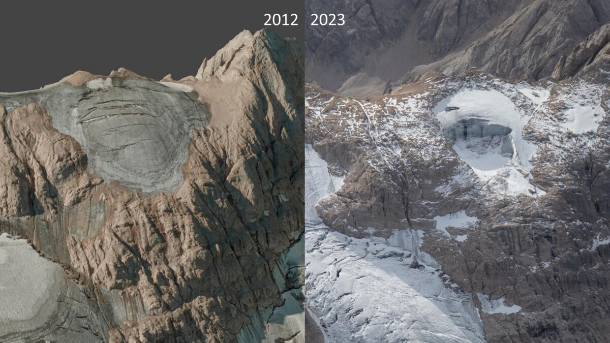
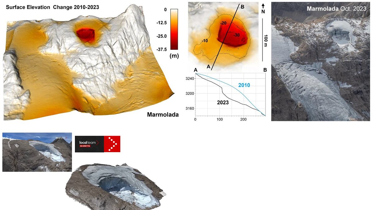
- Marmolada (Italy, July 2022): An ice avalanche involving roughly 70,000 cubic meters of ice and debris detached from Punta Rocca, killing 11 people. Scientific reconstruction proved that the collapse was driven by internal water pressure within crevasses during an exceptionally hot summer, generating a minor seismic signal without a tectonic trigger.
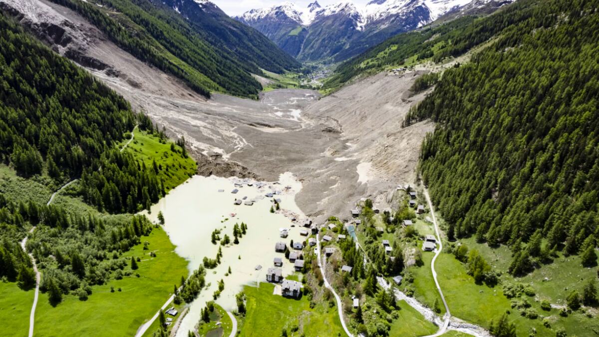
- Blatten (Switzerland, May 2025): A massive domino-style rock and ice avalanche involving the Birch Glacier mobilized roughly 9.5 million cubic meters of material, burying parts of the Lötschental village and temporarily damming the Lonza River. Like the Nepal event, progressive rock failure loaded the glacier, demonstrating the deadly efficiency of multi-stage environmental cascades.
Furthermore, the regional Alpine context of summer 2026 saw unprecedented instability. In the Mont Blanc massif, researchers with the French National Center for Scientific Research (CNRS) noted a staggering surge in rockfall activity—including a 15,000-cubic-meter collapse from the Aiguille du Midi on August 12—fueled by persistent high-altitude heatwaves and permafrost degradation.
Official Responses and International Action
Rescue and disaster-relief operations remain heavily hampered by geography. With major highways fractured and communication lines severed across Rasuwa and neighboring Tibetan districts, military helicopters and ground search teams have struggled to reach isolated pockets of survivors.
- Government and NGO Mobilization: Nepali and Chinese authorities deployed emergency response units, but rescue coordinators warned that relief logistics are among the most difficult faced in recent memory. Medical teams, temporary shelters, and food supplies are being rushed to staging areas outside the impact zone.
- Transboundary Data Sharing: Agencies such as ICIMOD and regional meteorological offices are utilizing high-resolution radar and optical satellite data to map the failure scar, calculate total displaced volumes, and assess the structural integrity of remaining debris blocks in the upper Lhende Khola.
The Lingering Threat Upstream
Hydrologists have issued stern warnings that the danger has not fully passed. Initial post-event analysis indicates that remnants of the avalanche debris remain lodged in the upper Lhende Khola. If this residual mass continues to impound water, secondary breaches or overtopping events could trigger subsequent flood waves down the valley. Downstream communities have been placed on high alert, instructed to steer clear of riverbanks as monitoring teams deploy automated water-level sensors.
Implications: Infrastructure, Climate, and Warning Systems
The catastrophe highlights systemic vulnerabilities in how mountain regions manage development and natural hazards.
The Transboundary Warning Challenge
Water respects no political borders. When hazards strike high-altitude borderlands, rivers can transport destruction downstream faster than telemetry or phone calls can cross international boundaries. The disaster underscores an urgent need for upgraded, integrated warning frameworks that extend far beyond static glacial lake inventories. Modern systems must incorporate:
- Real-time seismic monitoring optimized for mass movements.
- Continuous remote-sensing surveillance of steep, degrading glacierized slopes.
- Automated river-gauging stations tied to rapid-response transboundary communication networks.
The Climate Baseline
While scientists urge caution against hastily attributing a single weather or geological event entirely to global climate change, the underlying environmental baseline is shifting rapidly. The Hindu Kush Himalaya is warming at rates well above the global average. Glacier thinning, the loss of stabilizing buttresses, and the deep thermal degradation of ice-bearing permafrost are systematically increasing the frequency of high-altitude slope failures.
As hydropower projects, roads, and tourism infrastructure expand deeper into narrow Himalayan gorges to meet regional energy and economic demands, exposure to these multi-stage natural hazards multiplies exponentially.
Conclusion: Redefining Mountain Risk
The tragedy along the Nepal-Tibet border serves as a stark reminder that high-mountain disasters are rarely simple phenomena. Whether classified as an ice avalanche, a landslide-dam outburst, or a cascading flash flood, understanding the exact physical chain of events is not merely an academic exercise. It dictates how societies monitor fragile mountain ranges, how early warnings are sounded, and how vulnerable human lives are protected in the shadow of the world’s highest peaks.
