

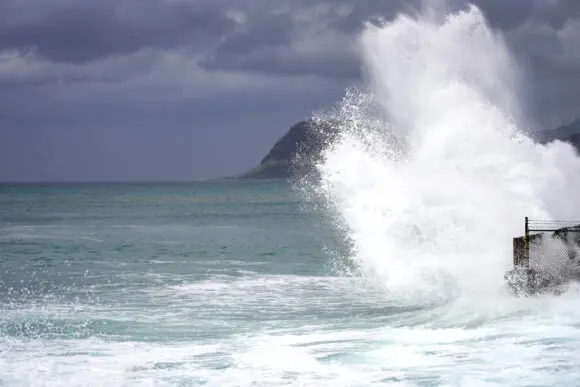
HONOLULU — Hawaii faces yet another severe meteorological threat as Hurricane Nolo bears down on the islands, bringing the prospect of catastrophic flooding, destructive winds, and dangerous mudslides. The approaching storm compounds an already historic year of climate-driven catastrophes that have battered the Aloha State, straining local infrastructure, testing emergency management systems, and leaving hundreds of millions of dollars in property damage in their wake.
According to advisories issued by the US National Hurricane Center (NHC), Hurricane Nolo was located approximately 450 miles south-southeast of Honolulu, packing maximum sustained winds of 75 miles (120 kilometers) per hour. Meteorologists warn that the storm is rapidly intensifying over warm Pacific waters and is forecast to mature into a major hurricane—reaching Category 3 status on the five-step Saffir-Simpson scale—with peak winds hitting 120 mph as it approaches Hawaii’s Big Island.
While the storm’s current trajectory suggests it may ultimately veer away from a direct landfall before tracking west, forecasters emphasize that the danger to the Hawaiian archipelago is acute. The primary threat stems not only from potential wind damage, but from staggering amounts of rainfall capable of unleashing catastrophic, life-threatening floods across vulnerable terrain.
Main Facts
- Storm Status & Intensity: Hurricane Nolo currently features top sustained winds of 75 mph (120 km/h) and is projected to strengthen into a major Category 3 hurricane with winds reaching 120 mph.
- Location & Trajectory: The storm is churning approximately 450 miles south-southeast of Honolulu. It is forecast to track dangerously close to Hawaii’s Big Island before turning westward.
- Rainfall Projections: Up to 20 inches of rain are widely expected across the Big Island, with isolated peak totals reaching an astonishing 35 inches.
- Active Alerts: A hurricane watch is in effect for the Big Island, while flood and tropical storm watches cover Maui, Lanai, Molokai, and Kahoolawe.
- Cumulative Damage: Hawaii has already sustained over $211 million in damage to state property alone in 2026, alongside more than 1,200 damaged private homes and at least 74 total structural losses stemming from a cascade of prior natural disasters.
Chronology of a Crisis: Hawaii’s 2026 Disaster Timeline
To understand the gravity of Hurricane Nolo’s approach, one must examine the relentless sequence of extreme weather events and geological incidents that have plagued Hawaii since the beginning of the year. The state, which is historically accustomed to tropical systems safely bypassing its shores or weakening significantly before arrival, has instead been caught in the crosshairs of anomalous Pacific weather patterns.
March: The Onset of Kona Lows
The trouble began in March when a series of powerful Kona low-pressure systems stalled over the islands. These systems unleashed torrential downpours, leading to widespread flash flooding, overflowing rivers, and saturated hillsides. The relentless rain eroded coastlines, compromised roadways, and initiated the year’s first wave of property damage.
May: Seismic Shocks
Barely had the state begun to recover from March’s floods when a significant earthquake struck in May. The tremor caused structural compromises across various public and private buildings, compounding the financial strain on local municipalities and homeowners who were still tallying flood-related losses.
Summer: A Barrage of Tropical Systems
The Atlantic and Pacific hurricane basins have experienced heightened activity, and Hawaii has borne the brunt of this increased volatility. Over the past two months alone, the islands have weathered two major hurricanes. Most notably, Hurricane Lala battered the Big Island in August, softening up the landscape and leaving soils saturated and unstable.
Now, in late September, Hurricane Nolo arrives as the culmination of this relentless cycle. With emergency resources already stretched thin and community resilience wearing thin, the state prepares for its most dangerous weather event of the year.
Supporting Data and Meteorological Analysis
Meteorologists at the US National Hurricane Center have expressed grave concern over Nolo’s heavy rain potential. Eric Blake, a senior hurricane specialist at the center, issued a stark warning in a recent technical analysis: "This rainfall may produce catastrophic life-threatening flooding and mudslides, especially in steep terrain."
Rainfall Projections and Geographical Vulnerability
The Big Island, characterized by dramatic topography including towering volcanic peaks like Mauna Kea and Mauna Loa, is uniquely vulnerable to rain-induced disasters. As moist tropical air is forced upward by the island’s steep slopes—a process known as orographic lifting—it cools and condenses, wringing out immense quantities of moisture.
- General Accumulations: 15 to 20 inches across windward and interior sections of the Big Island.
- Isolated Maximums: Up to 35 inches in localized pockets, heightening the risk of overflowing rivers, breached catchment basins, and catastrophic flash floods.
The Broader Pacific and Mexican Outlooks
While Hawaii focuses on Nolo, the broader tropical picture remains active. Farther east in the Pacific, Hurricane Polo recently registered top winds of 160 mph before slightly subsiding to 150 mph, maintaining its status as a formidable Category 4 storm.
Although the Mexican government has dropped all coastal warnings and watches as Polo tracks away from the coastline, the storm continues to pose a significant meteorological threat. Polo is forecast to dump heavy rainfall across Mexico’s Guerrero state, with lesser but still substantial amounts expected in Michoacan, Colima, and Jalisco. Long-range models suggest Polo may eventually strike Baja California before crossing northern Mexico as a degrading tropical system.
Official Responses and Emergency Preparedness
In response to the escalating threat posed by Hurricane Nolo, state and local authorities have swung into action, mobilizing emergency services and issuing urgent public safety directives.
Hawaii Governor Josh Green addressed the public in a video briefing, detailing the extensive toll the year’s disasters have already taken on the islands. "Even before Nolo, the state had suffered hundreds of millions of dollars in damage and impact on many houses," Governor Green stated.
According to state figures shared by the Governor:
- Public Infrastructure: State property damage has officially surpassed $211 million.
- Private Property: While comprehensive estimates for private buildings remain incomplete, more than 1,200 homes have sustained damage, with at least 74 homes completely destroyed.
To mitigate loss of life, emergency shelters have been formally opened across the Big Island. Local officials have urged residents living in low-lying areas, flood-prone zones, and steep mountainous terrain to heed evacuation warnings voluntarily before conditions deteriorate. First responders, search-and-rescue teams, and utility crews have been placed on high alert, staging equipment in strategic locations to enable rapid post-storm deployment.
Economic and Social Implications
The continuous cycle of natural disasters in 2026 carries profound implications for Hawaii’s economy, society, and long-term infrastructure resilience.
The Tourism Dilemma
As a premier global tourist destination, Hawaii’s economic lifeblood is inextricably linked to the hospitality and travel industry. Repeated weather disruptions, flight cancellations, and negative media coverage regarding hurricanes and floods threaten to deter visitors during crucial booking windows. Furthermore, the diversion of local government funds toward disaster recovery and infrastructure repair drains public coffers that might otherwise be allocated toward community development, education, and social services.
Housing and Insurance Pressures
The destruction of dozens of homes and the widespread damage to over a thousand private residences highlight a growing crisis in housing security and property insurance. With major storms becoming more frequent and intense, homeowners across Hawaii—and hazard-prone regions globally—face skyrocketing insurance premiums, non-renewals, and deductibles that make securing comprehensive property coverage increasingly difficult. For lower-income residents and fixed-income retirees, the loss of a home to flooding or high winds can trigger long-term displacement and financial ruin.
Climate Change and Infrastructure Adaptation
Hurricane Nolo serves as yet another stark reminder of the shifting baseline of extreme weather driven by global climate change. Hawaii, historically spared from frequent direct hits by major tropical systems due to cooler surrounding waters and prevailing wind shear, is experiencing warming ocean temperatures that provide fertile breeding grounds for stronger and more persistent storms.
Civil engineers and urban planners are now forced to rethink the design of Hawaii’s critical infrastructure. From coastal roadways and drainage systems capable of handling unprecedented volume, to building codes resilient to Category 3-plus wind speeds, the state faces a monumental and costly transition toward climate adaptation.
As Hurricane Nolo barrels closer to the islands, the immediate priority remains the protection of human life. However, once the skies clear and the floodwaters recede, the people and leaders of Hawaii will face the daunting task of rebuilding not just physical structures, but a more resilient society capable of weathering the new normal of Pacific meteorology.
