

EUROPE — As the calendar prepares to turn from September to October, a staggering meteorological phenomenon is making a dramatic comeback across the European continent. A powerful, sprawling "heat dome" is building northward from the Mediterranean and North Africa, setting the stage for an unseasonably intense and prolonged warm spell that will stretch well into the first week of October.
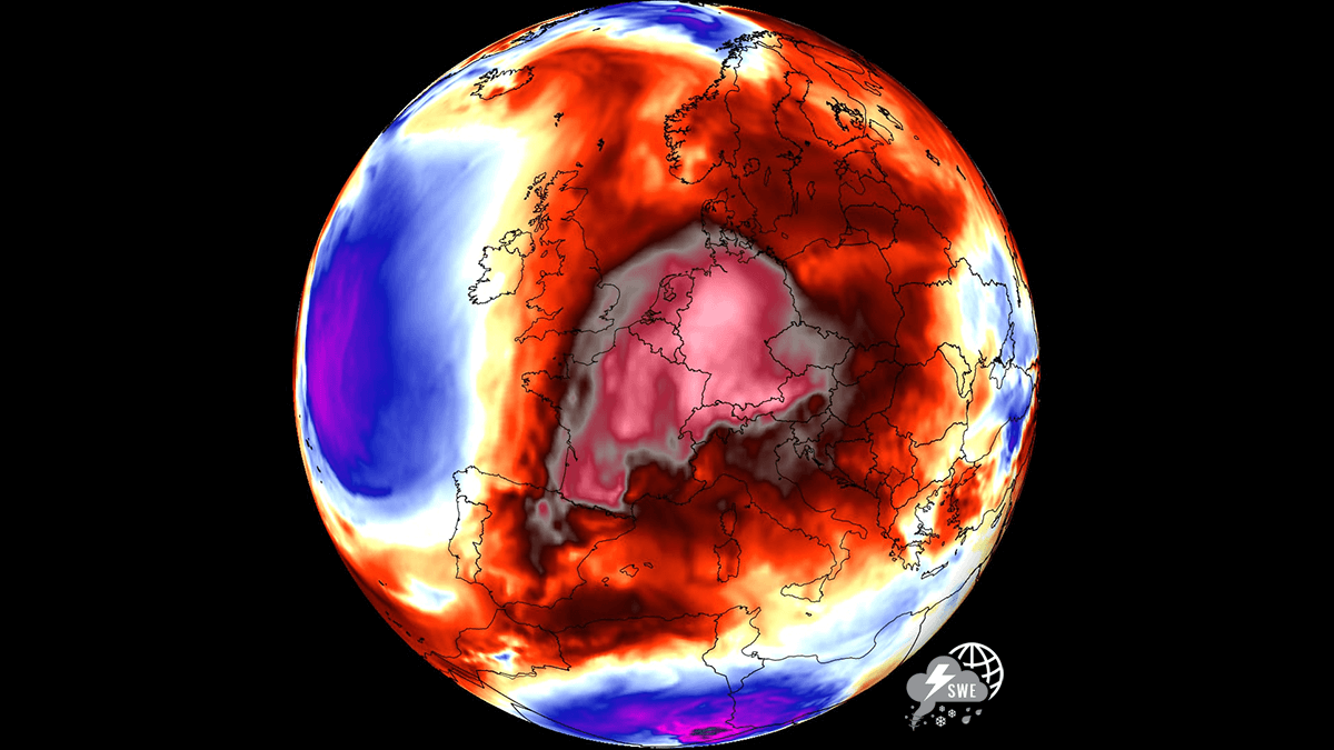
According to advanced meteorological models, significant 850 hPa temperature anomalies will locally climb 8 to 12 degrees Celsius above long-term climatological averages. This thermal surge will overspread vast portions of Western, Central, and Northern Europe, bringing mid-summer warmth to regions that should already be experiencing crisp, autumnal conditions.
Main Facts: The Anatomy of the Late-Season Heat Dome
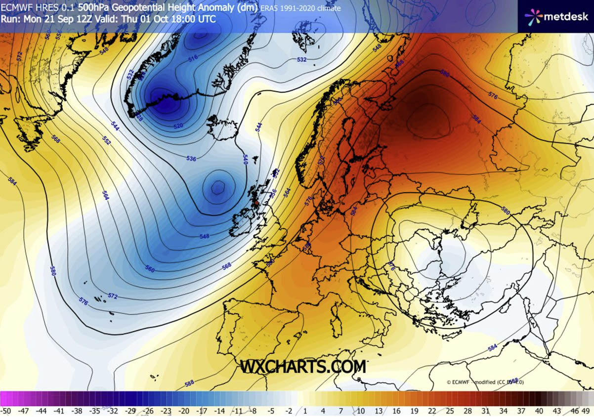
The primary driver behind this late-season thermal surge is a classic atmospheric dipole pattern. A deep, high-amplitude upper-level trough has established itself over the North Atlantic. This system is forcing an intense southerly jet stream plume to advect warm, tropical air deep into the heart of continental Europe.
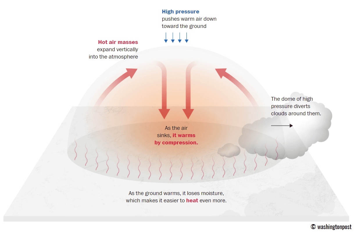
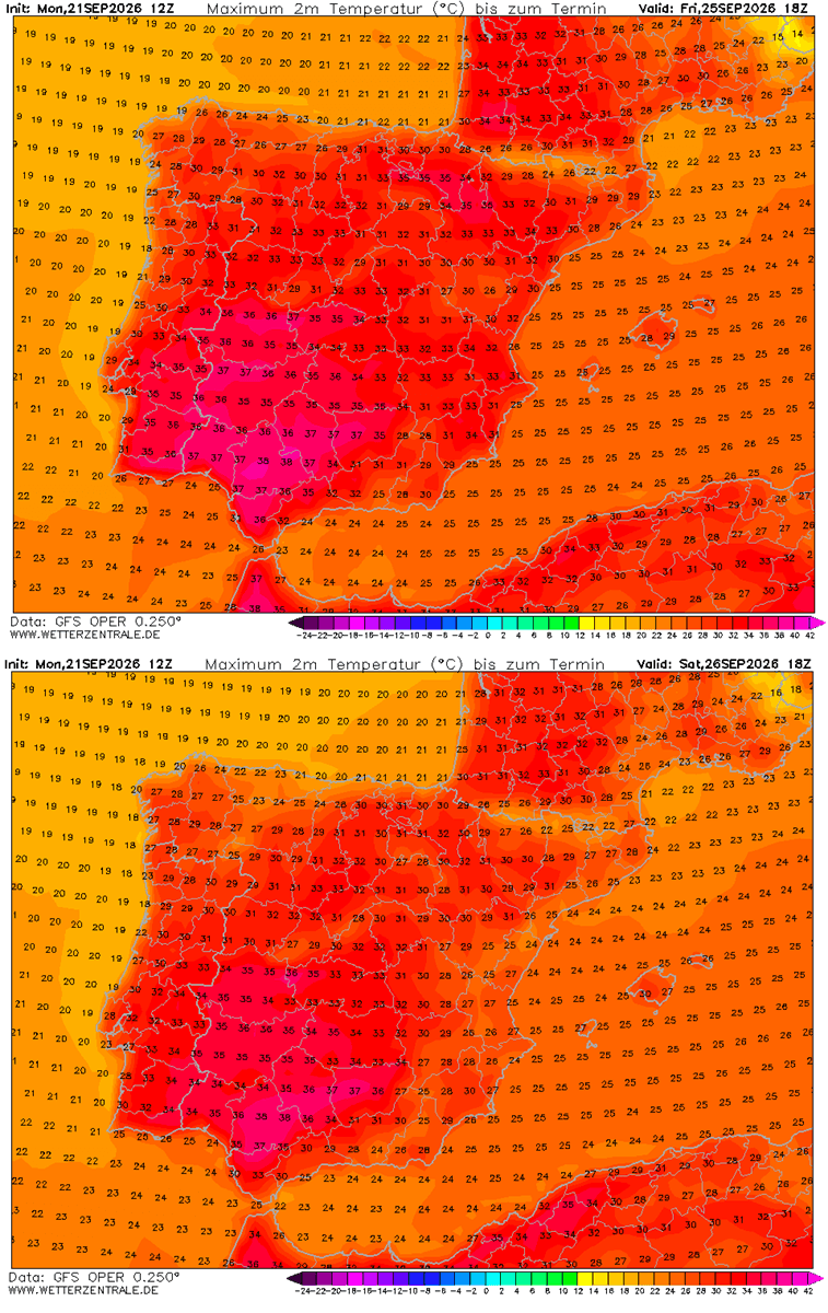
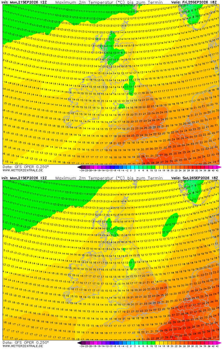
Beneath the core of this expansive blocking ridge, strong atmospheric subsidence is actively compressing and warming the lower atmosphere. This downward-pushing air acts as a lid on a pot, suppressing cloud cover and allowing relentless sunshine to bake the surface. As a result, afternoon surface temperatures are soaring into the upper 20s and peaking into the low 30s—and locally touching nearly 40 degrees Celsius in the Iberian Peninsula.
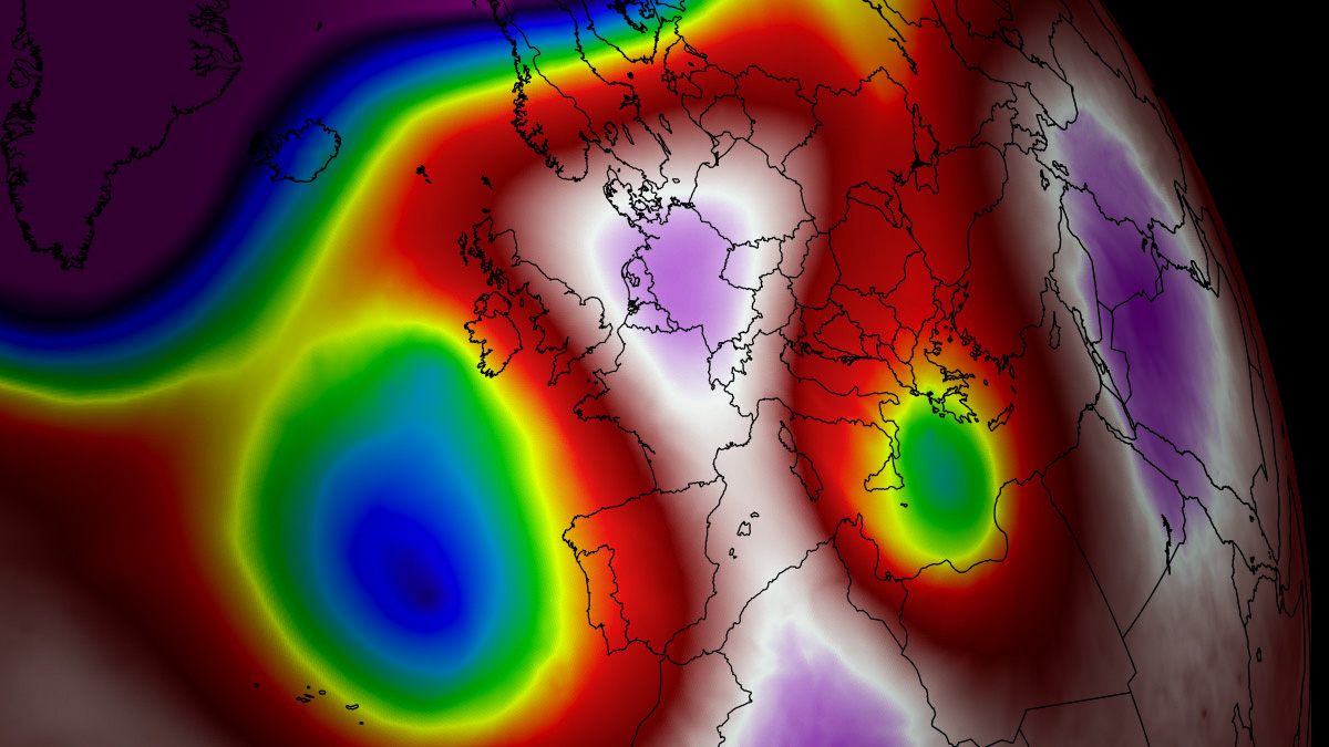
- Temperature Anomalies: 850 hPa temperatures are surging 8–12 °C above normal.
- Geographical Reach: Impacts extend from Spain and Portugal across France, Germany, the Benelux union, Italy, and deep into Scandinavia.
- Duration: The blocking pattern is projected to lock in place, maintaining anomalously high temperatures through the final days of September and deep into early October.
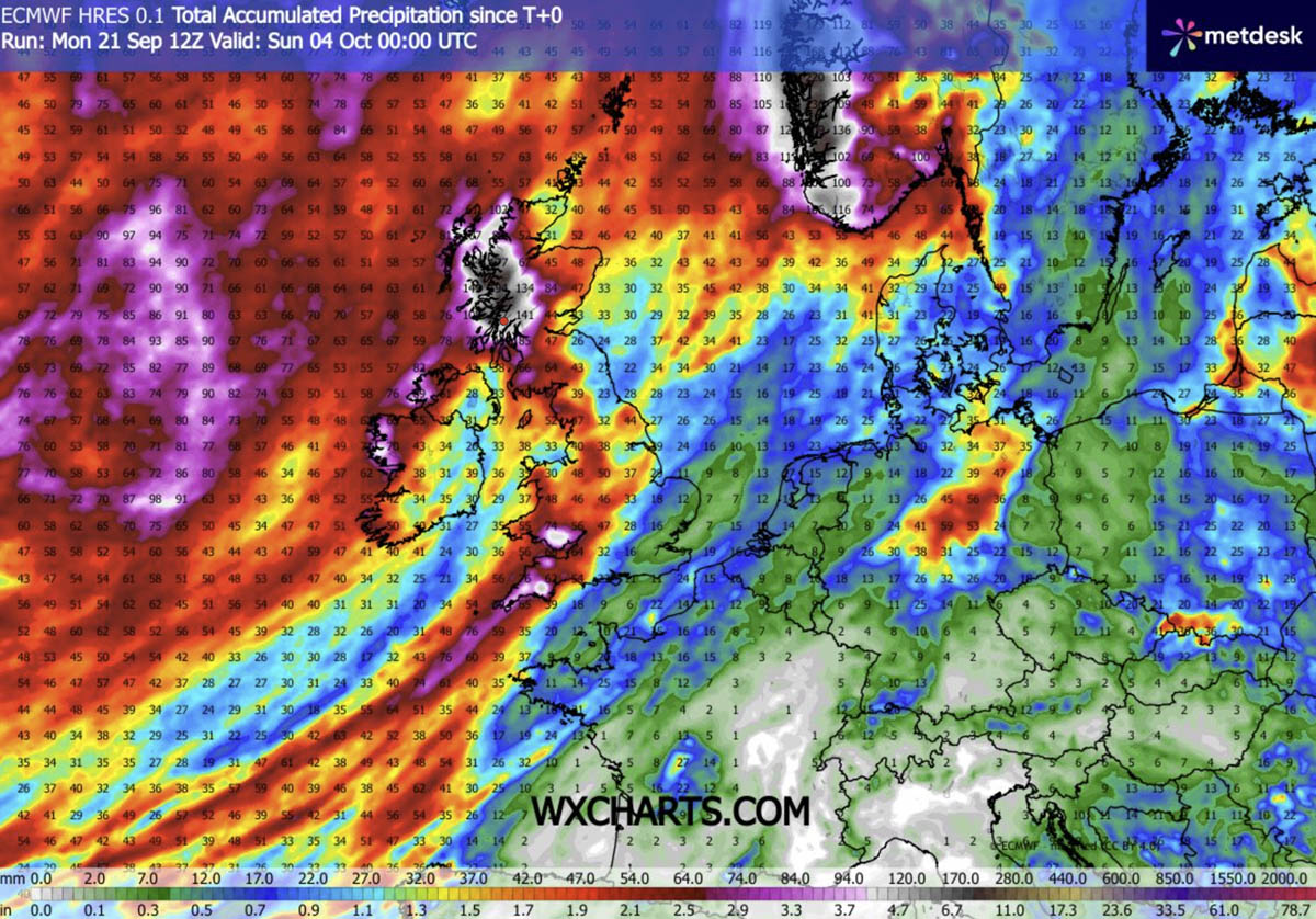
- Contrast: While continental Europe bakes under a stable, dry air mass, the Atlantic edge faces intense moisture plumes and heavy, orographic rainfall.
Chronology of the Event: From Atlantic Dipole to Continental Block
Understanding how this extreme weather event unfolds requires tracking its progression across the synoptic scale.
Phase 1: The Setup and Initial Surge (Mid-to-Late September)
The atmospheric configuration began taking shape as a deep upper-level wave deepened over the North Atlantic. This dynamic created an intense pressure gradient, fueling a robust southwesterly flow. Warm air masses originating over North Africa were successfully tapped, funneled northward across the Mediterranean, and pushed directly into the Iberian Peninsula and southwestern Europe.
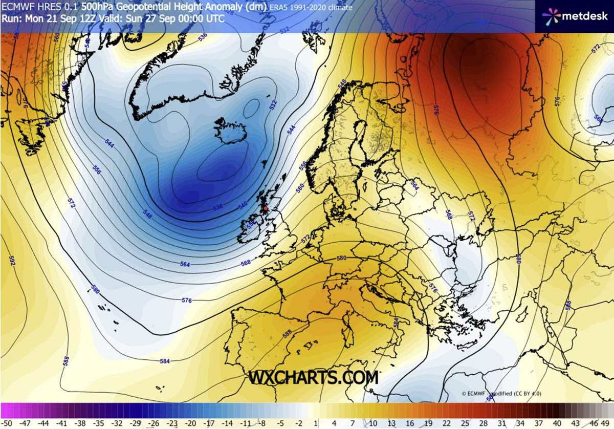
Phase 2: Peak Intensification over Western Europe (Thursday through Sunday)
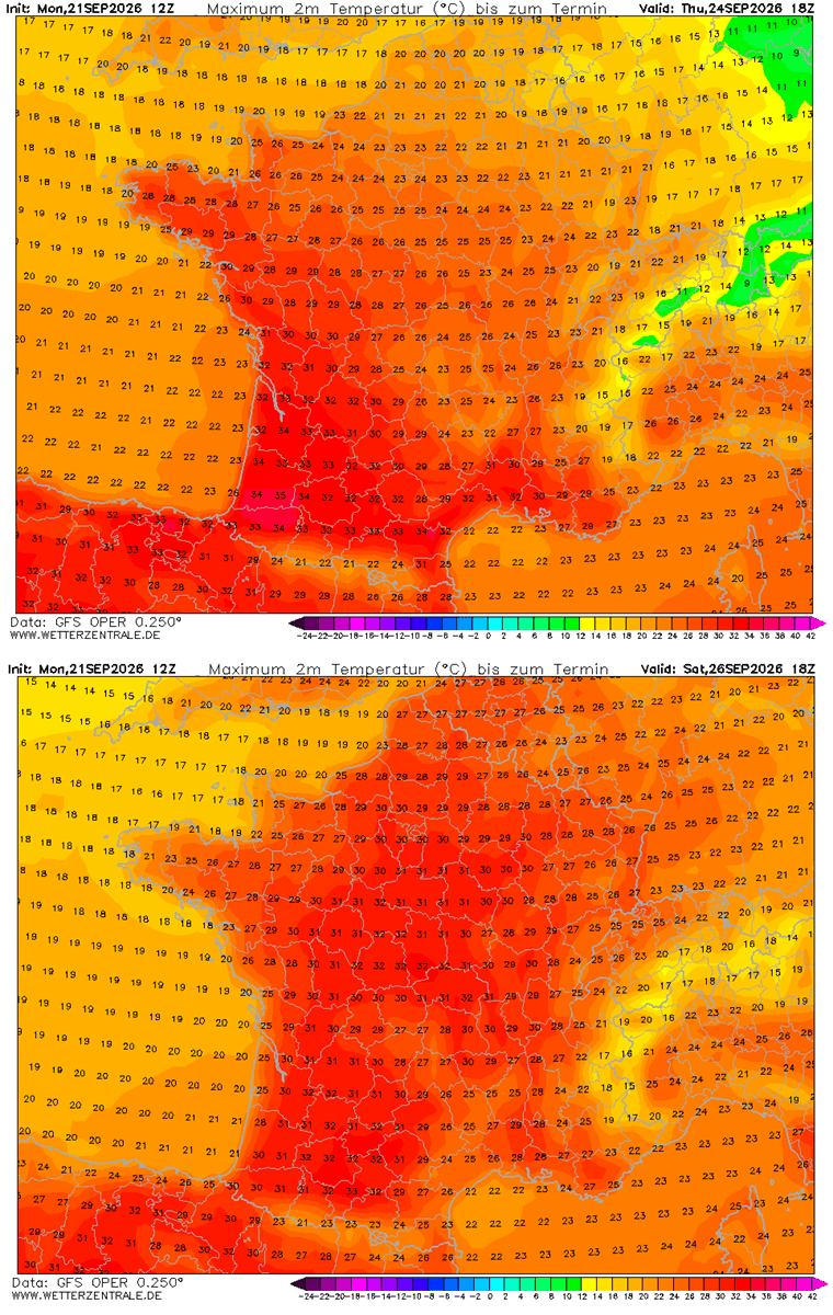
As the week progresses, the upper-level ridge builds aggressively, morphing into a classic omega block. The core of the heat dome parks itself over France, Spain, and Portugal. During this window, daytime highs in southern and central Spain consistently eclipse 35 °C, with localized hot spots hitting near 40 °C. Meanwhile, southern and central France experience temperatures climbing into the mid-to-upper 30s.
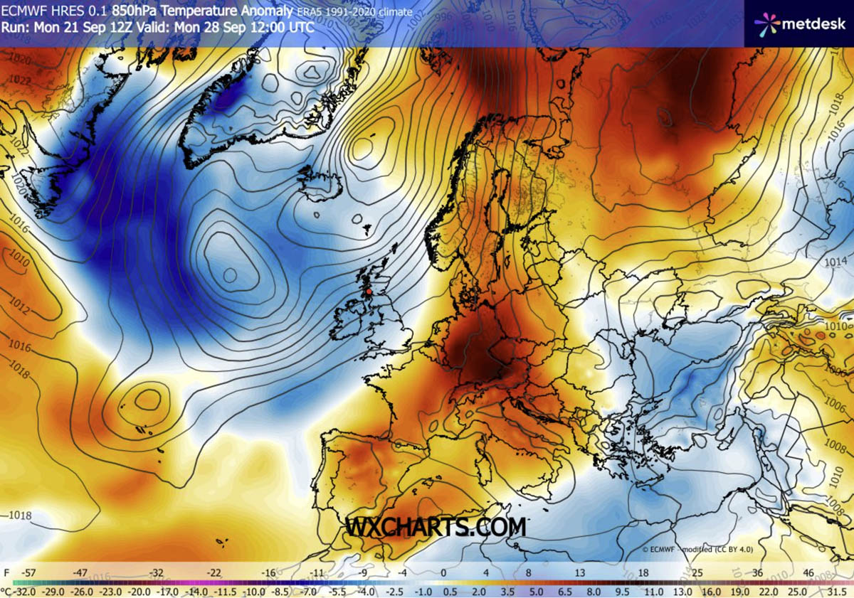
Phase 3: Expansion into Central Europe and Scandinavia (Late September into Early October)
Moving into the weekend and early next week, the warmth is not contained to the south. The blocking high-pressure system shifts slightly northeast, advecting the hot air mass into Germany, Poland, the Benelux nations, and eventually Scandinavia. Meteorological models from both the GFS and ECMWF indicate that Sweden and Finland will witness some of the most striking thermal anomalies relative to their normal early-October climate, keeping the summer-like conditions alive well past the autumn equinox.
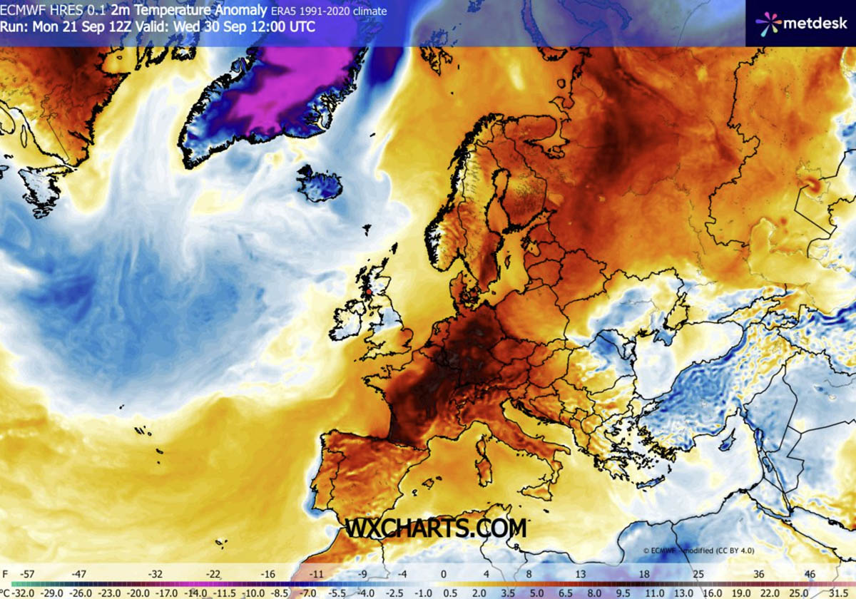
Supporting Data and Regional Breakdown
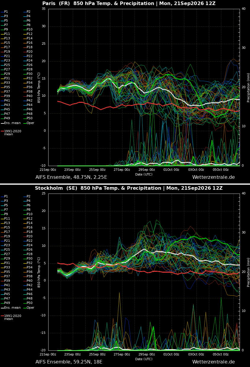
Meteorological data parsed from mid-range forecasts for major urban and agricultural basins—such as Paris, France, and Stockholm, Sweden—reveal a remarkably persistent signal. The heat wave is exceptionally long-lived, defying the traditional rapid cooling curve expected as autumn sets in.
Southwestern Europe (Spain and Portugal)
- Conditions: Extremely dry air mass combined with intense sunshine.
- Peak Temperatures: 34 °C to 38 °C across south-central Spain and Portugal, with localized peaks reaching up to 40 °C through Saturday.
- Impact: Elevated risk of drought persistence and heightened wildfire danger due to the prolonged dry spell.
Western Europe (France and the United Kingdom)
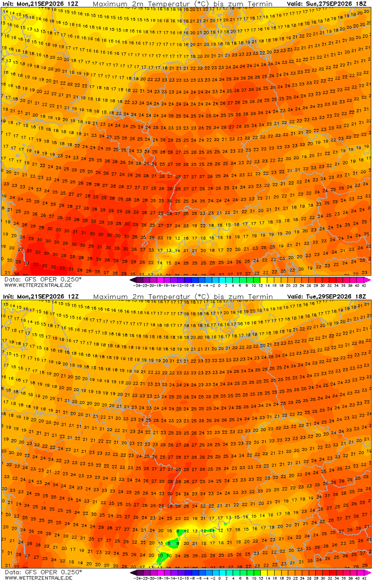
- France: Southern and central regions are bearing the brunt, with interior areas pushing toward 36 °C. Northern France and Benelux are registering comfortable yet unseasonably warm low-30s over the weekend.
- United Kingdom: While missing the extreme continental heat, south-central England is experiencing a notable warm pulse with mid-to-upper 20s through Sunday. Conversely, Scotland and Ireland remain sheltered under cooler Atlantic influences.
Central Europe and the Mediterranean (Germany, Italy, and the Balkans)
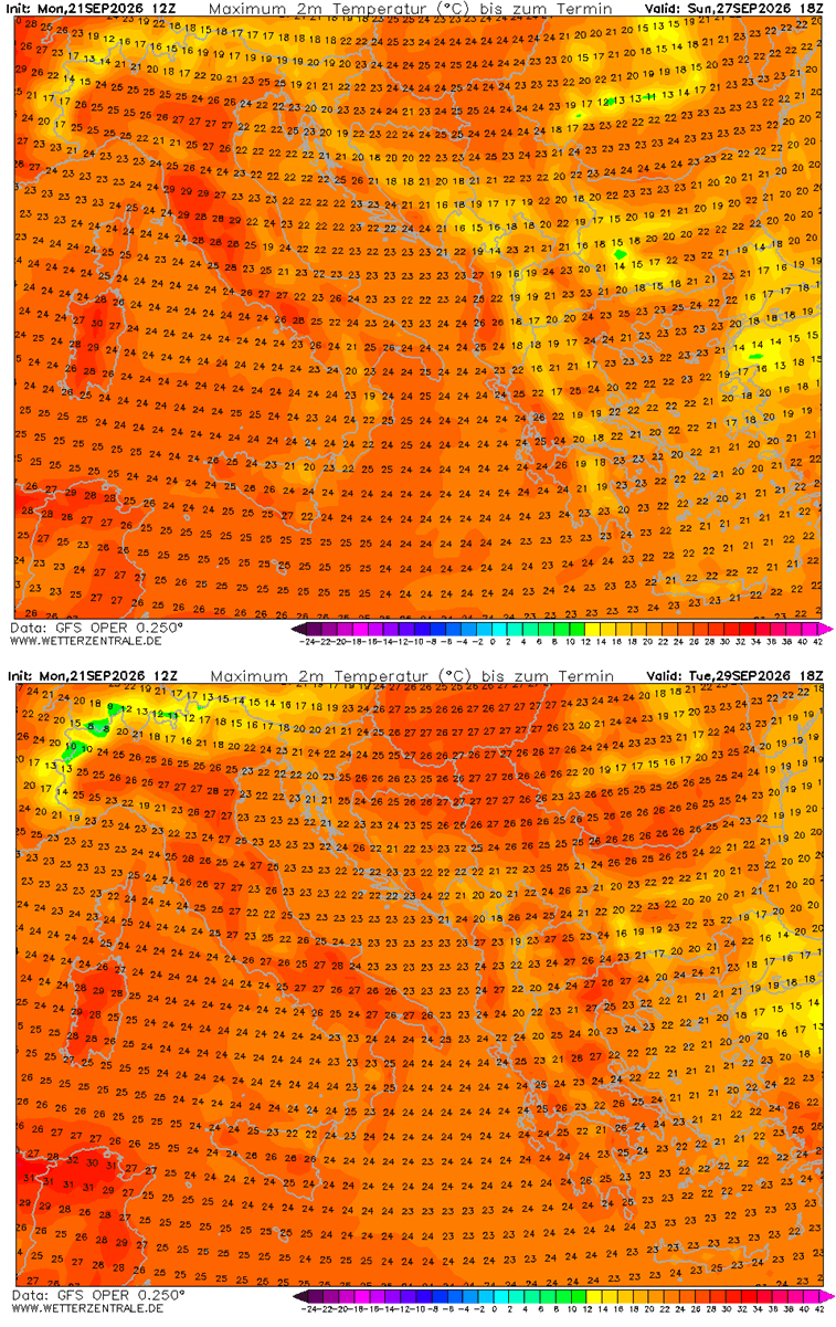
- Germany & Benelux: Temperatures are forecast to peak in the mid-to-upper 27–29 °C range, with the warmest conditions developing from Sunday through Tuesday.
- Italy & Balkans: Northern Italy’s Po Valley and Tuscany are challenging late-September record highs, with mercury readings pushing between 28 °C and 30 °C. Similar anomalies are noted across the north-central Balkans and Greece.
The Atlantic Contrast: Heavy Rains in the West
While continental Europe deals with extreme heat, the strong southwesterly jet stream positioned between the Atlantic low and the continental ridge is driving an atmospheric river of moisture toward the far western fringes of the continent. Western Ireland, Scotland, and southwestern Norway are bracing for substantial orographic rainfall, with accumulation totals potentially exceeding 150 millimeters by early October.
Implications: Health Risks, Urban Stress, and Energy Demands
While late-season warmth is often welcomed by tourists and outdoor enthusiasts, a heat dome of this magnitude and duration carries severe societal and environmental implications.
Public Health and Nocturnal Heat Stress
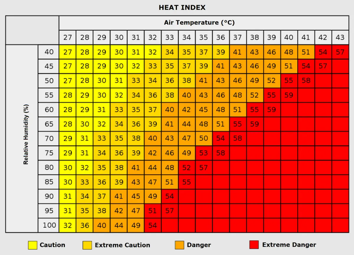
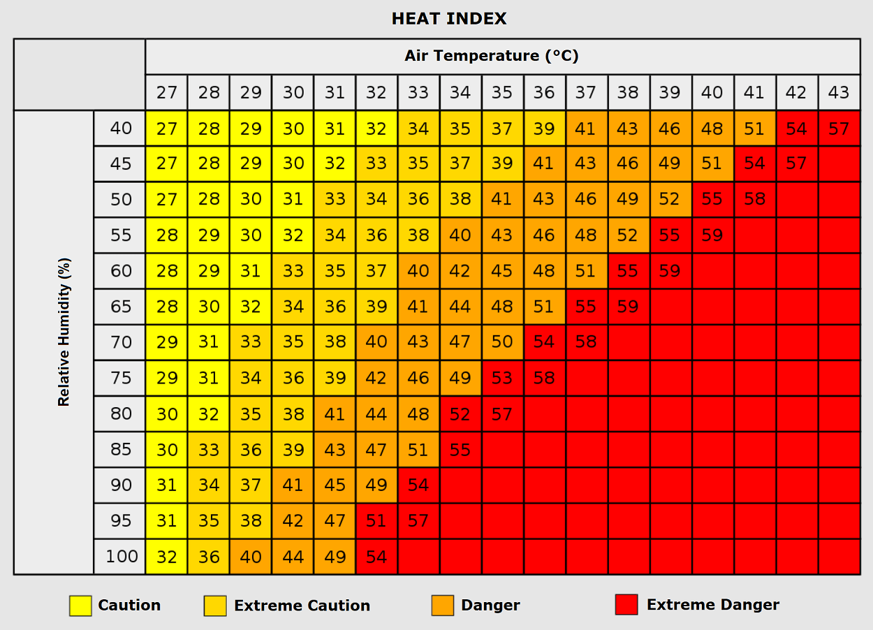
The most insidious danger of a robust heat dome is the lack of overnight relief. Forecasters have highlighted the threat of "tropical nights," where ambient temperatures refuse to drop below 24 °C. This continuous thermal load denies the human body its vital window to cool down and recover, exponentially increasing the risk of heat exhaustion, dehydration, and heat stroke.
Vulnerable populations—including the elderly, young children, and those with pre-existing cardiovascular or respiratory conditions—face heightened danger. Furthermore, urban environments constructed largely of heat-trapping materials like concrete and asphalt experience severe urban heat island effects, compounding the danger for lower-income urban residents who lack adequate climate control. Heatwaves are historically correlated with spikes in heart attacks, strokes, and respiratory distress.
Agricultural and Economic Pressures
For agricultural sectors, the prolonged dry and hot conditions place unexpected stress on late-season crop yields and soil moisture levels, particularly across the drought-sensitive basins of Southern and Western Europe. Additionally, energy grids face lingering summer-like demands for cooling and air conditioning at a time when energy systems are typically transitioning to seasonal maintenance profiles.
Official Outlook and Future Monitoring
Meteorological agencies across Europe, utilizing data inputs from global forecasting centers, continue to monitor the stabilization of this massive blocking ridge. While current models confirm that the heat dome will dictate weather patterns through the end of September and deep into the first week of October, long-range ensemble trends suggest that a more dynamic, unsettled weather pattern could finally break the block later in the month.
Residents living beneath the footprint of the heat dome are advised to stay updated with local meteorological alerts, practice proper hydration, and take precautions against prolonged sun exposure as Europe experiences one of its most anomalous late-season thermal events on record.
