

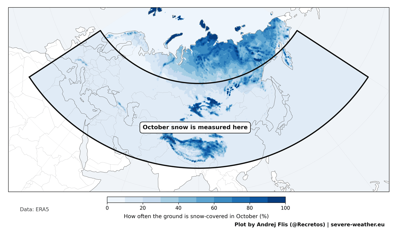
Every autumn, as temperatures begin to plummet across the Northern Hemisphere, a familiar debate resurfaces across meteorological forums and social media channels. Weather enthusiasts and long-range forecasters fixate on a single geographic metric: the rate at which snow cover expands across Siberia during October. For over a decade, this metric has been heralded as the ultimate "crystal ball" for winter forecasting—an early warning sign of severe, snowy winter weather destined to strike the United States, Canada, and Europe.
The concept stems from a heavily cited 2011 scientific study that linked rapid October snow advances in Eurasia to disruptions of the stratospheric Polar Vortex. However, a rigorous new empirical evaluation of 47 years of meteorological data—spanning from 1979 to 2025—reveals that this once-famous correlation has largely broken down. As the meteorological community prepares for Winter 2026/2027, experts are shifting their focus away from Siberian snow and toward a much more powerful driver: an active Super El Niño.
Main Facts: The Siberian Snow Theory Under Scrutiny
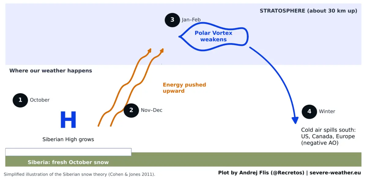
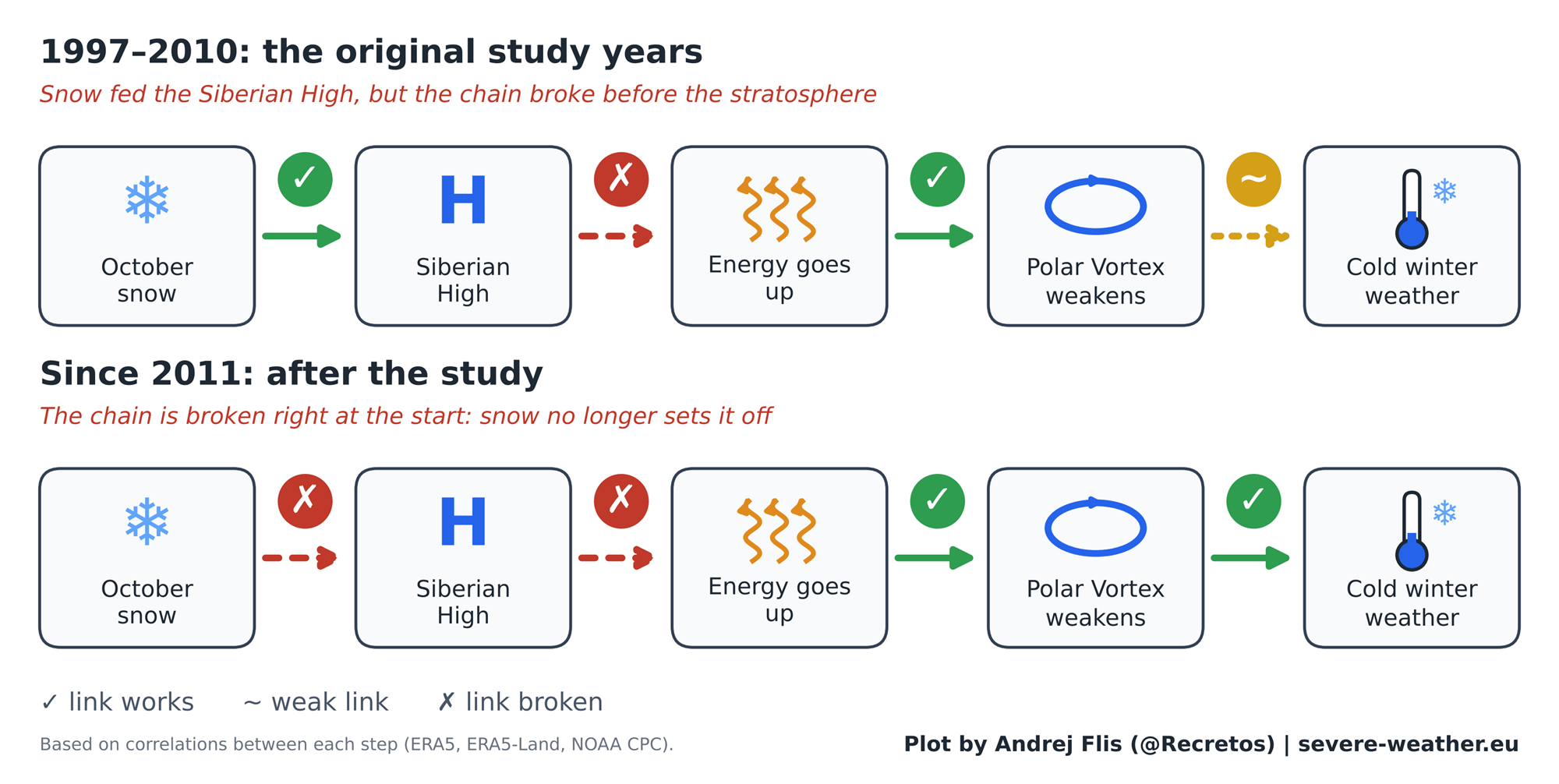
The foundational premise of the Eurasian snow theory is deceptively simple. When snow cover advances rapidly across Siberia and Central Asia in October, it cools the ground intensely. This cooling strengthens the Siberian High, a massive semi-permanent area of cold, heavy surface pressure over northern Asia.
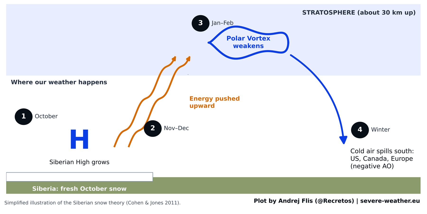
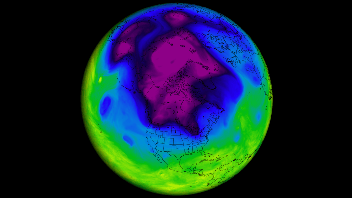
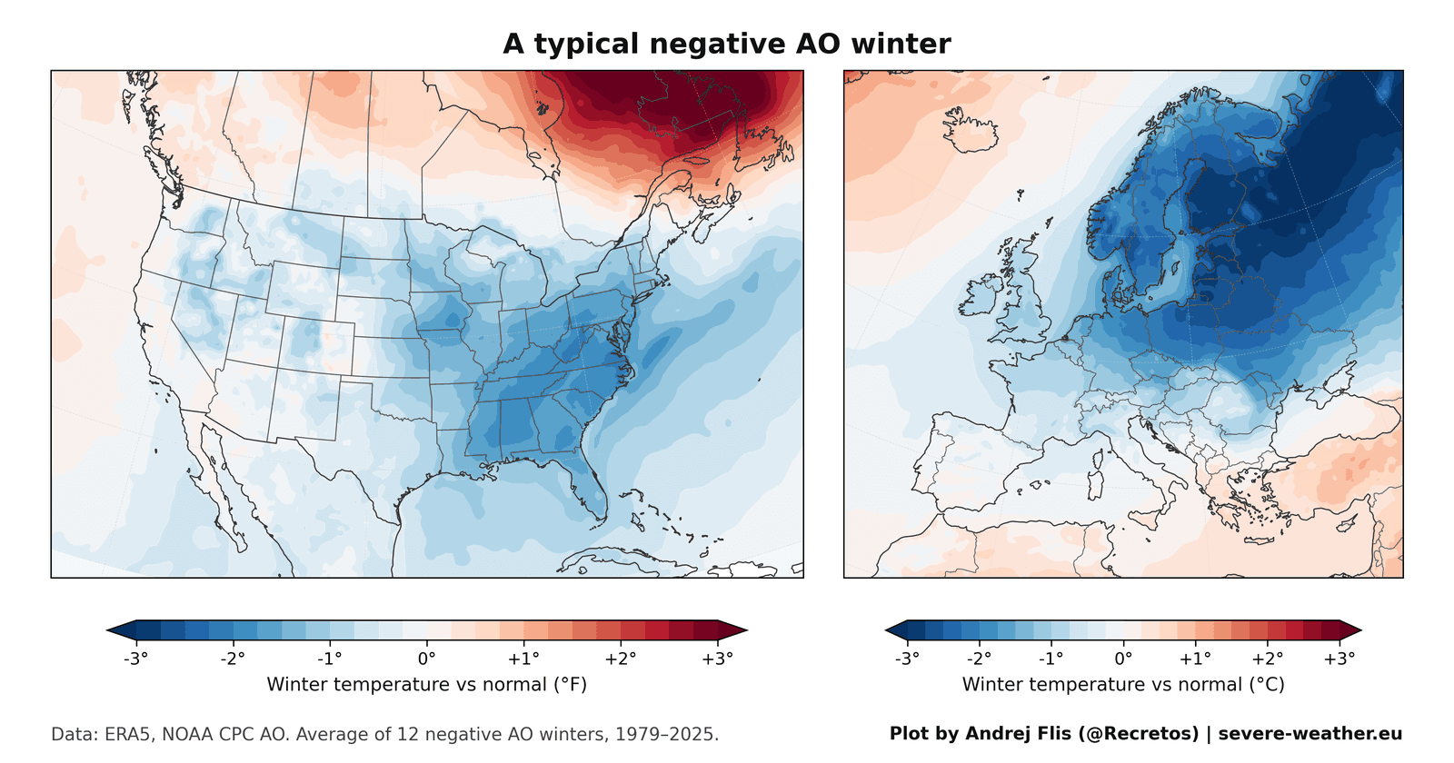
In theory, this intensified high-pressure system forces planetary-scale wave energy upward into the stratosphere—around 30 kilometers (18.5 miles) above the Earth’s surface. Once this energy reaches the stratosphere, it disrupts the Polar Vortex, a ring of strong westerly winds that normally bottles up frigid Arctic air. When the vortex becomes stretched, wobbly, or collapses entirely (often referred to as a negative Arctic Oscillation or AO phase), lobes of bitterly cold air can break away and spill southward into mid-latitude population centers.
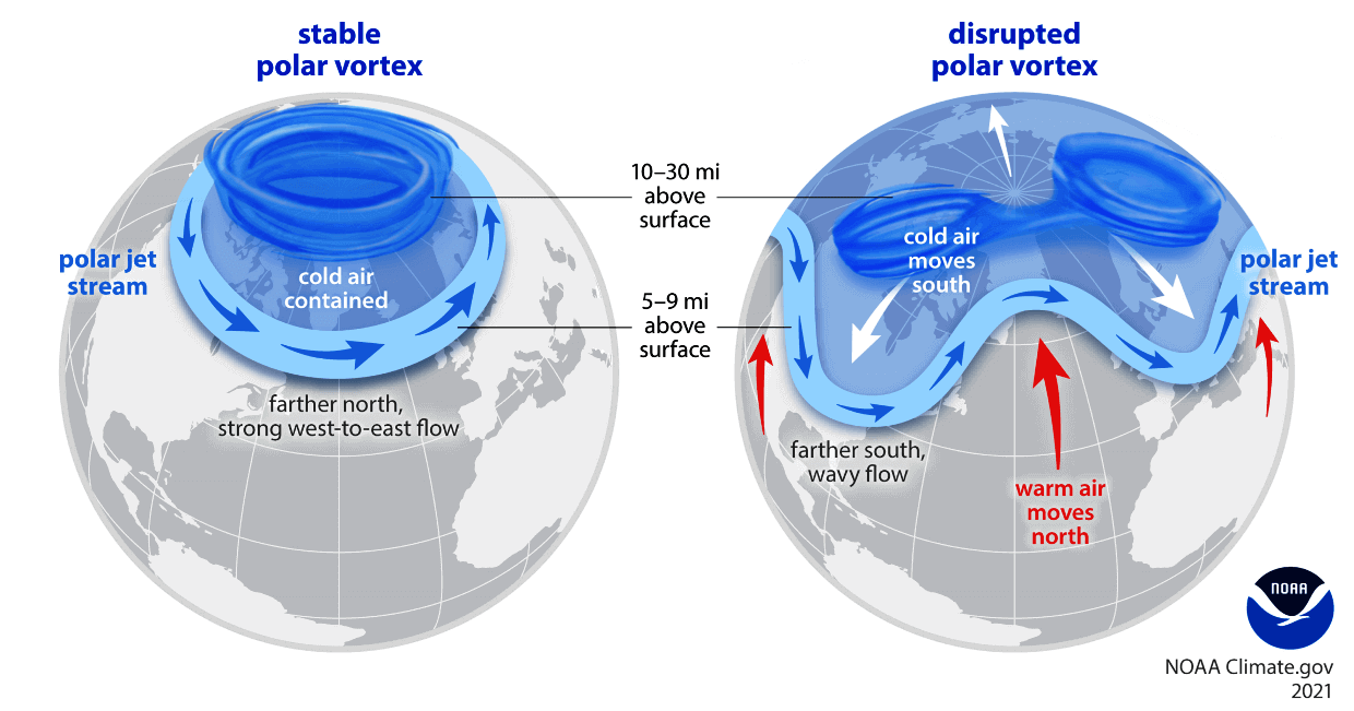
- The Original Finding: Published in 2011 by researchers Judah Cohen and Justin Jones, the initial study found a strong statistical link between fast October snow advances and subsequent negative AO winters.
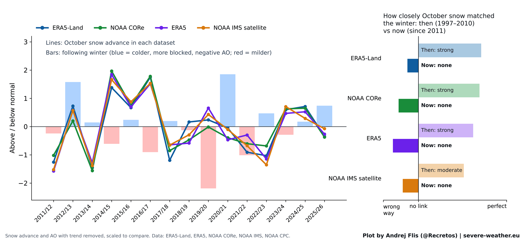
- The New Test: Using four independent snow datasets—including satellite observations and modern reanalysis products—meteorologists evaluated 47 winters of data, specifically testing 15 new winter seasons that occurred after the study’s publication.
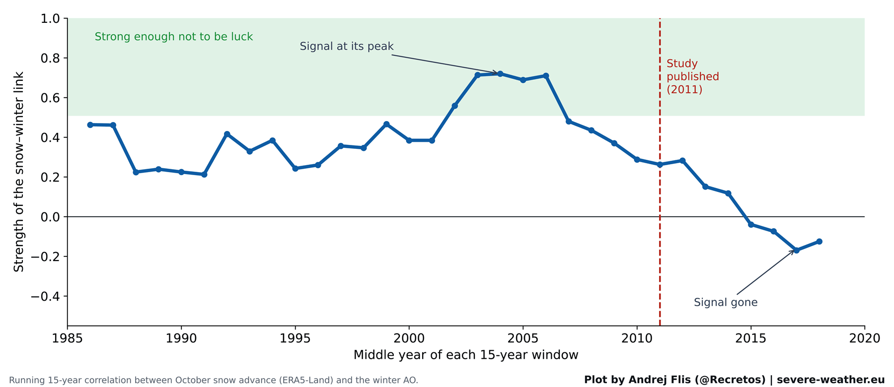
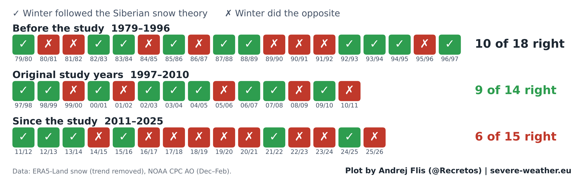
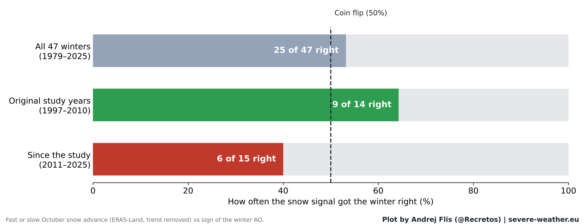
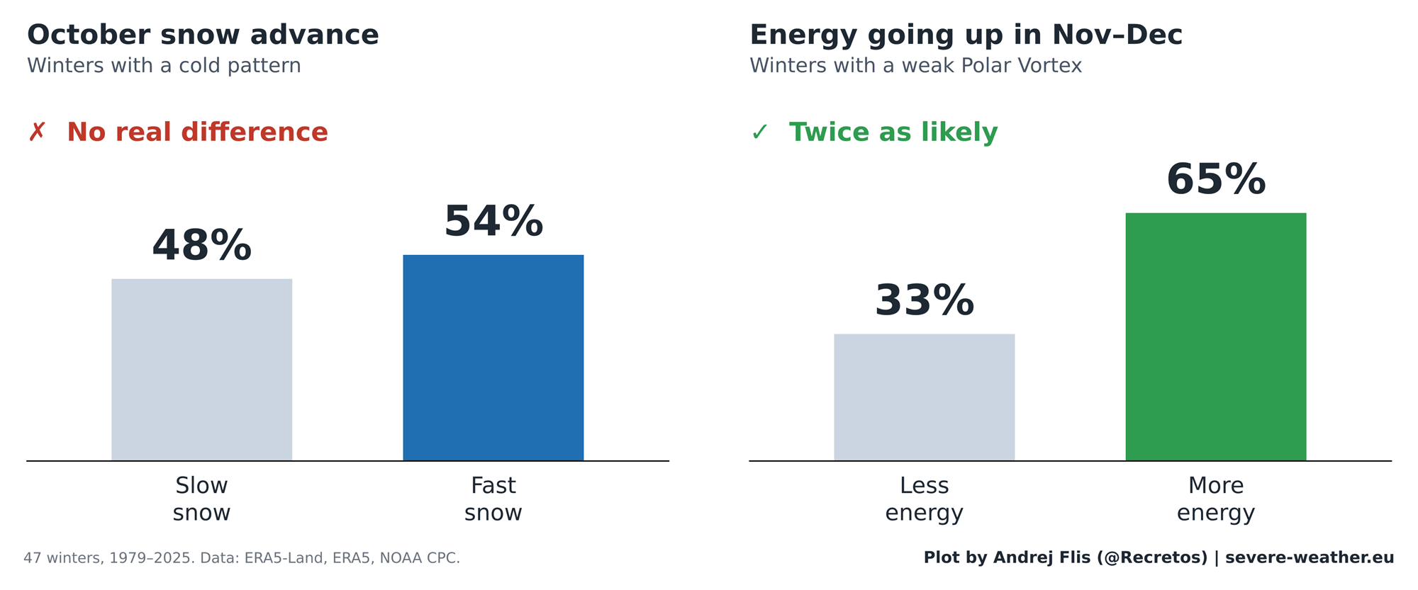
- The Verdict: Over the full 47-year dataset, the snow signal performed at a near coin-flip accuracy (correct 25 times, wrong 22 times). For the 15 winters following 2011, it proved correct in only 6 out of 15 instances—performing worse than random chance.
Chronology: The Rise, Fall, and Re-evaluation of a Forecasting Tool
The Golden Era (1997–2010)
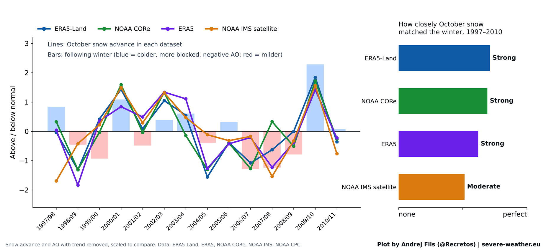
When Cohen and Jones published their landmark study in 2011, daily satellite snow maps only extended back to 1997, giving researchers a modest 14-year baseline. During this specific window, the correlation was remarkably robust.
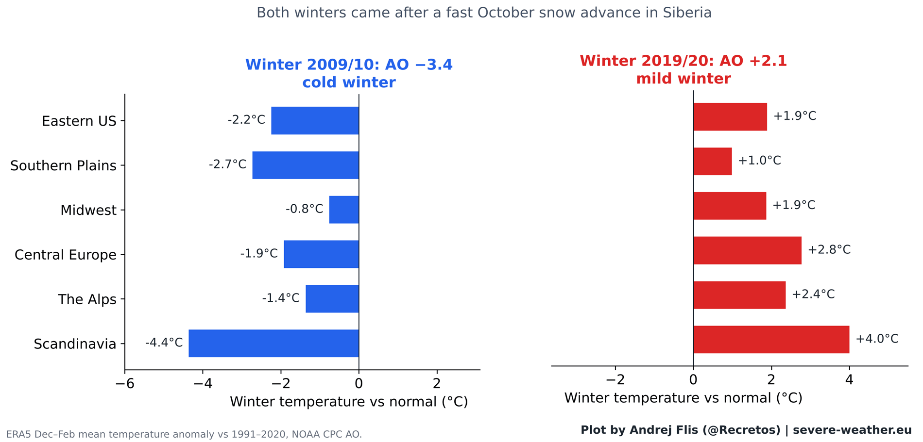
The theory achieved iconic status largely due to the historic Winter of 2009/2010. That season followed one of the fastest October snow advances on record and subsequently delivered the most negative AO phase recorded up to that time, bringing crippling blizzards to the Eastern United States and severe cold to Europe. This single, high-profile event cemented the Siberian snow index in the lore of long-range forecasting.
The Decoupling (2011–Present)
As time progressed, the predictive power of the index began to degrade. When tested against winters occurring after 2011, the statistical bridge connecting October Siberian snow to the winter Arctic Oscillation entirely vanished.
A prime example of this decoupling occurred during the Winter of 2019/2020. Despite being preceded by a rapid October snow advance, the season turned out to be one of the strongest positive AO winters on record, characterized by exceptionally mild conditions and a distinct lack of snow across much of Europe and North America. Step-by-step analysis of the atmospheric chain reaction reveals that while the stratosphere still responds reliably to energy pushed up from below in November and December, Siberian snow no longer reliably triggers that upward energy transfer.
Supporting Data: What 47 Years of Reanalysis Reveals
To ensure absolute scientific integrity, researchers cross-verified their findings across four distinct meteorological datasets: ERA5, ERA5-Land, NOAA IMS 24 km satellite observations, and NOAA CORe.
Regional Breakdowns
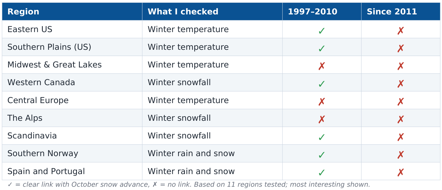
The breakdown of predictive power across 11 key regions in North America and Europe highlights the shifting dynamics:
- The Pre-2011 Period: Eastern U.S. winters showed a clear cooling trend following rapid snow advances, and winter precipitation patterns in southwestern and northern Europe aligned with the theory.
- The Post-2011 Period: Out of 44 regional checks conducted for the years following 2011, only a single regional metric displayed any residual signal (a weak, non-actionable correlation in Western Canada).
A Note on Reanalysis Anomalies
In conducting multi-decadal studies, data consistency is critical. During this evaluation, researchers identified a notable artifact in the standard ERA5 dataset: October snow cover across Eurasia drops abruptly by roughly 40% in 2004, coinciding with ECMWF’s integration of early satellite snow mapping. However, because independent datasets (such as NOAA CORe and satellite-derived IMS) corroborated the broader atmospheric trends, the ultimate conclusions regarding the snow index’s predictive failure remain uncompromised.
Implications for Winter 2026/2027: Enter the Super El Niño
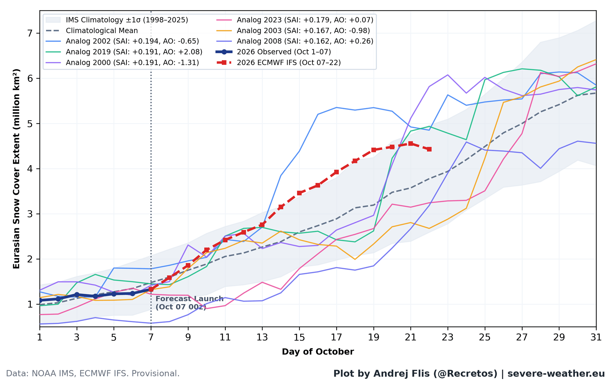
As October 2026 draws to a close, Eurasian snow cover is experiencing a late-month surge projected by ECMWF forecasts to place it in the top 15% for the month. Historically, comparable Octobers have yielded mixed results (three negative AO winters, one neutral, and two positive AO winters). Based on the empirical data, a fast snow advance this October does not guarantee a harsh winter.
Instead, meteorologists are turning their attention to a much more dominant atmospheric force currently shaping the globe: an active Super El Niño.
The Stratospheric Impact of Strong El Niño Events
Current ocean temperature anomalies tracked via NOAA data confirm a powerful Pacific El Niño signature. Advanced meteorological modeling and recent peer-reviewed studies indicate that strong El Niño events exert a profound influence on the stratosphere, leading to significant deceleration of the Polar Vortex winds during the heart of winter.
- December to February Outlook: ECMWF seasonal forecasts show the Polar Vortex remaining near normal through mid-December, before experiencing a pronounced slowdown toward late December and January.
- Potential for Sudden Stratospheric Warming (SSW): Model simulations suggest conditions favorable for a potential vortex disruption or collapse in mid-to-late winter.
- Geographic Distribution: When major stratospheric warmings occur under strong El Niño baselines, historical analogues point toward an increased likelihood of colder-than-average temperature anomalies settling across the central, southern, and eastern United States, driven by an amplified Pacific jet stream and persistent southern cloud cover. Conversely, current model runs indicate that Europe may see a milder flow, keeping core cold anomalies largely restricted to Scandinavia.
Summary and Expert Outlook
The enduring obsession with the Siberian October snow cover is a testament to the human desire for early, simple indicators of winter weather. While the snow advance theory provided valuable insights during the 2000s, 47 years of empirical data demonstrate that it is no longer a reliable standalone tool for predicting the state of the Polar Vortex or mid-latitude winter temperatures.
For Winter 2026/2027, forecasters advise looking past Eurasian snow cover. The true catalysts to monitor in the coming weeks will be November-December stratospheric wave activity—the true early warning system for a disrupted Polar Vortex—and the overwhelming thermal footprint of the ongoing Super El Niño.
