

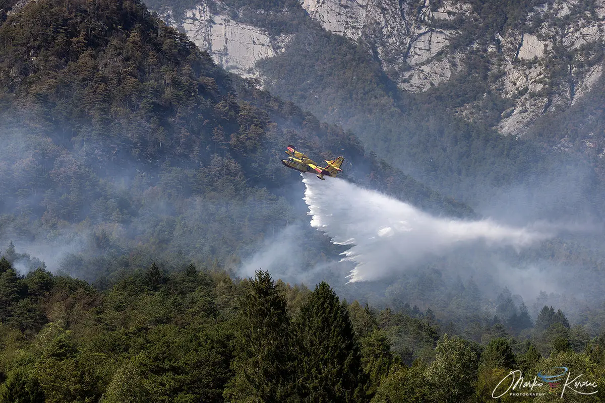
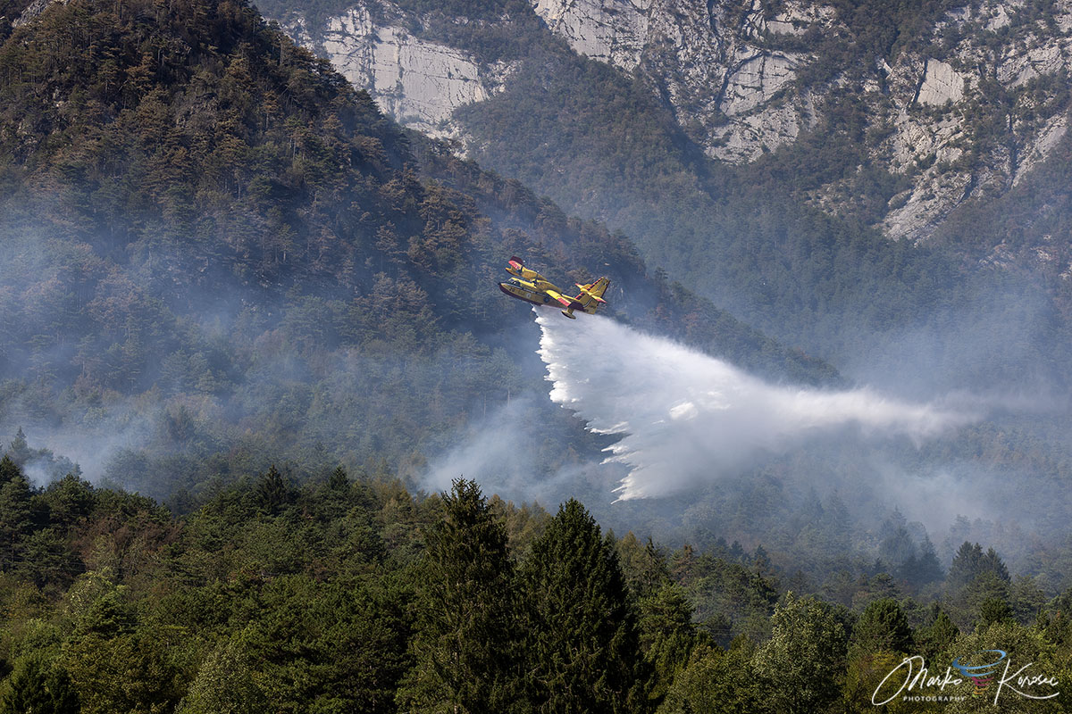
TOLMEZZO, ITALY — After ten grueling days of battling shifting winds, vertical limestone cliffs, and explosive fire behavior, emergency crews have finally brought one of the most severe Alpine forest fires of the summer under control. The ferocious blaze, which scorched more than 600 hectares across the peaks of Monte Amariana and Monte Amarianute in northeastern Italy’s Friuli-Venezia Giulia region, pushed perilously close to residential settlements before a dramatic shift in weather provided crucial atmospheric relief.
The fire, intensified by a severe summer heat dome and prolonged regional drought, forced emergency evacuations, mobilized a cross-border aerial task force, and left a permanent mark on the landscape of the Carnia region.

Main Facts: The Anatomy of an Alpine Disaster
The Monte Amariana wildfire will be remembered as a defining test of Italy’s civil protection framework, highlighting the growing vulnerability of high-altitude ecosystems to extreme weather events.
- Scale of Destruction: Over 600 hectares of pristine forest, brushwood, and steep limestone terrain were turned to ash.
- Geographic Focus: The fire burned across the Eastern Tolmezzo Alps, specifically targeting the pyramid-shaped limestone peak of Monte Amariana (1,905 meters) and neighboring Monte Amarianute.
- Human Impact: Evacuations were abruptly ordered in the hamlet of Pissebus, near Tolmezzo, as leaping flames pushed within 50 meters of residential properties. Power lines in the high- and medium-voltage networks were temporarily deactivated as a precautionary measure.
- Response Force: A massive multi-agency operation combined Italian Canadair water bombers, regional helicopters, and specialized Slovenian Air Tractor aircraft. On the ground, elite units from the Corpo Forestale Regionale and the Vigili del Fuoco (Fire Brigade) worked around the clock to protect valley communities.
- Turning Point: The crisis was officially broken by a powerful late-August frontal system that dumped between 150 mm and nearly 200 mm of rain across the region within a 72-hour window.
Chronology of the Crisis: From Spark to Suppression
The disaster unfolded in distinct phases, transitioning from an isolated lightning strike into an explosive regional emergency that defied standard containment strategies.
Phase 1: Ignition and the Heat Dome (Early August)
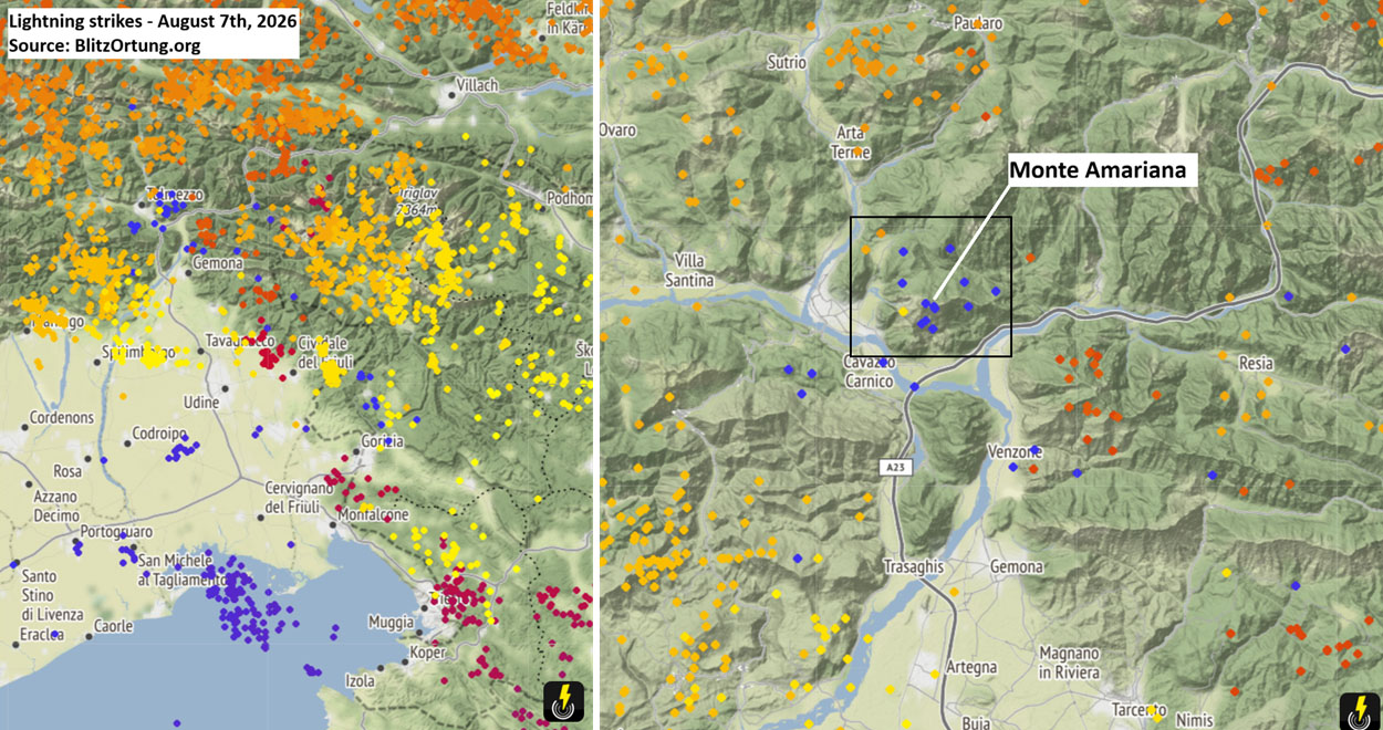
The crisis began during the peak of an oppressive European heat dome in early August 2026. Prolonged dry spells had dried out the undergrowth, creating a tinderbox of dry pine needle beds (Pinus nigra) and dense brushwood. On August 7th, a passing frontal wave sparked severe thunderstorms across the region. Lightning strikes—detected precisely by tracking networks such as Blitzortung—ignited the upper Cuel Feltron, a steep spur of Monte Amariana looming above the municipality of Amaro.
Phase 2: The Ferragosto Explosion (August 15th)
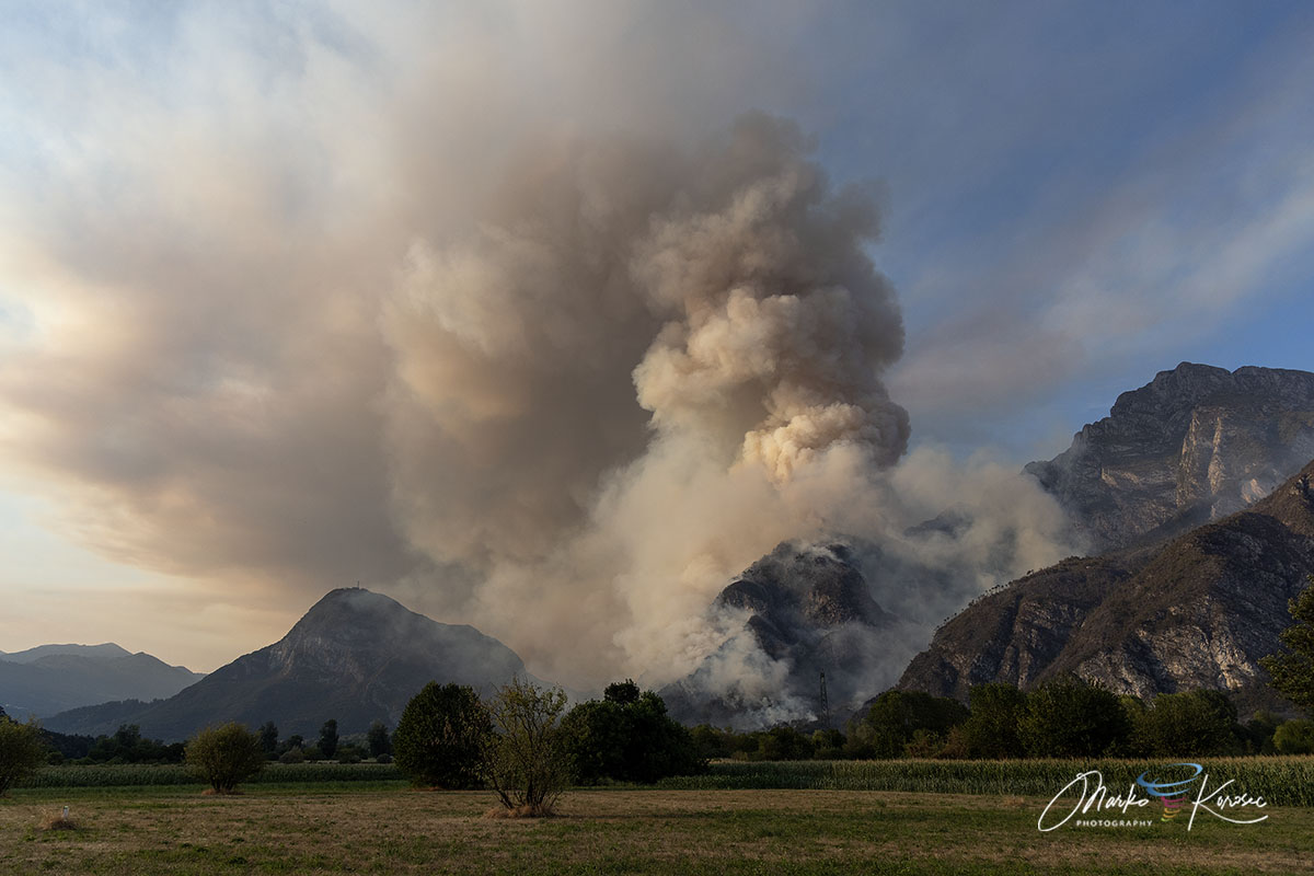
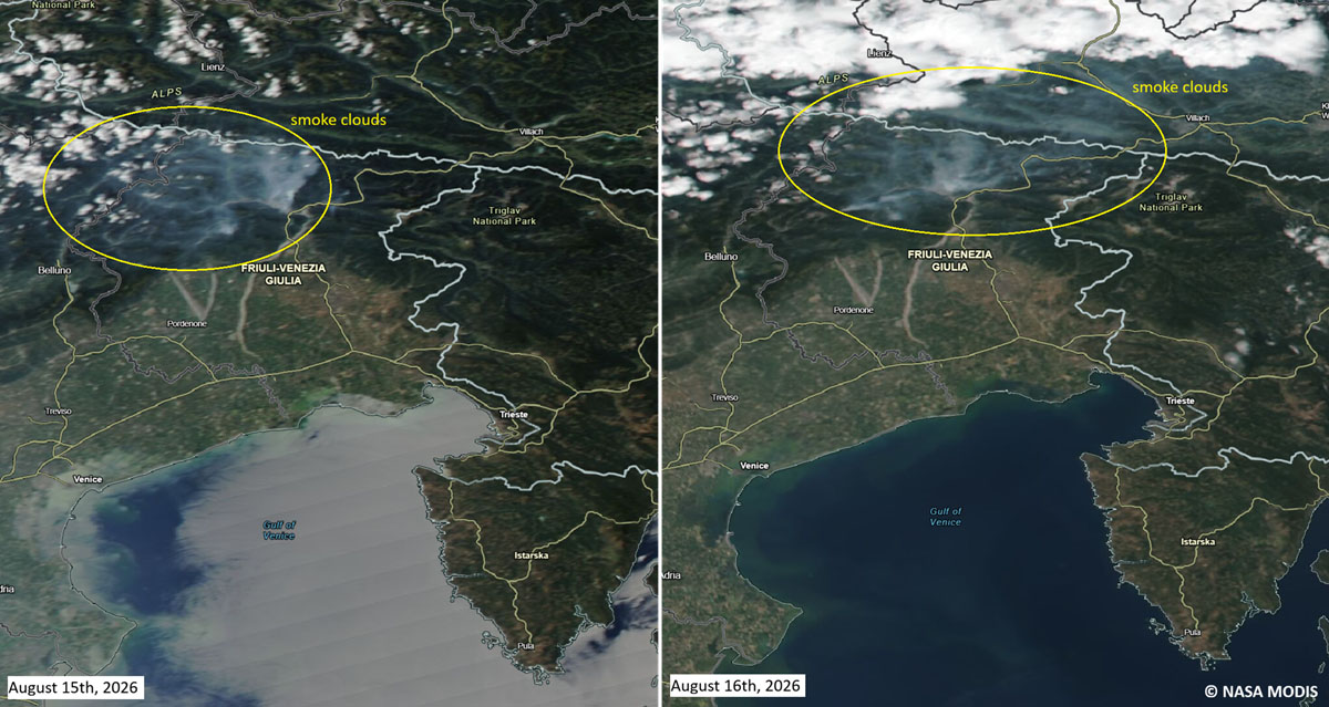
For over a week, the fire smoldered and crept along inaccessible ridges. However, the situation deteriorated drastically on August 15th, coinciding with Ferragosto, a major Italian national holiday. Gusty downslope winds roared through the valleys, fanning the embers and driving the fire across the Rio Confine ridge. The flames spilled directly onto Monte Amarianute, sweeping rapidly toward the outer hamlets of Tolmezzo, particularly threatening the Pissebus sector and the areas surrounding Illegio.
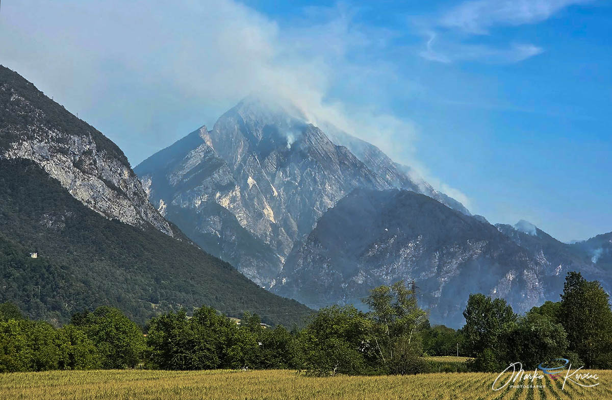
The fire’s intense heat created a vertical "chimney effect" along the sheer limestone cliffs. This explosive combustion generated massive pyrocumulus clouds—fire-induced thunderstorms—that towered above the mountain and further erraticized local wind patterns.
Phase 3: Containment and Thermal Monitoring (Late August)
By the third week of August, relentless water drops and strategic ground defenses had halted the forward march of the primary flame fronts. As smoke cleared from the Tagliamento valley, regional teams transitioned from active suppression to thermal drone monitoring. These high-tech sweeps scanned the smoking ruins for subterranean hotspots capable of triggering a secondary flare-up.
Supporting Data: Climate Context and Rainfall Deficits
The severity of the Monte Amariana wildfire was not an isolated anomaly, but rather the direct consequence of compounding meteorological pressures throughout the summer of 2026.
Meteorological data from Tolmezzo, Carnia, and the broader Friuli-Venezia Giulia region revealed significant rainfall deficits leading up to August. Months of below-average precipitation had depleted deep soil moisture and desiccated mountainous vegetation. The accumulation of dry fuel—particularly highly flammable resinous pine needles across steep, inaccessible gradients—provided the raw material necessary for an aggressive, fast-moving crown fire.
Furthermore, the fire behavior was dictated by the topography:
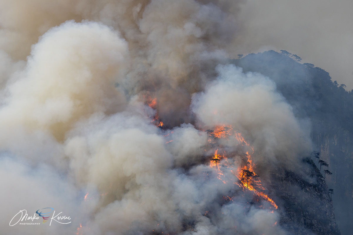
- Inaccessible Terrain: The vertical karst and limestone cliffs made direct ground assaults on upper sectors virtually impossible, rendering the fire almost entirely dependent on aerial intervention.
- Microclimatic Feedback: The intensity of the burning created localized thermal instabilities, complicating pilot operations through heavy turbulence and reduced visibility caused by thick, toxic smoke plumes.
Official Responses and Cross-Border Mobilization
Faced with a disaster that threatened populated valleys, regional and national authorities launched a swift, highly coordinated response.
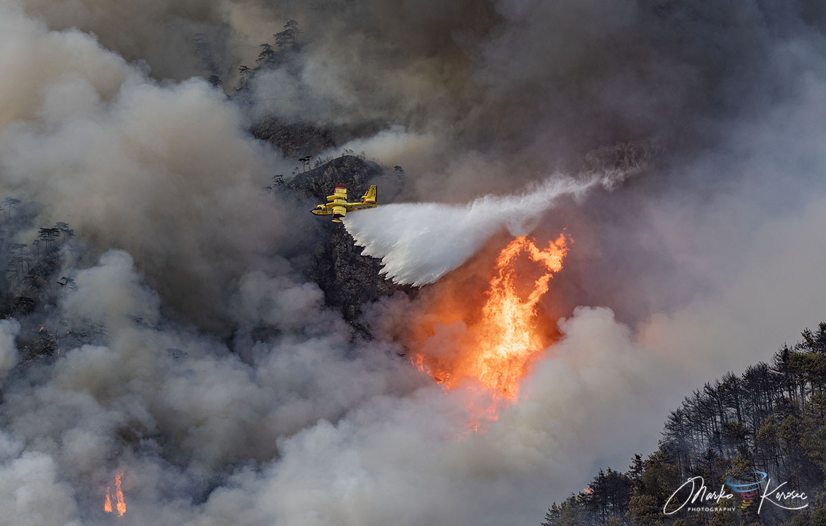
The aerial operation was notably international. In addition to Italy’s national fleet of Canadair water bombers, authorities integrated cross-border assets, deploying Slovenian Air Tractor water bombers alongside regional civil protection helicopters. These aircraft executed hundreds of precision drops over narrow mountain ridges, establishing a relentless water curtain between the advancing fire and vulnerable civilian infrastructure.
On the ground, the Vigili del Fuoco and the Corpo Forestale Regionale established defensive perimeters around Pissebus and Illegio. Firefighters deployed portable high-pressure pumps, cleared defensive firebreaks, and monitored shifting wind lines to protect homes. Utility companies cooperated closely with emergency managers, temporarily cutting high- and medium-voltage power lines running through the danger zone to prevent electrical arcs and safeguard emergency personnel.
Civil protection officials praised the stoic resilience of local residents and the seamless cooperation between Italian and international firefighting units, noting that without the rapid scaling of the aerial fleet, the outcome for mountain hamlets could have been catastrophic.
Environmental and Long-Term Implications
As the smoke clears and the region counts the cost of the disaster, environmental scientists and local authorities are turning their attention to the long-term implications for the Carnia region.
- Ecosystem Recovery: The loss of over 600 hectares of forest alters local habitats and removes vital root structures that stabilize the steep limestone slopes.
- Hydrogeological Risks: With the protective canopy and underbrush destroyed, the heavy autumn rains now pose an immediate secondary threat: flash flooding, mudslides, and severe soil erosion across the Tagliamento valley watershed. Regional engineers are already planning preventative stabilization measures.
- Climate Adaptation in the Alps: The Monte Amariana wildfire serves as a stark reminder that traditional Alpine environments—historically viewed as immune to mega-fires—are increasingly vulnerable to the shifting climate patterns of Southern Europe. Longer dry seasons, record-breaking heatwaves, and erratic lightning events are rewriting the rules of wildfire management in high-altitude terrain.
For now, the torrential downpours that dropped 150 to nearly 200 mm of rain across Friuli-Venezia Giulia between August 20th and 22nd have successfully extinguished the last remnants of the blaze. Yet, the charred slopes of Monte Amariana stand as a sobering monument to a changing climate, signaling an urgent need for enhanced forest management and cross-border emergency readiness in the European Alps.
