

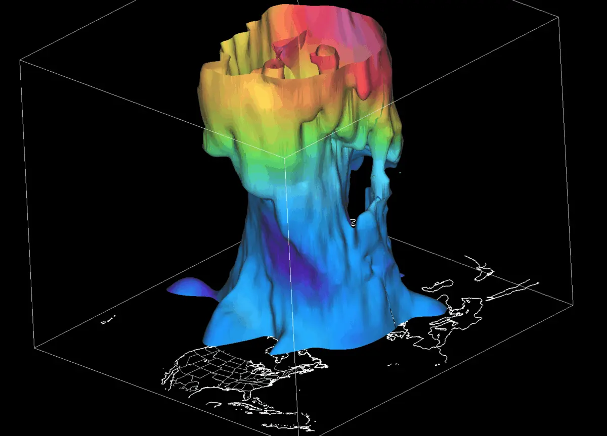
GLOBAL METEOROLOGICAL DESK — As meteorological autumn takes hold across the Northern Hemisphere, atmospheric scientists are tracking the early-season genesis of the Polar Vortex. Recent data from the stratosphere indicates a robust, rapid cooling cycle and an initial pressure drop over the North Pole, launching the circulation system into a stronger-than-average start compared to last year.

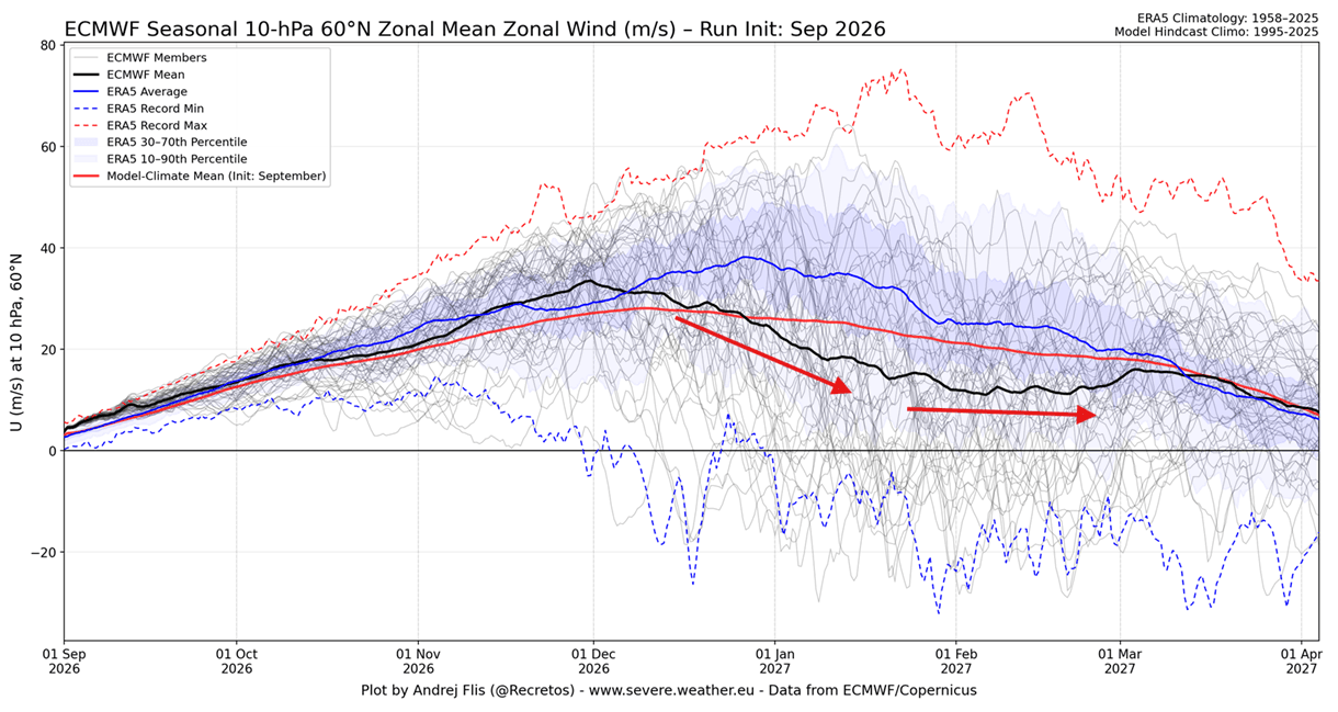
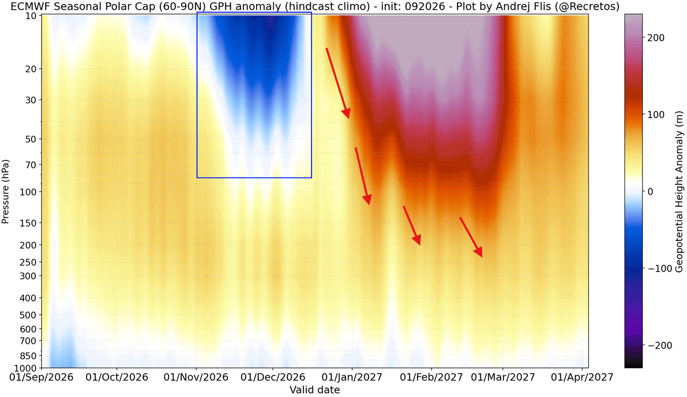
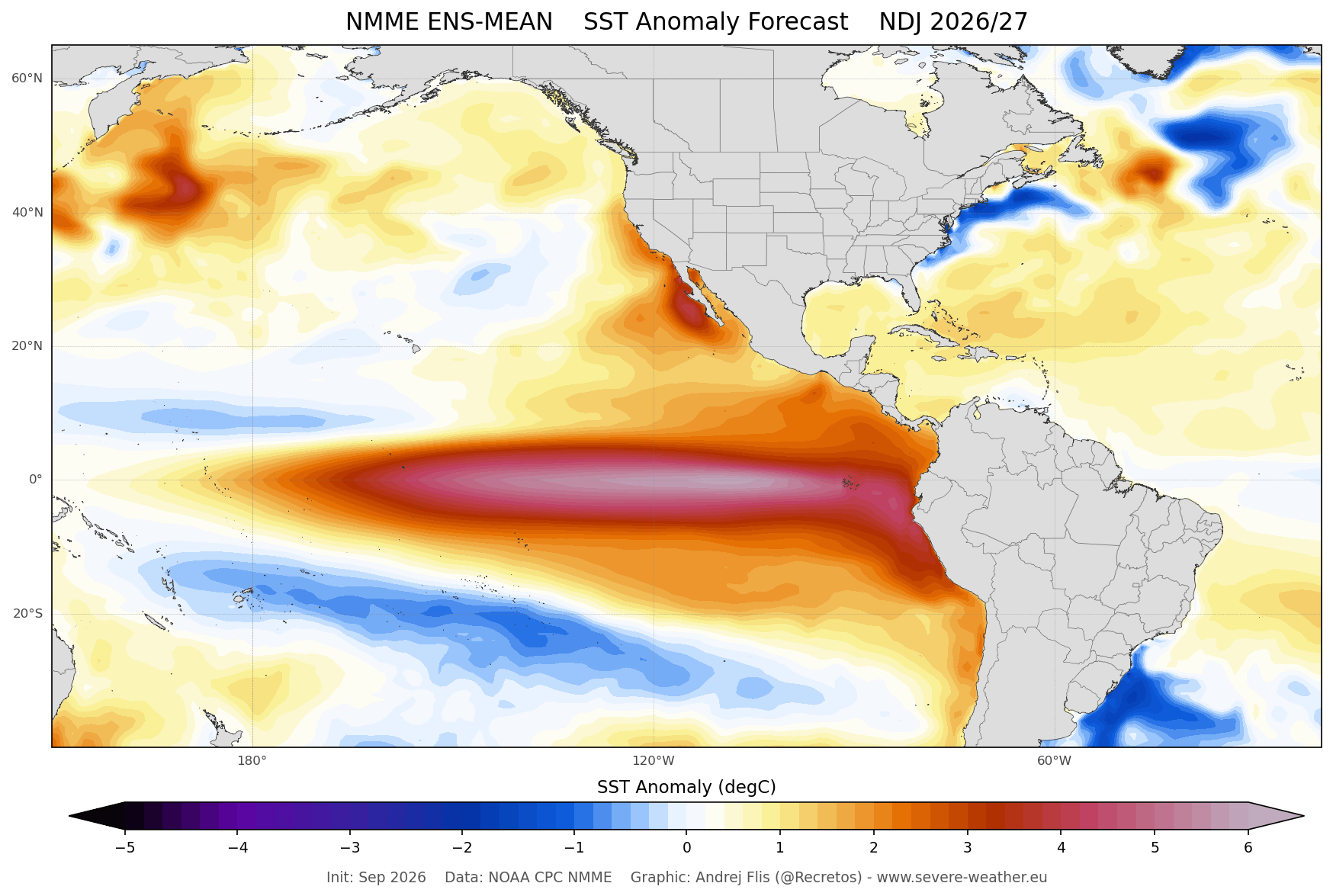
However, long-range dynamic forecasts for the upcoming Winter 2026/2027 suggest a dramatic mid-season pivot. Consensus among leading seasonal models points toward a notable deceleration of the vortex, characterized by weakening stratospheric winds and rising pressure anomalies by mid-winter. Compounding these atmospheric shifts is the emergence of a powerful Super El Niño in the tropical Pacific, introducing a high-impact catalyst that could fundamentally alter weather patterns across the United States, Canada, and Europe.
Main Facts: Decoding the Polar Vortex and Its Seasonal Shift
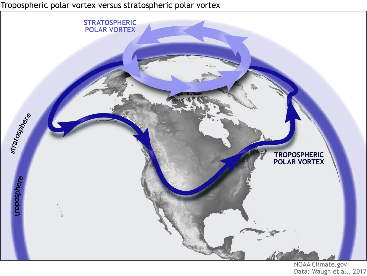
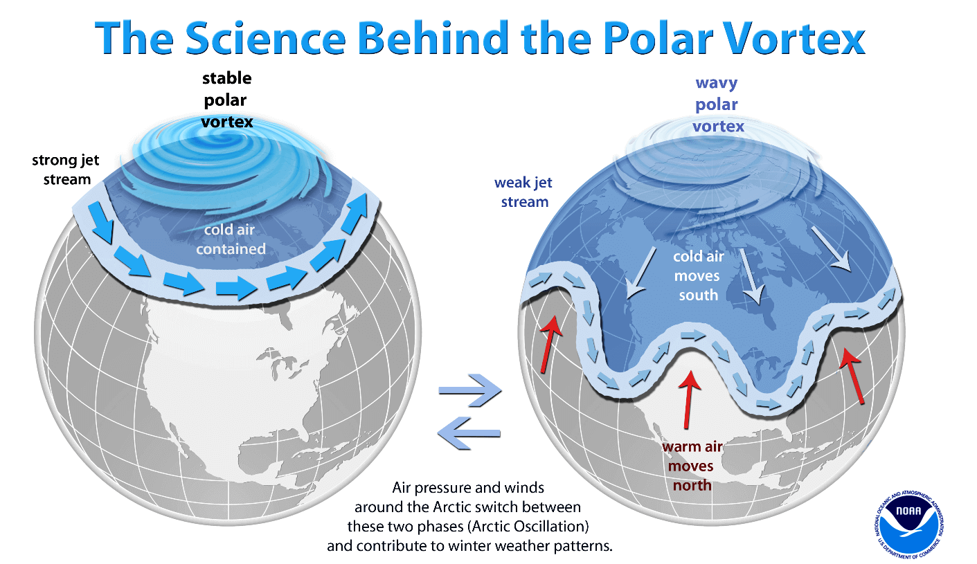
The Polar Vortex is the grand atmospheric engine of the Northern Hemisphere winter. Operating as a massive, spinning wall of air over the polar regions, it stretches from the Earth’s surface well into the stratosphere—reaching altitudes exceeding 50 kilometers (30 miles). This circulation system acts as an atmospheric barrier, trapping bitter Arctic air safely within high latitudes.
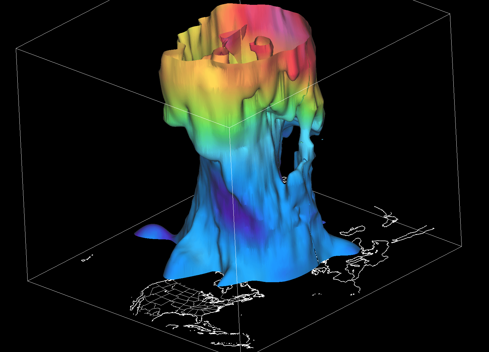
Meteorologists separate the vortex into two distinct, interacting layers:
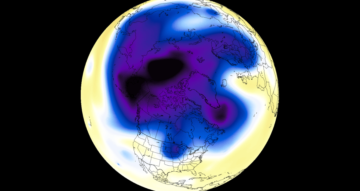
- The Stratosphere (Upper Layer): Located high above the ground, this upper vortex is largely symmetrical, tightly wound, and spins freely.
- The Troposphere (Lower Layer): Situated closer to the surface, this lower structure is inherently uneven and "wobbly." It is shaped by surface terrain, massive mountain ranges, and dynamic pressure systems that generate wave-like distortions.
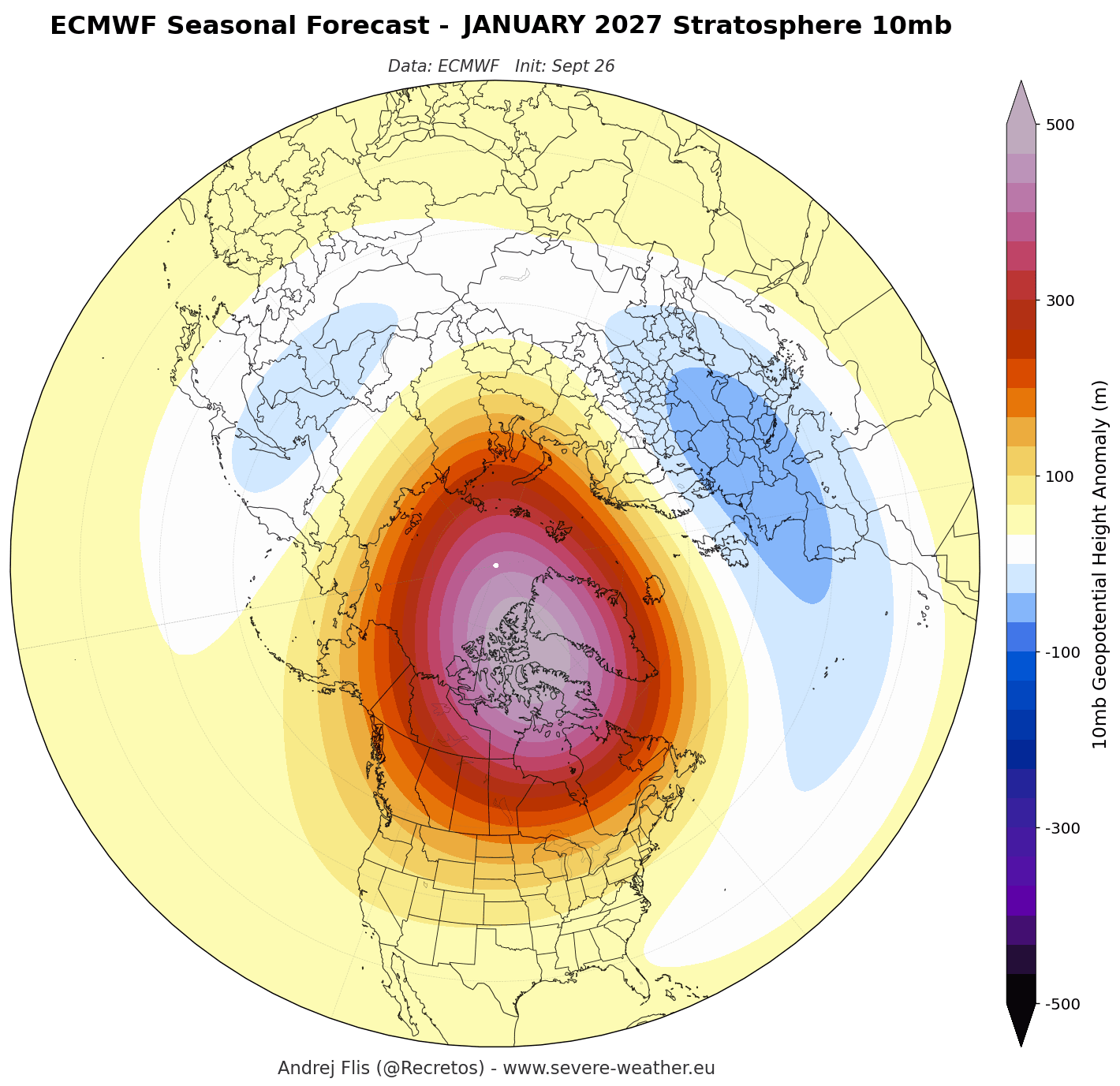
While early seasonal indicators show the stratospheric core developing with a healthy circular "donut" shape and a robust low-pressure center, extended-range models signal a turbulent shift. As winter progresses into January and February 2027, the vortex is projected to lose its structural integrity, opening the door for sweeping Arctic air outbreaks into lower mid-latitudes.
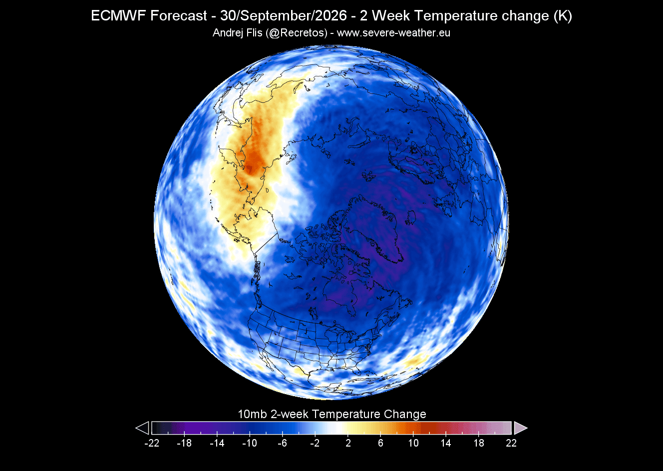
Chronology of the 2026/2027 Polar Vortex Development
Understanding how winter weather manifests at the surface requires tracing the life cycle of the Polar Vortex from its late-summer origins through the heart of the cold season.
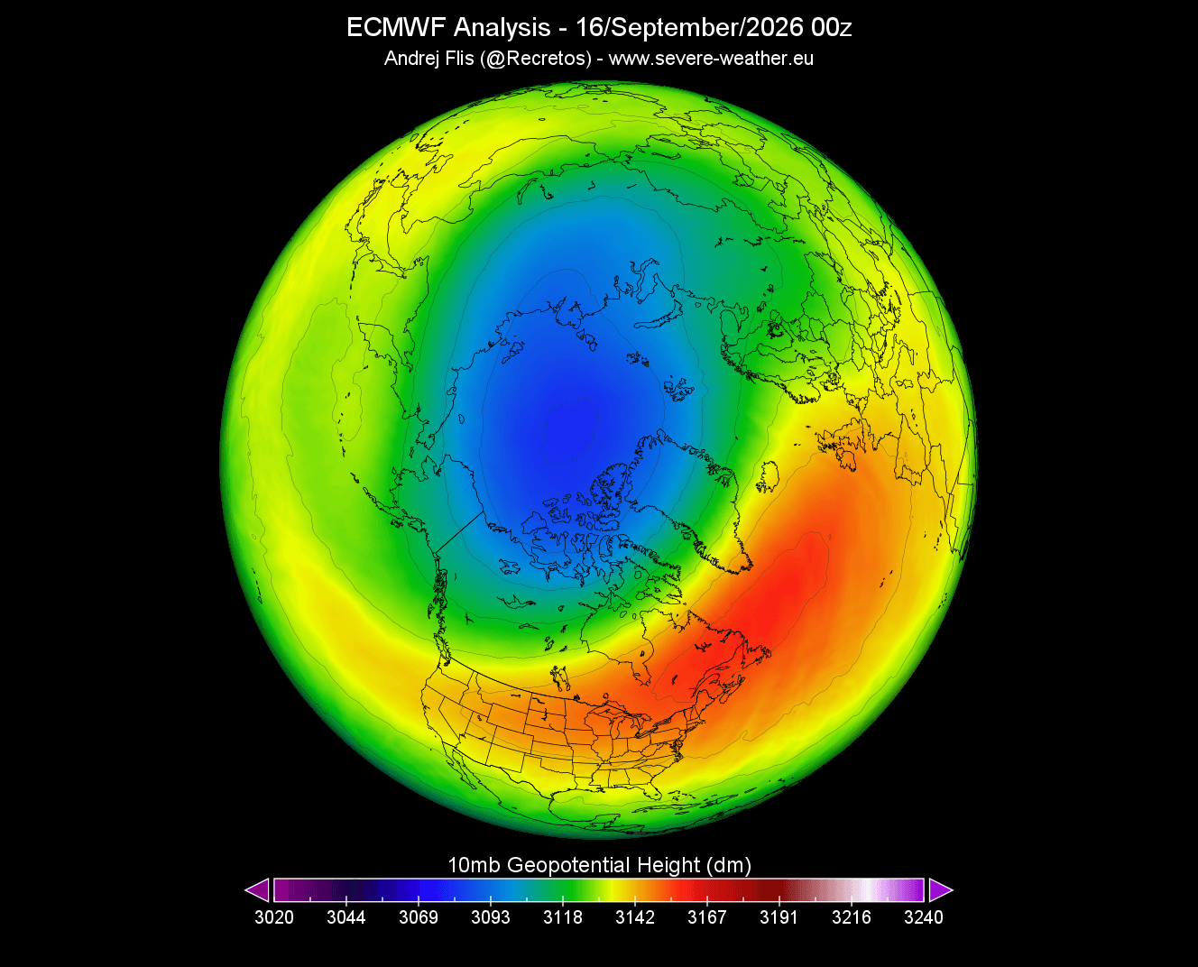
Late Summer to Early Fall: The Genesis
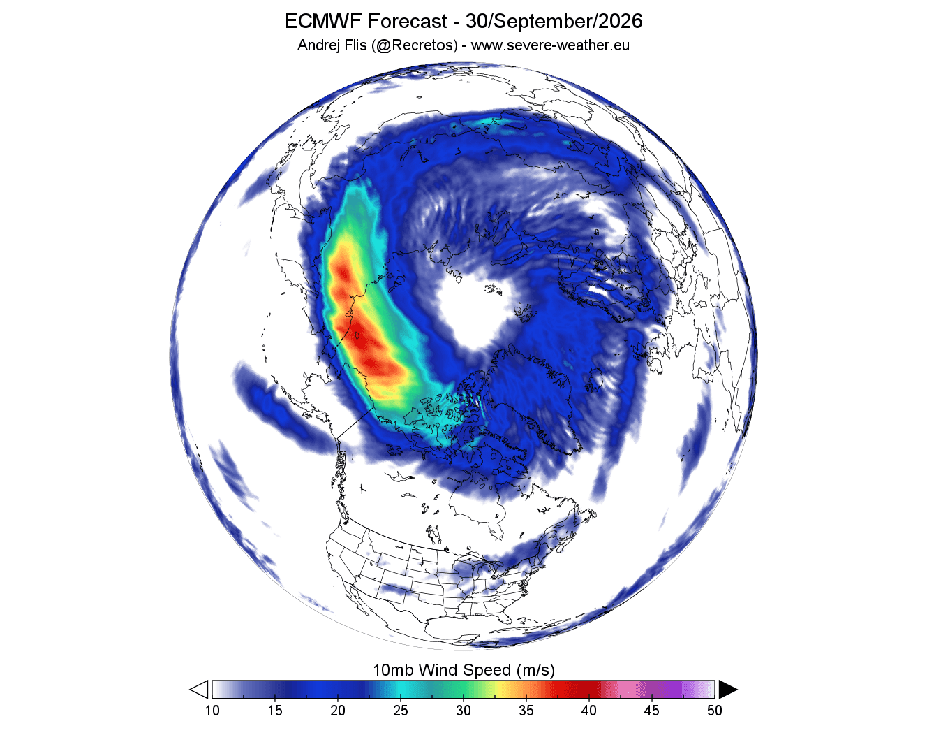
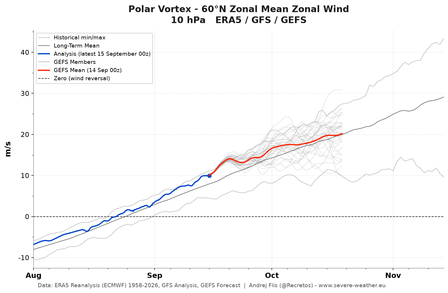
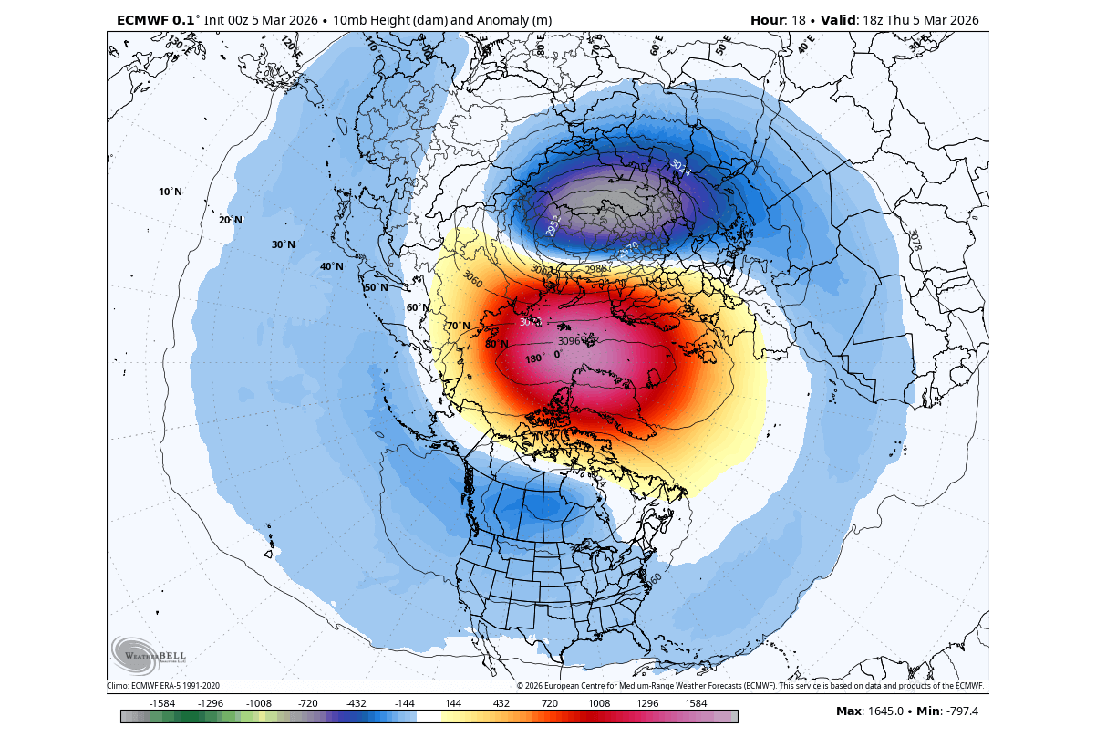
Stratospheric cooling typically initiates in August, intensifying dramatically through September and October. This creates a steep thermal gradient between the rapidly cooling polar cap and warmer southern latitudes. Consequently, stratospheric pressure plummets, establishing the cyclonic rotation of the new Polar Vortex. Current 14-day models show a well-defined cold core and a closed low-pressure center rapidly solidifying at the 10-millibar level (approx. 30 km / 18.5 miles high).
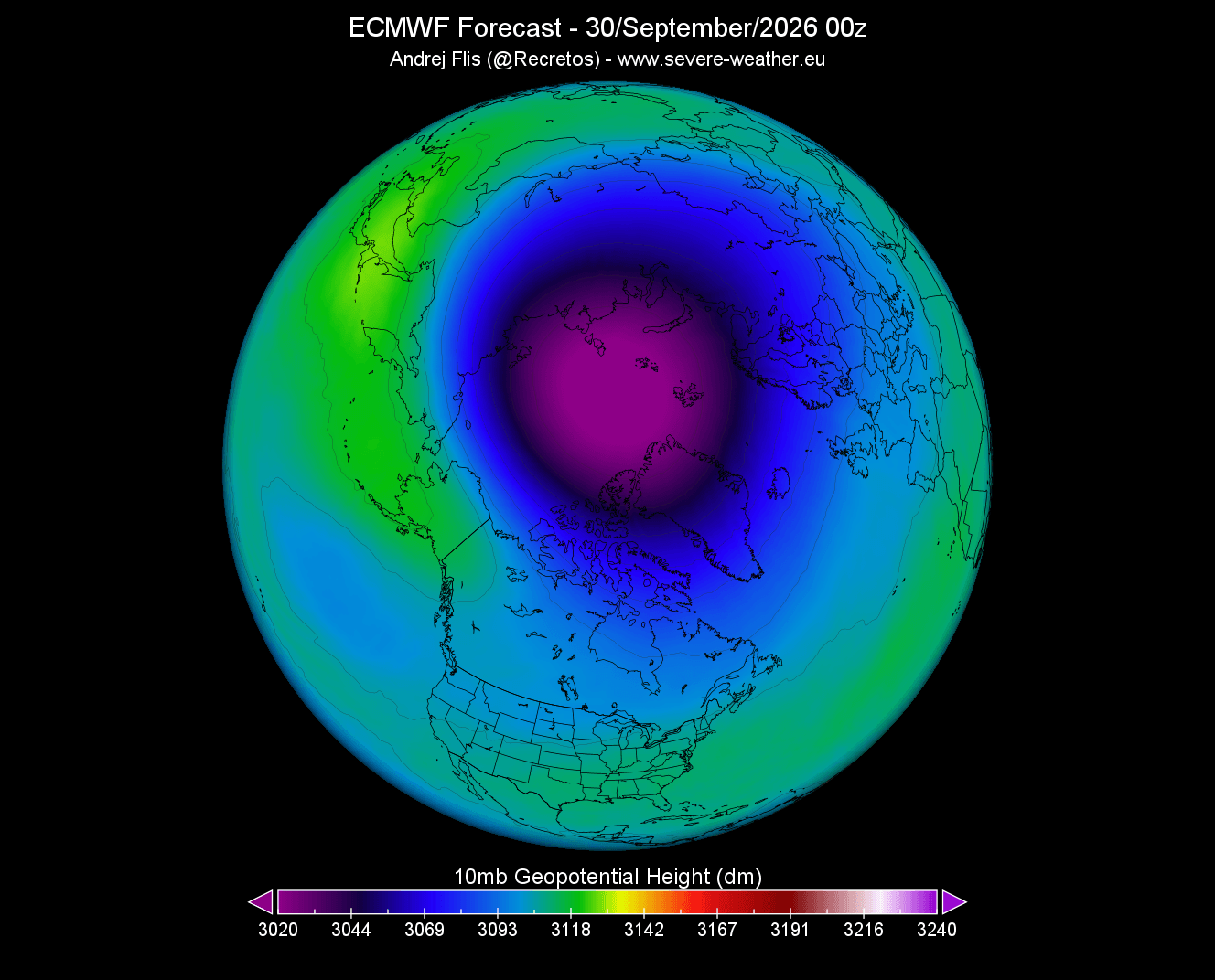
Early Winter: A Strong Initial Baseline
Entering November and December, early-season data suggests the vortex will maintain a normal-to-above-normal strength. During this phase, a stable, highly symmetrical vortex typically reinforces a strong polar jet stream, successfully containing frigid air within the Arctic Circle and delivering relatively mild conditions to portions of the central United States and Europe.
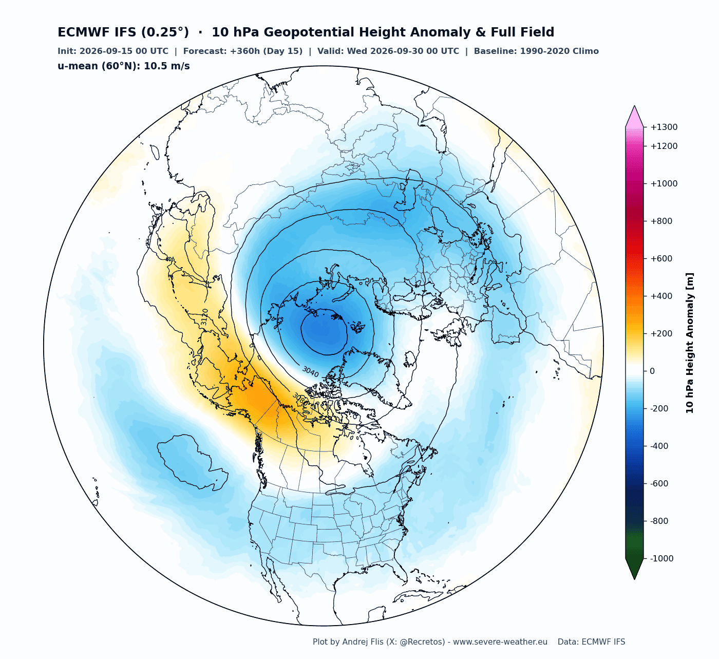
Mid-Winter (January–February 2027): The Deceleration Trend
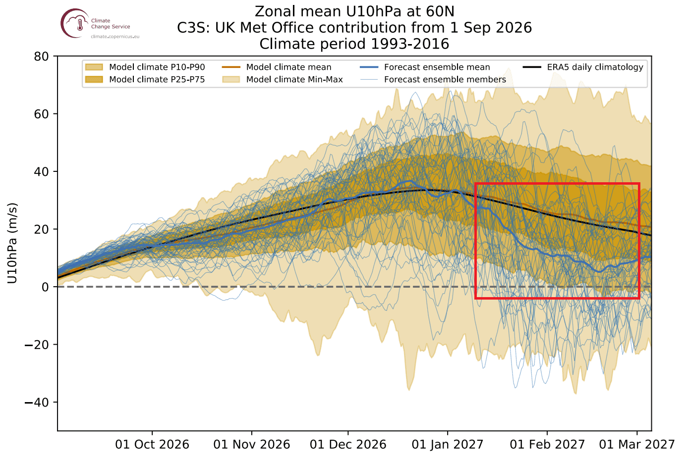
The critical inflection point arrives mid-season. Both the European Centre for Medium-Range Weather Forecasts (ECMWF) and the United Kingdom Meteorological Office (UKMO) seasonal ensembles depict a sharp downward spike in zonal wind speeds. The forecast lines dip well below long-term climate normals, signaling a significant deceleration or potential disruption trend. High-pressure anomalies are projected to build into the middle and lower stratosphere, effectively breaking down the vortex’s structural defenses.
Supporting Data and the Super El Niño Connection
The anticipated mid-winter breakdown of the Polar Vortex does not occur in a vacuum. Atmospheric data highlights a potent external driver: an intensifying Super El Niño event currently unfolding across the tropical Pacific.
[Tropical Pacific]
       │ (Oceanic Warming > +2°C)
       ▼
[Enhanced Planetary Wave Energy]
       │ (Propagates Upward)
       ▼
[Stratospheric Deceleration & High-Pressure Anomalies]
       │ (Mid-Winter 2027)
       ▼
[Polar Vortex Disruption / SSW Event]
       │ (10-30 Day Delay)
       ▼
[Surface Impact: Arctic Outbreaks in US, Canada, & Europe]
The Super El Niño Catalyst
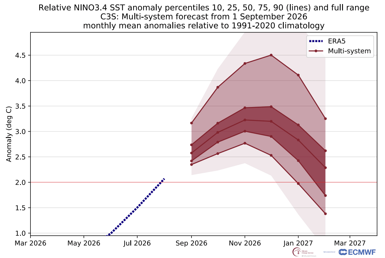
Oceanic temperature forecasts from the North American Multi-Model Ensemble (NMME) and Copernicus models show a massive expanse of positive sea-surface temperature anomalies. Peak seasonal anomalies are projected to exceed 2°C above normal—surpassing the official threshold for a "Super" El Niño event and ranking among the strongest episodes in decades.
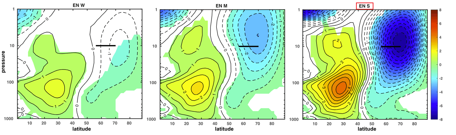
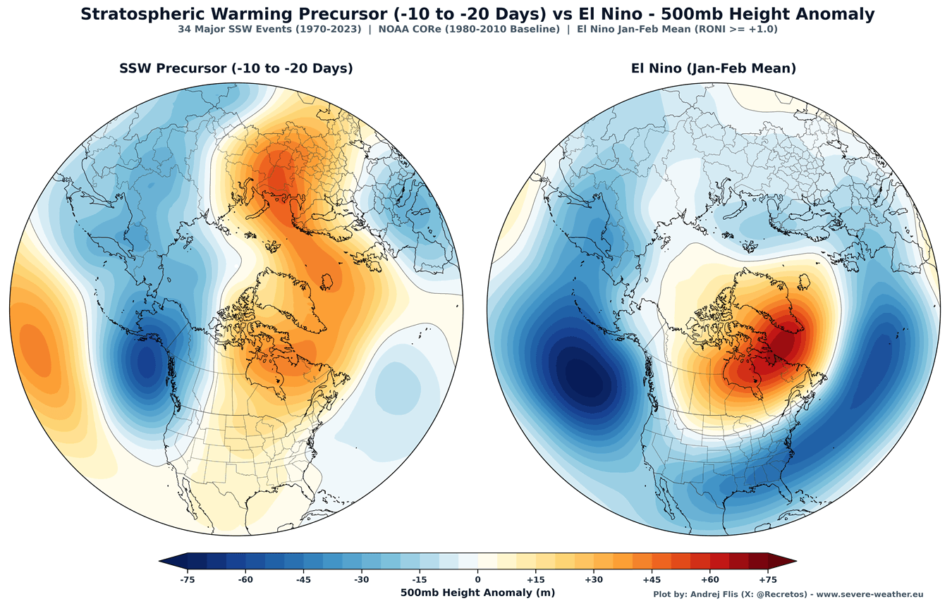
Historical simulations and climate studies demonstrate a direct correlation between strong El Niño phases and stratospheric deceleration. When an El Niño reaches high intensity, it modifies planetary-scale pressure waves across the globe. Specifically, it fosters a low-pressure anomaly over the North Pacific and Aleutians, paired with high-pressure zones over Greenland and northern Canada.
This specific configuration acts as a massive atmospheric battering ram, launching vertical wave energy upward into the stratosphere. The resulting influx of heat and momentum disrupts the stratospheric polar circulation, setting the stage for a potential Sudden Stratospheric Warming (SSW) event.
Official Responses and Mechanistic Insights: The Threat of an SSW
When vertical wave energy overwhelms the stratospheric vortex, it can trigger a Sudden Stratospheric Warming event—the ultimate disruption of the polar circulation. During an SSW, temperatures in the stratosphere can skyrocket by tens of degrees Celsius in just a few days, accompanied by a rapid pressure spike that can completely reverse the stratospheric winds from westerly to easterly.
SSW events generally manifest in two ways:
- Displacement Events: The vortex is shoved off the pole, often resulting in a slower, more variable surface weather response.
- Split Events: The vortex core is fractured into two or more distinct pieces. Historically, split events—such as those observed during past Super El Niño winters like 2015/2016—exert a faster, more persistent downward impact on surface weather.
According to research synthesized by the National Oceanic and Atmospheric Administration (NOAA), the meteorological impact of an SSW does not happen overnight. Because stratospheric disruptions propagate downward, surface weather typically responds within a 10- to 30-day delay window.
Historical composites of 34 major SSW events reveal a striking post-disruption surface signature: once the stratospheric high-pressure wave makes its downward transit, vast expanses of the United States, central Canada, and northern-to-central Europe experience pronounced negative temperature anomalies (colder-than-average conditions).
Implications for Winter Weather: What to Expect in North America and Europe
While meteorologists cannot yet forecast the exact calendar week of an SSW event months in advance, the converging signals of a Super El Niño and stratospheric wind deceleration carry profound implications for regional winter weather during 2026/2027.
United States and Canada
If the long-range disruption trends hold, the breakdown of the polar barrier will likely unleash the "Polar Express" pattern. Similar to disruptions observed in January 2026 and December of prior years, a weakened or split vortex encourages lobes of frigid Arctic air to plunge southward into the central and eastern United States, alongside the Canadian interior. These configurations dramatically elevate the risk of severe winter storms, prolonged freeze events, and widespread snowfall across mid-latitudes.
Europe
For Europe, a disrupted Polar Vortex often dismantles the traditional, mild westerly Atlantic flow. In its place, high-pressure blocking patterns over the North Atlantic can open pathways for continental easterly or polar northerly drafts, exposing northern, central, and eastern European nations to severe cold waves and significant snow accumulation.
Actionable Takeaway for the Public
As meteorological agencies—including the ECMWF and WeatherBell—continue to refine operational models through the autumn transition, residents across North America and Europe should prepare for a volatile winter season. While early winter may offer a deceptive sense of stability under a temporarily strong vortex, the mid-winter transition harbors significant potential for high-impact, disruptive cold waves. Monitoring localized updates and seasonal outlooks will be essential as the atmospheric engine shifts gears toward 2027.
