

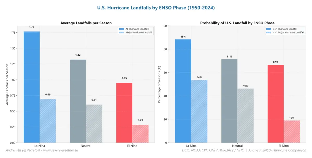
Global Weather Desk — As the northern hemisphere navigates the climatological peak of the Atlantic hurricane season, a massive meteorological anomaly is unfolding across the Pacific Ocean. A rapidly developing Super El Niño is currently reshaping global circulation, forging what meteorologists describe as an "atmospheric hurricane shield" over the United States.

Driven by unprecedented sea-surface temperature anomalies and subsurface Kelvin waves, this planetary-scale event is aggressively suppressing tropical cyclone development in the Atlantic basin. However, the far-reaching atmospheric fingerprints of this Super El Niño do not stop at the coastline. Long-range forecast models indicate that the extraordinarily quiet 2026 hurricane season is acting as a harbinger for winter, pointing toward a disrupted Polar Vortex and dramatic shifts in hemispheric weather patterns for the upcoming 2026/2027 cold season.
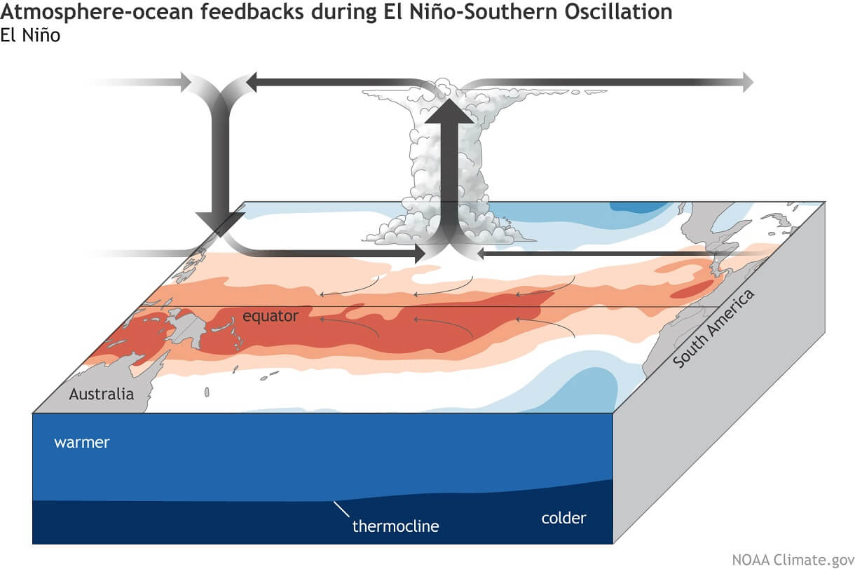
Main Facts: The Anatomy of a Super El Niño and Its Atlantic Shield
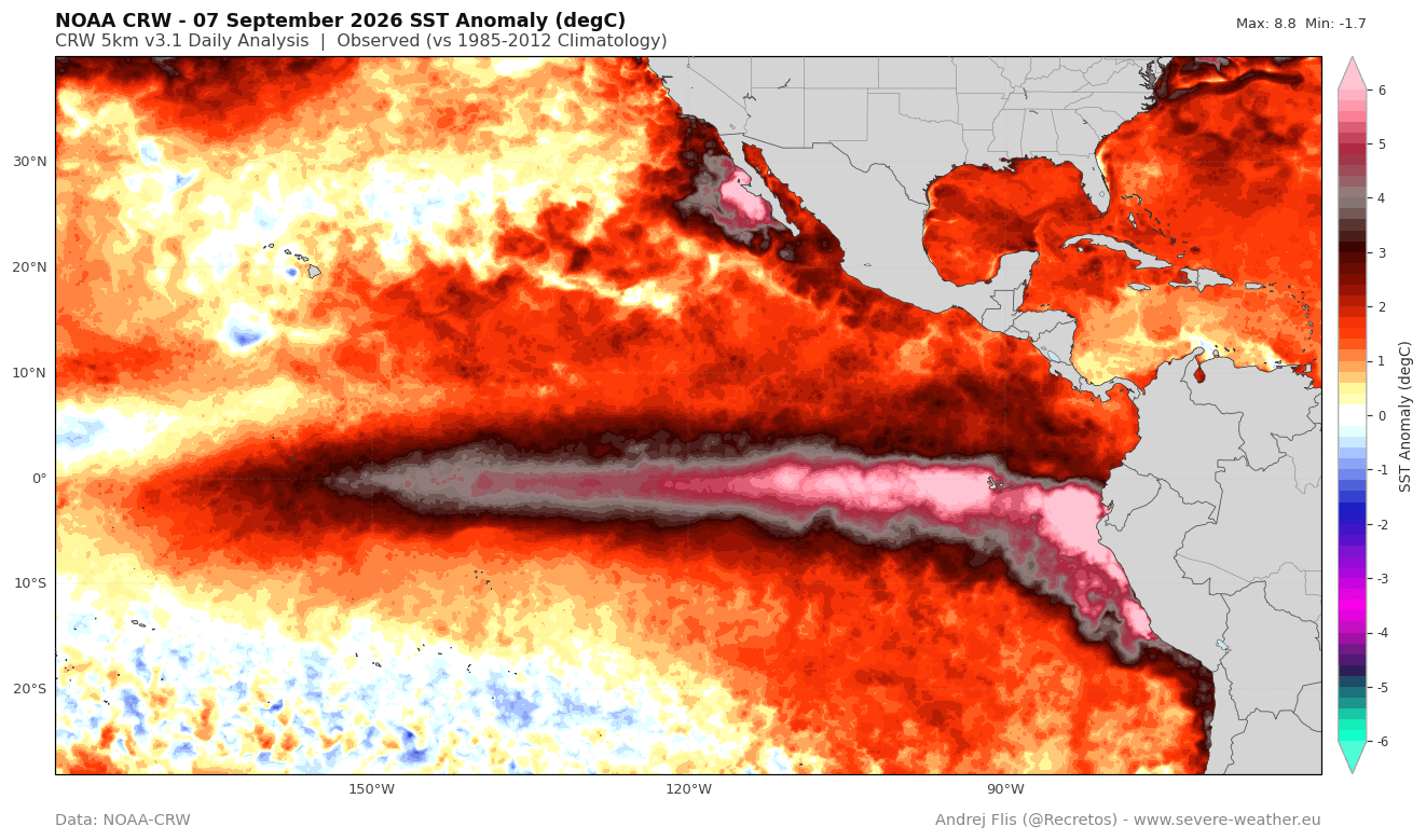
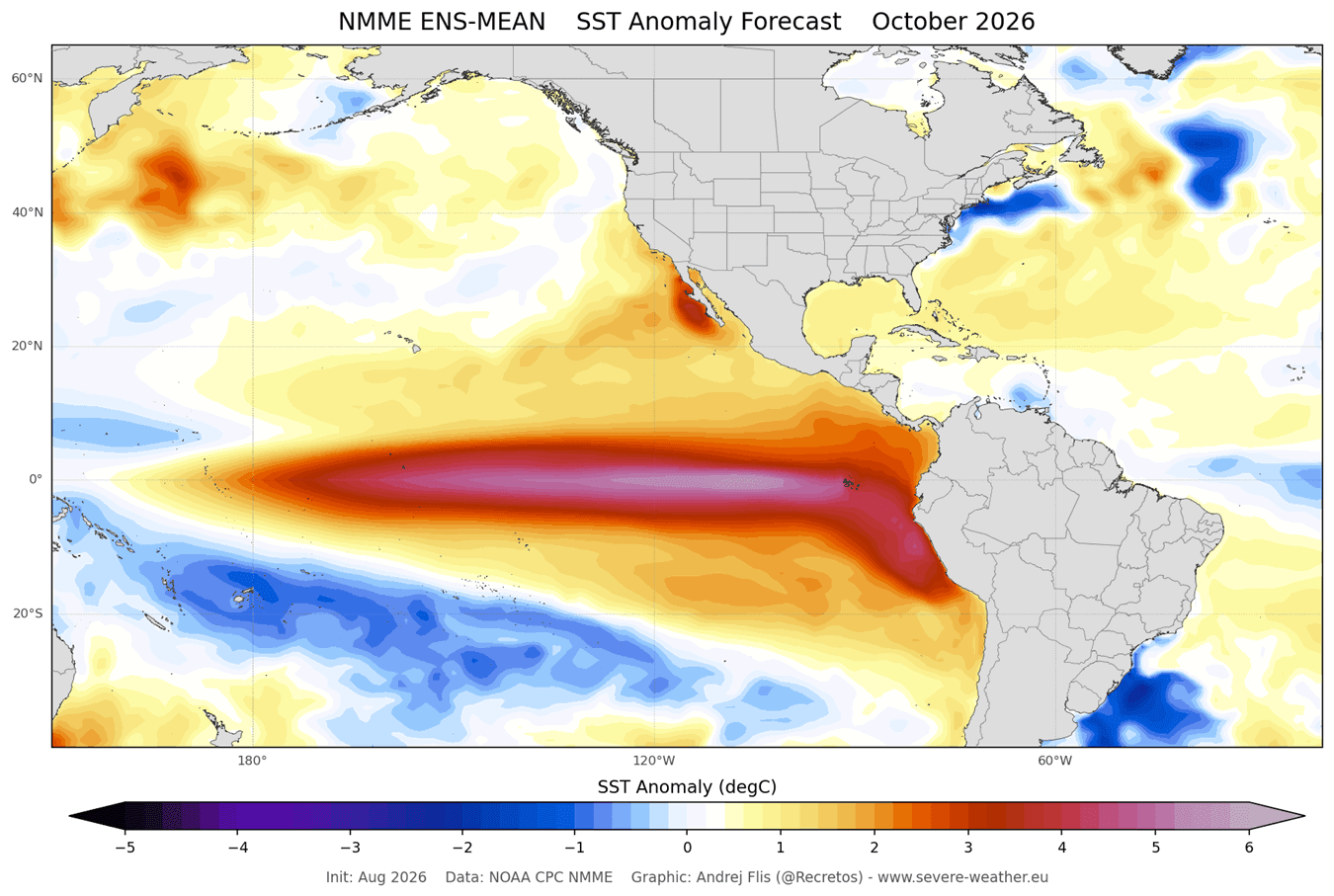
The El Niño-Southern Oscillation (ENSO) cycle is entering a rare, high-magnitude phase. Current observational analysis utilizing NOAA-Coral Reef Watch (CRW) data highlights massive warm anomalies pooled across the central and eastern tropical Pacific. Peak temperatures in these regions are registering more than 7°C (12.6°F) above historical norms.
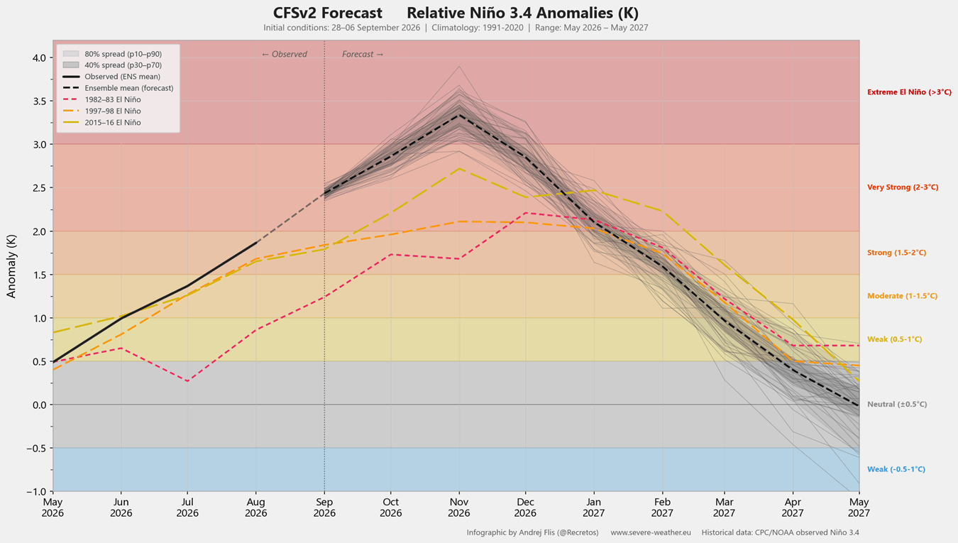
According to seasonal projections from the NCEP Climate Forecast System (CFS.v2), this event has easily cleared the threshold required to be classified as a "Super El Niño"—defined as sustained seasonal values exceeding +2°C. Current trajectories suggest this iteration will outpace the last three major Super El Niño events by a significant margin, potentially ranking as the strongest event observed in over a century.
[Pacific Super El Niño]
       │
       ├─► Enhanced Tropical Convection & Rising Air (Pacific)
       ├─► Atmospheric Bridge / Walker Circulation Shift
       └─► Descending Air (Subsidence) + Record Wind Shear + Dry Air (Atlantic)
                 │
                 ▼
     "Atmospheric Hurricane Shield"
                 │
                 ▼
   Suppressed Atlantic Activity (~8% of Normal ACE)
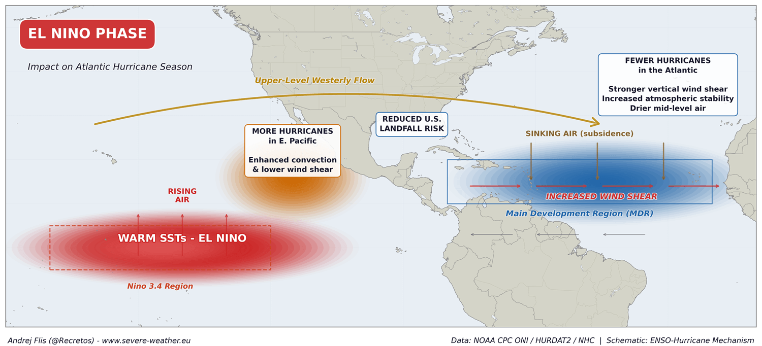
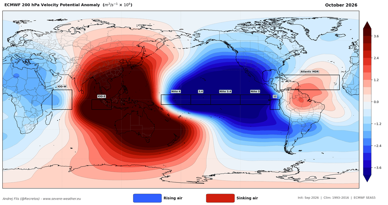
This massive heating of the equatorial Pacific triggers a profound reorganization of the Walker Circulation. Rising air over the warm Pacific drives massive thunderstorm activity, which in turn forces compensating downward motion (subsidence) over the tropical Atlantic, Caribbean Sea, and the Main Development Region (MDR).
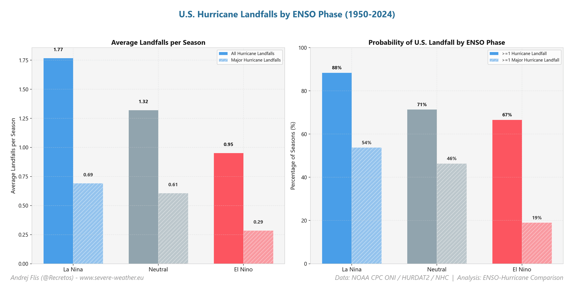
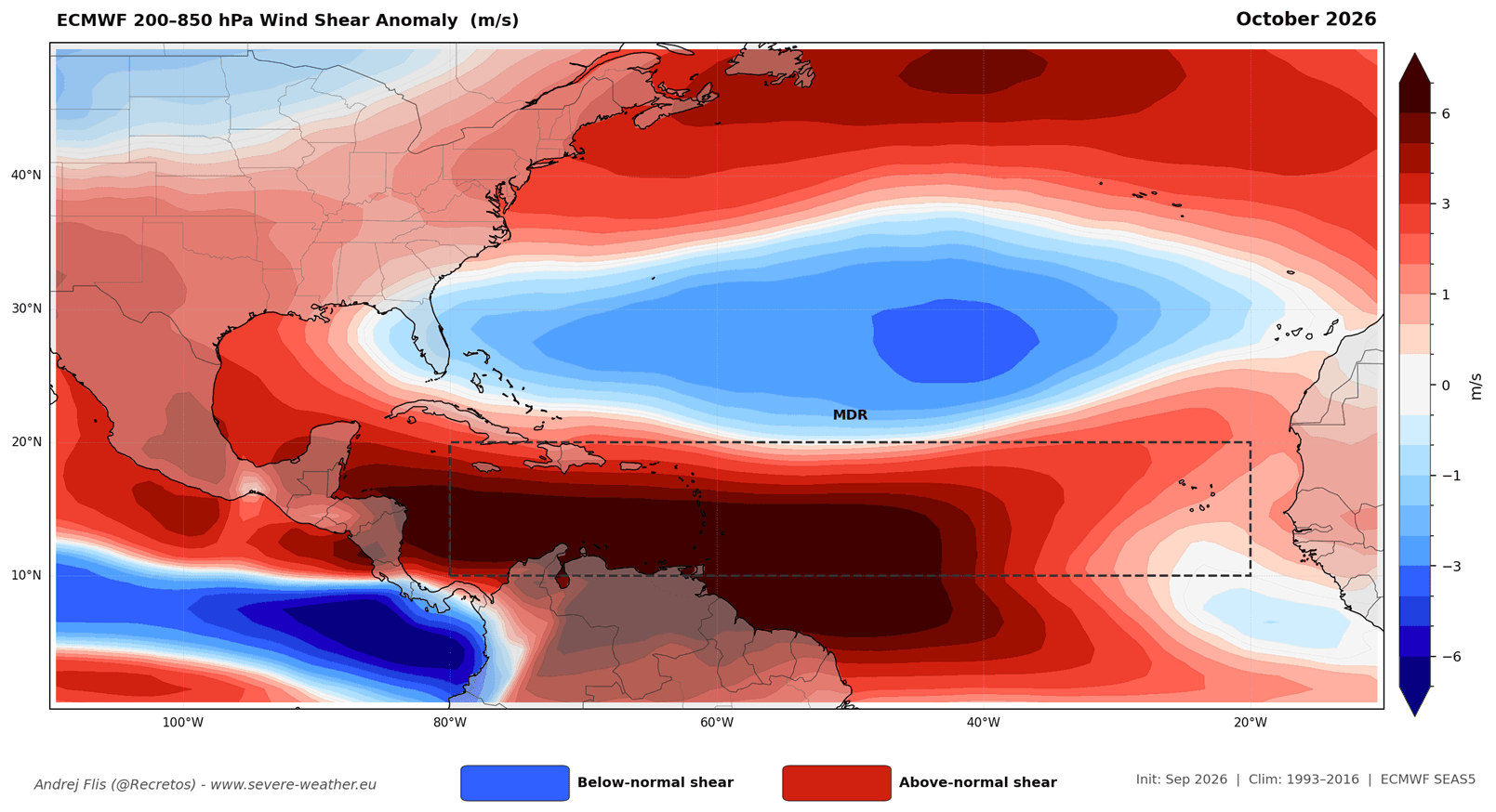
Simultaneously, this global teleconnection generates record-breaking vertical wind shear across the Atlantic basin. Together, the triad of sinking air, high moisture deficits in the lower troposphere, and hostile wind shear form an impenetrable atmospheric shield. This shield tears apart nascent tropical waves before they can organize, drastically mitigating the risk of destructive U.S. landfalls.
Chronology: From Subsurface Kelvin Waves to Late-Season Suppression
Spring and Early Summer 2026: The Subsurface Buildup
The genesis of the current Super El Niño can be traced deep beneath the ocean surface months prior to its surface manifestation. High-resolution subsurface ocean data captured the eastward migration and rapid expansion of massive warm water masses known as Kelvin waves. These subsurface waves acted as a deep-ocean conveyor belt, continuously feeding thermal energy upward and eastward. By late spring, this subterranean heat breached the surface, anchoring a powerful El Niño state that guaranteed profound global weather impacts by summer.
July and August 2026: Record-Breaking Wind Shear
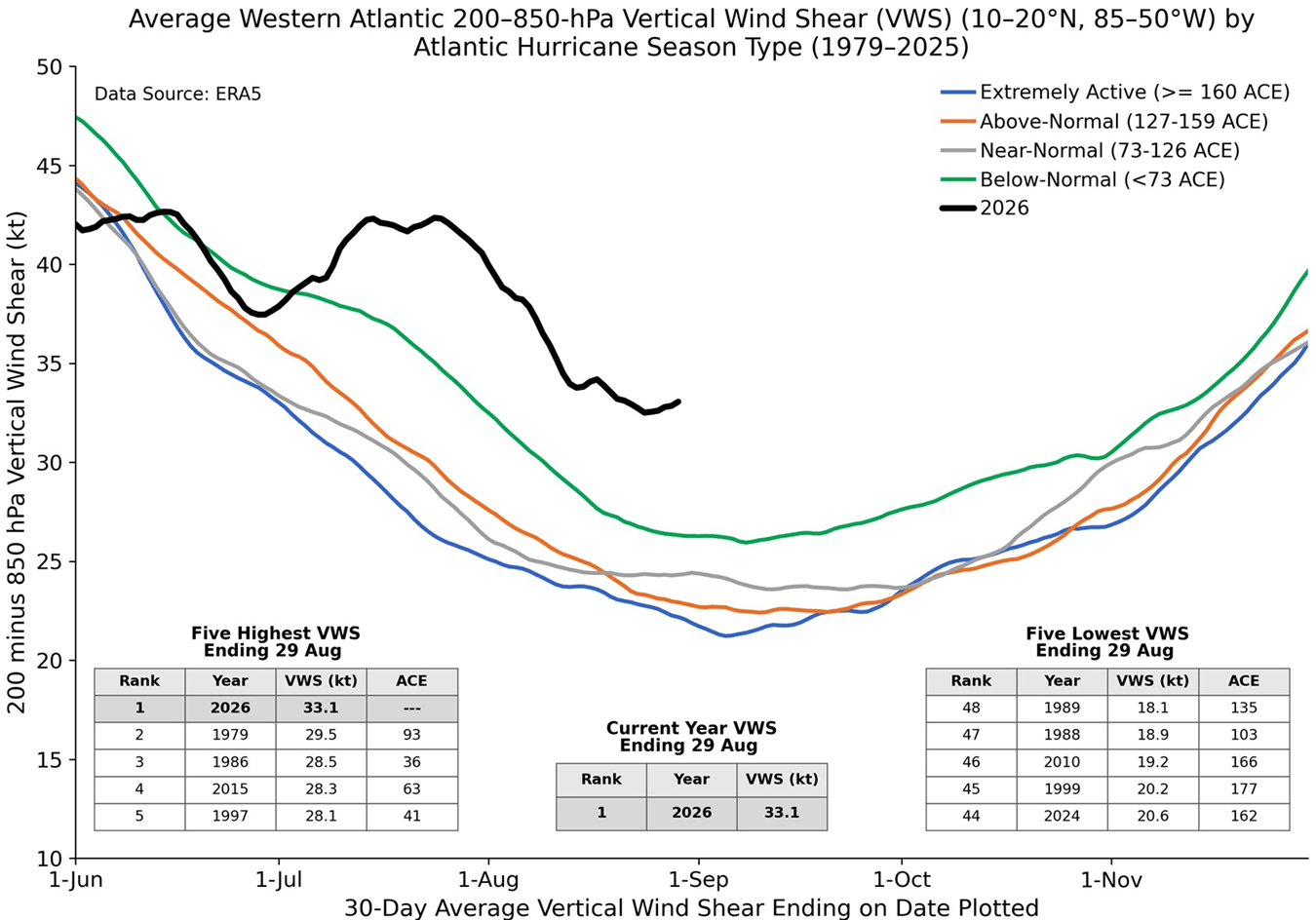
As the Atlantic hurricane season officially opened and approached its climatological ramp-up, the atmospheric impacts of the Pacific anomaly became glaringly apparent. According to historical tracking data and analysis by prominent seasonal hurricane researcher Dr. Philip Klotzbach, Atlantic wind shear through July and August shattered historical benchmarks. Data ranked 2026 wind shear as the highest observed for this period in the past 47 years.
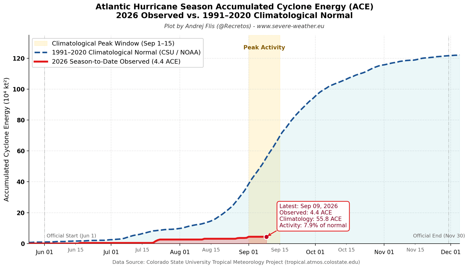
Concurrently, Accumulated Cyclone Energy (ACE)—the metric used by NOAA to measure the combined strength and duration of tropical storms and hurricanes—stalled out at roughly 8% of the historical climatological norm. Only five short-lived named systems formed during this period, with none achieving hurricane status.
September 2026: Peak Season Suppression
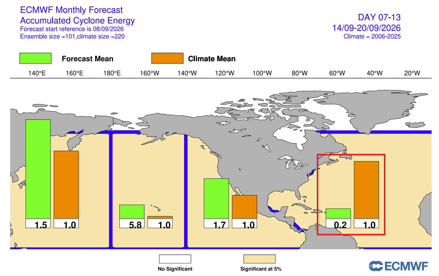
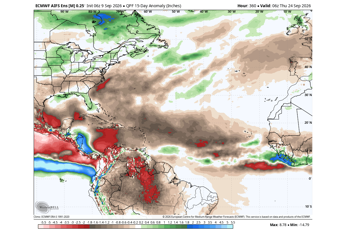
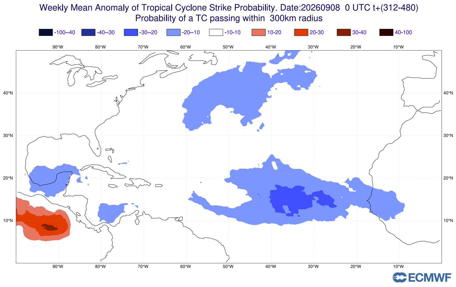
Entering the traditional peak of the hurricane season in mid-September, numerical models such as the European Centre for Medium-Range Weather Forecasts (ECMWF) confirmed the continuous suppression of the Atlantic basin. While the Eastern and Central Pacific basins experienced explosive, above-normal tropical activity—a hallmark of El Niño—the Atlantic remained locked under an anomalous pressure regime. Precipitation anomalies indicated widespread dry conditions across the MDR, all but guaranteeing an exceptionally quiet peak month.
October 2026 Outlook: An Early Collapse
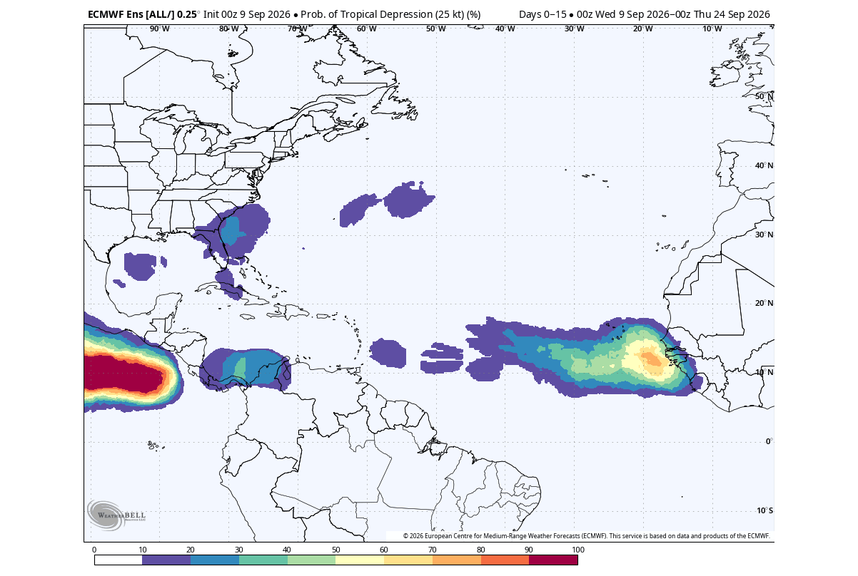
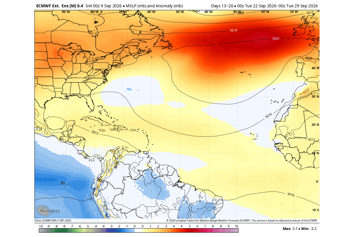
Looking forward into October, multi-model ensembles like the North American Multi-Model Ensemble (NMME) project core El Niño warm anomalies exceeding +5°C (+9°0°F). ECMWF circulation forecasts illustrate a continuation of intense subsidence over the Atlantic. While localized, short-lived tropical systems may still attempt to spin up close to home in the western Gulf of Mexico or the immediate coastal Caribbean, the overarching climatological framework points toward an early, definitive collapse of the 2026 Atlantic hurricane season.
Supporting Data and Meteorological Diagnostics
The empirical evidence underpinning the suppression of the 2026 Atlantic hurricane season is grounded in robust observational datasets and advanced numerical modeling:
- Accumulated Cyclone Energy (ACE): Sitting at a mere fraction of seasonal norms, the 2026 ACE index reflects an acute absence of sustained, major tropical systems.
- Vertical Wind Shear Anomalies: ERA5 and NOAA reanalysis data confirm that persistent upper-level westerly winds across the tropical Atlantic created extreme directional and speed shear, systematically decapitating tropical wave structures.
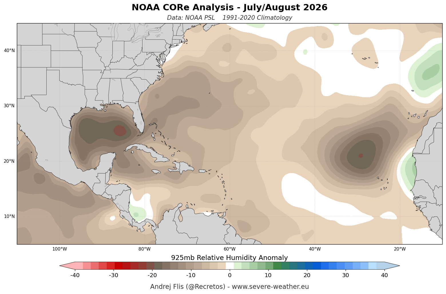
- Low-Level Moisture Deficits: NOAA CORe relative humidity data at the 925mb level (approx. 800–2,625 feet) demonstrated widespread, persistent dry anomalies across the Main Development Region throughout July and August. This dry air infiltrates the cores of developing storms, evaporating their convection and halting intensification.
- Precipitation and Pressure Fields: ECMWF ensemble forecasts for September and October display robust positive pressure anomalies over the tropical Atlantic, corresponding directly with suppressed cloud cover and reduced rainfall.
Official Responses and Expert Consensus
Leading meteorological institutions, including the National Oceanic and Atmospheric Administration (NOAA), the National Hurricane Center (NHC), and academic forecasting groups, have continually adjusted their seasonal outlooks to reflect the dominant force of the developing Super El Niño.
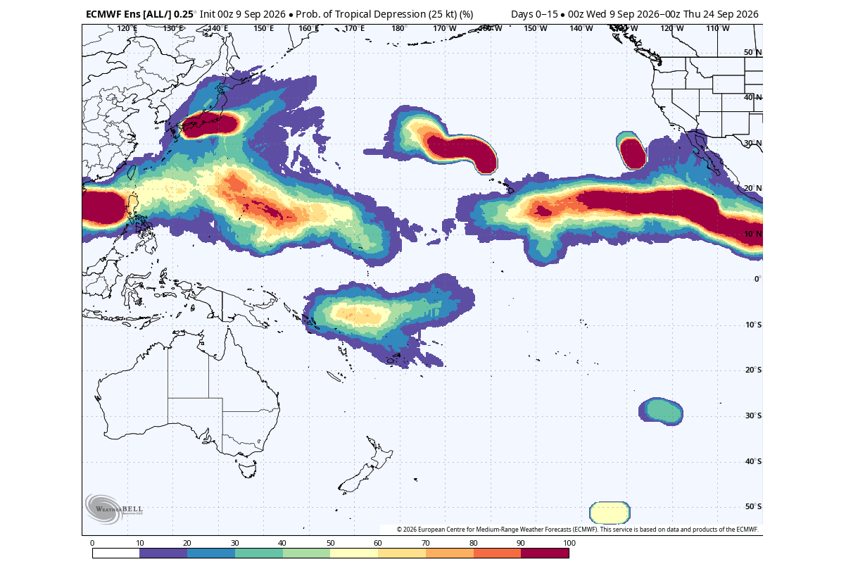
Forecasters emphasize that while an exceptionally quiet season significantly lowers the aggregate risk of catastrophic U.S. landfalls, it can inadvertently introduce public complacency. Emergency management agencies continue to remind coastal residents that it only takes one localized landfall—such as a late-season system emerging from the western Caribbean or Gulf of Mexico—to create a high-impact disaster, even during historically subdued years.
Implications: Winter 2026/2027 and the Polar Vortex Connection
Beyond the immediate relief provided to coastal communities by the Atlantic’s atmospheric shield, the broader implications of a Super El Niño extend directly into the upcoming winter season. Historical climatological analysis reveals a distinct teleconnection between unusually quiet Atlantic hurricane seasons and subsequent winter weather patterns across the Northern Hemisphere.
Winter Temperature and Circulation Patterns
The global atmospheric state driving the 2026 Super El Niño favors a specific configuration for Winter 2026/2027. ECMWF seasonal forecasts align with historical signatures, projecting a notable tendency toward below-normal temperatures across the southern and central United States. This pattern is driven by a persistent low-pressure anomaly over the south-central U.S. and North Atlantic, contrasted against significant high-pressure warmth dominating Canada. Conversely, Europe is favored to experience a predominantly mild, above-normal winter.
The Stratosphere and Polar Vortex Disruption
Perhaps the most striking implication of this Pacific-Atlantic teleconnection lies in the stratosphere. Historical data following slow hurricane seasons consistently points toward a warmer winter stratosphere and a structurally disrupted Polar Vortex.
[Super El Niño Tropics]
       │
       ▼
[Weakened Stratospheric Polar Vortex]
       │
       ▼
[Jet Stream Breakdown]
       │
       ▼
[Potential Arctic Air Outbreaks (US/Europe)]
Latest ensemble forecasts evaluating the 10mb zonal wind strength of the Polar Vortex indicate a pronounced deceleration and potential disruption trend emerging as early as January 2027. The model forecast lines trend well below both long-term historical averages and climatological normals.
A weakened or fractured Polar Vortex loses its ability to tightly bottle up extreme Arctic air. When this stratospheric engine stumbles, the circumpolar jet stream buckles, allowing lobes of frigid polar air to spill southward into mid-latitude population centers. Consequently, while the autumn of 2026 remains remarkably tranquil due to the Pacific’s atmospheric hurricane shield, the foundational dynamics are concurrently setting the stage for a potentially volatile, dynamic, and cold winter ahead.
