

By Global Weather Desk
1. Main Facts: The 2026 Ocean-Atmosphere Megashift
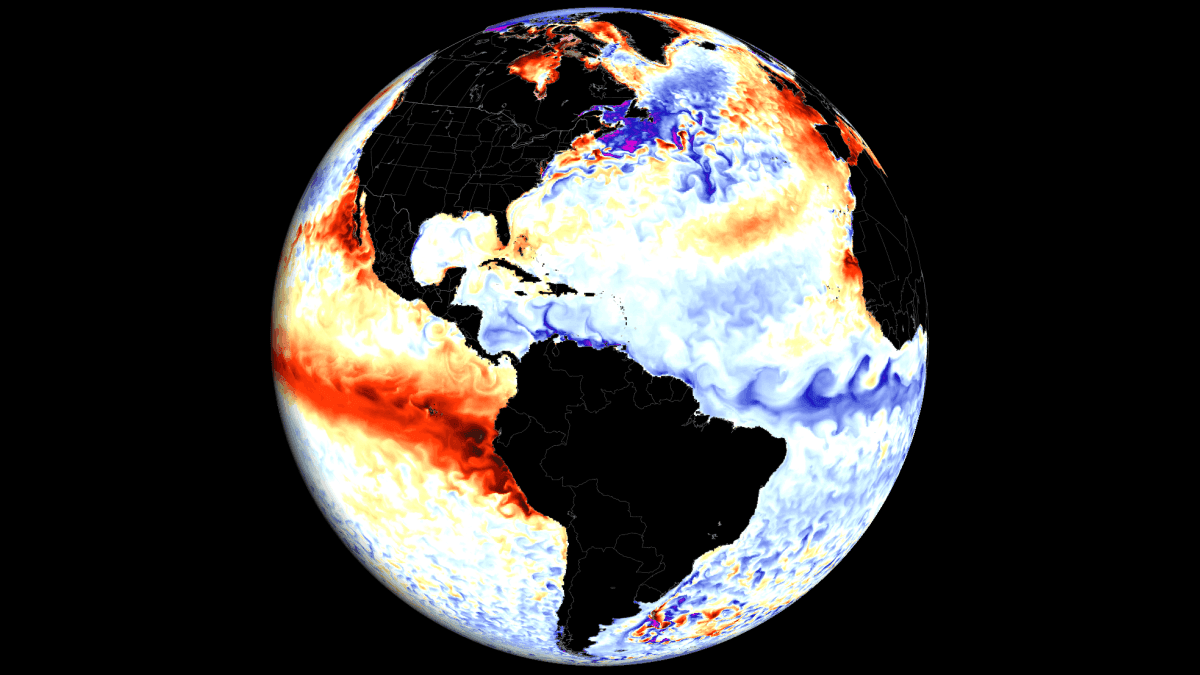
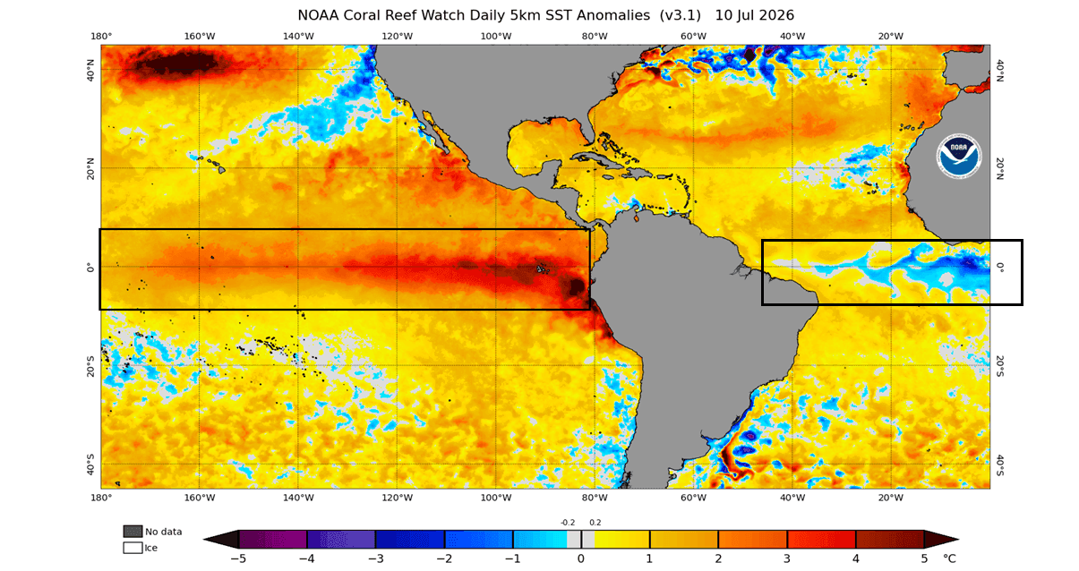
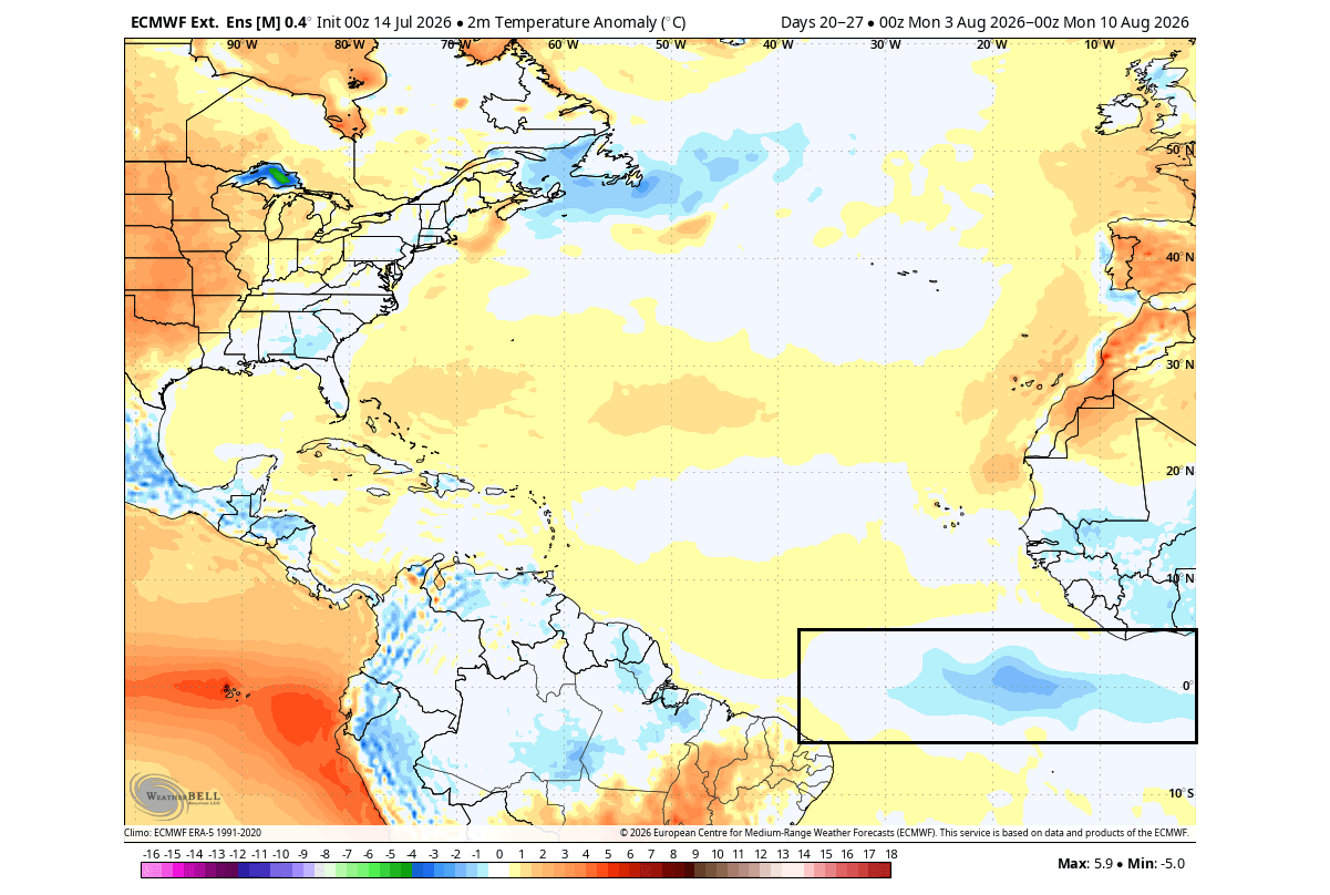
As the meteorological community monitors the unfolding patterns of the mid-2020s, an extraordinary and rare global ocean phenomenon has taken shape. A powerful, rapidly intensifying Super El Niño is currently dominating the equatorial Pacific Ocean, characterized by sea-surface temperature anomalies soaring 3 to 4 degrees Celsius above normal in its eastern sectors. Simultaneously—and in stark contrast—a rare Atlantic Niña has emerged in the tropical Atlantic basin, stamping a vast footprint of cold water across vital tropical nurseries.
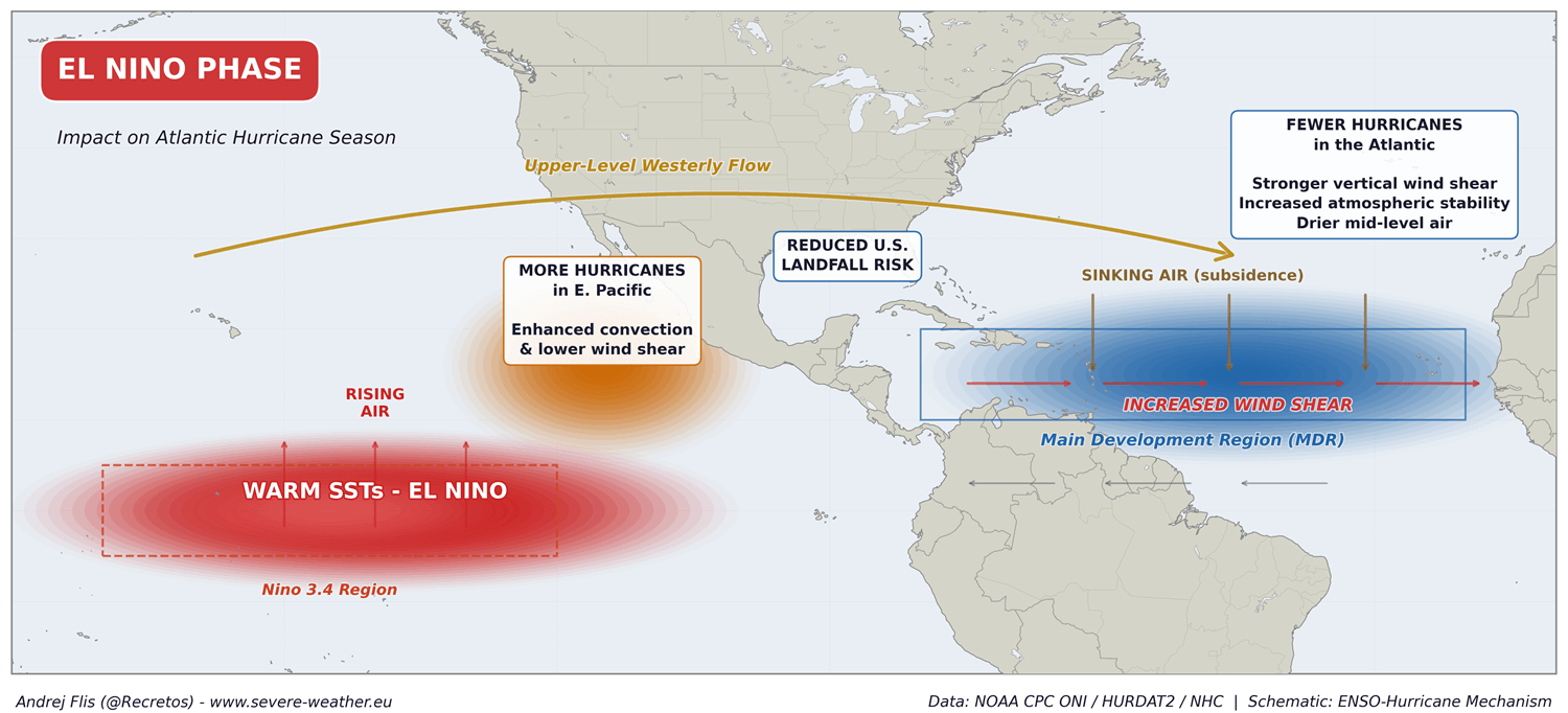
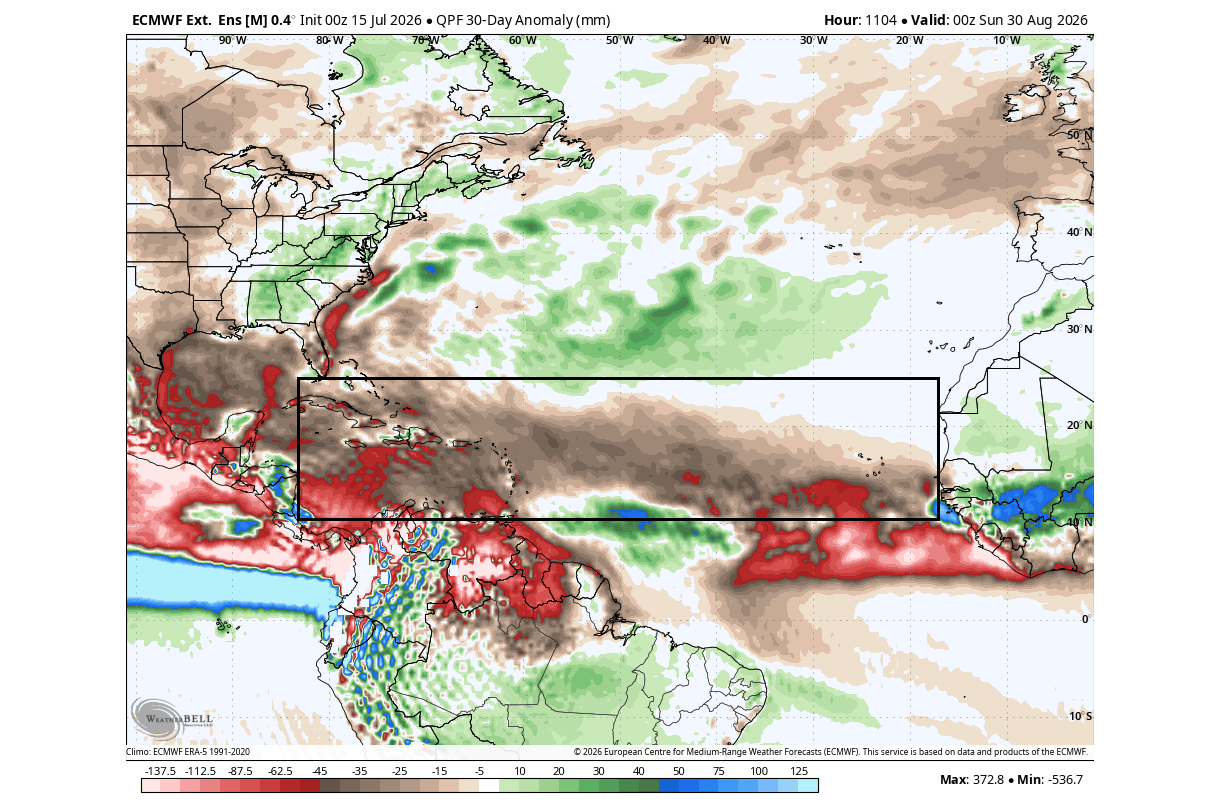
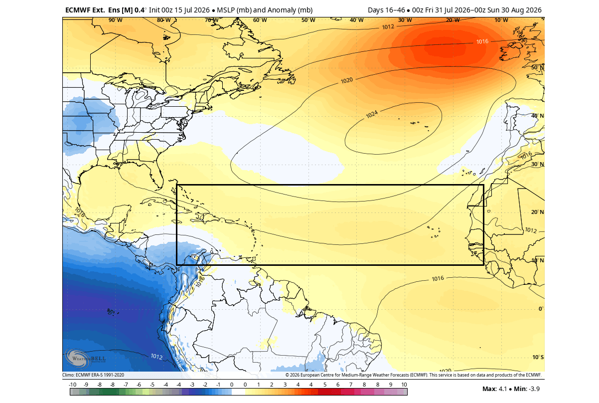
While these two phenomena appear to be polar opposites on global sea-surface temperature maps, their atmospheric impacts are working in precise harmony. Together, they are constructing a formidable atmospheric shield over the United States and Canada. This synchronized dual anomaly is driving higher barometric pressure, increased sinking air (subsidence), intensified vertical wind shear, and suppressed precipitation across the Main Development Region (MDR) for Atlantic tropical cyclones.
Key takeaways from the latest global modeling include:
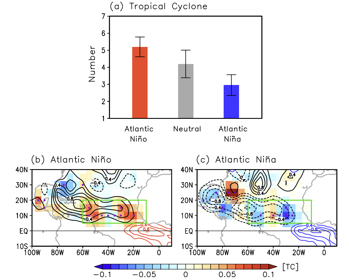
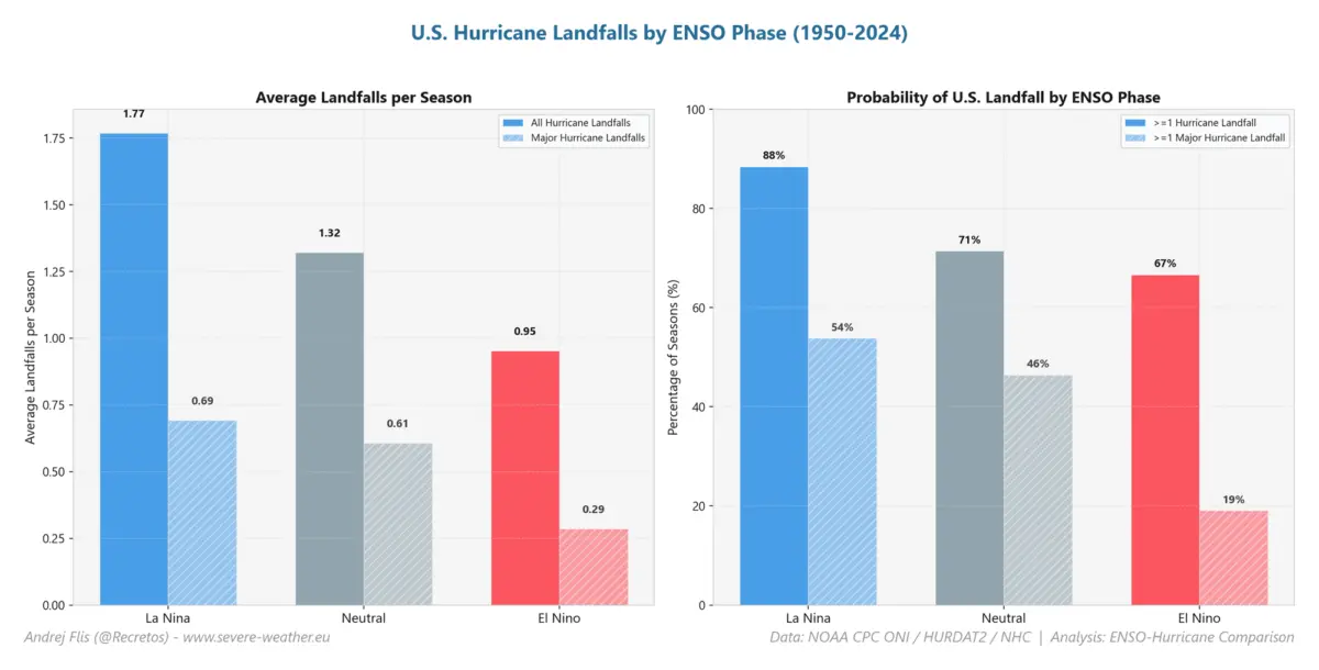
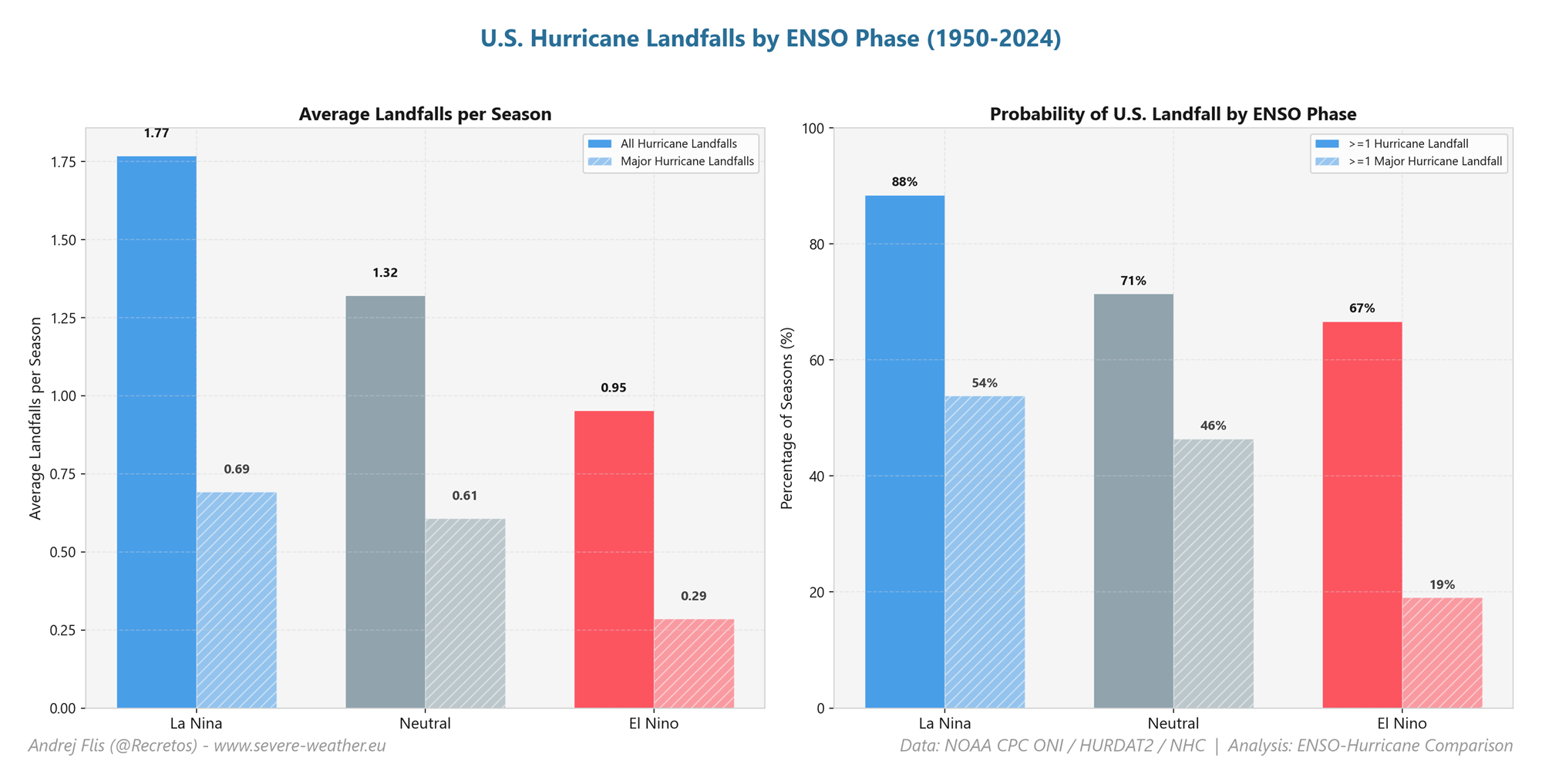
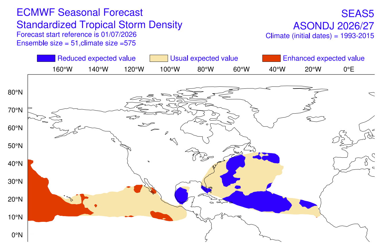
- Suppressed Atlantic Activity: Historical analogs and modern forecast ensembles indicate that a simultaneous Atlantic Niña and Pacific El Niño can slash tropical cyclone formation and U.S. landfall potential by up to 50% compared to neutral or La Niña years.
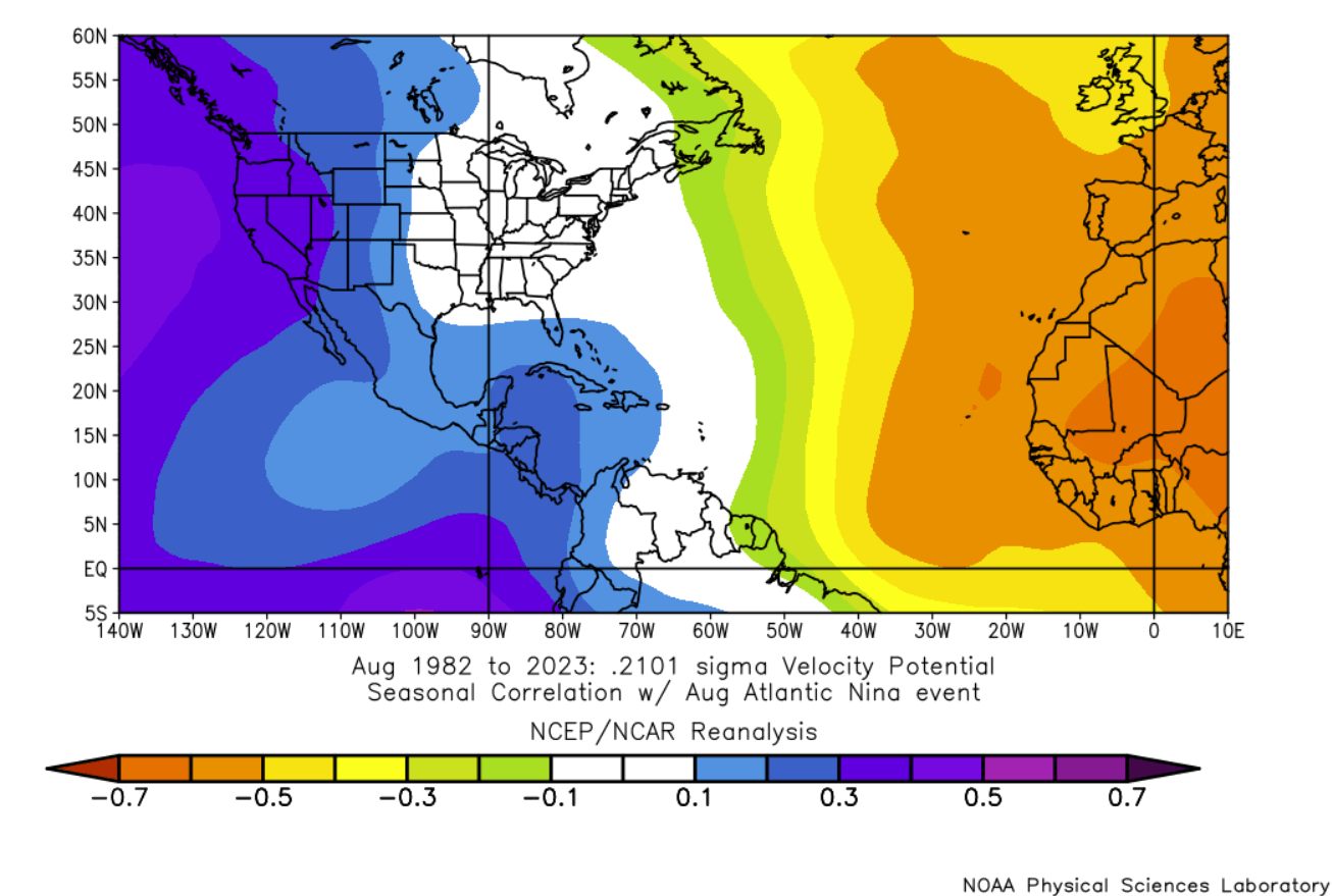
- The "Atmospheric Shield" Effect: The mechanical forcing of these ocean temperatures alters global velocity potential, ensuring that air columns over the tropical Atlantic remain stable and hostile to storm organization.
- Far-Reaching Implications: Beyond the immediate relief expected for the Atlantic hurricane season, this configuration serves as a vital diagnostic indicator for upcoming Fall and Winter 2026/2027 patterns, pointing toward a disrupted Stratospheric Polar Vortex and unique mid-latitude weather extremes.
2. Chronology: The Rapid Onset of Dual Ocean Anomalies
The timeline leading to this meteorological milestone began developing in late spring, transitioning into a high-impact climate regime by mid-summer:
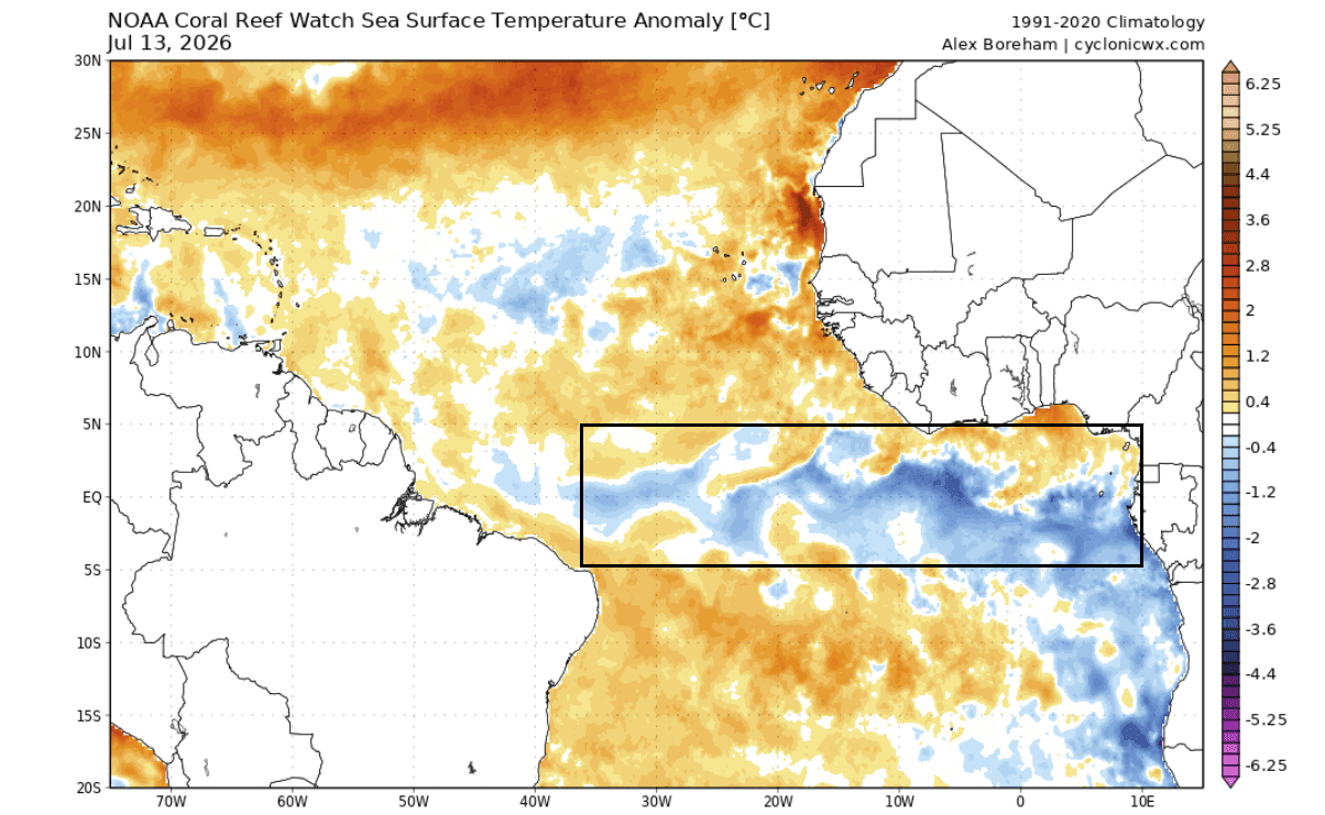
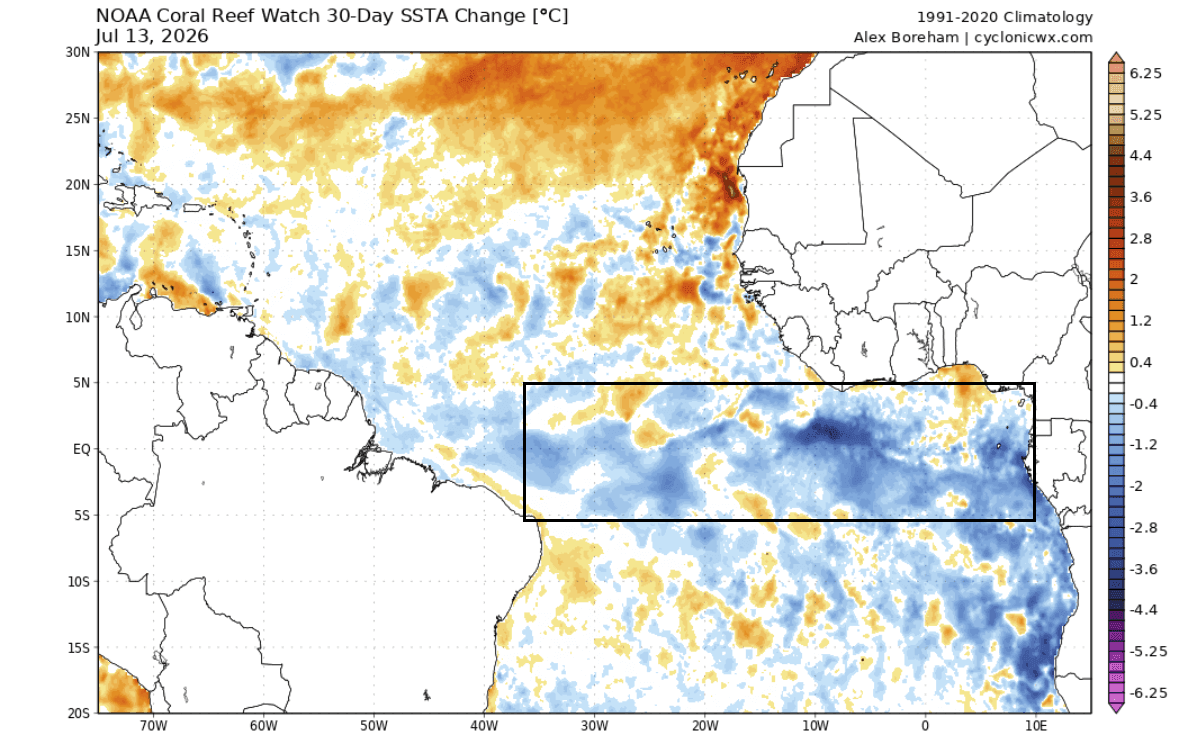
- May to June 2026: Trade winds—the crucial easterly currents circling Earth near the equator—underwent a severe decoupling. In the Pacific, weakened trade winds allowed warm waters to pool catastrophically, triggering the early, explosive growth of a Super El Niño. Concurrently, localized strengthening of trade winds over parts of the equatorial Atlantic drove deep, cold water to the surface through upwelling.
- Early July 2026: Advanced analysis from NOAA Coral Reef Watch (CRW) confirmed that the Pacific ENSO region had rocketed past normal thresholds, while a distinct cold pool stamped its presence across the equatorial Atlantic. This marked the formal initialization of an Atlantic Niña.
- Late July 2026: Extended-range runs from the European Centre for Medium-Range Weather Forecasts (ECMWF) corroborated the persistence of these anomalies. The weekly global ocean temperature forecasts predicted the Atlantic Niña would hold strong through August, locking in negative temperature anomalies of 1 to 3 degrees Celsius below normal.
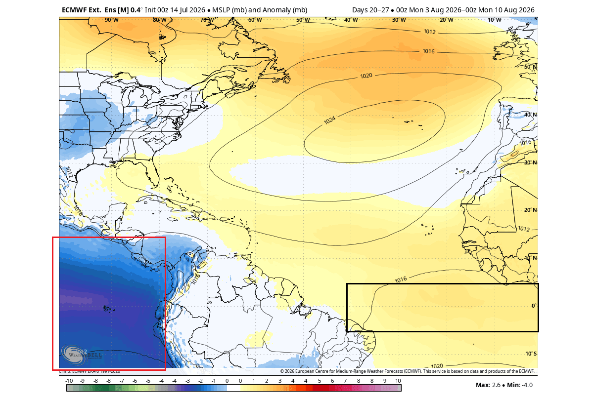
- August 2026 (Current State): As the threshold of the most active period of the Atlantic hurricane season arrives, surface pressure maps highlight a stark hemispheric contrast. Deep, low-pressure anomalies anchor the Super El Niño in the Pacific, while a stable, high-pressure atmospheric dome settles directly over the Atlantic Niña zone, effectively freezing out widespread tropical cyclogenesis.
3. Supporting Data: Oceanographic Indicators and Modeling
To comprehend how a few degrees of ocean temperature change can alter the weather across entire continents, meteorologists look to complex diagnostic tools, surface pressure charts, and historical baselines.
Ocean Temperatures and Atmospheric Pressure
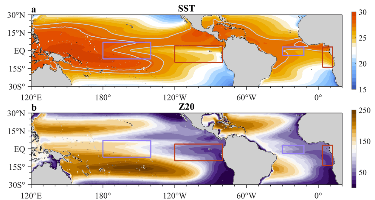
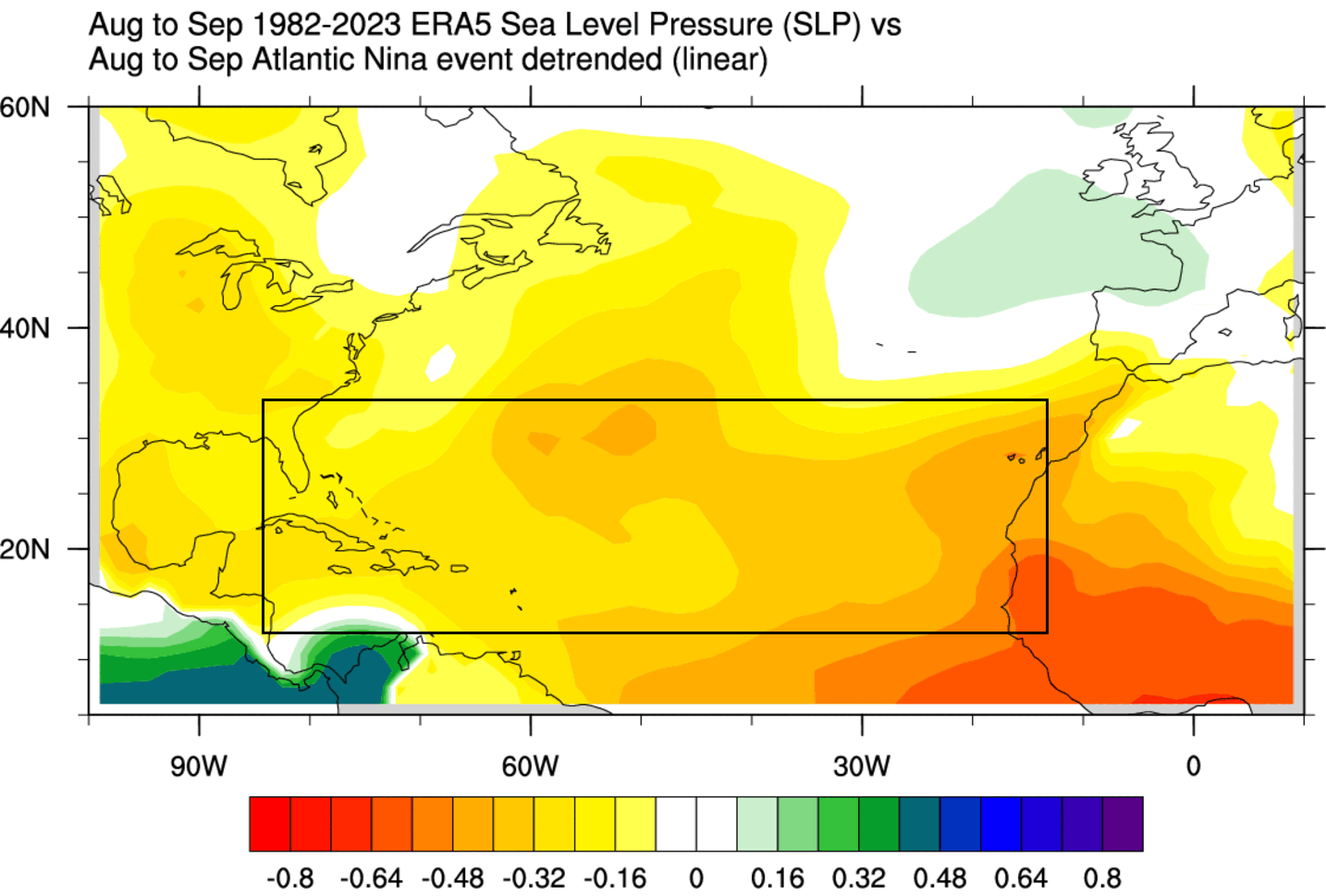
According to historical data spanning over four decades, Atlantic Niña events during summer are exceptionally scarce. If the current seasonal anomaly persists below the −0.5-degree threshold, the 2026 event will mark only the sixth such occurrence in over 40 years of reliable records.
ECMWF extended-range forecasts for August illustrate a stark pressure discrepancy between the two ocean basins. High-pressure anomalies dominate the tropical Atlantic, choking off the moisture and instability required for hurricanes to thrive. Conversely, low pressure dominates the eastern Pacific, fueling enhanced activity in that basin while keeping the North American mainland shielded from the Atlantic flank.
Velocity Potential and the Main Development Region (MDR)
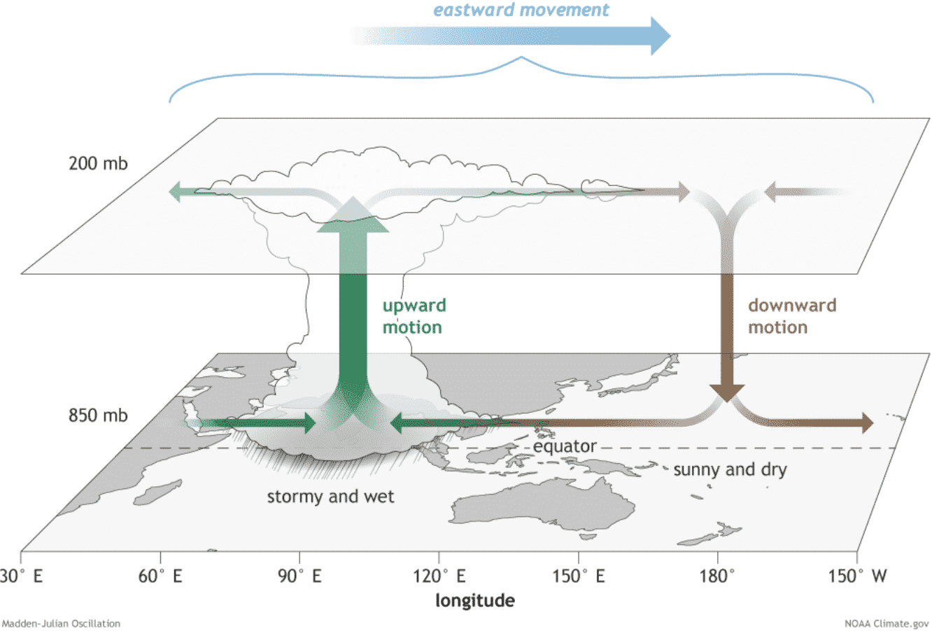
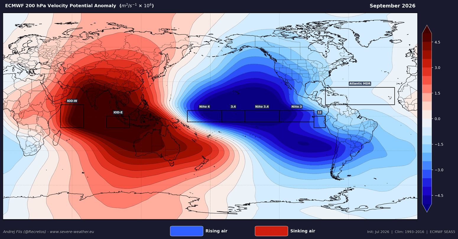
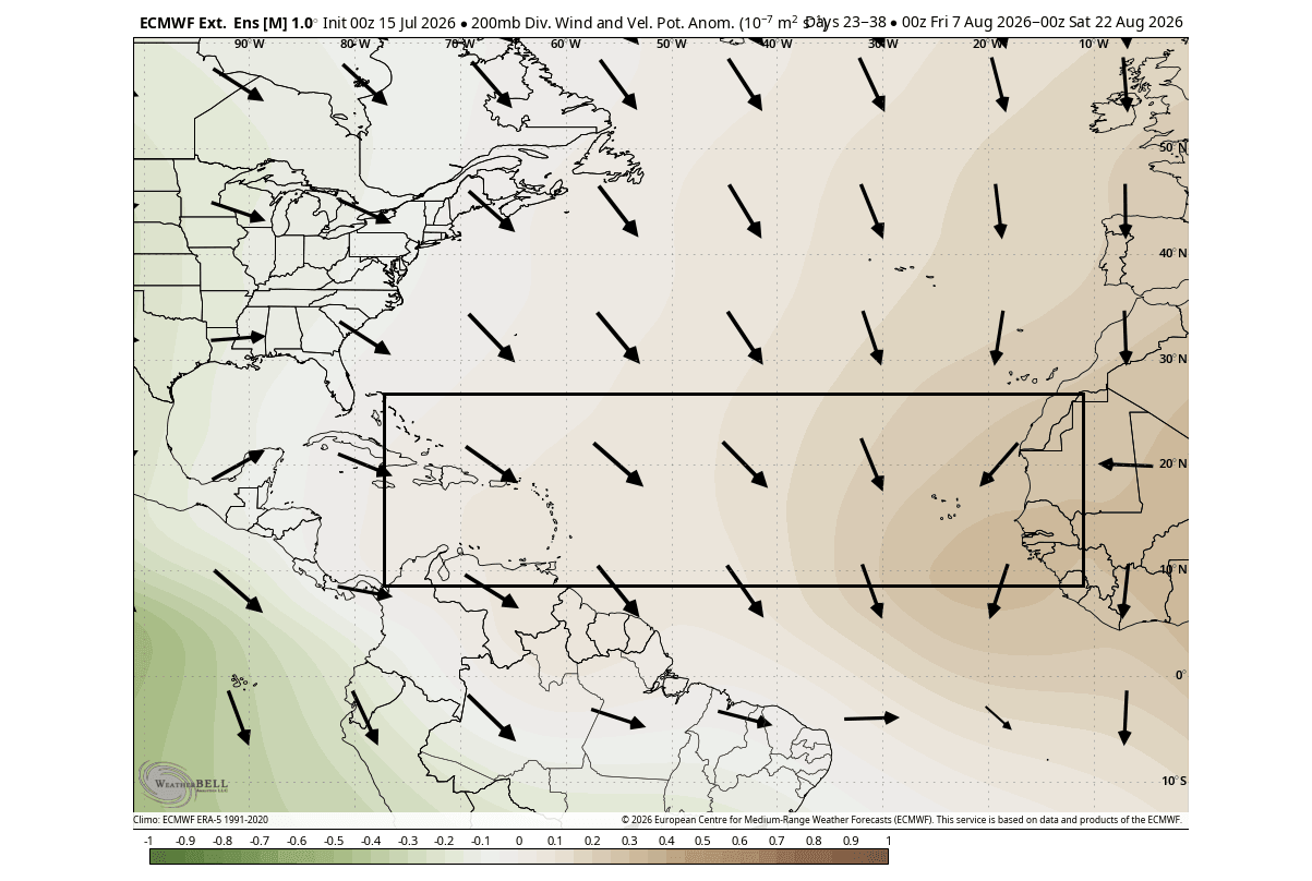
Atmospheric circulation is heavily governed by Velocity Potential, an indicator tracking where air rises and sinks on a global scale.
- Rising Motion (Green Anomalies): Associated with low pressure, warm water, deep convection, and stormy weather. This is currently dominating the Pacific.
- Sinking Motion (Brown/Stable Anomalies): Associated with high pressure, dry mid-levels, and suppressed cloud formation. This is currently blanketing the Atlantic MDR.
Seasonal forecasts for September 2026—the statistical peak of the hurricane season—reveal that the Atlantic MDR remains trapped in a suppressed atmospheric loop. African easterly waves moving off the continent encounter hostile, sinking air, severely limiting their ability to organize into tropical depressions, let alone major hurricanes.
4. Official Responses and Institutional Outlooks
Leading meteorological institutions have adjusted their seasonal forecasts to account for this unprecedented ocean-atmospheric coupling.
National Hurricane Center (NHC) and NOAA
Real-time tropical weather outlooks from the National Hurricane Center reflect the overarching atmospheric steering currents. While the Eastern and Central Pacific basins buzz with tropical disturbances fueled by the Super El Niño, the official 7-day Atlantic outlooks remain remarkably quiet for the height of summer. NOAA’s analyses continue to emphasize that while environmental shielding reduces overall threat levels, coastal residents must remain vigilant, as climate anomalies dictate probabilities rather than absolute certainties.
Colorado State University (CSU) Forecast Team
The esteemed tropical meteorology project at Colorado State University, currently led by Dr. Philip Klotzbach, released updated 2026 Atlantic hurricane outlooks incorporating these exact ocean parameters. When evaluating the Accumulated Cyclone Energy (ACE) index—a metric measuring the combined strength and duration of all tropical storms and hurricanes—CSU’s models point toward one of the quietest seasons in recent memory.
Furthermore, CSU’s U.S. Landfall Anomaly maps present a unified front: every single coastal county from Brownsville, Texas, all the way to Newfoundland, Canada, faces a below-normal hurricane landfall threat for the 2026 season.
5. Implications: From Quiet Summers to Winter Extremes
While a quiet hurricane season is welcomed by coastal communities seeking respite from property damage and storm surges, meteorologists warn that the underlying global atmospheric state carries massive implications for the upcoming Fall and Winter of 2026/2027.
The Historical Precedent: Lessons from 1992
It is a cardinal rule of meteorology that a quiet season does not mean a zero-risk season. The classic historical parallel is the 1992 hurricane season, which was heavily suppressed by a developing El Niño. Despite the overall lack of activity, that season produced Hurricane Andrew—a catastrophic Category 5 storm that devastated South Florida. The meteorological community stresses that statistical shielding lowers the probability of frequent strikes, but it only takes one rogue system to create a historic disaster.
Connecting the Dots to Winter 2026/2027
The global teleconnections driving the current summer anomalies do not vanish when autumn arrives; rather, they evolve. Historical data analyzing the aftermath of weak hurricane seasons and Super El Niño events points toward distinct recurring patterns for the cold months ahead:
- Temperature Anomalies: Winters following suppressed tropical activity often feature colder-than-normal temperature anomalies settling across parts of the United States, paired with high-pressure ridging over portions of Canada and Europe.
- Stratospheric Disruptions: Crucially, research indicates a strong correlation between slow hurricane seasons and a warmer winter stratosphere. This dynamic frequently leads to a weakened or disrupted Polar Vortex.
- Jet Stream Collapse and Cold Air Outbreaks: A weakened Polar Vortex loses its ability to tightly bottle up arctic air. Consequently, the stratospheric circulation breakdown allows frigid polar air to spill southward into the mid-latitudes, setting the stage for high-impact winter weather, severe cold snaps, and significant snowfall events across North America.
Looking Ahead
The interplay between the rare Atlantic Niña and the towering Super El Niño serves as a masterclass in global teleconnections. As the peak weeks of the hurricane season approach, the atmospheric shield will continue to suppress tropical activity across the Atlantic basin. However, forecasters advise utilizing this quiet window not just for immediate relief, but as an early warning system for the dramatic, winter-like weather patterns already beginning to telegraph their arrival for late 2026 and early 2027.
Stay tuned to the Global Weather Desk for continuous, long-range updates as meteorological models track the evolution from late-summer tropical suppression to winter atmospheric dynamics.
