

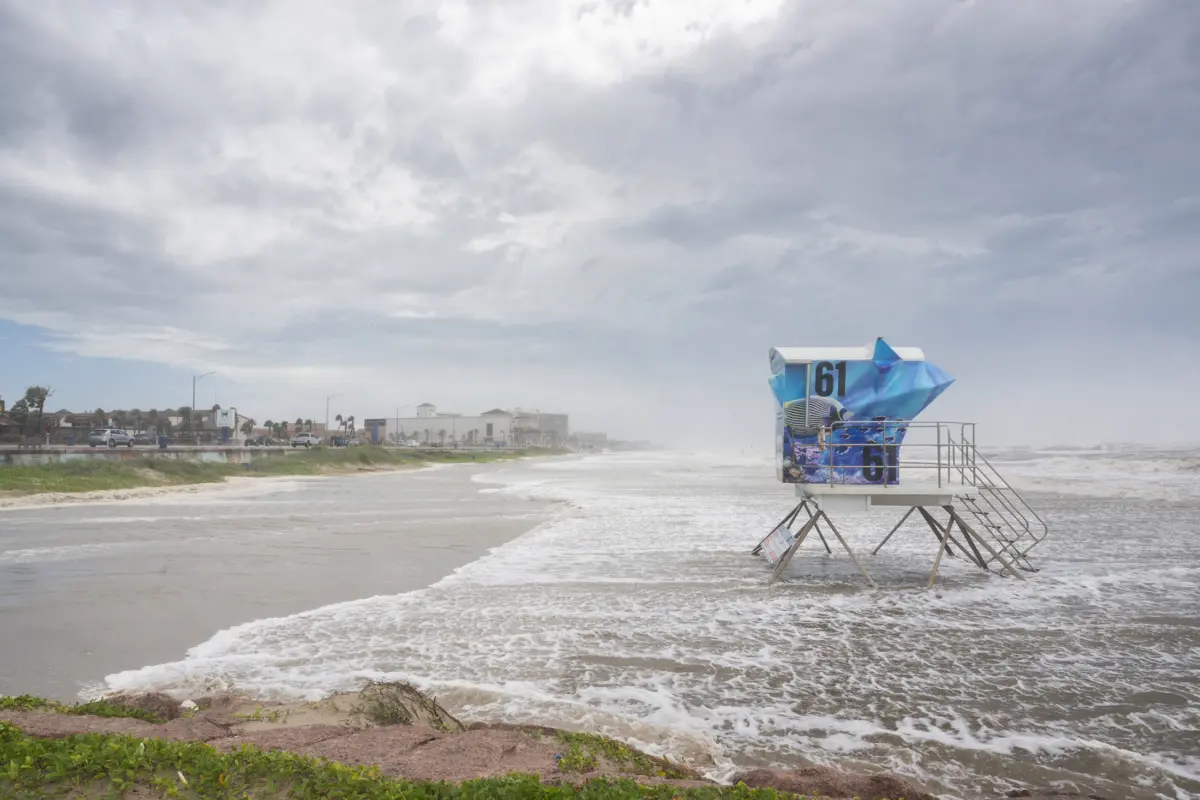
HOUSTON/NEW ORLEANS — Tropical storm warnings went into effect along vulnerable stretches of the Texas and Louisiana coastlines on Monday as a compact yet potent weather system gathered strength over the exceptionally warm waters of the Gulf of Mexico.
The developing disturbance, currently classified as a potential tropical cyclone by the United States National Hurricane Center (NHC), poses an immediate, albeit short-lived, threat of heavy rainfall, localized storm surge, and flash flooding to the central and western Gulf Coast. While forecasters note that the system lacks broad spatial reach, its proximity to land and the thermal energy available in the Gulf have prompted swift emergency preparations across municipal and industrial sectors alike.
If the system undergoes sufficient organization and sustains maximum winds of at least 39 miles per hour (63 kilometers per hour), it will officially be christened "Edouard." This designation would mark the fifth named storm of the current six-month Atlantic hurricane season, a season that has thus far experienced a somewhat suppressed overall frequency due to overarching global climate phenomena.
As residents from the upper Texas coast across the marshlands of Louisiana monitor the trajectory of the storm, local, state, and federal agencies are coordinating responses to mitigate potential disruptions to infrastructure, transportation, and the vital energy sector centered in the Gulf region.
Main Facts
The unfolding weather event is defined by several critical meteorological parameters and geographical risks:
- Current Location and Trajectory: As of Monday’s advisory issued by the NHC, the center of the unnamed system was located approximately 130 miles (209 kilometers) south of Morgan City, Louisiana. It is tracking on a northward to north-northwestward path that will bring the center—and its associated heavy weather bands—directly inland by Tuesday.
- Wind Speeds and Intensity: Maximum sustained winds are hovering around 35 mph (56 km/h), sitting just below the threshold for tropical storm status. Forecasters anticipate some minor intensification before the system makes landfall due to extraordinarily warm sea surface temperatures.
- Fuel for the Storm: The disturbance is traversing waters registering roughly 86°F (30°C). This thermal reservoir provides an ample energy supply for convective activity, allowing the storm to rapidly consolidate despite its compact physical dimensions.
- Primary Hazards: The principal threats associated with this system are not catastrophic winds, but rather torrential rainfall and the subsequent risk of urban and rural flooding. Rainfall accumulations could trigger localized flash floods across low-lying areas of Texas and Louisiana.
- Naming Convention: Upon reaching sustained winds of 39 mph, the system will be named Edouard, becoming the fifth named storm of the 2026 Atlantic hurricane season.
- Seasonal Context: The current Atlantic season is running slightly behind historical averages in terms of storm count and intensity, largely influenced by Pacific climate drivers that have introduced unfavorable wind shear across the tropical Atlantic basin.
Chronology of Events
The Genesis and Early Tracking
The origins of the disturbance trace back to a persistent cluster of thunderstorms and low-pressure anomalies lingering over the south-central Gulf of Mexico late last week. Meteorological models began registering coherent rotation within the disturbance over the weekend, prompting heightened surveillance by satellite telemetry and reconnaissance aircraft dispatched by the National Oceanic and Atmospheric Administration (NOAA).
By early Monday morning, the system had evolved from a disorganized tropical wave into a more structured potential tropical cyclone. Recognizing the imminent threat of tropical-storm-force winds reaching land within 36 hours, the NHC issued official tropical storm warnings for designated sectors of the Texas and Louisiana coasts.
Monday Advisory and Warnings
In its 11:00 AM EST advisory on Monday, the Miami-based hurricane center pinpointed the system 130 miles south of Morgan City, Louisiana. Meteorologists noted that while the storm’s circulation remained exceptionally tight and small in geographic scale, its forward speed and proximity to the coastline left a compressed window for local preparations.
Coastal communities from high-risk zones in Galveston, Texas, to coastal parishes in southern Louisiana immediately initiated pre-landfall protocols. Emergency management directors opened lines of communication with state transportation departments to monitor low-water crossings and potential evacuation routes in flood-prone parishes.
Projected Landfall and Short-Lived Window
According to the latest meteorological consensus, the system is projected to make landfall along the upper Texas or southwestern Louisiana coast sometime on Tuesday. Because the system is moving relatively quickly and will encounter friction over land almost immediately upon arrival, its window for intensification is severely restricted. Forecasters emphasize that any strengthening will be short-lived, with rapid weakening expected once the system moves inland and interacts with continental air masses. Nevertheless, the heavy precipitation threat will persist for 24 to 48 hours post-landfall as the remnants drift northward.
Supporting Data and Meteorological Context
To understand the behavior of this Gulf system, meteorologists look closely at both regional thermodynamic factors and the broader macro-climate state of the Atlantic basin during the 2026 season.
Sea Surface Temperatures and Energy Dynamics
The Gulf of Mexico is currently acting as a high-octane engine for tropical cyclogenesis. Sea surface temperatures hovering around 86°F (30°C) extend to significant depths, ensuring that passing weather disturbances can ingest substantial latent heat. This thermodynamic efficiency explains how even a small, fledgling system can quickly organize and threaten gale-force winds prior to landfall. However, the system’s small radius of maximum winds means that hurricane-force conditions are not anticipated, and tropical-storm-force winds will only extend outward a relatively short distance from the center.
Seasonal Anomaly: The El Niño Factor
A notable element of the 2026 Atlantic hurricane season has been its relative sluggishness compared to hyper-active years in recent memory. Statistically, by this point in a typical season, the Atlantic basin has already produced an average of six named storms, two of which would have matured into full-fledged hurricanes.
This year, however, only four short-lived storms have formed, none of which achieved hurricane status. The primary driver behind this suppression is the presence of El Niño conditions in the Pacific Ocean. El Niño events typically trigger strong upper-level wind shear across the Caribbean Sea and the tropical Atlantic. This wind shear acts as an atmospheric machete, shredding the tops off developing thunderstorms and preventing vertical stacking—a structural necessity for tropical storm intensification.
Despite the prevailing wind shear in the broader Atlantic basin, the Gulf of Mexico often operates under its own micro-climatic rules, allowing localized systems to develop rapidly independent of overarching basin-wide trends.
Official Responses and Emergency Preparedness
State and local authorities across the Gulf Coast have mobilized resources to address the impending rainfall and wind threats. Emergency operations centers in vulnerable parishes and counties have transitioned to enhanced monitoring postures.
State and Local Actions
- Texas: Emergency management officials in Galveston and surrounding coastal counties have urged residents to clear drainage ditches, secure outdoor property, and monitor local weather alerts. Municipal crews have tested high-water rescue vehicles and ensured that pumps in low-lying urban areas are fully operational.
- Louisiana: Parish presidents along the southern coast have issued advisories focusing heavily on the threat of localized street flooding and minor coastal overwash driven by persistent onshore winds. Sandbag distribution sites were opened early Monday morning in several parishes, allowing residents to protect flood-prone properties.
Federal Coordination
The Federal Emergency Management Agency (FEMA) and the National Weather Service are maintaining constant contact with state emergency operations centers. Forecasters are providing high-resolution quantitative precipitation forecasts to help local officials identify which watersheds are at the highest risk of overflowing. Public safety announcements emphasize that motorists should never drive through flooded roadways, reiterating the classic meteorological safety mantra: "Turn Around, Don’t Drown."
Implications for Energy, Economy, and Infrastructure
The Gulf of Mexico is not only a home for millions of coastal residents and fragile ecosystems, but it also serves as the beating heart of the United States energy infrastructure. Consequently, any tropical disturbance in these waters commands intense scrutiny from financial markets, energy analysts, and supply chain logistics managers.
Energy Sector Impacts
The Gulf region accounts for a significant share of total U.S. crude oil and natural gas production, alongside a dense concentration of petroleum refineries, processing plants, and pipeline networks.
- Offshore Platforms: While this specific system is compact and moving rapidly toward the coast rather than meandering across deepwater production fields, energy companies operating in the central and western Gulf routinely review safety procedures at the first sign of tropical development. Non-essential personnel on offshore platforms are sometimes evacuated as a precautionary measure, though widespread production shut-ins are generally reserved for systems threatening major hurricane intensity.
- Refining Capacity: The coastal stretch between Texas and Louisiana houses a vast percentage of American refining capacity. Heavy rainfall and potential localized flooding pose operational challenges for refineries and chemical plants, particularly regarding stormwater management and electrical substation protection. Energy traders closely monitor these systems for potential disruptions to gasoline and distillate yields, which can cause short-term fluctuations in fuel futures markets.
Supply Chain and Transportation
Beyond the energy sector, the Gulf Coast is home to critical maritime ports, intermodal freight hubs, and freight rail corridors.
- Port Operations: Port authorities in areas under tropical storm warnings may implement vessel traffic restrictions, pilot suspensions, or port closures as sustained winds increase and visibility drops due to heavy downpours. Temporary halts in maritime commerce can create short-term bottlenecks in the import and export of agricultural commodities, manufactured goods, and containerized freight.
- Aviation and Ground Transit: Regional airports are monitoring ceiling and visibility minimums as rain bands sweep ashore. While major hub airports in Houston and New Orleans are accustomed to managing severe convective weather, localized ramp closures and flight delays are possible during the height of the storm on Tuesday.
Long-Term Environmental and Agricultural Considerations
While the threat of wind damage is minimal, the influx of freshwater from heavy rainfall can have mixed effects on local ecosystems. On one hand, inland areas suffering from prolonged dry spells or agricultural deficits will welcome the moisture. On the other hand, excessive rainfall in short bursts can overwhelm agricultural drainage systems, saturate crop roots, and cause temporary agricultural stress in low-lying fields across the coastal plain. Furthermore, coastal marshes may experience temporary surges in water levels, though the transient nature of the storm limits the risk of long-term ecological degradation.
Conclusion
As the unnamed potential tropical system tracks northward through the warm waters of the Gulf of Mexico, the immediate priority for millions of residents and commercial operators along the Texas and Louisiana coasts is vigilance and rapid preparation.
While the system is small, fast-moving, and unlikely to evolve into a major hurricane—potentially becoming Tropical Storm Edouard before making landfall on Tuesday—its capacity to deliver heavy rainfall, localized flooding, and gusty winds demands respect. Backed by 86°F waters, the storm serves as a vivid reminder of the latent energy residing in the Gulf during the peak months of the Atlantic hurricane season.
Federal, state, and local emergency management teams remain on high alert, ensuring that infrastructure remains secure, energy markets are informed, and the public is equipped with the timely meteorological data necessary to weather the storm safely.
