

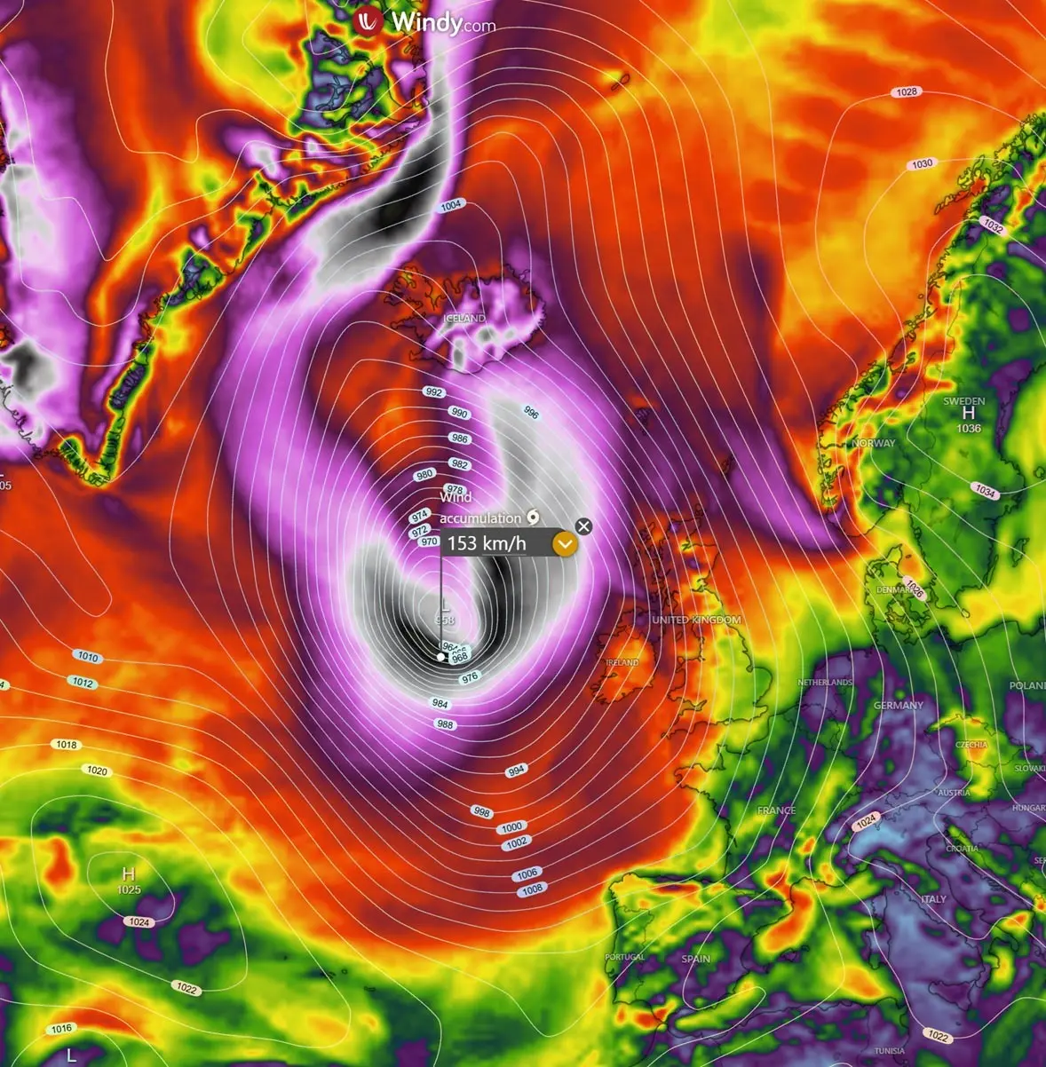
NORTH ATLANTIC — A meteorological monster is taking shape over the North Atlantic, poised to slam into Western Europe with ferocious intensity. Weather forecasters and meteorologists are tracking the rapid development of a violent "bomb cyclone" that is set to unleash severe gales, torrential rainfall, and colossal ocean swells across Ireland, the United Kingdom, and eventually Iceland.
With central barometric pressures projected to plummet below 950 mbar, the storm’s massive circulation will affect a wide swath of the continent, bringing hazardous travel conditions, potential structural damage, and coastal flooding. Authorities have already begun issuing warnings as coastal communities brace for the worst of the impact.
Main Facts: The Anatomy of a Bomb Cyclone
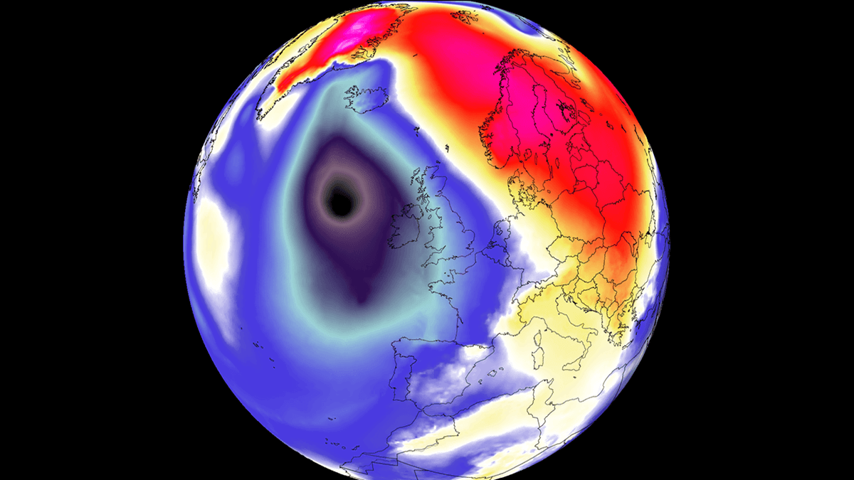
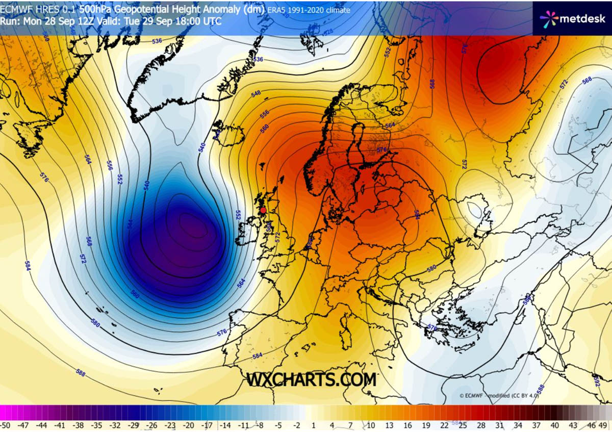
The explosive cyclogenesis currently unfolding over the North Atlantic is driven by a potent combination of atmospheric dynamics. A high-amplitude upper-level trough is swinging aggressively out of the North Atlantic, where it is colliding with an expansive 1035 hPa blocking high-pressure system firmly anchored over Central Europe and Scandinavia.
This steep baroclinic gradient is squeezing isobars tightly across the United Kingdom and Ireland, setting the stage for a dangerous windstorm. In meteorological terms, a system officially earns the classification of a "bomb cyclone" when its central barometric pressure rapidly deepens by more than 24 millibars (mbar) within a 24-hour period (a process known as bombogenesis).
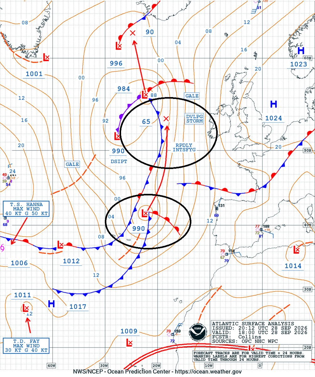
Analysis from the Ocean Prediction Center (OPC) revealed that the storm’s central pressure is tumbling from a respectable 990 mbar down to 965 mbar, with an additional 15 to 20 mbar drop expected as the core tracks further north toward the Arctic. While the lowest pressure core will remain offshore—tracking north between Iceland and Scotland—the storm’s gargantuan circulation field spans thousands of kilometers, threatening widespread disruptions across Western Europe.
Chronology of the Storm: From Genesis to Landfall
The life cycle of this severe North Atlantic weather event is moving at a breakneck pace, capturing the attention of forecasters across Europe.
Monday Night: Satellite Detection and Initial Deepening
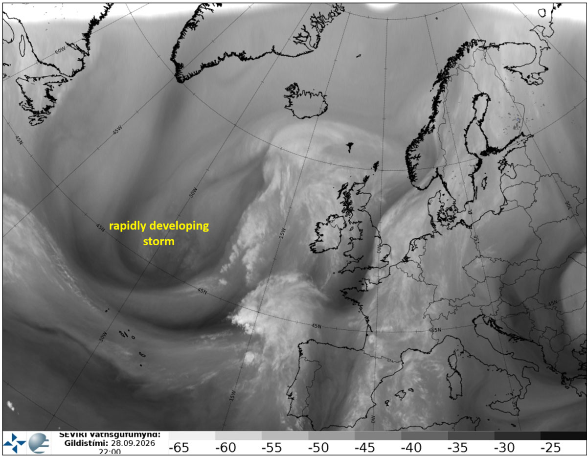
Satellite imagery captured the early warning signs of the impending tempest late Monday. Water vapor spectrums highlighted a vigorous baroclinic zone and an intensifying jet stream, confirming that standard autumn squalls would be replaced by a rapidly deepening bomb cyclone. OPC tracking indicated the wave was emerging just west of the Iberian Peninsula before initiating its aggressive northward charge.
Tuesday: Warnings Issued and Gales Arrive
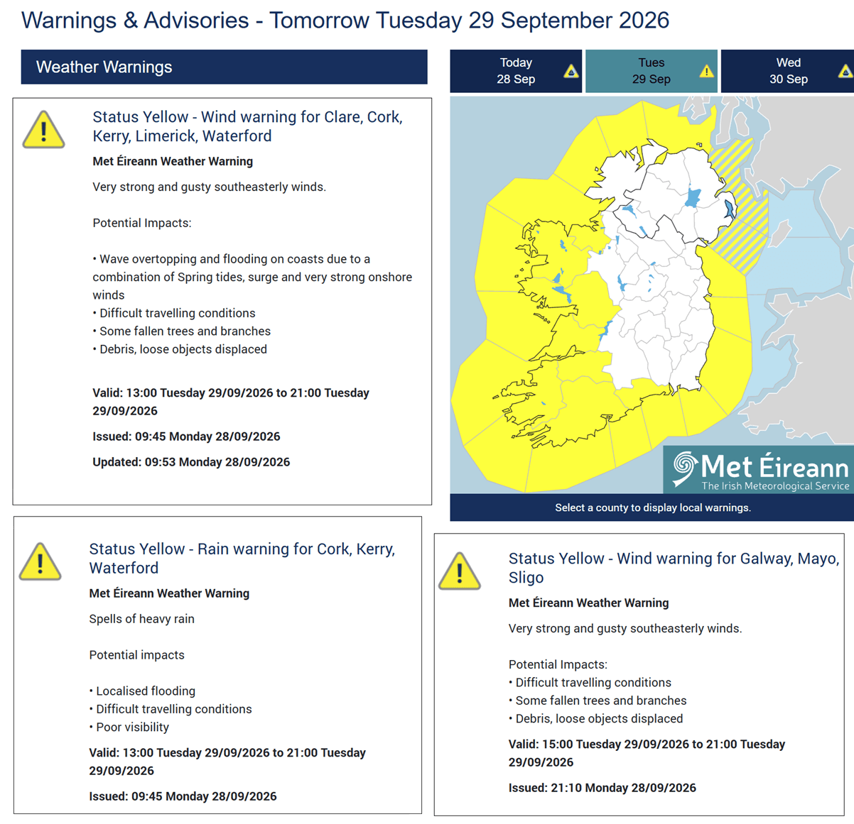
By Tuesday morning, the storm system was visibly organizing on satellite feeds as its central pressure fell at an accelerated rate. In response, national meteorological agencies—including Met Éireann—issued yellow weather warnings for coastal areas of Ireland and Northern Ireland. Very strong, gusty southeasterly winds began whipping across the region, creating treacherous driving conditions, downing trees, and threatening local flooding. Surface cold fronts began sweeping east, bringing sudden squalls of heavy rain.
Wednesday: Peak Intensity and Near-Hurricane-Force Winds
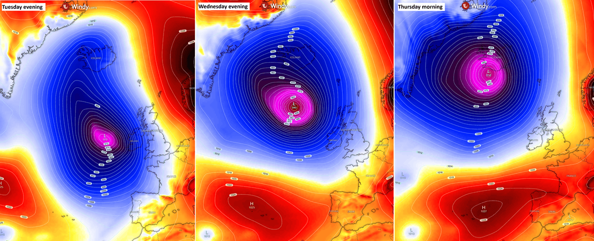
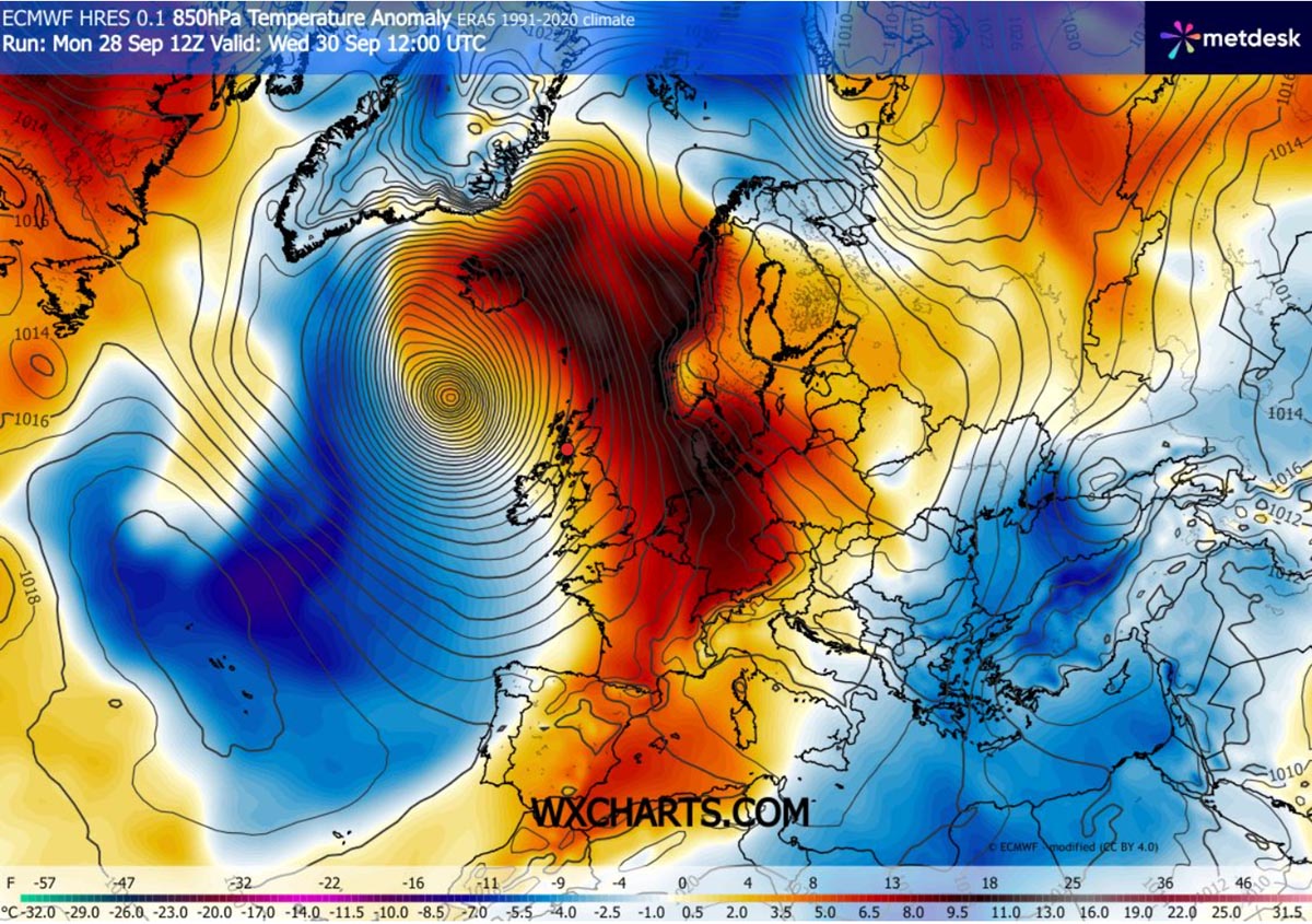
The storm is expected to reach its terrifying maturity on Wednesday. As the system tracks north past the west of the Faroe Islands, its central pressure is forecast to bottom out near 945 to 950 mbar. A tightly wound pressure gradient surrounding the core will generate near-hurricane-force winds, battering the open waters and threatening remote island communities. Concurrently, a powerful southerly jet stream will begin pumping unseasonably warm air northward, driving anomalous temperature spikes far into Scandinavia.
Thursday: Landfall in Iceland
By Thursday morning, the weakening yet still massive low-pressure center will make its final approach, moving directly ashore in Iceland. While the system’s winds will begin to subside as it interacts with land topography, its moisture-laden front will lock into place, triggering a secondary crisis: catastrophic orographic rainfall and severe flooding across Iceland’s southern and southeastern territories.
Supporting Meteorological Data and Regional Impacts
The sheer scale of this Atlantic low-pressure system ensures that its impacts will be multifaceted, touching on extreme winds, anomalous warmth, towering waves, and torrential downpours.
Wind Swaths and Gust Projections
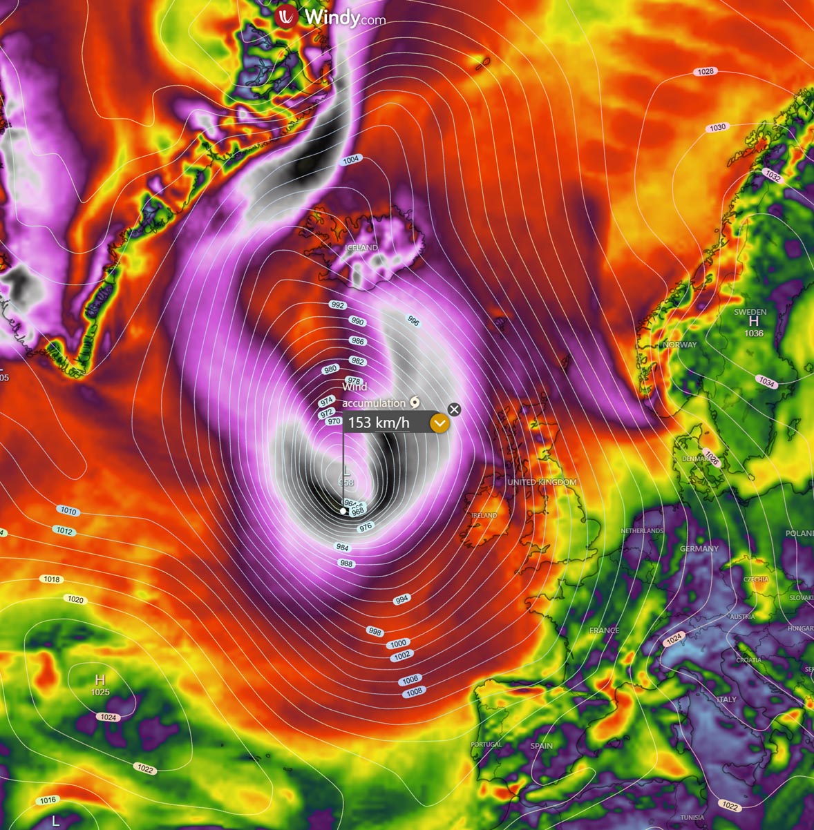
Forecasters have mapped out expansive wind swaths indicating where the worst of the atmospheric fury will be felt. Peak wind gusts ranging between 100 km/h and 130 km/h are expected to hammer Ireland, Northern Ireland, Scotland, and Western England. However, areas closest to the storm’s center—particularly the Outer Hebrides and open maritime zones—could experience destructive gusts surpassing 150 km/h.
Maritime Hazards: 12-Meter Waves
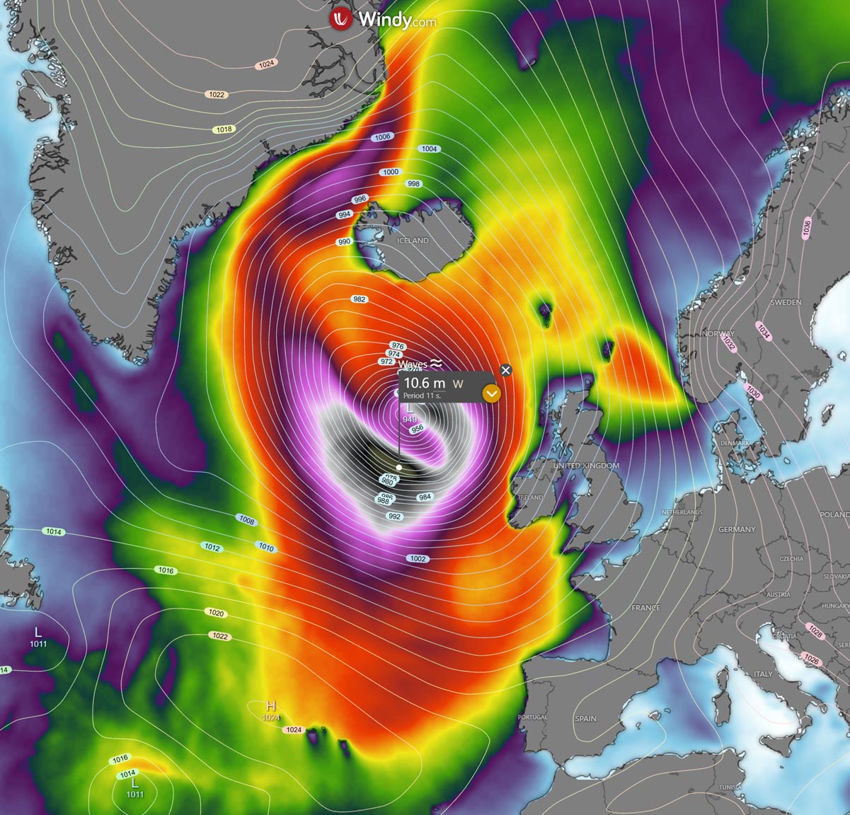
Perhaps the most dramatic signature of this bomb cyclone will be found on the high seas. The storm’s immense fetch will generate monumental wave heights, propagating outward from Tuesday afternoon through Thursday midday. Significant wave heights of 10 to 12 meters (33 to 39 feet) are projected to the immediate west of Ireland and Scotland. Along the rugged Atlantic-facing coasts of western Ireland, Northern Ireland, and the Scottish islands, pounding wave heights of 8 to 10 meters will create severe coastal erosion hazards and make maritime navigation virtually impossible.
Temperature Anomalies and Warm Plume
Unusual thermal dynamics will accompany the storm. Because of the robust southerly airflow on the eastern flank of the circulation, an unseasonably warm air mass is being dragged northward. Northwestern Europe, Denmark, the Faroes, and parts of Scandinavia will experience significant positive temperature anomalies at the 850 mbar level, contrasting sharply with the turbulent, stormy conditions at the surface.
Atmospheric River and Extreme Rainfall in Iceland
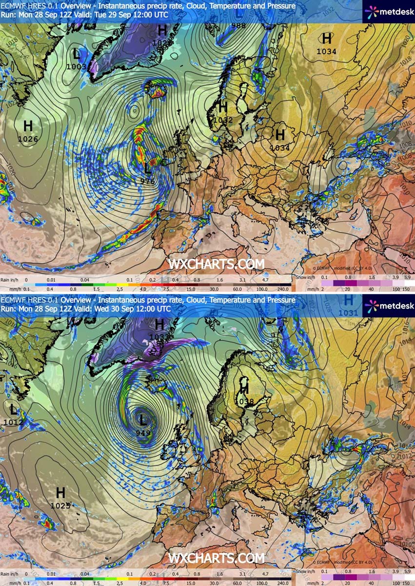
While rainfall across the UK and Ireland will be relatively transient—delivered quickly by fast-moving squall lines—Iceland faces a much more protracted and severe hydro-meteorological threat. Beginning Wednesday afternoon and stretching into Thursday, a classic atmospheric river will establish itself over the island nation. Driven by persistent south-southeasterly winds, heavy, moisture-laden air will be forced upward by local topography, resulting in extreme orographic rainfall. Current hydrological models suggest isolated regions in southern and southeastern Iceland could receive a staggering 250 to 300 mm (nearly 12 inches) of rain, raising immediate concerns for flash floods and landslides.
Official Responses and Public Safety Measures
In anticipation of the severe weather, national weather services and civil defense agencies have ramped up their alert levels.
Met Éireann and the UK Met Office have utilized yellow and amber weather alerts to caution citizens against unnecessary travel. Transport authorities have warned of high-sided vehicle restrictions on major bridges and exposed roadways, while rail networks are preparing for potential delays caused by fallen timber and wind-blown debris.
Coastal municipalities in Ireland and western Scotland have urged residents and tourists to stay away from promenades, piers, and shoreline cliffs. The combination of high astronomical tides, gale-force onshore winds, and 10-meter swells creates a high risk of coastal overtopping and localized flooding in low-lying maritime communities.
In Iceland, meteorological agency Veðurstofa Íslands (Vedur IS) is closely monitoring the impending rainfall totals and wind fields, advising travelers to postpone mountain crossings and remote driving as the atmospheric river moves ashore late Wednesday.
Wider Implications: A Sign of an Active Autumn
The sudden eruption of a sub-950 mbar bomb cyclone in mid-September highlights the energetic state of the North Atlantic basin as the autumn transition begins. While individual storms of this magnitude are not entirely unprecedented for the shoulder seasons, the combination of a robust blocking high over Europe and a fiercely active jet stream has created a textbook environment for explosive cyclogenesis.
Furthermore, climatologists note that this high-impact storm arrives against the backdrop of broader global weather anomalies, including record-breaking sea surface temperatures in the Atlantic and Pacific basins—such as the unfolding 2026/2027 Super El Niño phenomenon. Warmer ocean waters act as prime thermodynamic fuel for tropical and extra-tropical systems alike, raising questions about whether European coastlines could face an increasingly volatile storm season in the months ahead.
For now, emergency services across the UK, Ireland, and Iceland remain on high alert. Residents living in vulnerable coastal or flood-prone areas are strongly encouraged to monitor real-time updates from meteorological agencies, secure outdoor property, and prepare for potential power outages as the bomb cyclone unleashes its full fury.
