

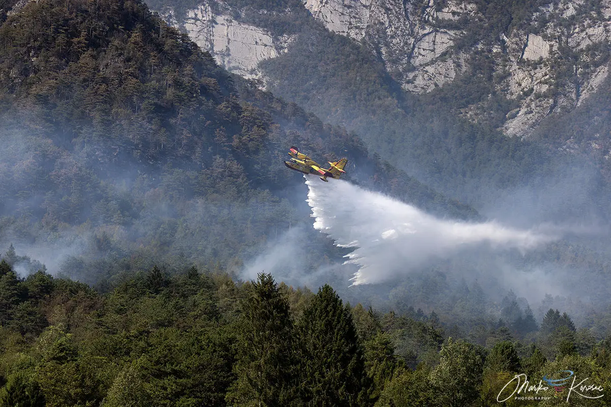
TOLMEZZO, ITALY — After ten days of relentless destruction that scorched over 600 hectares of rugged terrain, a historic and fiercely aggressive mountain wildfire across Monte Amariana and Monte Amarianute in northeastern Italy has finally been brought under control. Driven by extreme summer heat domes, severe regional drought, and treacherous topography, the blaze stood as one of the most severe Alpine forest fires to strike the Friuli-Venezia Giulia region in recent memory.
Emergency evacuations, a massive cross-border aerial firefighting mobilization, and a dramatic shift in the weather ultimately spared local communities from catastrophic damage. As regional teams transition to thermal drone monitoring, authorities are assessing the environmental toll of a disaster fueled by climate extremes and prolonged dry spells.

Main Facts: Anatomy of an Alpine Disaster
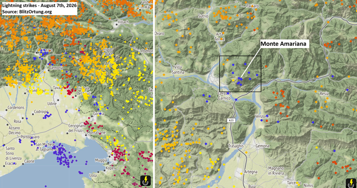
The wildfire crisis erupted against the backdrop of an unrelenting European heat wave during early August 2026. The initial spark occurred on August 7th, when a frontal wave swept across the region, triggering intense lightning strikes—detected dynamically by systems like Blitzortung—across the upper Cuel Feltron, a steep spur of the Monte Amariana complex above the municipality of Amaro.
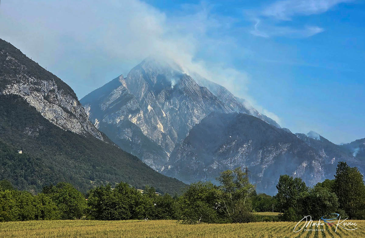
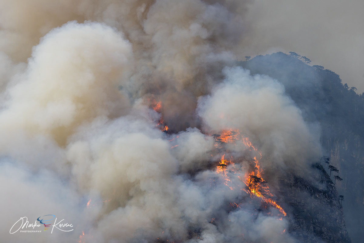
The fire’s growth was supercharged by the geography of the Eastern Tolmezzo Alps in the Carnia region. Monte Amariana, a distinctive pyramid-shaped limestone peak rising to 1,905 meters, features vertical karst cliffs, dry pine needle beds dominated by Pinus nigra (black pine), and dense brushwood. These sheer limestone faces made direct ground access nearly impossible on the upper sectors, creating an upward "chimney effect" that allowed the fire to behave with explosive volatility.
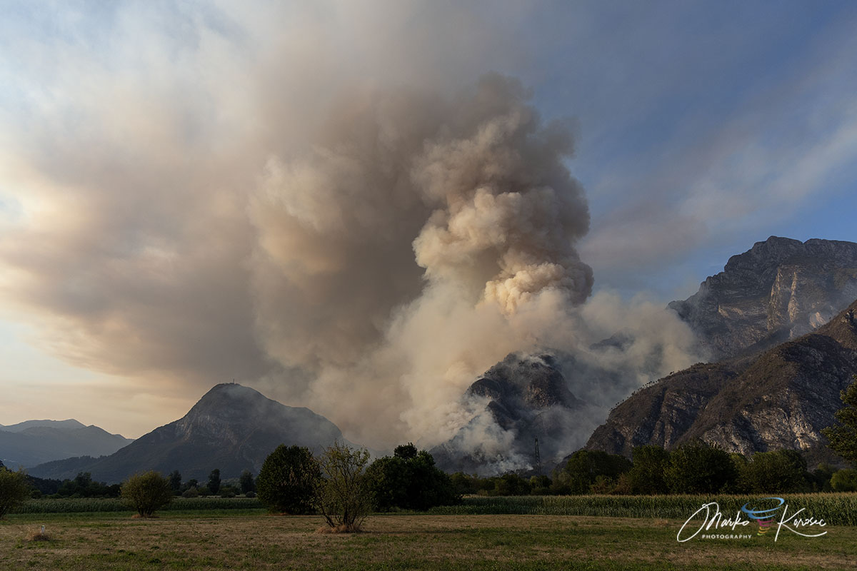
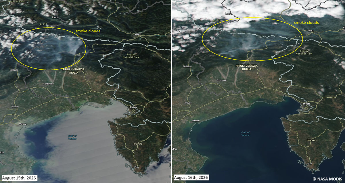
The situation escalated dramatically on Ferragosto (August 15th), a major Italian holiday. Gusty downslope winds fanned the flames across the Rio Confine ridge onto Monte Amarianute, sending a wall of fire sweeping directly toward the outer hamlets of Tolmezzo. The Pissebus sector and areas near Illegio faced immediate danger as flames advanced within 50 meters of residential homes, prompting mandatory emergency evacuations. The intensity of the blaze was such that it generated towering pyrocumulus clouds visible for miles across the Tagliamento valley.
Chronology of the Crisis: From Spark to Suppression
Phase 1: Ignition and Initial Smoldering (August 7)
Following a persistent summer heat dome that baked Western and Central Europe, a series of severe thunderstorms swept across northeastern Italy. Lightning strikes ignited dry fuel beds on the steep, inaccessible slopes of Cuel Feltron. Initially contained by the steepness of the terrain and lack of immediate wind support, the fire smoldered in the dense underbrush and Pinus nigra litter.
Phase 2: The Ferragosto Explosive Flare-Up (August 15)
As holiday celebrations commenced across Italy on August 15th, weather conditions deteriorated. Strong, dry downslope winds aligned with the steep topography, pushing the fire across the natural barrier of the Rio Confine. The fire transitioned from a slow-moving timber fire into an aggressive crown fire, jumping ridges and threatening populated valleys.
Phase 3: Direct Threat and Evacuations (August 16–18)
With the fire pushing aggressively down toward the valley floor, flames reached within 50 meters of homes in the hamlet of Pissebus. Local authorities ordered immediate evacuations. Power lines carrying high and medium voltage through the operational zone were temporarily deactivated as a safety precaution. Pyrocumulus clouds formed above the summit, signaling extreme atmospheric instability driven by the intense heat of the fire.
Phase 4: The Turning Point and Atmospheric Relief (August 20–22)
After days of relentless aerial bombardment, a significant frontal system swept across Friuli-Venezia Giulia between August 20th and 22nd. The system delivered a long-awaited meteorological gift: widespread, heavy downpours that dropped between 150 to nearly 200 mm of rain across the region within a 72-hour window. This deluge completely drowned out the remaining active flame fronts, ending the immediate emergency.
Supporting Data: Regional Drought and Meteorological Context
The severity of the Monte Amariana wildfire cannot be understood in isolation; it was the direct consequence of an exceptional cumulative rainfall deficit and unprecedented summer heat across the Friuli-Venezia Giulia region.
Meteorological data collected leading up to August 2026 highlighted extreme stress on regional ecosystems. Tolmezzo and the broader Carnia territory had experienced weeks of sub-normal precipitation, creating an environment where subterranean moisture levels plummeted and forest floors became tinderboxes. The fine dead fuels—twigs, pine needles, and dry grasses—reached critical moisture thresholds, allowing any ignition source to take hold immediately.
Compounding the dry soils was the broader continental weather pattern. The wildfire unfolded concurrently with the expansion of Europe’s fifth major heat dome of the season, which sent temperatures soaring past 40°C across parts of Western and Central Europe. In this climate context, even high-altitude Alpine environments, typically protected by cooler microclimates, became acutely vulnerable to explosive fire behavior.
Official Responses and Operational Mobilization
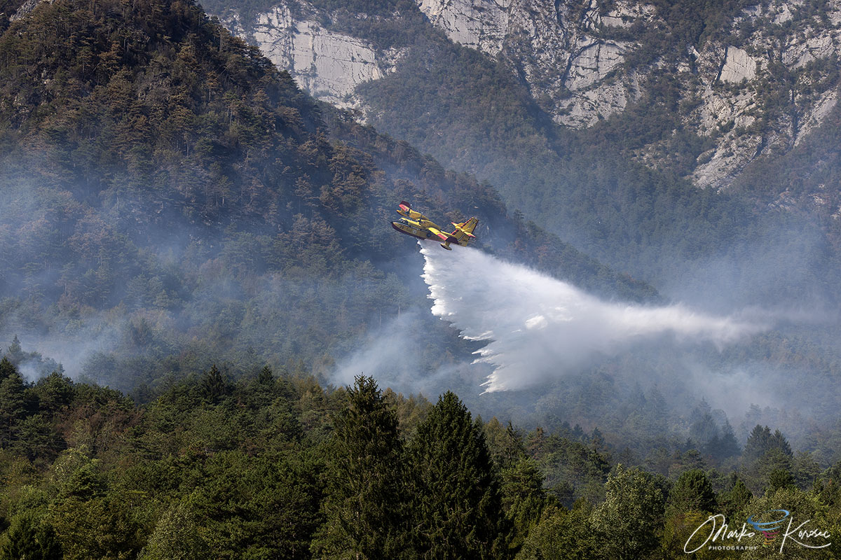
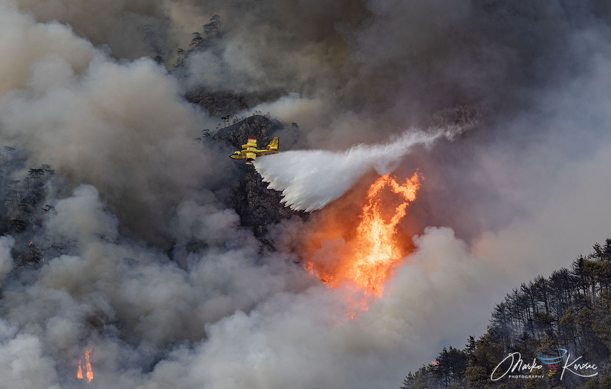
Given the extreme danger to human life, property, and critical infrastructure, Italian civil protection authorities launched a massive, multi-agency operational response. Because the vertical limestone cliffs prevented firefighters from reaching the upper fire lines on foot, the strategy relied heavily on an unprecedented national and cross-border aerial task force.
The Aerial Fleet
- Italian Canadairs: The backbone of the aerial attack, specialized CL-415 water-scooping aircraft performed relentless runs, scooping water from nearby lakes and reservoirs to dump hundreds of precision payloads onto the raging ridges.
- Slovenian Air Tractor Water Bombers: In a display of vital international cooperation, specialized Air Tractor units from neighboring Slovenia were deployed to reinforce the Italian fleet, executing steep-angle drops over inaccessible ravines.
- Regional Helicopters: Nimble regional rotorcraft provided tactical spotting, transported specialized mountain firefighting crews, and dropped targeted buckets of water on persistent hotspots.
Ground Operations
While aircraft fought the upper inferno, ground crews established defensive perimeters at the base of the mountain to protect threatened residential zones. The mobilization included:
- Corpo Forestale Regionale (Regional Forestry Corps): Tasked with strategic fire-line planning, tactical assessments, and post-fire environmental investigations.
- Vigili del Fuoco (National Fire Corps): Deployed structural protection units in Pissebus and Illegio, setting up defense lines to shield homes from flying embers and advancing brush fires.
Following the heavy rains of August 22nd, operations transitioned from active suppression to mop-up and prevention. Regional teams deployed thermal-imaging drones across the 600-plus burned hectares to scan for underground smoldering and residual hotspots, ensuring that hidden embers could not reignite under a returning sun.
Implications: Lessons from the Carnia Wildfire
The Monte Amariana disaster serves as a sobering reminder of the changing risk profile facing European mountain ecosystems. Traditionally, catastrophic wildfires have been viewed as a Mediterranean threat, largely concentrated in regions like southern Italy, Greece, or Spain. However, the events in Carnia underscore that high-altitude Alpine regions are increasingly susceptible to intense forest fires when severe drought aligns with extreme heat events.
Key implications moving forward include:
- Changing Alpine Fuel Dynamics: The accumulation of dry Pinus nigra needles and continuous brushwood in steep limestone terrain creates "chimney" environments that standard ground crews cannot safely navigate, necessitating permanent readiness for specialized aerial assets.
- The Value of Cross-Border Cooperation: The deployment of Slovenian Air Resources alongside Italian fleets highlights the necessity of regional and international burden-sharing as extreme weather events cross national borders with greater frequency.
- Climate Adaptation and Monitoring: With climate projections indicating longer, hotter summers and more erratic precipitation patterns in northern Italy, regional authorities face the challenge of enhancing early-warning systems, expanding thermal drone infrastructure, and managing forest density to mitigate future risks.
As air quality steadily recovers across the Tagliamento valley and local residents return to their homes in Pissebus, the scorched slopes of Monte Amariana stand as a stark monument to the power of extreme weather—and a testament to the resilience of the international and local emergency teams who brought the mountain back from the brink.
