

Main Facts
Long-range meteorological forecasts for the upcoming Fall 2026 and Winter 2026/2027 seasons point toward a rare, record-strong Super El Niño event shaping global atmospheric circulation. Ocean-atmosphere modeling from major institutions—including the European Centre for Medium-Range Weather Forecasts (ECMWF), the North American Multi-Model Ensemble (NMME), and the National Oceanic and Atmospheric Administration (NOAA)—indicate that tropical Pacific sea surface temperatures are tracking well above historical thresholds.

The primary structural features of this developing climate pattern feature:
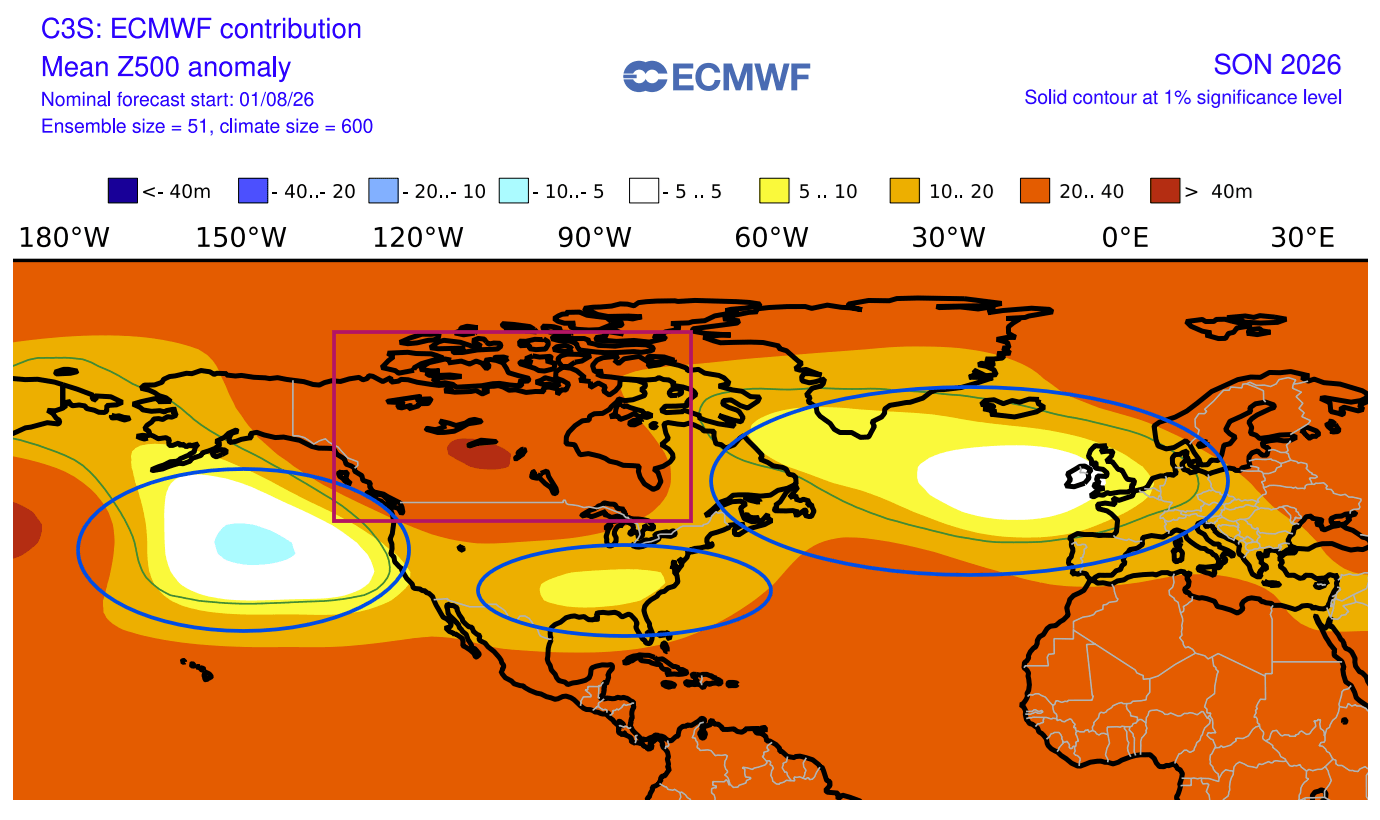
- A dominant high-pressure anomaly anchored over Canada, disrupting the standard polar jet stream.
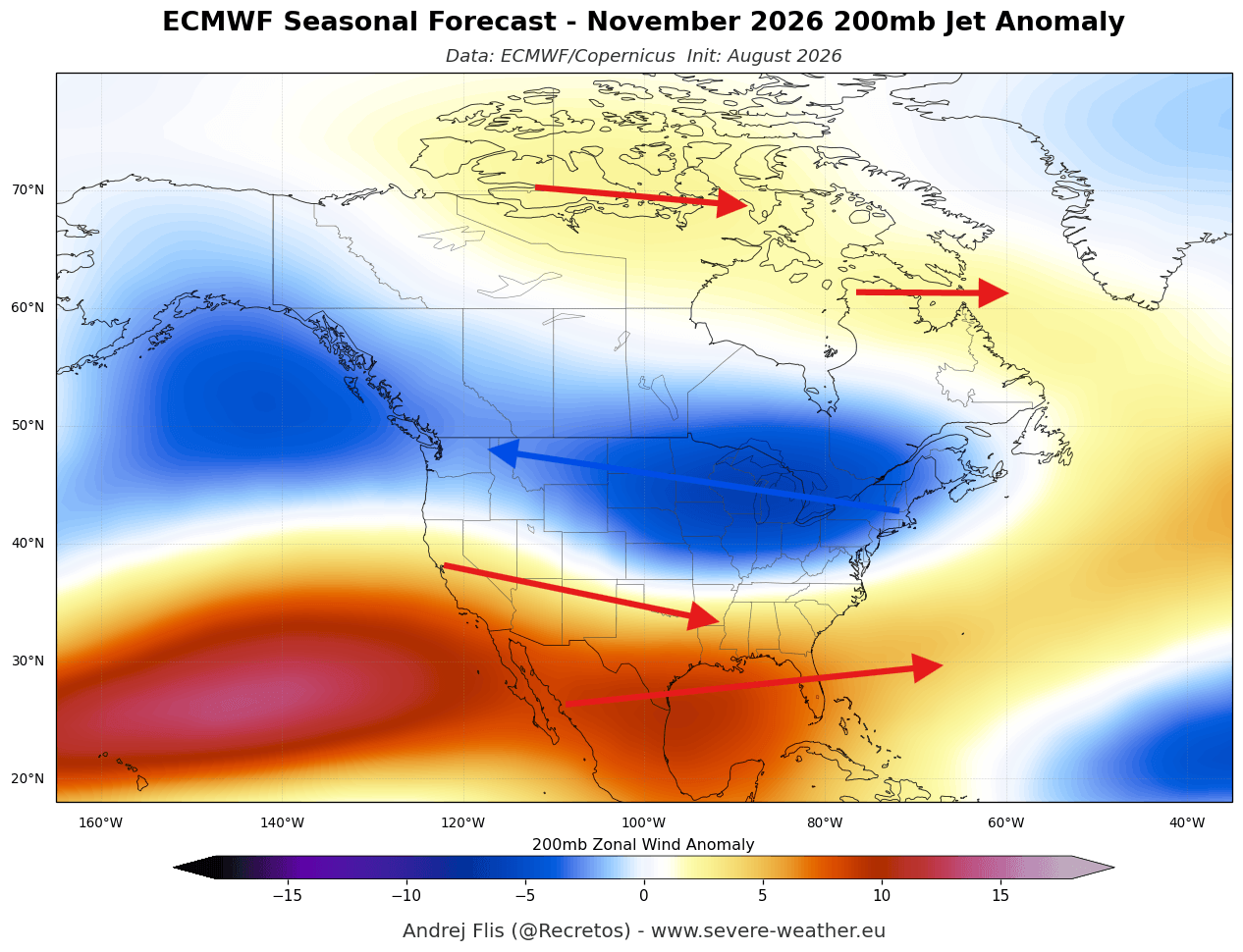
- An active southern storm track spanning the United States, fueled by a supercharged subtropical jet stream.
- A split-flow atmospheric regime that has emerged months ahead of schedule, mimicking patterns normally reserved for the peak of winter.
- An elevated risk of Polar Vortex disruption in mid-winter, driven by intense wave energy propagating from the troposphere into the stratosphere.
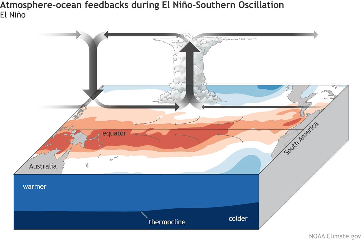
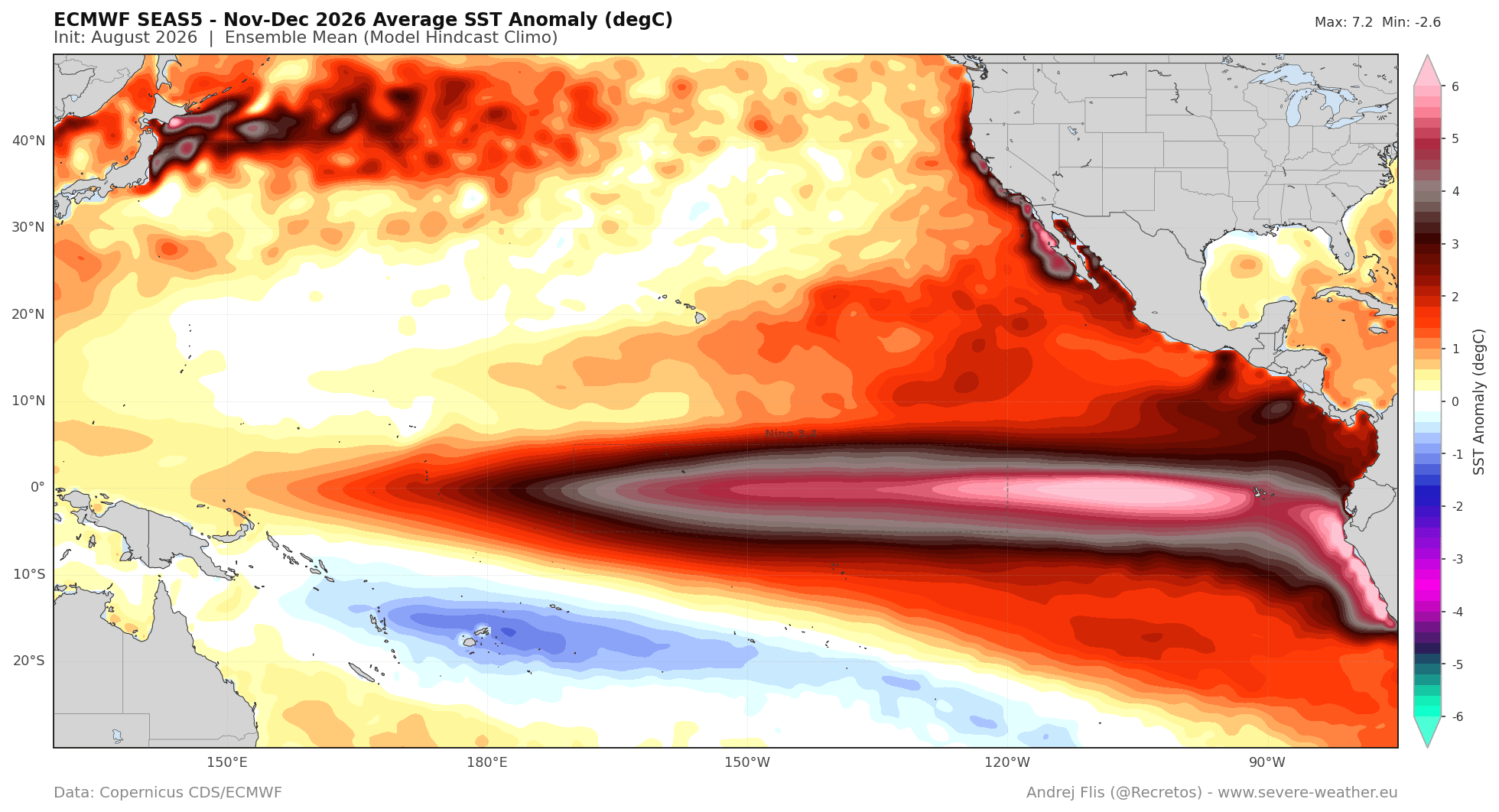
Unlike typical moderate El Niño cycles, this event is classified as an Eastern Pacific (EP) based Super El Niño, meaning peak warmth is concentrated further east in the basin. This dynamic triggers more aggressive shifts in global moisture transport, bringing wetter conditions to the southern United States and southern Europe while establishing mild, high-pressure-driven anomalies across western and northern Canada and parts of continental Europe.
Chronology of Development: From Spring Buildup to Fall Amplification
The Summer Surge and Subsurface Kelvin Wave Activity
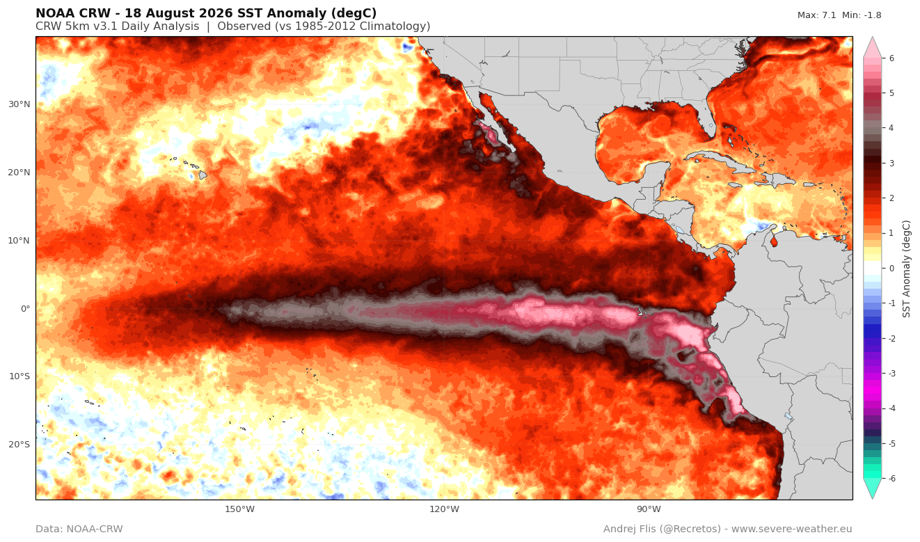
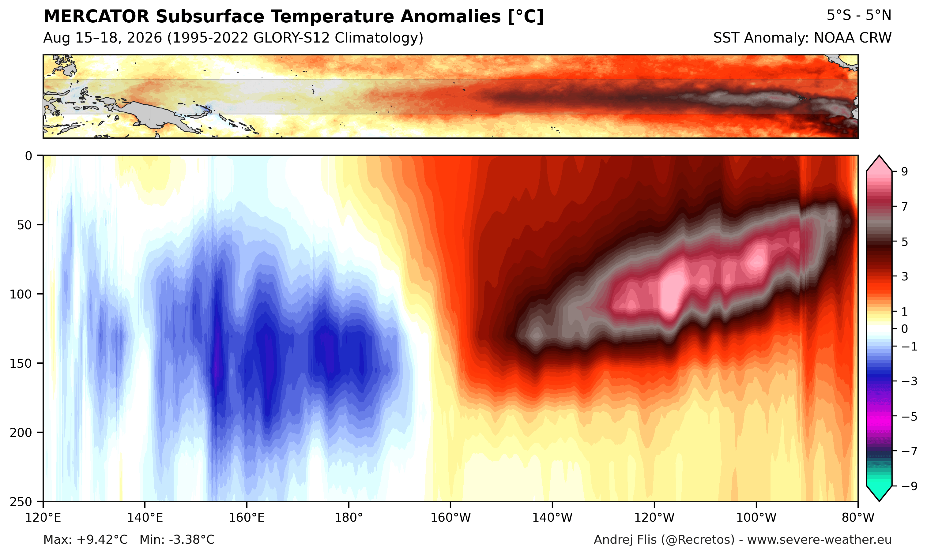
The trajectory of the 2026/2027 Super El Niño began taking shape earlier in the year, but the rate of intensification over the summer caught forecasters by surprise. Oceanic data from NOAA-CRW and the Australian Bureau of Meteorology (BOM) revealed subsurface temperature anomalies soaring past 7°C to 9°C above normal within the top 250 meters of the tropical Pacific.
This subsurface reservoir of heat is tied to a powerful, record-strong downwelling Kelvin wave generated by persistent westerly surface winds. As these warm subsurface waters propagate eastward and rise toward the surface, they provide a continuous thermal engine that insulates the El Niño event against seasonal cooling, locking in its strength well into the upcoming winter.
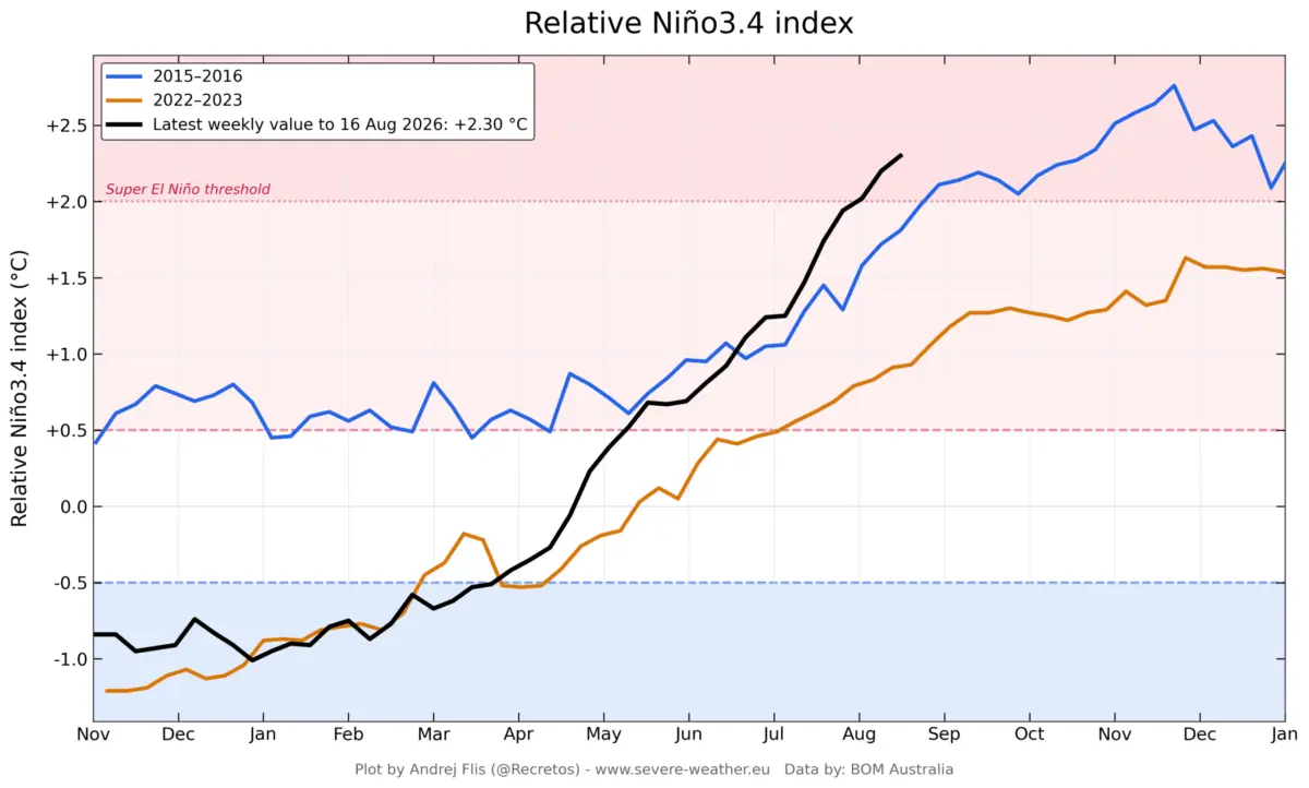
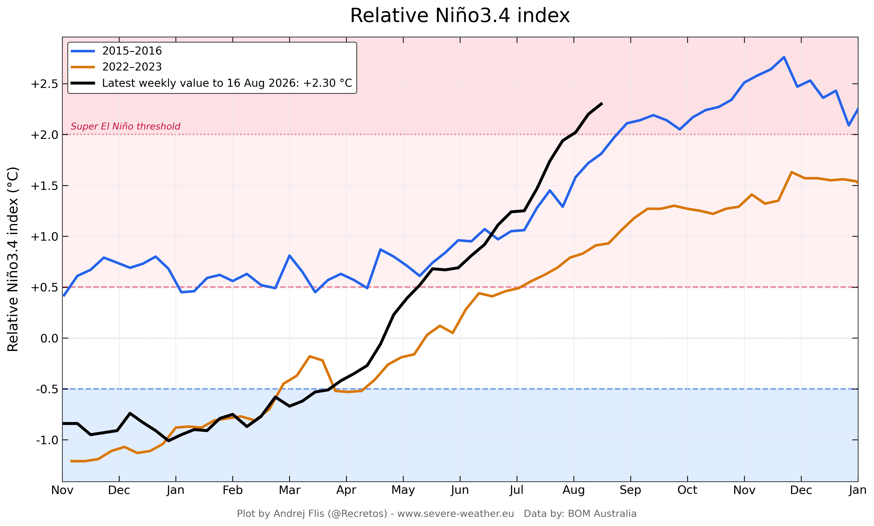
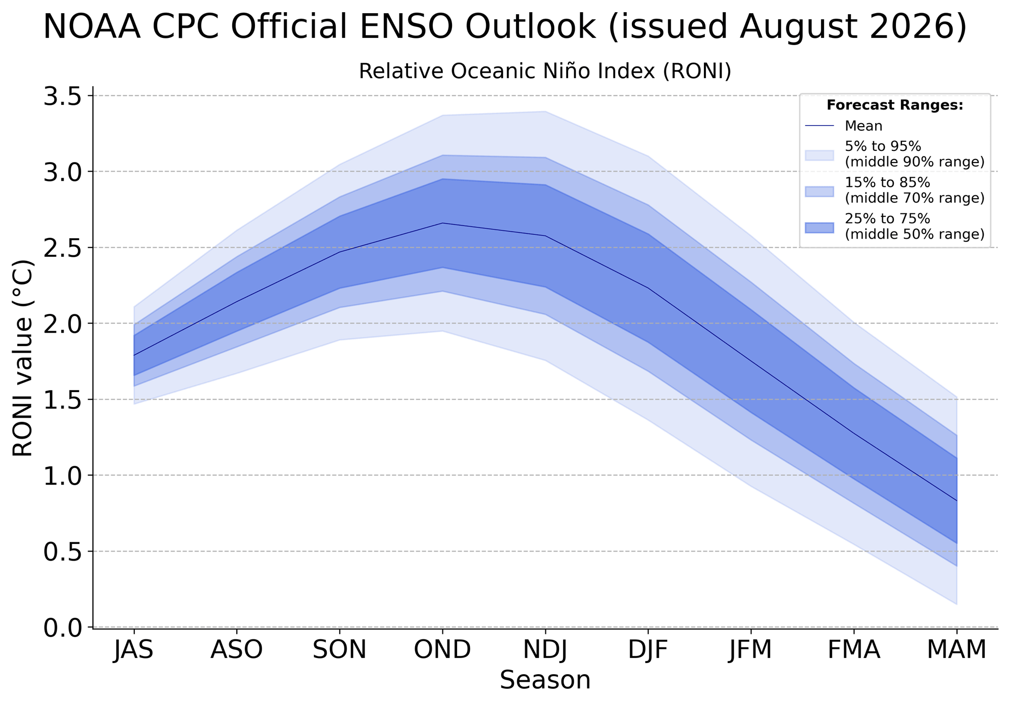
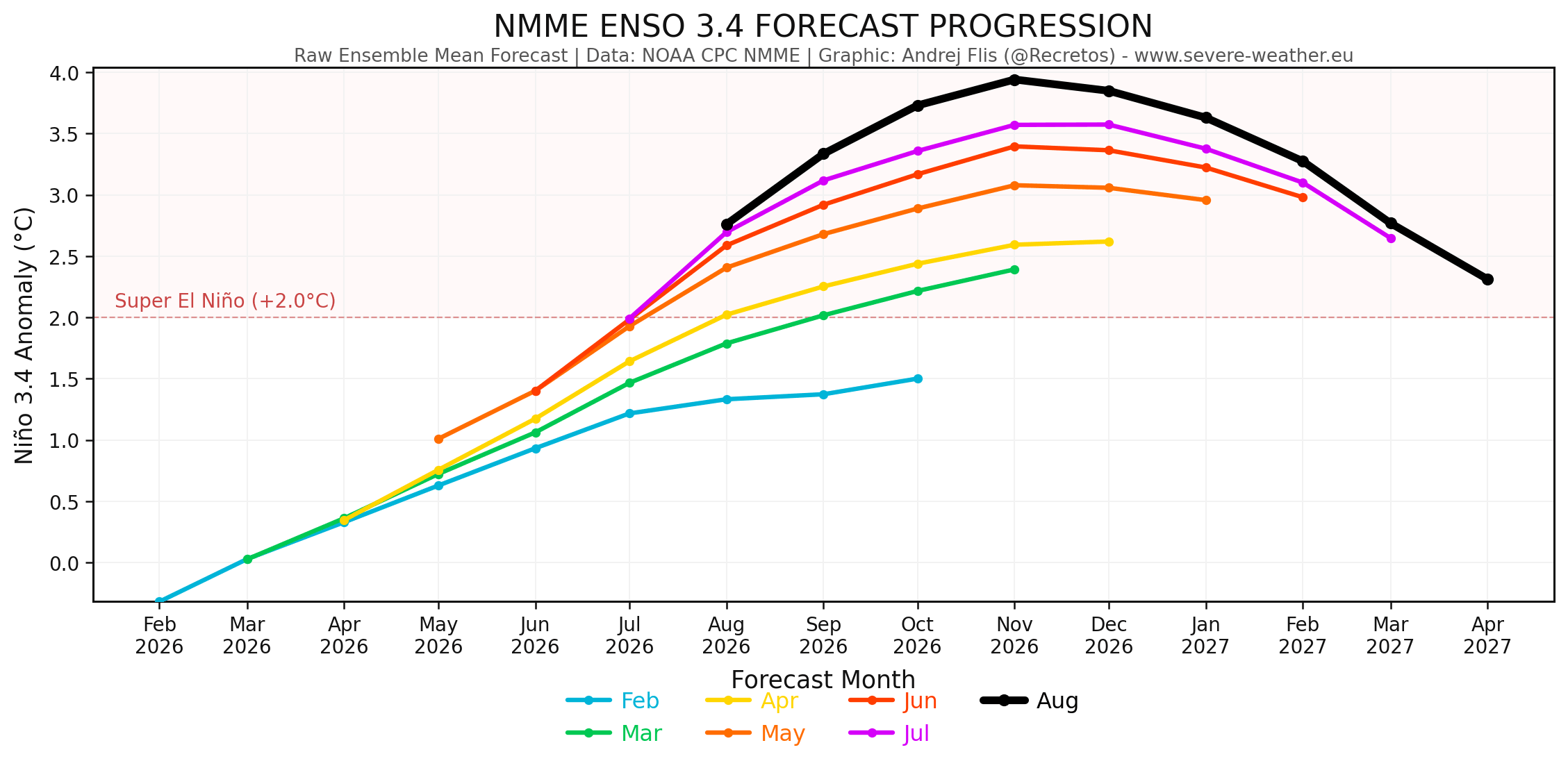
By August, temperature anomalies in the main ENSO tracking regions had already surpassed the comparable developmental benchmarks of the historic 2015/2016 Super El Niño event. Sustained seasonal values have cleared the +2.0°C threshold required for Super El Niño classification, with model runs pushing peak projections toward +3.5°C to +4.0°C.
The Early Transition to Winter-Like Patterns in Fall
Typically, the transition from meteorological fall (September through November) to winter features a gradual evolution of pressure anomalies. However, because the 2026 oceanic forcing is so aggressive, the atmosphere has bypassed the standard transitional phase.
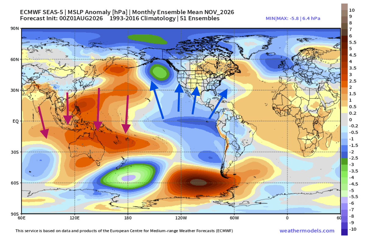
By early Fall 2026, ECMWF global pressure models revealed a fully established winter-like configuration:
- The North Pacific Low: Enhanced convective activity in the central and eastern Pacific deepens low-pressure centers over the North Pacific.
- The Canadian High-Pressure Block: A robust ridging pattern takes hold over Canada, acting as a thermal and dynamical roadblock to direct polar air masses.
- The Southern Storm Track: A series of low-pressure systems align across the southern tier of the United States, driven by a pronounced subtropical jet stream.
This early alignment demonstrates how powerfully tropical ocean forcing can cascade into mid-latitude circulation anomalies long before the calendar turns to December.
Supporting Data and Model Analysis
Global Multi-Model Consensus (ECMWF & NMME)
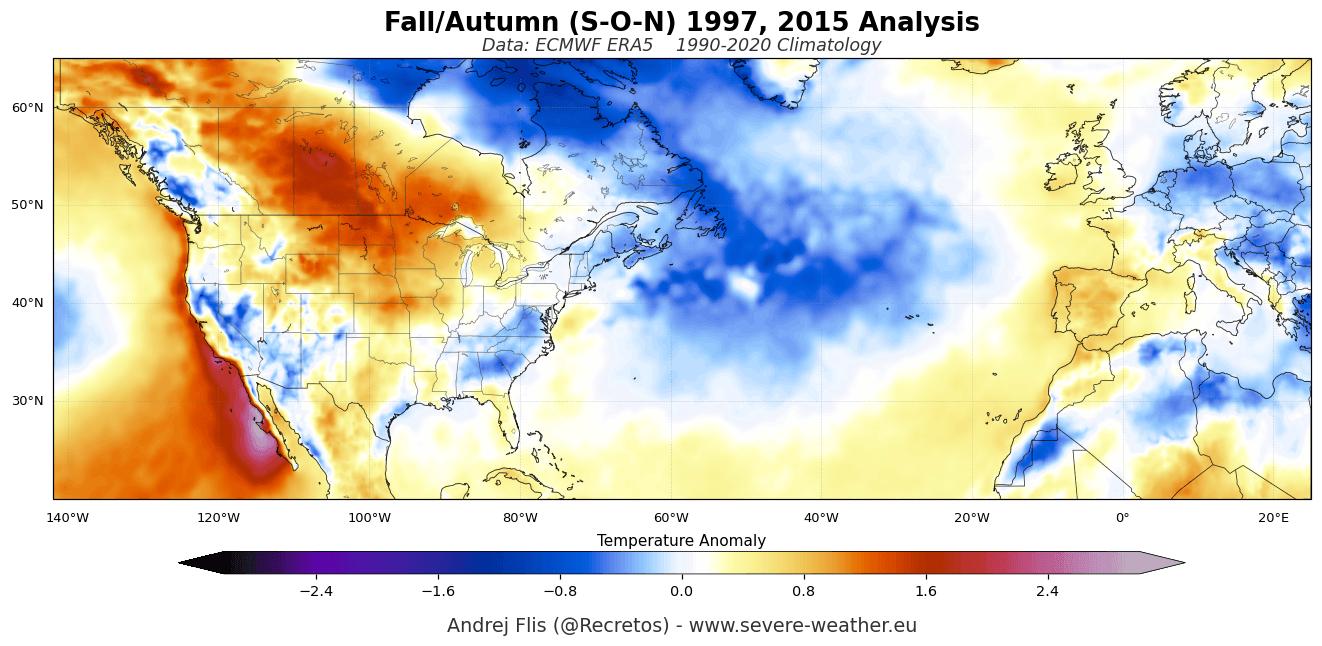
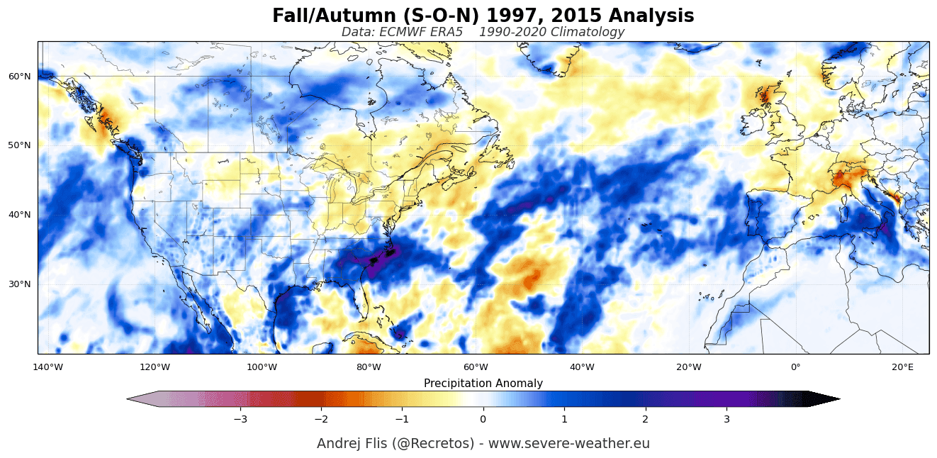
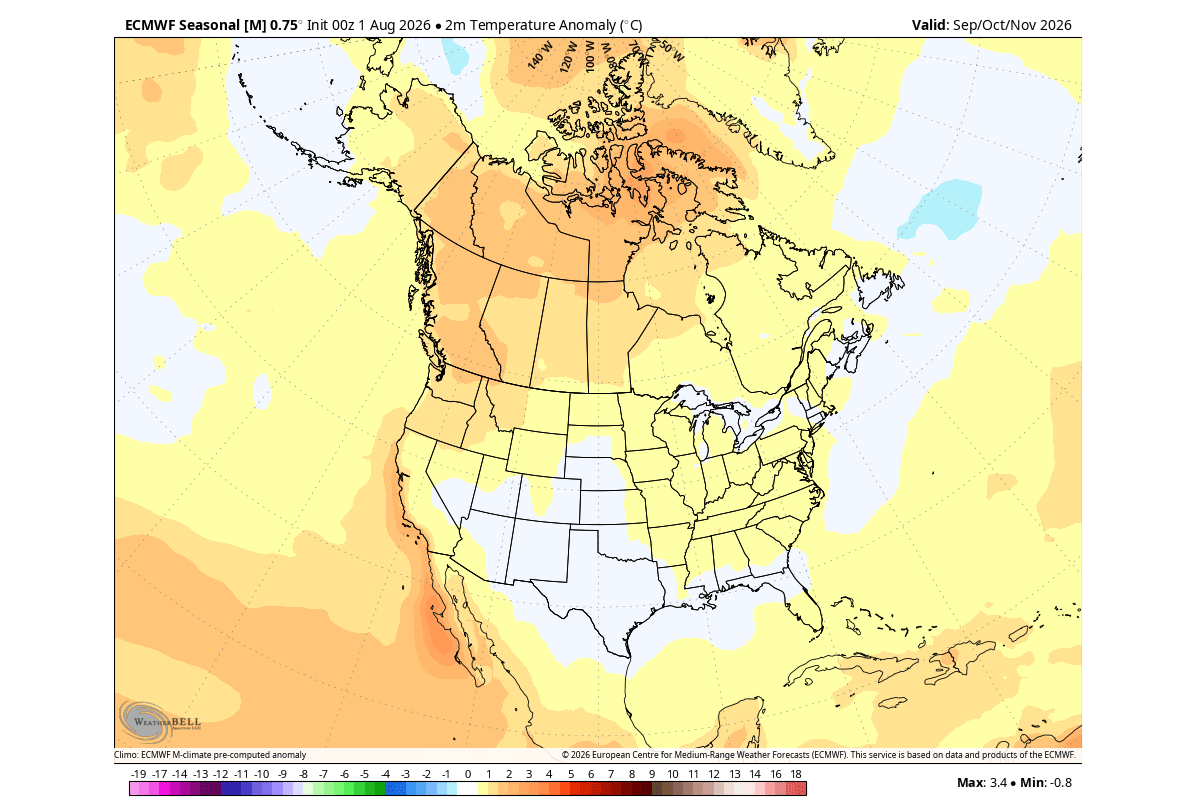
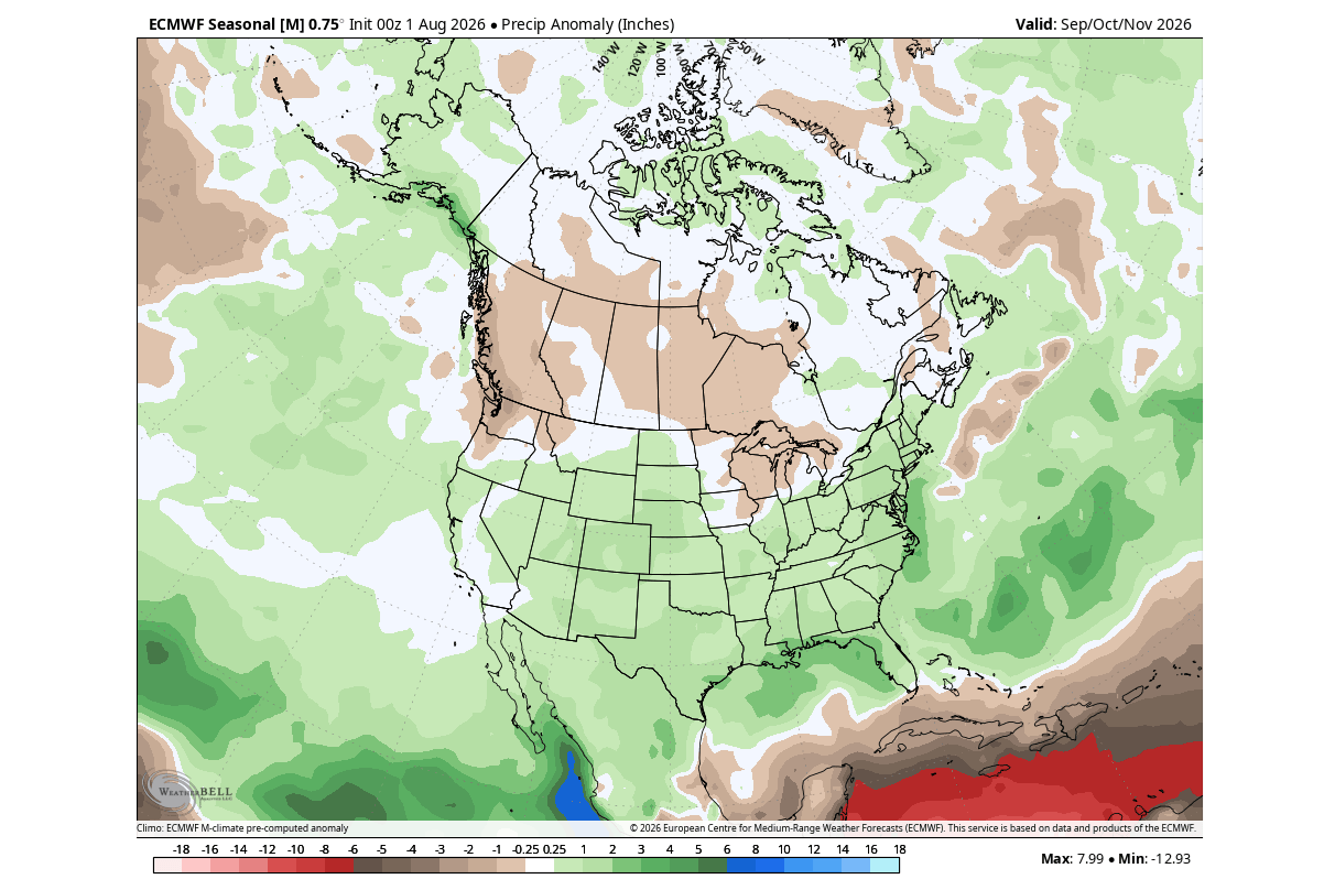
The latest model runs from both the ECMWF and the NOAA NMME display a high degree of convergence regarding temperature and precipitation distributions across North America and Europe.
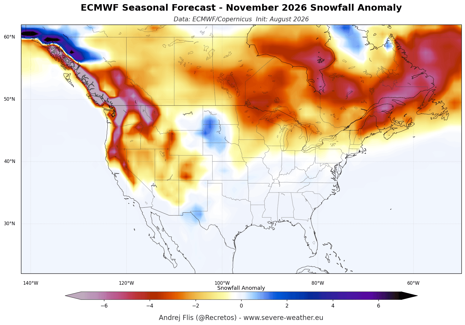
- North American Temperatures: Above-normal temperatures are heavily favored across western and central Canada, as well as the northern tier of the United States. Conversely, near-normal to slightly below-normal temperature anomalies are projected for the U.S. West Coast and the Southeast, buffered by persistent cloud cover and storm activity along the southern jet stream.
- North American Precipitation: A classic El Niño signature is stamped across the United States. The southern and southeastern states face a wetter-than-average fall and winter, marked by frequent moisture surges from the Pacific. Meanwhile, the Pacific Northwest and parts of southern Canada are projected to experience drier-than-average conditions due to Canadian high-pressure ridging.
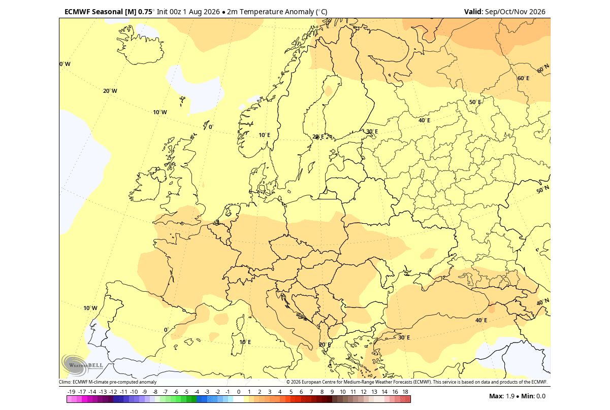
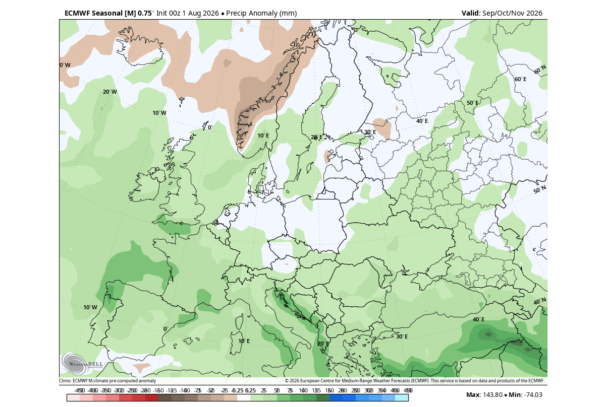
- European Surface Patterns: Driven by a prominent North Atlantic low-pressure system, Europe is leaning toward a mild, westerly-dominated regime. Central, western, and southeastern Europe face above-normal surface temperatures and increased precipitation potential as moist oceanic air sweeps inland. Snowfall accumulations for November are expected to remain below average across lower elevations, though higher mountain ranges—such as the western Alps—retain sufficient cold air to support early-season snowpack development.
Historical Analogs and El Niño Typology
Because no two El Niño events are identical, forecasters rely on historical analogs from the most recent comparable events—specifically the strong Eastern Pacific configurations of past decades. Research demonstrates that EP-based events exert a stronger influence on North Pacific pressure gradients, pulling moisture directly into the southern U.S. and altering storm tracks across the Atlantic basin.
The 2026/2027 setup departs from standard analogs simply by virtue of its accelerated intensity, forcing climate researchers to evaluate real-time data against theoretical upper limits of El Niño dynamics.
Implications for Winter 2026/2027 and the Polar Vortex
The Mid-Winter Pattern: Blocking and Split-Flow
As the season progresses from December into February, long-range CFSv2 and ECMWF projections indicate a major amplification of the existing pattern. A persistent mid-level high-pressure blocking anomaly over Canada will continue to function as a meteorological boulder, splitting the jet stream.
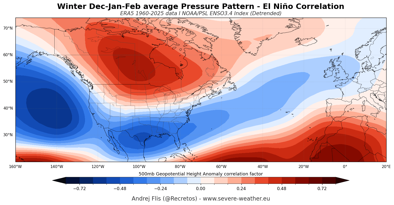
While Canada and the high-latitude U.S. experience a milder winter, the southern, central, and eastern United States lie in the crosshairs of a supercharged subtropical jet. This configuration does not inherently guarantee uniform, widespread cold outbreaks, but it dramatically increases the frequency of moisture-rich storm systems, high temperature contrasts, and severe weather risks across the southern half of the country.
Stratospheric Coupling and the Polar Vortex Risk
One of the most consequential developments of the upcoming winter is the interplay between the Super El Niño and the Polar Vortex. The Polar Vortex, a vast cyclonic circulation spanning the troposphere and stratosphere up to 50 kilometers (31 miles) in altitude, dictates the containment of arctic air.
Scientific literature confirms that El Niño winters carry an elevated statistical tendency toward Sudden Stratospheric Warming (SSW) events and severe Polar Vortex disruptions. The intense planetary-scale waves generated by tropospheric heating over the North Pacific and North America propagate vertically into the stratosphere, hammering the edges of the Polar Vortex and decelerating its zonal winds.
Latest stratospheric outlooks from both the ECMWF and the UK Meteorological Office (UKMO) highlight an unusual deceleration of stratospheric winds slated for late December and January. If this forecasted slowdown materializes, it significantly increases the risk of a major Polar Vortex disruption or partial collapse.
While a weakened Polar Vortex does not guarantee immediate, sustained cold for every region, it removes the stratospheric barrier that locks frigid arctic air in place. When the vortex buckles, paths open for dramatic, disruptive cold-air outbreaks to spill out of the high latitudes into mid-latitude population centers across North America and Eurasia during the heart of winter.
Official Responses and Outlook Summary
Meteorological agencies worldwide continue to monitor the rapid evolution of the tropical Pacific. The official NOAA CPC outlook maintains high confidence in the sustained intensity of the event, with multi-model ensembles confirming that the global climate system is locked into a high-amplitude Super El Niño regime.
Forecasters advise communities, agricultural sectors, and emergency management agencies in vulnerable regions—particularly across the southern United States, where heavy moisture and storm risks are elevated—to prepare for an active cold season. As the transition into Winter 2026/2027 unfolds, scientists will closely track stratospheric wind profiles and pressure anomalies to gauge the exact timing and severity of potential Polar Vortex disruptions.
