

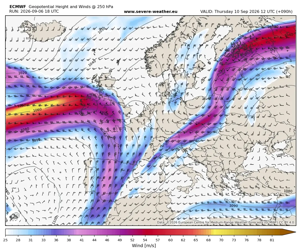
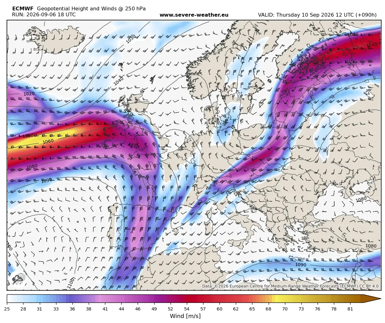
EUROPE — A dramatic meteorological shift is violently overhauling the European continent, bringing a definitive and abrupt halt to the prolonged, oppressive early-September Heat Dome. Driven by a powerful upper-level trough surging out of the North Atlantic, a potent surface cold front is plowing across Western and Central Europe.
The boundary is crashing directly into the extreme, record-warm air mass that has stagnated over the region for weeks. This volatile atmospheric collision is triggering a widespread, multi-day severe weather outbreak stretching from the towering peaks of the Alps down into the Western Balkans. Behind this high-impact front, an unseasonably cold, polar-origin air mass is rapidly overspreading the continent, promising a staggering thermal collapse and the season’s first significant high-altitude snowfall.

Main Facts: The Anatomy of a Meteorological Reversal
The transition, which began taking shape earlier in the week, marks the textbook execution of a classic "summer-killer" pattern—a meteorological event where intense, prolonged summer heat is forcefully flushed out by a much colder, dynamic air mass, flipping the continental weather regime from stagnant warmth to crisp, volatile autumn conditions.
- The Trigger: A deep upper-level trough emerging from the North Atlantic and pushing eastward across Western and Central Europe.
- The Thermal Collapse: Daytime highs that recently hovered between 35°C and 40°C are plunging by 15°C to 20°C in less than 24 hours behind the front.
- The Hazards: The volatile boundary is producing a severe weather outbreak characterized by giant hail, damaging straight-line winds, torrential downpours leading to flash floods, and a localized threat of tornadoes.
- Geographic Scope: The hardest-hit regions include Eastern France, Switzerland, the Balearic Islands, Northern Italy, Austria, Slovenia, Croatia, and portions of the Western Balkans.
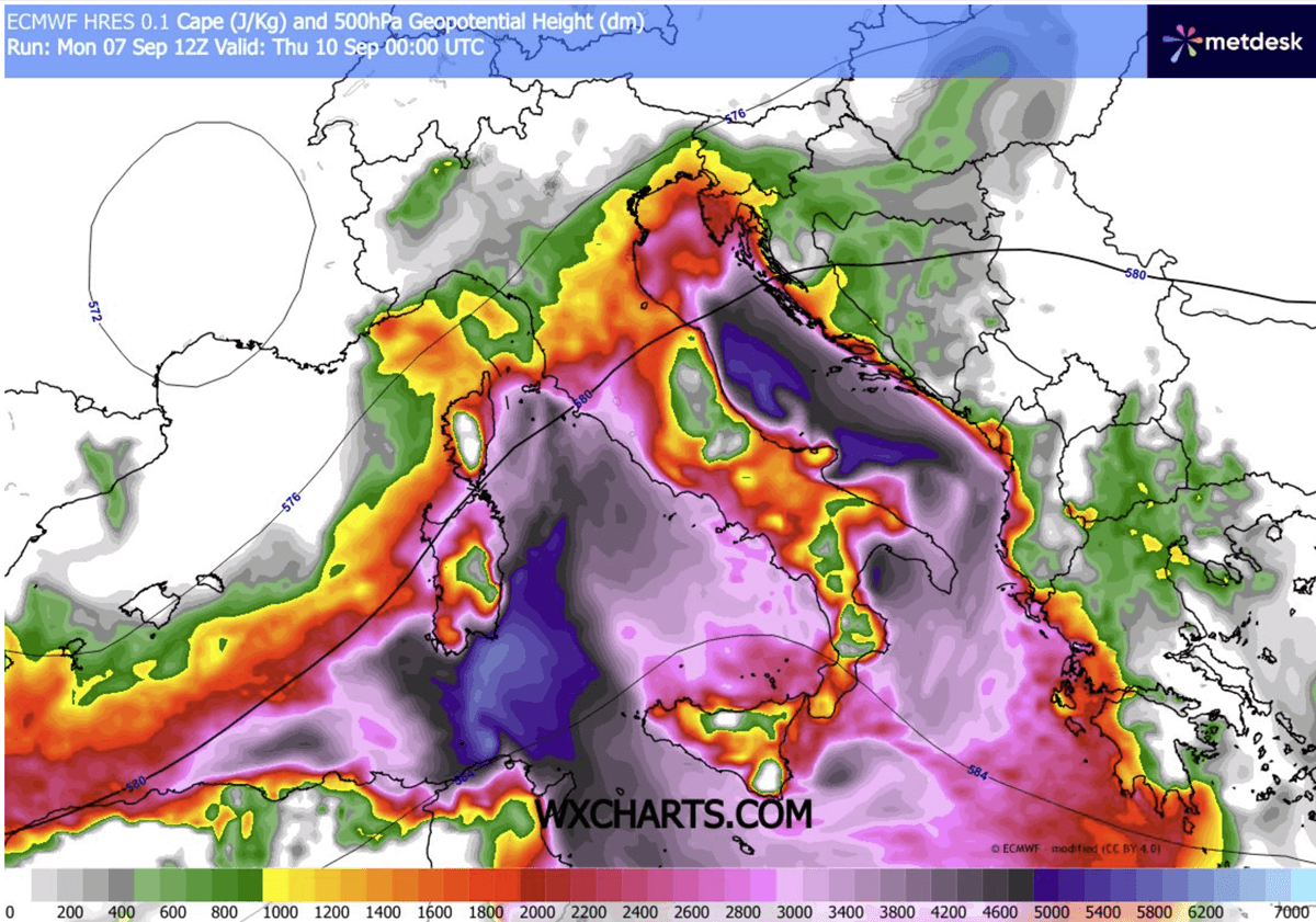
- Marine Fuel: Unprecedented moisture levels, stoked by an ongoing historic marine heatwave across the Mediterranean Sea, are interacting with extreme atmospheric instability (CAPE values exceeding 3,000–4,000 J/kg) to supercharge convective storms.
Chronology: How the Event Unfolds
The progression of this major weather pattern change follows a rapid, multi-stage timeline spanning from early-week destabilization through to weekend cooling.
Monday Night to Tuesday: Frontal Approach and Ridge Breakdown
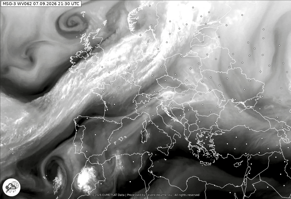
The atmospheric machinery began shifting late Monday when the leading edge of the frontal boundary was analyzed tracking across Western Europe, stretching from a deep low-pressure system over Scandinavia down toward the Azores. The high-amplitude ridge that maintained the early-September Heat Dome began to buckle under intense upper-level forcing.
By Tuesday, the primary upper-level wave emerged into Western Europe, initiating the displacement of the warmest air masses toward Eastern Europe and western Russia, where the final gasps of the heatwave will linger until Friday.
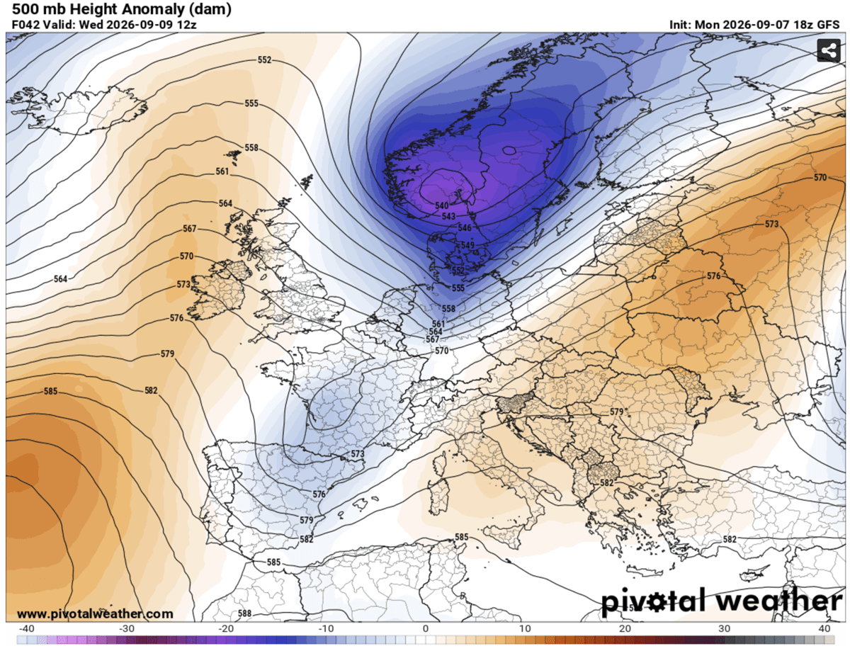
Wednesday: The Outbreak Begins in the West and Alps
By Wednesday midday, the high-pressure differential and the sharp temperature gradient dramatically amplified the jet stream, driving strong wind shear across the warm sector of the advancing cold front.
Violent severe storms erupted initially around the Balearic Islands before marching aggressively into Eastern France, Switzerland, and Northern Italy. A secondary low-pressure system began to pinch off over the Northern Mediterranean, causing the frontal system to slow down and intensify over the Alpine foothills and the North Adriatic Sea.
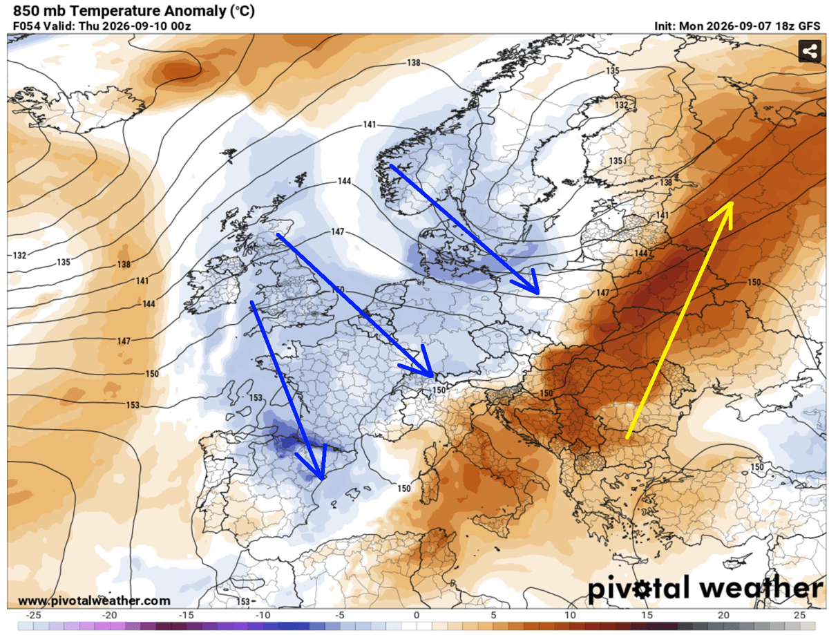
Thursday: Expansion into the Balkans and Flash Flood Peak
As the system progresses into Thursday, the focus of the severe weather shifts east-southeast. The front pushes firmly into Austria, Slovenia, Croatia, and the Western Balkans.
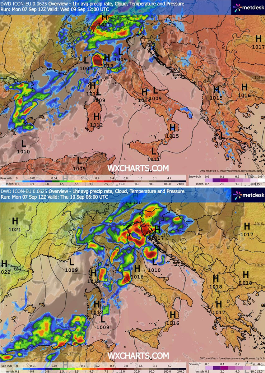
Because the secondary low forces the front to slow down over local geographical convergences, a "training-cell" effect is taking hold. Storms are repeatedly moving over the same saturated regions, particularly along Liguria Bay, the North Adriatic, and the Tuscan coast. Rainfall totals are projected to locally reach 150 to 200 mm within a 48-hour window, drastically heightening the risk of life-threatening flash floods and mudslides.
Friday into the Weekend: Polar Air and Alpine Snow
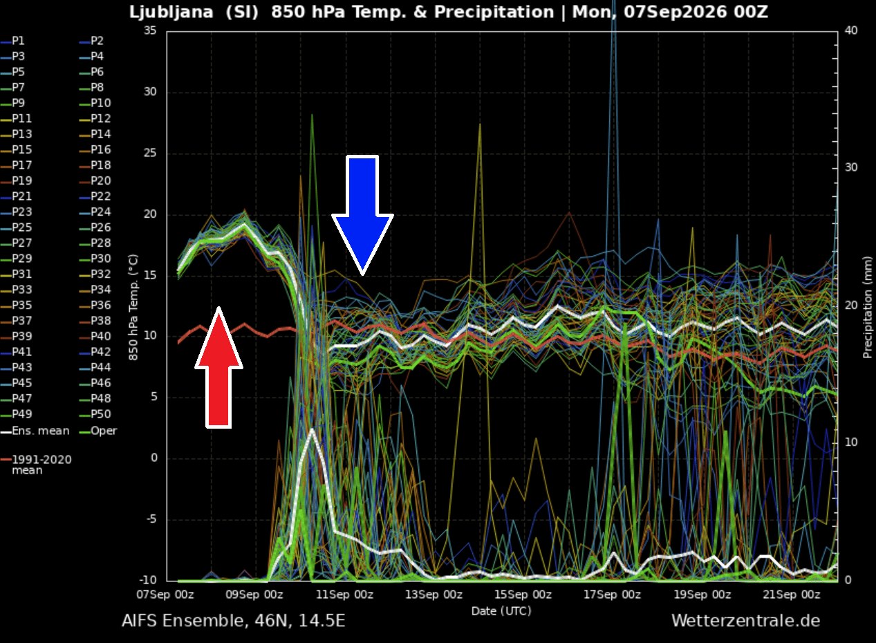
By Friday, the core of the cold air mass overspreads Central Europe. Meteogram data for cities like Ljubljana, Slovenia, illustrate the vertical drop: 850 mbar temperatures tumbling by roughly 15°C in a 24-hour period.
As freezing levels plummet, the high elevations of the Alps will transition from torrential rain to the season’s first heavy snowfall. Continental winds will lower snow lines across high-mountain passes, leaving a distinctively crisp, autumn-like atmosphere in place as the weekend arrives.
Supporting Data and Synoptic Diagnostics
Meteorological models—including runs from key forecasting platforms such as PivotalWeather and WXcharts—highlight the extreme nature of this transition.
- Temperature Anomalies: At standard 850 mbar levels, temperatures at the start of the week were tracking roughly 10°C above long-term climatological normals (around 18°C to 20°C). The incoming polar air mass wipes out these anomalies, plunging values well below seasonal averages.
- Instability Parameters: Convective Available Potential Energy (CAPE) values surging past 3,000 to 4,000 J/kg, combined with high dewpoints and strong vertical wind shear, have provided an ideal environment for organized supercells. These parameters explain the severe threat of large to giant hail and destructive wind gusts.
- Precipitation Projections: Coastal and mountainous convergence zones in the Northern Mediterranean are bearing the brunt of the moisture-laden fetch, with hydrological models flagging severe runoff risks where 4-to-8 inches of rain are forecast to fall in rapid succession.
Official Responses and Civil Protection Alerts
With high-impact weather hazards targeting heavily populated and tourist-dense regions across the Mediterranean and Alpine corridors, civil protection agencies across multiple nations have issued high-level warnings.
- Italy: The Department of Civil Protection has issued orange and red alerts for several northern regions, including Lombardy, Veneto, and Liguria, warning residents and local municipalities of potential urban flooding, rockfalls, and severe wind damage to infrastructure.
- Switzerland and Austria: Mountain authorities have issued advisories for hikers and mountaineers, strongly urging the postponement of high-altitude excursions as rapid snow accumulation and sub-zero wind chills threaten exposed routes in the Alps.
- Slovenia and Croatia: Meteorological services (like DHMZ and ARSO) have highlighted the danger of sudden flash floods along small streams and urban drainages, advising drivers to avoid flooded underpasses and coastal roadways prone to storm surges.
Implications: A Permanent End to Summer?
The destruction of the early-September Heat Dome carries wide-ranging implications for the European continent, signaling both immediate relief and long-term seasonal shifts.
Agricultural and Hydrological Relief
While the severe storms pose an immediate threat of wind and hail damage to late-season crops, the widespread rainfall is providing much-needed relief to drought-stressed soils across parts of Central Europe and the Mediterranean basin, which have suffered through months of compounding heatwaves and dry conditions. However, the intensity of the rainfall risks causing localized agricultural washout and flash erosion.
Energy and Infrastructure
The abrupt drop in temperatures will instantly curtail the massive energy demands driven by continuous air conditioning usage during the Heat Dome. Power grids will experience a swift transition load, though authorities remain vigilant regarding potential localized power outages caused by straight-line thunderstorm winds and falling tree branches.
The Broader Seasonal Outlook
This aggressive pattern change serves as the definitive punctuation mark on the summer of 2026 across Western and Central Europe. Long-range meteorological trends suggest that the atmosphere has entered a much more dynamic, progressive regime. As mid-September approaches, forecasters anticipate that subsequent systems will continue to sweep in from the Atlantic, locking in autumn conditions and shifting the focus of long-range modeling toward the impending transition into late-year weather patterns.
