

As autumn deepens across the Northern Hemisphere, meteorologists and atmospheric scientists are closely tracking the early formation of the seasonal Polar Vortex. While current data indicates that the vortex is organizing rapidly with significant stratospheric cooling, long-range forecasts point toward a dramatic mid-winter slowdown. Coupled with the development of a powerful Super El Niño in the tropical Pacific, the upcoming Winter 2026/2027 season could feature high-impact disruptions, potentially reshaping weather patterns across the United States, Canada, and Europe.

Main Facts: The Anatomy of the 2026/2027 Polar Vortex
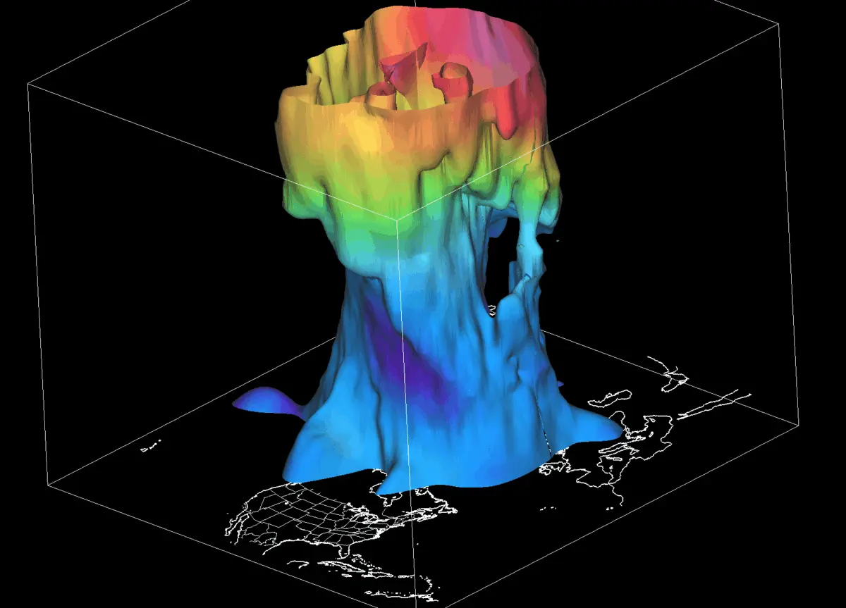
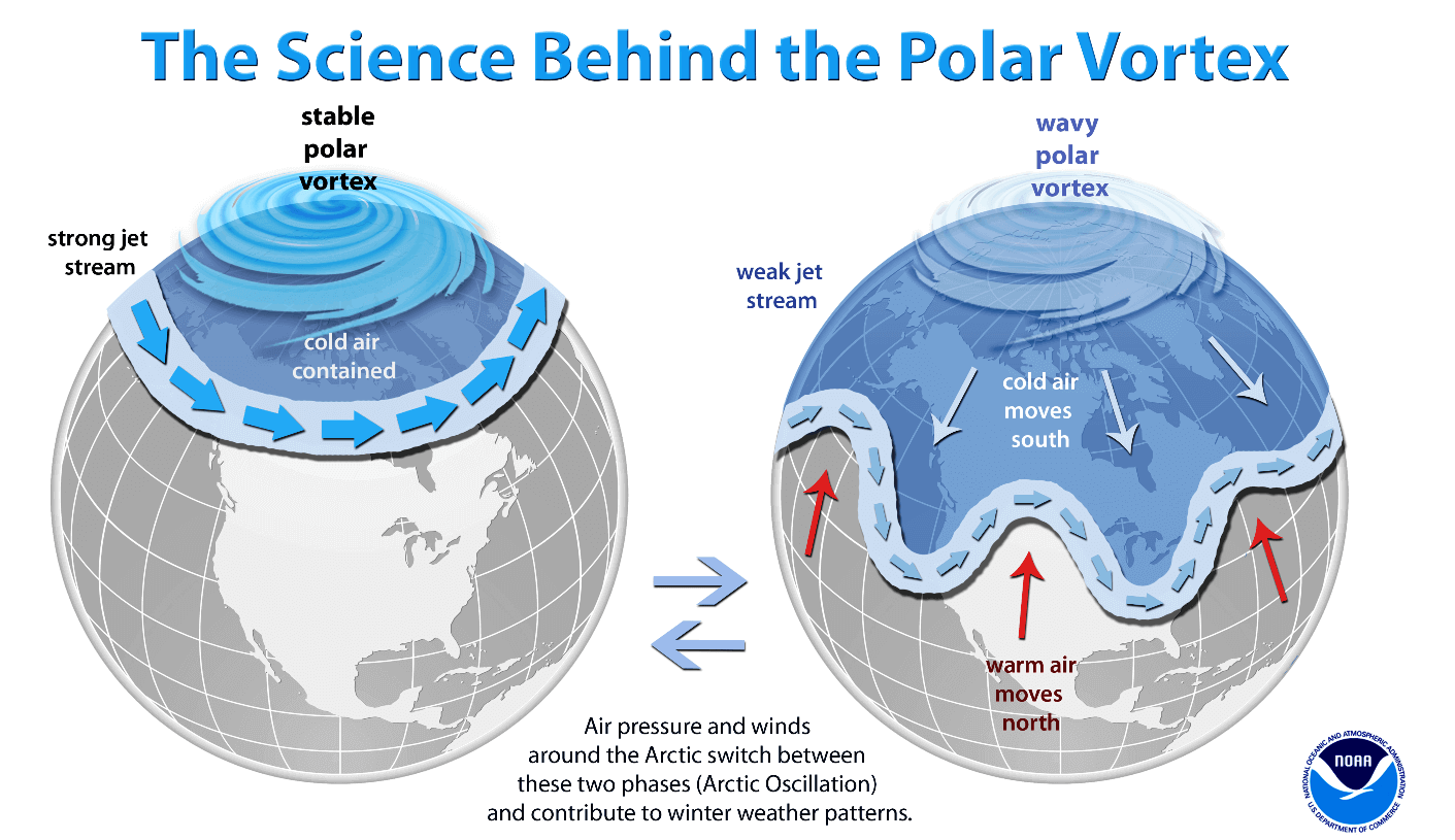
The Polar Vortex is the massive, spinning pool of bitterly cold air that hovers over the polar regions, extending from the Earth’s surface high up into the stratosphere—more than 50 kilometers (30 miles) above the ground. It acts as an atmospheric barrier, trapping frigid Arctic air inside the polar circle.
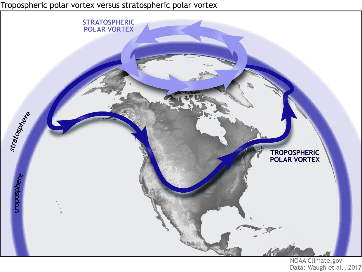
The vortex operates across two distinct layers:
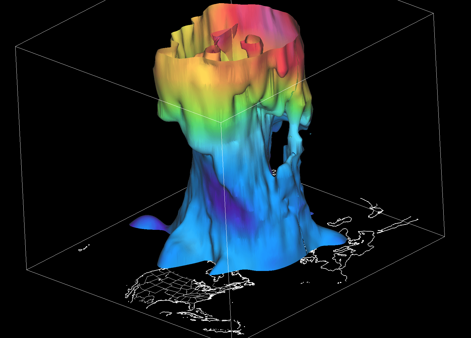
- The Stratosphere (Upper Layer): Symmetrical, highly stable, and driven by high-altitude winds.
- The Troposphere (Lower Layer): Highly distorted and "wobbly," shaped by continental terrain, mountain ranges, and large pressure systems.
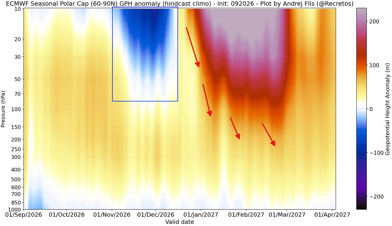
For the upcoming Winter 2026/2027, early data shows a robust formation phase. Rapid stratospheric cooling and significant pressure drops over the North Pole in late summer and early autumn have allowed the upper vortex to establish a strong, well-defined cyclonic core. However, seasonal models suggest this strength is temporary, pointing toward a significant mid-winter deceleration that could open the door to severe Arctic outbreaks.
Chronology: From Autumn Establishment to Mid-Winter Disruption
Understanding how the Polar Vortex evolves requires tracing its lifecycle from the initial freeze in late summer to potential breakdown events in the dead of winter.
Phase 1: Late Summer and Autumn Formation (August – October)
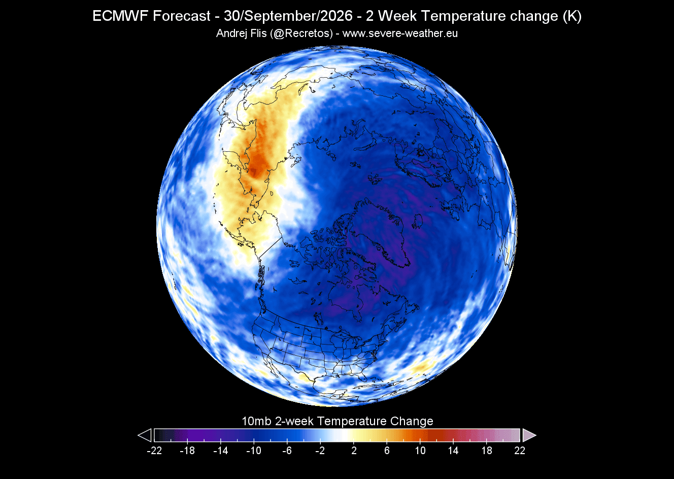
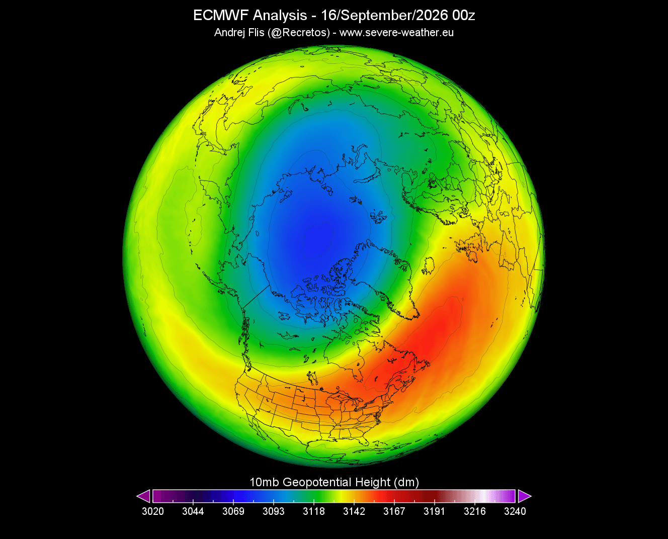
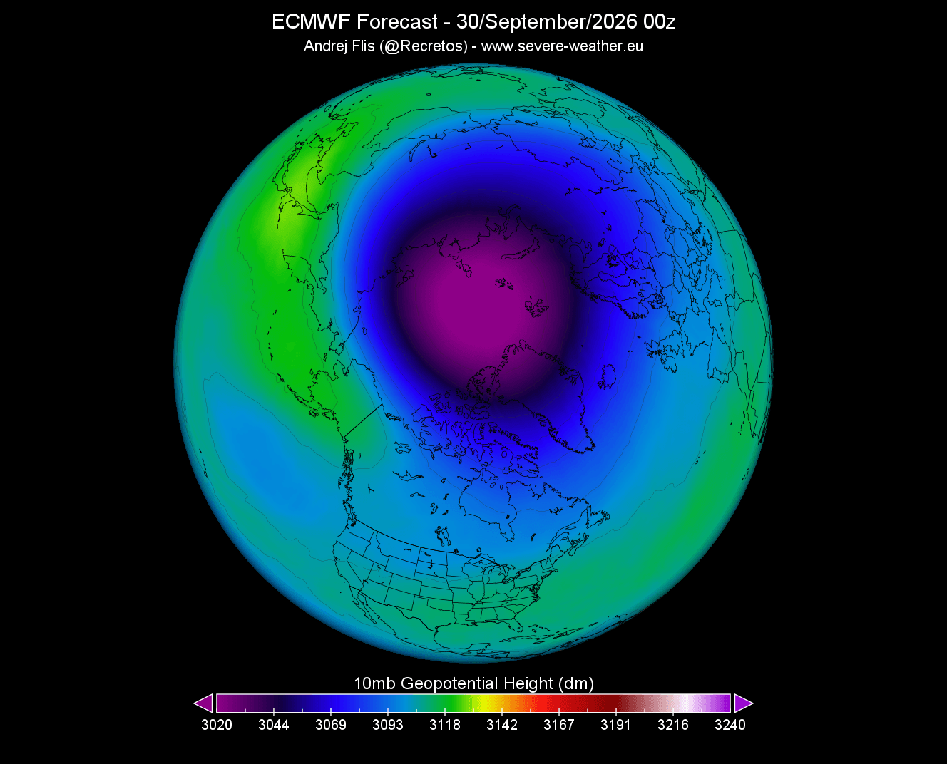
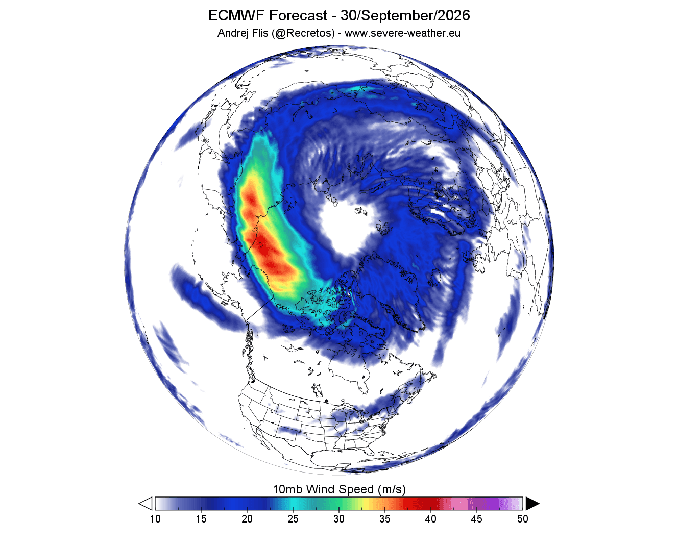
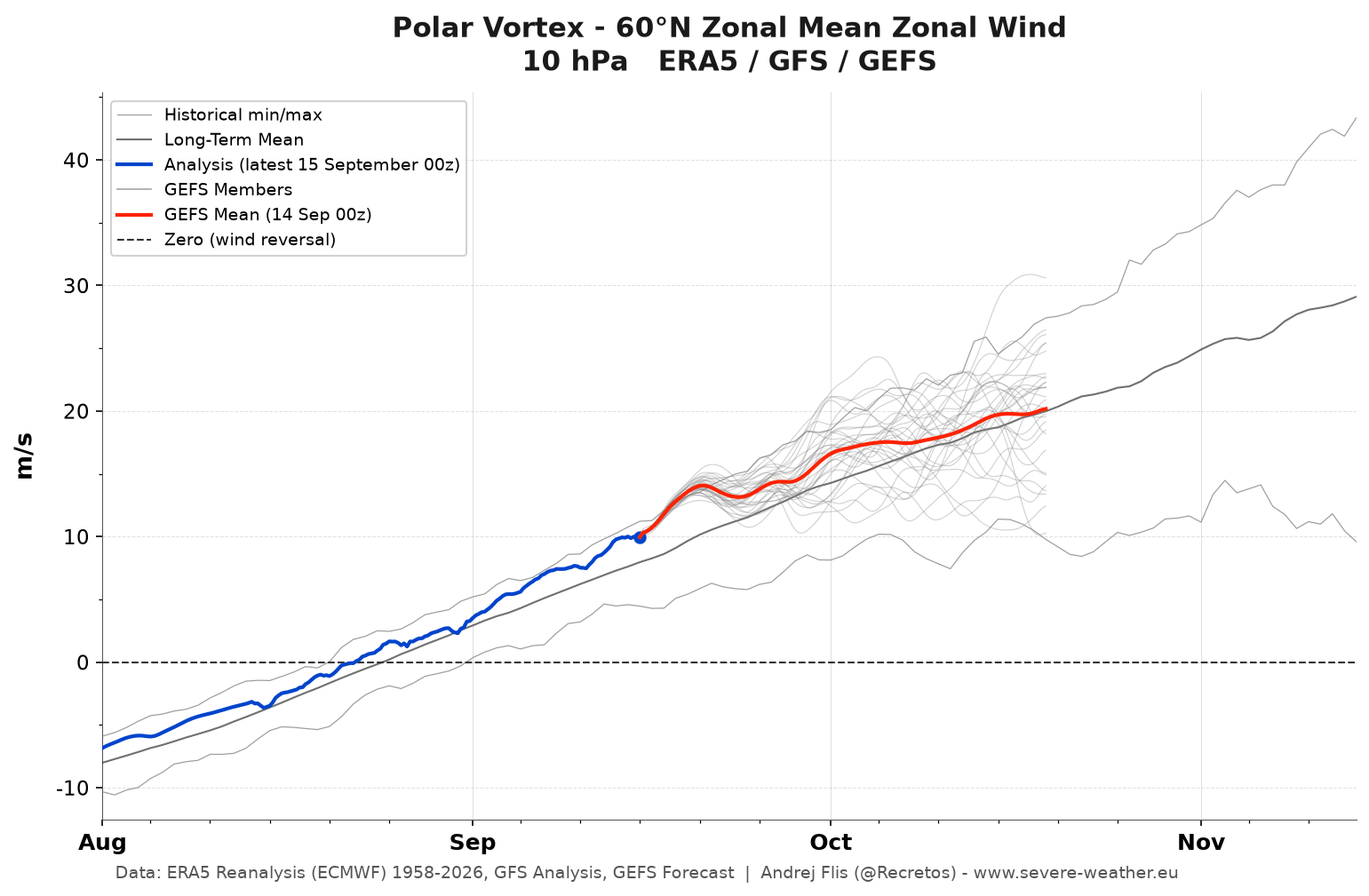
The seasonal cycle of the Polar Vortex begins in August as solar radiation diminishes over the Arctic. The resulting temperature gradient between the freezing pole and the warmer mid-latitudes causes atmospheric pressure to plunge. By late September, a massive low-pressure core forms in the mid-stratosphere, accompanied by a circular, high-speed wind stream known as the stratospheric night jet. Current 2026 model runs show the vortex organizing faster and stronger than it did at the same point last year.
Phase 2: Early Winter Stability (November – December)
As winter officially begins, the vortex typically maintains a strong, stable mode. A robust Polar Vortex tightens the polar jet stream, effectively locking the core freeze inside the Arctic and resulting in milder, more tranquil early-winter conditions across large portions of the United States and Europe.
Phase 3: Mid-Winter Deceleration and Disruption Signals (January – February 2027)
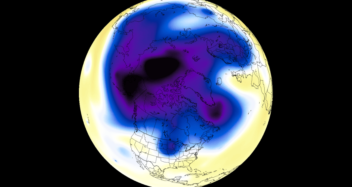
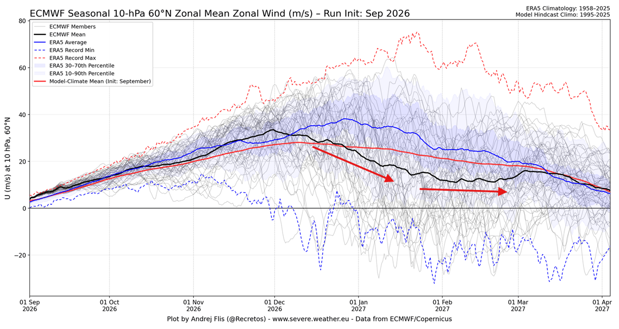
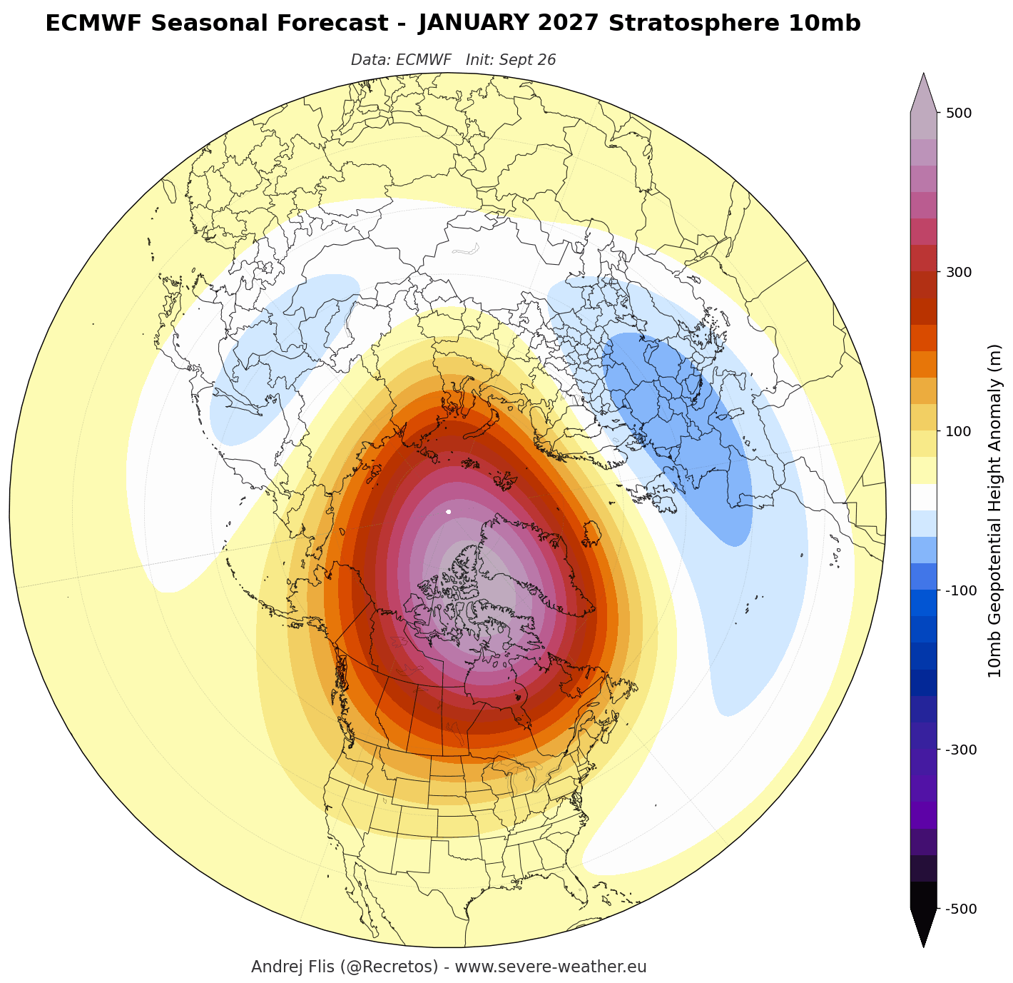
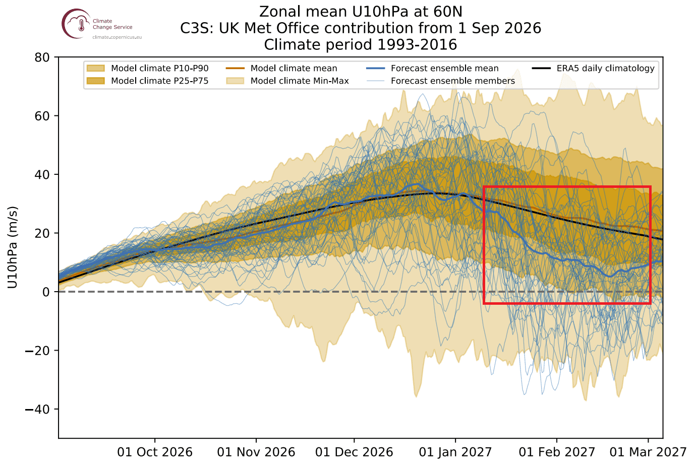
According to consensus seasonal data from premier forecasting centers like the ECMWF (European Centre for Medium-Range Weather Forecasts) and the UK Met Office (UKMO), the stability of the vortex is expected to break down sharply by January 2027. Stratospheric wind forecasts indicate a profound deceleration, dropping well below historical baselines. This sets the stage for a potential Sudden Stratospheric Warming (SSW) event or a major structural collapse, which historically triggers intense winter weather anomalies in the lower atmosphere.
Supporting Data and Atmospheric Mechanics
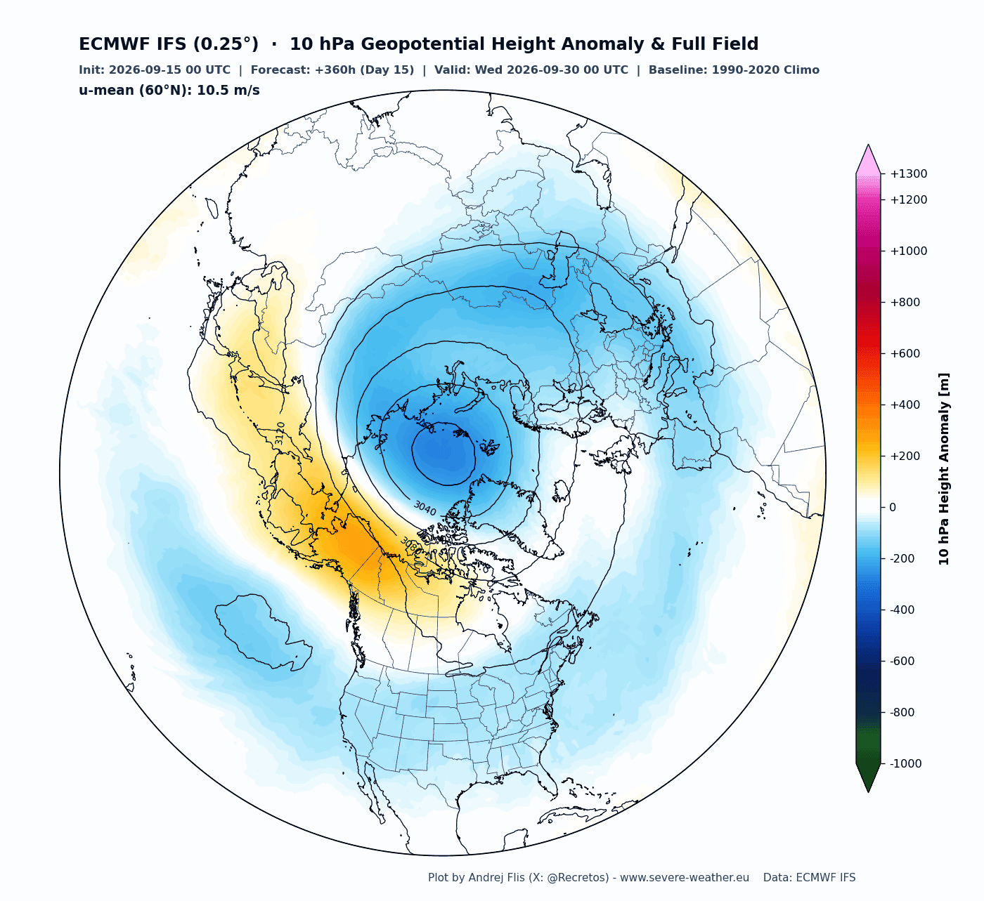
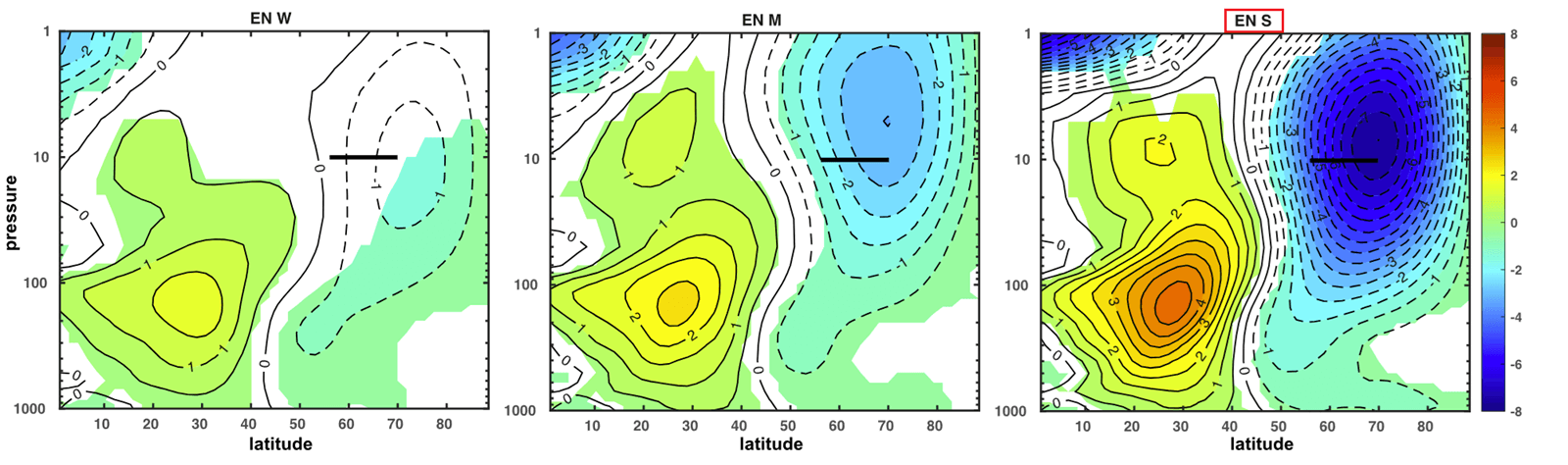
Meteorologists monitor the health and stability of the Polar Vortex by tracking zonal wind speeds and geopotential height anomalies at the 10-millibar (hPa) level, roughly 30 kilometers high.
The Super El Niño Connection
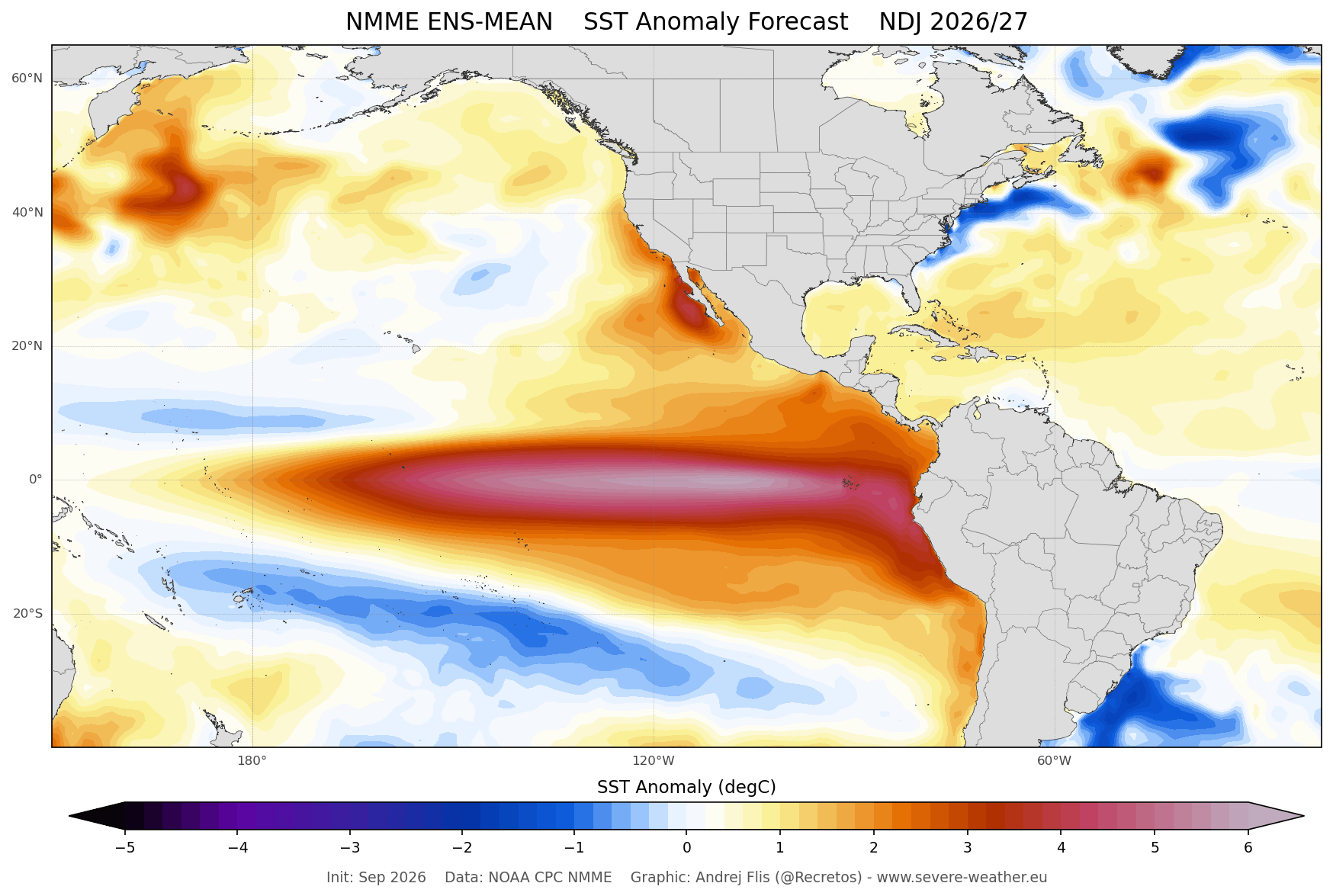
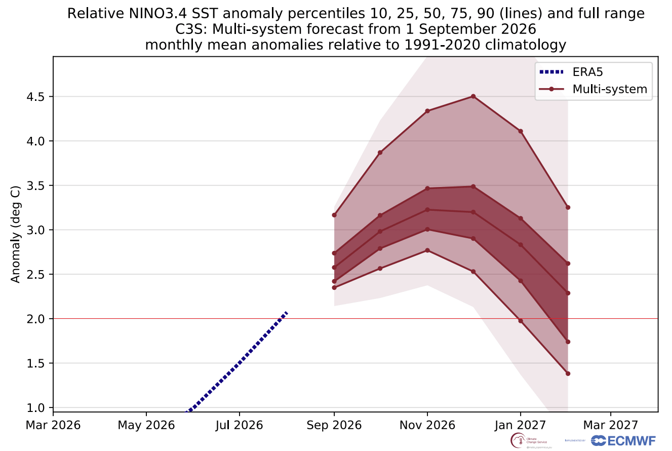
A critical wildcard in the Winter 2026/2027 forecast is the ongoing development of a Super El Niño in the tropical Pacific. Multi-model ensembles—including the National Multi-Model Ensemble (NMME) and Copernicus data—project tropical Pacific sea surface temperatures to peak at more than 2 degrees Celsius above normal, classifying it as one of the strongest El Niño events in decades.
Extensive climate research demonstrates a strong statistical link between intense El Niño events and stratospheric deceleration. During a Super El Niño, specific planetary-scale pressure waves—characterized by low pressure over the North Pacific and high pressure near Greenland and northern Canada—propagate vertically into the stratosphere. This wave energy acts as a battering ram against the Polar Vortex, destabilizing its circulation and drastically increasing the probability of a mid-winter breakdown.
Understanding Sudden Stratospheric Warming (SSW)
When wave energy overwhelms the vortex, it can trigger an SSW event. During an SSW, temperatures in the stratosphere can skyrocket by tens of degrees Celsius within days, and the stratospheric winds can completely reverse from westerly to easterly.
Depending on the nature of the event, SSW disruptions generally manifest in two ways:
- Displacement Events: The vortex is pushed off-center, leading to a gradual or localized shift in weather patterns.
- Split Events: The vortex splits into two or more distinct cores. These events often produce faster, more persistent downward impacts on surface weather.
Historically, data compiled across dozens of major SSW events shows that within 10 to 30 days of a stratospheric collapse, high-pressure blocking patterns force frigid Arctic air southward into the mid-latitudes.
Official Insights and Historical Parallels
Forecasters look to past analog years to gauge what a weakened Polar Vortex coupled with a Super El Niño means for populated regions.
A striking historical parallel occurred during the Winter of 2015/2016, which also featured a historic Super El Niño. That season experienced significant stratospheric disruptions and stretched vortex configurations that sent severe cold-air outbreaks plunging deep into the central and eastern United States, alongside impactful winter storms in Canada and Europe. Similarly, disruptions observed in January 2026 compressed the vortex and funneled the "Polar Express" pattern directly into North America and north-central Europe.
Atmospheric researchers emphasize that even when a full, textbook SSW wind reversal does not officially occur, partial structural disruptions—such as vortex stretching or elongation—are more than sufficient to displace freezing air masses toward heavily populated regions.
Implications for Winter Weather: US, Canada, and Europe
The ultimate downstream effect of a disrupted Polar Vortex is felt at the surface, where altered jet stream configurations dictate daily weather.
- United States: A weakened or displaced vortex increases the likelihood of high-impact Arctic outbreaks, bringing sustained sub-freezing temperatures, heavy snowfall, and ice storms to the central, eastern, and northern states. Conversely, western regions may experience milder, drier conditions typical of strong El Niño regimes.
- Canada: Regions across southern and central Canada frequently experience enhanced winter storm tracks and persistent cold anomalies when the vortex stretches southward, tapping directly into polar air reserves.
- Europe: A destabilized polar circulation often breaks down the mild westerly Atlantic winds, allowing blocking high-pressure systems to form over the North Atlantic. This frequently exposes northern and central Europe to severe cold snaps and late-season snow events.
Conclusion and Outlook
As meteorological agencies continue to process real-time observations through the autumn transition, all eyes remain fixed on the stratosphere. While the Polar Vortex currently exhibits a healthy, vigorous start, the convergence of long-range stratospheric deceleration signals and a powerful Super El Niño points toward a volatile mid-winter season. If these trends hold, residents across the United States, Canada, and Europe should prepare for a potentially stormy and sharply colder second half of Winter 2026/2027.
