

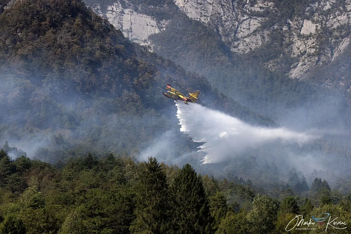
TOLMEZZO, ITALY — After ten days of relentless burning, a fierce mountain wildfire that scorched more than 600 hectares across the rugged peaks of Monte Amariana and Monte Amarianute has finally been brought under control. Delivering one of the most severe Alpine forest fire emergencies experienced in Italy’s Friuli-Venezia Giulia region this summer, the blaze pushed emergency responders to their absolute limits.
Threatening residential neighborhoods, triggering urgent evacuations, and closing down vital regional infrastructure, the historic fire was ultimately neutralized by a combination of a massive international aerial task force, tireless ground operations, and a timely, drought-breaking meteorological shift that brought life-saving rainfall to the Tagliamento valley.

Main Facts: Anatomy of an Alpine Catastrophe
The Monte Amariana wildfire will be remembered as a defining test of modern emergency coordination in complex, high-altitude terrain. Sparked during the peak of an oppressive European heatwave, the fire consumed over 600 hectares of pristine forest, precipitous slopes, and fragile ecosystems within the Eastern Tolmezzo Alps of the Carnia region.
- Geographic Scope: The fire zone spanned the pyramid-shaped limestone peak of Monte Amariana (1,905 meters above sea level), its steep spur Cuel Feltron above Amaro, and the adjacent ridge of Monte Amarianute.
- Human Impact: As the flames aggressively pushed down the mountain, coming within a harrowing 50 meters of residential properties, civil protection authorities ordered emergency evacuations in the vulnerable hamlet of Pissebus, on the outer edges of Tolmezzo.
- Operational Scale: A multi-national aerial armada—including Italian Canadairs, regional helicopters, and specialized Slovenian Air Tractor water bombers—executed hundreds of precision water drops. They worked in tandem with ground teams from the Corpo Forestale Regionale and the Vigili del Fuoco (Fire Department).
- Resolution: The active flame fronts were suppressed following relentless aerial and ground interventions, while air quality in the Tagliamento valley slowly recovered. The final extinction was secured by a powerful atmospheric frontal system that delivered over 100 to nearly 200 millimeters of rainfall across the broader Friuli-Venezia Giulia region within a 72-hour window.
Chronology of the Crisis: From Spark to Deluge
Phase 1: Ignition and the Heat Dome (Early August)
The crisis began in early August 2026, when a persistent and punishing "heat dome" settled over Western and Central Europe, driving temperatures well above seasonal averages and baking the vegetation of northeastern Italy into an ultra-dry tinderbox.
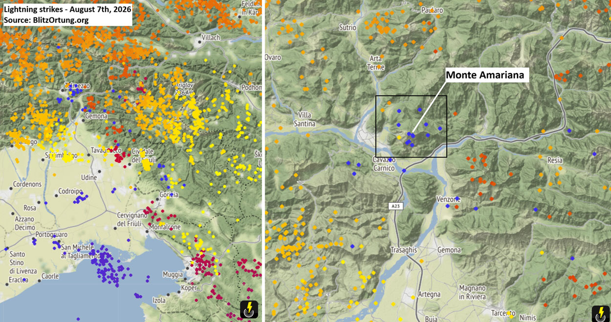
On August 7th, as a sharp atmospheric frontal wave swept through the region, a series of lightning strikes—tracked meticulously by Blitzortung lightning-detection networks—ignited the upper Cuel Feltron ridge, a steep, inaccessible slope towering above the town of Amaro.
Phase 2: The Ferragosto Explosion (August 15th)
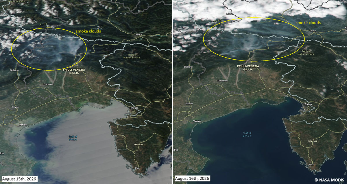
For over a week, the fire smoldered and crept across difficult upper elevations. However, the situation escalated into an explosive regional emergency on August 15th—Italy’s major national holiday, Ferragosto.
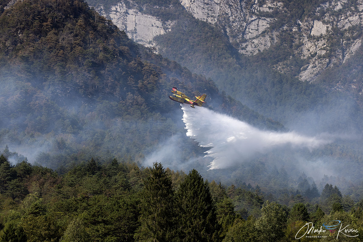
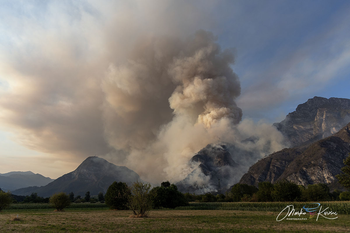
Sudden, gusty downslope winds roared across the Carnic Alps, fanning the embers and driving the fire across the Rio Confine ridge. The flames vaulted directly onto Monte Amarianute, sweeping aggressively toward the outer northern sectors of Tolmezzo, specifically targeting the Pissebus district and threatening the historic village of Illegio.
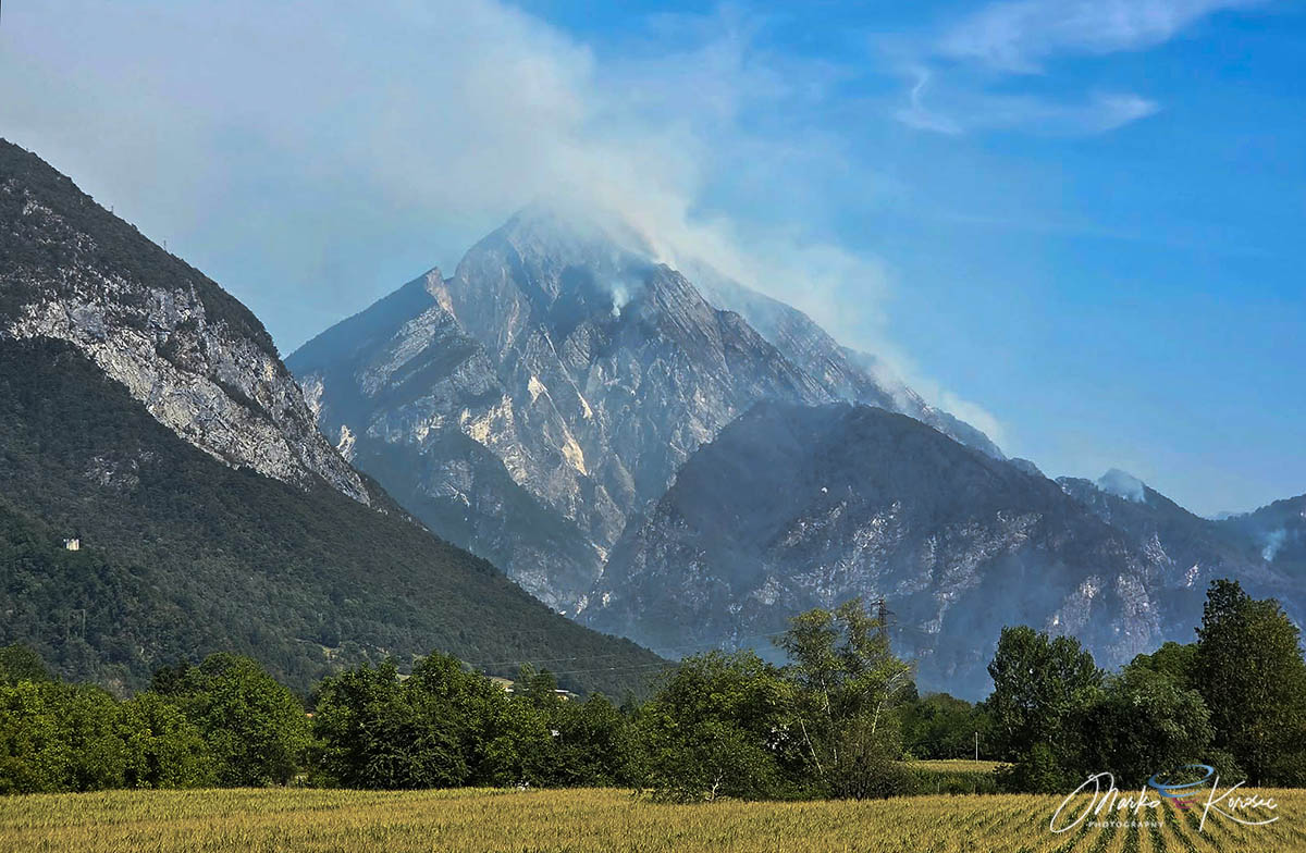
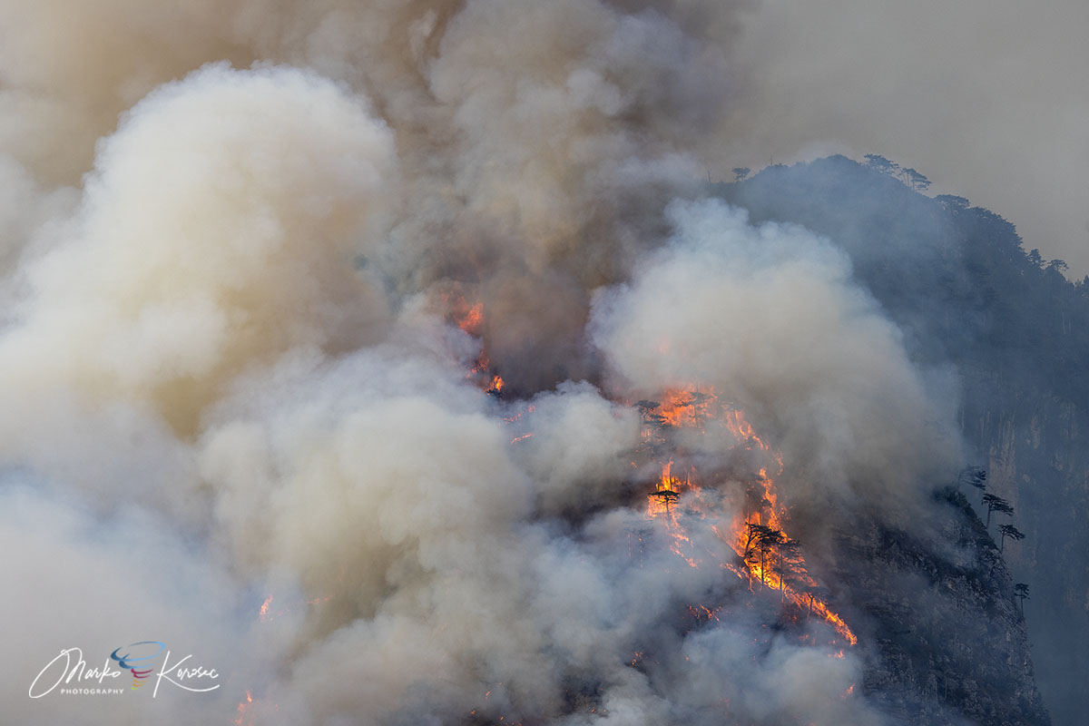
Because the mountain is characterized by sheer vertical limestone and karst cliffs, direct ground access to the upper fire lines was rendered virtually impossible. The canyon-like topography created a severe "chimney effect," sucking in oxygen and accelerating the flames upward through dense beds of dry pine needles (Pinus nigra) and thick brushwood. The fire’s intense thermal output grew so volatile that it generated towering pyrocumulus clouds—fire-induced thunderstorms—directly above the mountain summit.
Phase 3: The Turning Point and Final Extinction (Late August)
For days, firefighters fought a desperate holding action to keep the flames from reaching valley infrastructure. High- and medium-voltage power lines running through the operational zone were temporarily deactivated as a precautionary measure to prevent secondary electrical hazards.
The turning point arrived between August 20th and 22nd. A sweeping, moisture-laden Atlantic trough finally breached the European blocking pattern, bringing heavy, prolonged downpours to the entire Friuli-Venezia Giulia region. Accumulating between 150 mm and nearly 200 mm of rain in less than 72 hours, the heavy precipitation saturated the smoldering limestone crevices, completely extinguishing the last remaining active pockets of the Monte Amariana wildfire.
Supporting Data and Topographical Challenges
The severity of the Monte Amariana disaster cannot be understood without examining the unique topography and the climatological backdrop that set the stage for the disaster.
The Terrain
Monte Amariana rises sharply to 1,905 meters, acting as a prominent landmark in the Carnic Prealps. Its geology is defined by fractured limestone, vertical rock faces, and sparse soil layers that drain moisture rapidly. Combined with dense stands of Pinus nigra—whose resinous needles and low-hanging branches burn with explosive intensity—the mountain essentially functioned as an inclined fuel ladder.
Meteorological Context
The summer of 2026 was defined by extreme meteorological anomalies across Europe, characterized by recurring heat domes. Regional rainfall data for Tolmezzo and the wider Friuli-Venezia Giulia territory revealed a severe, multi-week precipitation deficit leading up to August. This cumulative drought left forest litter, shrubbery, and root systems critically dehydrated. When the dry lightning struck on August 7th, the landscape lacked any natural moisture buffer to slow the ignition’s spread.
Official Responses and Operational Deployment
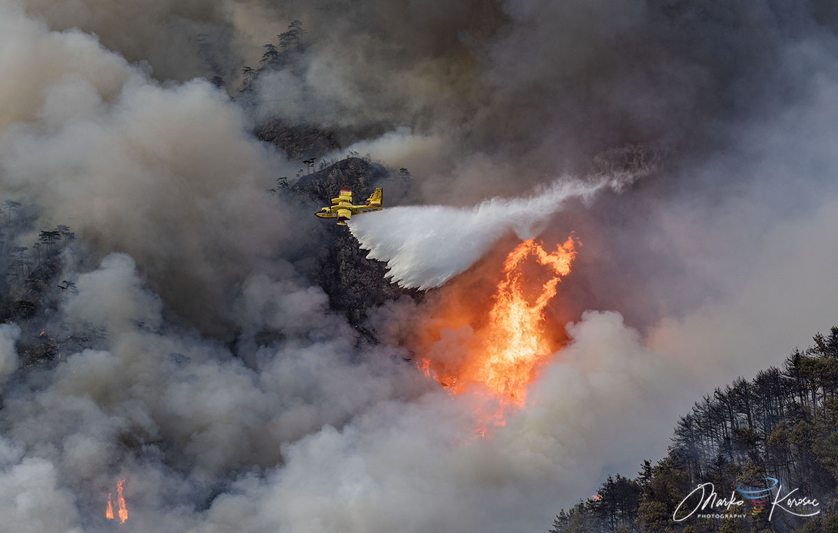
The containment and ultimate suppression of the Monte Amariana wildfire required an unprecedented level of international and inter-agency cooperation. Because ground crews could not safely scale the vertical limestone precipices of the upper ridge lines, emergency management relied heavily on a coordinated multi-tier aerial strategy.
- Aerial Task Force:
- Italian Canadairs: The backbone of the national fleet, executing continuous skimming runs to drop thousands of liters of water harvested from nearby lakes and marine reservoirs.
- Slovenian Air Tractors: Deployed as part of a crucial cross-border European civil protection agreement, these agile water bombers maneuvered deftly through narrow Alpine valleys to deliver targeted retardant and water payloads.
- Regional Helicopters: Utilized for rapid transport of specialized mountain-rescue firefighters, equipment hauling, and continuous tactical reconnaissance.
- Ground Operations:
- Personnel from the Corpo Forestale Regionale (Regional Forestry Corps) and the Vigili del Fuoco established defensive perimeters along the base of the mountain.
- Firefighters utilized portable high-pressure pumps, created strategic firebreaks, and wet down residential structures in Pissebus to protect civilians from advancing embers.
- Following the suppression of active flames, regional teams transitioned to advanced thermal-imaging drone monitoring to scan the blackened landscape for hidden subsurface hotspots capable of triggering a reignition.
Implications: Lessons from the Carnic Alps
The 10-day battle on Monte Amariana underscores a growing, alarming reality for mountainous regions across Southern and Central Europe. As climate anomalies intensify, traditional Alpine environments—historically accustomed to reliable summer precipitation and lower fire risks—are increasingly susceptible to extreme drought-driven wildfires.
The incident highlights several critical takeaways for emergency management in the years ahead:
- Cross-Border Cooperation is Vital: The seamless integration of Slovenian air assets alongside Italian national fleets proved that regional civil protection frameworks must scale up to international levels to manage hyper-aggressive modern fires.
- Topographical Vulnerability: Fires in vertical, karst limestone terrain present nearly insurmountable challenges for ground-based initial attacks, cementing the absolute necessity of robust, highly responsive aerial firefighting fleets.
- The Expanding Fire Season: Events in Friuli-Venezia Giulia demonstrate that high-altitude ecosystems are no longer immune to the explosive fire dynamics more commonly associated with Mediterranean shrublands or North American timberlands.
With the heavy rains of late August now washing clean the Tagliamento valley and extinguishing the last embers on Monte Amariana, local authorities are left to assess the ecological scars left behind. While the immediate threat to life and property has passed, the 2026 Carnic Alps wildfire serves as a stark reminder of the shifting environmental pressures facing Europe’s most cherished mountain landscapes.
