

GLOBAL METEOROLOGICAL DESK — A powerful Super El Niño is rapidly developing across the equatorial Pacific Ocean, creating what atmospheric scientists describe as an "atmospheric hurricane shield" for the United States. Driven by extraordinary sea-surface temperature anomalies, this planetary-scale event is fundamentally altering global wind patterns, creating unprecedented wind shear and dry-air anomalies across the Atlantic basin. Consequently, the 2026 Atlantic hurricane season is experiencing historic suppression near its seasonal peak, raising critical questions not only about coastal safety this autumn but also about the potential for an unstable Polar Vortex and a volatile winter weather pattern ahead.

Main Facts: The Anatomy of a Super El Niño
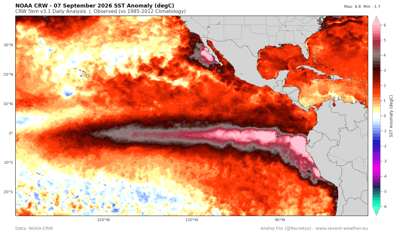
The ongoing climate anomaly in the tropical Pacific has exceeded traditional thresholds to enter "Super El Niño" territory. Sustained seasonal temperature values in the El Niño-Southern Oscillation (ENSO) region have surpassed +2 degrees Celsius above normal, with peak anomalies in the eastern Pacific climbing more than 7°C (12.6°F) above historical averages.
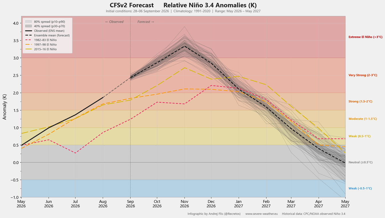
According to analyses from the National Oceanic and Atmospheric Administration (NOAA) and seasonal models from the National Centers for Environmental Prediction (NCEP), this event is poised to eclipse the last three major Super El Niño occurrences by a notable margin. If current projections verify, the 2026/2027 cycle will rank as the strongest El Niño event in over a century.
Crucially, this phenomenon is not confined to the ocean’s surface. High-resolution subsurface ocean data reveals a robust Kelvin wave—a massive pool of warm water moving rapidly eastward beneath the surface—which is continuously pumping energy into the upper ocean. This guarantees that the El Niño forcing will remain locked in place well into the upcoming winter season, dictating hemispheric circulation patterns across North America and beyond.
Chronology of a Quiet Season: From Summer Heat to Autumn Suppression
To understand how this Pacific phenomenon protects the U.S. coastline, meteorologists examine the chronological evolution of the 2026 Atlantic hurricane season:
- Late Spring to Early Summer 2026: Subsurface Kelvin waves begin surging eastward across the Pacific, rapidly elevating ENSO region temperatures and signaling the transition to a dominant El Niño phase.
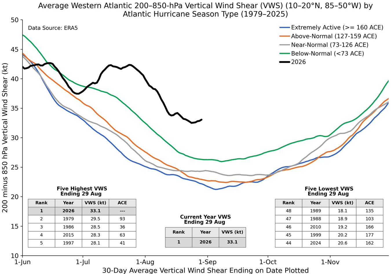
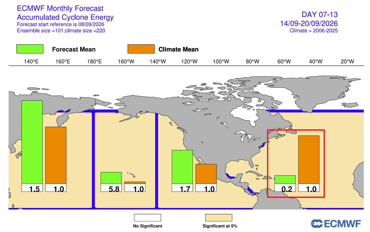
- July and August 2026: As the peak of the hurricane season approaches, the Accumulated Cyclone Energy (ACE) index in the Atlantic flatlines. Data from Colorado State University and NOAA shows that total Atlantic ACE sits at a meager 8% of the normal climatological baseline for this time of year, generated by only five short-lived, weak named systems that failed to reach hurricane status.
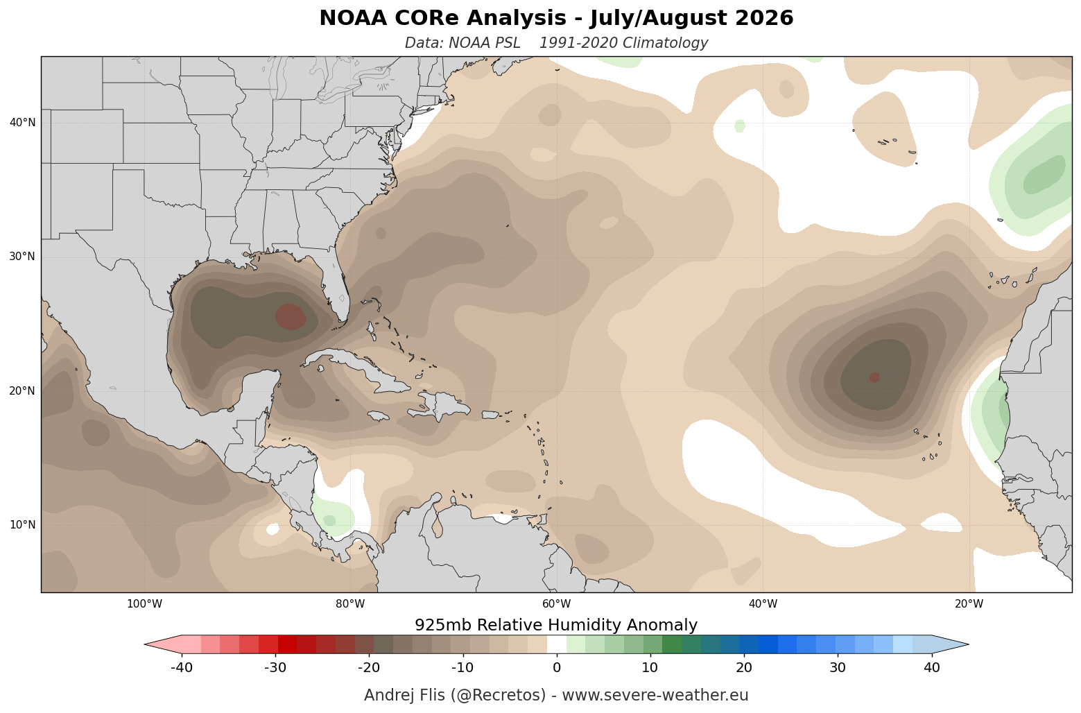
- Mid-Summer Wind Shear Peaks: Driven by altered Walker circulation cells, Atlantic wind shear surges to the highest levels recorded for July and August in the past 47 years. Simultaneously, 925mb relative humidity datasets demonstrate pervasive mid-level dryness across the Main Development Region (MDR).
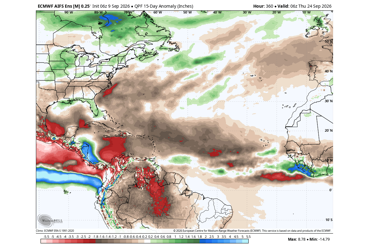
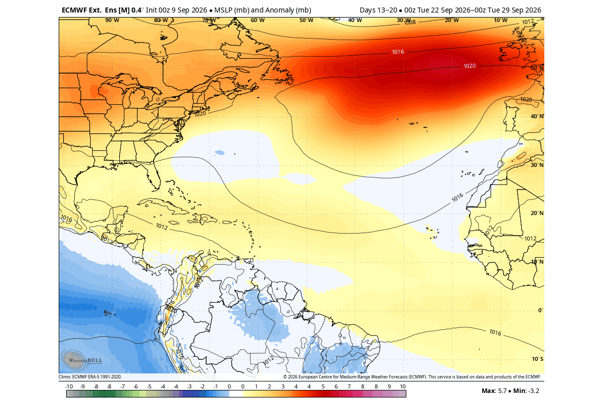
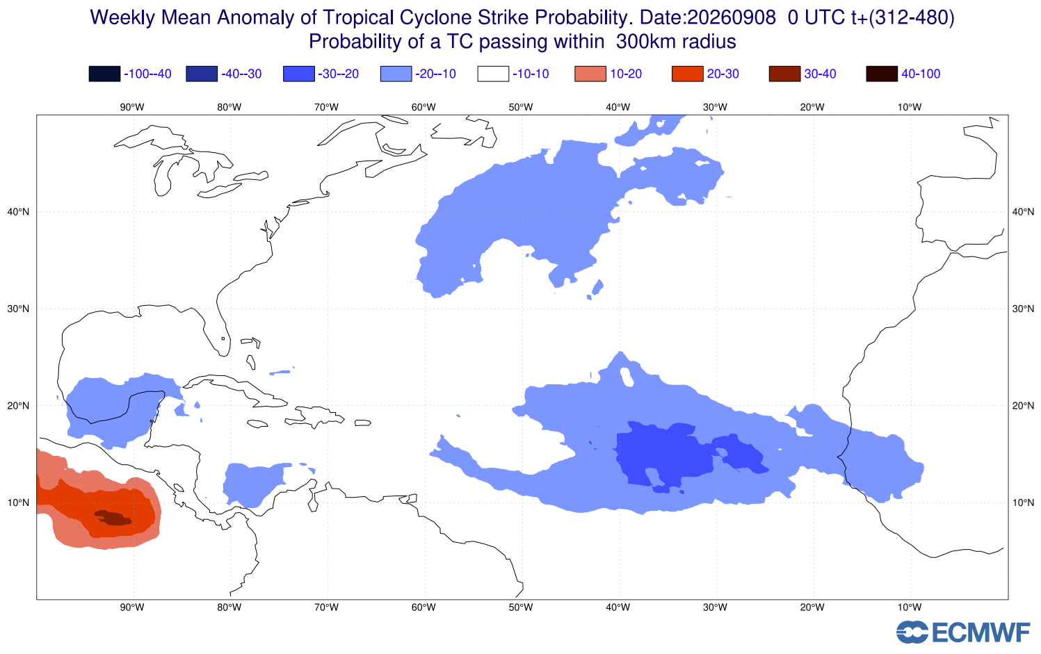
- September Peak Suppression: European Centre for Medium-Range Weather Forecasts (ECMWF) projections confirm that mid-September—historically the most active period of any hurricane season—is witnessing widespread atmospheric stability, sinking air (subsidence), and below-normal precipitation across the entire tropical Atlantic.
- October Outlook: NMME and ECMWF long-range models indicate that core El Niño anomalies will strengthen further, with core Pacific ocean temperatures exceeding +5°C (+9°F). This ensures that any potential late-season development in the Caribbean will be immediately torn apart by relentless wind shear, locking the Atlantic into a historically quiet state.
Supporting Data: The Science Behind the Shield
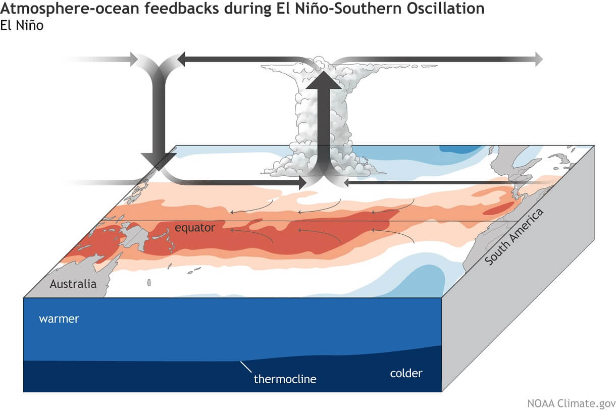
The mechanism protecting the United States from tropical landfalls is rooted in fundamental atmospheric dynamics. During a strong El Niño, the Walker circulation—the loop of air that moves Pacific moisture and heat—shifts eastward. This causes intense rising air and heavy precipitation in the central and eastern Pacific, which in turn triggers compensatory sinking air and high-pressure stability over the tropical Atlantic.
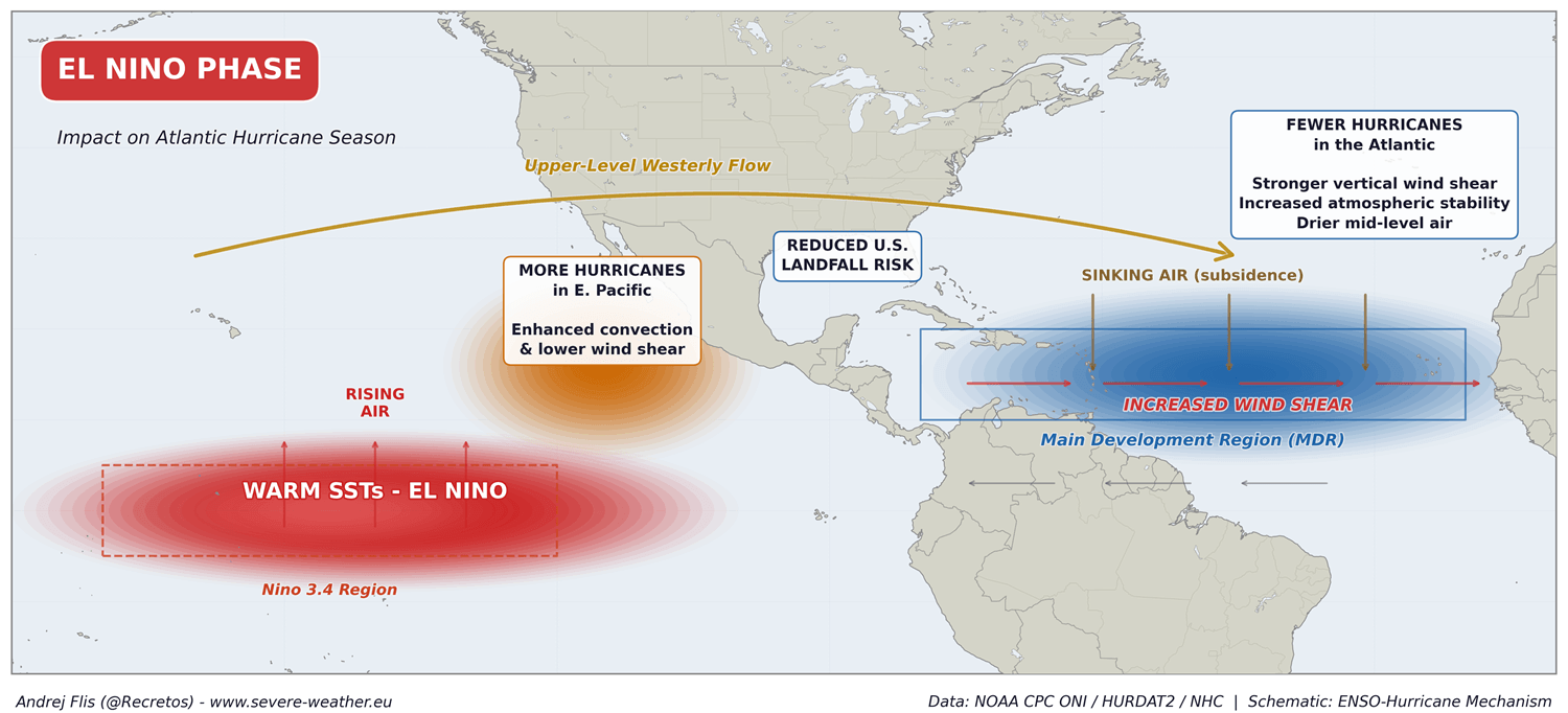
This atmospheric bridge creates three primary inhibitors to hurricane development:
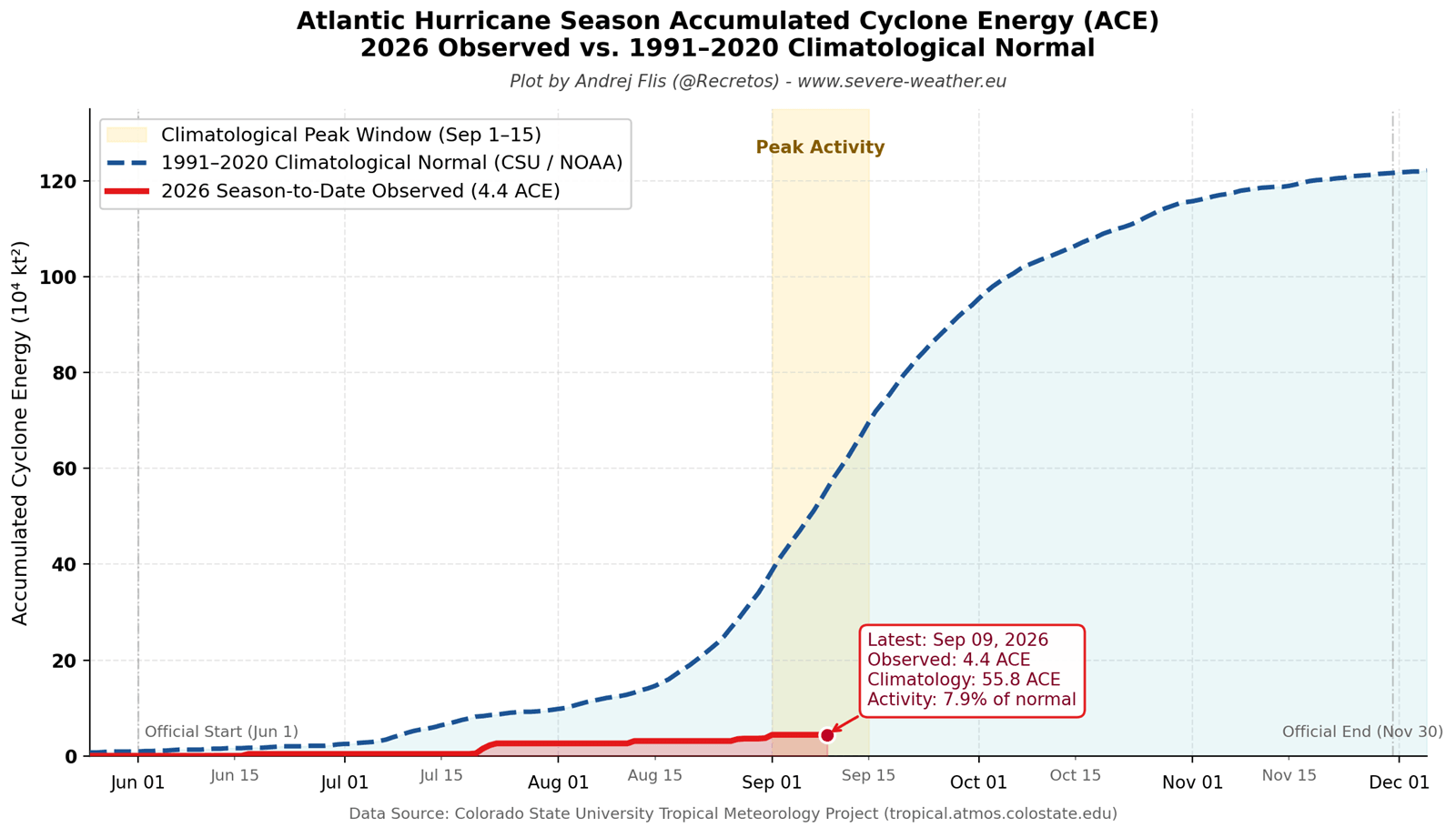
- Record-Breaking Vertical Wind Shear: As quantified by tropical meteorologist Dr. Philip Klotzbach’s datasets, severe horizontal and vertical wind speed differences tear at the vertical columns of developing tropical disturbances. This shear decapitates storms before they can consolidate.
- Tropospheric Subsidence: Sinking air suppresses cloud formation and thunderstorms, robbing tropical waves of the convective energy they require to organize.
- Mid-Level Dryness: NOAA CORe relative humidity data shows an extensive deficit of moisture throughout the lower and middle troposphere in the Main Development Region. Dry air entrainment evaporates a storm’s inner core, effectively starving it of fuel.
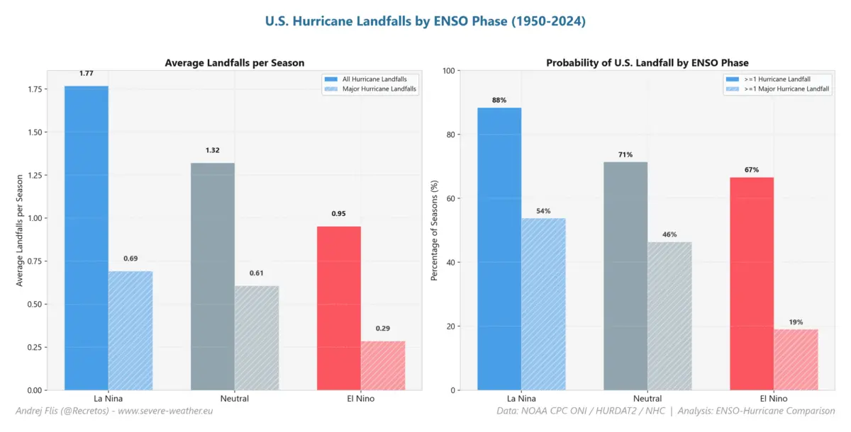
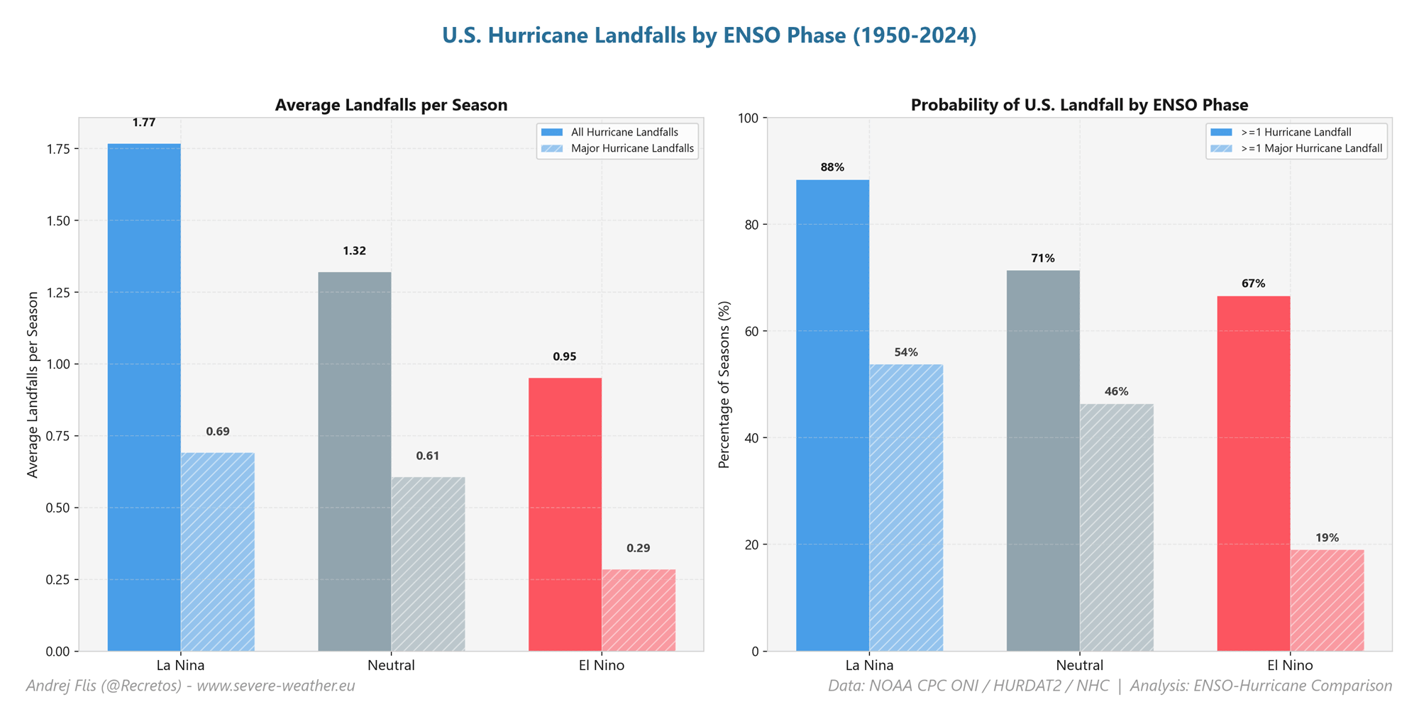
Historically, NOAA National Hurricane Center data reveals that El Niño phases produce the lowest U.S. landfall probabilities and the lowest frequency of major hurricanes. The 2026 season serves as a textbook manifestation of this statistical reality.
Official Responses and Expert Consensus
Leading meteorological institutions, including NOAA, the Climate Prediction Center (CPC), and the European Centre for Medium-Range Weather Forecasts (ECMWF), have continuously updated their seasonal outlooks to reflect the overpowering influence of the Pacific anomaly.
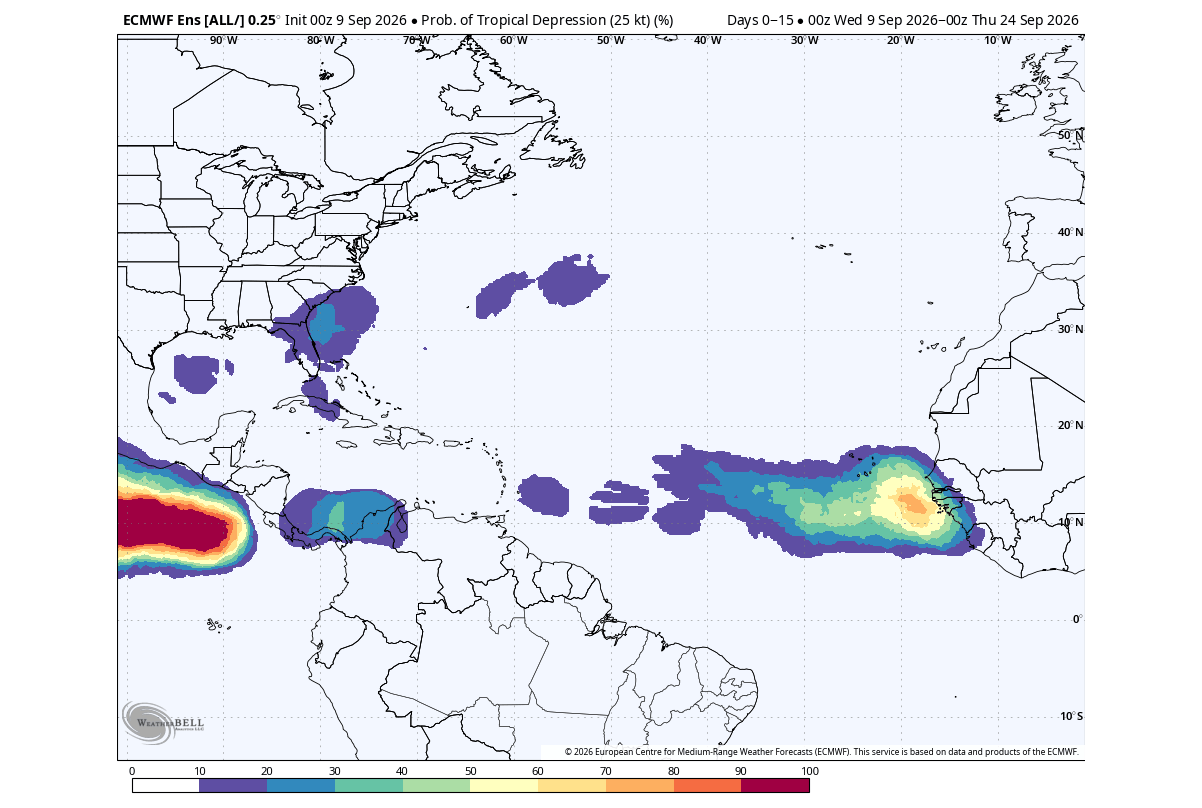
While emergency management agencies and coastal communities breathe a sigh of relief over the dramatically reduced risk of catastrophic U.S. landfalls, climate scientists emphasize that a quiet overall season does not eliminate localized risks. Forecasters continue to monitor the western Caribbean and immediate Gulf of Mexico for brief, opportunistic, and short-lived hybrid systems that can materialize close to the coastline despite regional hostility.
Furthermore, climatologists are pivoting their analytical focus toward the secondary implications of this Super El Niño: what a dormant tropical Atlantic portends for the impending winter season across the Northern Hemisphere.
Implications: Winter 2026/2027 and the Polar Vortex Connection
Historical climate analogues demonstrate a profound teleconnection between weak Atlantic hurricane seasons driven by El Niño and subsequent winter weather patterns across North America and Europe.
Temperature Trends and Circulation
Analyses of winters following heavily suppressed hurricane seasons indicate a distinct temperature anomaly setup:
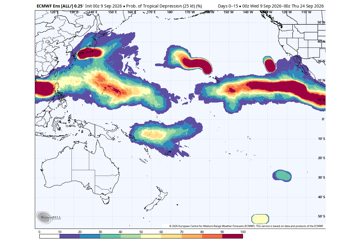
- United States: A persistent low-pressure pattern over the south-central U.S. favors below-normal temperatures across the southern and central states during mid-to-late winter 2026/2027.
- Canada and Europe: High-pressure dominance over Canada is projected to yield notable warmth in northern latitudes, while mid-winter European forecasts lean toward widespread above-normal temperatures.
The Stratospheric Disruption and Polar Vortex
Perhaps the most critical implication lies high above the Earth’s surface in the stratosphere. Historical data links suppressed tropical Atlantic seasons to a warmer winter stratosphere and a structurally vulnerable Polar Vortex.
Latest ECMWF ensemble forecasts for the 10mb zonal wind strength—the standard metric for gauging Polar Vortex integrity—reveal an aggressive deceleration and potential disruption signal beginning as early as January 2027. The forecast ensemble lines trend far below both historical averages and model climatology, signaling a high probability of a weakened or disrupted Polar Vortex in January and February.
When the Polar Vortex weakens, its ability to lock frigid Arctic air inside the polar cap diminishes. This breakdown allows dramatic, uncontained "spills" of polar air to plunge southward into mid-latitude regions, including the United States and Canada. Consequently, while coastal residents enjoy a reprieve from hurricane threats this autumn, meteorologists warn that the same Super El Niño architecture could lay the groundwork for a volatile, cold, and potentially snowier winter ahead.
