

Published: September 21, 2026
Category: Long-Range Weather Outlook / Climate Science
Main Facts: A Historic Climate Driver Takes Hold
As the meteorological community looks ahead to the upcoming cold season, the first comprehensive winter 2026/2027 snowfall predictions point to a single, overwhelming climate driver: a rapidly developing, historic Super El Niño.
Forecast data from premier global modeling centers, including the European Centre for Medium-Range Weather Forecasts (ECMWF) and the United Kingdom Meteorological Office (UKMO), reveal pronounced snowfall contrasts across the United States, Canada, and Europe. This powerful ocean-atmospheric phenomenon is actively reshaping the global jet stream and altering low-pressure storm tracks.
Key takeaways from the initial long-range modeling include:
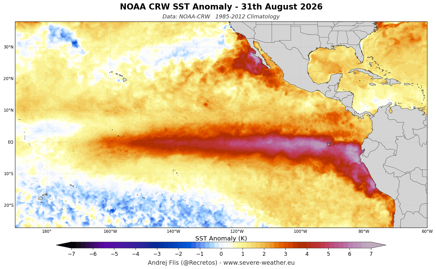
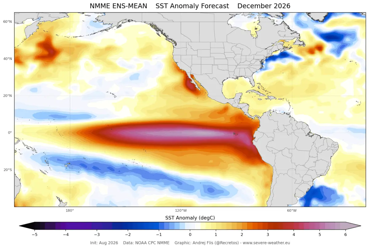
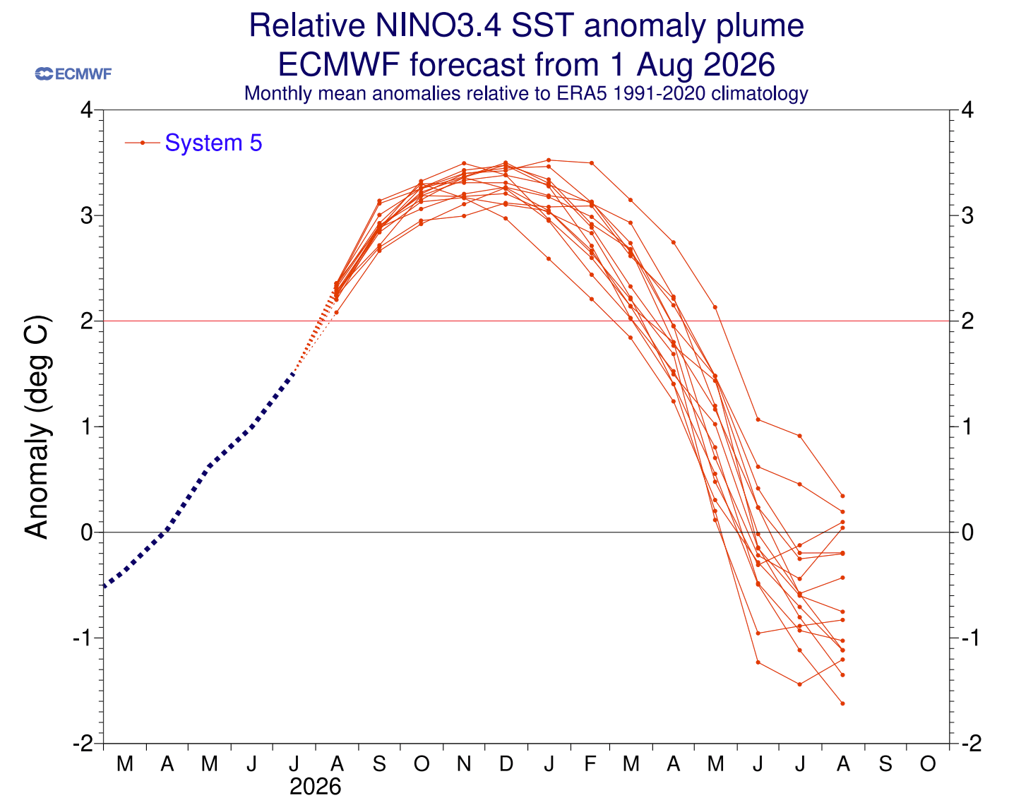
- The Super El Niño Threshold: Sustained seasonal ocean temperature anomalies in the tropical Pacific have already surpassed the +2°C threshold required for a "Super" designation, with peak anomalies projected to exceed +3°C.
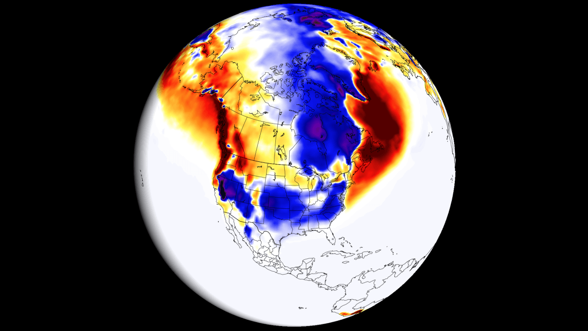
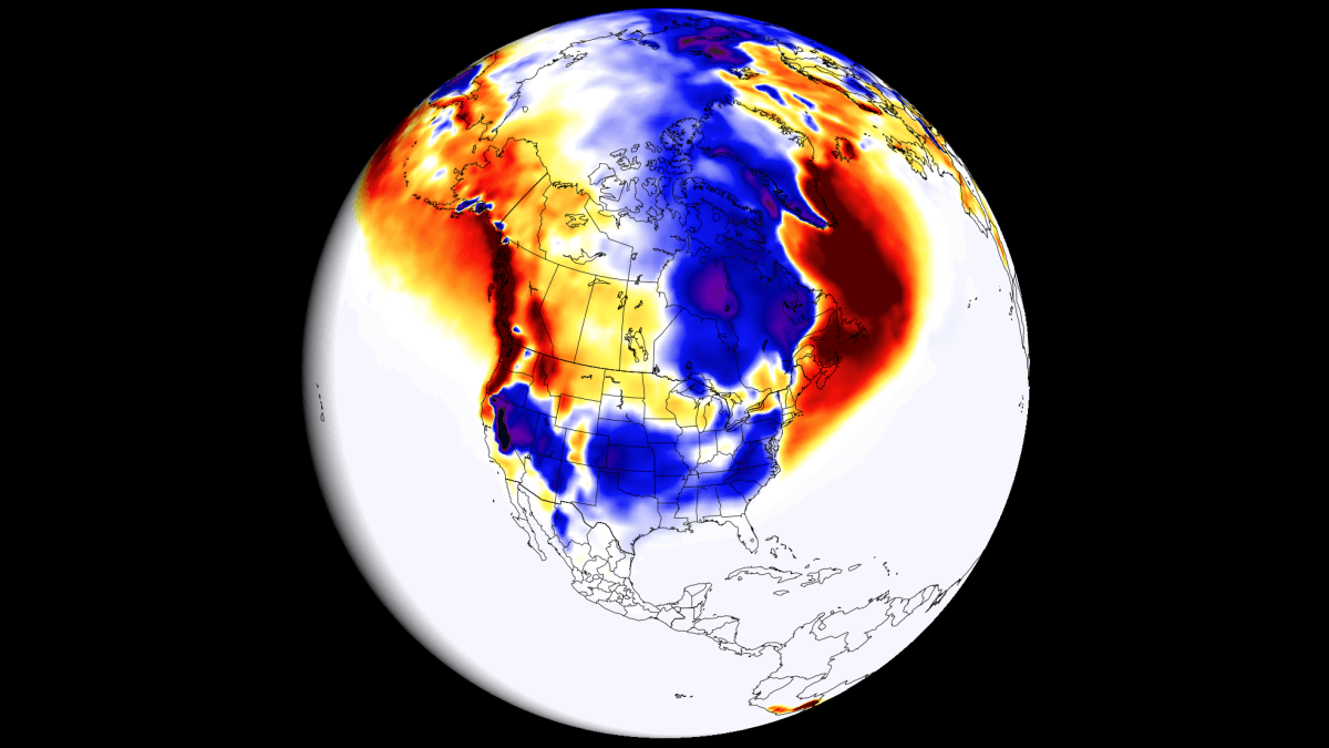
- North American Snowfall Splits: The southern and central United States, the Southwest, and sections of the East Coast/Mid-Atlantic face an enhanced potential for above-normal snowfall. Conversely, the Pacific Northwest, the Great Lakes, the Ohio Valley, and southern Canada are tracking toward significant snow deficits.
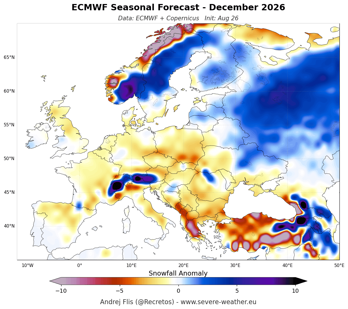
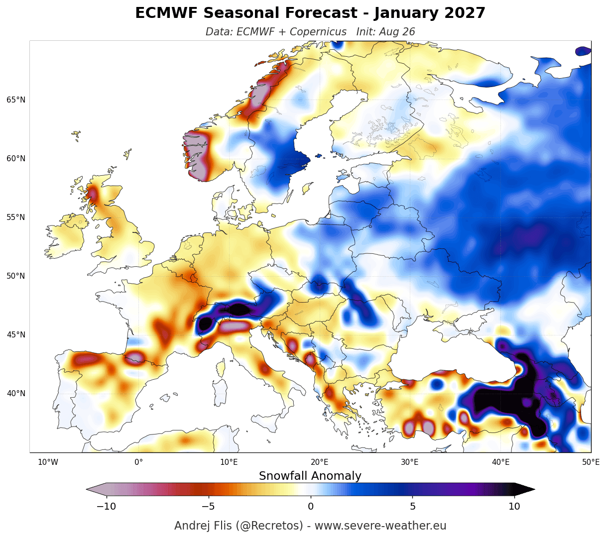
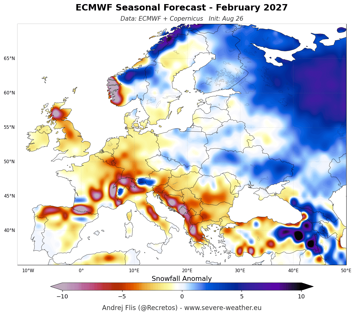
- European Snow Drought: Europe is facing a predominantly mild, westerly-driven winter, translating to widespread below-normal snowfall across lowlands and mid-elevations. Natural snowpack will likely be restricted to higher mountain elevations (such as the Alps) and the far northern and northeastern tiers of the continent.
Chronology: The Evolution of the 2026/2027 Super El Niño
Understanding how the upcoming winter weather patterns will materialize requires tracking the physical mechanisms currently unfolding in the Pacific Ocean and the atmospheric responses observed over recent months.
Late Summer to Early Fall 2026: Subsurface Energy and Kelvin Waves
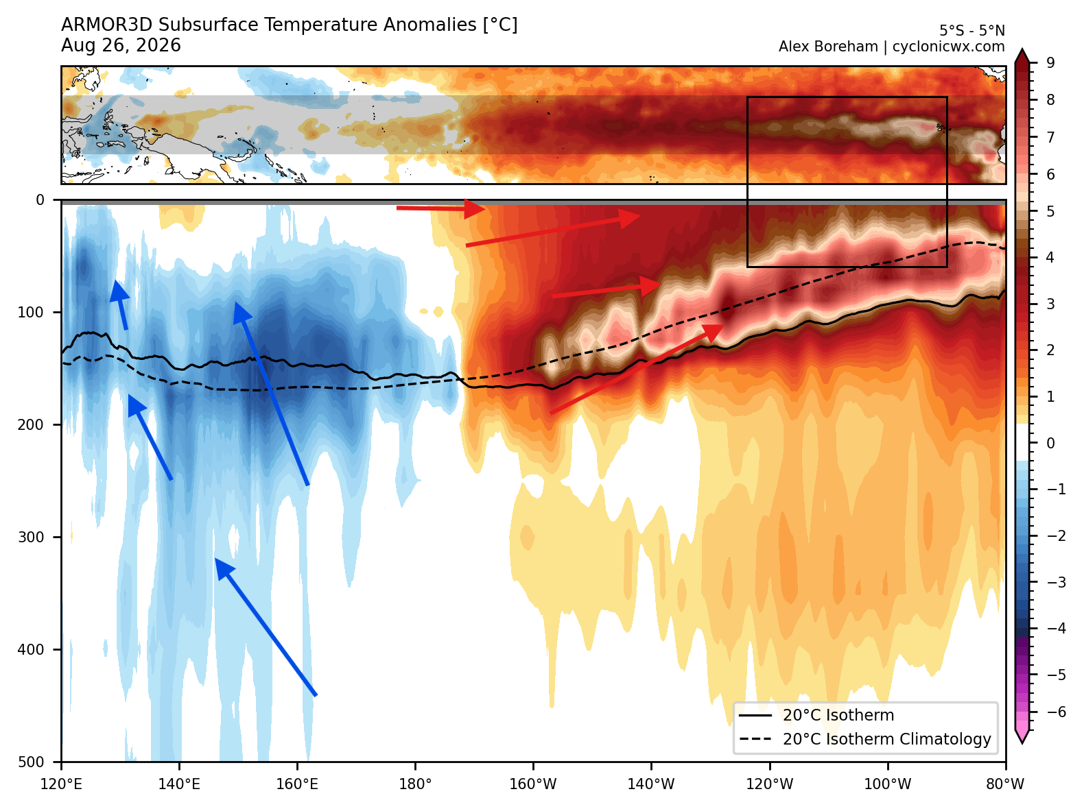
The foundation of the 2026/2027 winter outlook was laid months prior through anomalous ocean-warming dynamics in the tropical Pacific. Subsurface temperature analysis from NOAA-CRW data revealed a massive downwelling Kelvin Wave propagating across the upper 250 meters (800 feet) of the tropical Pacific.
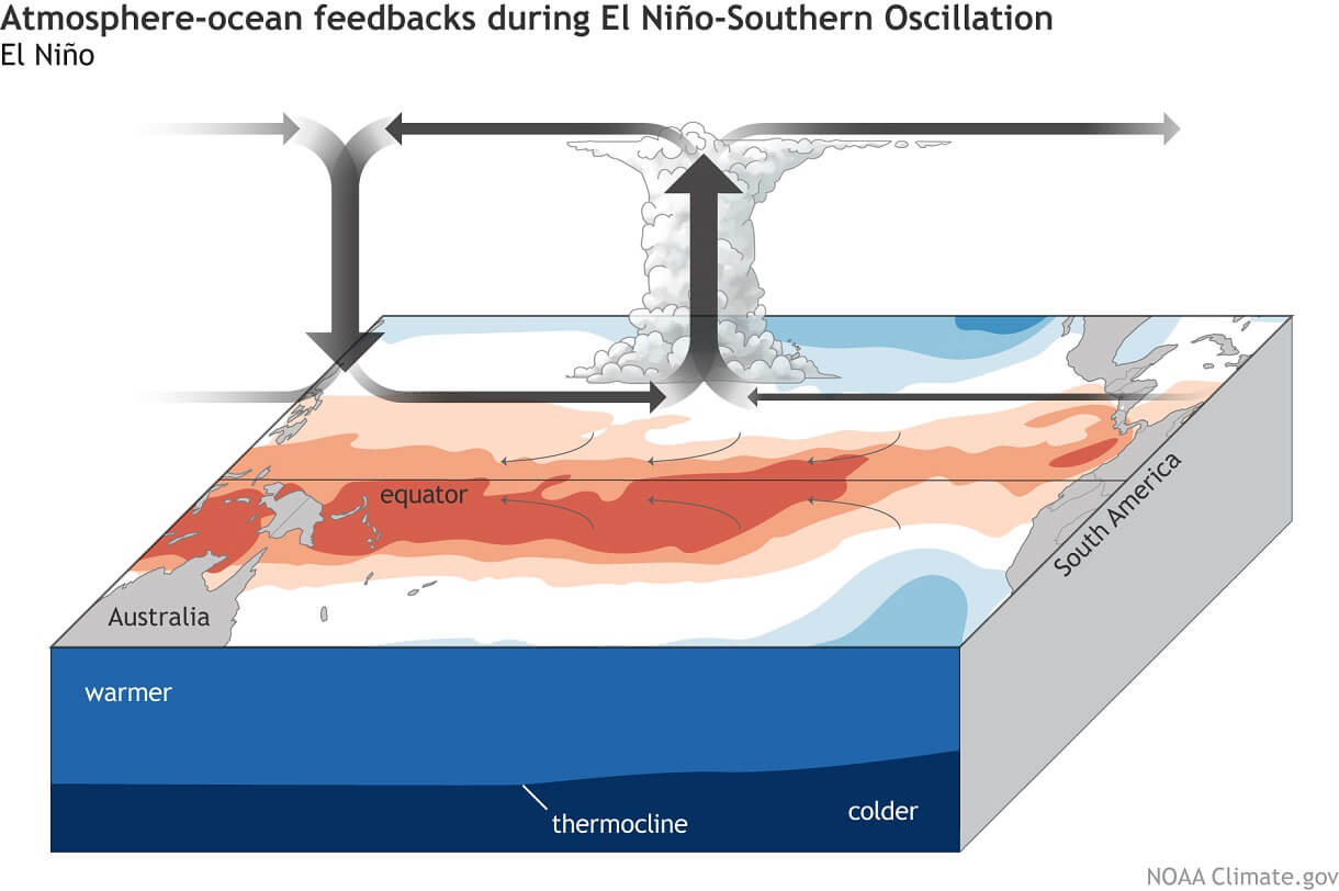
During this phase, subsurface thermal anomalies surged to more than 10°C (18°F) above normal. Strong westerly wind bursts displaced warm upper-ocean waters eastward, while simultaneously pulling up colder, deeper water in the west—a classic hallmark of a rapidly intensifying El Niño. By September, these subsurface anomalies breached the surface, driving peak ocean temperature anomalies exceeding 6°C (10.8°F) above normal in the eastern Pacific.
Peak Intensity Ahead of Winter
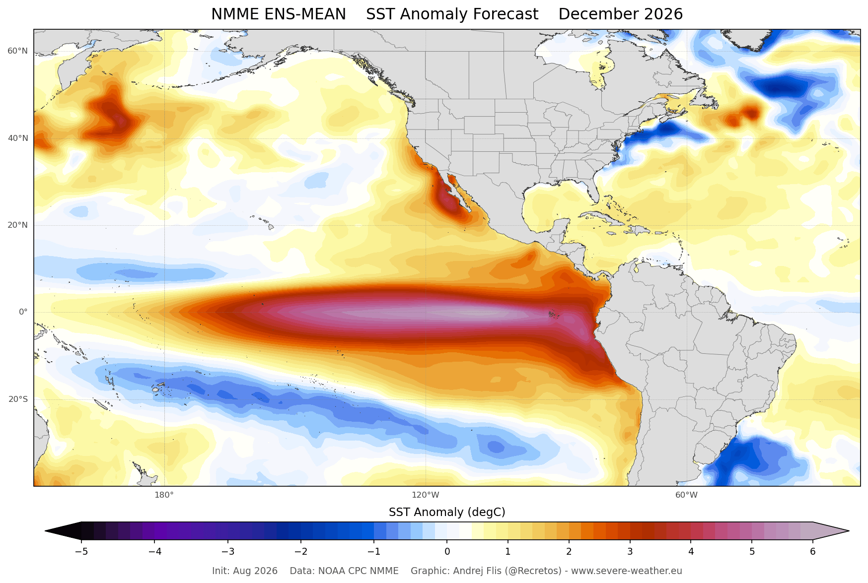
According to extended seasonal projections from the ECMWF and the North American Multi-Model Ensemble (NMME), this Super El Niño is scheduled to peak around December 2026. This timing places the maximum oceanic forcing directly on the doorstep of the Northern Hemisphere winter. Past analogs of Super El Niño events demonstrate that such an energetic state provides a stable supply of thermal energy, locking the global circulation pattern into a predictable El Niño configuration well into the heart of the cold season.
Supporting Data: Jet Stream Dynamics and Historical Analogs
To translate ocean temperatures into terrestrial snowfall, meteorologists analyze shifts in the jet stream—the high-altitude river of air (8–11 km up) that steers moisture and storm systems.
The El Niño Jet Stream Configuration
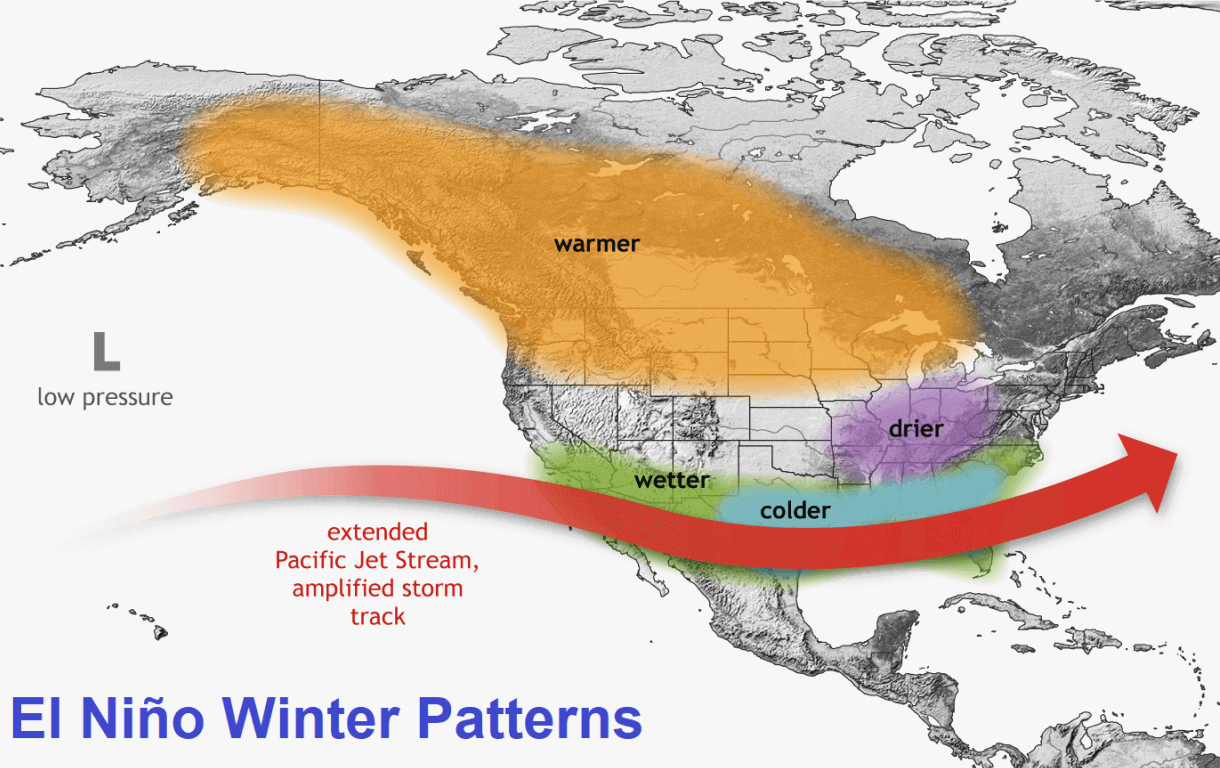
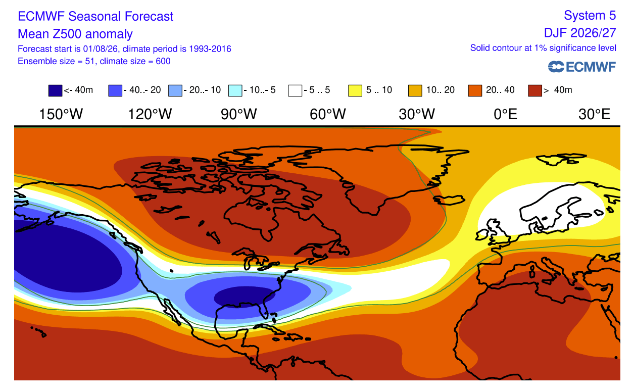
In a standard El Niño winter, the North Pacific low-pressure zone weakens the polar jet stream while dramatically invigorating the subtropical jet stream across the southern United States.
- The Southern Surge: An extended Pacific jet stream carries increased moisture, lower pressures, and cooler temperatures across the southern tier of the U.S. When paired with cold air intrusions, this pattern supercharges snowfall potential across the Central Plains, the Southwest, and parts of the South.
- The Canadian Blocking Ridge: Simultaneously, a persistent high-pressure ridge tends to set up over Canada and the Pacific Northwest. This blocks Arctic air masses from plunging deeply into the northern U.S., starving the Great Lakes and the Northeast of sustained, cold northern storm tracks during average El Niño years.
ERA5 Reanalysis of Past Super Events
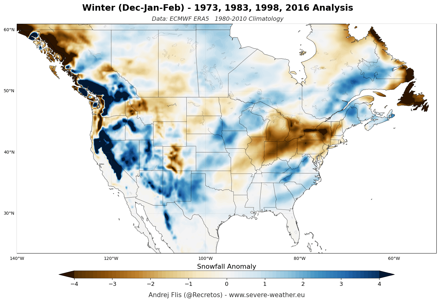
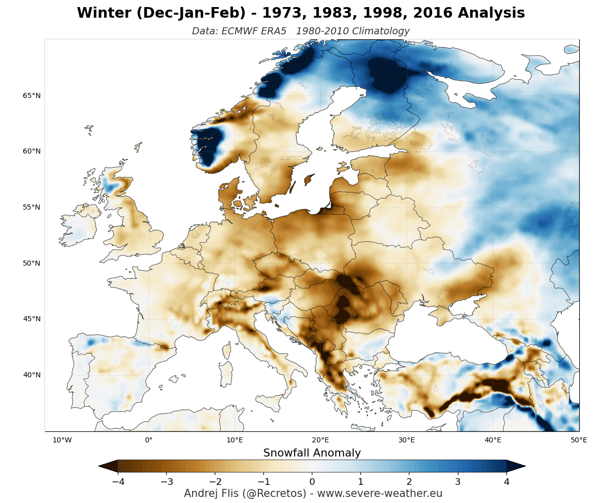
Composite data derived from ERA5 reanalysis of past Super El Niño winters illustrate clear spatial anomalies:
- Above-Normal Snowfall Regions: The Sierra Nevada, the Four Corners region, the Southern Rockies, and parts of the Central Plains consistently recorded higher-than-average seasonal snow totals during past extreme events.
- Below-Normal Snowfall Regions: The Pacific Northwest, the Great Lakes, the Ohio Valley, and the European continent experienced profound snowfall deficits due to persistent warm-air advection and suppressed northern storm tracks.
Official Model Forecasts: ECMWF and UKMO Regional Breakdown
Europe: A Predominantly Mild Outlook
Both the ECMWF and UKMO long-range models project a challenging season for European snow enthusiasts.
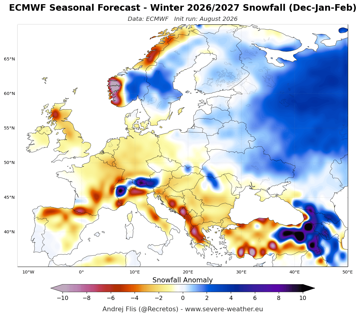
- Seasonal Averages: The overarching European seasonal average indicates below-normal snowfall across the majority of the continent. A robust high-pressure ridge in the south, combined with a vigorous North Atlantic low-pressure system, forces a persistent mild westerly and southwesterly flow into Europe.
- Elevation is Key: Lowlands and mid-elevations will struggle to maintain snow cover. Ski resorts and mountain operators will rely heavily on elevations above 1,800 to 2,000 meters—particularly in the Alps—where colder ambient temperatures can still support a natural snowpack.
- Monthly Progression: November sets a slow tone with delayed mountain snowfall. December and January maintain widespread lowland deficits, though higher-latitude regions in northern and northeastern Europe (alongside elevated Alpine zones) will occasionally tap into cold air outbreaks. February, traditionally a peak snow month, faces strong high-pressure suppression across central and western Europe.
United States and Canada: Dynamic Month-to-Month Contrasts
North America presents a much more complex and dynamic scenario, driven by the direct positioning of the Pacific jet stream.
- Seasonal Totals: ECMWF total snowfall accumulation models show an impressive volume of snow targeting the central and southern tiers of the U.S., contrasted against a pronounced snow drought across southern Canada, the Pacific Northwest, and the northern Plains.
- December (The Slow Start): Early-winter forecasts indicate a gradual onset. While the central Plains and parts of the Northeast begin seeing early snow events, the Great Lakes and the Pacific Northwest remain unusually dry.
- January (The Pattern Amplifies): A significant shift occurs in January. Above-average snowfall potential expands aggressively across the central and southern Plains, the Midwest, the Ohio Valley, and the Mid-Atlantic. In the West, heavy positive snow anomalies lock onto the Sierra Nevada, the Great Basin, and the central Rockies.
- February (The Southern Jet Peaks): The active southern Pacific jet peaks in February. Heavy, widespread snowfall targets the southern half of the United States—ranging from the Sierra Nevada and south-central Rockies across the Plains, and stretching eastward into the Mid-Atlantic states. Conversely, negative snow anomalies persist from Washington and Oregon across the northern Plains, the Great Lakes, and New England.
To contextualize these regional trends, specialized ensemble data for southern states like Texas indicate near-normal snowfall through December, followed by a noticeable upward tick in January and February. While absolute accumulation numbers remain modest in southern latitudes, the trend highlights the frequency and penetration of active southern storm tracks.
Implications: What Winter 2026/2027 Means for Sectors and Regions
The emergence of a historic Super El Niño carries substantial socioeconomic and environmental implications across multiple sectors:
- Winter Tourism and Ski Industries: Ski resorts in the European Alps, the Sierra Nevada, Utah, and the Central/Southern Rockies can look forward to favorable snowpacks at higher elevations. However, resorts in the Pacific Northwest, the Midwest, and eastern Canada must prepare for potential marginal snow years, relying on robust snowmaking infrastructure.
- Water Resource Management: The snowpack in the Western United States (particularly California and the desert Southwest) serves as a natural reservoir. Above-average snowfall in the Sierra Nevada and the Rockies bodes well for spring meltwater supplies, alleviating long-term drought concerns in those basins. Conversely, reduced snowpack in the Pacific Northwest and parts of Canada may pose challenges for late-spring hydrological planning.
- Transportation and Infrastructure: Municipalities across the Mid-Atlantic and Central Plains should prepare for active, moisture-laden storm systems in mid-to-late winter. While northern cities may experience lower-than-average snow removal costs, sudden transitions in the jet stream can still trigger high-impact, disruptive winter storms across unexpected regions.
As autumn progresses, meteorological agencies will continue refining these models. Stakeholders, travelers, and winter weather enthusiasts are advised to monitor ongoing updates as the 2026/2027 Super El Niño reaches its peak intensity.
