

Main Facts
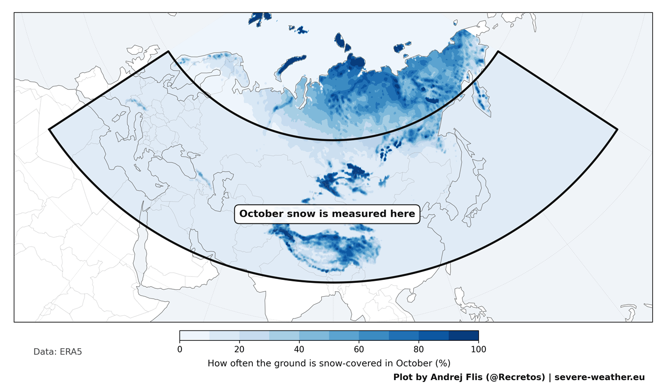
Every autumn, weather forums and social media light up with a familiar debate: Is snow spreading rapidly across Siberia? For over a decade, a popular meteorological theory has held that an early, fast-moving October snow advance across Eurasia serves as a crucial leading indicator for a cold, snowy winter across the mid-latitudes of the United States, Canada, and Europe.
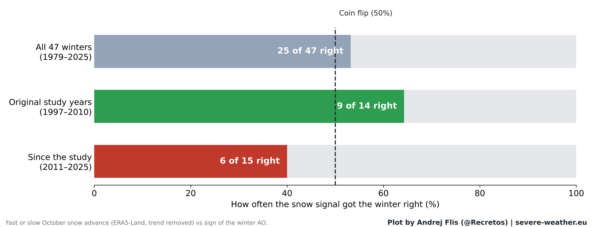
However, a comprehensive new 47-year data analysis spanning from 1979 to 2025—utilizing four independent snow datasets—reveals a startling reality: the predictive power of the Siberian snow signal has largely broken down. While the underlying atmospheric physics regarding the stratosphere and the Polar Vortex remain robust, using October Siberian snow cover to reliably forecast the winter Arctic Oscillation (AO) is no better than a coin flip today.
Instead, meteorologists are turning their attention to other dominant drivers for the upcoming Winter 2026/2027 season, most notably an active Super El Niño event in the Pacific and November-December stratospheric energy fluxes.
Chronology: The Rise, Fall, and Re-Examination of a Winter Forecasting Staple
The 2011 Breakthrough
The concept gained mainstream traction in 2011 when prominent atmospheric scientists Judah Cohen and Justin Jones published a landmark study. They established a clear statistical link between the speed of October snow cover expansion across Eurasia and the behavior of the winter Arctic Oscillation.
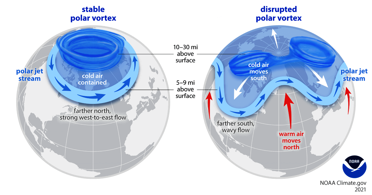
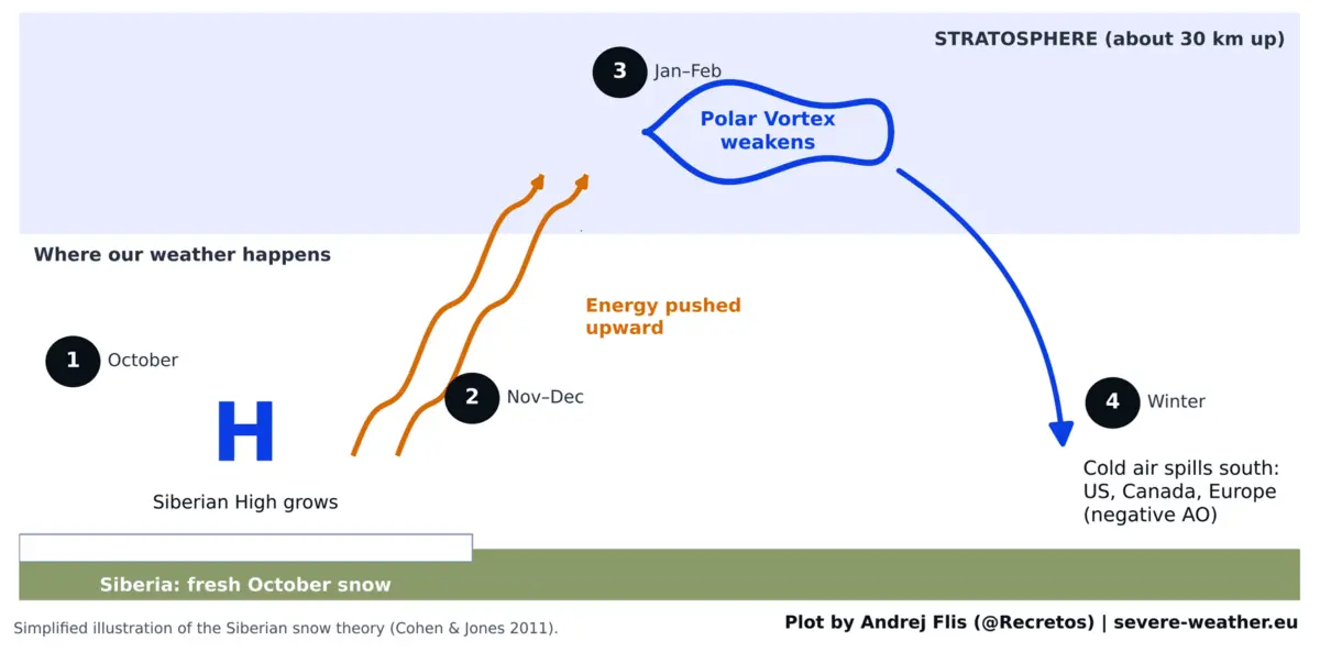
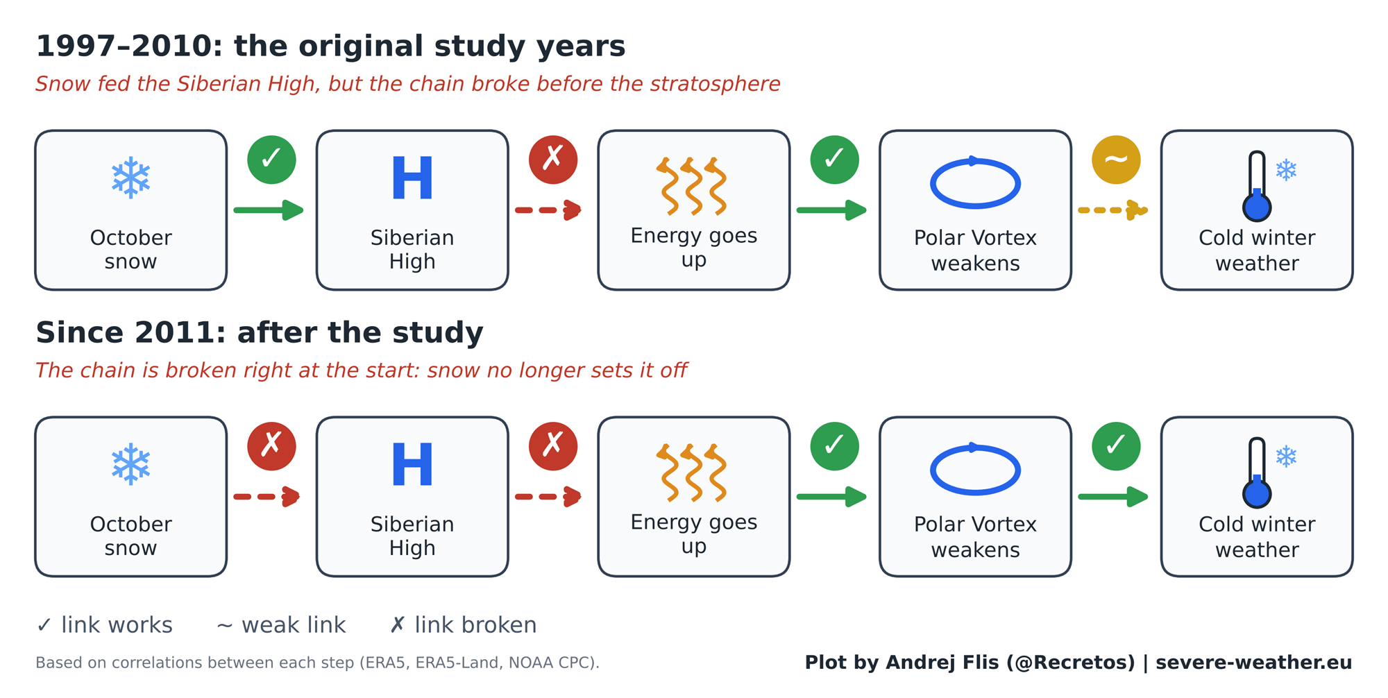
The physical mechanism proposed was elegant and logical:
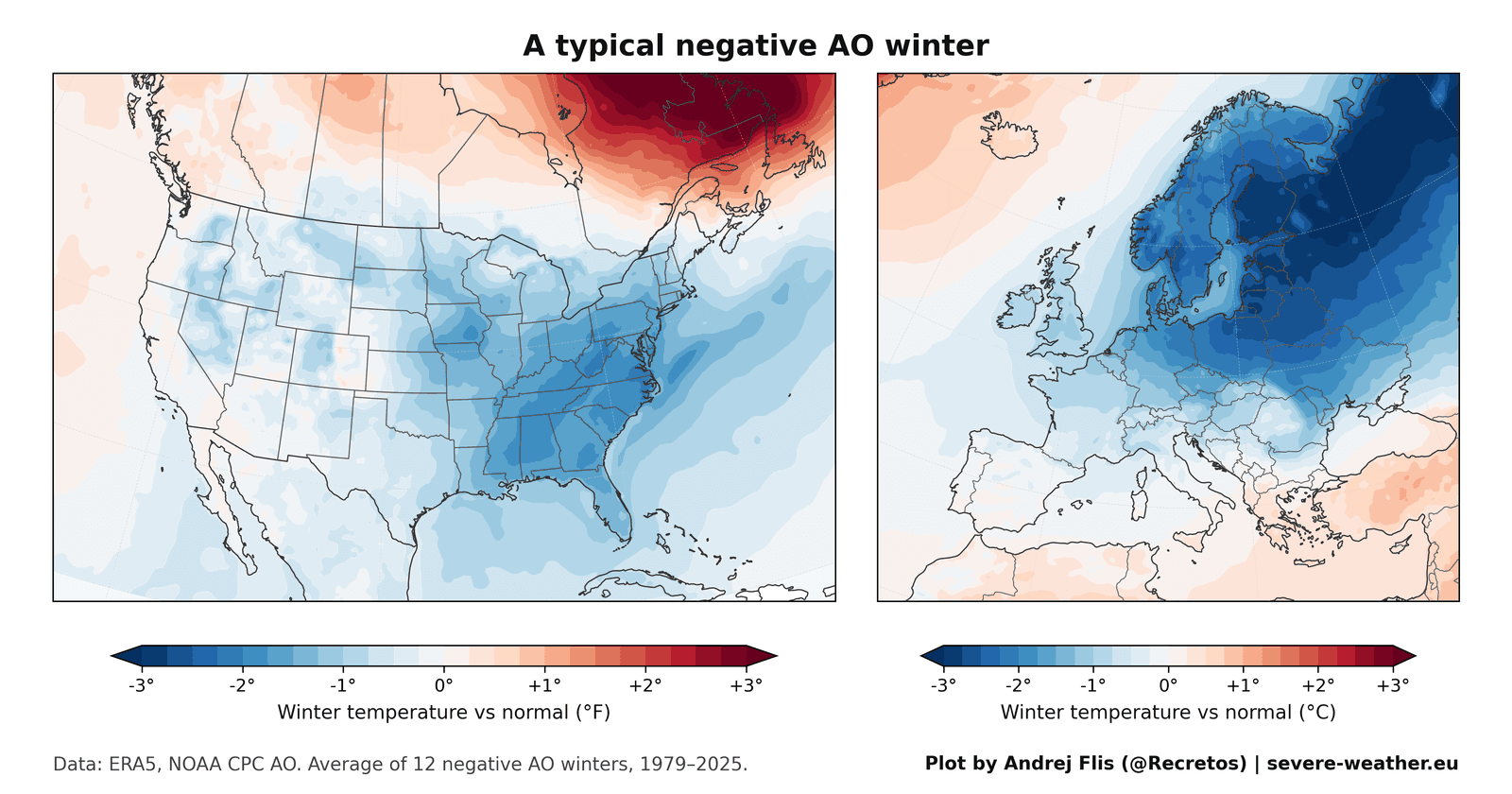
- Surface Cooling: Fresh, extensive October snow cools the ground and reinforces the Siberian High, a massive high-pressure zone over northern Asia.
- Stratospheric Ascent: This enhanced pressure system forces planetary wave energy vertically into the stratosphere, roughly 30 kilometers (18.5 miles) above the surface.
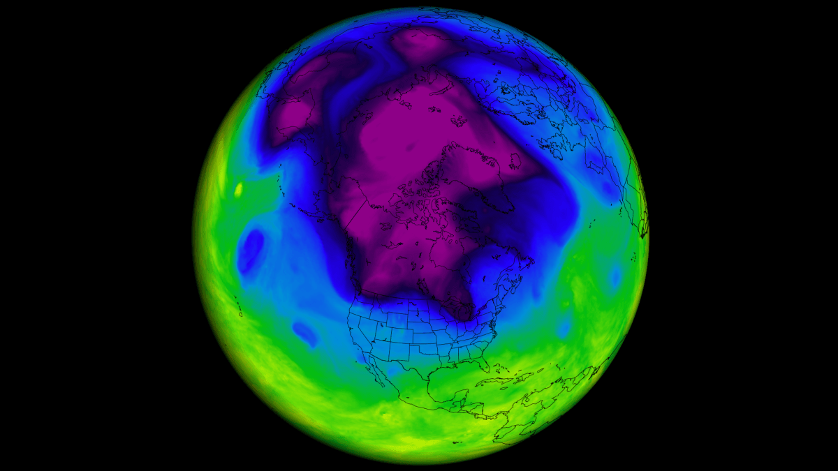
- Vortex Disruption: The influx of energy disrupts and weakens the Polar Vortex—the ring of fierce winds that normally traps bitter Arctic air near the North Pole.
- Surface Spillage: A weakened or stretched vortex allows lobes of frigid Arctic air to spill southward into North America and Europe, pushing the Arctic Oscillation into a negative phase.
The Signal Fades Post-2011
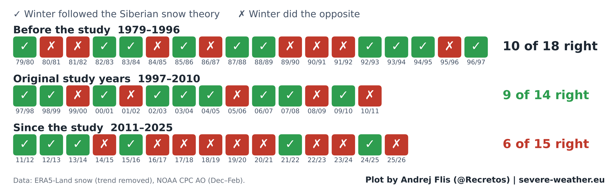
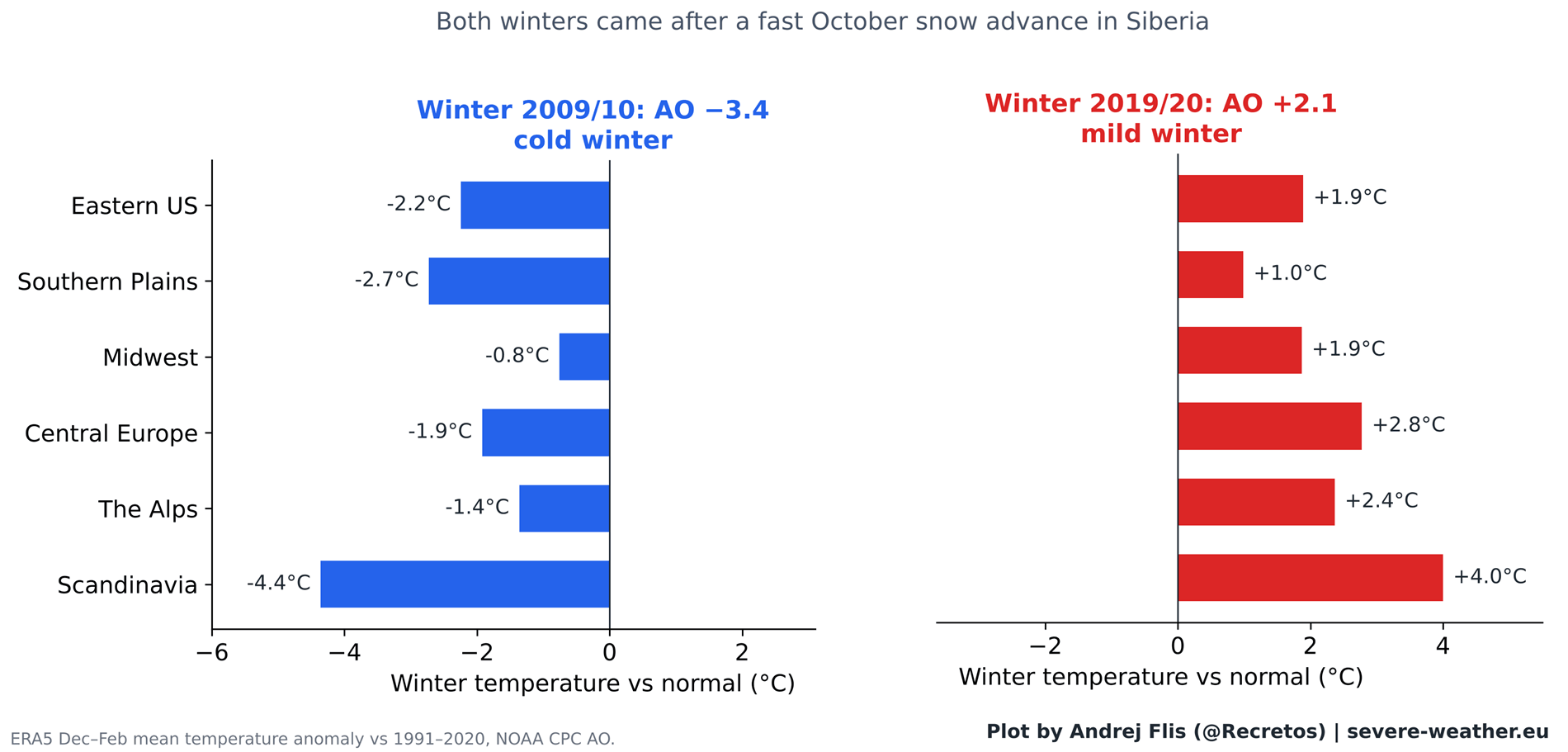
During the baseline study period (1997–2010), the theory performed exceptionally well, correctly predicting winter trends 9 out of 14 times. This success was heavily amplified by standout winters like 2009/2010, which followed a rapid October snow advance and culminated in severe cold across Europe and historic mid-Atlantic snowstorms in the U.S.
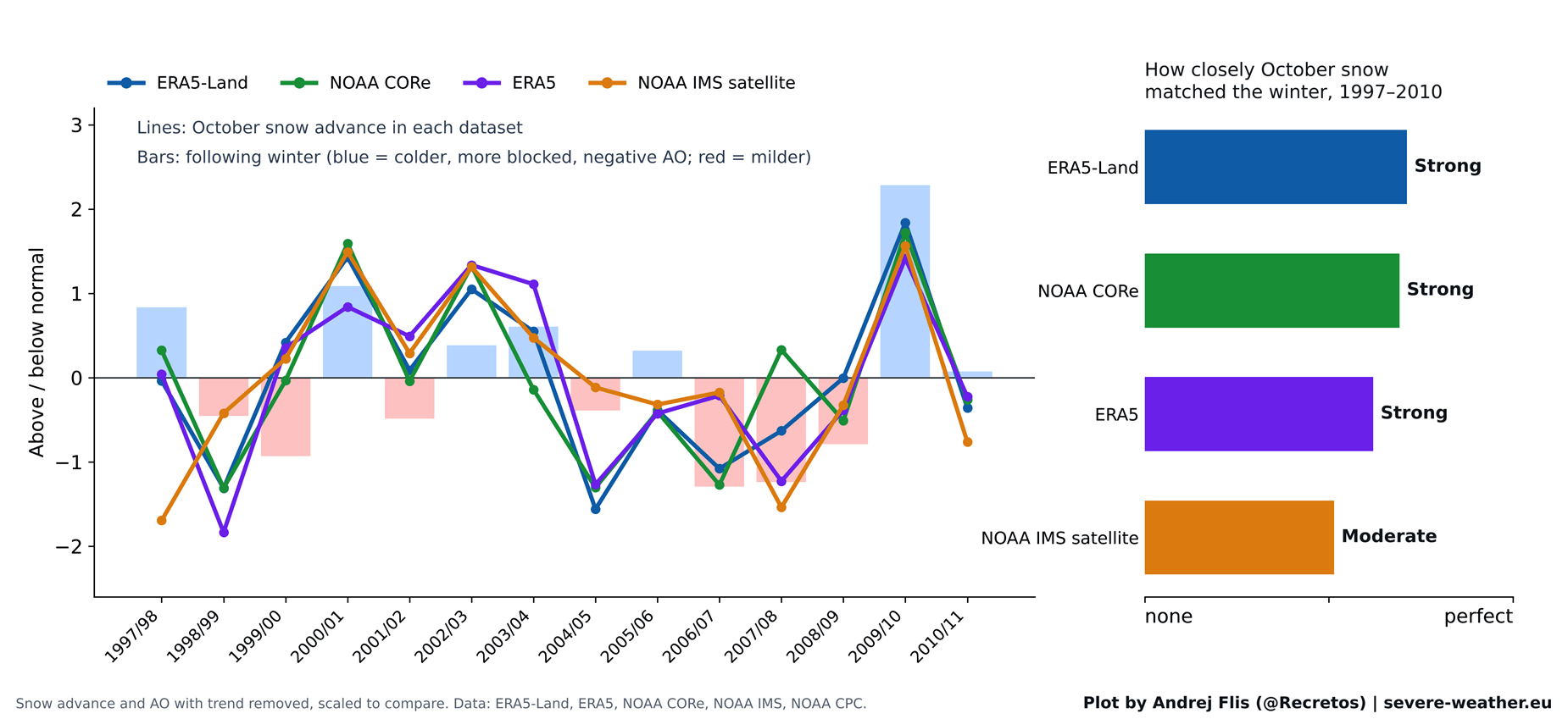
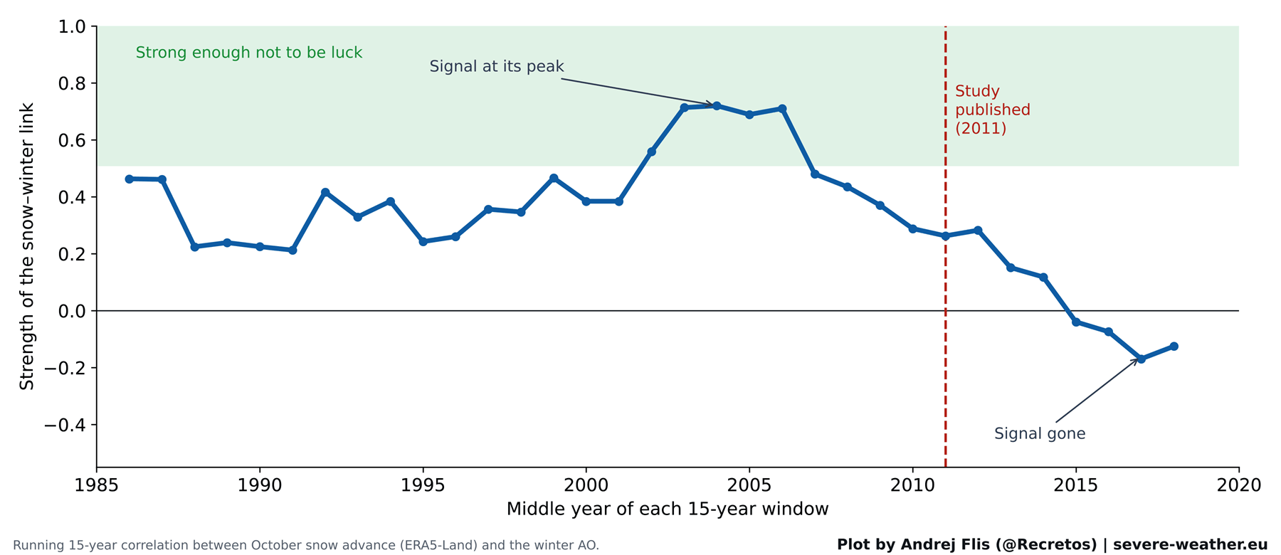
However, when tested against the 15 winters that followed publication (2011–2025), the predictive signal flatlined. Across this modern era, the snow indicator proved correct in only 6 out of 15 years—falling below random chance.
Supporting Data: What 47 Winters Reveal
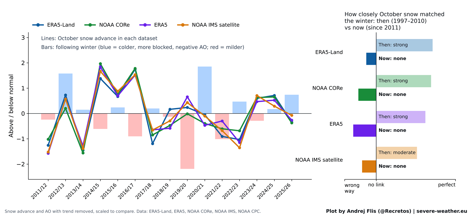
To test the longevity of the theory, researchers evaluated 47 years of historical records (1979–2025) using four distinct datasets: ERA5, ERA5-Land, NOAA IMS satellite observations, and NOAA CORe reanalysis.
The Scorecard
- Overall Performance (1979–2025): Correct in 25 out of 47 winters (approximately 53% accuracy—essentially a coin toss).
- Original Study Era (1997–2010): Strong correlation, driven partly by the extreme dynamics of the 2009/2010 winter.
- Post-Study Era (2011–Present): Correct in only 6 of 15 winters, showing a complete decoupling of the October snow-to-AO link.
Breaking Down the Chain Reaction
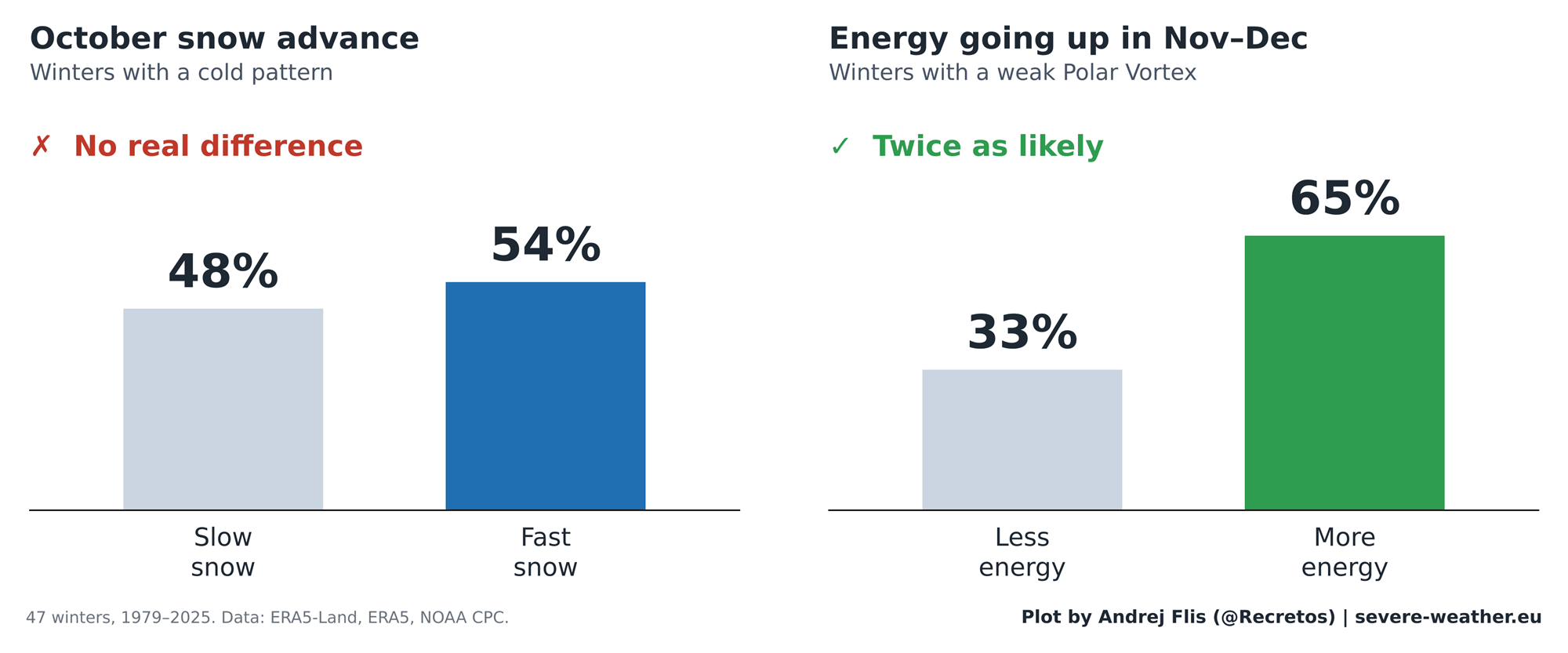
Step-by-step verification of the atmospheric chain reaction exposes where the theory stumbles. While the latter half of the sequence remains sound—meaning that elevated wave energy in November and December does reliably weaken the Polar Vortex in January and February—the initial trigger has broken down. October snow no longer consistently forces a stronger Siberian High or transmits the necessary energy upward into the stratosphere.
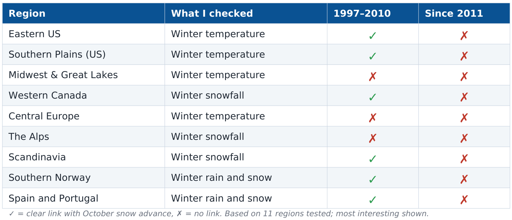
Furthermore, regional analyses across 11 distinct sectors in North America and Europe show that historical winter temperature and precipitation correlations tied to October Siberian snow have evaporated since 2011.
Official Perspectives and Modern Meteorological Implications
Atmospheric scientists emphasize that while the Siberian snow metric has lost its utility as a standalone forecast tool, the broader science of stratospheric monitoring remains vital.
The Super El Niño Factor for Winter 2026/2027
For the upcoming Winter 2026/2027 season, forecasters are prioritizing a much larger atmospheric driver: a powerful Super El Niño currently dominating the Pacific basin.
Climate model simulations, including seasonal outlooks from the European Centre for Medium-Range Weather Forecasts (ECMWF), indicate that strong El Niño events exert a powerful decelerating influence on the stratospheric Polar Vortex during mid-to-late winter.
- The January–February 2027 Outlook: ECMWF zonal wind models show a significant downward trend in stratospheric wind speeds by late December, raising the probability of a Sudden Stratospheric Warming (SSW) event or a major vortex collapse in early 2027.
- Geographic Impacts: Historically, a disrupted Polar Vortex combined with a Super El Niño signature establishes an active Pacific jet stream. Current temperature anomaly forecasts point toward persistent cooler-than-average conditions across the central, southern, and eastern United States due to frequent cloud cover and storm tracks, while northern Europe experiences a milder maritime flow with cold anomalies largely restricted to Scandinavia.
A Technical Note on Reanalysis Data
During the exhaustive data collection for this study, researchers uncovered a notable artifact within the standard ERA5 reanalysis dataset: a sudden, artificial 40% drop in Eurasian October snow cover occurring around 2004.
Cross-referencing with independent observational archives like NOAA CORe and satellite-based IMS tracking confirmed that this anomaly is an artifact of changing satellite assimilation methods within ERA5 rather than an actual physical loss of Siberian snow. Fortunately, because alternative datasets and localized reanalyses (such as ERA5-Land) corroborate the broader findings, the overarching conclusions regarding the decay of the snow-forecast signal remain entirely unaffected.
Outlook for Winter 2026/2027
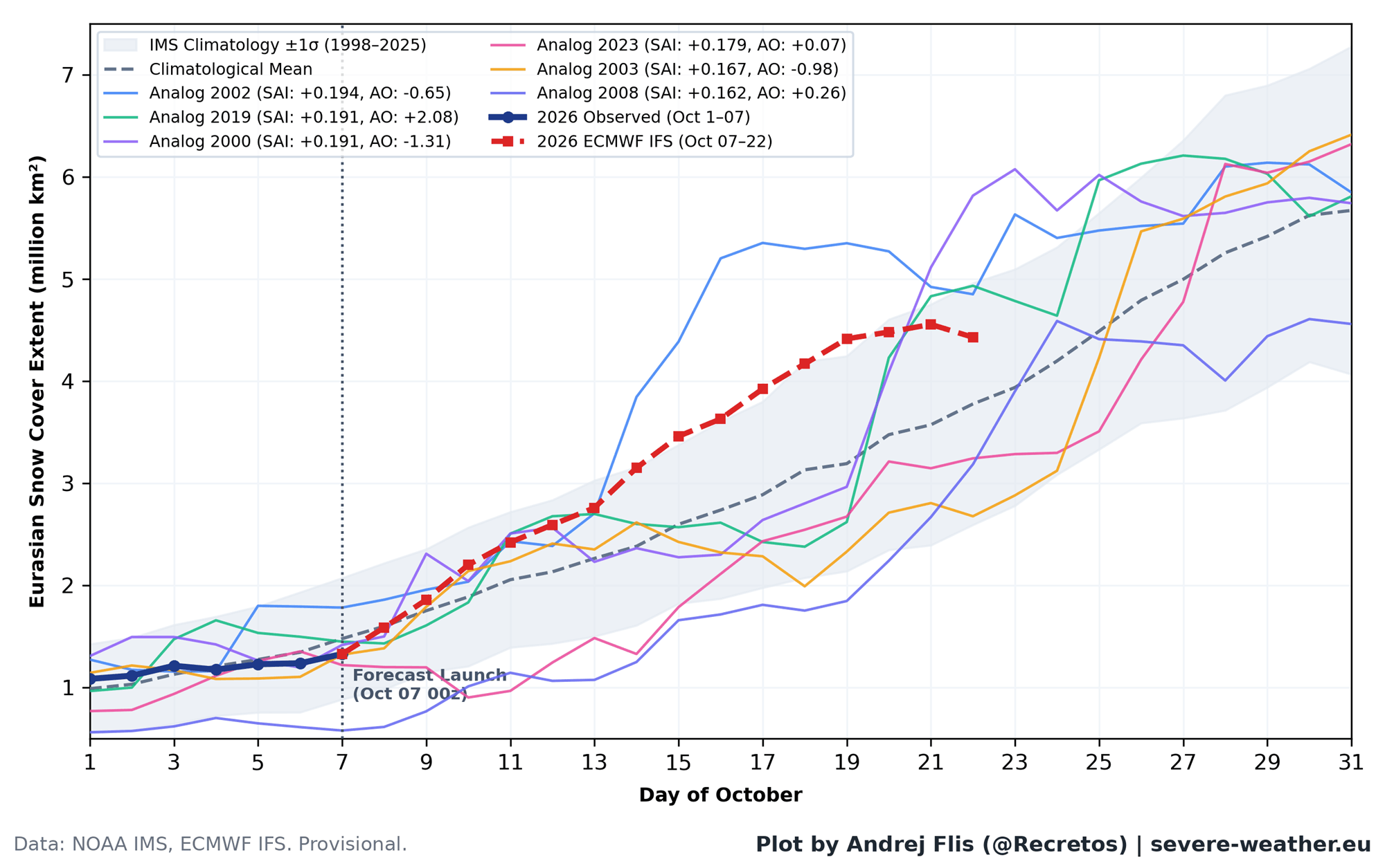
As October concludes, Eurasian snow cover is projected to make a late-month surge, placing it in the upper 15% of historical advance rates for this time of year. Under the old paradigm, this would spark widespread predictions of a harsh, snowy winter across the Northern Hemisphere.
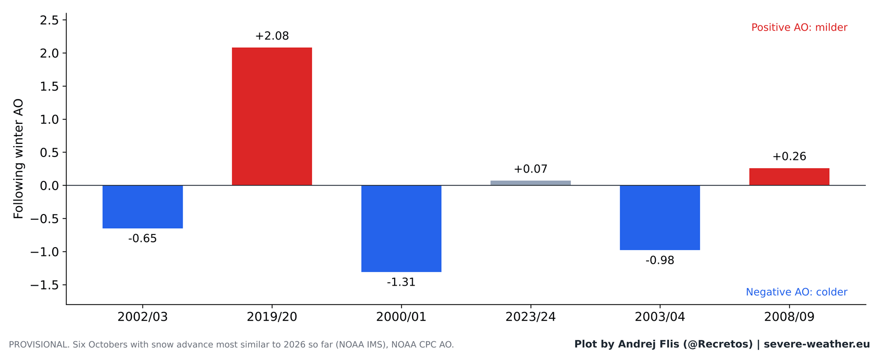
Modern meteorological science, however, takes a more nuanced approach. While the classic Siberian snow advance theory can no longer be relied upon to predict winter outcomes, advanced stratospheric modeling and oceanic indicators like the Super El Niño provide the real framework for understanding Winter 2026/2027. Forecasters will continue monitoring November-December stratospheric heat fluxes as the true early-warning system for mid-winter weather disruptions.
