

Main Facts
As the 2026 Atlantic hurricane season enters its historically most active stretch, meteorologists and climatologists are tracking a fascinating and rare confluence of global ocean anomalies. Operating in tandem across the world’s two largest ocean basins, a rare Atlantic Niña has emerged in the tropics just as a powerful Super El Niño continues its rapid intensification in the Pacific.
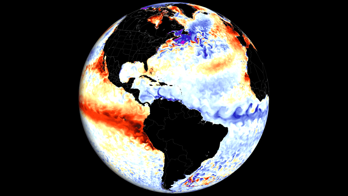
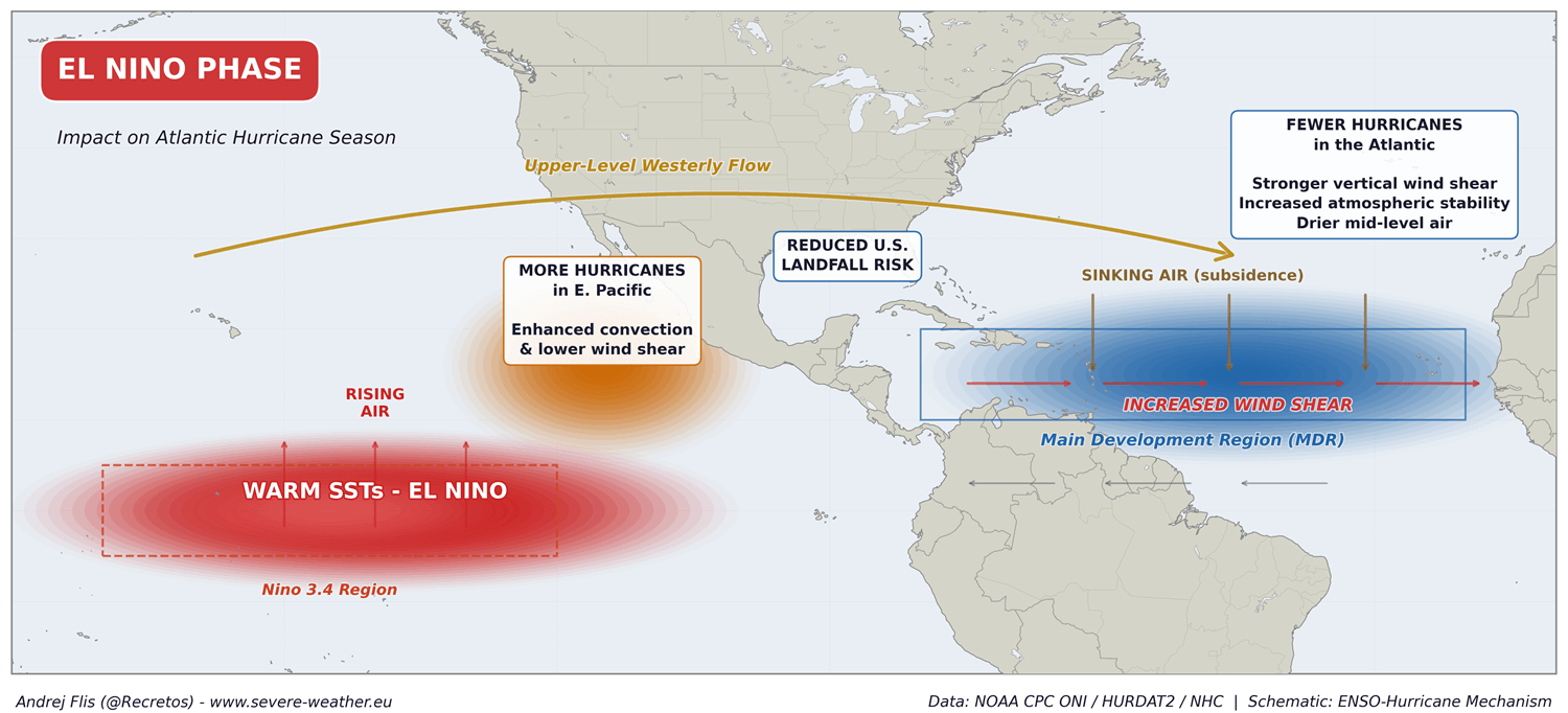
While these two phenomena sit on opposite sides of the globe and display contrasting thermal signatures on the map—one defined by exceptional warmth, the other by stark cooling—their atmospheric impacts are driving in precisely the same direction. Together, they are forging a formidable atmospheric shield over the United States and the broader Atlantic basin.
Key elements of this meteorological setup include:
- The Atmospheric Shield: High pressure, sinking air, enhanced vertical wind shear, and reduced rainfall are dominating the Main Development Region (MDR), creating an exceptionally hostile environment for tropical cyclone genesis and intensification.
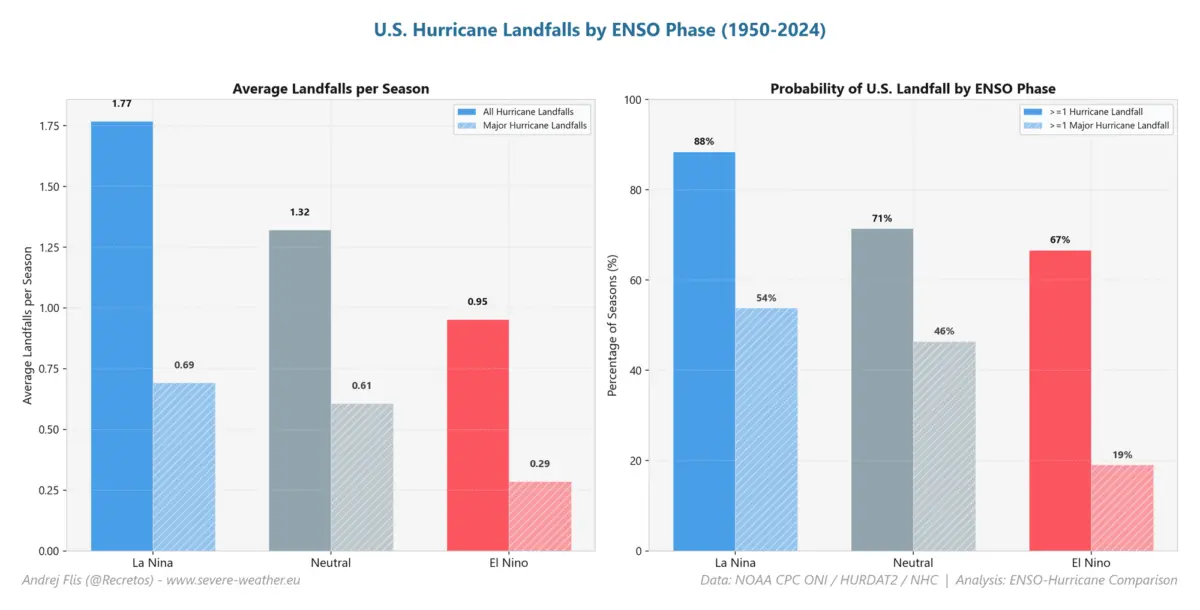
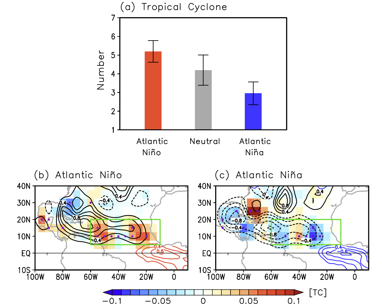
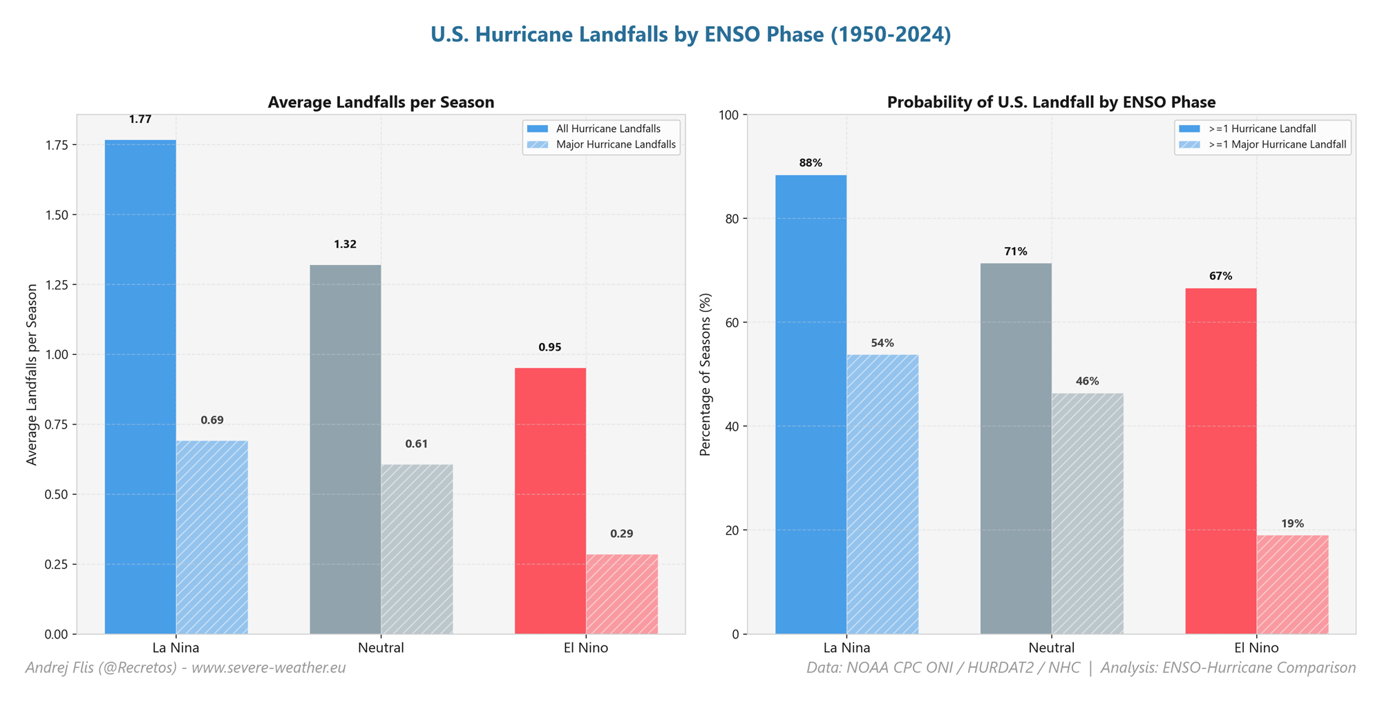
- Statistical Suppression: Historical analogues indicate that an Atlantic Niña phase can reduce tropical cyclone activity by up to 50%. When paired with a robust El Niño, the risk of hurricane landfalls along the United States coastline drops significantly compared to neutral or La Niña years.
- Rarity of the Event: If current cooling trends persist and seasonal anomalies drop below −0.5°C, the 2026 Atlantic Niña will mark only the sixth such event recorded in over 40 years of reliable modern historical data.
- Winter Teleconnections: Beyond immediate tropical suppression, this quiet hurricane season serves as an atmospheric precursor. Long-range forecast models and historical teleconnections suggest that the global drivers behind these conditions are already laying the groundwork for a disrupted stratospheric Polar Vortex and a volatile winter weather pattern for 2026/2027 across North America.
Chronology
The unfolding of this unique meteorological scenario began to take shape during the late spring and early summer of 2026, driven by fluctuations in global trade wind patterns and ocean-atmosphere coupling.
- Late Spring 2026: Equatorial trade winds across the Pacific began to weaken abnormally, allowing warm subsurface waters to surge eastward. This rapid accumulation of heat laid the foundation for the current Super El Niño event, with eastern Pacific anomalies quickly soaring to 3 to 4 degrees Celsius above normal.
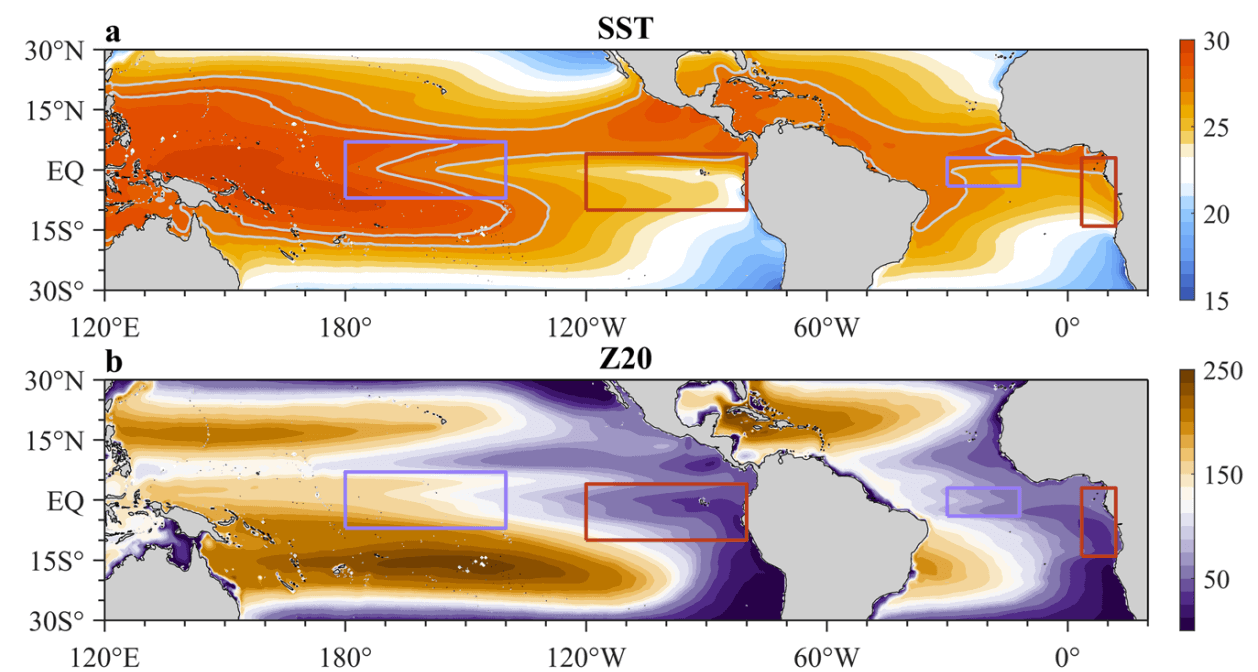
- Early Summer 2026: Conversely, strong easterly trade winds intensified across the tropical Atlantic basin. This localized strengthening triggered strong upwelling, pulling colder deep ocean waters to the surface and initiating a rare Atlantic Niña event.
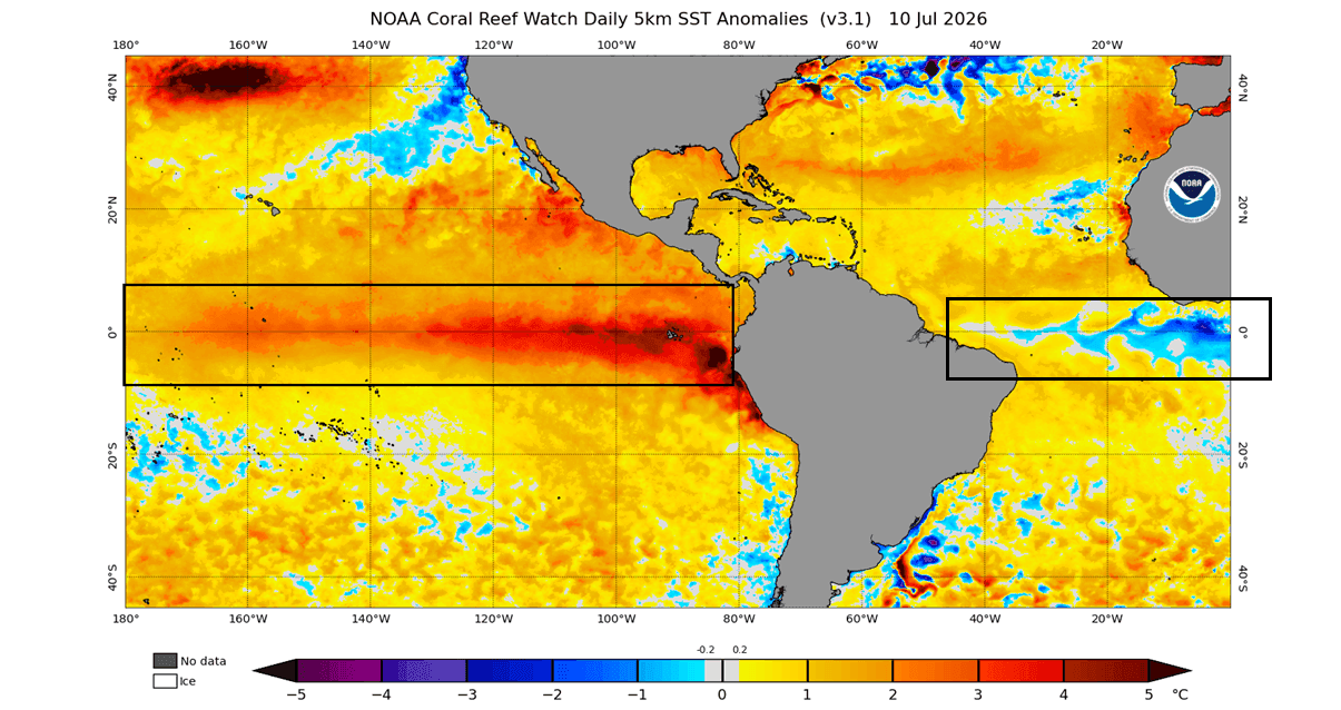
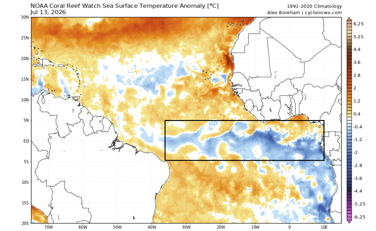
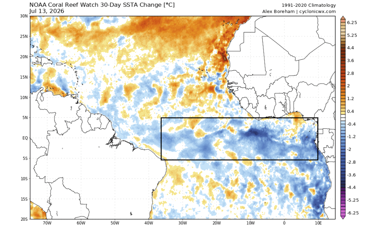
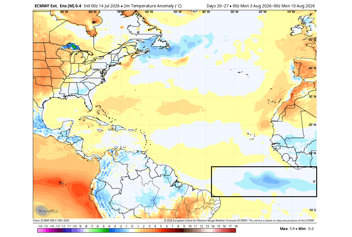
- July 2026: Real-time data from NOAA’s Coral Reef Watch (CRW) and the European Centre for Medium-Range Weather Forecasts (ECMWF) confirmed the simultaneous maturation of both anomalies. While the Pacific ENSO region displayed extreme warmth, a prominent cold tongue developed across the equatorial Atlantic, showing temperatures 1 to 3 degrees Celsius below average over a 30-day period.
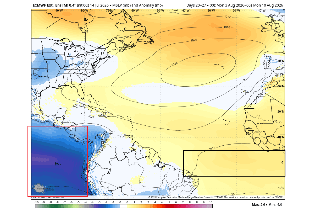
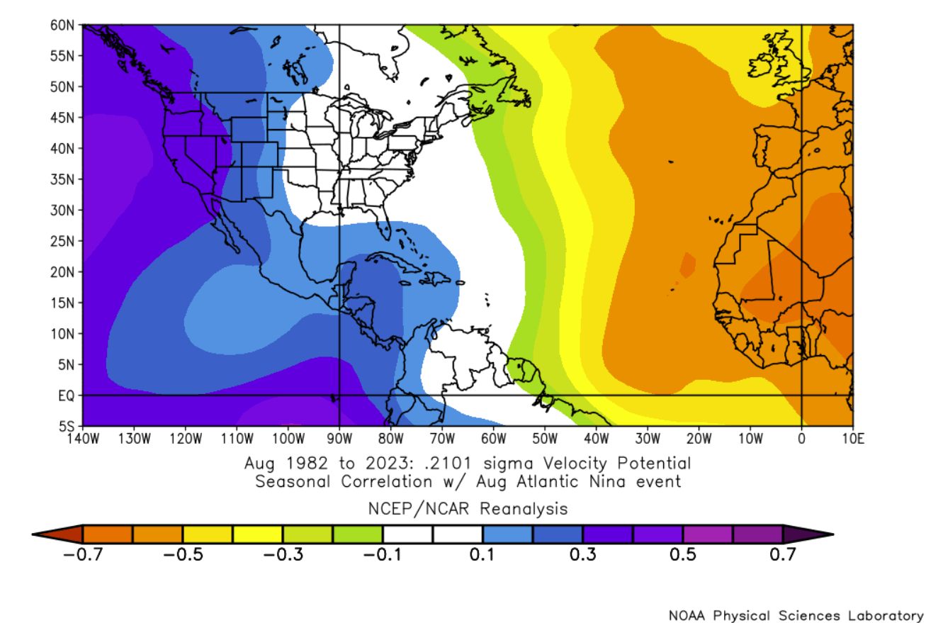
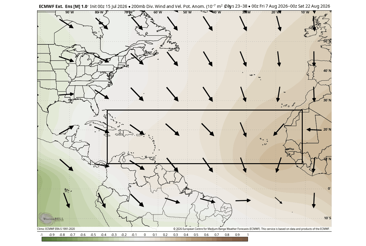
- August 2026 (Present): As the calendar turns to August—traditionally the threshold of accelerated tropical activity—extended-range ECMWF forecasts have mapped out persistent high-pressure anomalies and suppressed velocity potentials over the Atlantic MDR. Official outlooks from the National Hurricane Center (NHC) and specialized tropical monitoring centers reflect this stagnation, showing a heavily subdued Atlantic basin contrasted by heightened activity in the Pacific.
Supporting Data
The alignment of the Pacific Super El Niño and the Atlantic Niña is unprecedented in its combined scope, heavily documented by leading meteorological institutions and data models.
Oceanic and Atmospheric Diagnostics
According to recent NOAA CRW analyses, the primary ENSO regions in the Pacific are exhibiting peak anomalies that exceed normal parameters by multiple degrees. Simultaneously, 30-day temperature change maps illustrate a broad, sweeping cooling trend across the equatorial Atlantic. This cooling is directly tied to enhanced trade wind activity, which restricts surface heat accumulation.
[Pacific Basin]                    [Equatorial Atlantic]
  Super El Niño                      Atlantic Niña
  (Warm Anomalies: +3°C to +4°C)     (Cold Anomalies: -1°C to -3°C)
         │                                   │
         └───────────────┬───────────────────┘
                         ▼
           Unified Atmospheric Response:
    Enhanced Wind Shear, Sinking Air, High Pressure
                         │
                         ▼
          Suppressed Atlantic Hurricane Season
Velocity Potential and Circulation
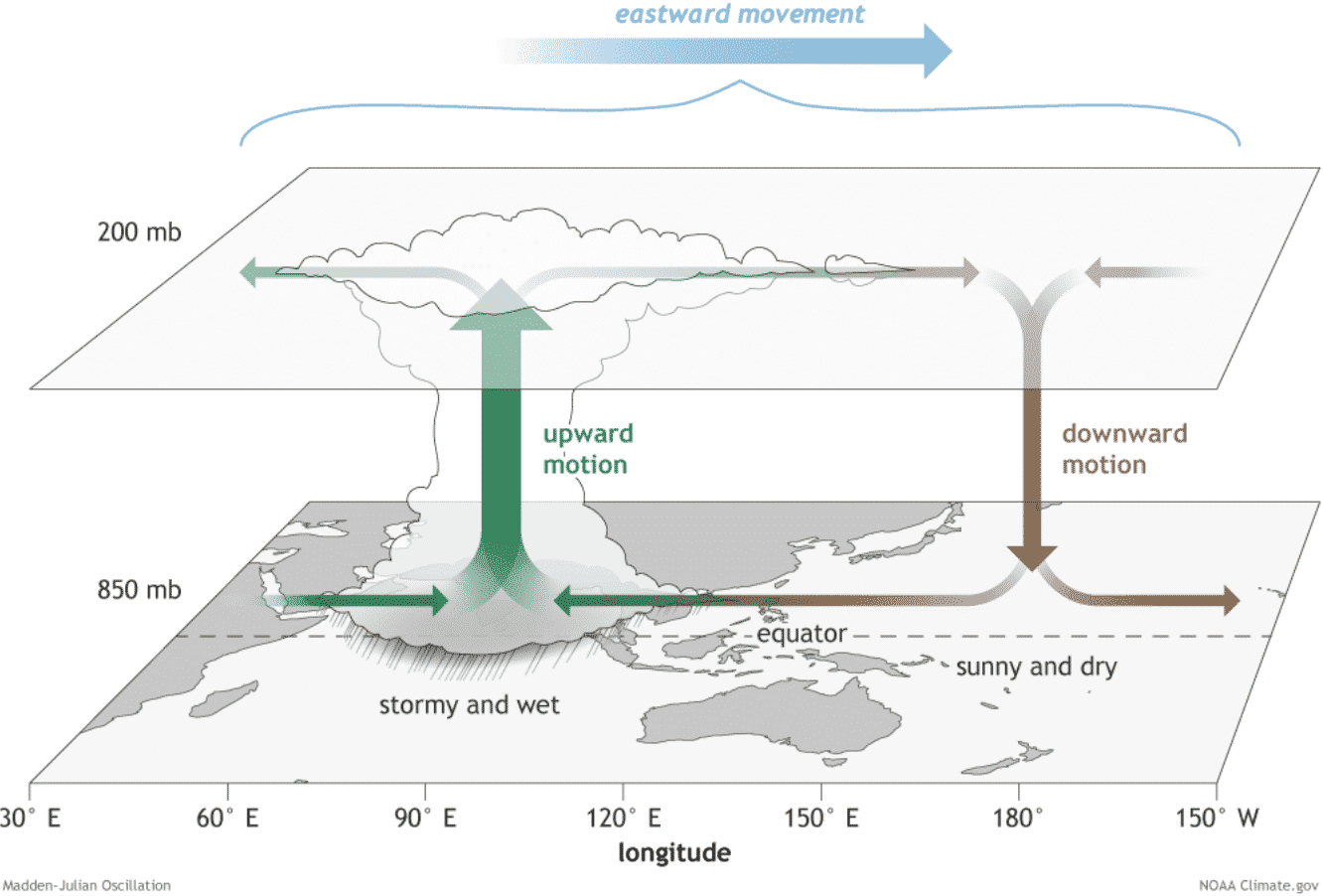
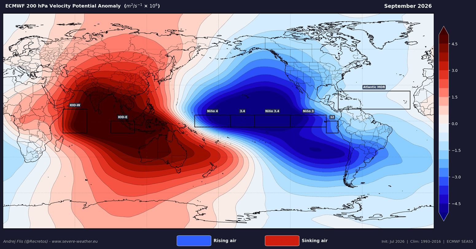
Meteorologists utilize Velocity Potential indicators to measure large-scale atmospheric divergence and convergence. During the current season, upper-level models demonstrate strong sinking motion (subsidence) over the Atlantic MDR. Subsidence stabilizes the atmosphere, preventing the formation of convective cloud towers essential for tropical wave organization.
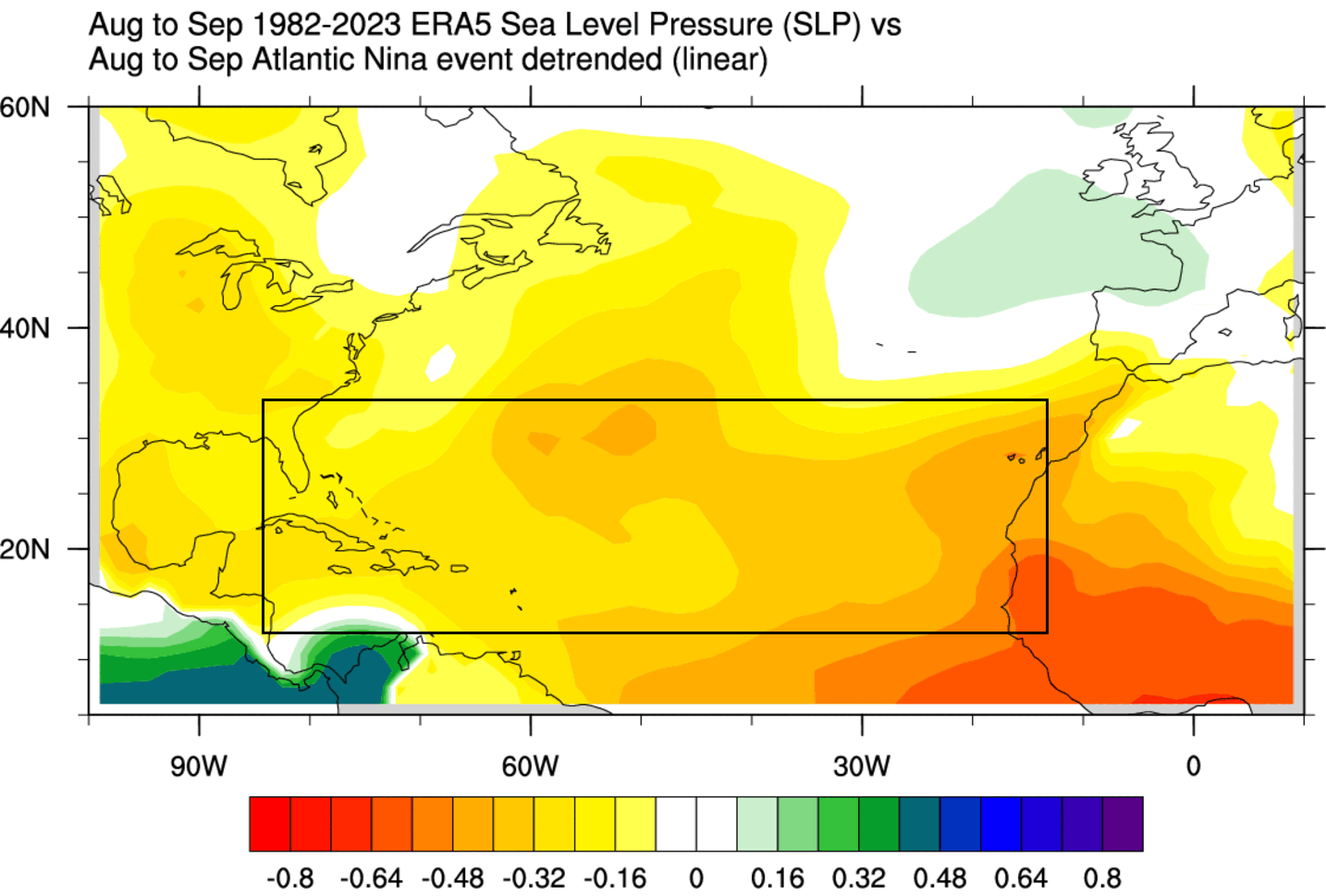
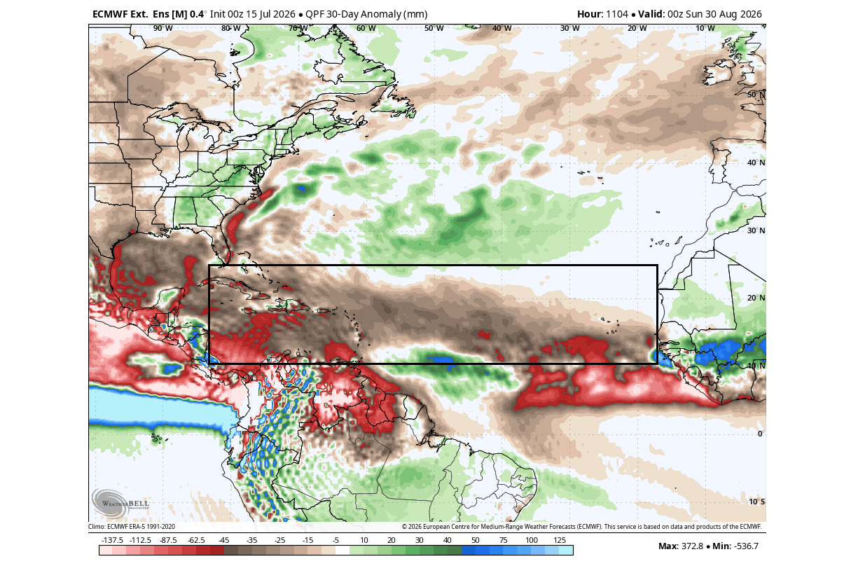
Furthermore, precipitation anomaly forecasts for August and September 2026 illustrate a widespread expanse of below-normal rainfall stretching from the Caribbean through the Gulf of Mexico and up the United States Eastern Seaboard. Surface pressure models mirror this, showing above-normal pressure readings across zones that typically feature cyclonic low pressure during active seasons.
Official Responses and Expert Outlooks
Forecasting agencies and university research teams have adjusted their seasonal expectations to account for these dominant global anomalies.
Colorado State University (CSU) Forecasts
The tropical meteorology project at Colorado State University, led by Dr. Philip Klotzbach, released updated 2026 outlooks emphasizing a suppressed overall threat. Utilizing the Accumulated Cyclone Energy (ACE) index—a metric measuring the combined intensity and duration of tropical storms and hurricanes—CSU projections place the 2026 season well below historical norms.
In translating these metrics into landfall risk, CSU’s anomaly mapping reveals that every coastal county stretching from Brownsville, Texas, to the shores of Newfoundland faces a below-normal hurricane threat.
Historical Context and Caveats
Despite the overwhelmingly hostile environment for storm development, official voices from NOAA and the National Hurricane Center continually emphasize a vital baseline rule of meteorology: below-normal risk does not mean zero risk.
Climatologists frequently point to the 1992 season as a stark historical precedent. Despite being heavily suppressed by an El Niño phase, the 1992 season produced Hurricane Andrew—a catastrophic Category 5 storm that devastated South Florida. Modern forecasters use this historical reality to remind coastal populations that statistical probabilities can always be punctured by high-impact outliers.
Implications
The cascading impacts of the 2026 Atlantic Niña and Pacific Super El Niño extend far beyond summer tropical tracking, offering critical clues regarding global weather patterns for the remainder of the year and into the 2026/2027 winter season.
The Macro-Scale Weather Connection
Oceanic anomalies act as massive thermal batteries that dictate global atmospheric circulation. The identical systemic drivers responsible for suppressing the Atlantic hurricane season also leave an indelible imprint on mid-latitude jet streams as the Northern Hemisphere transitions into autumn and winter.
Winter 2026/2027 and the Polar Vortex
Long-range analytical models examining historical post-quiet-hurricane seasons reveal fascinating correlations within the stratosphere:
- Stratospheric Warming: Winters following suppressed tropical activity frequently exhibit a warmer winter stratosphere.
- A Weakened Polar Vortex: This stratospheric warmth is often coupled with a disrupted or destabilized Polar Vortex. A compromised vortex loses its structural integrity, reducing its ability to lock frigid Arctic air safely within the polar cap.
- Mid-Latitude Cold Spills: When the Polar Vortex breaks down, the polar jet stream buckles. This dynamic allows substantial outbreaks of cold air and severe winter weather to spill southward into the mid-latitudes, impacting portions of the United States and Canada.
Thus, while the current summer climate provides coastal residents with a much-needed atmospheric shield against tropical landfalls, it simultaneously sets the stage for a dramatic, volatile shift in winter weather dynamics. Meteorologists will continue to monitor these intricate teleconnections as the year progresses, mapping the path from tropical quiescence to potential winter extremes.
