

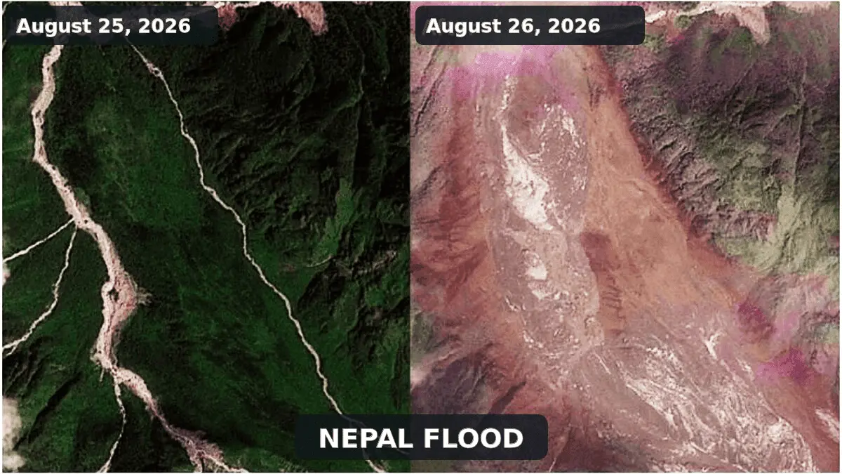
August 26, 2026 — A violent and fast-moving surge of water, mud, and boulders tore through the transboundary Bhote Koshi-Trishuli river system, devastating vulnerable settlements, critical infrastructure, and lifeline roads in northern Nepal and southern Tibet.
What initially baffled geophysicists as a sudden seismic disturbance has now been identified as a catastrophic high-mountain cascade: a massive ice and rock avalanche that temporarily dammed a steep Himalayan valley before giving way to an overwhelming debris-laden flash flood.
As search-and-rescue teams struggle to penetrate remote canyons cut off by washed-out bridges, the disaster has underscored the growing vulnerabilities of high-altitude regions to complex, multi-stage geohazards.
Main Facts
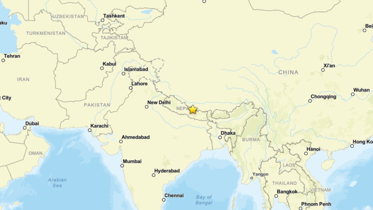
The disaster unfolded on August 26, 2026, originating in the upper Lhende Khola—a steep, glacierized tributary of the Bhote Koshi close to the international border between Nepal and Tibet.
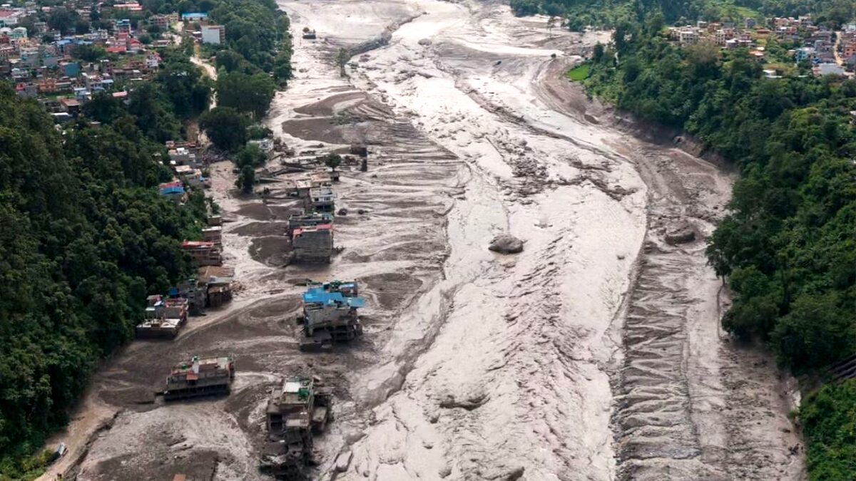
- The Scope of Destruction: The resulting flash flood surged downstream into Nepal’s Rasuwa district, decimating roads, bridges, local communities, and hydropower installations.
- Casualties: According to preliminary reports from the Associated Press released late on August 26, at least 160 fatalities have been confirmed across Nepal and China, with hundreds of tourists, migrant workers, and local residents still listed as missing. Authorities warn that this figure is almost certainly a significant underestimate due to the extreme inaccessibility of the impact zone.
- Hydrological Impact: Satellite data compiled by the International Center for Integrated Mountain Development (ICIMOD) indicates that water levels on the Trishuli River spiked by an astonishing 9 meters (nearly 30 feet) in approximately 30 minutes.
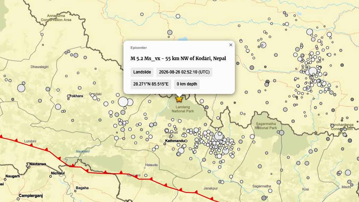
- The Seismic Shift: Crucially, a seismic signal initially cataloged by the U.S. Geological Survey (USGS) as a magnitude 4.4 earthquake near the border was later reclassified as a magnitude 5.2 landslide. Seismologists confirmed that the ground shaking was a byproduct—the geophysical signature—of the massive slope collapse itself, rather than a tectonic trigger.
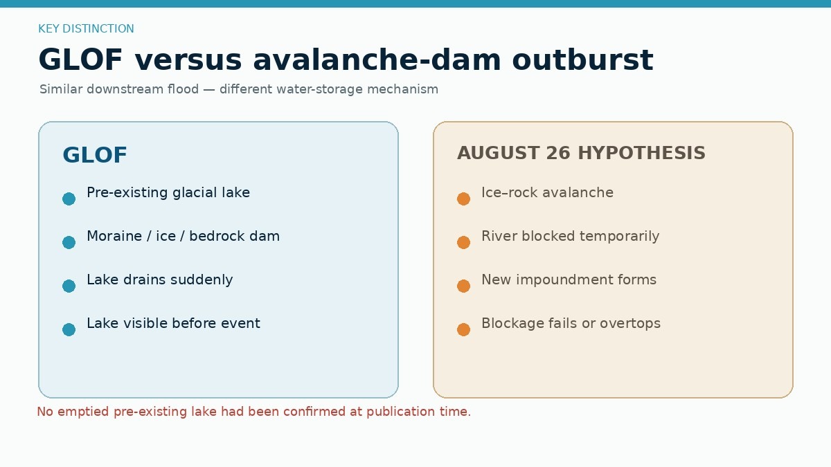
- Distinction from GLOFs: Despite early media reports labeling the event a Glacial Lake Outburst Flood (GLOF), current satellite evidence points instead to an avalanche-induced landslide-dam outburst flood, marking a vital technical distinction for future hazard monitoring.
Chronology of the Event
Reconstructing the timeline of a high-mountain disaster requires piecing together satellite imagery, seismic records, and eyewitness accounts from the few survivors near the border.
Phase 1: Slope Destabilization and Collapse
Long-term environmental pressures—including steep topography, glacial thinning, and rising temperatures—pushed a steep, glacierized slope in the upper Lhende Khola to its mechanical breaking point. On August 26, an immense mass of bedrock, glacier ice, and snow detached. This mixed ice and rock avalanche accelerated rapidly down the high-altitude valley, shattering bedrock and pulverizing ice into a fast-moving granular flow.
Phase 2: The Seismic Signature
As millions of tons of material cascaded downward, it generated intense low-frequency seismic waves. Automated global monitoring networks initially picked up the disturbance, leading to the misinterpretation that a magnitude 4.4 tectonic earthquake had struck the region. Subsequent waveform analysis by the USGS corrected this, proving that the ground motion was entirely generated by the catastrophic mass movement.
Phase 3: Valley Blockage and Temporary Damming
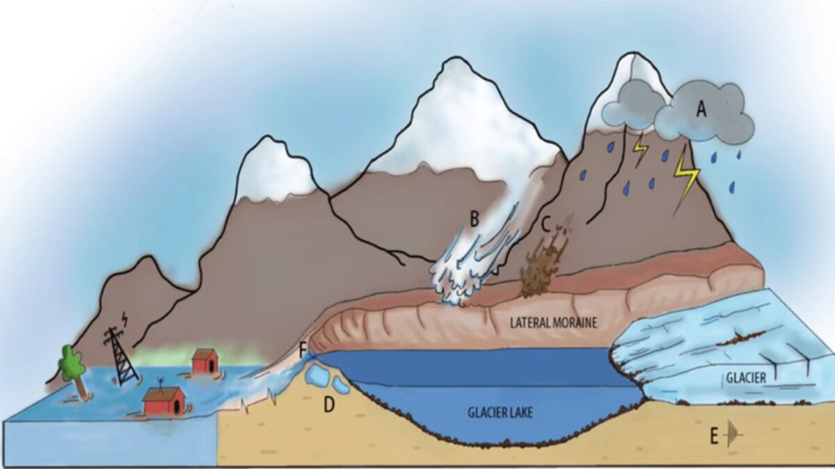
The descending avalanche slammed into the narrow Lhende Khola valley, choking the channel with an irregular, permeable dam composed of boulders, shattered ice, sediment, and snow. Water rapidly pooled behind this unstable barrier, forming a short-lived, landslide-dammed lake.
Phase 4: The Outburst and Flash Flood
Unable to hold the mounting hydrostatic pressure, the improvised natural dam breached. The sudden escape of impounded water, combined with the debris of the original avalanche, transformed into a hyper-concentrated debris flow. This wall of water and mud scoured riverbanks, picked up additional sediment, and propagated rapidly downstream into the Bhote Koshi and Trishuli river systems, striking populated valleys with devastating speed.
Supporting Data and Scientific Analysis
To understand the mechanics of the August 26 disaster, geomorphologists are looking closely at the anatomy of high-altitude mass movements, drawing comparisons with recent catastrophic events in the Alps.
The Physics of an Ice-and-Rock Avalanche
Unlike seasonal snow avalanches—which typically rely on weak layers within a snowpack—or standard glacial flow (which moves at rates of centimeters to meters per day), an ice avalanche occurs when a hanging glacier, steep tongue, or serac loses structural support, accelerating to tens of meters per second in seconds. When combined with bedrock failure, the resulting ice-and-rock avalanche behaves as an energetic fluid-solid mixture.
The GLOF Misconception
A Glacial Lake Outburst Flood (GLOF) requires the sudden drainage of a pre-existing lake dammed by moraine, ice, or bedrock. While a deadly flood in the same river system on July 8, 2025, was successfully traced to a supraglacial lake north of the Langtang Himal, high-resolution satellite imagery from the August 2026 event has revealed no emptied pre-existing glacial lake as the primary source. Instead, the water was temporarily impounded behind the avalanche debris itself—distinguishing it structurally from a traditional GLOF.
Global Parallels: Marmolada and Blatten
The event bears striking resemblances to recent high-mountain collapses in Europe:
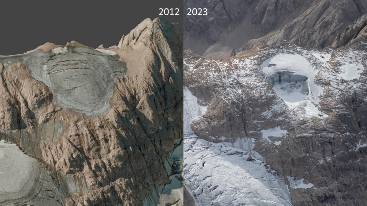
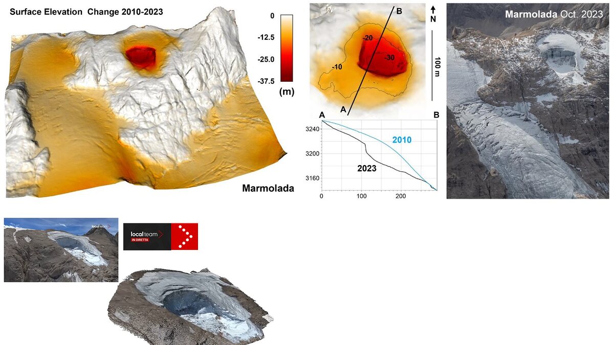
- Marmolada (Italy, 2022): A thermal-stress-induced collapse of approximately 70,000 cubic meters of ice and debris killed 11 mountaineers. Like the Nepal-Tibet disaster, the Marmolada collapse generated a localized seismic signal rather than being triggered by an earthquake.
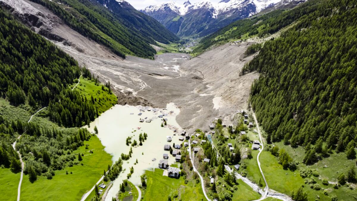
- Blatten (Switzerland, 2025): A massive rock and ice avalanche involving the Birch Glacier mobilized 9.5 million cubic meters of material, burying parts of the Lötschental village and damming the Lonza River. The Blatten disaster serves as a textbook example of a progressive "domino-style" cascade where rockfall loads a glacier, triggering a combined avalanche that subsequently blocks a river channel.
Official Responses and Rescue Operations
Rescue and relief efforts face unprecedented obstacles. The same flash flood that claimed lives also wiped out the primary road networks, bridges, and communication lines connecting Nepal to Tibet.
- Government and Military Deployment: Nepalese authorities have mobilized military helicopters to airlift stranded tourists and injured residents from remote gorges, though heavy cloud cover and ongoing rains have repeatedly grounded rescue flights.
- Cross-Border Coordination: Local agencies in both Nepal and China are utilizing emergency satellite feeds provided by international bodies like ICIMOD and the European Union’s Copernicus program to map inaccessible terrain, identify survivors, and assess structural integrity downstream.
- Continued Flood Warnings: Hydrologists have issued urgent warnings to downstream communities. Because satellite data indicates that portions of the debris blockage may still be retaining water in the upper Lhende Khola, residents along the Bhote Koshi and Trishuli corridors have been advised to remain on high alert for secondary outburst waves.
Implications and Future Outlook
The catastrophe on the Nepal-Tibet border highlights profound systemic challenges for mountainous regions facing rapid environmental changes.
The Warning-System Deficit
Traditional early-warning systems in the Himalayas have historically focused on monitoring known, expanded glacial lakes. However, sudden avalanches that block rivers and form ephemeral, short-lived lakes defy conventional monitoring parameters. Rivers cross international borders far faster than bureaucratic warnings can be communicated, highlighting an urgent need for automated, real-time river gauges, seismic slope-monitoring networks, and rapid transboundary communication protocols.
The Climate Context
While scientists caution against prematurely attributing any single extreme weather event directly to climate change without formal attribution studies, the broader environmental baseline is undeniable. The Hindu Kush Himalaya region is warming at rates significantly higher than the global average.
This warming drives:
- Accelerated glacial thinning and retreat.
- The degradation of ice-bearing permafrost, which destabilizes steep rock walls.
- Increased meltwater infiltration, which increases hydrostatic pressure within fractures.
At the same time, socioeconomic pressures—including the rapid expansion of hydropower projects, tourism infrastructure, and valley-floor settlements—are placing more human lives and economic investments directly in harm’s way.
Conclusion
The August 26 disaster is a stark reminder that high-mountain hazards rarely operate in isolation. By understanding the complex cascades linking slope failures, seismic signatures, temporary natural dams, and flash floods, scientists and policymakers can better adapt warning infrastructure to protect vulnerable communities before the next mountain crisis strikes.
