

By Global News Desk
Published: August 27, 2026
Main Facts
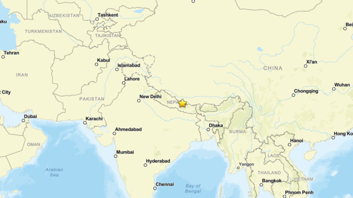
A catastrophic flash flood driven by a massive surge of water, mud, and boulders tore through the transboundary Bhote Koshi-Trishuli river system on August 26, 2026. The disaster devastated settlements, critical infrastructure, and hydropower installations across northern Nepal and southern Tibet.
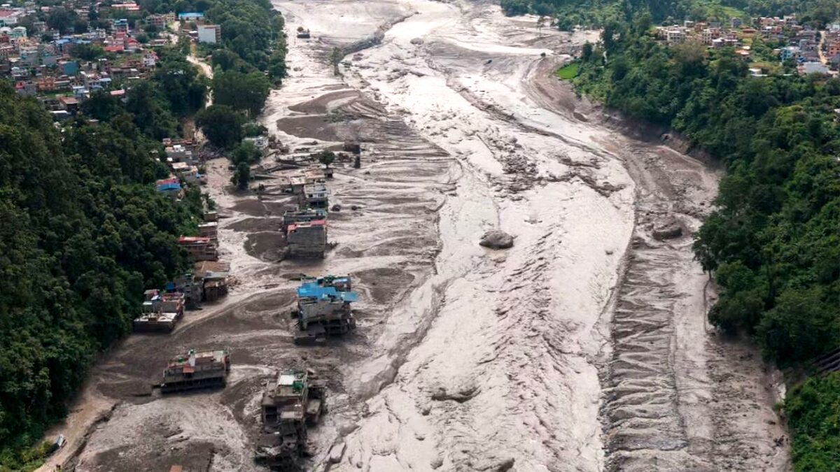
According to preliminary reports released by the Associated Press, at least 160 people have been confirmed dead across Nepal and China, while hundreds more—including tourists, local residents, and migrant laborers—remain unaccounted for. Rescue and recovery operations are severely hampered as roads, bridges, and communications lines have been completely obliterated or buried under meters of debris.
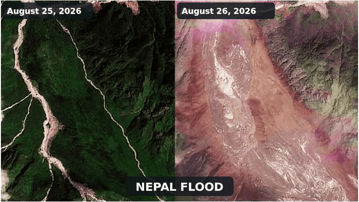
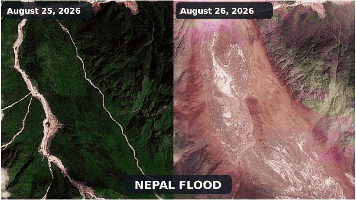
Satellite evidence analyzed by the International Center for Integrated Mountain Development (ICIMOD) indicates that the disaster originated from a massive ice and rock avalanche in the upper Lhende Khola, a steep tributary of the Bhote Koshi near the international border. The falling mass temporarily blocked the narrow river valley, creating an unstable natural dam. When this temporary barrier breached, it unleashed a violent debris-rich flood wave downstream.
Crucially, geophysical assessments have corrected initial assumptions regarding the disaster’s trigger. A seismic signal initially logged by the U.S. Geological Survey (USGS) as a magnitude 4.4 earthquake has been reclassified as a magnitude 5.2 landslide. This confirms that the seismic waves were generated by the cataclysmic collapse of the mountain slope itself, rather than acting as a tectonic trigger for the disaster.
Chronology of the Disaster
Pre-Event Conditions
Leading up to August 26, the high-altitude regions of the Hindu Kush Himalaya experienced extended periods of exceptionally warm temperatures, accelerated glacier thinning, and early seasonal snow loss. These environmental factors degraded ice-bearing permafrost and destabilized steep, fractured rock walls across the region, setting the stage for slope failure.
The Collapse and Seismic Signature
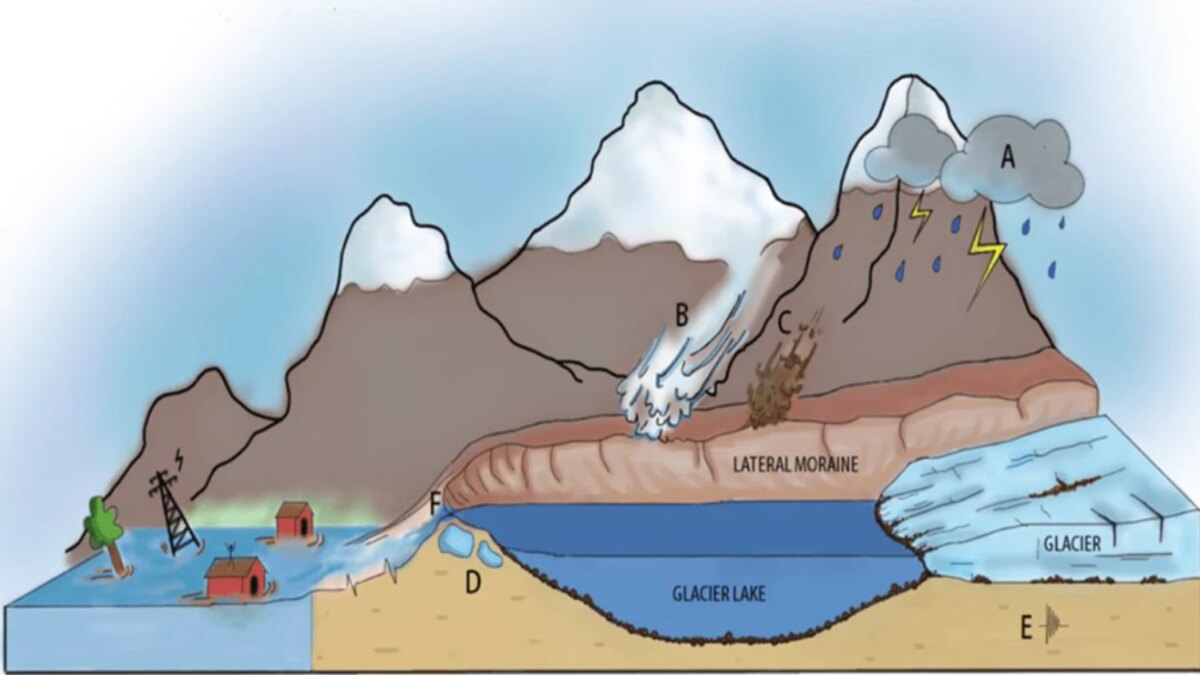
At an unspecified hour on August 26, a steep glacierized and periglacial slope in the upper Lhende Khola suffered a catastrophic structural failure. A mixture of bedrock, glacial ice, and snow detached and accelerated downslope at velocities reaching tens of meters per second.
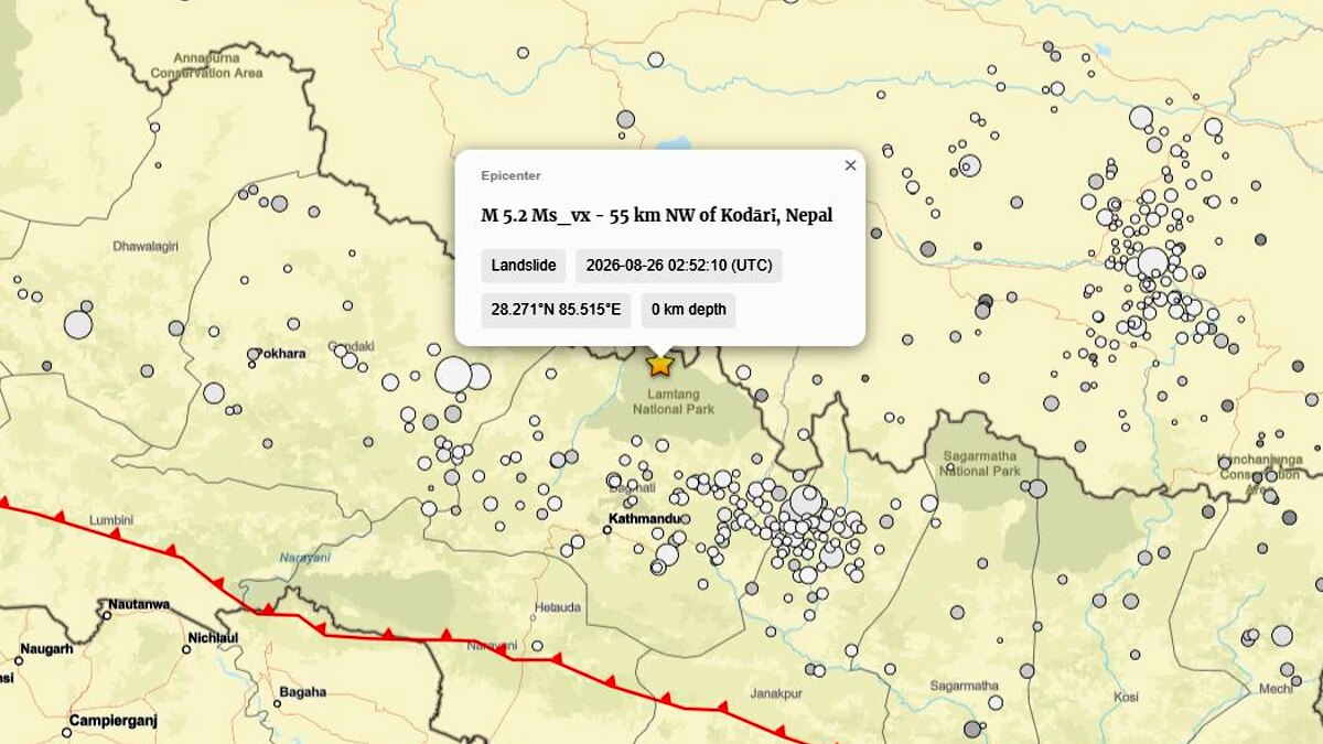
As the avalanche descended, it registered on regional seismographs. The USGS initially cataloged the ground motion as a magnitude 4.4 tectonic earthquake. However, subsequent waveform analysis proved that the signal was actually a magnitude 5.2 landslide signature—the direct geophysical footprint of millions of tons of rock and ice violently collapsing into the valley.
Valley Obstruction and Flash Flood Surge
Upon reaching the valley floor, the avalanche debris slammed into the Lhende Khola, creating an irregular, highly permeable natural dam. Water rapidly accumulated behind this makeshift barrier, forming a short-lived landslide-dammed lake.
Within roughly 30 minutes, the pressure proved too great. The dam suffered a catastrophic partial breach, releasing the impounded water along with pulverized ice, sediment, and boulders. Entering the Bhote Koshi and Trishuli river systems, the flood wave propagated downstream into Nepal’s Rasuwa district. River levels on the Trishuli spiked by an astonishing nine meters in less than half an hour, catching downstream communities completely off guard.
Immediate Aftermath and Ongoing Risk
By late August 26, the torrent had swept away roads, bridges, and vital infrastructure. Rescue teams rushed to the border zone, but access remains heavily restricted. Concurrently, hydrologists have warned that a portion of the original avalanche obstruction may still be holding back water in the upper Lhende Khola, raising fears of a secondary outburst flood if the remaining barrier fails.
Supporting Data and Technical Breakdown
To fully understand the mechanics of the August 26 disaster, scientists emphasize the need to differentiate between distinct high-mountain hazards that are frequently conflated in public reporting:
1. Ice-and-Rock Avalanche vs. GLOF (Glacial Lake Outburst Flood)
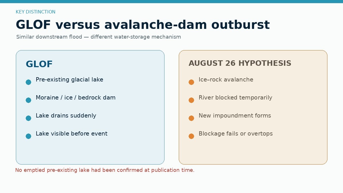
Initial media reports frequently labeled the event a Glacial Lake Outburst Flood (GLOF). However, glaciologists and ICIMOD specialists have clarified that no pre-existing, permanent glacial lake has been identified as the primary source.
- GLOFs require the sudden drainage of a pre-existing lake dammed by moraine, ice, or bedrock.
- The August 26 event, by contrast, was an ice-and-rock avalanche that directly blocked a flowing river channel, generating a temporary landslide-dammed lake that subsequently failed. While a small supraglacial or ice-marginal pocket of water may have contributed to the volume, the primary driver was mass-movement blocking rather than lake drainage.
2. The Mechanics of Ice-Rock Avalanches
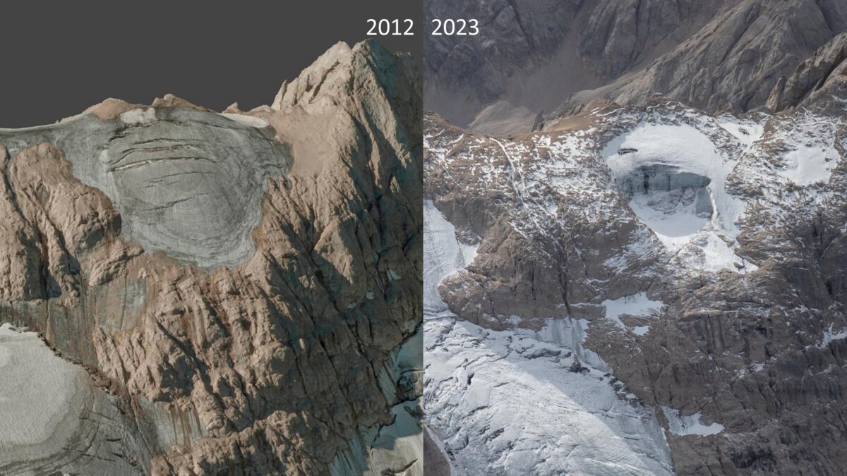
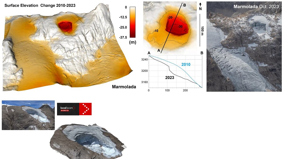
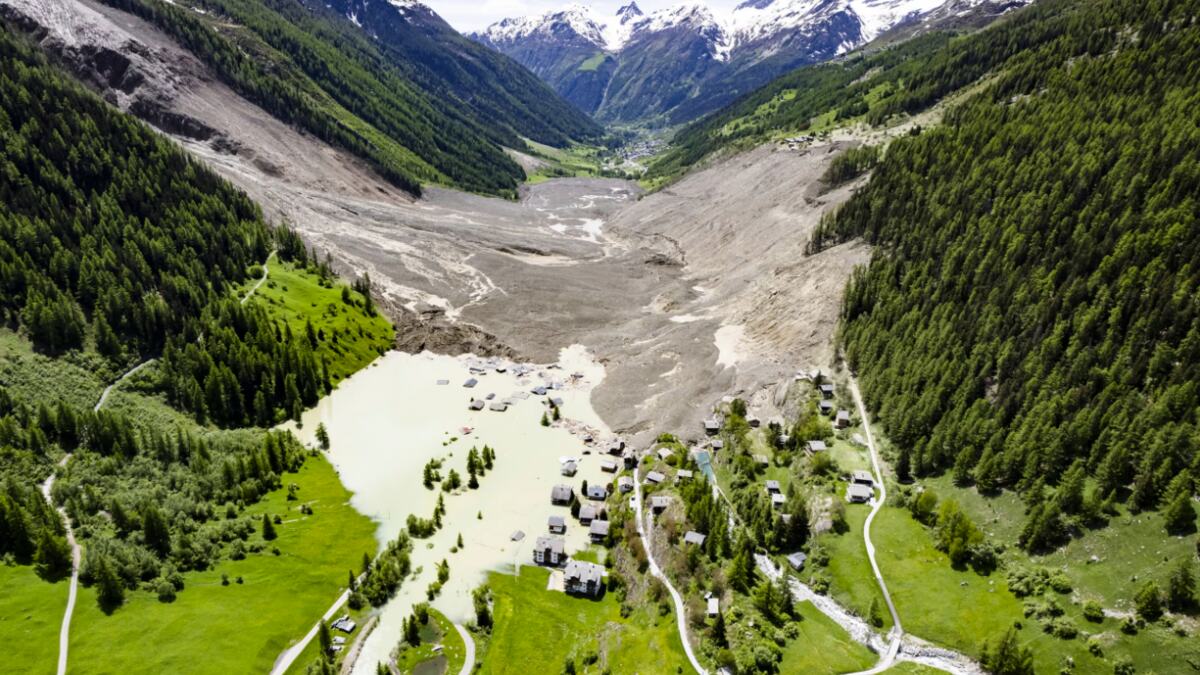
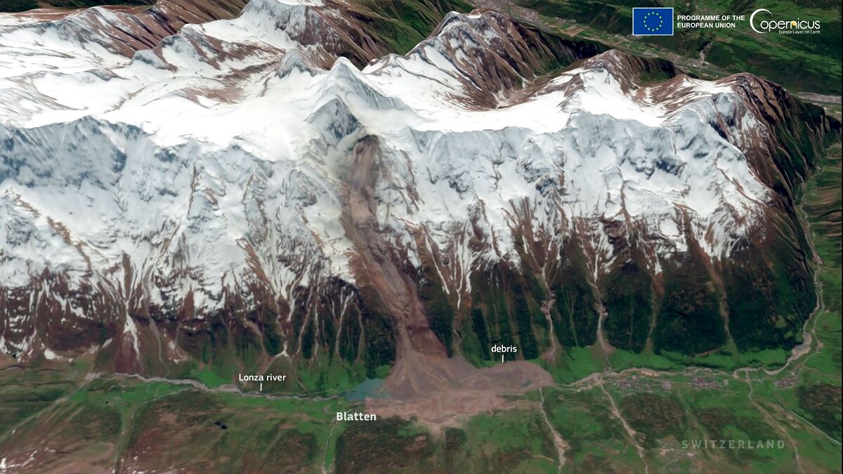
The disaster mirrors other high-profile cryospheric failures, such as the July 2022 Marmolada Glacier collapse in Italy and the May 2025 Blatten disaster in Switzerland. In these events, progressive rock fracturing—driven by internal water pressure, hydrostatic forces, and permafrost degradation—weakens the structural integrity of a slope until it undergoes sudden, catastrophic failure. Once the mixed mass of ice and rock shatters, it transforms into a high-speed granular flow, scouring riverbeds and entraining massive sediment loads as it travels.
3. Seismic Reclassification Data
The USGS event page (us7000tbwb) provides critical technical data validating the nature of the event:
- Initial Automatic Report: Magnitude 4.4 earthquake.
- Revised Expert Assessment: Magnitude 5.2 landslide.
- Significance: Proves that large-scale mass movements can mimic tectonic earthquakes during automated processing due to the sheer energy released by falling mountain masses. Similar seismic signatures were recorded during the 2022 Marmolada collapse.
Official Responses and International Action
Government agencies, international bodies, and scientific networks have mobilized in response to the humanitarian and geophysical crisis:
- Search and Rescue Operations: Nepalese authorities, alongside local emergency services, have deployed personnel to the hard-hit Rasuwa district and surrounding border regions. However, rescue efforts are severely bottlenecked by destroyed infrastructure, blocked mountain passes, and ongoing hazards.
- Scientific Assessments: ICIMOD, working alongside satellite data providers like Planet Labs and Copernicus, has ramped up high-resolution remote-sensing analysis to map the failure scar, calculate the volume of displaced material, and monitor the upper Lhende Khola for secondary dam stability.
- Transboundary Collaboration: Because the disaster originated in Tibet (China) and wreaked havoc downstream in Nepal, agencies are emphasizing the urgent need for robust, real-time transboundary data-sharing. Meteorological agencies and river-monitoring boards are working to establish automated early-warning networks that can outpace the speed of mountain flash floods.
Implications and Future Outlook
The catastrophe along the Nepal-Tibet border highlights profound long-term implications for mountain communities, infrastructure planning, and climate science in the Hindu Kush Himalaya.
1. The Climate Baseline and Cryospheric Instability
While scientists urge caution against directly attributing this single weather-independent slope failure to climate change, researchers agree that regional warming is systematically altering the Himalayan cryosphere. Rapid glacier retreat, permafrost thaw, and intense seasonal meltwater cycles are increasing the baseline instability of high-altitude rock walls and hanging glaciers. Longer periods of positive temperatures allow water to penetrate deep into bedrock fractures, eroding mechanical support over years and decades.
2. Infrastructure Vulnerability and Economic Exposure
The rapid expansion of hydropower projects, highways, and tourism infrastructure along narrow Himalayan river valleys has exponentially increased human exposure to high-mountain hazards. Traditional hazard assessments—which historically focused strictly on mapping pre-existing glacial lakes—are proving inadequate against sudden, unmonitored ice-rock avalanches and flash floods.
3. Redefining Early-Warning Systems
The disaster demonstrates that early-warning frameworks must evolve. Monitoring must expand beyond traditional GLOF inventories to encompass high-altitude slope stability, real-time seismic monitoring of mass movements, automated upstream river gauges, and rapid cross-border communication protocols.
As search operations continue and scientific teams pore over satellite imagery and seismic logs, the August 26 disaster stands as a stark reminder of the volatile forces shaping the roof of the world—and the urgent need for a more comprehensive approach to transboundary mountain risk management.
