

WEST COAST — Large swaths of Northern California and southern Oregon found themselves on high alert as dangerous meteorological conditions converged to create a critical wildfire threat. Plagued by persistent drought and tinderbox vegetation, the region entered a perilous window of vulnerability as authorities issued urgent Red Flag Warnings, cautioning that any new ignition source could rapidly escalate into an uncontrollable blaze.
The compounding factors of exceptionally dry vegetation, low relative humidity, and intensifying seasonal winds have transformed the Pacific Northwest and northern sectors of the Golden State into a volatile landscape. With emergency management teams stretched thin and ongoing battles against existing conflagrations continuing into late summer, state and federal agencies have mobilized resources to mitigate potential disaster.
Main Facts
The immediate crisis is defined by a convergence of severe weather hazards and critically dry terrain. According to the National Weather Service (NWS), official Red Flag Warnings were enacted to alert communities to the heightened danger of rapid fire spread.
- Geographic Scope: The warnings blanket extensive portions of Northern California and southern Oregon, specifically targeting areas where topography and dry fuels amplify wildfire behavior.
- Duration and Timing: NWS warnings were in active effect from noon to 8:00 p.m. local time, aligning with peak daytime temperatures and minimum humidity levels.
- Wind Projections: Sustained winds across the affected corridors are forecast to reach speeds of up to 25 miles per hour (40 kilometers per hour), accompanied by aggressive wind gusts topping out at 35 miles per hour.
- National Risk Assessment: The U.S. Storm Prediction Center (SPC) classified the danger as an "elevated" risk—representing level 1 on a 3-tier scale—for both Monday and Tuesday, signaling a multi-day hazard period.
- Fuel Conditions: The SPC underscored that "very dry fuels will continue to support an elevated fire weather threat," noting that months of below-average precipitation have left brush, timber, and grasses severely dehydrated and primed to burn.
- Active Incidents: The California Department of Forestry and Fire Protection (Cal Fire) reported tracking six distinct active fires across the state, with the heaviest concentration and largest acreage consumption occurring within Monterey County.
Chronology of the Crisis
The escalation of the late-summer wildfire season followed a familiar yet devastating trajectory, marked by lingering heatwaves, delayed rainfall, and sporadic lightning and human-caused ignitions.
- Early August: The foundational phase of the current emergency began taking shape as summer temperatures peaked. On August 8, the Timber Fire ignited in Monterey County, California. Fueled by dry chaparral and steep terrain, the fire immediately challenged initial attack resources.
- Mid-August: Throughout the middle weeks of the month, crews fought tirelessly against the Timber Fire, which slowly expanded its footprint despite defensive line construction.
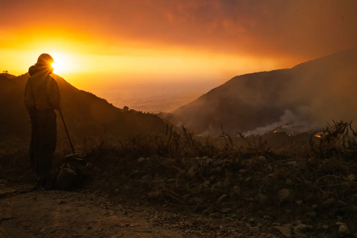
- Late August: Conditions deteriorated further as a new threat emerged. On August 26, the Plaskett Fire sparked in the rugged Big Sur region of Monterey County. Burning through dense, inaccessible wilderness, the fire exhibited aggressive behavior driven by shifting coastal winds and extreme fuel dryness. By August 30, tactical operations—including air support and ground crew deployment—were fully engaged, captured visually as firefighters closely monitored the advancing flames.
- Early September (Current Period): The meteorological landscape took a turn for the worse as high-pressure systems ushered in strong winds. Recognizing the impending collision of gusts and tinder-dry vegetation, the National Weather Service and the U.S. Storm Prediction Center issued coordinated Red Flag Warnings and elevated risk advisories for Monday and Tuesday, setting emergency services on maximum alert.
Supporting Data and Meteorological Analysis
Understanding the gravity of the current situation requires examining the quantitative metrics driving the crisis. Meteorologists and fire behavior analysts rely on specific data points to gauge the volatility of the landscape.
Wind Dynamics
Wind is universally recognized as one of the most unpredictable and dangerous variables in wildfire propagation. It supplies continuous oxygen to the fire front, drives embers ahead of the main body to spawn spot fires, and rapidly changes the direction of the flames.
- Sustained winds: 25 mph (40 km/h)
- Peak gusts: Up to 35 mph
- Impact: These velocities are more than sufficient to push flames through heavy brush and timber at rates that outpace ground evacuation efforts, necessitating pre-emptive warnings.
Active Fire Metrics
The scale of the active fires under state monitoring highlights the strain on suppression assets:
- The Timber Fire (Monterey County):
- Ignition Date: August 8
- Total Area Burned: 24,970 acres
- Containment Level: 21% contained
- The Plaskett Fire (Monterey County):
- Ignition Date: August 26
- Total Area Burned: 15,479 acres
- Containment Level: 1% contained
Fuel Moisture Content
In fire science, "fuels" refer to living and dead organic matter that can burn. The Storm Prediction Center’s classification of "very dry fuels" points to exceptionally low Live Fuel Moisture (LFM) and Dead Fuel Moisture (DFM) readings. When 10-hour and 100-hour dead fuels drop to historic lows, even a minor spark from equipment, power lines, or human negligence can instantly transition from an ignition to a crown fire.
Official Responses and Mitigation Measures
In response to the escalating danger, local, state, and federal agencies have rolled out comprehensive mitigation, communication, and regulatory measures to protect lives and property.
Public Safety Advisories
The National Weather Service has shifted its strategy heavily toward proactive public engagement. Rather than reacting solely to active flames, the agency issued direct instructions urging residents within the warning zones to:
- Sign Up for Local Alerts: Ensuring real-time notifications via county emergency systems (such as Nixle or local sheriff office channels).
- Review Emergency Plans: Encouraging families to finalize evacuation routes, assemble go-bags, and establish communication protocols in the event of sudden displacement.
Regulatory and Insurance Interventions
The ripple effects of the prolonged wildfire crisis extend beyond immediate firefighting. Recognizing the financial and housing vulnerabilities faced by residents in high-risk zones, regulatory bodies have stepped in. Notably, Oregon regulators extended wildfire emergency orders to legally pause insurance cancellations, protecting homeowners from losing vital property coverage amidst the heightened seasonal risk.
Interagency Fire Suppression
Cal Fire, alongside federal partners including the U.S. Forest Service, has coordinated heavy equipment, hand crews, and aviation assets. In regions like Big Sur, firefighters have utilized strategic burnout operations, natural fire breaks, and defensive line fortifications to protect critical infrastructure and residential clusters, particularly around the perimeter of the Plaskett and Timber fires.
Broader Implications
The convergence of red flag warnings, relentless winds, and deep-seated drought conditions carries profound implications for the American West, touching upon environmental policy, economic stability, and long-term community resilience.
Economic and Insurance Pressures
The frequency and intensity of catastrophic wildfires in Northern California and southern Oregon are fundamentally reshaping the insurance landscape. As seen with regulatory interventions in Oregon, insurers are increasingly reluctant to write or renew policies in high-risk "WUI" (Wildland-Urban Interface) zones. The continued expansion of fires like the Timber and Plaskett—which have collectively scorched nearly 40,000 acres in Monterey County alone—strains insurance pools, drives up premiums, and threatens property values across the Pacific coast.
Climate Trends and Extended Fire Seasons
Historically, Western wildfires were confined to a distinct "fire season" lasting from late summer through autumn. However, climatic shifts have blurred these boundaries, resulting in year-round vulnerability. Parched soils, reduced snowpacks, and higher average temperatures mean that vegetation loses moisture earlier in the year and retains it later. This structural shift forces state agencies to maintain heightened alert statuses for months on end, leading to cumulative fatigue among firefighting personnel and severe budgetary strains for state governments.
Community Resilience and Preparedness
As climate models project persistent drying trends across the Pacific Northwest and California, the burden of survival increasingly falls on community-level preparation. The directive from meteorological authorities to know emergency plans is no longer merely cautionary advice; it is a vital survival protocol. Moving forward, urban planners, local governments, and residents must grapple with the reality of living in a fire-adapted ecosystem, emphasizing brush clearance, hardened home construction, and robust early-warning infrastructure to mitigate the inevitable return of high-danger red flag events.
