

By Global Geohazards Reporting Desk
Published: August 27, 2026
Main Facts
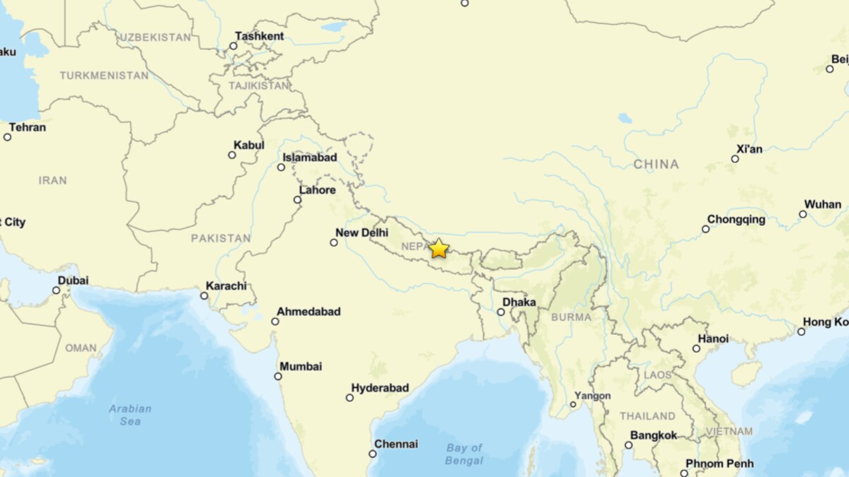
A catastrophic natural disaster struck the transboundary Bhote Koshi-Trishuli river system, wreaking havoc across northern Nepal and southern Tibet. Triggered on August 26, 2026, a massive mixture of water, mud, and house-sized boulders tore through narrow Himalayan valleys.
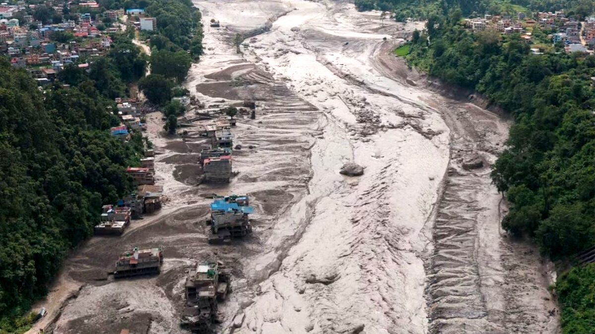
According to preliminary reports from the Associated Press, the death toll reached at least 160 individuals across Nepal and China, with hundreds of tourists, migrant workers, and local villagers listed as missing. Officials and disaster management agencies have warned that this figure is almost certainly a significant underestimate, as vast stretches of critical infrastructure remain completely inaccessible.
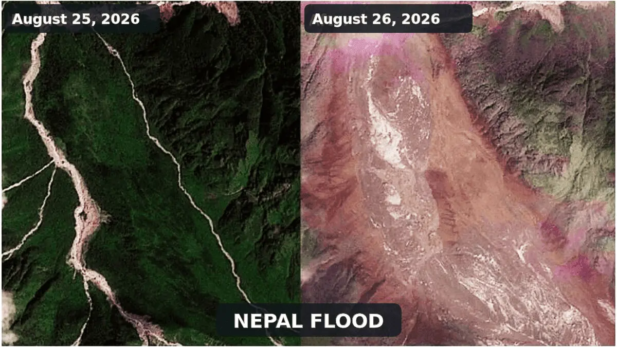
High-resolution satellite imagery analyzed by the International Center for Integrated Mountain Development (ICIMOD) revealed that the disaster originated from a massive ice and rock avalanche in the upper Lhende Khola, a remote Himalayan tributary. The cascading debris temporarily dammed the river channel before breaching, sending a violent, debris-laden surge downstream.
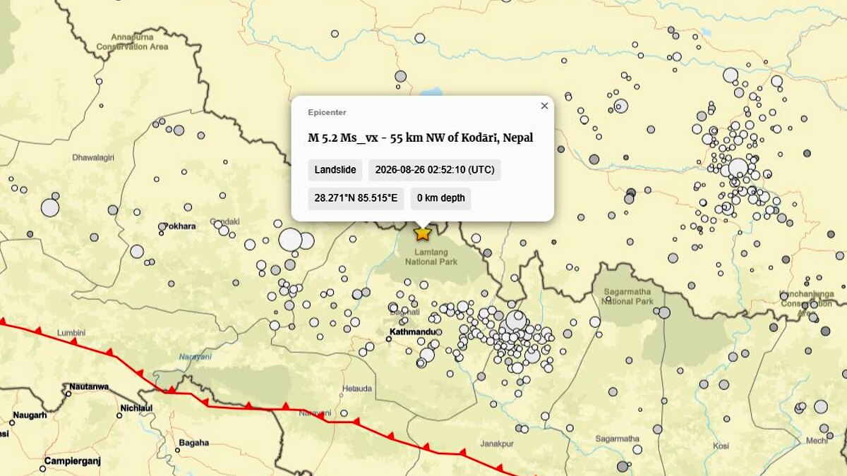
In a crucial scientific update, the U.S. Geological Survey (USGS) revised its initial seismic assessments. What was first cataloged as a magnitude 4.4 tectonic earthquake was later reclassified as a magnitude 5.2 landslide. This confirms that the recorded seismic activity was not the tectonic trigger of the disaster, but rather the powerful ground-shaking signature generated by the massive collapse itself.
Chronology of Events
The Pre-Disaster Window: Months of Growing Instability
While the disaster unfolded in a matter of minutes, glaciologists and geomorphologists emphasize that the mechanical conditions for failure had likely been building over years, decades, or a prolonged period of exceptionally warm summer weather. Rising temperatures at high altitudes have accelerated glacier thinning, degraded ice-bearing permafrost, and opened fractures within steep rock walls that were previously structurally reinforced by ice.
August 26, 2026: The Collapse and Seismic Shock
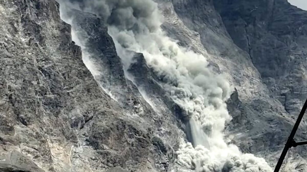
At an undetermined hour on August 26, a steep glacierized and periglacial slope in the upper Lhende Khola failed. A colossal mass of bedrock, glacial ice, and snow detached from the heights, hurtling down the mountainside as an ice-and-rock avalanche.
As the material plummeted, it registered on regional seismic networks. Automated processing initially flagged the ground motion as a tectonic earthquake near the Nepal-Tibet border. However, as seismologists audited the waveforms, the event was correctly identified as a massive mass movement (USGS event us7000tbwb), reclassified as a magnitude 5.2 landslide.
The Channel Blockage and Sudden Surge
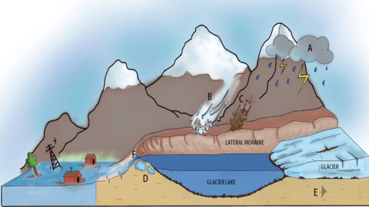
Upon plunging into the upper Lhende Khola, the avalanche shattered and deposited millions of tons of mixed ice, boulders, and sediment directly across the narrow river channel. This created an irregular, highly permeable, and unstable natural dam.
Water quickly pooled behind the barrier, forming a temporary landslide-dammed lake. Within a short window, hydrostatic pressure and seepage caused the temporary dam to fail catastrophically. The sudden release of impounded water, combined with the debris-choked avalanche mass, produced a violent flash flood.
According to reports verified by Reuters, water levels on the downstream Trishuli River surged by an astonishing nine meters (nearly 30 feet) in approximately 30 minutes, sweeping away roads, bridges, settlements, and vital hydropower installations as it crossed the international border into Nepal’s Rasuwa district.
Supporting Data & Technical Breakdown
Debunking the GLOF Misconception
In the immediate aftermath of the disaster, initial media reports frequently labeled the event a Glacial Lake Outburst Flood (GLOF). However, cryospheric specialists and satellite analysts quickly pushed back against this terminology.
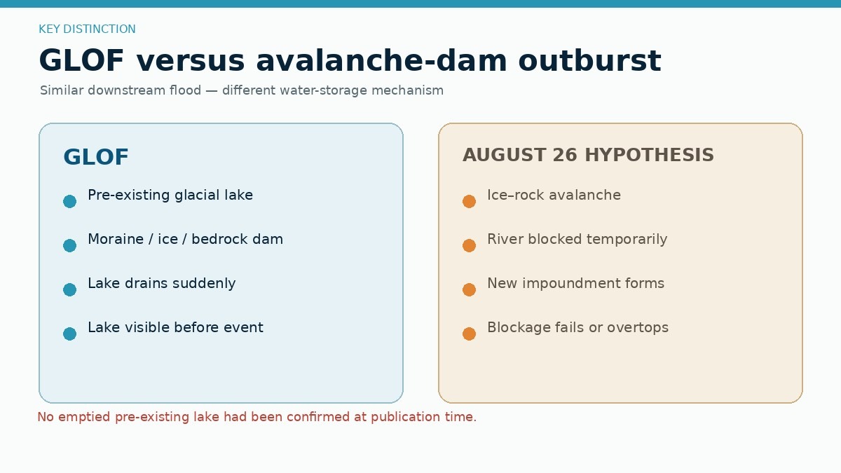
A true GLOF requires the catastrophic drainage of a pre-existing glacial lake—such as a moraine-dammed or supraglacial lake. While a deadly flood in the same broader Bhote Koshi system on July 8, 2025, was successfully traced to a supraglacial lake north of the Langtang Himal, investigators found no evidence of an emptied pre-existing lake as the primary source for the August 26 disaster.
Instead, current satellite data confirms an avalanche-dam outburst flood. While a small supraglacial or ice-marginal pocket of water may have contributed liquid volume, the primary mechanism was an ice-and-rock avalanche that physically blocked a dry or flowing river channel, creating an ephemeral barrier that subsequently breached.
Comparative Analogs: Marmolada and Blatten
Earth scientists analyzing the August 26 event immediately drew comparisons to recent high-mountain catastrophes in Europe:
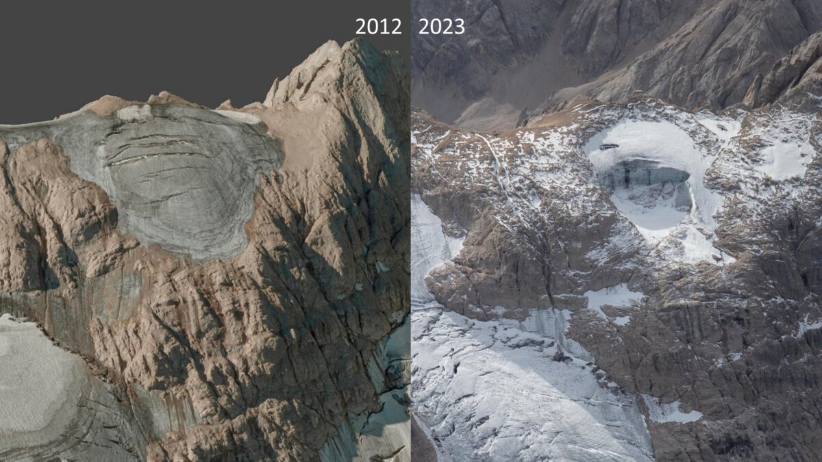
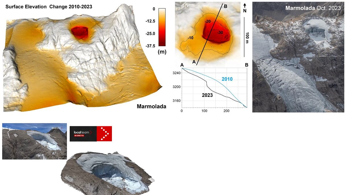
- Marmolada (Italy, July 2022): Approximately 70,000 cubic meters of ice and rock detached from the Italian Dolomites, killing 11 mountaineers. Scientific modeling published by Francese et al. confirmed that an unseasonably warm summer, water-filled crevasses, and hydraulic uplift drove the collapse without any tectonic earthquake trigger.
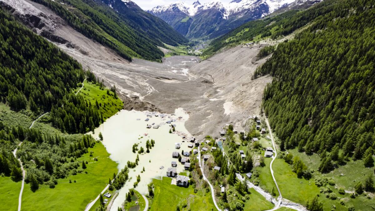
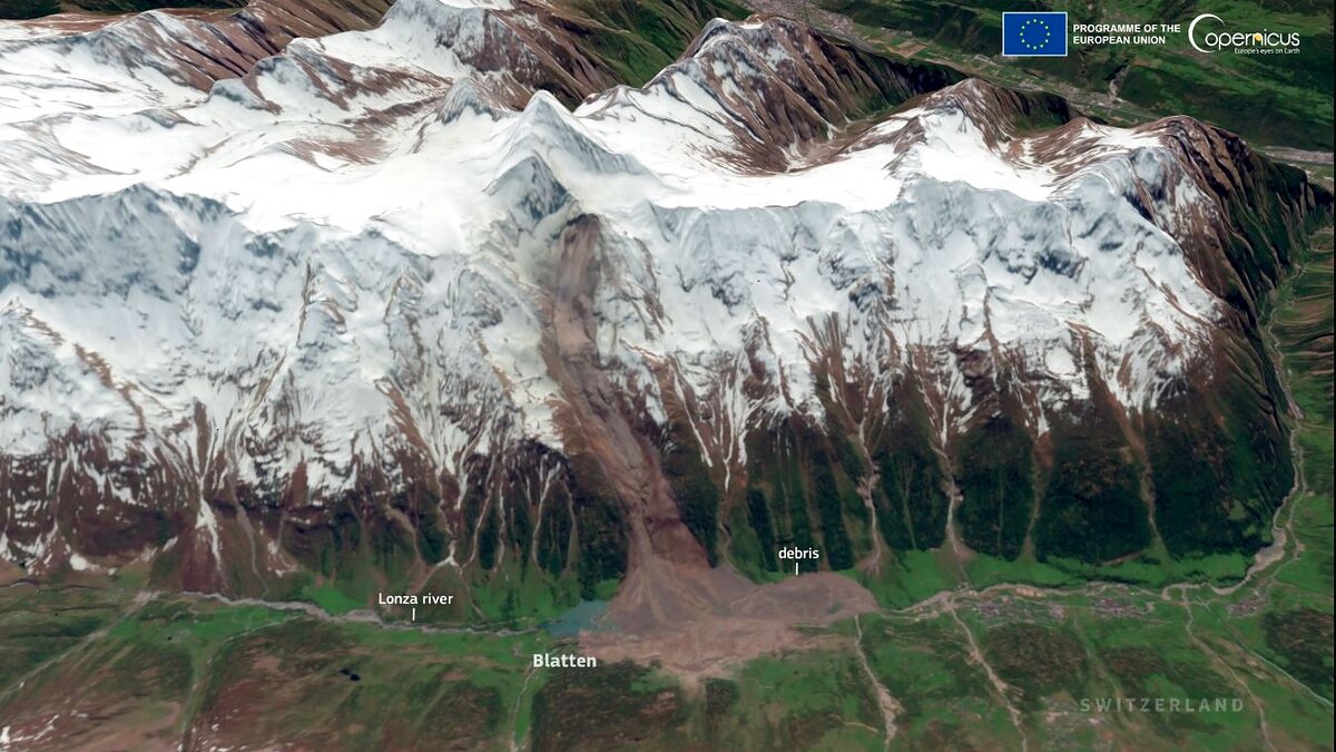
- Blatten (Switzerland, May 2025): A massive rock and ice avalanche involving the Birch Glacier mobilized roughly 9.5 million cubic meters of material (including 2.9 million cubic meters of ice and 6.5 million cubic meters of rock). Documented extensively by the Swiss Glacier Bulletin (GLAMOS) and NASA Earth Observatory, the Blatten disaster serves as a near-exact blueprint for the Nepal event: a progressive rock failure loaded a glacier, which collapsed, crossed a valley floor, and dammed a river to create a secondary flood hazard.
Alpine Context and the 2026 Heat Baseline
The event occurred against the backdrop of an intensely volatile high-mountain summer in 2026. In the European Alps, researchers with the French National Center for Scientific Research (CNRS) reported an unprecedented frequency of rockfalls—estimating roughly 450 major rockfalls in the Mont Blanc massif alone for 2026, compared to a few dozen annually a decade prior. Unseasonable warmth, early snow loss, and thermal penetration into bedrock have systematically eroded the structural integrity of high-altitude landscapes worldwide.
Official Responses and Rescue Operations
Rescue and recovery operations faced immediate, severe bottlenecks. Because the disaster zone spans the remote, rugged terrain of northern Nepal and southern Tibet, primary access routes, mountain highways, and bridges were entirely obliterated or buried under meters of mud and boulders.
International agencies, including the International Center for Integrated Mountain Development (ICIMOD) and the United Nations Office for Disaster Risk Reduction, mobilized satellite tasking protocols to provide high-resolution imagery to ground crews. Search-and-rescue teams from Nepal and China deployed to affected districts, though responders noted that heavy machinery was frequently required to clear dense thickets of rock and shattered timber before missing persons could be reached.
Local and regional authorities issued urgent warnings to downstream populations, urging residents and travelers along the Bhote Koshi and Trishuli river corridors to remain on high alert. Government officials stressed that because parts of the initial avalanche debris dam may still impound residual water in the upper Lhende Khola, the threat of a secondary outburst flood has not entirely dissipated.
Implications and Future Outlook
The Science of Cascading Hazards
The catastrophe on the Nepal-Tibet border underscores a fundamental truth of modern geomorphology: high-mountain disasters are rarely isolated events; they are complex cascades. An ice-and-rock avalanche transitioned into a landslide dam, which subsequently failed into a debris-laden flash flood.
Recognizing these cascading pathways is not merely an academic exercise. Traditional hazard mapping often treats floods, avalanches, and landslides as mutually exclusive phenomena. Understanding how an atmospheric or thermal trigger can initiate a mechanical slope failure—which in turn generates seismic waves, creates temporary dams, and sparks downstream floods—is vital for saving lives.
Transboundary Early Warning Challenges
One of the most sobering takeaways from the August 26 disaster is the vulnerability of transboundary river systems. Natural hazards do not respect international borders; water, mud, and debris can travel downstream from remote Tibetan headwaters into densely populated Nepalese valleys far faster than traditional bureaucratic communications can travel.
Experts emphasize that modern warning systems must evolve. Relying solely on static inventories of known glacial lakes is no longer sufficient. Future safety frameworks will require:
- Integrated Cryospheric Monitoring: Continuous satellite and ground-based surveillance of steep, unstable glacierized slopes and permafrost degradation zones.
- Seismic Landslide Detection: Leveraging real-time seismic networks to automatically identify and classify mass movements rather than dismissing them as false tectonic earthquakes.
- Automated Hydrological Sensors: Real-time river gauges deployed high in tributary headwaters linked to automated, cross-border siren networks.
- Rapid Transboundary Protocols: Streamlined communication channels between neighboring nations to ensure that downstream populations receive life-saving alerts minutes—not hours—after a high-altitude collapse occurs.
As the Hindu Kush Himalaya region continues to warm at rates well above the global average, the baseline stability of the world’s highest mountains is shifting. The August 26 disaster serves as a tragic reminder of the urgent need to adapt infrastructure, enhance monitoring, and rethink how humanity coexists with the fragile, melting giants of the high mountains.
