

Global Overview — As the northern hemisphere looks ahead to the upcoming cold season, initial long-range predictions for the Winter 2026/2027 snowfall cycle are revealing the stark, highly contrasted impacts of an unfolding Super El Niño. Meteorological forecast data from premier international modeling centers—including the European Centre for Medium-Range Weather Forecasts (ECMWF) and the UK Met Office (UKMO)—indicates that this historic climatic event is actively reshaping the global jet stream and dictating low-pressure system tracks.
The resulting seasonal roadmap highlights dramatic variations in snow accumulation across the United States, Canada, and Europe. While millions of skiers, winter enthusiasts, and municipal planners wait for the first flakes to fall, meteorologists are closely monitoring subsurface ocean dynamics that suggest this could be one of the most powerful El Niño events recorded in decades.
Main Facts: The Anatomy of a Super El Niño
To understand how the upcoming winter weather will behave, meteorologists must examine the engine driving these global anomalies: the tropical Pacific Ocean.
The El Niño Mechanism
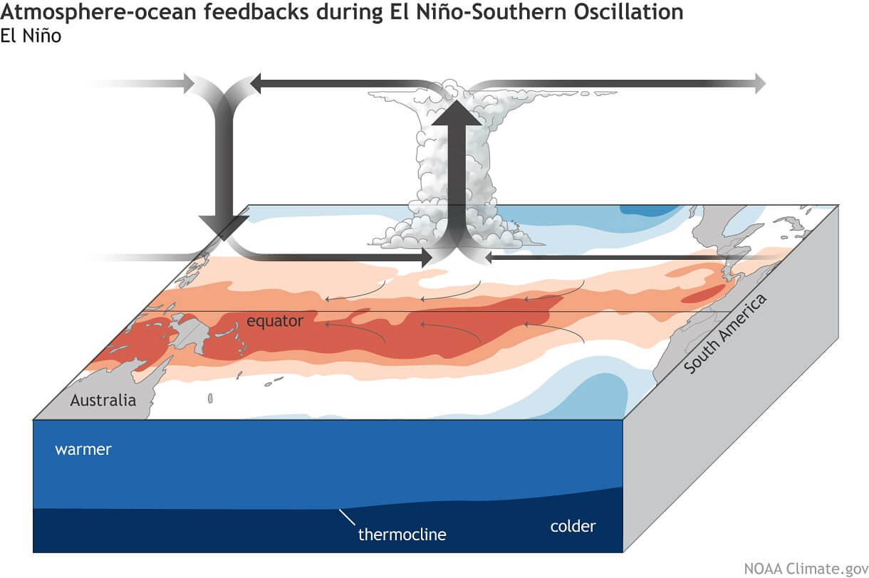
An El Niño event is characterized by unusually warm ocean surface temperatures in the central and eastern equatorial Pacific. Under normal conditions, trade winds blow from east to west across the tropical Pacific, piling up warm surface water in the west. During an El Niño, these trade winds weaken or reverse. Warm water surges eastward, increasing rising air, enhancing precipitation, and lowering atmospheric pressure over the central and eastern Pacific. Conversely, sinking, stable air and high pressure dominate the western Pacific.
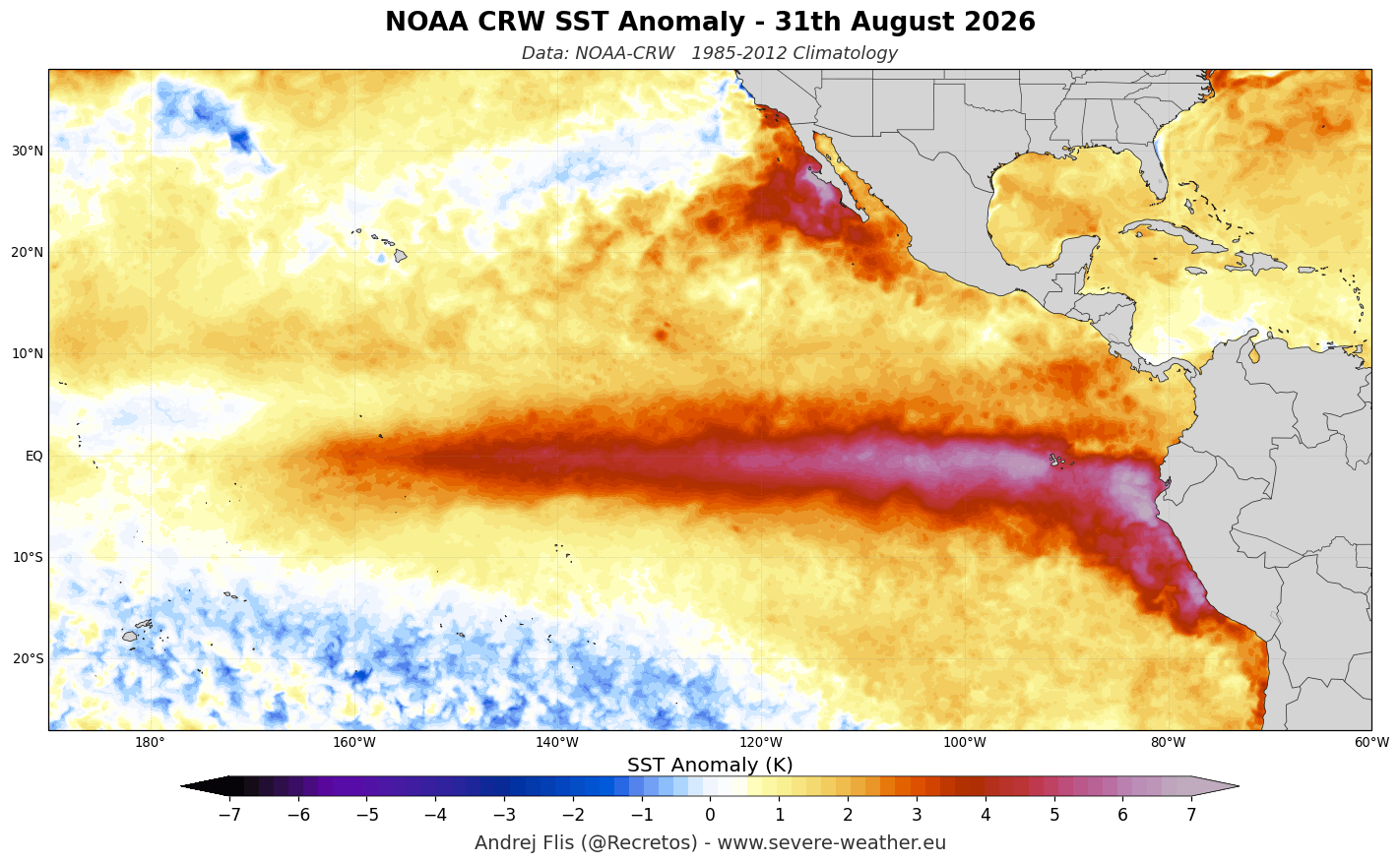
This massive shift in thermal energy disrupts the Walker circulation—the loop of air currents looping across the tropical Pacific—and sends "atmospheric bridges" outward to alter global pressure systems, wind patterns, and ultimately, daily weather across the globe.
Reaching "Super" Status
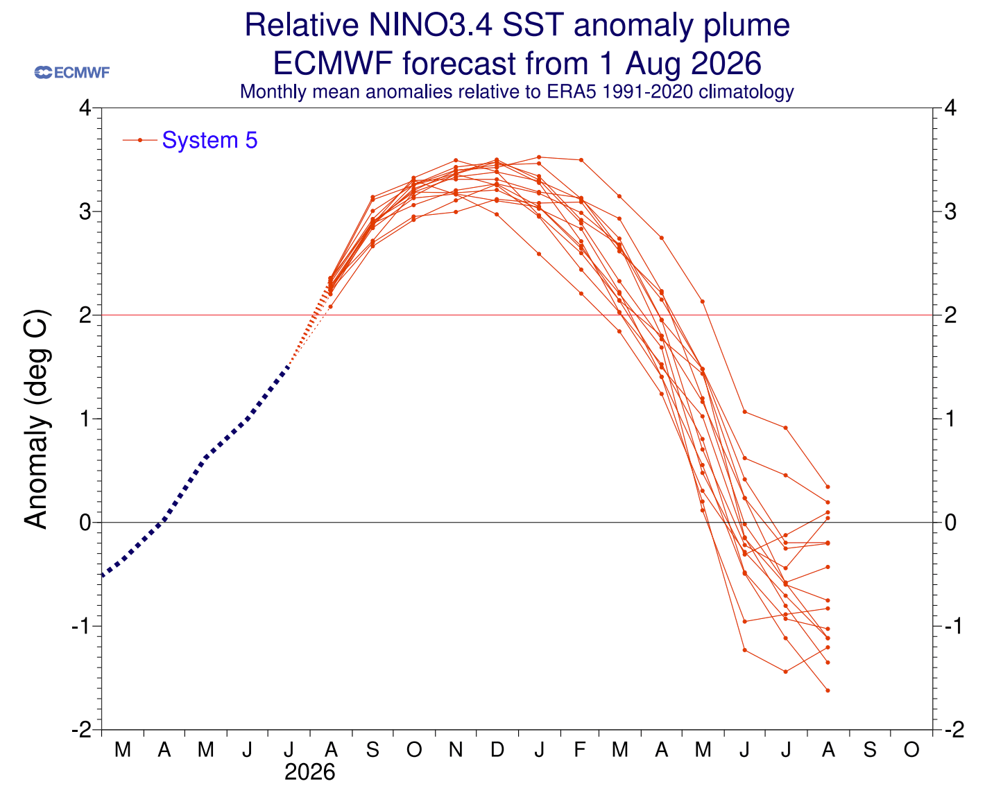
Not all El Niño events are created equal. To earn the designation of a Super El Niño, sustained seasonal temperature anomalies across the critical Niño 3.4 region must exceed +2.0 degrees Celsius above normal for multiple consecutive months.
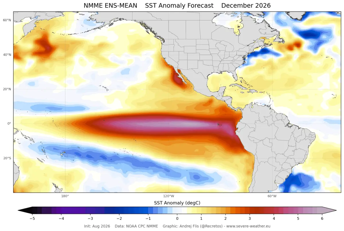
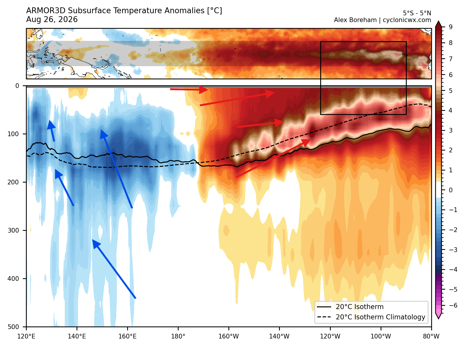
Current oceanic analysis based on NOAA-CRW data shows that the developing 2026 event has not only surpassed this +2°C threshold but is tracking toward an unprecedented peak. Surface anomalies in the eastern tropical Pacific are currently exceeding +6°C (10.8°F) above normal. Beneath the surface, a massive downwelling Kelvin Wave—a pulse of warm water moving eastward through the upper 250 meters (800 feet) of the ocean—is pumping thermal energy into the eastern Pacific with subsurface anomalies topping +10°C (18°F) above normal.
With colder water upwelling in the west as part of standard thermocline tilting, these dynamics guarantee that the current Super El Niño will maintain immense strength well into the core of the 2026/2027 winter season.
Chronology: The Evolution Toward Winter 2026/2027
The progression of this weather driver follows a distinct timeline, moving from oceanic precursors to atmospheric adjustments and, finally, to regional snow anomalies.
Late Summer to Fall 2026: Subsurface Surfacing
During the late summer and early autumn months, the aforementioned Kelvin Waves advanced eastward, steadily breaching the ocean surface. By September, ocean temperature anomaly maps confirmed that a full-scale Super El Niño was locked in. Extended seasonal runs from the ECMWF model projected that the event would peak in late fall or early winter (around December), sailing past a staggering +3 anomaly at its height.
December 2026: Early Winter Onset
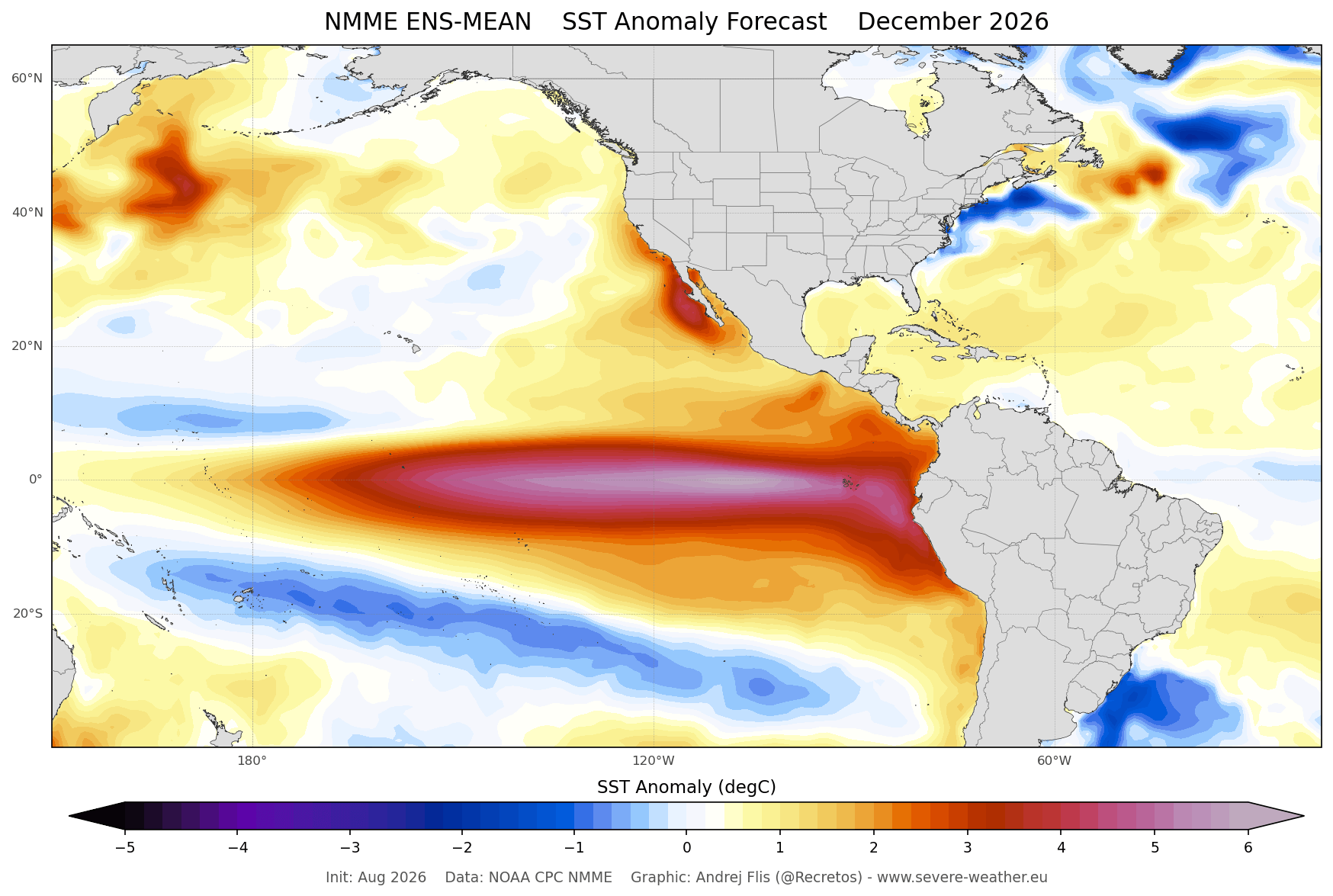
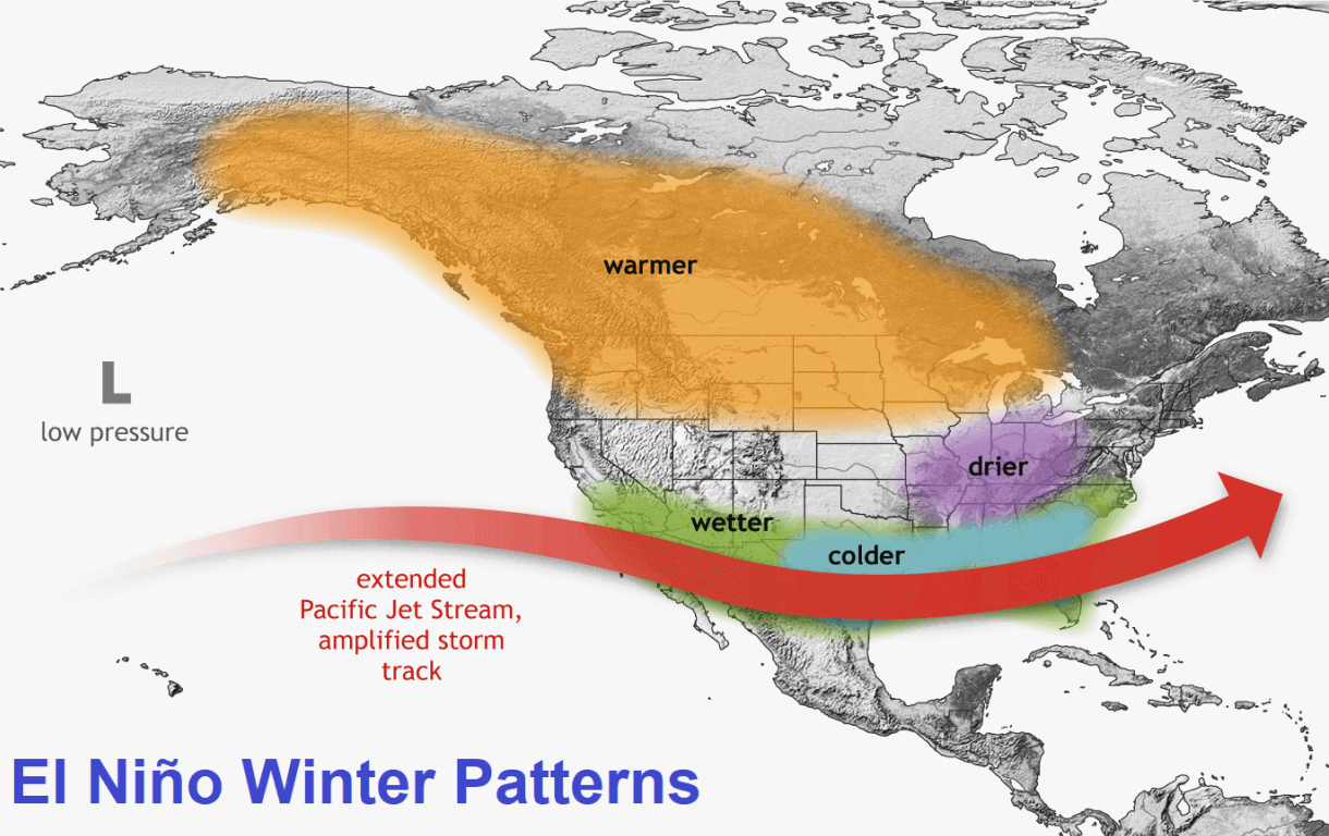
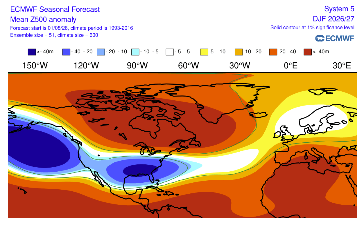
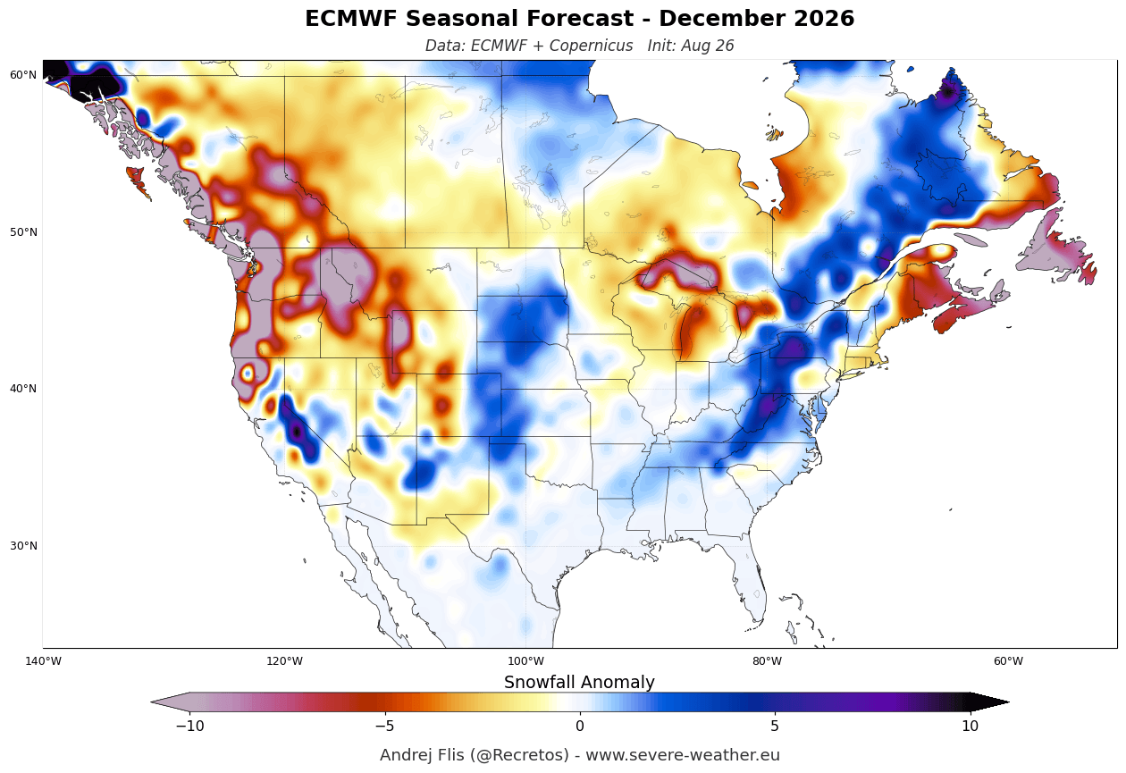
As meteorological winter begins, the newly minted Super El Niño will exert maximum control over the North American continent. The early winter model data, including projections from the North American Multi-Model Ensemble (NMME), show a classic El Niño pressure configuration taking shape: a deep, persistent low-pressure zone establishing itself in the North Pacific, paired with a robust high-pressure blocking ridge over Canada.
This configuration initiates a split in the jet stream. The polar jet retreats northward, while the subtropical Pacific jet intensifies dramatically, targeting the southern United States with cooler temperatures, ample moisture, and increased storm activity.
January to February 2027: Mid-to-Late Winter Peak
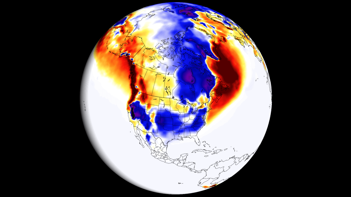
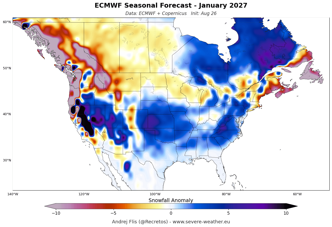
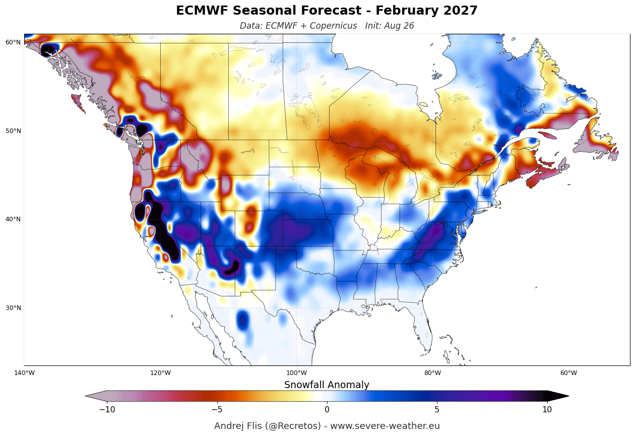
By mid-winter, the southward-shifted storm tracks become entrenched. January and February forecasts from both ECMWF and UKMO depict an active southern storm corridor delivering repeated rounds of heavy precipitation. States across the southern and central U.S., the Plains, and the Mid-Atlantic will experience peak snowfall anomalies, while northern latitudes—including the Pacific Northwest, the Great Lakes, and southern Canada—find themselves largely starved of traditional winter storms due to persistent high-pressure suppression.
Supporting Data: ECMWF and UKMO Long-Range Snowfall Predictions
Modern long-range forecasting relies on ensemble modeling, combining multiple computer simulations to isolate robust probabilistic trends rather than exact daily weather. For Winter 2026/2027, the ECMWF and UKMO models offer a comprehensive look at what regions will win or lose in the snowfall department.
Europe: A Mild, Elevation-Dependent Winter
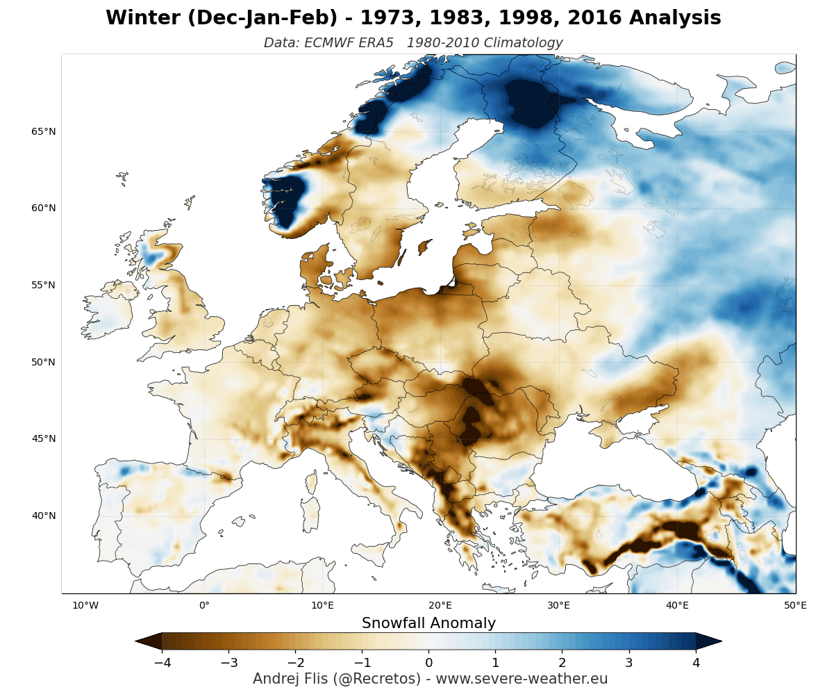
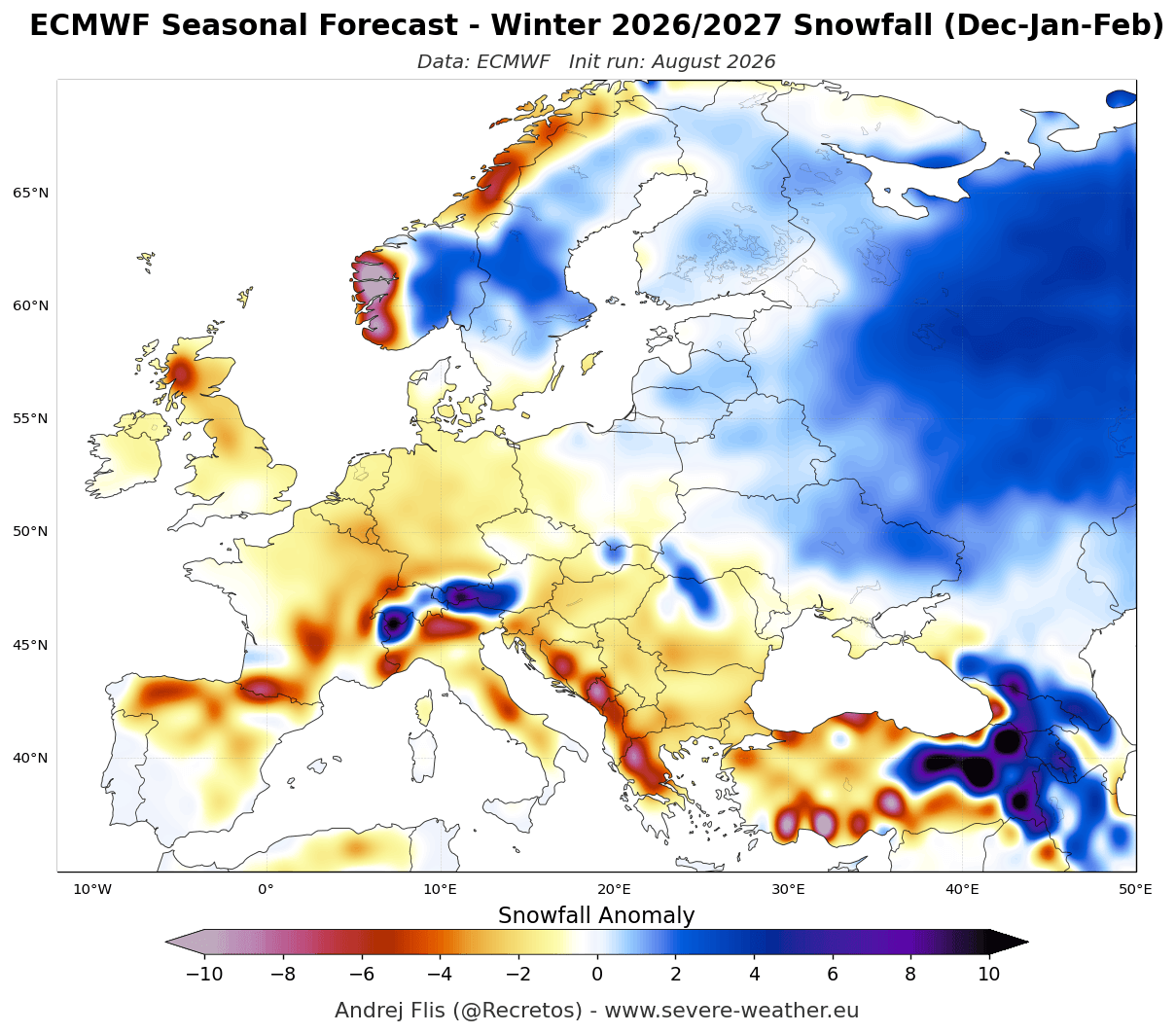
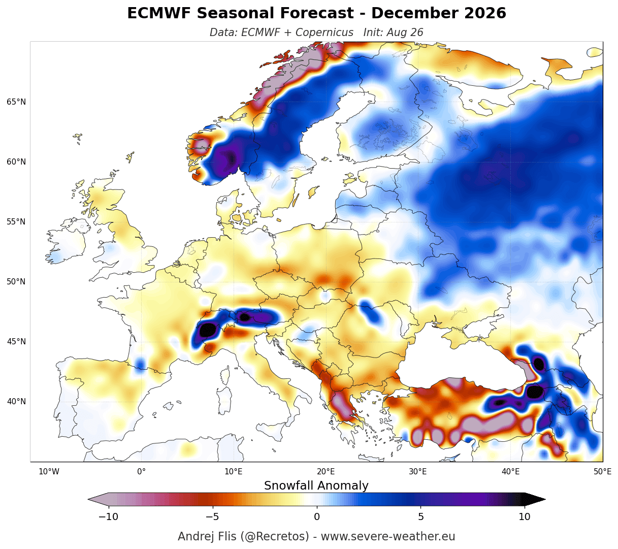
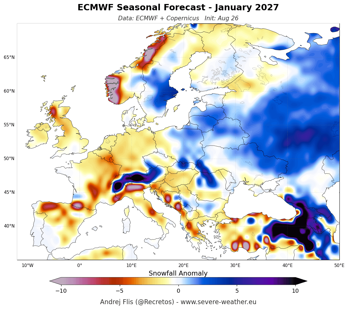
For Europe, the overarching message from both the ECMWF and UKMO seasonal averages is a widespread snowfall deficit.
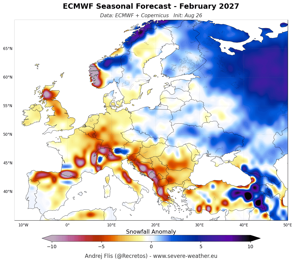
- The Mechanism: A dominant high-pressure ridge expanding across southern and central Europe, combined with a strong North Atlantic low-pressure zone to the north, will drive a persistent, mild westerly and southwesterly flow into the continent.
- The Lowlands: Low-elevation cities and agricultural regions across western, central, northwestern, and southern Europe are expected to see significantly below-normal snowfall from November through February.
- The High Ground & Far North: Skiers will need to chase altitude. High-elevation resorts in the Alps (particularly those sitting above 1,800 to 2,000 meters) and northern territories (such as Scandinavia) will benefit from low enough temperatures to secure a viable natural snowpack, though overall totals will still lag behind historical averages in many sectors.
United States and Canada: The North-South Divide
North America presents a much more dynamic, high-contrast set of snowfall predictions directly tied to the Super El Niño jet stream.
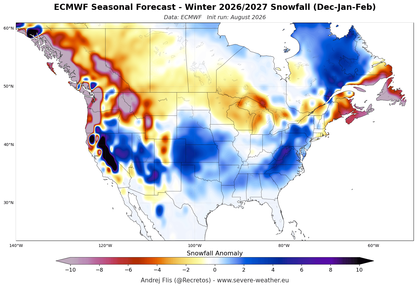
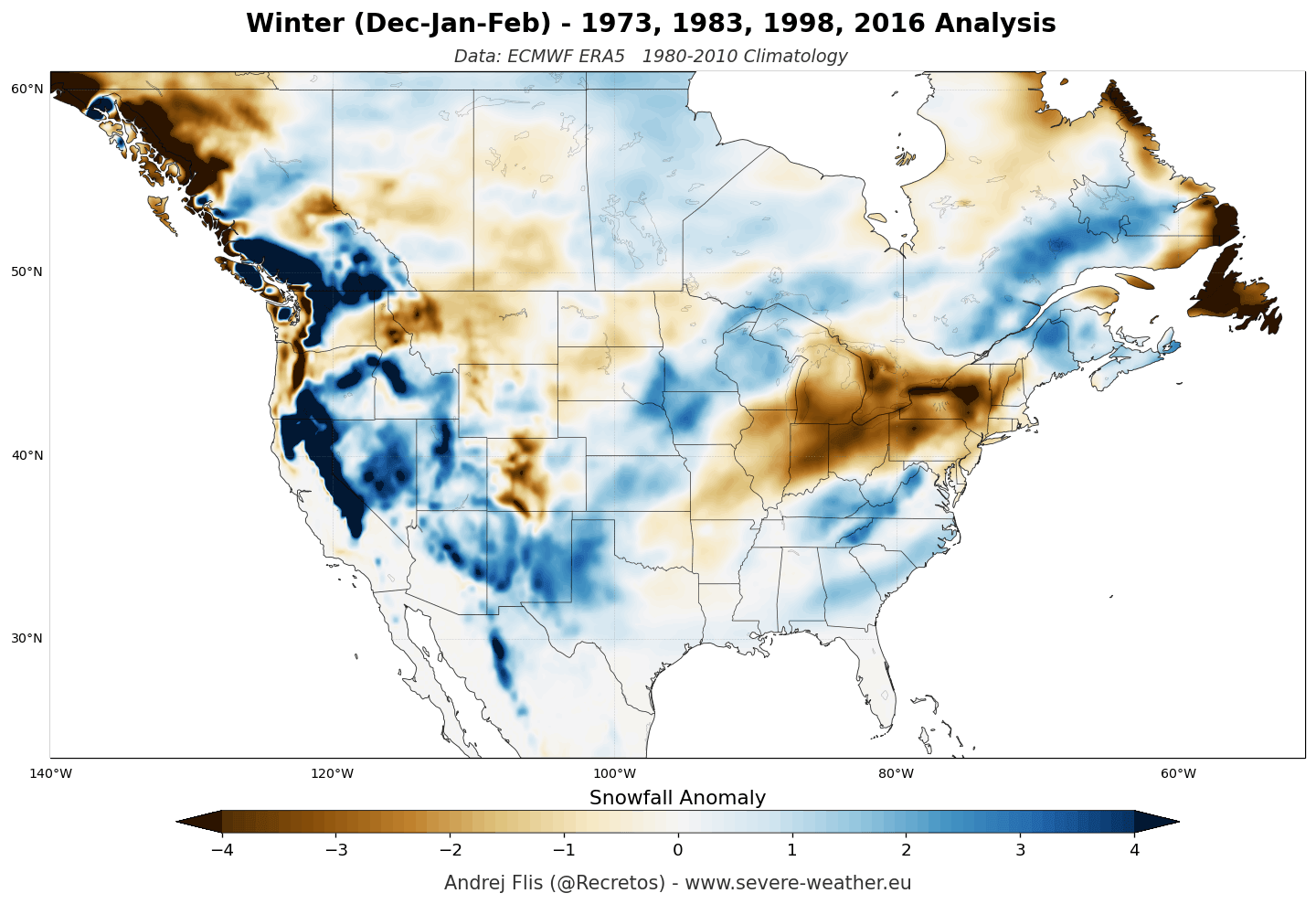
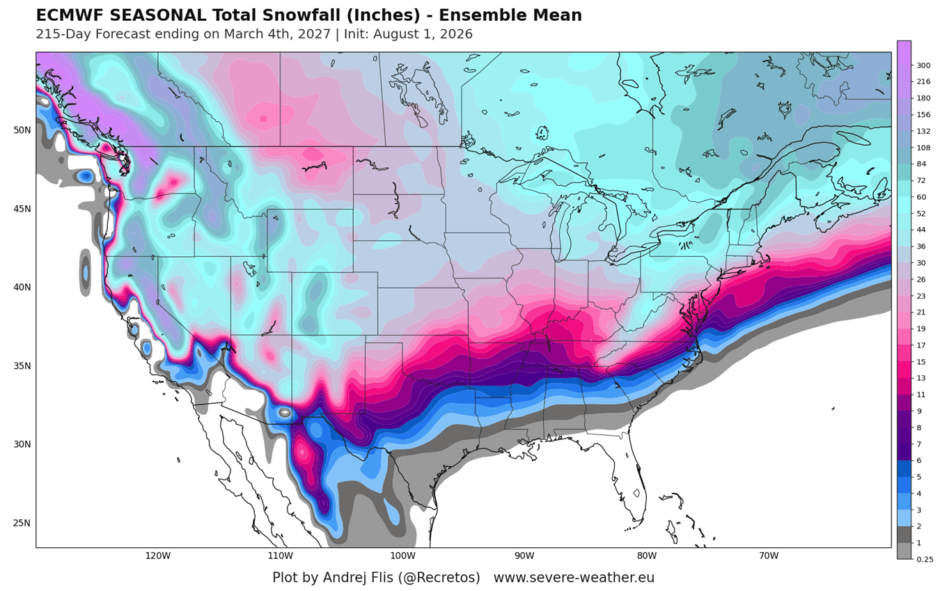
- Western Mountains: The high-altitude terrain of the western United States stands out as a primary winner. Strong, moisture-laden Pacific storms riding the southern jet stream will frequently impact California’s Sierra Nevada, Utah, the Great Basin, and the Central-to-Southern Rockies (Colorado, Arizona, New Mexico), generating above-normal snow depth and excellent conditions for ski resorts.
- Central Plains & Mid-Atlantic: Moving eastward, the seasonal forecasts depict a positive snowfall anomaly stretching from the Central Plains across parts of the Midwest, the Ohio Valley, and into the Mid-Atlantic. For instance, ensemble data for southern states like Texas points toward near-normal December snowfall followed by an aggressive upward trend in January and February.
- The Northern Tier & Canada: Conversely, the northern tier of the United States and the majority of southern Canada are bracing for a meager snow season. The Pacific Northwest, northern Plains, Great Lakes, New England, and southern Canadian provinces (including Quebec and Ontario) face pronounced snowfall deficits. The shifting storm track leaves these areas starved of cold-core low-pressure systems, keeping temperatures too warm and moisture paths too far south.
Official Responses and Meteorological Analysis
Climatologists and operational forecasters tracking the 2026/2027 setup emphasize that while seasonal anomalies provide critical strategic insight, they must be interpreted correctly.
"A below-normal snowfall forecast does not mean an absolute absence of snow," note lead forecasters at Severe Weather Europe. "It simply indicates that regions expected to receive lower-than-average accumulations will still experience periodic winter weather events and temporary snow cover; however, the cumulative depth over the three-month winter period will fall well beneath historical benchmarks."
Research corroborates these predictive models. Historical analog studies—such as foundational work by Kunkel and Angel (1999)—demonstrate that strong El Niño events reliably suppress snowfall across the northern United States while supercharging moisture delivery to the American Southwest via displaced winter cyclones. Furthermore, subsequent analyses of East Coast storm behavior during major El Niño winters (such as a notable 2011 climatological study) confirm that when coastal storms phase correctly with a southerly jet stream, heavy localized precipitation can occasionally surprise mid-Atlantic and northeastern populations, even amidst an overall deficit trend.
Implications: What Winter 2026/2027 Means for Industries and Communities
The realization of a historic Super El Niño carries wide-ranging socioeconomic and environmental implications across the Northern Hemisphere:
- Winter Tourism and Ski Industries: Resorts in the European Alps, the American Southwest, the Sierra Nevada, and the Southern Rockies can anticipate strong visitor numbers as snow enthusiasts flock to guaranteed powder zones. Conversely, operators in the Pacific Northwest, the Great Lakes, and the European lowlands will likely need to rely heavily on artificial snowmaking to offset natural deficits.
- Municipalities and Transportation: Cities across the southern and central United States must prepare for the logistical challenges of an active winter storm track. Sudden, heavy snow events in non-traditional zones can catch municipal transit authorities off guard, leading to major disruptions. Meanwhile, northern cities may experience reduced snow-removal budgets, though diminished winter snowpack can have negative implications for spring and summer water supplies.
- Hydrology and Agriculture: The stark north-south precipitation split will significantly impact regional water management. The American Southwest and parts of California stand to benefit from a healthy mountain snowpack that replenishes reservoirs during the spring melt. In contrast, the northern tier and parts of the Canadian prairies may face emerging drought concerns going into the spring and summer of 2027 due to limited winter precipitation storage.
As the meteorological community continues to ingest real-time observational data from satellites, ocean buoys, and atmospheric soundings, updates will refine these baseline projections. For now, communities across North America and Europe are advised to prepare for a winter defined by extremes: exceptional warmth and sparse snow in the north, contrasted by active storm tracks, moisture, and high-altitude powder in the south and west.
