

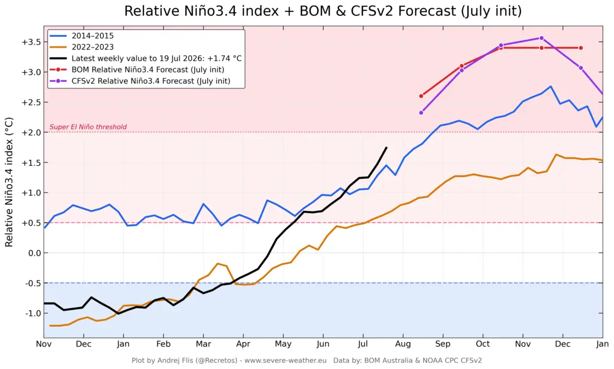
GLOBAL — Latest meteorological data confirms that the 2026 El Niño event is rapidly accelerating, outpacing early-season projections and pushing deeper into the rare "Super El Niño" threshold. Expanding warm Pacific waters and shifting atmospheric circulation are driving anomalies that global forecasting authorities warn could make this the strongest El Niño event in the modern historical record.

With atmospheric pressure systems already locking into place, scientists, climatologists, and meteorological institutions across multiple continents are sounding the alarm. The unfolding event threatens to dramatically alter weather patterns, amplify winter storm tracks across North America, reshape European precipitation dynamics, and significantly elevate the risk of a major stratospheric Polar Vortex disruption heading into the Winter of 2026/2027.
Main Facts: The Anatomy of a Record-Breaking Event
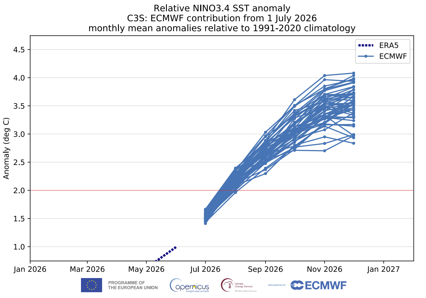
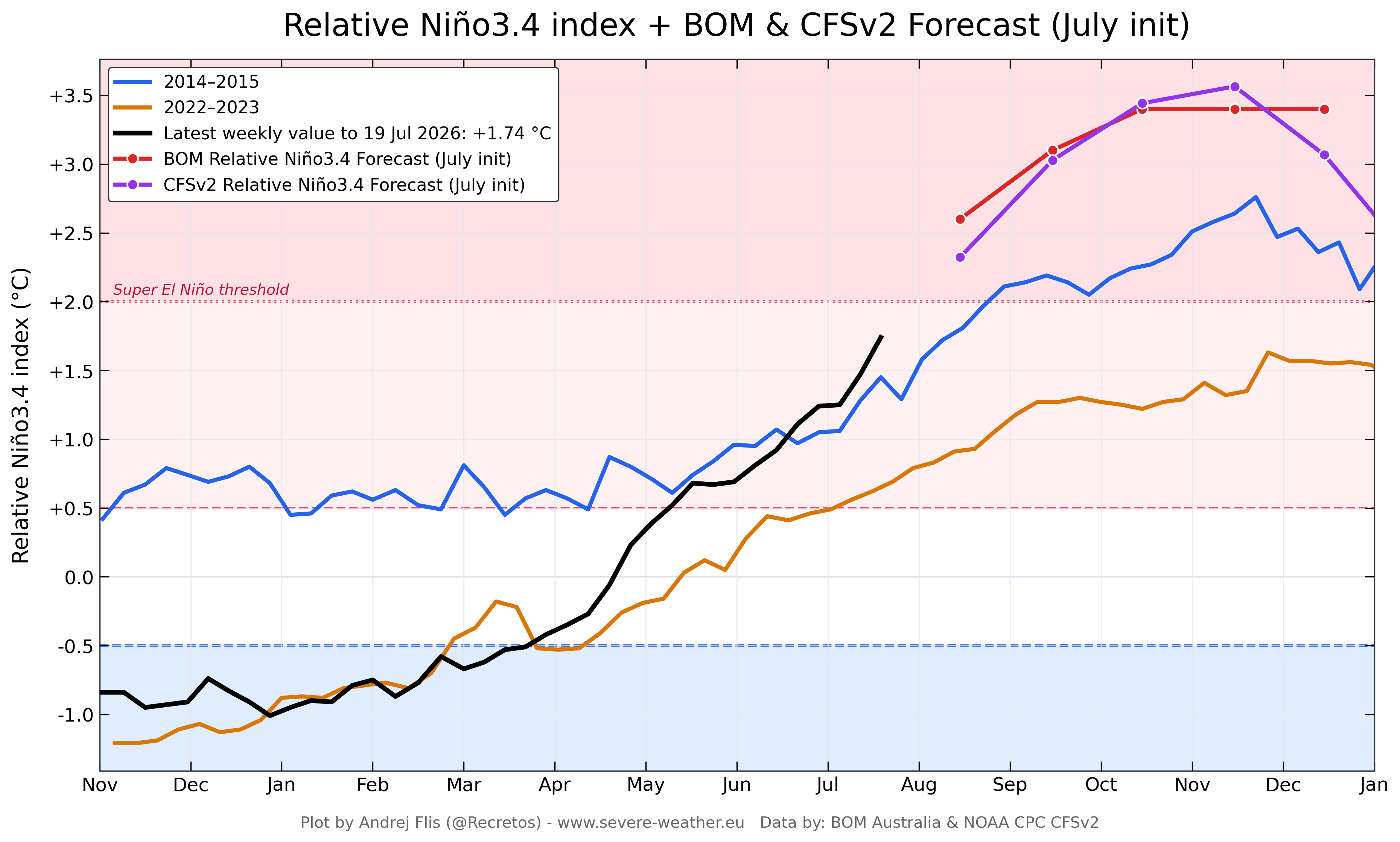
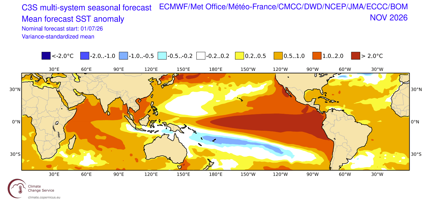
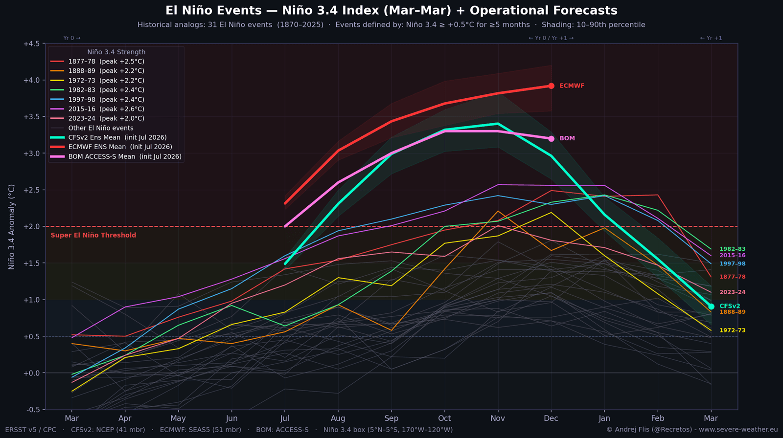
A Super El Niño is scientifically defined when sea surface temperature (SST) anomalies in the central and eastern equatorial Pacific Ocean exceed and sustain a threshold of +2.0°C or higher above the long-term average. However, current multi-model consensus from premier forecasting centers—including the European Centre for Medium-Range Weather Forecasts (ECMWF), the National Oceanic and Atmospheric Administration (NOAA) CFSv2, and the Australian Bureau of Meteorology (BOM)—suggests this event could easily surpass +3.0°C, entering unprecedented statistical territory.
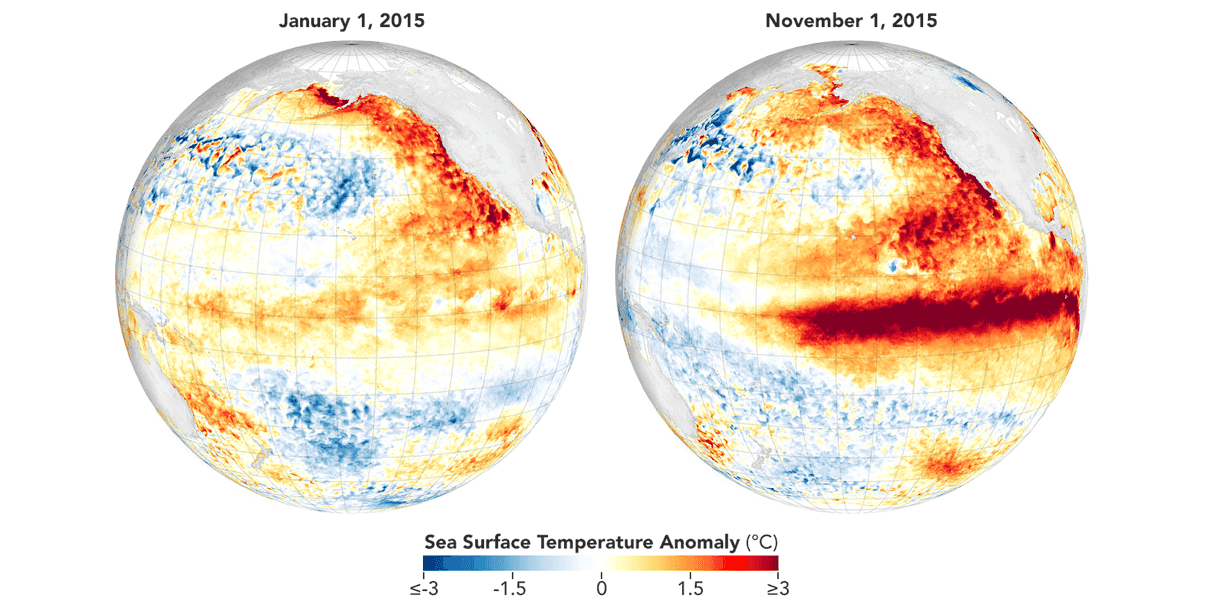
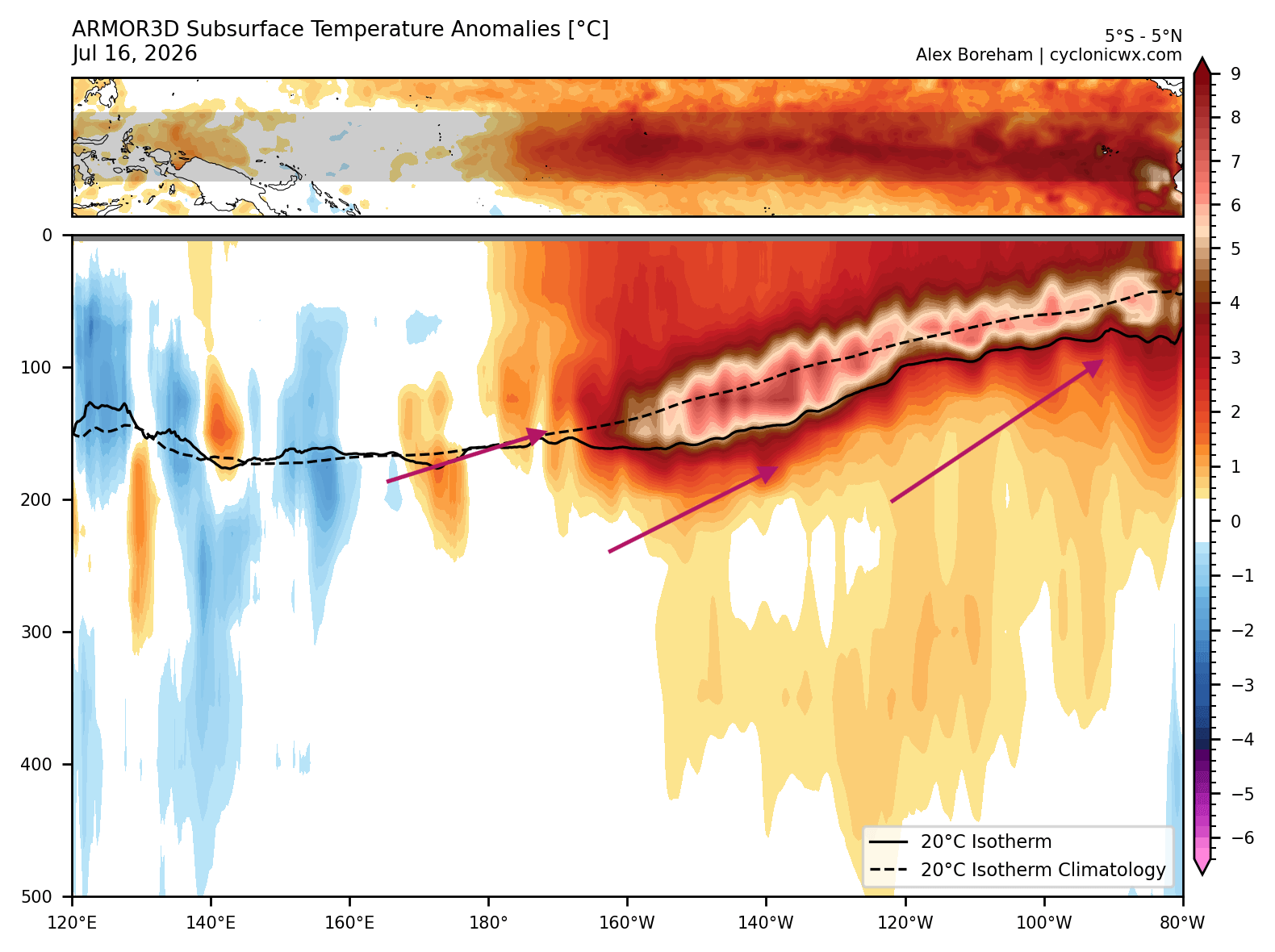
- Unprecedented Subsurface Energy: Beneath the ocean surface, a powerful Kelvin wave driven by intense westerly wind bursts is pumping exceptionally warm water toward the eastern Pacific, with core subsurface temperatures peaking more than 7°C above normal.
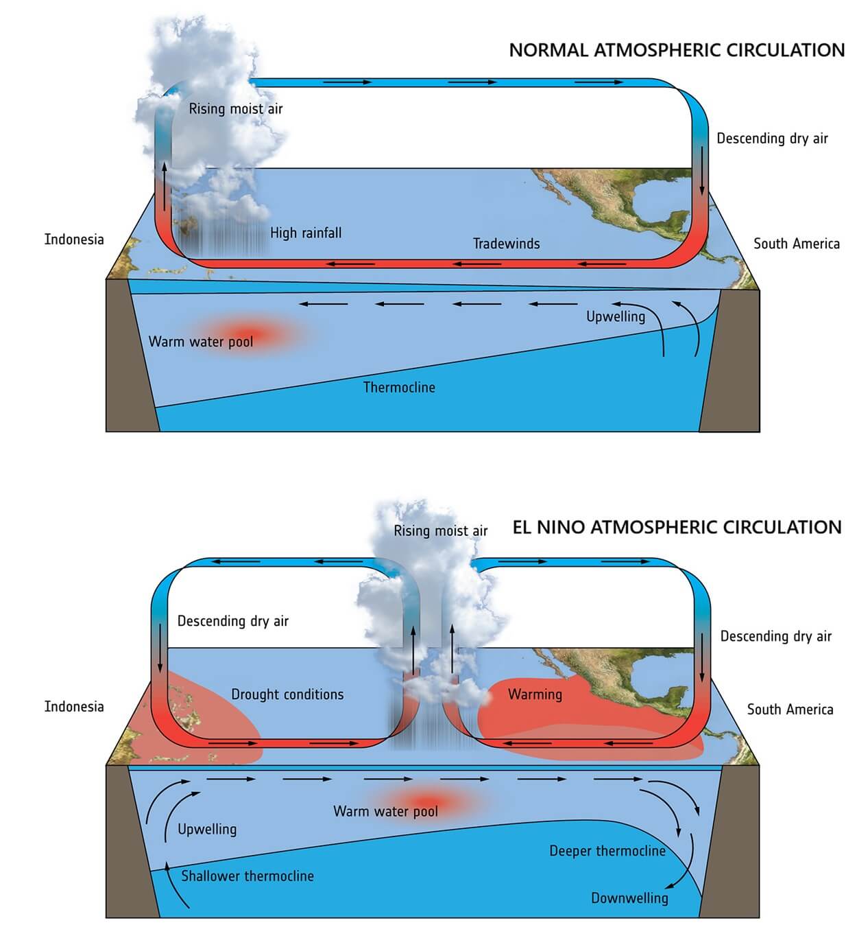
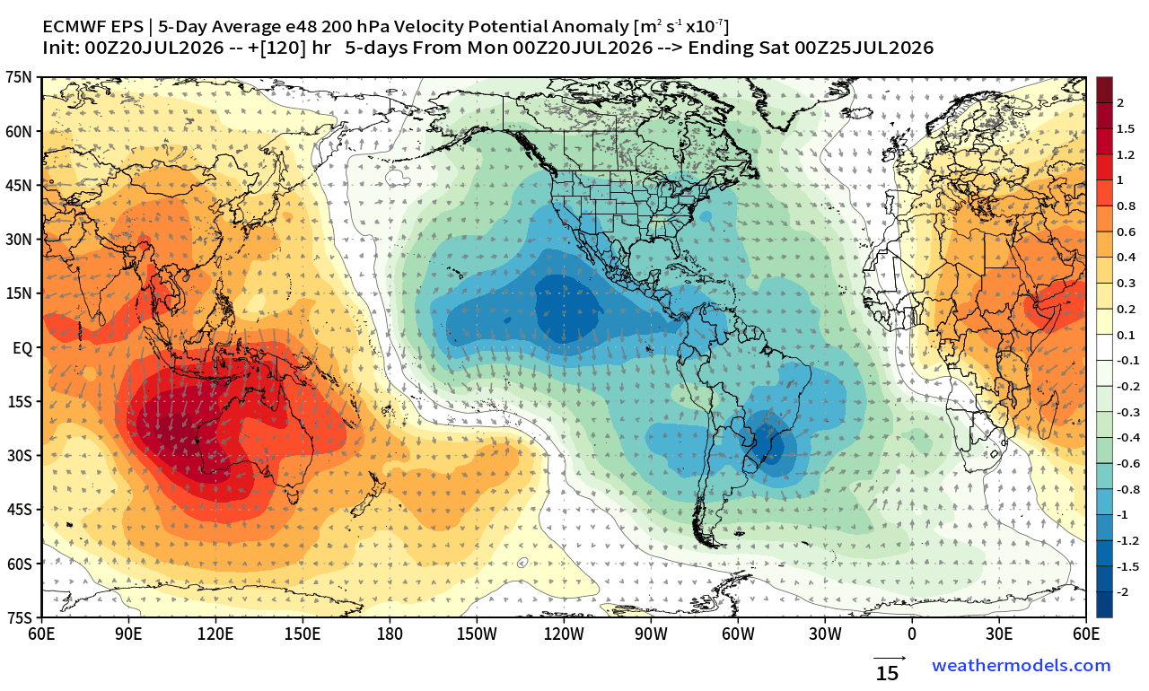
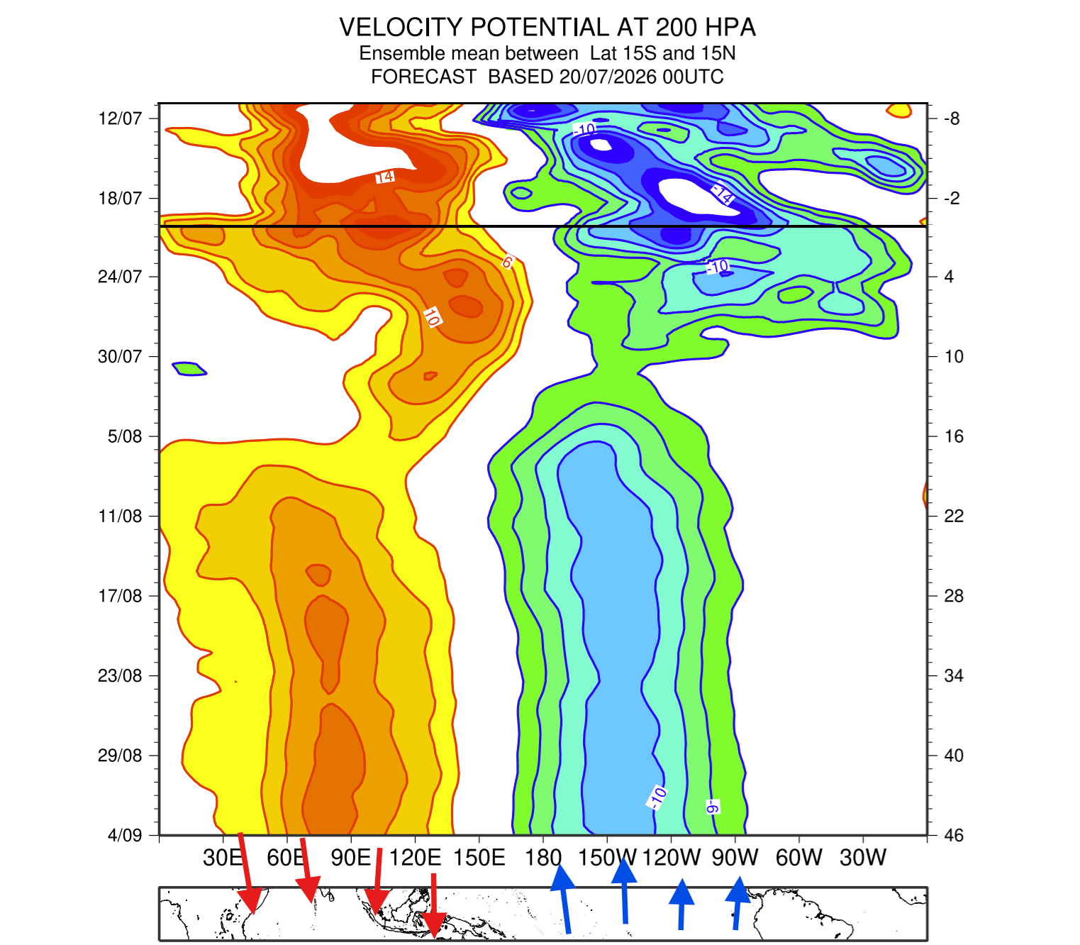
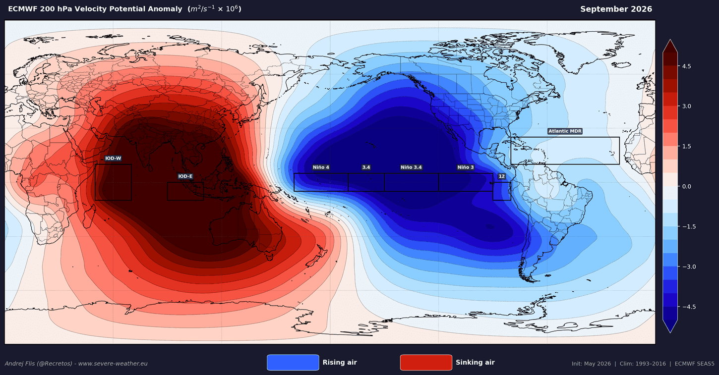
- Atmospheric Locking: The global climate system has already transitioned into "El Niño mode," establishing a stationary atmospheric standing wave. This locks large-scale rising air over the central and eastern Pacific while suppressing circulation in surrounding regions.
- Historical Comparison: Current trajectory metrics show the 2026 event developing faster and peaking higher than both the moderate 2023/2024 El Niño and the historic 2015/2016 Super El Niño.
Chronology: From Subsurface Anomalies to Global Atmospheric Shift
The rapid unfolding of the 2026/2027 El Niño can be traced through a distinct sequence of oceanographic and atmospheric developments observed over the past several months:
1. Spring to Early Summer: Subsurface Ignition
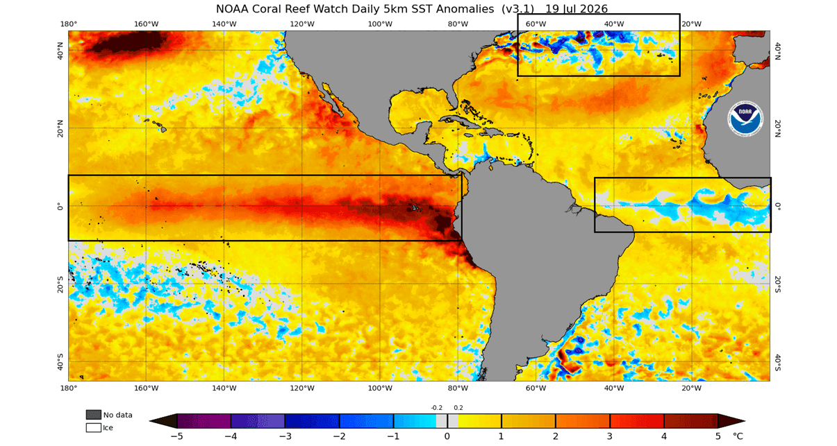
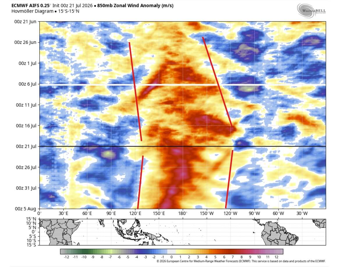
Long-range tracking identified the early precursors of an equatorial warm phase. Unlike typical ENSO developments, this cycle was supercharged by massive subsurface anomalies accumulating in the western Pacific. Strong westerly wind bursts—transient episodes where near-surface winds blow from west to east—began pushing massive volumes of warm sub-surface water eastward.
2. Mid-to-Late Summer: The Kelvin Wave Surge
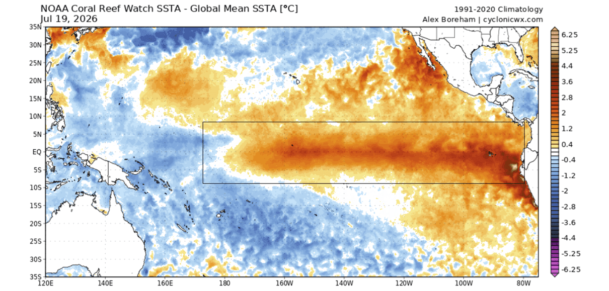
By July, a robust Kelvin wave propagated across the equatorial Pacific, driving subsurface core temperatures up to 7°C above average. As these waters breached the surface in the eastern Pacific, sea surface temperatures spiked by 3°C to 4°C above normal, creating a stark thermal contrast with surrounding oceans and triggering an immediate response in global wind and pressure patterns.
3. Fall 2026: Atmospheric Transition and Standing Waves
As the ocean anomalies intensified, the atmosphere reacted by fundamentally shifting the Walker circulation—the loop of tropical air rising and sinking across the globe. Rather than maintaining dynamic, moving weather systems, the sheer thermal energy of the Pacific forced the atmosphere to form a fixed standing wave. Data from the ECMWF confirmed that this stationary pattern locked into place by September, ensuring that El Niño will dictate global circulation through the upcoming winter and into the spring of 2027.
Supporting Data: Multi-Model Consensus and Historical Context
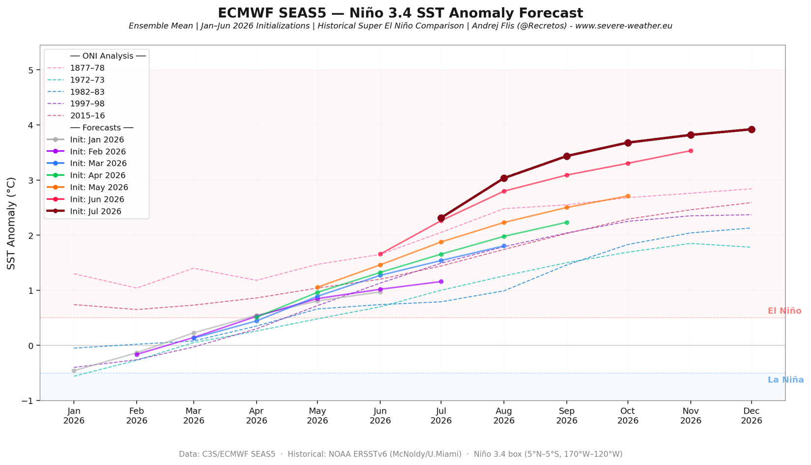
Global forecasting authorities utilizing normalized relative ENSO indices have reached a rare consensus: every major model run since January has continuously revised peak temperature projections upward.
[Historical Peak: 2015/2016] ----------> +2.6°C
[Current ECMWF Forecast 2026/2027] ------> +3.0°C to +4.0°C (Unprecedented)
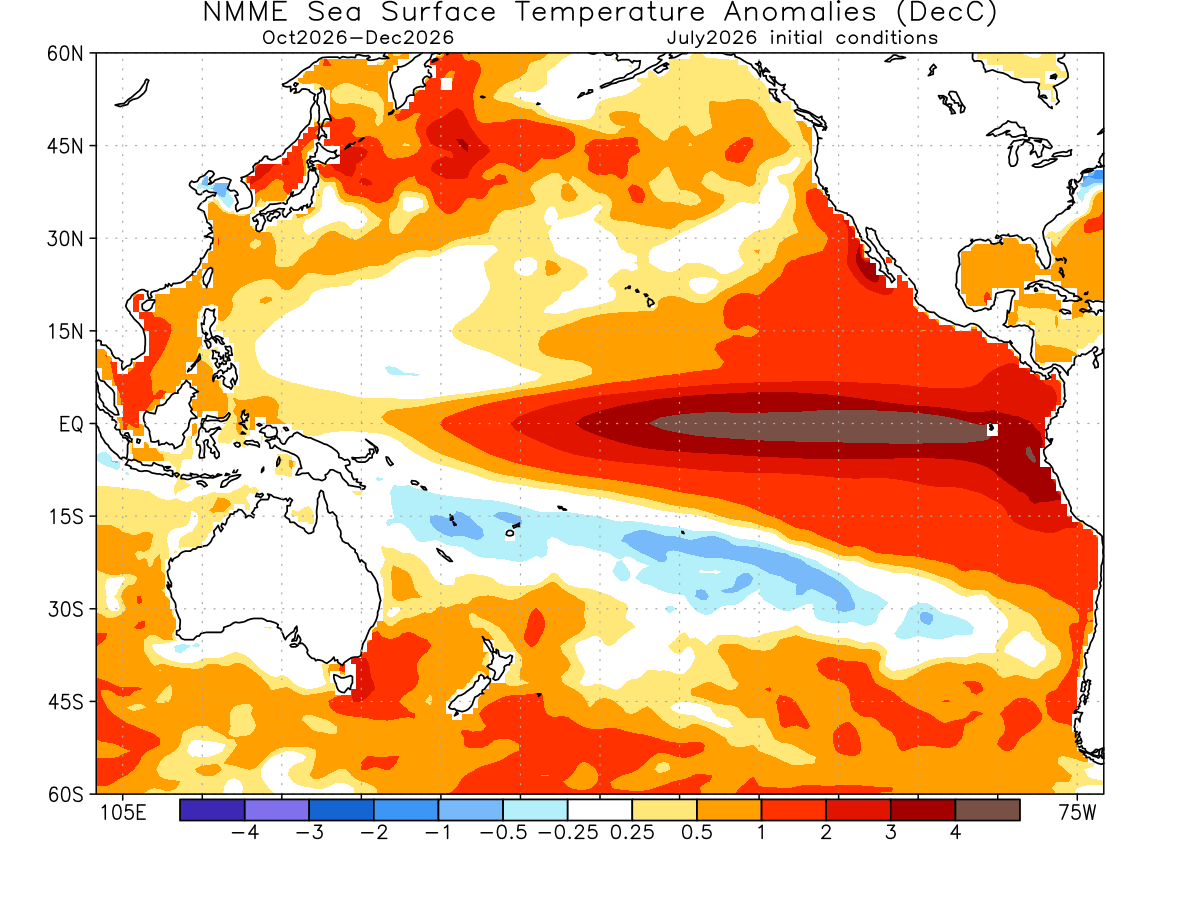
The NOAA National Multi-Model Ensemble (NMME) for the October–December period projects anomaly values exceeding +4.0°C across parts of the primary ENSO region. When compared against historical data extending back to 1870, the projected peak for the winter of 2026/2027 exceeds any recorded event in the past 155 years.
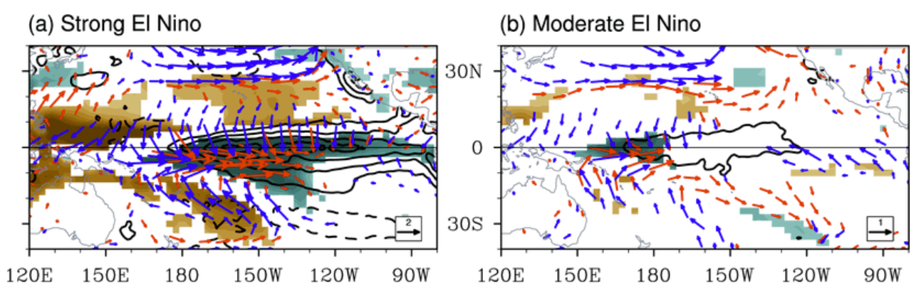
Furthermore, velocity potential analyses demonstrate that this Super El Niño acts as a massive "pressure release valve" for the global climate system. By fundamentally altering trade winds and shifting global pressure fields, it supersedes minor regional climate drivers, establishing a teleconnection network that influences weather far beyond the tropics.
Official Responses and Scientific Implications
Climatologists are viewing this unfolding event with a mixture of professional fascination and caution. Because a Super El Niño occurs roughly once a decade or less, each event serves as a stress test for modern forecasting models.
According to leading meteorological modeling authorities, the primary scientific concern is the non-linear amplification of weather impacts. While moderate El Niños produce scattered, predictable adjustments to regional jet streams, Super El Niños completely overhaul planetary circulation.
+-------------------------------------------------------------+
|               SUPER EL NIÑO TELECONNECTION                  |
+-------------------------------------------------------------+
|  Tropical Pacific Warming                                   |
|       │                                                     |
|       ▼                                                     |
|  Atmospheric Standing Wave & Walker Cell Lock               |
|       │                                                     |
|       ▼                                                     |
|  Polar Jet Stream Displacement & Amplified Southern Track   |
+-------------------------------------------------------------+
Official advisories emphasize that standard historical templates for El Niño winters may actually underestimate the severity of the weather anomalies expected in the coming months. The rapid onset of the event has caught even veteran meteorologists off guard, prompting continuous updates to long-range seasonal risk assessments.
Implications for North America, Europe, and the Polar Vortex
The downstream effects of the 2026/2027 Super El Niño will vary significantly by region, with North America bearing the brunt of the direct atmospheric bridge.
North America: A Tale of Two Winters (January–February 2027)
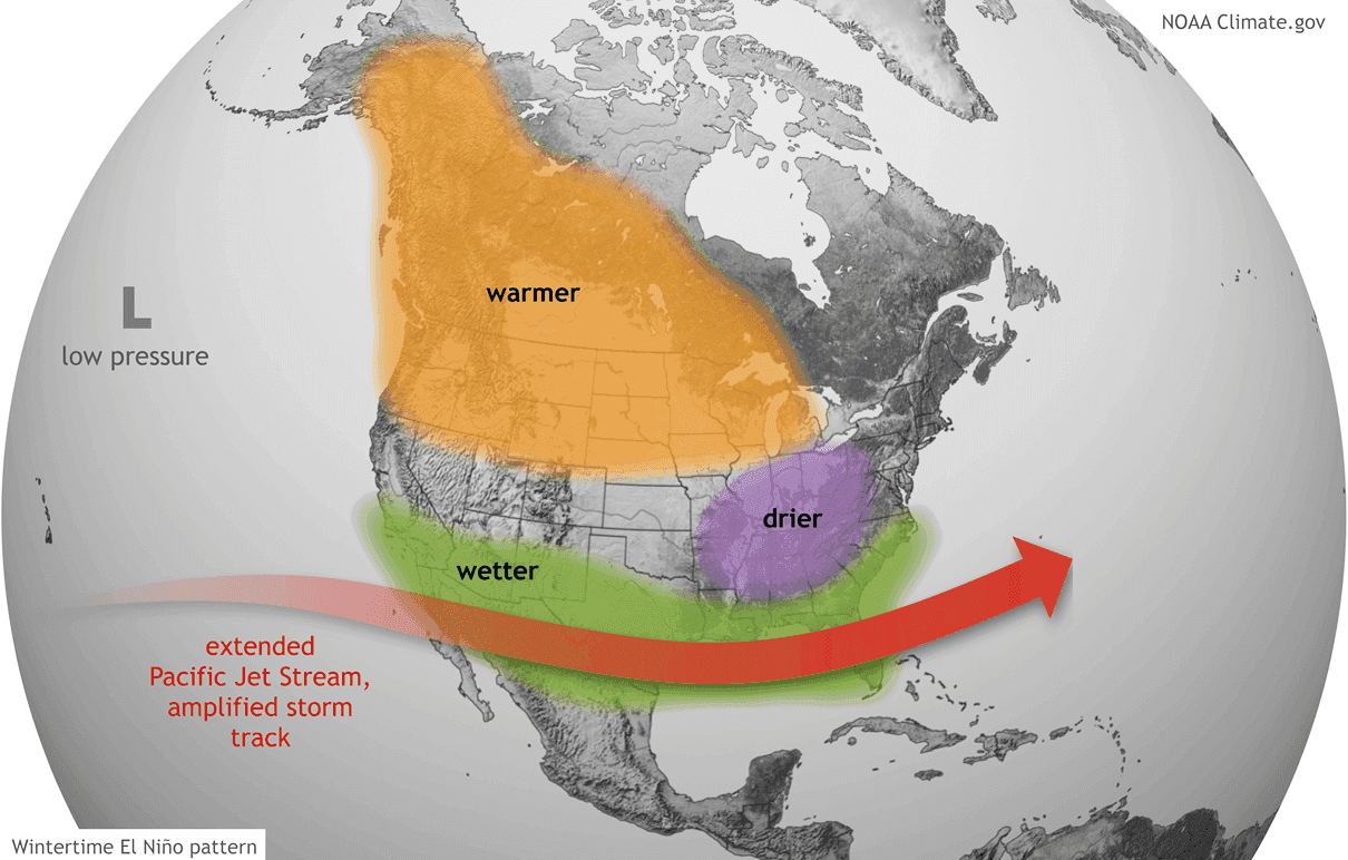
- The Pacific Northwest and Western Canada: Persistent low pressure in the North Pacific will drive the polar jet stream further north, resulting in significantly warmer-than-average temperatures and reduced mountain snowfall in western Canada and the northern United States.
- The Canadian High-Pressure Block: Mid-level forecasts from both the CFSv2 and ECMWF models highlight a persistent, high-amplitude blocking anomaly centered over Canada and Greenland. This high-pressure block acts as a wedge, deflecting cold air and serving as an anchor for the winter pattern.
- The Southern and Eastern Storm Track: An energized, moisture-rich southern Pacific jet stream will drive frequent, heavy precipitation systems from California and Texas across the Gulf Coast and up into the Mid-Atlantic and East. Where this abundant moisture collides with southward-deflected cold air intrusions from the Canadian blocking high, the potential for high-impact winter storms, heavy snowfall, and ice events increases substantially across the Central and Eastern U.S.
Europe: A Less Direct, More Complex Response
Europe does not experience the direct atmospheric teleconnections seen in North America, resulting in lower predictability for the continent. Model runs for January 2027 suggest a developing high-pressure ridge from the south, with competing model runs (CFSv2 vs. ECMWF) debating whether northwest Europe will experience mild, expanded ridging or occasional northerly cold air drops stemming from displaced low-pressure systems.
The Polar Vortex Disruption Risk
Perhaps the most critical wild card for the Northern Hemisphere is the stratosphere. Historically, strong El Niño phases statistically elevate the probability of a mid-winter Sudden Stratospheric Warming (SSW) event.
An SSW event leads to the deceleration or total collapse of the stratospheric Polar Vortex—the spinning vortex of cold air anchored over the Arctic.
- The Seasonal Signal: Latest ECMWF ensemble forecasts for the 10hPa zonal wind levels indicate a pronounced downward trend in Polar Vortex strength for January 2027, dipping well below historical averages.
- The "Polar Express" Effect: If a full vortex disruption or reversal occurs, it weakens the containment of Arctic air. When combined with the pre-existing pressure anomalies of a Super El Niño, a disrupted Polar Vortex can open the floodgates for severe, late-season cold air outbreaks across the mid-latitudes of North America and Europe.
Outlook
As the 2026 Super El Niño continues its rapid ascent toward its anticipated late-autumn peak in November and December, global meteorological agencies will maintain round-the-clock monitoring of subsurface thermal waves, trade wind fluctuations, and stratospheric indicators.
With communities across North America and Eurasia facing the prospect of an intensely amplified winter season, preparedness and early seasonal advisories remain critical as the planet enters uncharted climatic territory.
