

As the meteorological community looks toward the closing months of 2026, a colossal climate engine is gathering unprecedented momentum across the tropical Pacific. The rapid development of a record-strength Super El Niño is swiftly becoming the dominant force shaping global weather patterns. According to the latest long-range forecasts from major meteorological institutions, including the ECMWF, NOAA CPC, and the NMME, this weather phenomenon is bypassing typical seasonal development timelines. Instead of gradually building into the cold season, it has already triggered an unusually evolved, winter-like atmospheric response across the Northern Hemisphere.

This extensive atmospheric forcing promises to fundamentally alter regional climates across North America and Europe, raising significant questions for agricultural planning, energy markets, and emergency preparedness as the world bridges the Fall 2026 and Winter 2026/2027 seasons.
Main Facts: The Anatomy of a Record-Strong Super El Niño
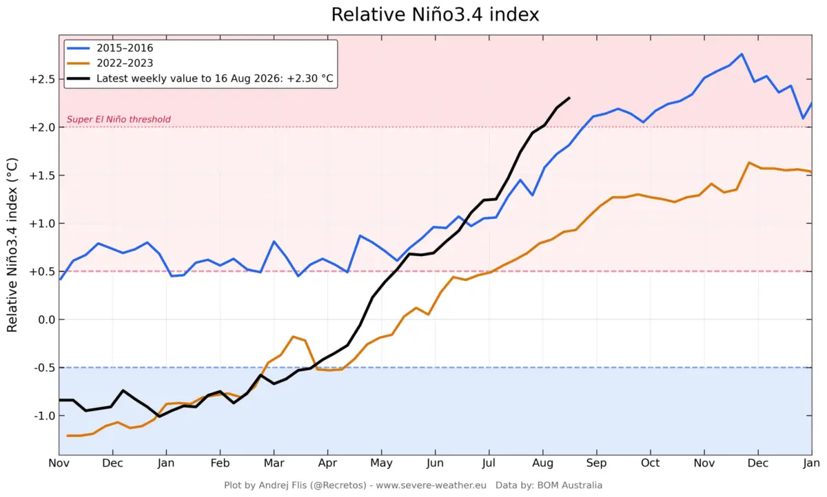
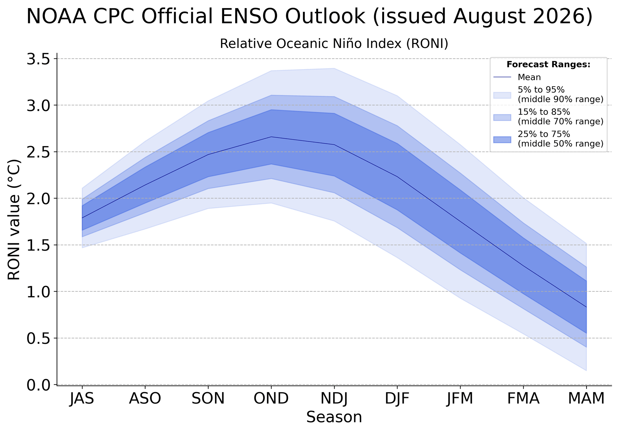
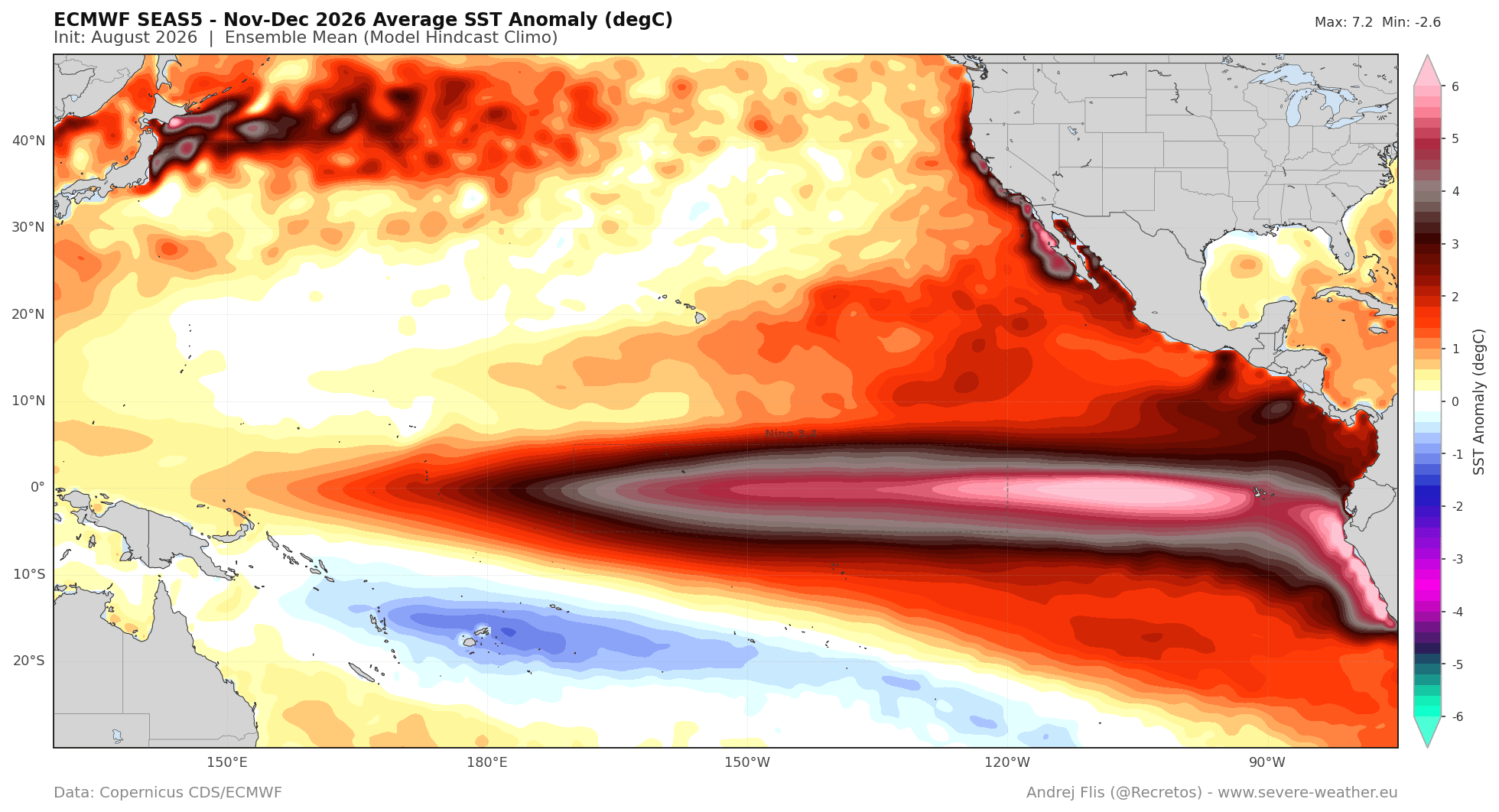
At the heart of the current climate anomaly is a staggering surge in equatorial Pacific Ocean temperatures. To be classified as a Super El Niño, seasonal sea-surface temperature anomalies in the primary ENSO (El Niño-Southern Oscillation) regions must sustain values exceeding +2.0°C above the long-term average. Current data indicates that this threshold has not only been met months ahead of schedule, but it has already eclipsed the pacing of historic heavyweights like the 2015–2016 event.
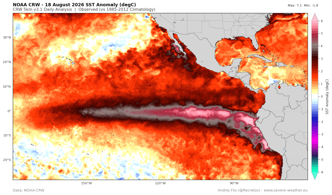
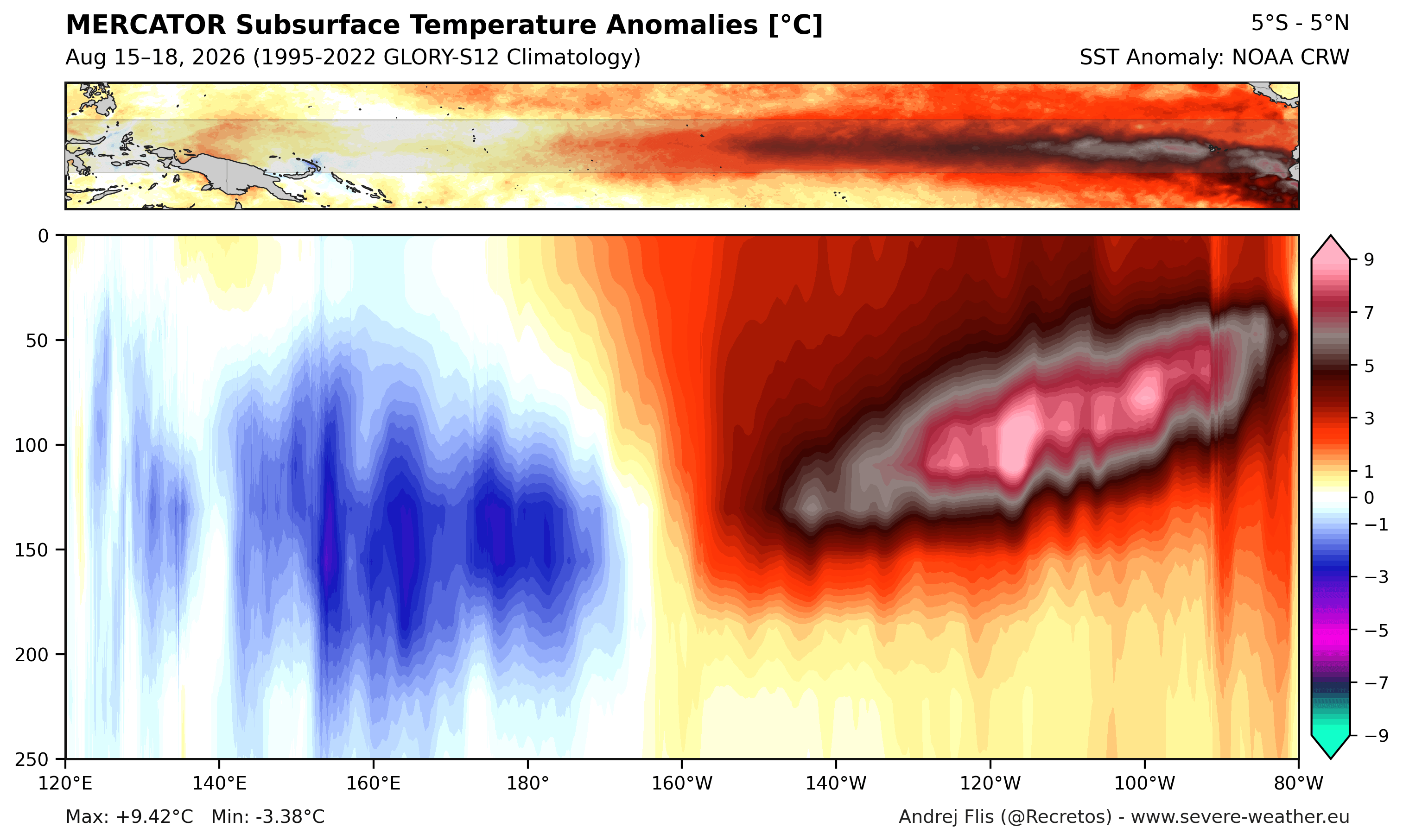
- Subsurface Thermal Energy: Below the ocean’s surface, a powerful downwelling Kelvin Wave is coursing through the top 250 meters of the tropical Pacific. Driven by anomalous westerly surface winds, this subsurface warm core features peak anomalies exceeding 9°C (16°F) above normal.
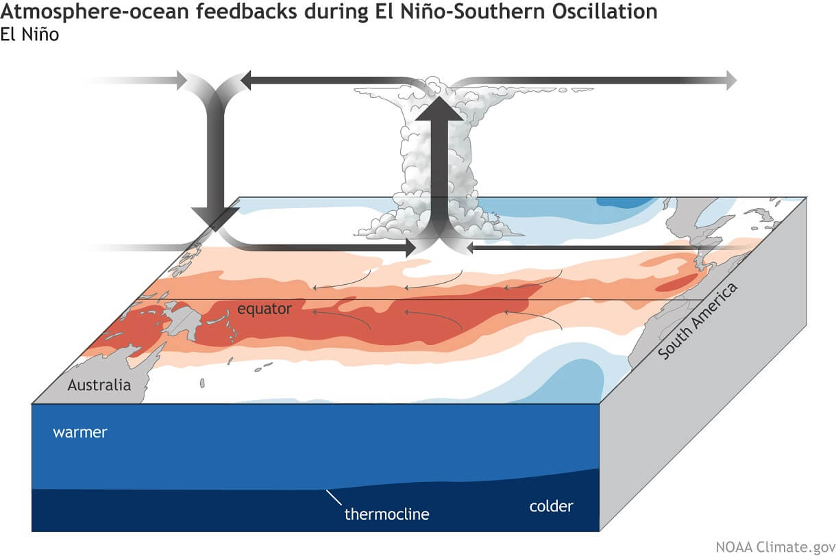
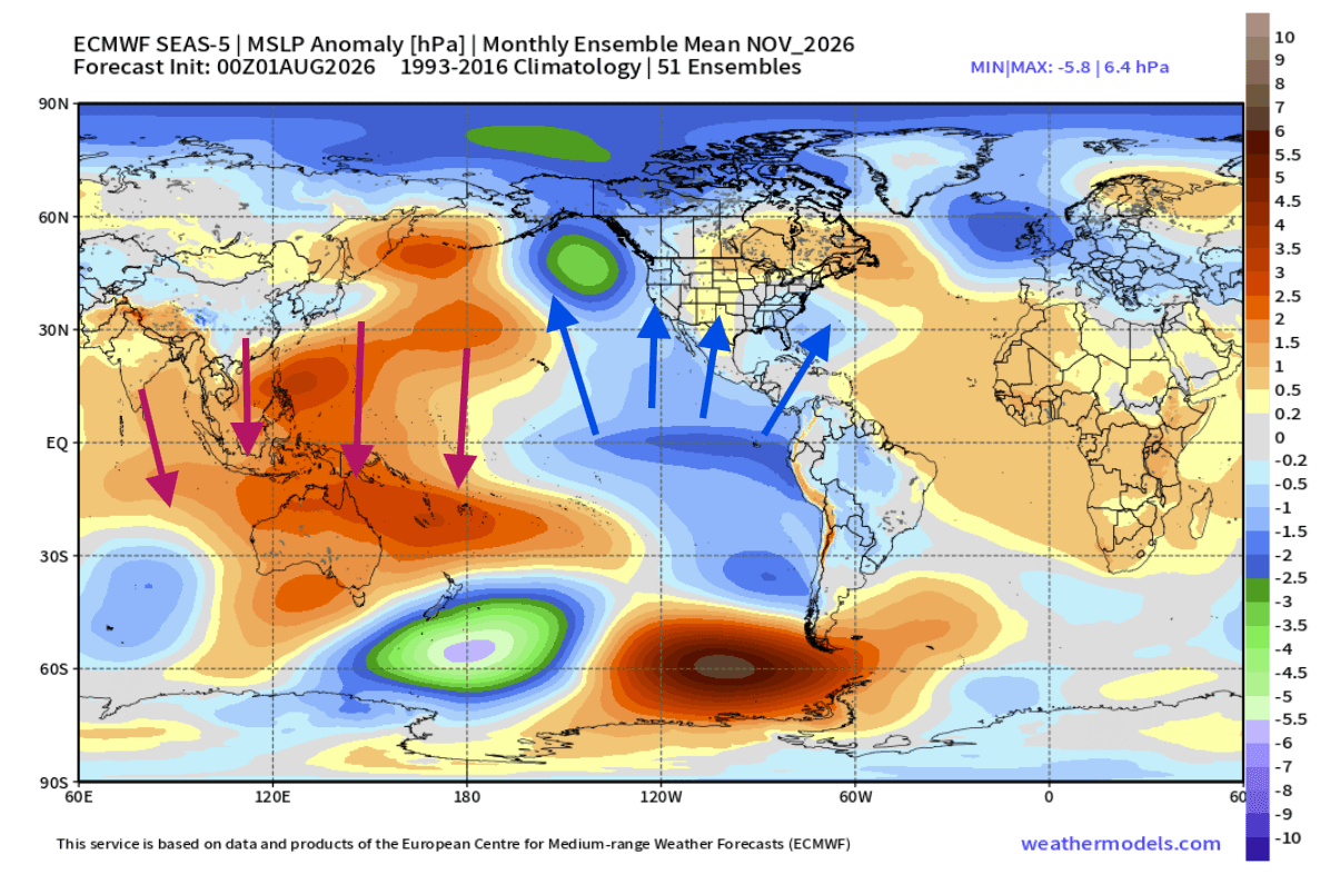
- The Atmospheric Bridge: As this colossal pool of warm water slowly rises, it continuously pumps thermal energy into the atmosphere. This alters the Walker Circulation—suppressing precipitation and raising pressure over the western Pacific while generating lower pressure, rising air, and heightened precipitation across the central and eastern Pacific.
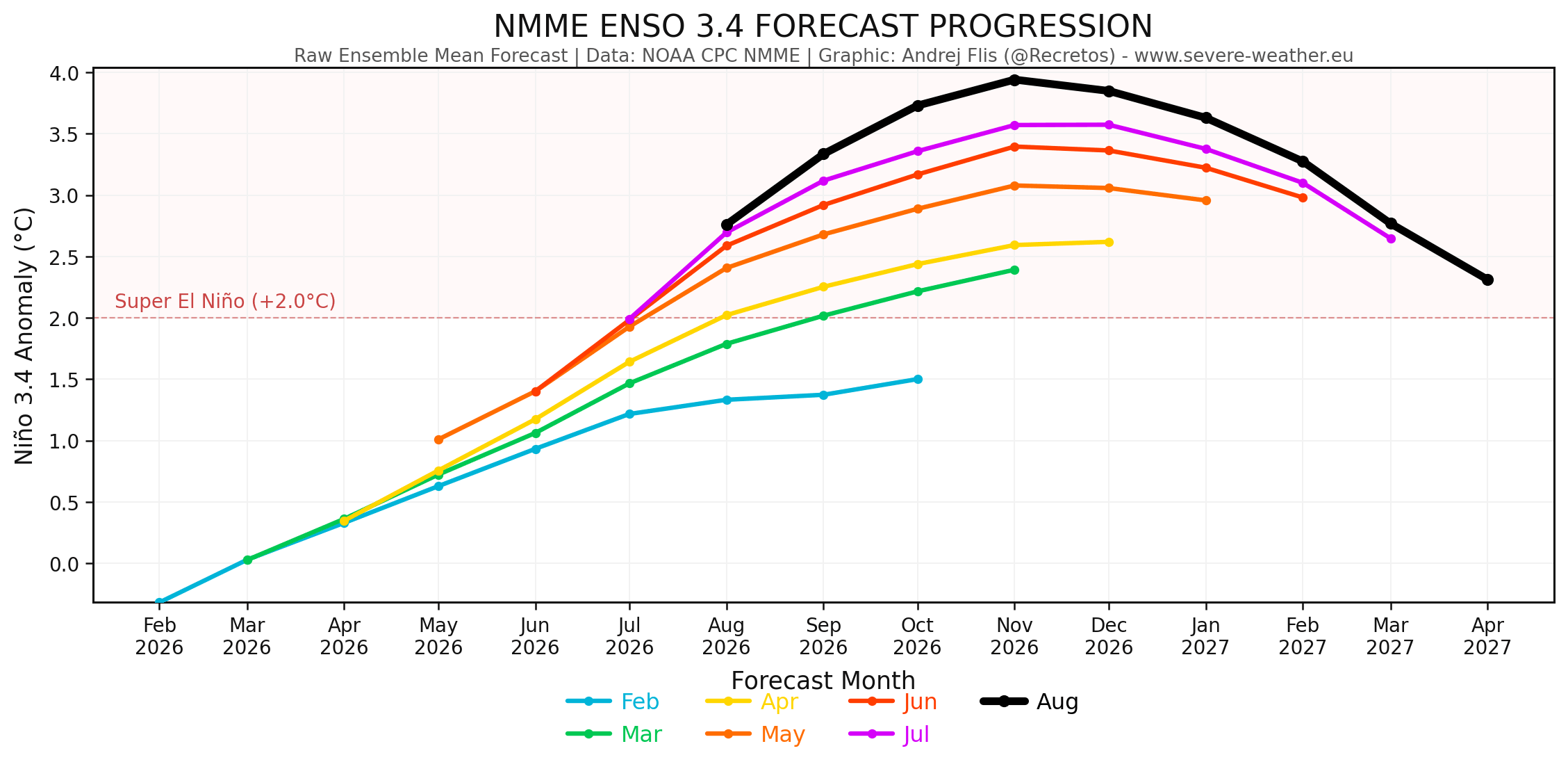
- Model Projections: Official NOAA CPC and NMME multi-model ensembles show peak seasonal anomalies potentially climbing toward an astonishing +4.0°C. If verified, this would position the 2026/2027 event as one of the strongest El Niño episodes in modern observational history.
Chronology of Development: From Summer Surges to Early Winter Signals
The rapid escalation of this climate anomaly has caught many forecasters by surprise due to its exceptionally accelerated timeline:
Late Summer to Early Fall 2026: Rapid Intensification
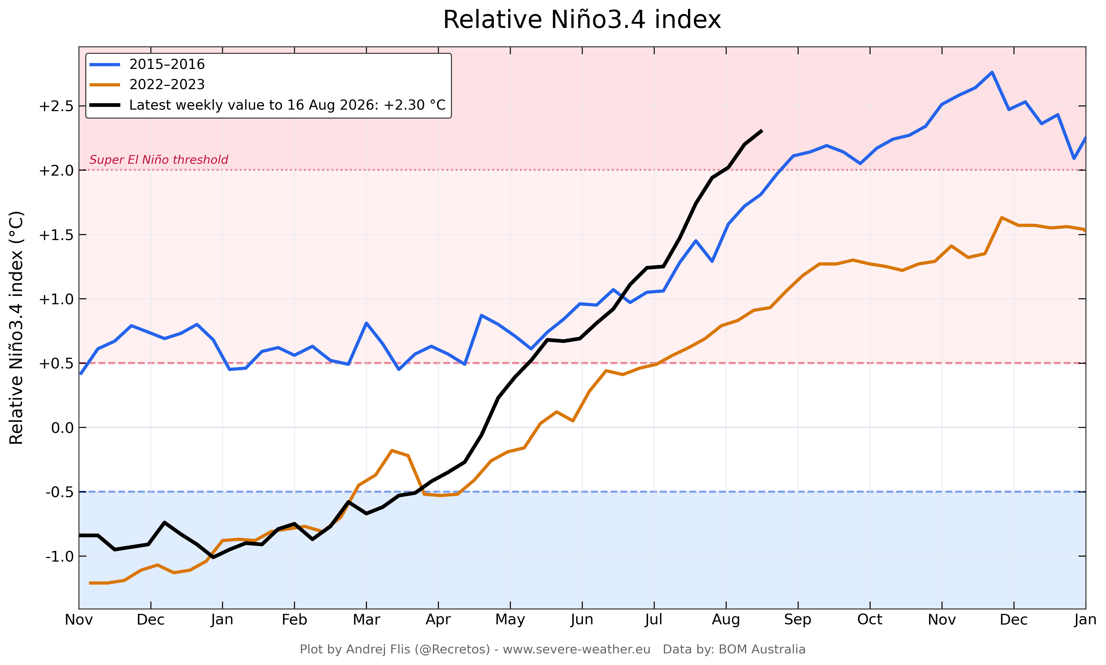
By August 2026, weekly data from the Australian Bureau of Meteorology (BOM) and NOAA confirmed that subsurface temperature anomalies were outpacing those recorded during the historic 2015 event. While 2015 values did not reach current levels until late October, the 2026 event achieved these milestones months earlier. This early maturation immediately began altering the tropical rainfall and global pressure architecture.
Fall 2026: An Accelerated Seasonal Shift
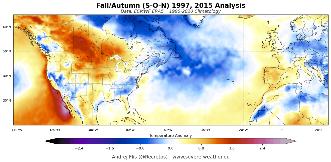
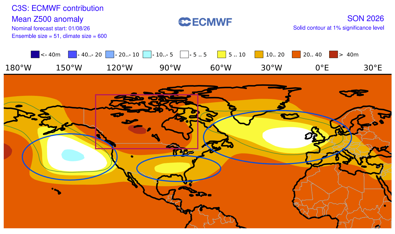
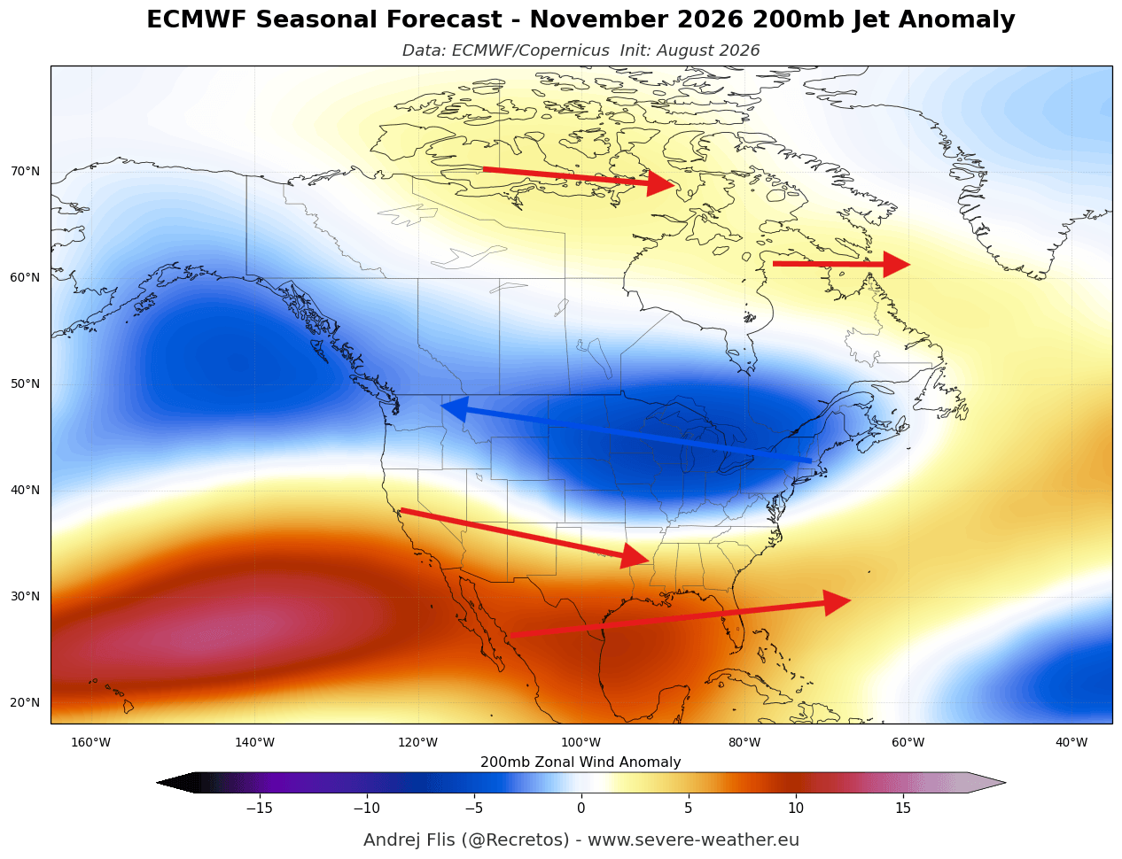
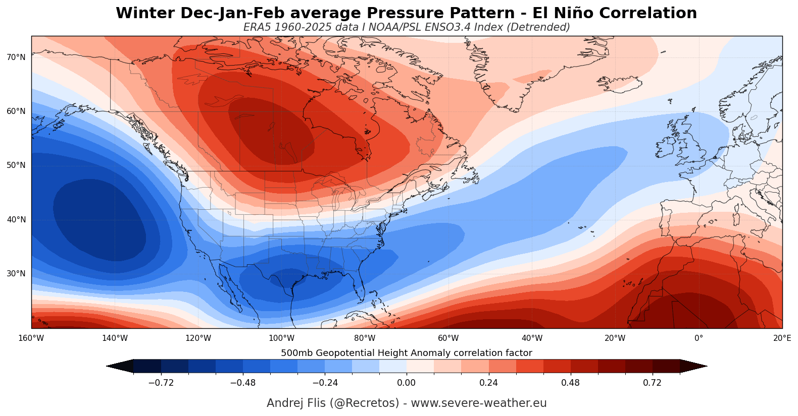
Ordinarily, the transition from fall to winter features a gradual evolution of jet stream pathways. However, the sheer intensity of the 2026 Super El Niño has forced an early-season split-flow pattern over North America. A pronounced high-pressure anomaly has anchored itself over Canada, while an active, moisture-laden southern storm track establishes across the United States. This structural alignment mirrors patterns typically observed in the dead of winter rather than the early autumn months.
Winter 2026/2027 Outlook: Peak Amplification
As the calendar turns toward December, January, and February, forecasting models indicate a steady intensification rather than a shifting of pressure centers. Mid-level blocking over Canada and a supercharged subtropical jet stream across the southern and eastern United States are projected to define the mid-to-late winter landscape, heightening the risk of dramatic weather extremes.
Supporting Data and Model Consensus: North America and Europe
To understand the breadth of these changes, meteorologists rely on multi-model ensembles that cross-reference the European Centre for Medium-Range Weather Forecasts (ECMWF) with North American modeling systems (NMME).
North American Impacts
- Temperature Trends: The persistence of a robust high-pressure blocking ridge over Canada and the northern tier of the United States will drive above-normal temperatures across western and south-central Canada, as well as the upper Midwest and Northeast. Conversely, the active southern storm track will temper anomalies, keeping temperatures closer to seasonal averages across the southern U.S.
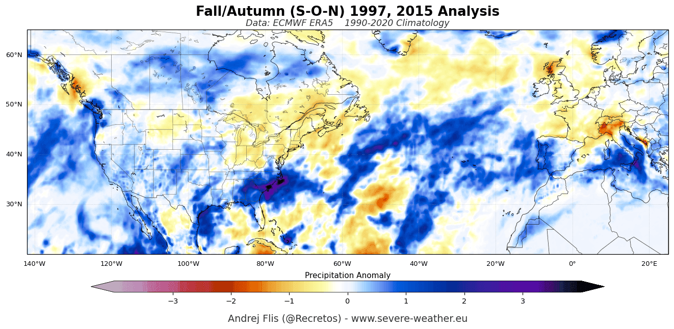
- Precipitation and Snowfall: A strongly amplified Pacific jet stream will deliver abundant moisture to the southern and southeastern United States, resulting in above-average precipitation. Snowfall trends for late fall and early winter show a complex picture: while Canadian blocking initially suppresses early snow cover in many northern zones, elevated regions of the U.S. Northern Plains and West Texas could experience localized, heavy late-season snowfall events driven by southern stream disturbances.
European Impacts
- Westerly Flow and Temperatures: Downstream impacts of the Pacific forcing extend across the North Atlantic, where a persistent low-pressure anomaly is forecast to drive a dominant westerly and southwesterly flow into Europe. This setup will advect mild, moist oceanic air across the continent, translating to above-normal surface temperatures, particularly across central, western, and southeastern regions.
- Precipitation and Alpine Snow: The influx of Atlantic moisture will elevate rainfall totals across much of Western and Southern Europe. For winter sports enthusiasts, however, the mild baseline temperatures threaten a slow start to the snow season. Only high-elevation zones, such as the western Alps, will maintain sufficient cold to turn incoming moisture into significant snow accumulations.
Official Responses and Strategic Implications
As long-range models solidify around a record-breaking Super El Niño, emergency management agencies, agricultural sectors, and energy markets are beginning to factor these projections into their winter preparations.
Governments across North America are reviewing infrastructure readiness along the southern storm corridors, where repeated, moisture-rich systems could trigger localized flooding and severe weather outbreaks. In the agricultural sector, farmers across the U.S. Corn Belt and the southern plains are adjusting planting and harvesting schedules to account for projected moisture surpluses and temperature anomalies. Meanwhile, energy providers in Europe and North America are closely monitoring the projected westerly flows and winter blocking patterns to forecast heating demand and manage fuel reserves effectively.
Implications for the Polar Vortex: The Threat of Stratospheric Disruption
Perhaps one of the most critical subplots of the 2026/2027 winter season involves the interaction between the Super El Niño and the Polar Vortex.
The Polar Vortex is a massive cyclonic circulation spanning the troposphere and stratosphere (reaching altitudes over 50 km / 31 miles) that normally traps frigid polar air in the high latitudes. However, climatological studies indicate that strong El Niño winters feature an elevated statistical tendency toward Sudden Stratospheric Warming (SSW) events and structural disruptions.
The Mechanics of a Disruption
Powerful atmospheric waves generated in the North Pacific and North America during an El Niño event propagate upward, injecting immense energy into the stratosphere. This energy decelerates the stratospheric winds that maintain the Polar Vortex.
Latest forecasts from both the ECMWF and the UK Meteorological Office (UKMO) reveal an unusual, pronounced deceleration of zonal stratospheric winds slated for late December and January.
- The Spill-Out Effect: A weakened or fully disrupted Polar Vortex loses its ability to bottle up Arctic air. When the vortex undergoes major elongation or collapse, lobes of the polar vortex can break off, sending severe northerly outbreaks spilling southward into mid-latitude population centers in North America and Europe.
- Historical Precedent: While a Super El Niño generally implies milder conditions across certain northern zones due to persistent ridging, a mid-winter Polar Vortex collapse completely flips the script, introducing high-impact, short-notice extreme cold waves that can disrupt transportation, power grids, and daily life.
Conclusion
The convergence of a record-setting Super El Niño and early signals of stratospheric instability makes the upcoming Fall 2026 and Winter 2026/2027 seasons one of the most closely watched periods in modern meteorological history. As the atmosphere transitions into its winter configuration, continuous monitoring will be essential to anticipate how these competing global drivers will ultimately dictate local weather realities.
