

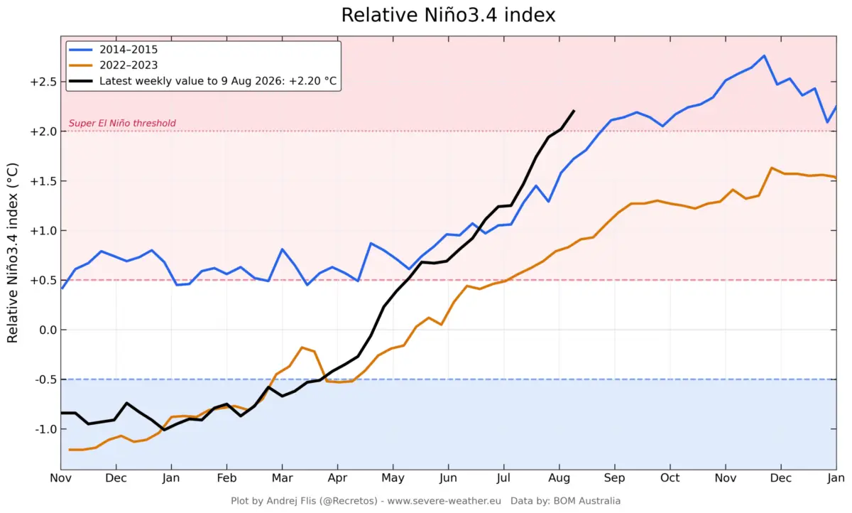
As meteorologists and climate scientists closely monitor the tropical Pacific, a formidable weather driver is rapidly taking shape. A Super El Niño is intensifying at an unprecedented pace, with fresh oceanographic and atmospheric data pointing toward a historic peak later this year. Surpassing the developmental speeds of past legendary events, including the 2015–2016 cycle, this emerging climate phenomenon is already leaving its fingerprints on global circulation.

Long-range forecasting models from leading meteorological centers—such as the European Centre for Medium-Range Weather Forecasts (ECMWF) and the National Oceanic and Atmospheric Administration (NOAA)—have consistently revised their projections upward. As this extreme event locks into place, its ripple effects are expected to fundamentally reshape the upcoming Fall 2026 and Winter 2026/2027 seasons across the United States, Canada, and Europe.
Main Facts: Anatomy of an Extreme ENSO Event
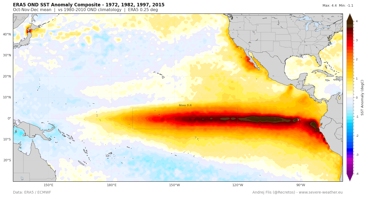
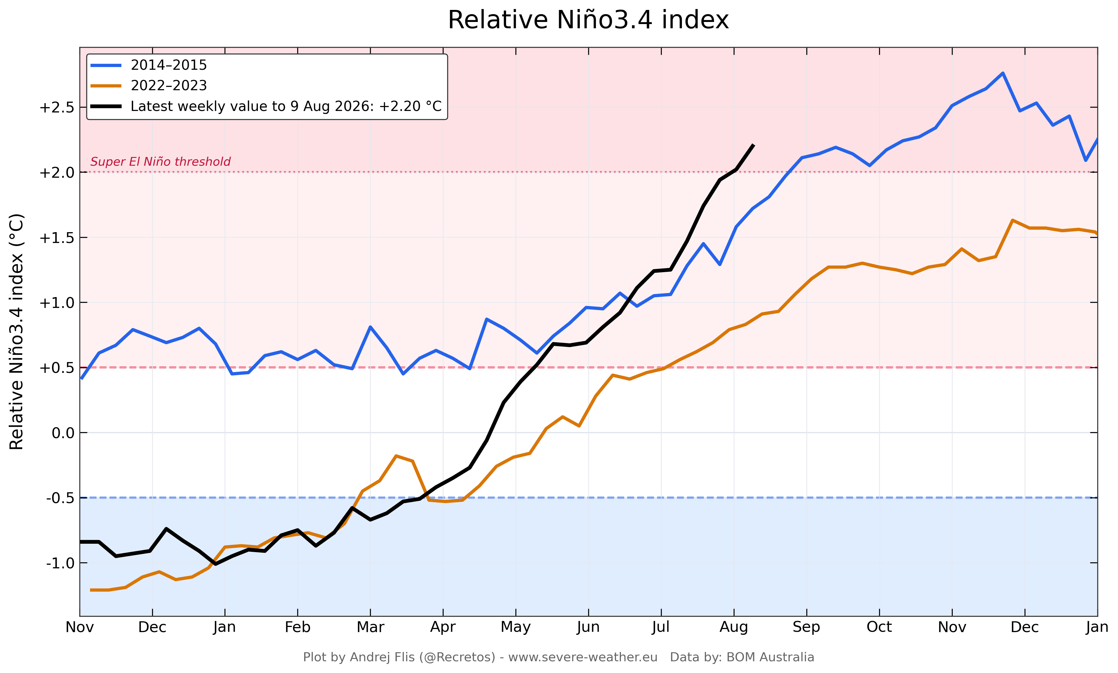
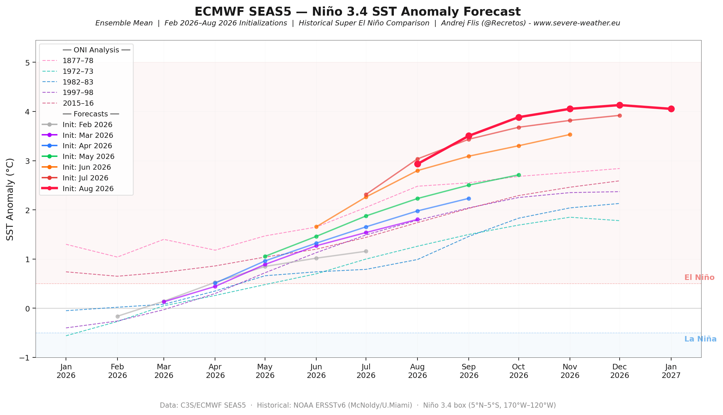
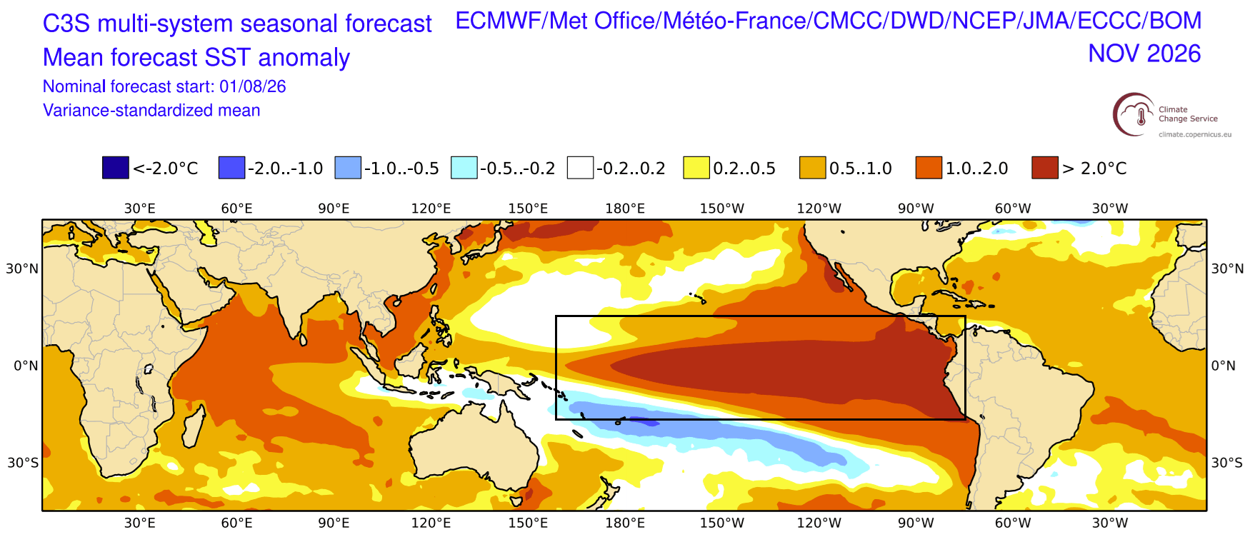
The El Niño-Southern Oscillation (ENSO) is currently transitioning aggressively from a neutral phase into a robust El Niño regime, quickly escalating toward "Super" status—a classification traditionally reserved for events where sea surface temperature (SST) anomalies in the main equatorial Pacific (ENSO regions) reach or exceed +2.0°C above the long-term average. Current runs indicate that parts of this developing event could shatter expectations by crossing the unofficial +3.0°C threshold, placing it securely in historic territory.
The engine driving this rapid acceleration relies on two primary components:
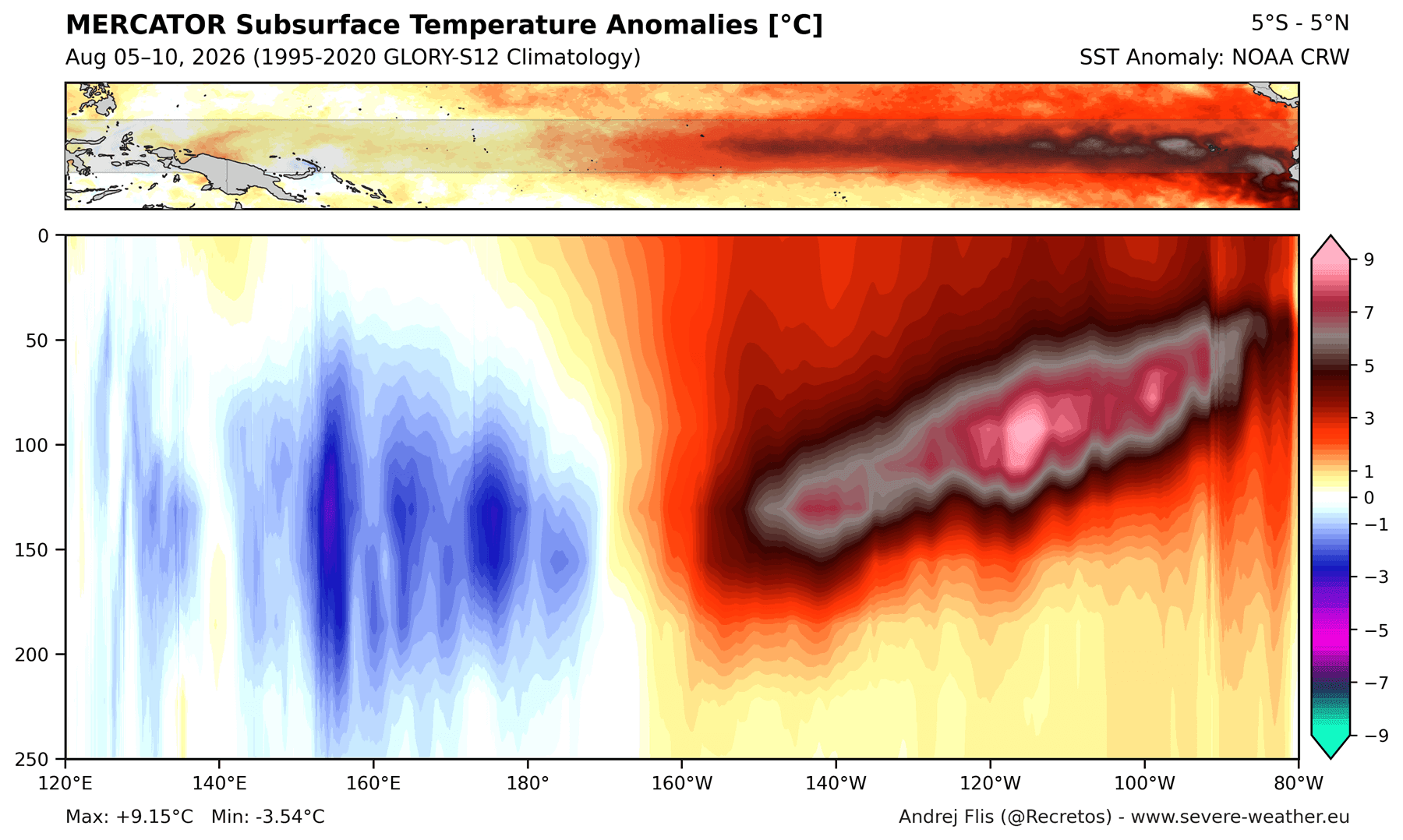
- Subsurface Thermal Energy (Kelvin Waves): A powerful downwelling Kelvin wave is currently propagating eastward through the top 250 meters of the equatorial Pacific. Subsurface temperature anomalies are reaching a staggering 9°C (16°F) above normal, providing a continuous, deep-ocean thermal reserve that will sustain the El Niño well into the winter months.
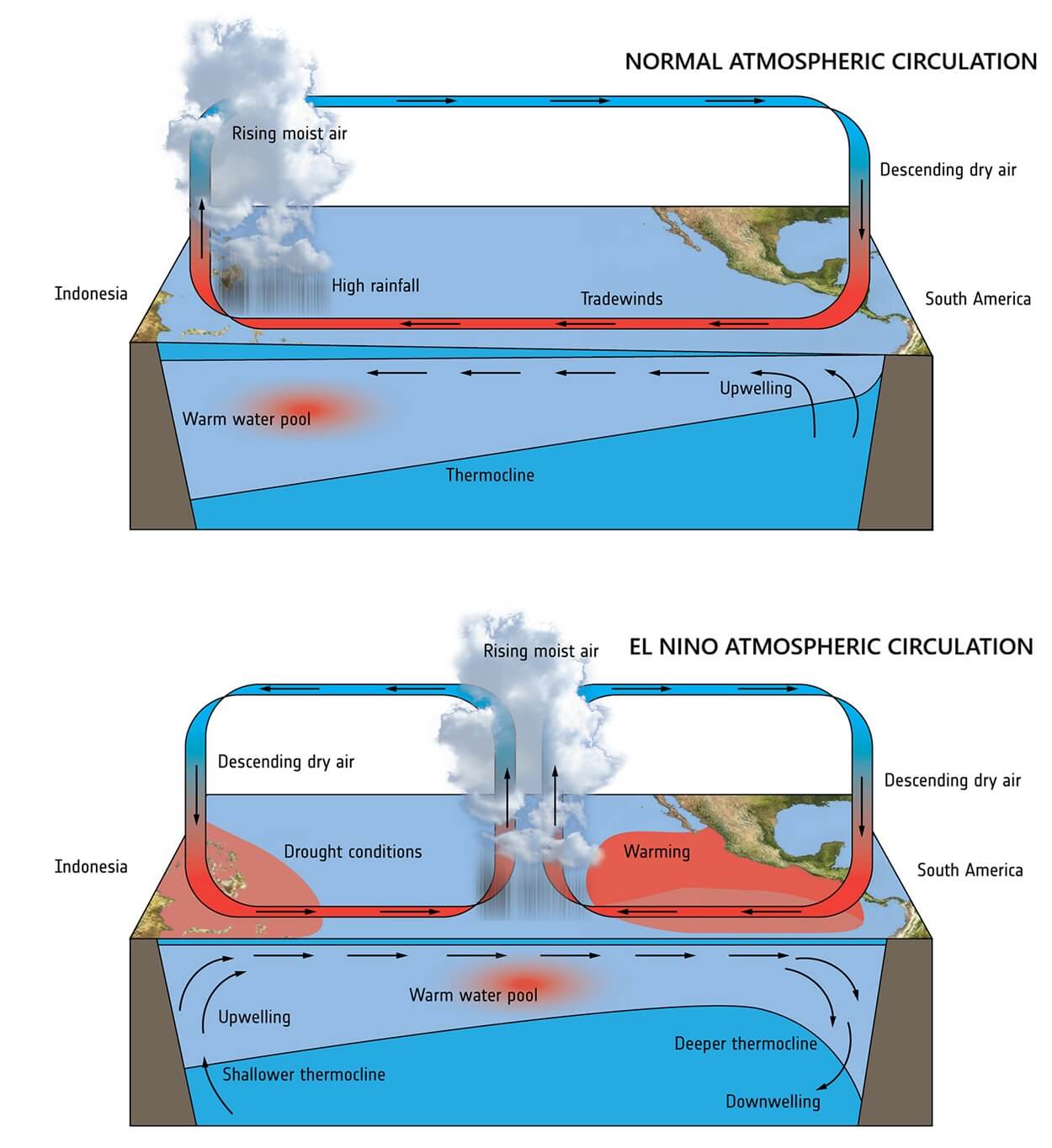
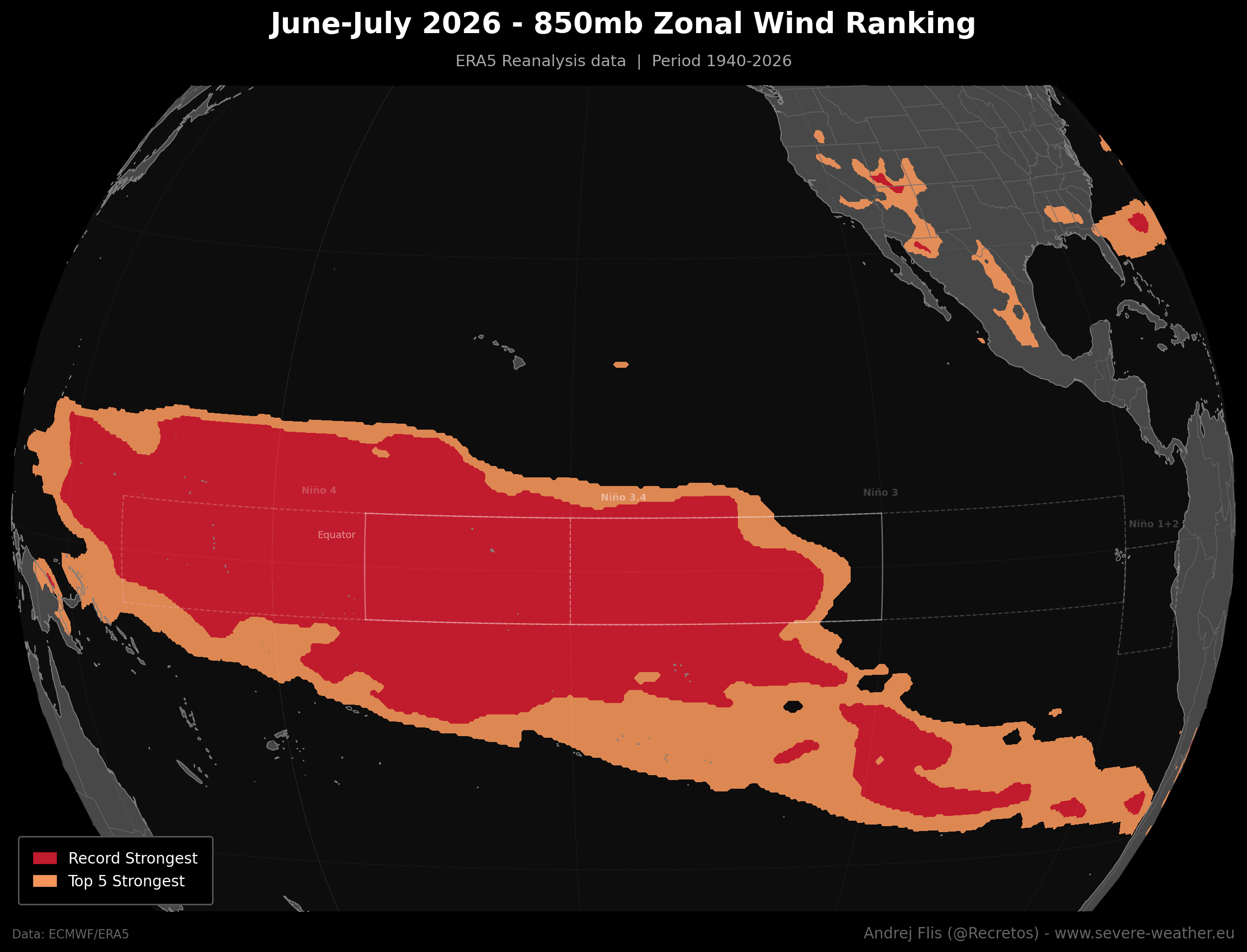
- Record-Breaking Westerly Wind Bursts: June and July 2026 recorded the strongest low-level westerly wind anomalies across the western and central equatorial Pacific in an 86-year ERA5 reanalysis dataset. This sudden collapse of the trade winds has piled up massive amounts of warm water and effectively locked the global atmosphere into a permanent, stationary wave pattern.
Chronology of Development: From Spring Acceleration to Late-Year Projections
Understanding how this extreme climate driver evolved requires tracking its rapid trajectory from the early months of 2026 to its anticipated winter peak.
Spring 2026: The Initial Spark
As the Northern Hemisphere transitioned out of winter, seasonal models began picking up early signals of Pacific warming. However, because standard numerical models struggle to simulate individual, chaotic wind bursts, the true magnitude of the event was initially underpredicted.
Summer 2026: The Collapse of Trade Winds and Record Indices
During June and July, unprecedented westerly wind bursts occurred across the equatorial Pacific. NOAA’s Multivariate ENSO Index (MEI v2) registered an extraordinary bi-monthly jump, climbing 3.4 points from a cool -1.0 in February-March to a record-high +2.4 in June-July. This marked the highest June-July value in NOAA’s historical record dating back to 1979, confirming an unusually tight and early ocean-atmosphere coupling.
Fall 2026: Early Winter Signatures
Entering the autumn months, the atmosphere has already begun responding to the massive heat engine in the Pacific. Rather than exhibiting a traditional, muted transition phase, long-range models show that the global circulation has locked into an advanced El Niño pattern months ahead of schedule.
Winter 2026/2027: The Anticipated Peak
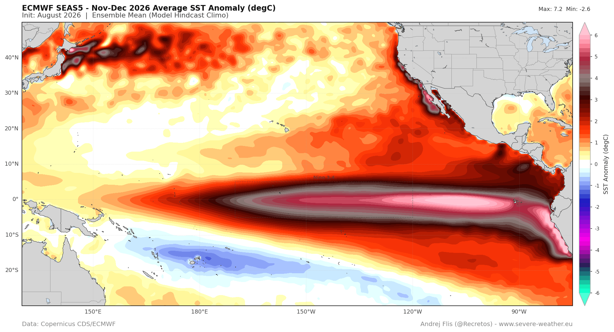
Meteorological projections place the absolute peak of this Super El Niño between November and December 2026. During this window, the anomaly field is expected to cover over 10% of the global ocean surface, driving maximum atmospheric teleconnections across the Northern Hemisphere.
Supporting Data and Observational Analysis
To grasp the sheer scale of the 2026/2027 event, climate scientists rely on a convergence of satellite data, reanalysis datasets, and ensemble forecasts.
Ocean Surface and Subsurface Anomalies
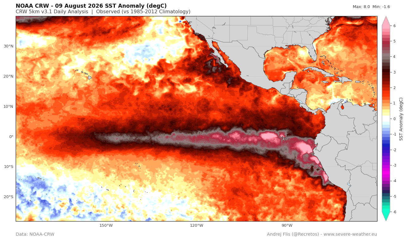
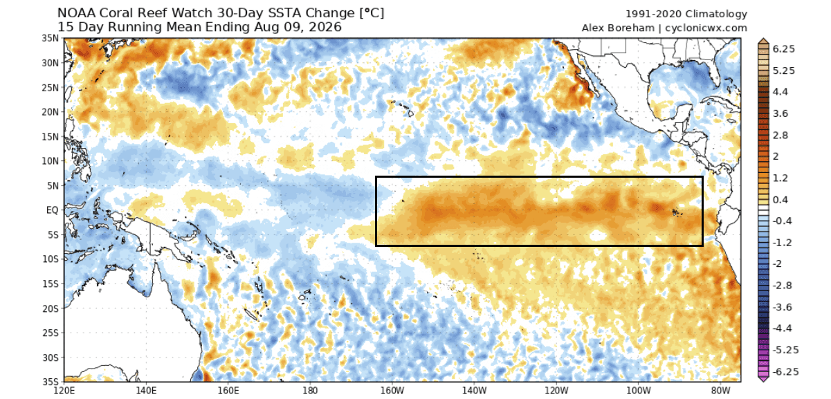
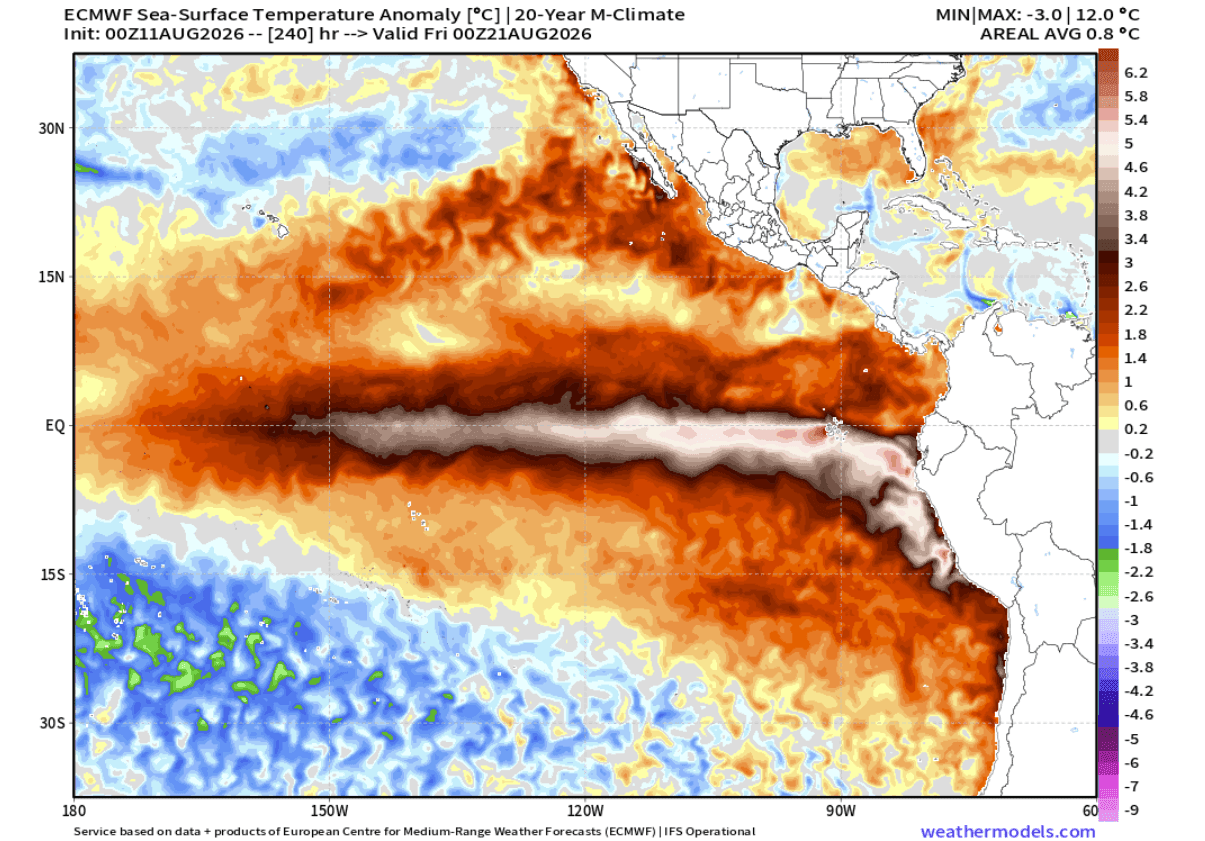
Recent analyses from NOAA’s Coral Reef Watch (CRW) and ECMWF highlight sea surface temperature anomalies exceeding +5°C to +6°C locally in the eastern tropical Pacific. Furthermore, a 30-day comparative analysis reveals a broad warming trend exceeding +1.5°C across vast swaths of the ENSO belt.
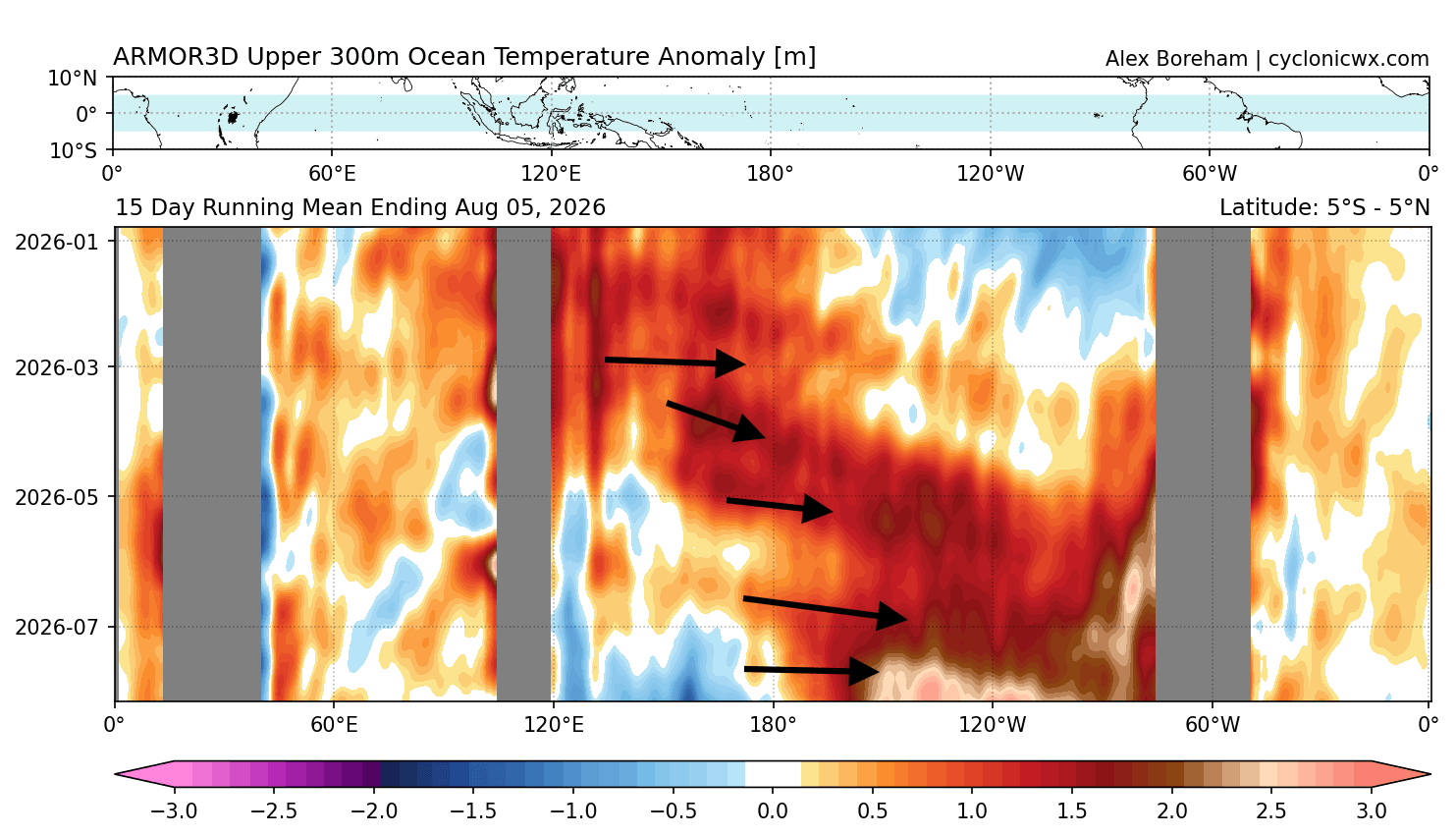
Beneath the surface, the core of the event is clearly visible. The downwelling Kelvin wave is transferring massive amounts of heat eastward. This process guarantees that surface cooling will be staved off, ensuring a resilient, long-lasting event.
Atmospheric Standing Waves
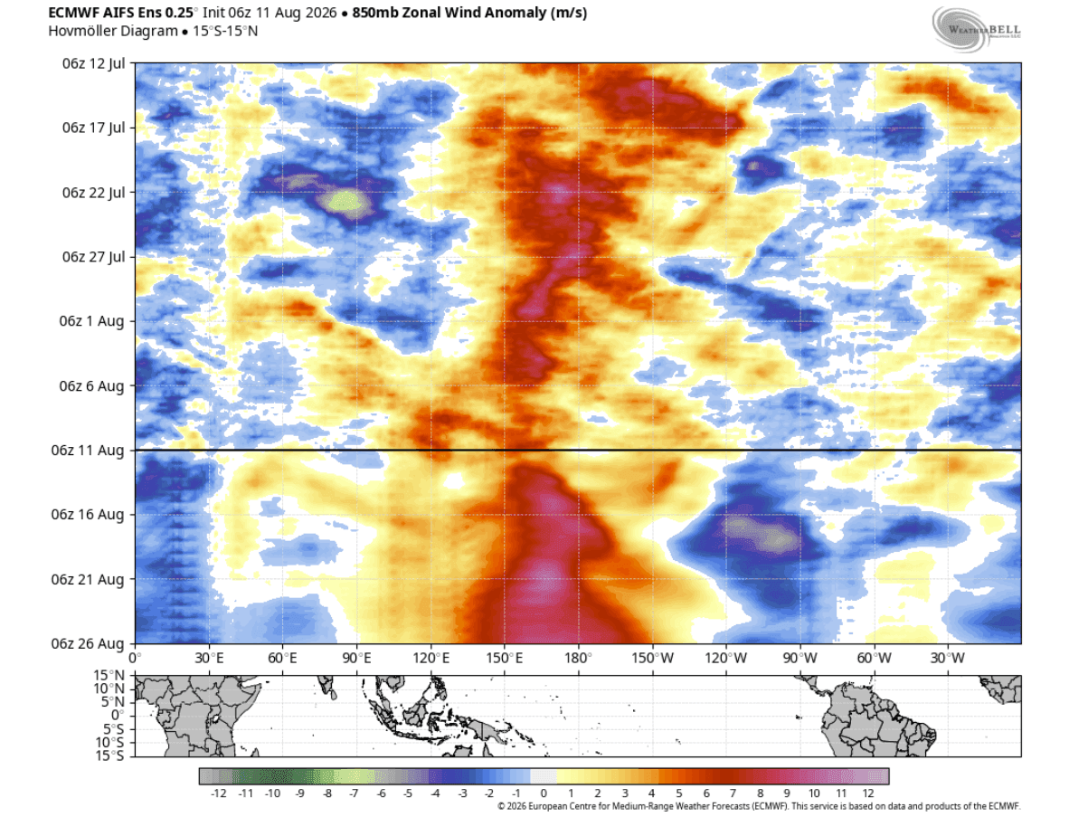
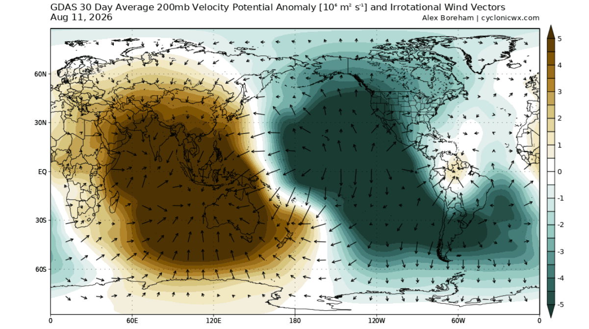
The atmospheric response is best monitored via the Velocity Potential parameter, which tracks large-scale rising and sinking air (the Walker Cell circulation). Normally, these regions of vertical motion migrate dynamically. However, the sheer thermal energy of this Super El Niño has forced the atmosphere into a standing wave configuration.
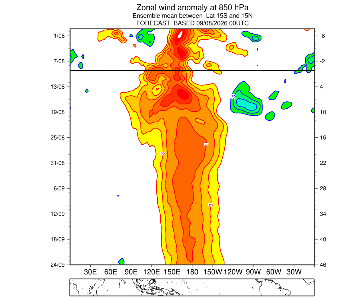
Persistent rising air (heavy convective rainfall and low pressure) is locked over the central and eastern Pacific, while robust sinking air dominates the Indian Ocean basin. This stationary setup is the primary mechanism through which tropical anomalies dictate mid-latitude weather.
Official Responses and Scientific Consensus
Global forecasting centers, including ECMWF, NOAA CPC, and the Australian Bureau of Meteorology (BOM), have updated their ensemble suites to reflect the unprecedented growth rate of the current cycle.
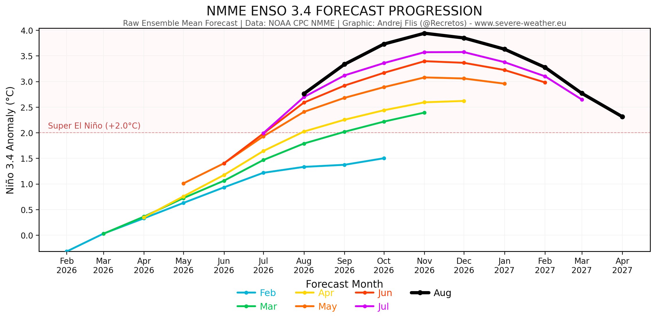
In comparative model tracking, the last seven consecutive ECMWF forecast runs have steadily trended toward a stronger peak anomaly. This persistent upward revision indicates that the physical ocean-atmosphere feedback loops are operating at maximum capacity. Climatologists emphasize that while every El Niño shares general characteristics, "Super" events behave with extreme volatility, often producing non-linear climatic disruptions that challenge historical analogs.
Implications: Regional Weather Impacts for Fall and Winter 2026/2027
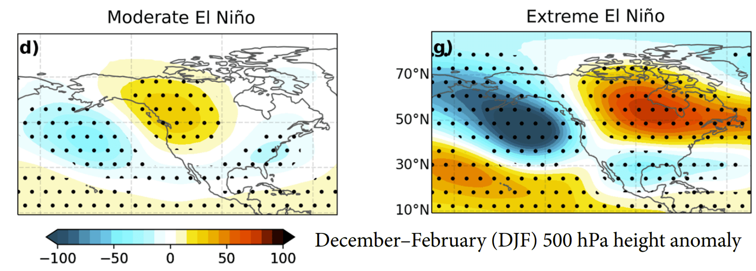
The teleconnections established by a powerful Super El Niño dictate specific pressure configurations across the globe, directly influencing temperature, precipitation, and snowfall anomalies.
United States and Canada
- Fall 2026: Weather patterns will feature a prominent high-pressure ridge building over Canada, paired with a Pacific low and an active storm track slicing across the southern United States. This will yield drier-than-average conditions in the Pacific Northwest and southern Canada, while increasing rainfall across the U.S. Southeast and Mid-Atlantic.
- Winter 2026/2027: The classic El Niño signature deepens. High-pressure blocking over Canada and the northern tier will promote milder-than-normal conditions across the West Coast, the Pacific Northwest, and the Northeast. Conversely, the active southern jet stream will drive persistent cloud cover, frequent storm systems, and cooler-than-normal temperatures across Texas, the Gulf Coast, and the Southeast.
- Late Winter Curveball (February 2027): Emerging data from CFSv2 and ECMWF suggest that mid-to-late winter could see a dramatic eastward shift in the pressure wave. If northern blocking forces a deep, active low-pressure channel through the central and eastern U.S., a colder anomaly pattern could materialize, priming the Central Plains, Midwest, and interior Northeast for significant winter storm and heavy snowfall scenarios.
Europe
- Atmospheric Downstream Impact: While the primary catalyst is in the Pacific, the amplified North American jet stream influences downstream flow across the Atlantic.
- Fall and Winter Outlook: Extended pressure anomaly forecasts indicate a persistent low-pressure extension into northwestern and northern Europe. This setup promotes a dominant westerly and southwesterly flow from the Atlantic, translating into a milder-than-average winter season across much of central, western, and southern Europe.
- Precipitation and Snow: Above-normal precipitation is favored across large parts of the continent due to moisture-laden Atlantic systems. However, broad, sustained snowfall anomalies will likely be restricted to the far north, northeast, and higher central mountain elevations, as mild maritime air limits widespread lowland snow cover.
Conclusion
The 2026/2027 Super El Niño is evolving into one of the most thoroughly documented and rapidly developing extreme climate events in modern meteorological history. Driven by historic westerly wind bursts and an exceptionally powerful subsurface Kelvin wave, its influence is already locking global atmospheric circulation into a stationary wave pattern.
As the event approaches its late-autumn and early-winter peak, communities across North America and Europe must prepare for a highly polarized seasonal outlook—ranging from southern U.S. storm tracks and potential late-winter cold snaps to a predominantly mild, wet European regime. Continuous monitoring by international forecasting agencies will remain critical as these historic climate dynamics continue to unfold.
