

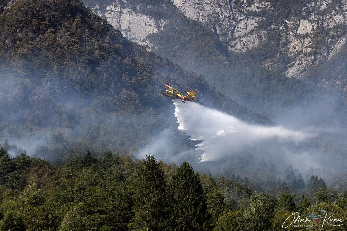
TOLMEZZO, ITALY — After ten harrowing days of relentless fire, treacherous topography, and explosive meteorological phenomena, the destructive mountain wildfire that scorched more than 600 hectares across Monte Amariana and Monte Amarianute has finally been brought under control. Marking one of the most severe Alpine forest fire emergencies in the Friuli-Venezia Giulia region this summer, the blaze pushed emergency services to their absolute limits before a vital, late-August atmospheric relief delivered the decisive blow.
The crisis, which peaked during the peak holiday celebrations of Ferragosto, forced emergency evacuations, threatened residential neighborhoods, and required a massive cross-border aerial firefighting mobilization. Now, as regional authorities transition from active suppression to thermal drone monitoring, scientists and civil protection agencies are examining the unique confluence of extreme heat domes, severe drought, and volatile mountain topography that allowed the fire to detonate across the Carnian Alps.

Main Facts: The Anatomy of an Alpine Disaster
The Monte Amariana wildfire was not merely a localized brush fire; it was a textbook example of extreme fire behavior supercharged by regional climatic stress.
- The Burn Zone: Over 600 hectares of rich forest, steep karst landscapes, and tinder-dry Pinus nigra (black pine) ecosystems were reduced to ash across the Monte Amariana (1,905 meters) and Monte Amarianute complex.
- Proximity to Populations: The fire’s most terrifying phase occurred when aggressive flames breached the Rio Confine ridge and cascaded toward the outer hamlets of Tolmezzo. Flames pushed within 50 meters of homes in the vulnerable sector of Pissebus, triggering urgent civilian evacuations and threatening nearby Illegio.
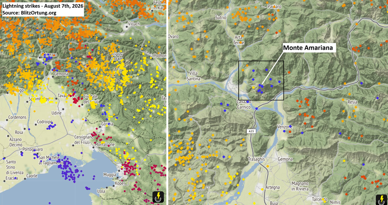
- The Spark: The disaster trace back to early August, when a punishing heat dome blanketed southern and western Europe, baking the Italian Alps. On August 7th, a passing frontal wave generated dry lightning strikes—tracked meticulously by Blitzortung detection networks—igniting the upper Cuel Feltron spur above Amaro.
- The Escalation: While initial crews monitored the remote spark, the situation exploded on August 15th (Ferragosto). Gusty downslope winds fanned the embers, driving the blaze over ridges and into explosive growth phases.
- The Resolution: Relief arrived in the form of a dramatic shift in weather patterns. Between August 20th and 22nd, a robust frontal system swept across northeastern Italy, dumping between 150 mm and nearly 200 mm of rain within a 72-hour window. This deluge, combined with an international air armada, ultimately neutralized the active fronts.
Geographical Profile & Mountain Topography
To understand why the Monte Amariana fire proved so difficult to contain, one must examine the unforgiving geography of the Eastern Tolmezzo Alps in the Carnia region of northeastern Italy.
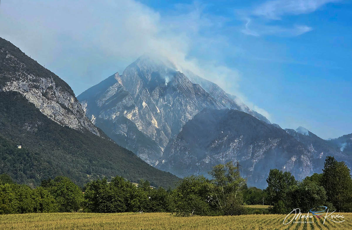
Monte Amariana rises as a distinctive, pyramid-shaped limestone massif. Its upper reaches are characterized by sheer vertical karst cliffs, narrow ridges, and steep, inaccessible terrain. Compounding the natural topography was the fuel structure: dense brushwood and extensive stands of Pinus nigra. Over decades, these conifers had accumulated deep, highly combustible layers of dry pine needles and deadfall.
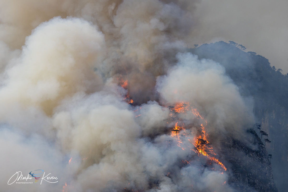
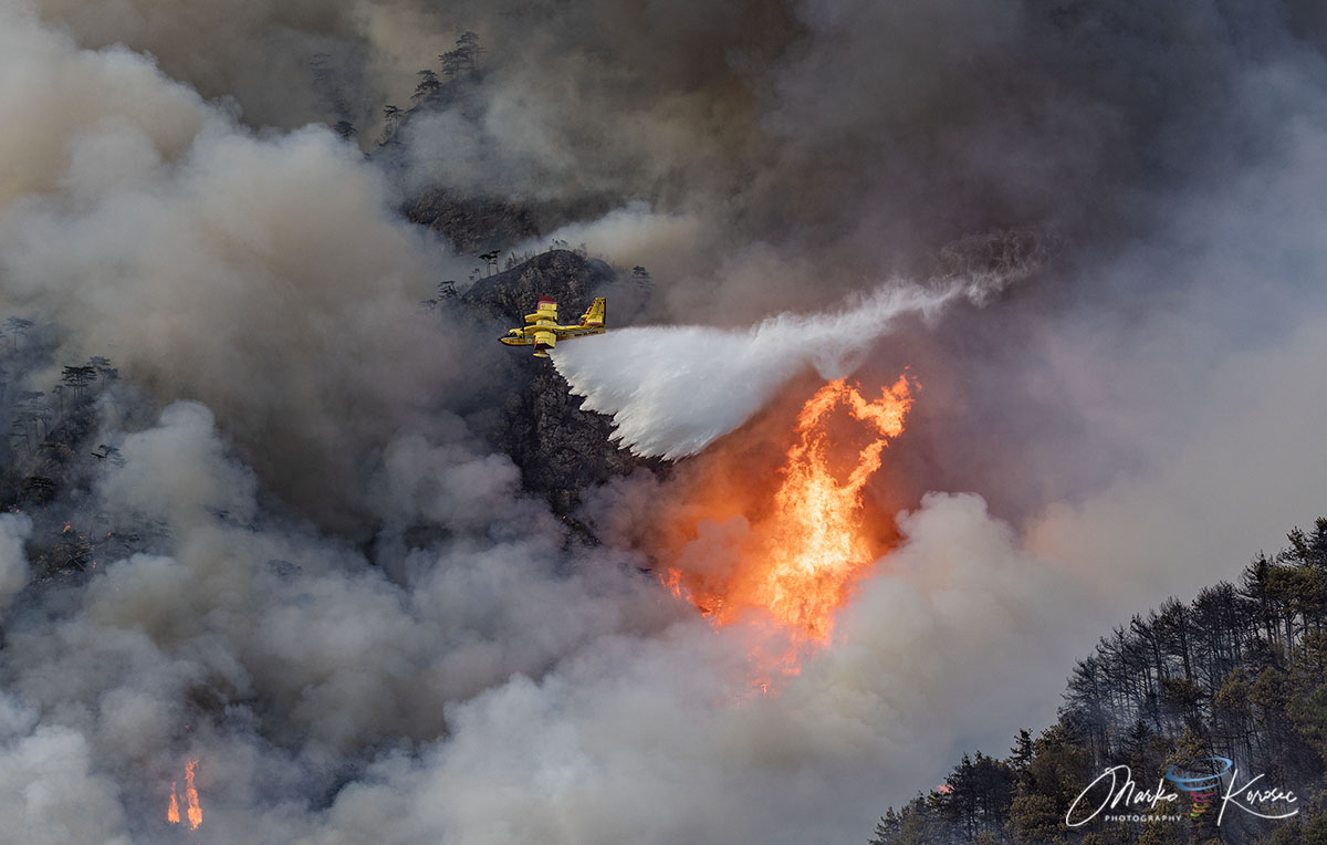
When the fire ignited on the steep spur of Cuel Feltron, the mountain’s geography worked directly against firefighters. The combination of vertical limestone walls and steep gradients created an aggressive upward "chimney effect." Heat and flames channeled rapidly up the ravines, drying out unburned vegetation ahead of the main front and generating its own localized weather systems. Direct ground access to these upper sectors was rendered entirely impossible, forcing incident commanders to rely almost exclusively on aerial intervention.
Chronology of the Crisis: From Spark to Deluge
The ten-day timeline of the Monte Amariana wildfire illustrates how quickly a remote lightning strike can transform into a catastrophic community emergency under the right atmospheric conditions.
Phase 1: Ignition and Smoldering (Early August)
In the opening days of August, an excessive heat dome gripped Western and Central Europe, sending temperatures soaring and evaporating soil moisture across the Friuli-Venezia Giulia region. On August 7th, a severe weather front crossed the Alps, accompanied by intense lightning activity. Several strikes hit the high-altitude, inaccessible limestone slopes of Cuel Feltron above Amaro, sparking hidden fires deep within the organic soil and dry pine litter.
Phase 2: The Ferragosto Explosion (August 15th)
For over a week, the fire smolded in remote pockets, difficult to reach by foot. However, on August 15th—the national holiday of Ferragosto—weather conditions deteriorated rapidly. Gusty downslope winds developed, drastically increasing oxygen supply to the smoldering embers. The fire woke up with explosive fury, leaping across the Rio Confine ridge line onto Monte Amarianute.
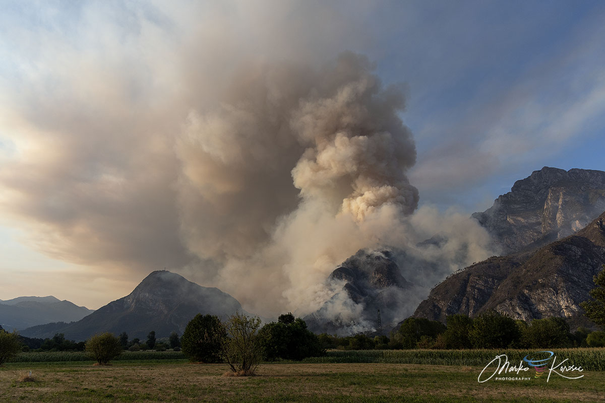
As the blaze raced down the mountain toward Tolmezzo, the extreme energy release superheated the air, creating massive pyrocumulus (and nascent pyrocumulonimbus) clouds that billowed thousands of meters into the atmosphere. These fire-generated clouds altered local wind patterns, driving erratic fire behavior and showering burning embers onto lower slopes.
Phase 3: Direct Threat and Evacuations (August 16th – 19th)
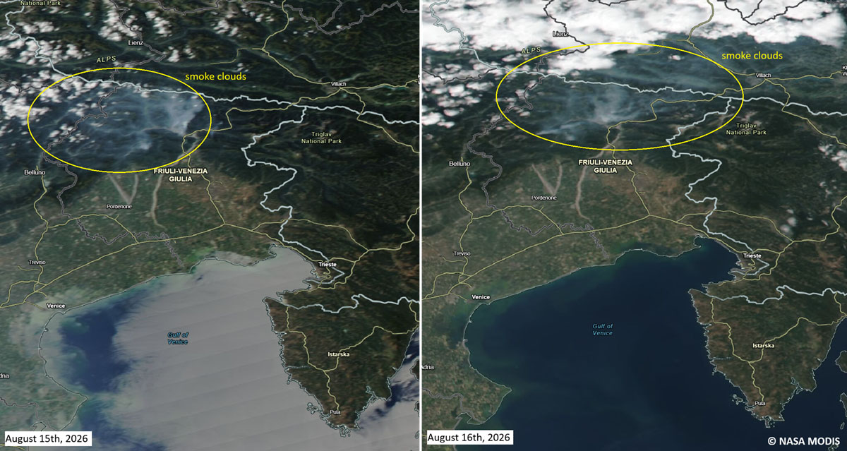
By mid-August, the fire had breached lower elevation boundaries. Flames pressed within 50 meters of residential properties in the Pissebus hamlet, while smoke choked the Tagliamento valley. Civil Protection authorities ordered emergency evacuations, deployed structural protection units, and temporarily deactivated high- and medium-voltage power lines running through the danger zone to prevent electrical faults and ensure public safety.
Phase 4: The Deluge and Containment (August 20th – 22nd)
As ground and air crews fought desperately to hold perimeter lines, meteorological forecasts began to show a promising shift. A deep Atlantic trough collided with Mediterranean moisture, bringing a powerful frontal system to northeastern Italy. Between August 20th and 22nd, the region received an overwhelming accumulation of 150 to nearly 200 mm of rain. The heavy downpours drowned the remaining active flame fronts, effectively bringing an end to the active wildfire season across the wider Friuli-Venezia Giulia area.
Personnel and Operational Fleet: A Cross-Border Response
Given the physical impossibility of deploying ground crews to the vertical cliffs of Monte Amariana, the Italian Civil Protection agency orchestrated a massive, multi-tiered aerial and ground defense strategy.
The Aerial Task Force
The operation demonstrated high-level international cooperation within Europe:
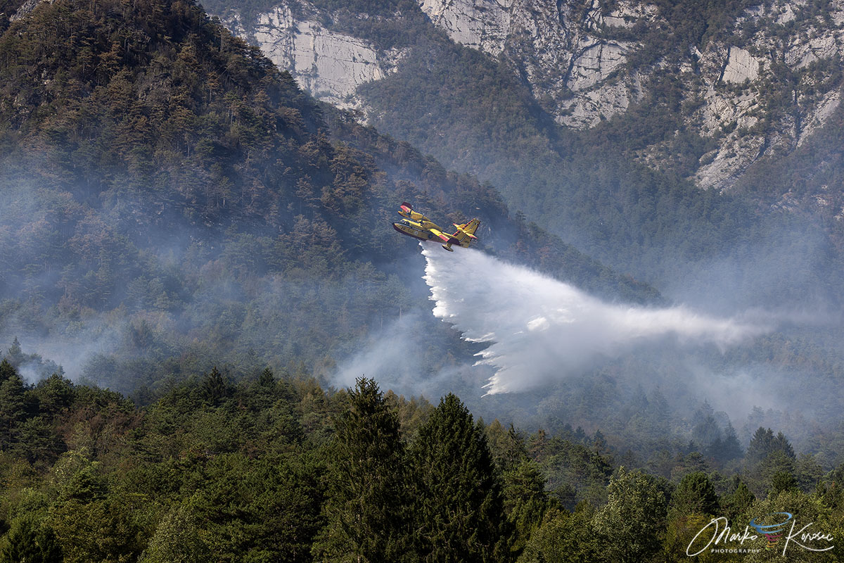
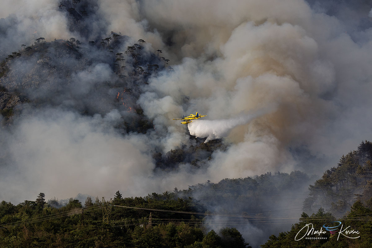
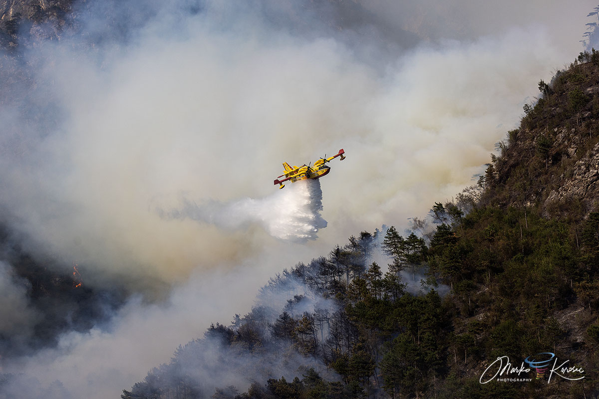
- Italian Canadairs: The backbone of the national fleet, amphibious CL-415 water bombers executed hundreds of high-precision drops, scooping water from nearby lakes and reservoirs to pound the ridge lines.
- Slovenian Air Tractor Water Bombers: In a vital display of cross-border European solidarity, specialized agricultural-conversion water bombers from Slovenia were deployed to supplement the Italian fleet. Their tight turning radius and rapid turnaround times proved invaluable in the narrow Alpine valleys.
- Regional Helicopters: Specialized multi-role helicopters transported firefighting personnel to elevated staging zones and executed precision bucket drops on stubborn hotspots inaccessible to fixed-wing aircraft.
Ground Operations
While the skies roared with aircraft, ground forces anchored the defense at the base of the mountain:
- Corpo Forestale Regionale (Regional Forestry Corps): Tasked with tactical tracking, fire behavior modeling, and directing tactical backburns where safe.
- Vigili del Fuoco (National Fire Corps): Positioned directly within threatened hamlets like Pissebus and Illegio, firefighters established defensive perimeters, deployed hose lines, and protected homes from advancing spot fires.
Following the heavy rains, the operational focus shifted away from active suppression. Regional teams deployed thermal-imaging drones to scan the charred 600-hectare footprint, hunting for subterranean hotspots capable of surviving the deluge and reigniting under future heatwaves.
Regional Drought and Meteorological Context
The severity of the Monte Amariana disaster did not occur in a vacuum. It was the direct product of a prolonged summer drought and an exceptionally dry baseline across the Friuli-Venezia Giulia region.
Climatological data for Tolmezzo and the broader Carnia mountains heading into August revealed alarming precipitation deficits. Months of below-average rainfall had dried out deep-soil moisture reserves. When combined with the fifth major heat dome of the European summer—which pushed temperatures past the 40°C mark across parts of the continent—the regional landscape became a literal powder keg.
The vegetation, already stressed by heat and water scarcity, offered virtually no resistance to the energy released by the August 7th lightning strikes. Experts note that as Mediterranean and Alpine ecosystems face increasing frequencies of severe meteorological droughts, fires of this intensity—once considered anomalous in wet northern Italian mountain ranges—are becoming an alarming structural reality.
Environmental Implications and Outlook
As the smoke finally clears over the Tagliamento valley and air quality returns to normal levels, the environmental toll of the Monte Amariana wildfire is coming into sharp focus. Over 600 hectares of vital Alpine habitat have been altered. The loss of Pinus nigra forests and understory brush not only strips the region of biodiversity but leaves the steep limestone slopes highly vulnerable to future soil erosion and mudslides when autumn storms arrive.
Local municipalities and regional authorities are now pivoting toward long-term recovery strategies. These will likely include slope stabilization projects, reforestation initiatives using more fire-resilient native species, and enhanced early-warning sensor arrays across remote limestone peaks.
The 10-day battle of Monte Amariana stands as a stark warning for the European Alps: as climate patterns shift toward prolonged summer heat domes and erratic precipitation, even high-altitude mountain environments can transform from lush sanctuaries into high-risk wildfire zones overnight.
