

AUSTIN, Texas — The State of Texas has swung into high-gear emergency response mode, deploying rescue aircraft, high-water vehicles, and specialized aquatic units as Tropical Storm Edouard gathers strength in the Gulf of Mexico. Forecasters warn that the system is on a direct collision course with the upper Texas coast, threatening the greater Houston metropolitan area and surrounding regions with torrential downpours, life-threatening flash flooding, and powerful winds.
Federal meteorologists upgraded the persistent disturbance in the Gulf to Tropical Storm Edouard on Monday evening. The National Hurricane Center (NHC) cautions that the system could approach hurricane intensity just prior to landfall, creating a volatile hazard profile characterized by intense rainfall rates, damaging winds, and a dangerous coastal storm surge.
With less than 48 hours of warning time since the system first displayed potential threats to the Lone Star State, state and local officials are racing against the clock to protect residents. The unfolding crisis comes at a precarious time for Texas, which is simultaneously grappling with historic drought-driven wildfires in the north and struggling to recover from catastrophic floods that devastated parts of the state earlier this year.
Main Facts
Tropical Storm Edouard formed rapidly in the Gulf of Mexico over the weekend, catching emergency management officials off guard due to its compressed formation timeline. Unlike traditional Atlantic hurricanes that offer a comfortable five-to-seven-day window for preparation, Edouard emerged quickly, leaving local agencies scrambling to execute emergency protocols.
The core hazards associated with Tropical Storm Edouard include:
- Catastrophic Rainfall: Widespread accumulations of 3 to 6 inches are expected along and east of Interstate 45, with isolated spots in the Houston area and Harris County potentially receiving between 10 and 15 inches of rain.
- Intense Rainfall Rates: Forecasters warn of downpour rates reaching 3 to 4 inches per hour, dramatically increasing the risk of instantaneous flash flooding in urban areas and locations with poor drainage systems.
- Damaging Winds: Sustained inland winds of 20 to 30 mph are anticipated, with gusts reaching up to 45 mph. At the immediate point of landfall, wind speeds could peak at a destructive 60 mph.
- Storm Surge: A coastal storm surge warning remains in effect from High Island, Texas, to the Vermillion/Cameron Parish Line in Louisiana, with projected water level rises of 2 to 4 feet threatening low-lying coastal communities.
- Compound Disasters: The storm’s high winds threaten to fan the flames of ongoing, massive wildfires in North Texas, creating a grueling multi-front emergency for state disaster services.
Chronology of Events
The rapid escalation of Tropical Storm Edouard caught both meteorologists and emergency personnel by surprise, establishing a tense timeline of escalating alerts and urgent preparations.
Sunday: The Threat Emerges
The meteorological disturbance in the Gulf of Mexico first began showing signs of organization and potential trajectory toward the Texas coastline. Emergency management officials immediately took notice, though the compressed timeline left significantly less margin for error than standard tropical weather events.
Monday: Intensification and Warnings
- Morning: National Weather Service (NWS) meteorologists hosted technical briefings, highlighting the severe risk of localized rain totals reaching 6 to 9 inches, alongside extreme hourly rainfall rates.
- Late Afternoon / Evening: Federal forecasters officially upgraded the system to Tropical Storm Edouard. The National Hurricane Center issued tropical storm warnings stretching along the coast from the Bolivar Peninsula eastward into Louisiana. Concurrently, a storm surge warning was activated for vulnerable coastal zones.
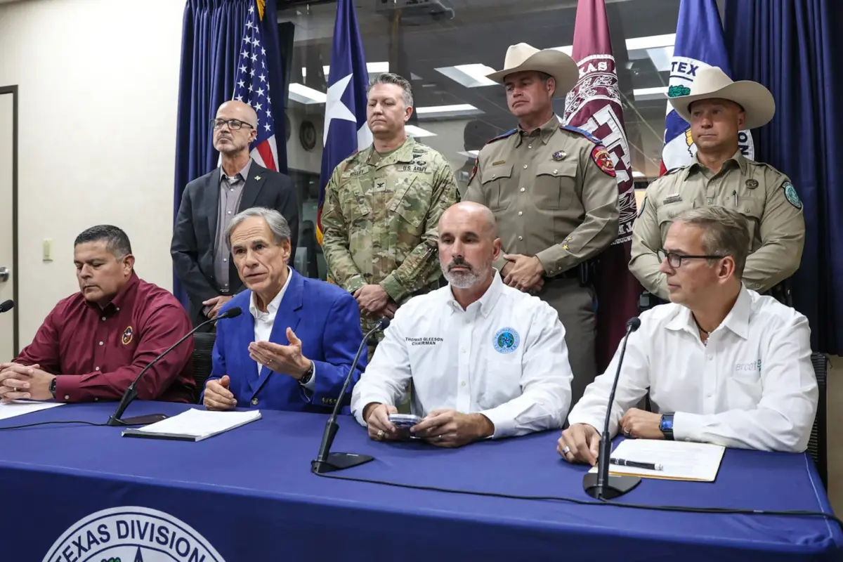
- Evening Press Conference: Texas Governor Greg Abbott delivered a televised state update, announcing the full activation of the State Operations Center and confirming that local rain totals could spike as high as 15 inches in hardest-hit areas.
Tuesday: Landfall and Peak Impacts
- Mid-to-Late Morning: Outer bands of Tropical Storm Edouard begin making landfall, bringing sharply escalating winds, sudden squalls, and the onset of heavy precipitation across southeast Texas.
- Afternoon and Overnight: The primary window for extreme rainfall rates and flash flooding begins, extending well into Tuesday night. Officials have emphasized that dangers will persist long after dark, advising residents to stay off the roads and shelter in place.
Supporting Data and Meteorological Analysis
According to data compiled by the National Weather Service Houston/Galveston office, Tropical Storm Edouard poses a textbook urban flooding threat. Jimmy Fowler, warning coordination meteorologist with the NWS, emphasized during a Monday briefing that the primary danger lies in the localized intensity of the storm’s rain bands.
"Where those heavier rainfall totals occur, flash flooding will be possible, especially over areas of poor drainage," Fowler stated. The convergence of heavy moisture from the Gulf and slow-moving atmospheric steering currents means that certain neighborhoods could experience prolonged periods of torrential downpours.
Governor Greg Abbott underscored the gravity of these projections during his emergency briefing, noting that localized rain totals could scale up to 15 inches in Harris County—an expansive, highly paved urban landscape prone to rapid water accumulation.
Furthermore, the meteorological footprint of the storm extends beyond water. Forecasters predict that sustained winds of 20 to 30 mph, with gusts up to 45 mph inland and up to 60 mph at the immediate landfall zone, will cause localized structural damage, down tree limbs, and knock out power lines. Combined with a projected storm surge of 2 to 4 feet, coastal erosion and tidal inundation are virtually guaranteed in low-lying sectors.
Official Responses and State Mobilization
Recognizing the severe nature of the incoming storm, the State of Texas has launched a massive, multi-agency disaster response.
Governor Abbott announced that the State Operations Center is fully operational, coordinating the deployment of roughly 1,500 state personnel. To address the inevitable water rescues required during major Texas flash floods, the state has pre-positioned specialized assets, including high-water rescue vehicles, shallow-draft boats, and rescue aircraft.
"We have seen too often vehicles being swept away," Abbott said during his Monday address, issuing a stern plea to the public. "It is so incredibly important for anybody in any region of the state, but especially in Harris County, to avoid driving into what appears to be waters on the roadway."
Local school districts have also taken proactive measures to safeguard students and faculty. Major Houston-area educational institutions, including Channelview, Galena Park, and Humble school districts, announced planned closures for Tuesday, keeping thousands of children and staff off hazardous roadways.
Orlando Alanis, assistant agency director for the Texas Division of Emergency Management, praised the state’s rapid mobilization despite the short notice. "This is our first big storm of the season," Alanis noted. "And I’ll tell you, Texas is prepared."
Broader Implications and Concurrent Crises
The arrival of Tropical Storm Edouard does not occur in a vacuum; rather, it strikes a state already physically and economically fatigued by a relentless series of natural disasters and lingering emergency recovery struggles.
The Shadow of Recent Floods
The storm approaches the Texas coast less than two months after a catastrophic weather event battered the southwest portion of the state. Torrential rains stretching from San Antonio west to the U.S.–Mexico border triggered devastating floods in communities such as Uvalde, Crystal City, and Kerrville. The July 2025 flash floods in Kerrville and surrounding counties were particularly lethal, resulting in the tragic deaths of at least 119 people.
Compounding this trauma, local governments and affected families are still waiting for major federal disaster relief funds to be approved, leaving many communities in a vulnerable state of incomplete reconstruction as Edouard bears down on them.
The Wildfire Paradox
In a cruel twist of Texas weather, the heavy moisture and high winds of a tropical storm bring competing hazards. While southeast Texas prepares to drown in freshwater and storm surge, other parts of the state are engaged in a desperate battle against aggressive wildfires fueled by prolonged hot and dry conditions.
Earlier this month, the state has had to divide its firefighting and emergency resources to combat major blazes, most notably the Ross Fire in North Texas. By Monday, the Ross Fire had scorched more than 90,000 acres, cementing its place as one of the largest wildfires ever recorded in the Dallas-Fort Worth metropolitan area. Emergency managers are closely monitoring whether Edouard’s turbulent, high-speed wind gusts will aggravate dry conditions and stoke new fire starts elsewhere in the state before the storm’s moisture fully saturates the region.
Looking Ahead
As Tropical Storm Edouard makes its final approach, Texas faces a rigorous test of its disaster resilience. With emergency crews staged, warnings broadcasted, and citizens urged to exercise extreme caution, the coming days will require vigilance, restraint, and community solidarity to navigate the overlapping perils of wind, water, and fire.
