

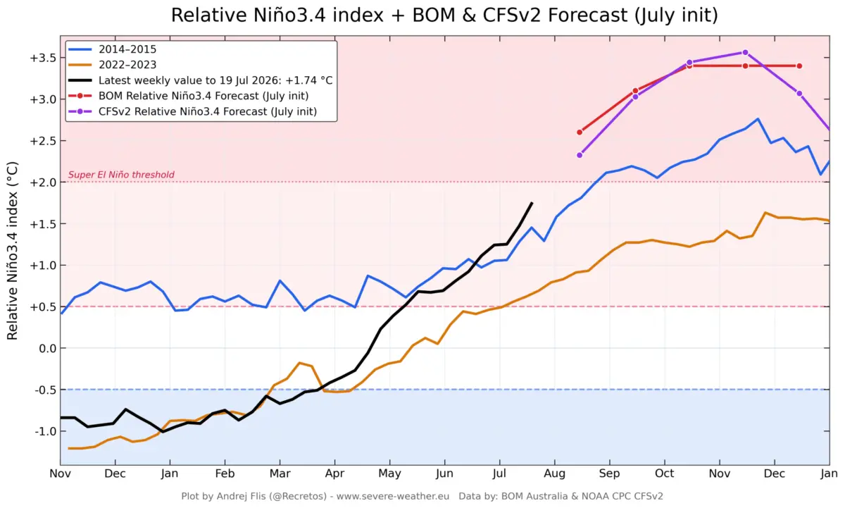
August 12, 2026 — Global meteorological agencies are tracking an extraordinary climate shift as the 2026 El Niño rapidly intensifies across the equatorial Pacific Ocean. According to updated long-range data and multi-model consensus, warm Pacific waters are expanding at an unprecedented rate, forcing the developing climate anomaly firmly into "Super El Niño" territory.

With surface and subsurface thermal anomalies already eclipsing historical benchmarks, meteorologists warn that this event could challenge or surpass the strongest El Niño occurrences in the modern instrumental record. The atmospheric consequences are no longer theoretical; global circulation patterns have begun shifting, setting the stage for a highly amplified and volatile winter season across the United States, Canada, and Europe for 2026/2027.
Main Facts: The Anatomy of a Record-Breaking ENSO Event
The El Niño-Southern Oscillation (ENSO) is a naturally occurring climate phenomenon defined by periodic fluctuations in sea surface temperatures across the equatorial Pacific. It alternates between warm (El Niño) and cold (La Niña) phases every few years, profoundly influencing global atmospheric circulation, precipitation distribution, and temperature trends.
The current 2026 event is distinguished by several critical factors:
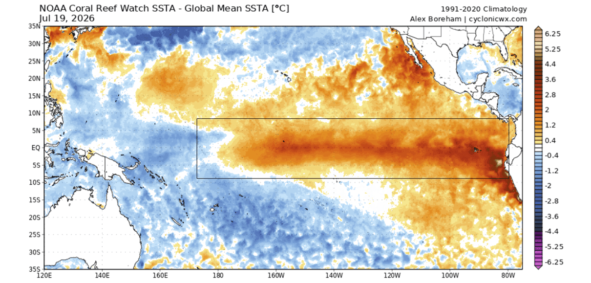
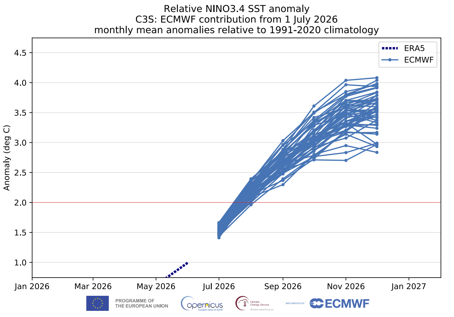
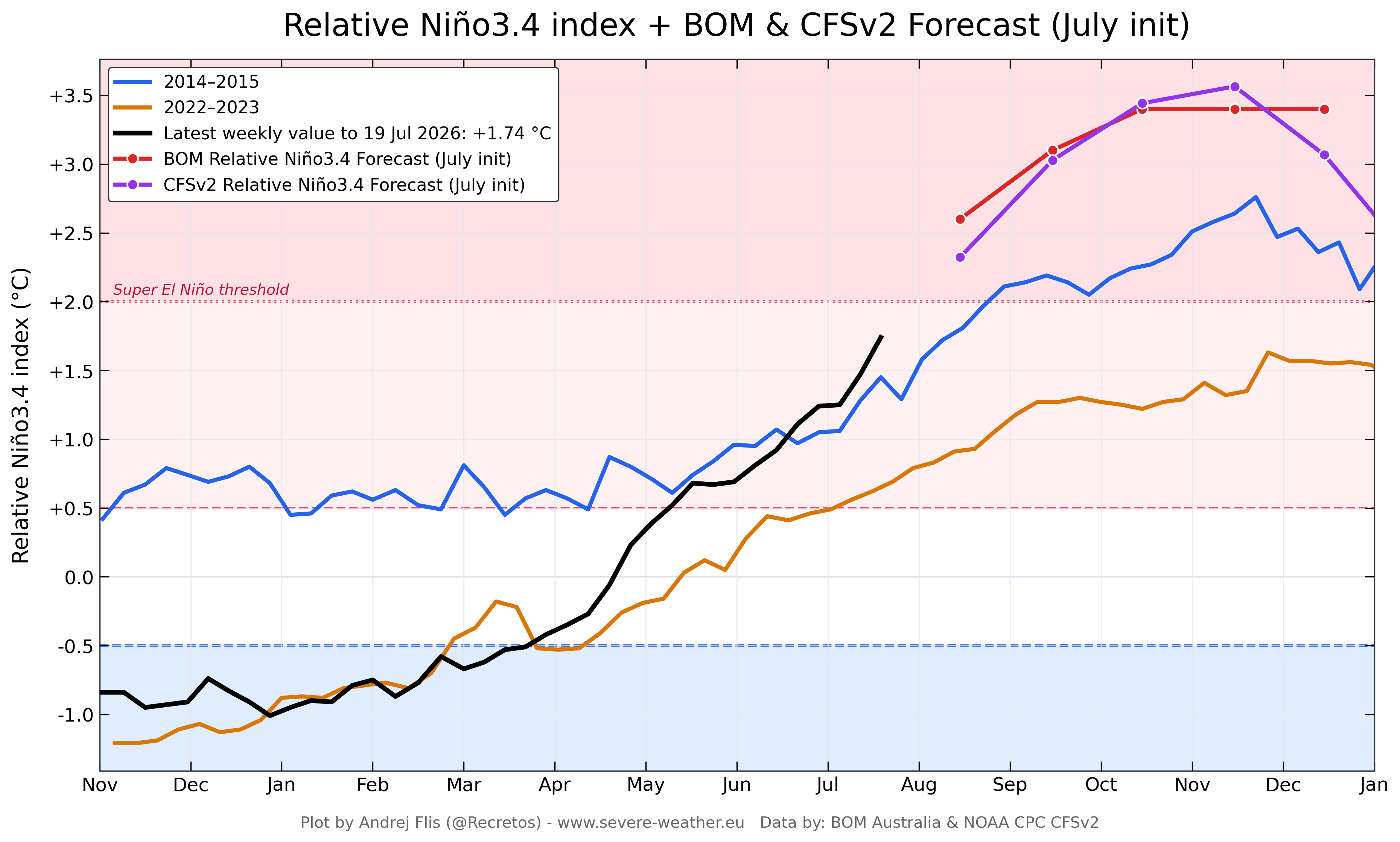
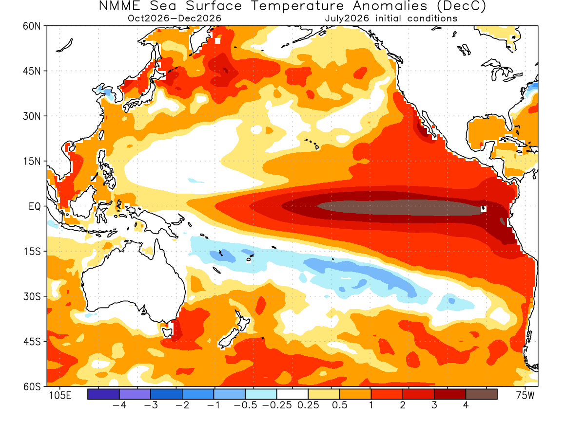
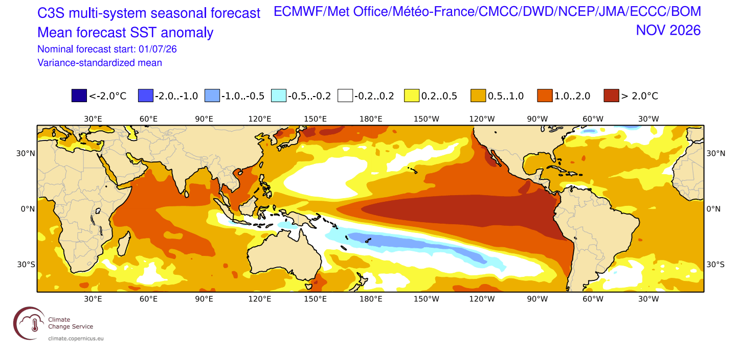
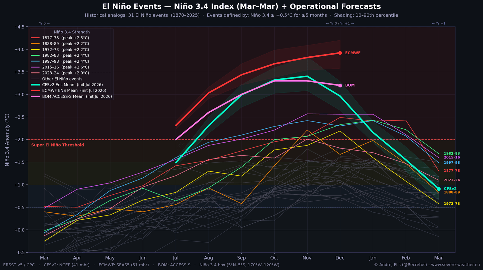
- Unprecedented Intensity: Multi-model forecasts from the European Centre for Medium-Range Weather Forecasts (ECMWF), the United States NOAA CFSv2, and Australia’s Bureau of Meteorology (BOM) project peak sea surface temperature anomalies exceeding +3.0°C to +4.0°C above the long-term average in the key Niño regions.
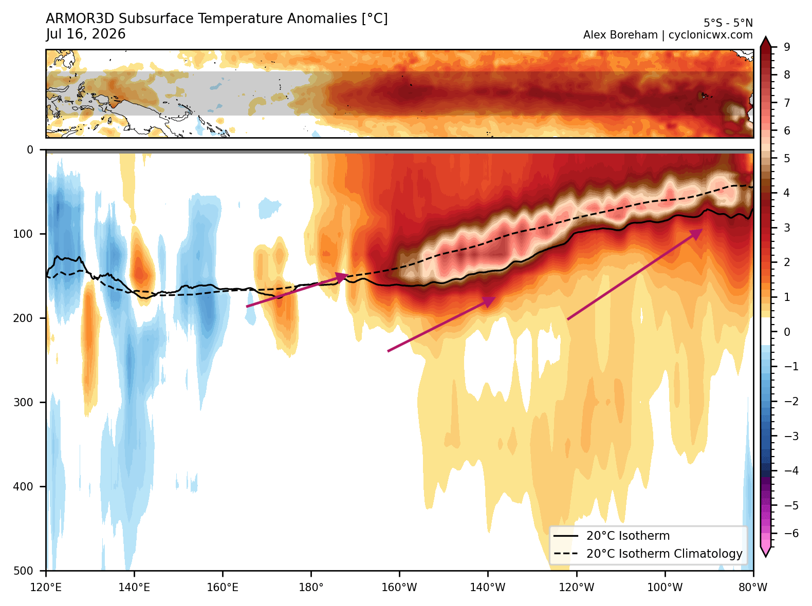
- The Subsurface Engine: Beneath the ocean surface, a powerful Kelvin wave driven by vigorous westerly wind bursts has pushed subsurface warm water anomalies more than 7°C above normal toward the eastern Pacific.
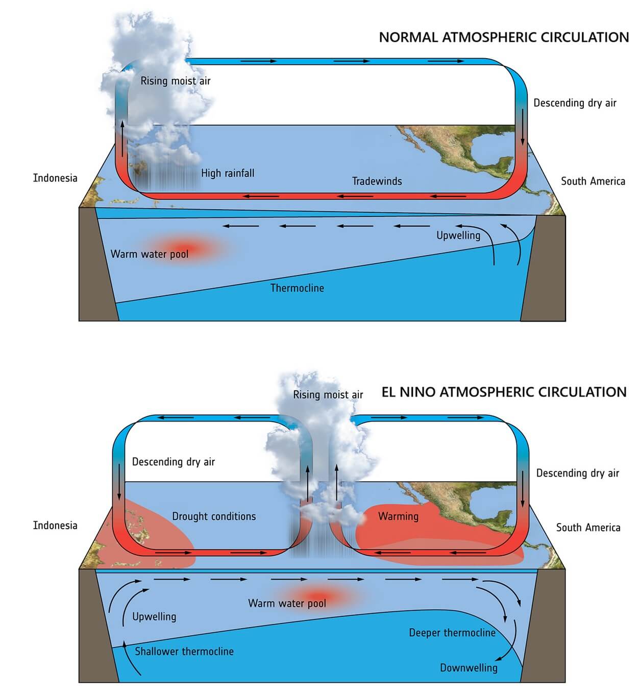
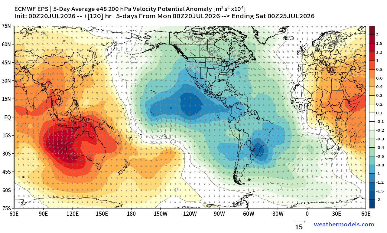
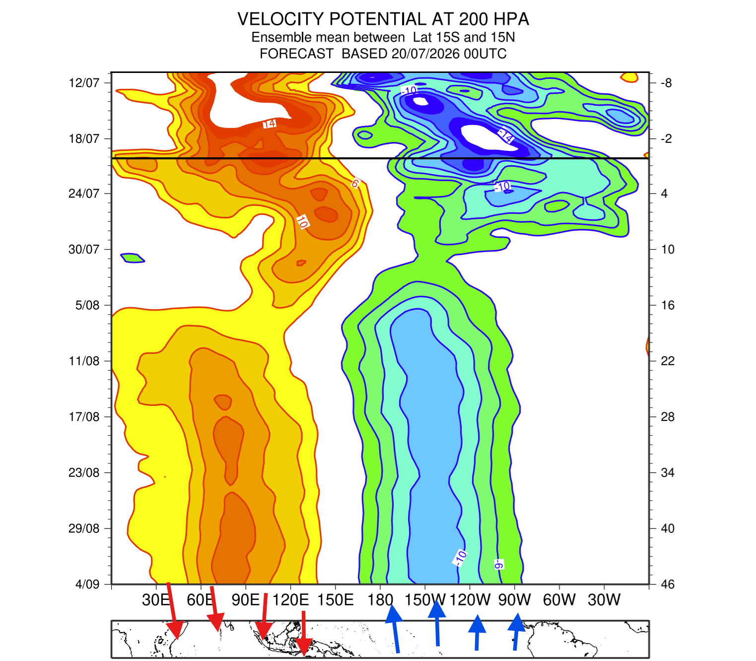
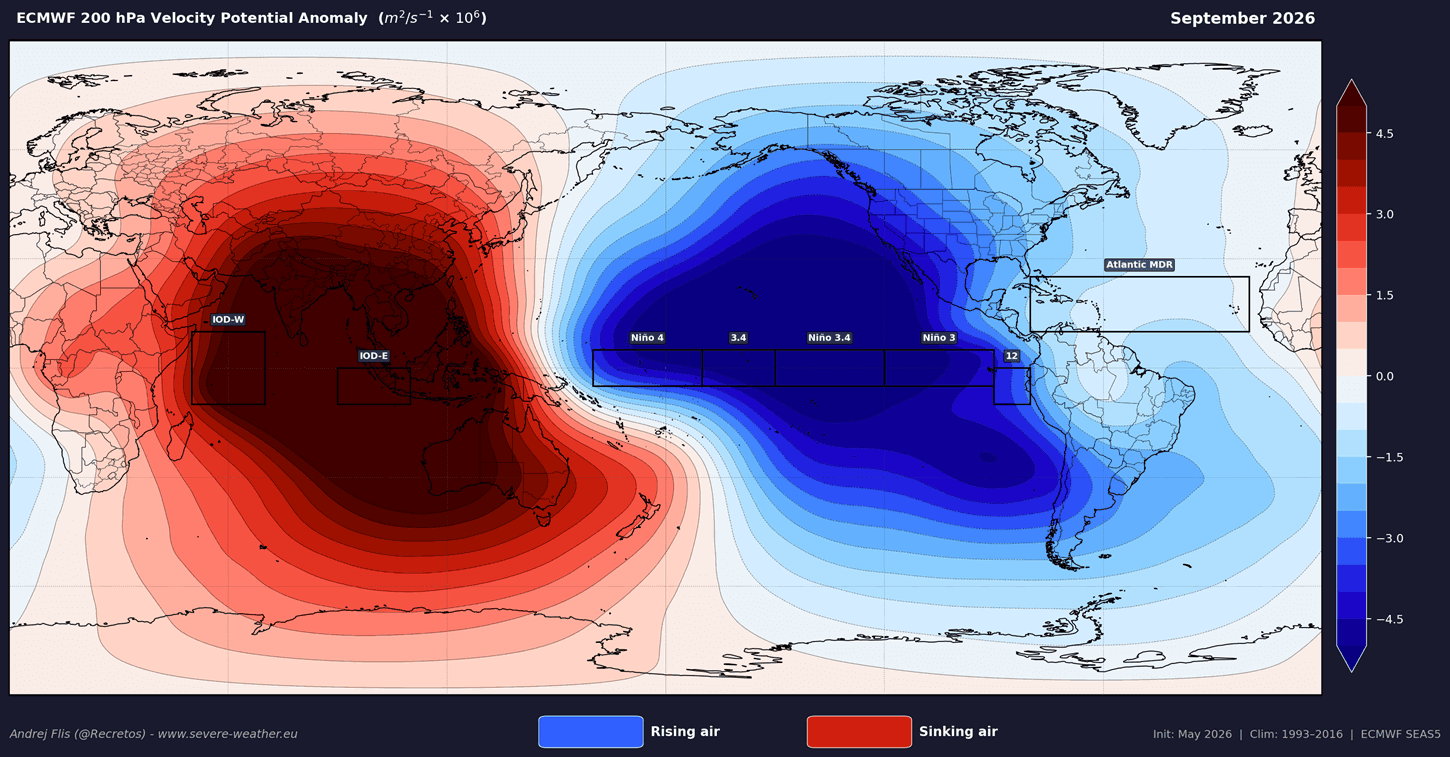
- Atmospheric Lockdown: The tropical Walker circulation cell has locked into an El Niño configuration, establishing a permanent standing wave of rising air and low pressure over the central and eastern Pacific that will dictate global weather patterns through spring 2027.
- Stratospheric Vulnerability: The extreme thermal forcing from the Pacific increases the probability of a major disruption or collapse of the stratospheric Polar Vortex during mid-winter, heightening the risk of severe cold air outbreaks into the mid-latitudes.
Chronology: From Summer Onset to Winter Projection
The escalation of the 2026/2027 Super El Niño has moved at a breakneck pace, catching forecasters off-guard with its early-season vigor.
Spring to Early Summer 2026: Subsurface Initialization
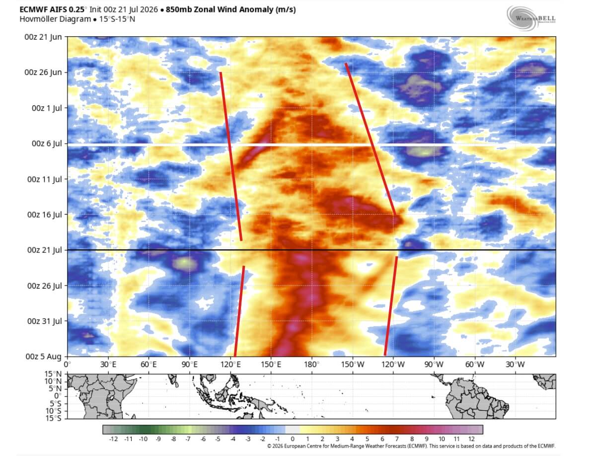
Early signs of anomalous subsurface warmth began accumulating in the western and central Pacific. Unusually strong westerly wind bursts—episodes where surface trade winds abruptly reverse or weaken—pushed immense reserves of warm subsurface water eastward. This subterranean heat transfer formed a massive Kelvin wave, laying the physical foundation for the current event.
Late July to August 2026: Surface Emergence and Model Convergence
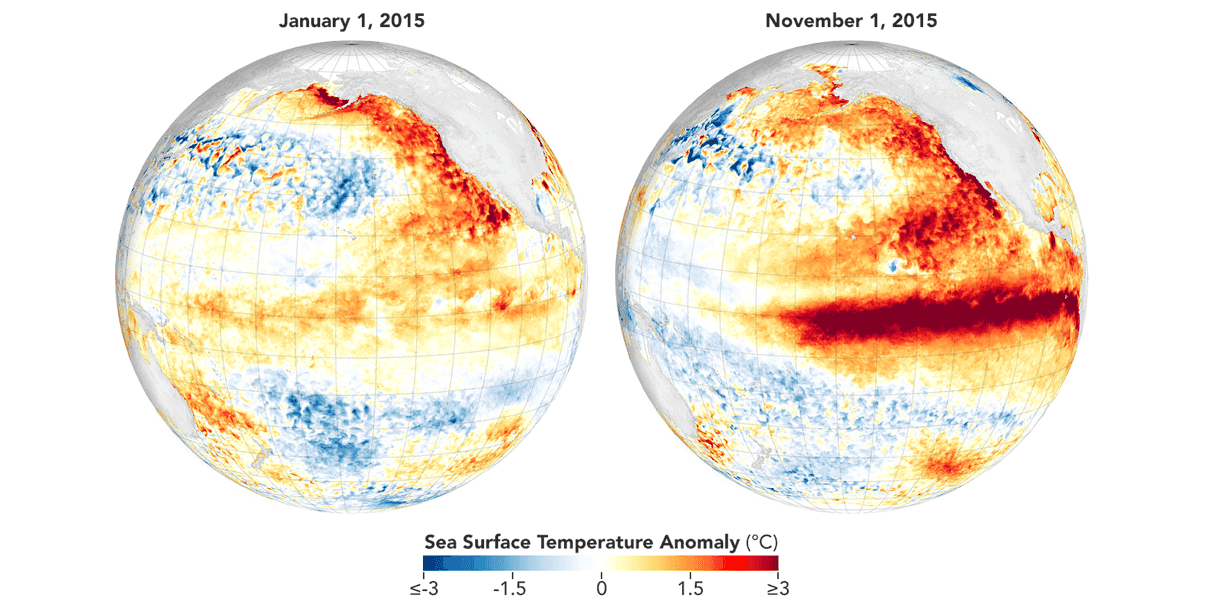
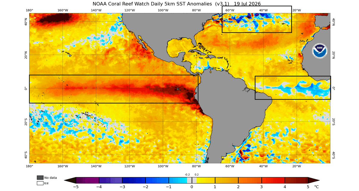
By late July, surface temperatures in the eastern tropical Pacific surged 3°C to 4°C above baseline averages. As observational data confirmed these extremes, major global climate models—including the ECMWF, NOAA CFSv2, and BOM—began updating their seasonal runs. Successive model iterations through August consistently trended stronger, pushing the projected winter peak higher than any recorded event since comprehensive record-keeping began in 1870, eclipsing even the historic 2015/2016 Super El Niño.
Fall 2026 (Projected): Atmospheric Coupling
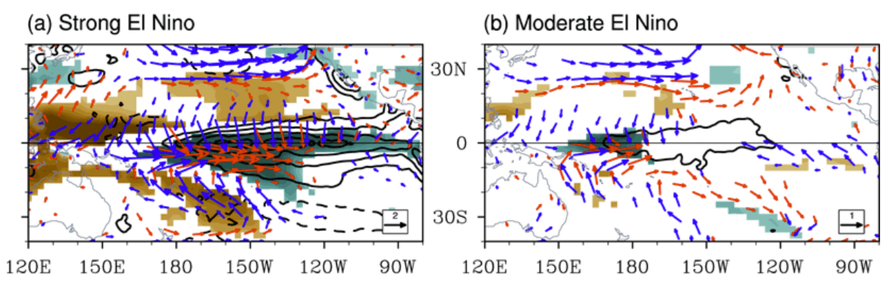
As autumn progresses, the atmospheric bridge will fully mature. The establishment of low pressure over the eastern Pacific and high pressure over the western Pacific will permanently anchor the Walker circulation cell. This phase will alter global jet streams, steering tropical moisture corridors and dictating the initial behavior of the Northern Hemisphere storm tracks.
Winter 2026/2027 (Projected): Peak Impacts and Stratospheric Interaction
The true high-impact phase of the Super El Niño will unfold between December 2026 and February 2027. Driven by persistent high-pressure blocking over Canada and an energized southern jet stream across North America, the winter will feature stark regional contrasts. Simultaneously, elevated planetary-wave activity is expected to stress the stratospheric Polar Vortex, raising the specter of sudden stratospheric warming (SSW) events and mid-winter cold air releases.
Supporting Data: Ocean Anomalies and Planetary Dynamics
Understanding the scale of the 2026 event requires examining the complex mechanical interplay between the ocean and the atmosphere.
The Kelvin Wave and Trade Wind Dynamics
The engine driving this Super El Niño lies in the upper 500 meters (1,640 feet) of the equatorial Pacific. Subsurface analyses reveal a massive core of warm water anomalies peaking at over 7°C above normal. This thermal mass is transported eastward by Kelvin waves, which are themselves fueled by persistent westerly wind anomalies in the tropical trade wind belt. As these warm waters rise to the surface in the eastern Pacific, they create a massive thermal contrast with surrounding ocean basins—such as the cooler tropical Atlantic and North Atlantic—effectively supercharging global atmospheric circulation.
Multi-Model Consensus and Historical Context
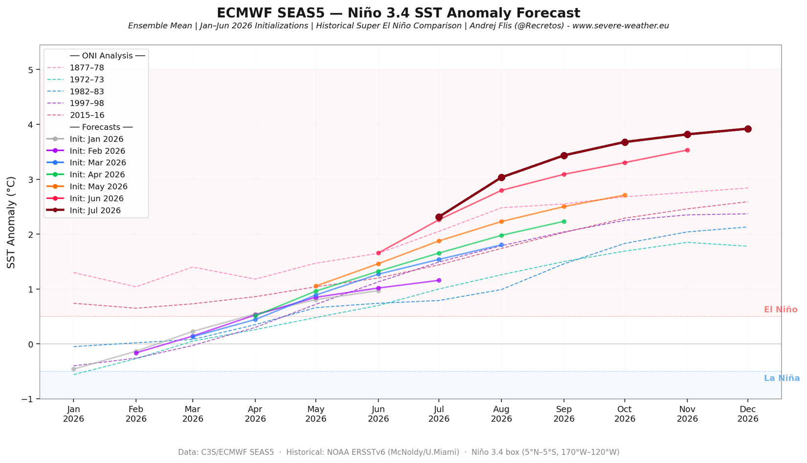
Scientifically, a Super El Niño is formally recognized when sea surface temperature anomalies in the primary Niño regions sustain a threshold of +2.0°C or higher. The current ECMWF ensemble forecasts show this threshold being shattered, with anomalies surging past +3.0°C and approaching historical ceilings near +4.0°C.
When plotted against historical events dating back 155 years, the projected 2026/2027 peak outpaces both the moderate 2023/2024 El Niño and the legendary 2015/2016 benchmark event. Furthermore, trend analysis of the last seven ECMWF forecast runs displays a continuous upward revision with each successive update, reflecting an unfolding reality that standard long-range algorithms initially underestimated.
Official Responses and Meteorological Outlooks
Meteorological authorities across North America, Europe, and Australia are actively refining their seasonal guidance in response to the unprecedented model outputs. National weather centers emphasize that while Super El Niños follow general behavioral blueprints, their sheer magnitude often introduces chaotic feedback loops that can override standard climatological expectations.
Forecasters note that the combination of a record-strong Pacific anomaly and an emerging rare Atlantic La Niña profile creates a complex "atmospheric shield" and storm-steering mechanism. While the signals for North America are robust and display high inter-model agreement, the outlook for Europe remains less definitive, hinging primarily on how the European pressure ridges interact with migratory Atlantic low-pressure systems.
Implications: Regional Weather Impacts for Winter 2026/2027
The overarching footprint of a Super El Niño dictates specific, high-impact regional weather regimes across the Northern Hemisphere.
North America: A Tale of Two Winters
The projected winter circulation over the United States and Canada exhibits textbook Super El Niño characteristics, but amplified to an extreme degree:
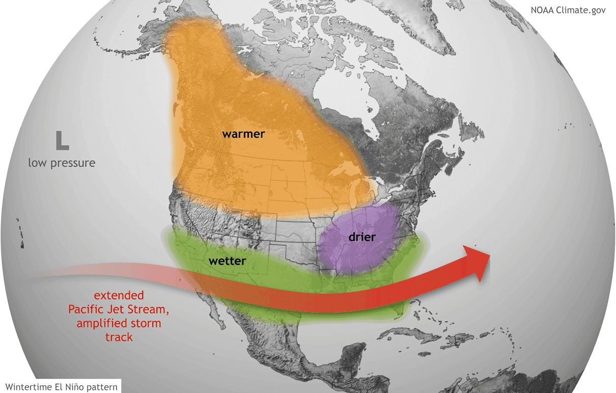
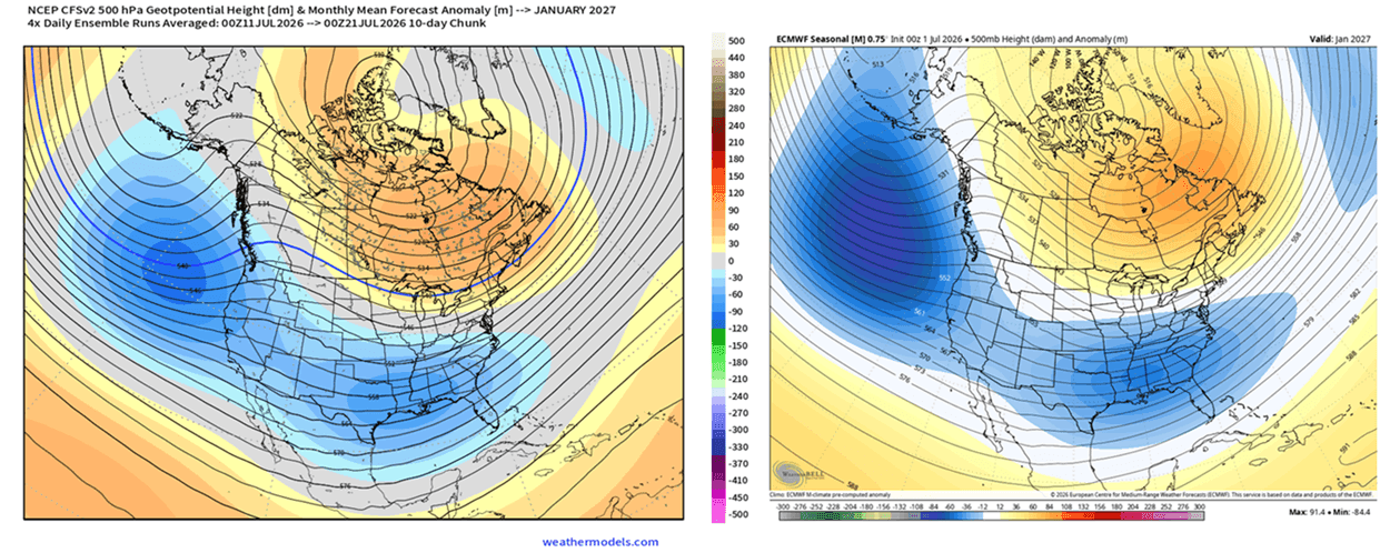
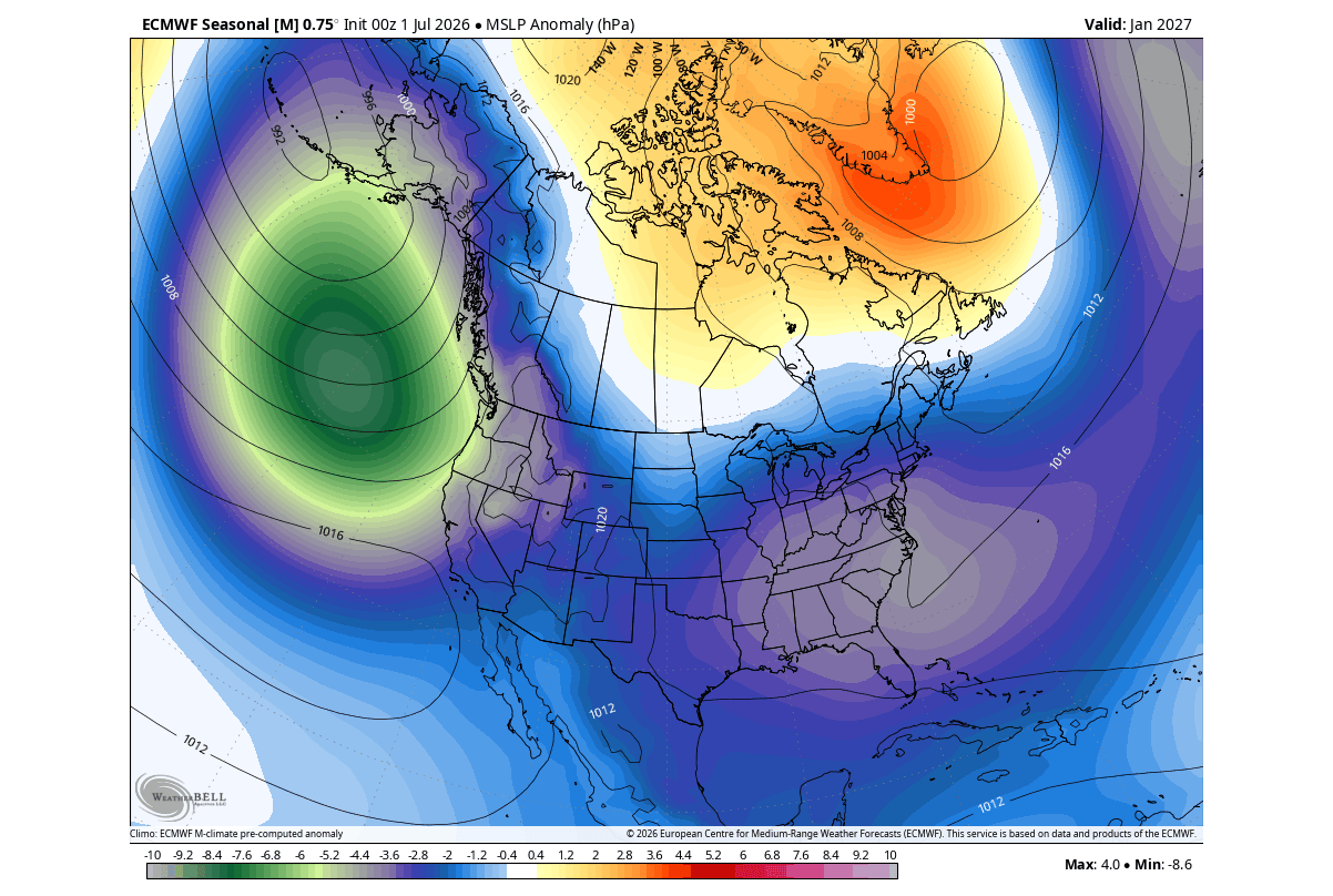
- Canada and the Northern United States: A persistent mid-level high-pressure blocking anomaly is forecast to anchor over Canada. This ridge will deflect the polar jet stream northward, resulting in a significantly milder, warmer-than-average winter across western Canada and the northern tiers of the U.S.
- The Southern and Eastern United States: Conversely, the southern Pacific jet stream will become heavily energized, establishing a relentless storm track across California, Texas, the Gulf Coast, and up into the Mid-Atlantic and Northeast. Frequent moisture-rich low-pressure systems will bring above-normal precipitation, heavy rainfall, and an elevated threat of severe weather.
- Snow and Ice Potential: Where the southern storm track intersects incoming southward intrusions of continental cold air—frequently unlocked by Canadian blocking or Polar Vortex disruptions—the setup creates a high-risk environment for major winter storms, ice events, and significant snowfall across the Central and Eastern U.S.
Europe: A Fragmented Response
Europe’s response to the Pacific anomaly is more indirect. Mid-winter forecast trends from the CFSv2 and ECMWF models suggest a sprawling high-pressure ridge extending from the south, juxtaposed against low-pressure anomalies across northern and northwestern Europe. While statistical models suggest a generally milder, drier regime under the influence of the southern ridge, competing model runs indicate potential windows for northerly airflow into the United Kingdom and Ireland, leaving European winter weather less locked-in than that of North America.
The Polar Vortex Connection
Perhaps the most volatile wildcard for Winter 2026/2027 is the state of the Polar Vortex. Strong El Niño events statistically favor mid-winter disruptions of the stratospheric vortex, often triggered by planetary-scale wave energy propagating upward from the troposphere.
Current ECMWF seasonal ensemble forecasts indicate a significant deceleration of 10hPa zonal winds in the Arctic stratosphere during January and February. If this weakening trend culminates in a Sudden Stratospheric Warming (SSW) event or a full vortex collapse, the resulting structural breakdown could unleash trapped Arctic air masses southward, injecting severe cold-air outbreaks into mid-latitude population centers regardless of baseline seasonal warmth.
Conclusion
The unfolding 2026/2027 Super El Niño represents a rare, high-energy geophysical event capable of reshaping global weather dynamics for months to come. With subsurface engines driving surface anomalies into uncharted historical territory and the global atmosphere firmly locked into El Niño mode, governments, agricultural sectors, and emergency management agencies must prepare for a winter season characterized by extreme meteorological contrasts, heightened storm risks, and atmospheric volatility.
