

Introduction and Main Facts
Meteorologists and climate scientists are closely tracking the rapid development of a powerful, historic Super El Niño across the tropical Pacific Ocean. Driven by massive subsurface ocean anomalies and amplified by Kelvin waves, this Pacific climate driver is exerting a profound planetary-scale influence on the global atmosphere.

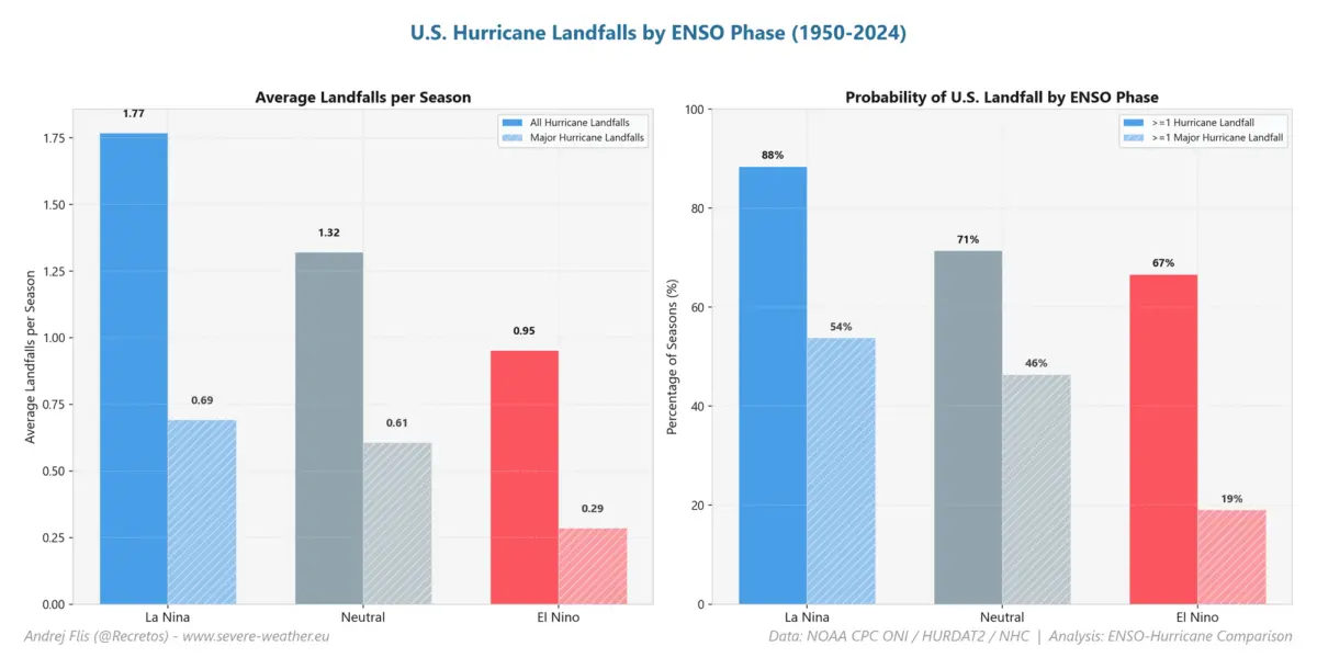
For the United States and the broader North American continent, this emerging climate phenomenon has forged what meteorologists describe as an atmospheric hurricane shield. By altering global circulation patterns—specifically through increased atmospheric subsidence, record-shattering wind shear, and severe mid-level drying—the unfolding Super El Niño has effectively crippled the 2026 Atlantic hurricane season.
Key facts regarding this atmospheric anomaly include:
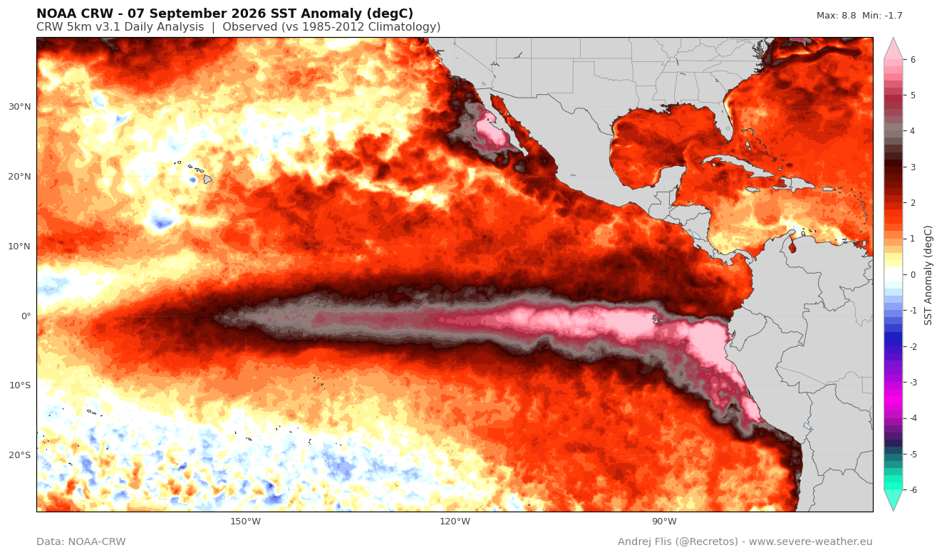
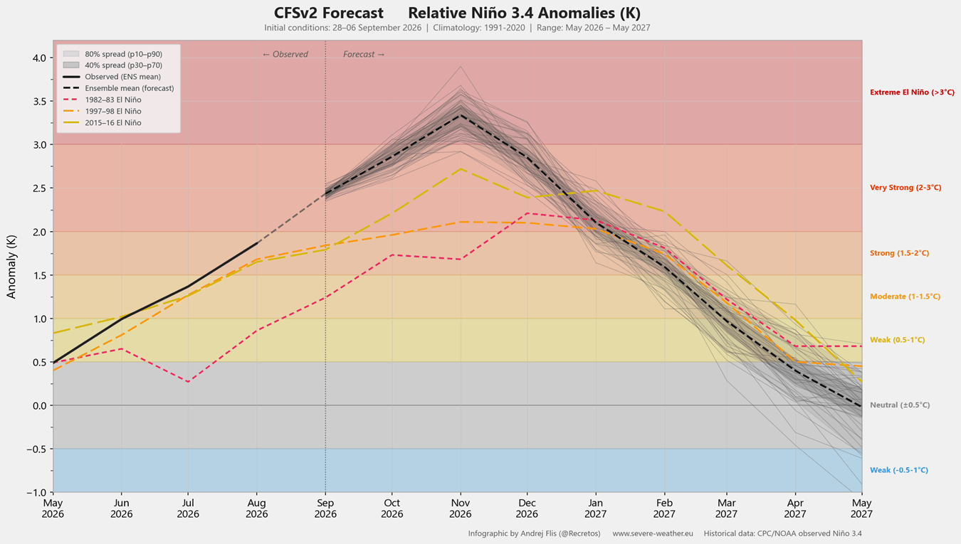
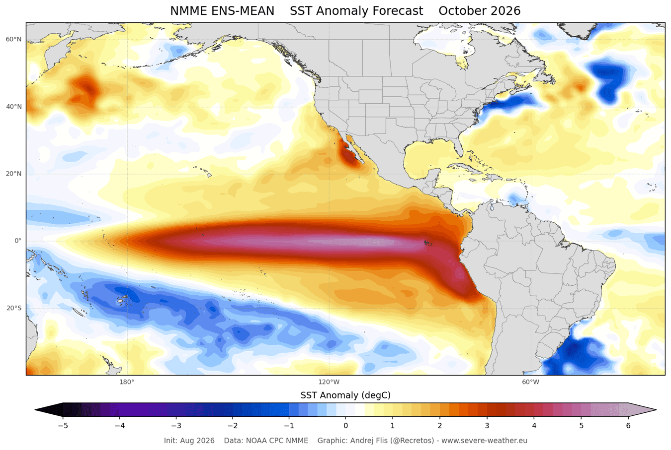
- Historic Intensity: NOAA-CRW and NCEP CFSv2 model data indicate that peak temperature anomalies in the eastern ENSO region have exceeded +7°C above normal, with sustained seasonal values surpassing the +2°C threshold required to classify this as a Super El Niño. Current projections suggest this could be the strongest event in over a century.
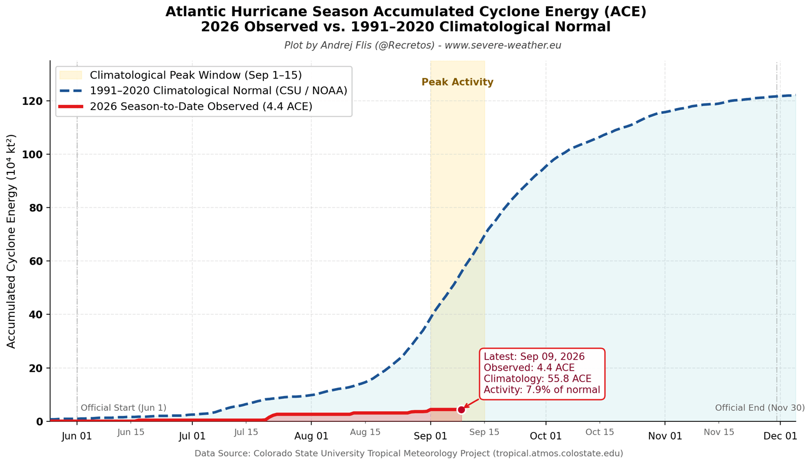
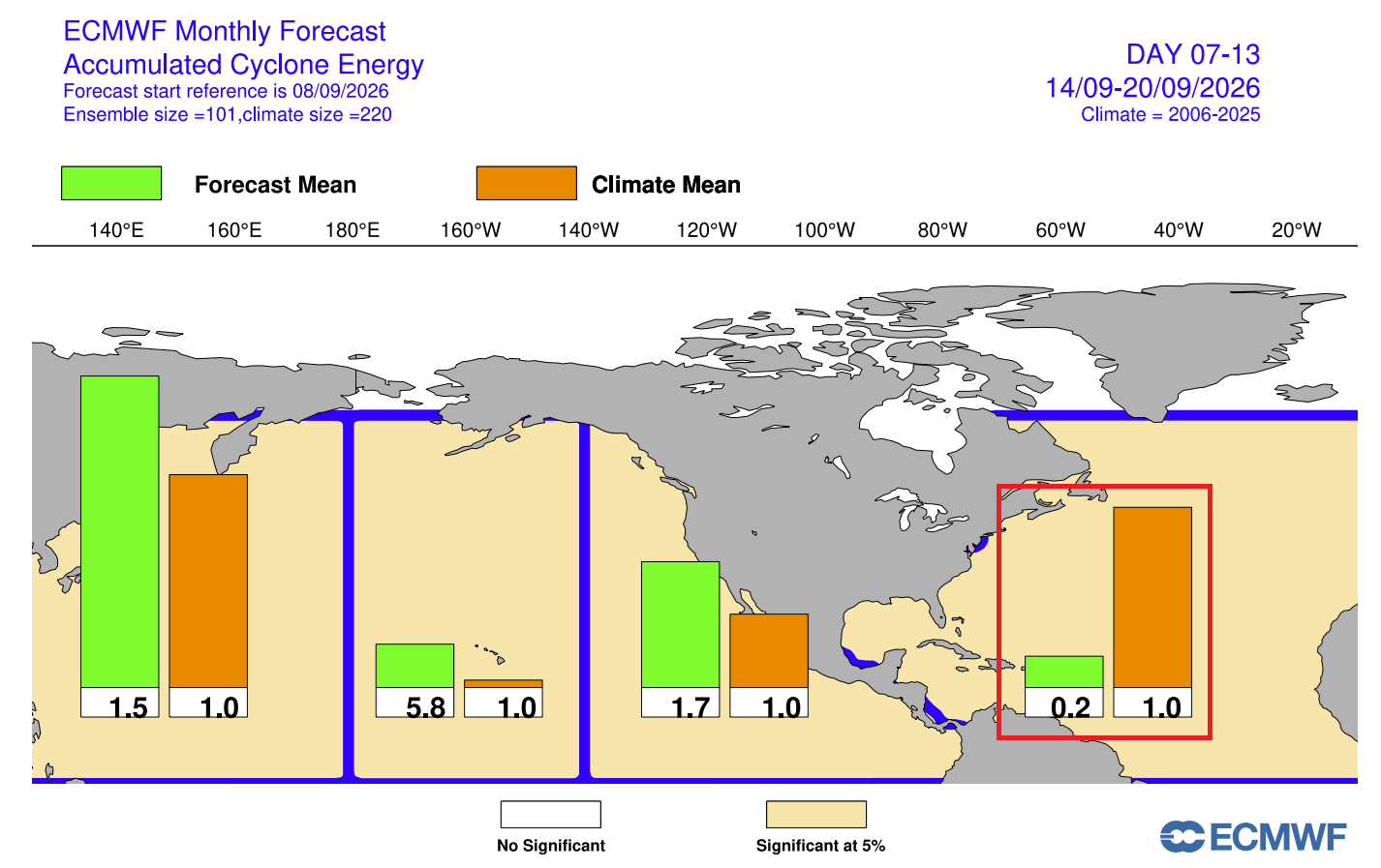
- Suppressed Atlantic Activity: As the season nears its historical peak, the Accumulated Cyclone Energy (ACE) index sits at a meager 8% of normal climatological values, fueled by just five short-lived, sub-hurricane-strength named systems.
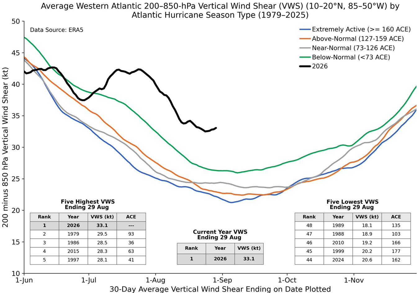
- Record-Breaking Wind Shear: Analysis from leading tropical meteorologist Dr. Philip Klotzbach shows that Atlantic wind shear values through July and August reached the highest levels recorded in the past 47 years.
- Cascading Winter Implications: Beyond suppressing tropical storms, historical analogs and advanced ECMWF seasonal models suggest this quiet hurricane season serves as an early harbinger for Winter 2026/2027, signaling potential mid-winter Polar Vortex disruptions and a colder, snowier pattern for parts of the United States.
Chronology of the 2026 Climate Shift: From Subsurface Waves to Planetary Forcing
To understand how a tropical Pacific warming event protects the United States from Atlantic hurricanes, one must examine the chronological evolution of oceanic and atmospheric signals leading up to the fall of 2026.
Spring to Early Summer: The Birth of a Kelvin Wave
The foundation of the 2026 Super El Niño was laid months prior beneath the ocean surface. High-resolution subsurface ocean analysis revealed the genesis of a powerful eastward-propagating thermal anomaly known as a Kelvin wave. Over a three-month period, this subsurface heat content expanded rapidly, rising toward the surface in the central and eastern Pacific.
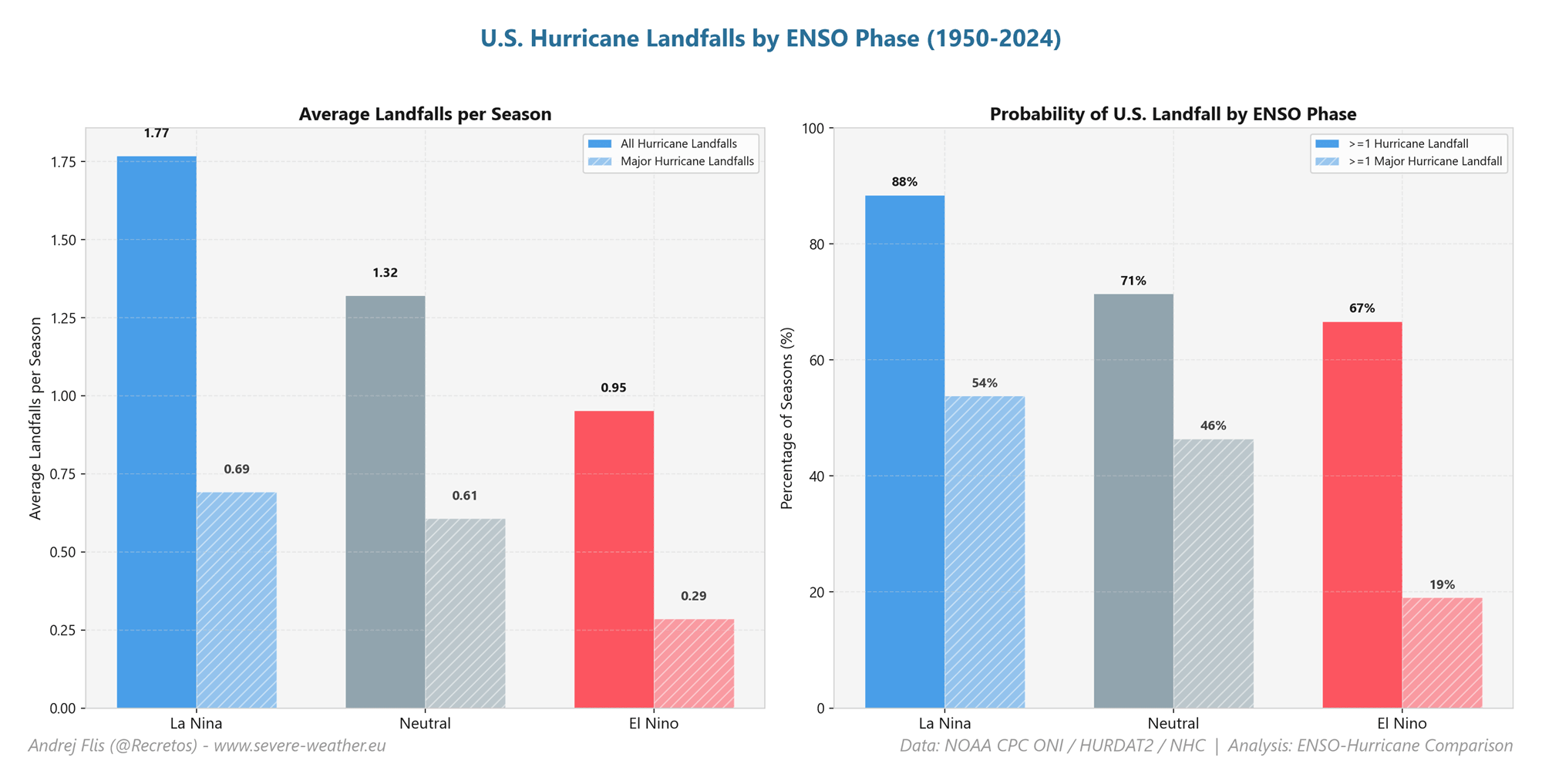
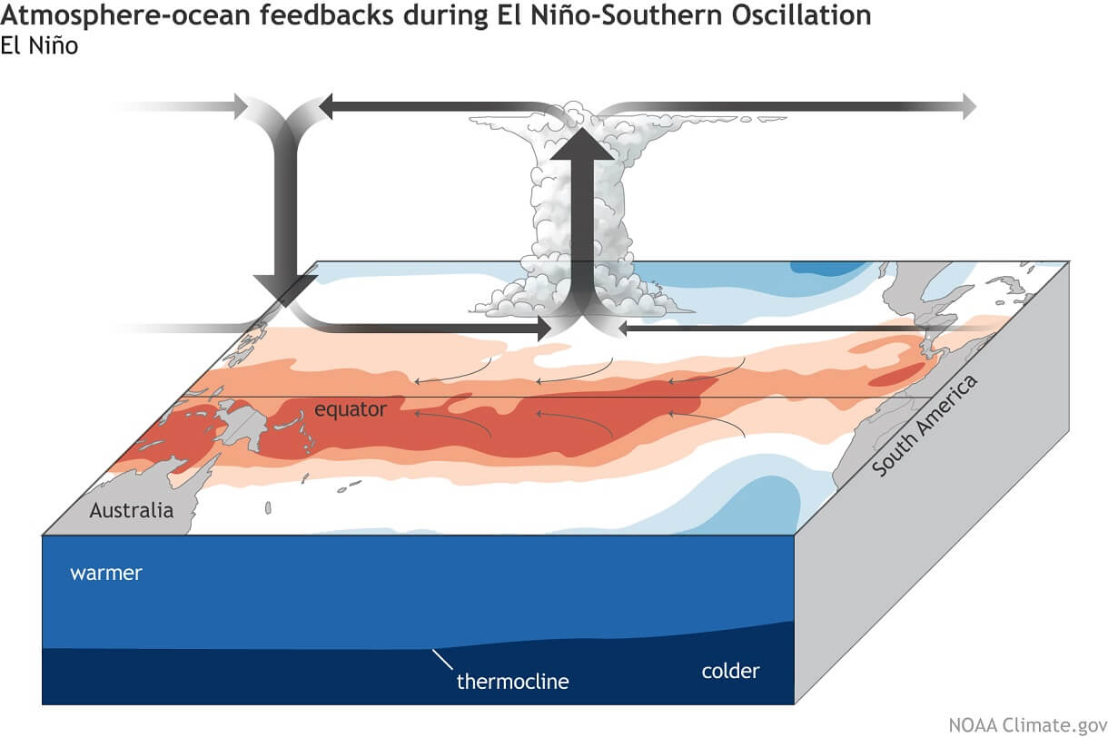
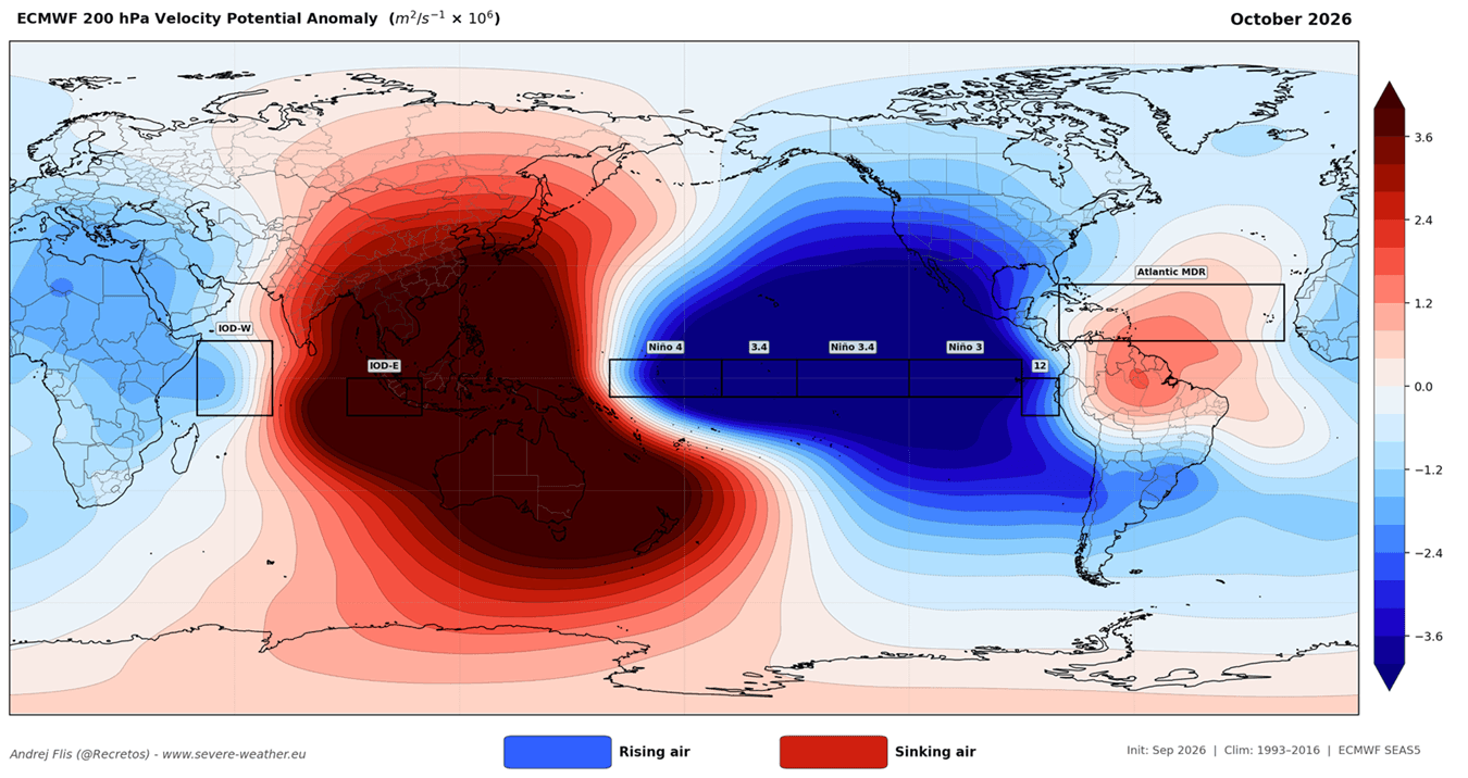
As these warm anomalies breached the surface, they fundamentally altered the Walker Circulation—the massive atmospheric overturning loop spanning the tropical Pacific. This shift triggered enhanced rising air and lower surface pressure over the central and eastern Pacific, balanced by widespread sinking air (subsidence) over the western Pacific and maritime continents.
Mid-Summer: Constructing the Atmospheric Shield
By July and August, the oceanic forcing successfully coupled with the global atmosphere, establishing teleconnections that reached across the North American continent and into the tropical Atlantic basin.
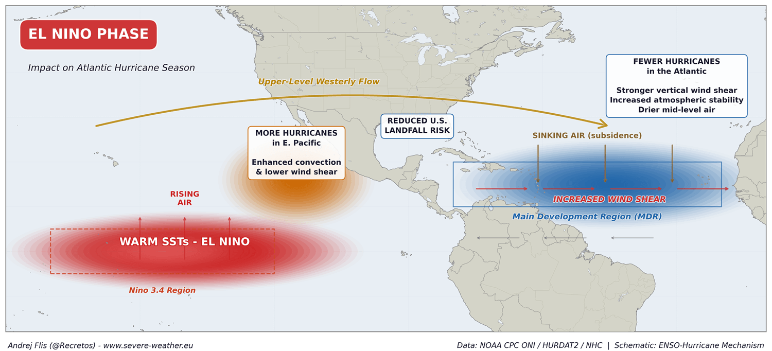
While the Eastern and Central Pacific experienced robust tropical development supported by favorable low pressure and moisture, the Atlantic Main Development Region (MDR) encountered an entirely different reality. The large-scale atmospheric bridge established by the El Niño redirected wind patterns, introducing an unprecedented barrier of upper-level winds and dry air. This natural defense mechanism effectively shielded the U.S. coastline from tropical landfalls during the traditional ramp-up of the season.
Supporting Data and Meteorological Analysis
The suppression of the 2026 Atlantic hurricane season is not a matter of subjective observation; it is backed by extensive data sets from NOAA, the European Centre for Medium-Range Weather Forecasts (ECMWF), and top academic research groups.
Accumulated Cyclone Energy (ACE) Deficit
The most robust metric for measuring tropical storm intensity and duration is the Accumulated Cyclone Energy index. Climatological comparisons provided by Colorado State University and NOAA data illustrate a stark divergence in 2026. While the historical normal ACE curve climbs steeply through August and September, the 2026 curve remains virtually flat, registering only about 8% of normal activity. The season has produced merely five short-lived named systems, none of which managed to transition into a hurricane.
Unprecedented Wind Shear and Mid-Level Dryness
The physical mechanisms tearing apart potential tropical systems are twofold: vertical wind shear and relative humidity anomalies.
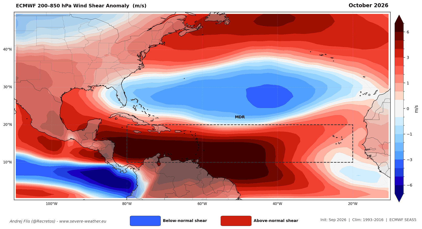
- Wind Shear: According to data analyzed by Dr. Philip Klotzbach, Atlantic wind shear during July and August 2026 ranked as the highest in a 47-year historical record. High shear strips the warm core off developing thunderstorms, tilting their vertical structures and exposing them to destructive upper-level winds.
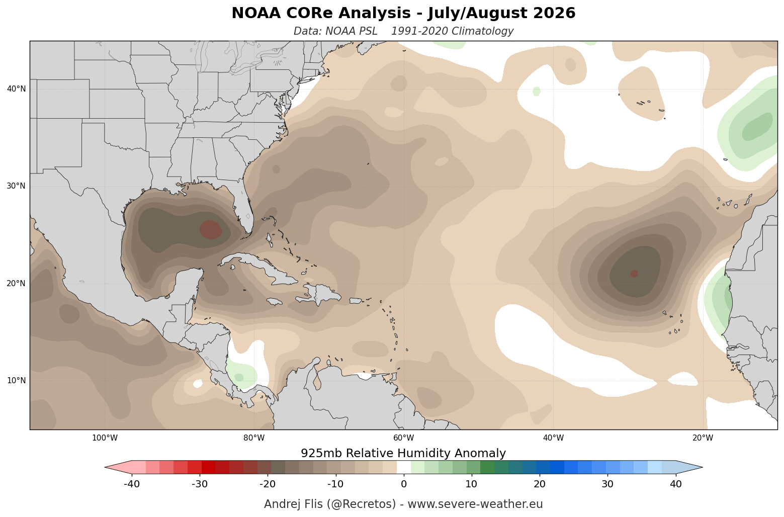
- Moisture Depletion: Utilizing NOAA CORe data at the 925mb level (approximately 800 to 2,625 feet), spatial analysis reveals broad swaths of below-normal relative humidity across the MDR. This dry air intrusion starves nascent tropical waves of the moisture and latent heat required for organized cyclogenesis.
ECMWF Model Consensus for September and October
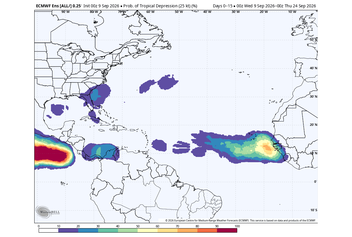
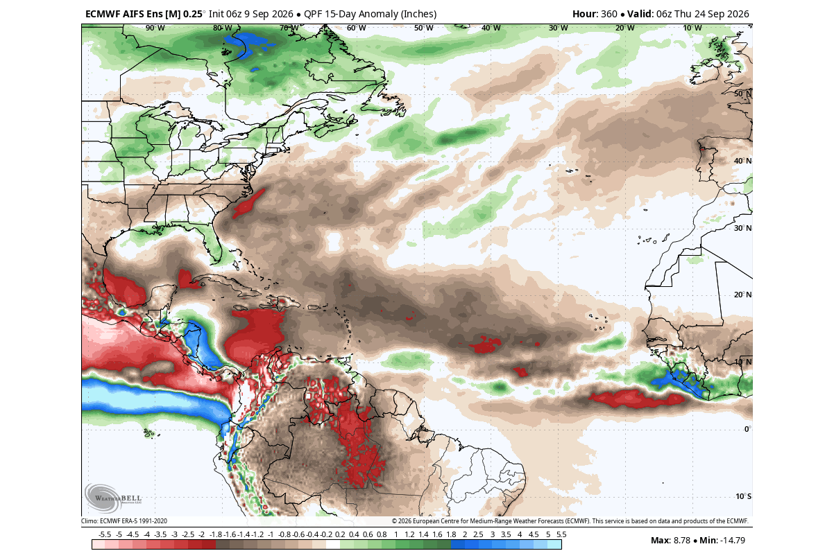
Seasonal projections from the ECMWF reinforce this persistent suppression. Forecast models mapping the peak of September and the transition into October show:
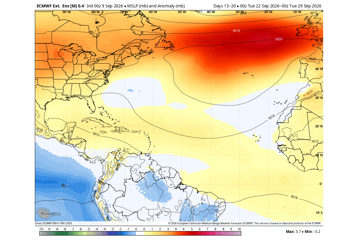
- Subsidence Dominance: Widespread sinking motion across the Caribbean, Gulf of Mexico, and Atlantic MDR, directly choking off cloud formation and precipitation.
- Persistent Shear Anomalies: Continued hostile wind shear anomalies spanning the tropical Atlantic toward the eastern seaboard of the United States.
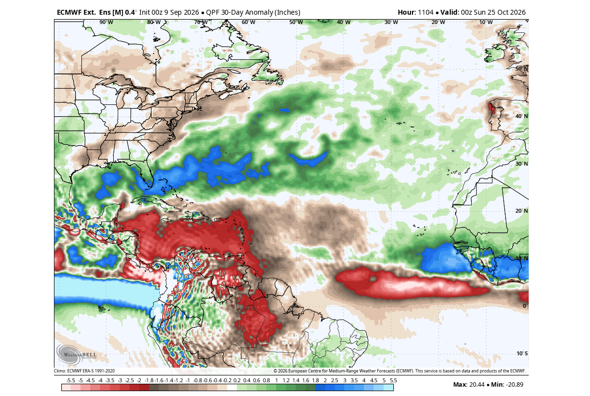
- Precipitation Deficits: Significant below-normal precipitation anomalies blanketing the entire Caribbean basin, pointing toward an exceptionally early collapse of the Atlantic hurricane season.
Official Responses and Scientific Consensus
Major meteorological institutions, including the National Oceanic and Atmospheric Administration (NOAA), the Climate Prediction Center (CPC), and academic forecasting hubs, have continuously updated their outlooks to reflect the unprecedented magnitude of this Super El Niño.
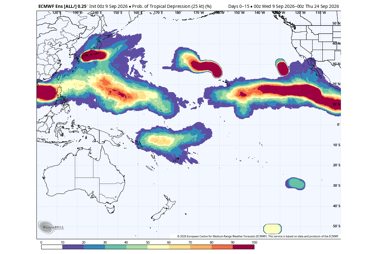
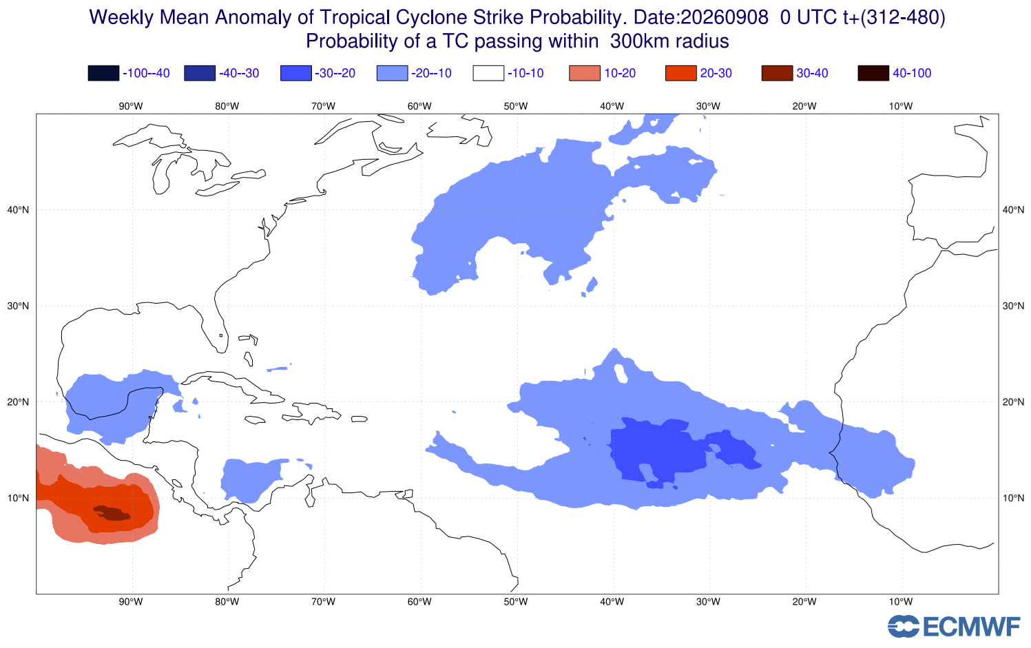
Forecasters emphasize that while seasonal odds heavily favor a remarkably quiet tropical environment regarding U.S. landfalls, the atmosphere never reaches a state of absolute zero risk. Official advisories consistently remind coastal communities that individual, brief, and localized systems can still spin up in close proximity to the coastline—such as in the western Gulf of Mexico or the western Caribbean—where local water temperatures can briefly support marginal development.
However, official consensus remains aligned: the overarching global forcing of the Super El Niño acts as a formidable suppressor, ensuring that 2026 will be recorded as one of the least active Atlantic hurricane seasons in modern meteorological history.
Implications for Winter 2026/2027 and the Polar Vortex
In meteorology, quiet periods in the tropics do not exist in a vacuum. The planetary-scale teleconnections responsible for a suppressed hurricane season frequently leave a lasting imprint on subsequent seasonal patterns, specifically targeting the upcoming winter.
Winter Temperature Anomalies
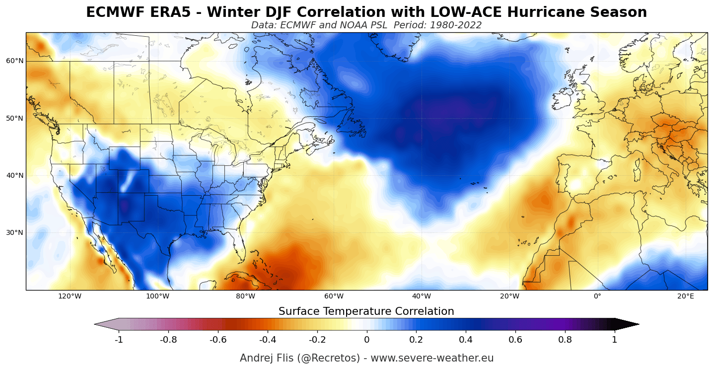
Historical analogs pairing weak hurricane seasons with Super El Niño phases reveal a distinct surface temperature signature across North America. ECMWF seasonal forecasts for Winter 2026/2027 align closely with these historical patterns, projecting:
- Below-Normal Temperatures: Cooler-than-average winter conditions spanning the southern and central United States, driven by persistent low-pressure troughs.
- Canadian Warmth: Significant positive temperature anomalies dominating Canada, anchored beneath a dominant high-pressure regime.
- European Mildness: Widespread above-normal winter temperatures across much of the European continent.
The Stratosphere Connection: A Disrupted Polar Vortex
Perhaps the most intriguing implication of a suppressed hurricane season tied to a Super El Niño involves the stratosphere and the behavior of the Polar Vortex.
While a quiet tropical season does not mechanically force stratospheric shifts, both phenomena share a common root in global atmospheric wave propagation driven by tropical forcing. Latest ensemble data tracking the 10mb zonal wind strength of the Polar Vortex indicate a striking deceleration and a potential disruption trend emerging by early January 2027.
The forecast ensemble lines project well below long-term averages, signaling a weakened or destabilized Polar Vortex mid-winter. A compromised Polar Vortex loses its ability to tightly bottle up Arctic air, frequently allowing lobes of bitter, sub-freezing air to spill southward into the mid-latitudes. Consequently, climatologists note that the combination of a Super El Niño and a weakened stratospheric vortex drastically increases the statistical probability of a colder, snowier winter across parts of the United States and Canada.
As the scientific community continues to monitor these cascading atmospheric bridges, researchers will publish detailed updates on the evolution of the 2026/2027 Polar Vortex and its unfolding impacts on the Northern Hemisphere.
