

Updated: August 12, 2026
Dateline: Global Meteorology Desk

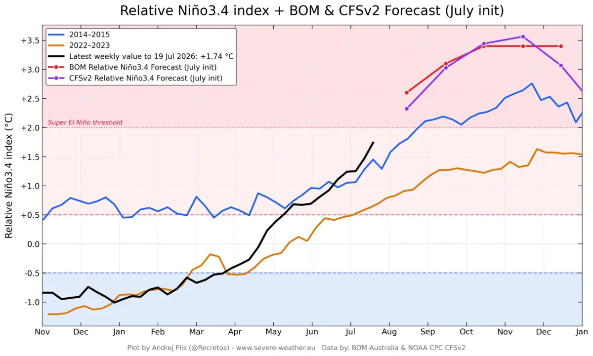
Meteorological agencies across the globe are sounding alarms as incoming telemetry points toward the rapid, unchecked acceleration of a 2026 equatorial Pacific warm phase. Surpassing initial seasonal predictions, this rapidly unfolding meteorological phenomenon has crossed the threshold into the elite and volatile category of a Super El Niño.
According to consolidated data from the European Centre for Medium-Range Weather Forecasts (ECMWF), the National Oceanic and Atmospheric Administration (NOAA), and Australia’s Bureau of Meteorology (BOM), current ocean and atmospheric anomalies are tracking higher than any observed event in the modern historical record dating back to 1870. As this high-energy anomaly expands across the Pacific, climatologists warn that its far-reaching consequences will fundamentally rewrite global weather patterns, setting the stage for an extraordinary and potentially disruptive Winter 2026/2027 across North America and Europe.
Main Facts: The Anatomy of a Super El Niño
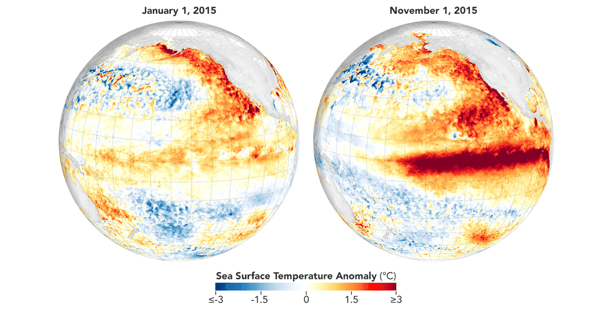
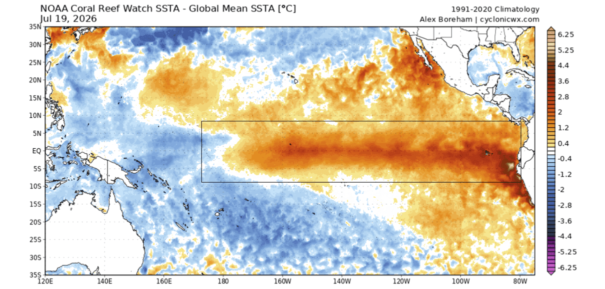
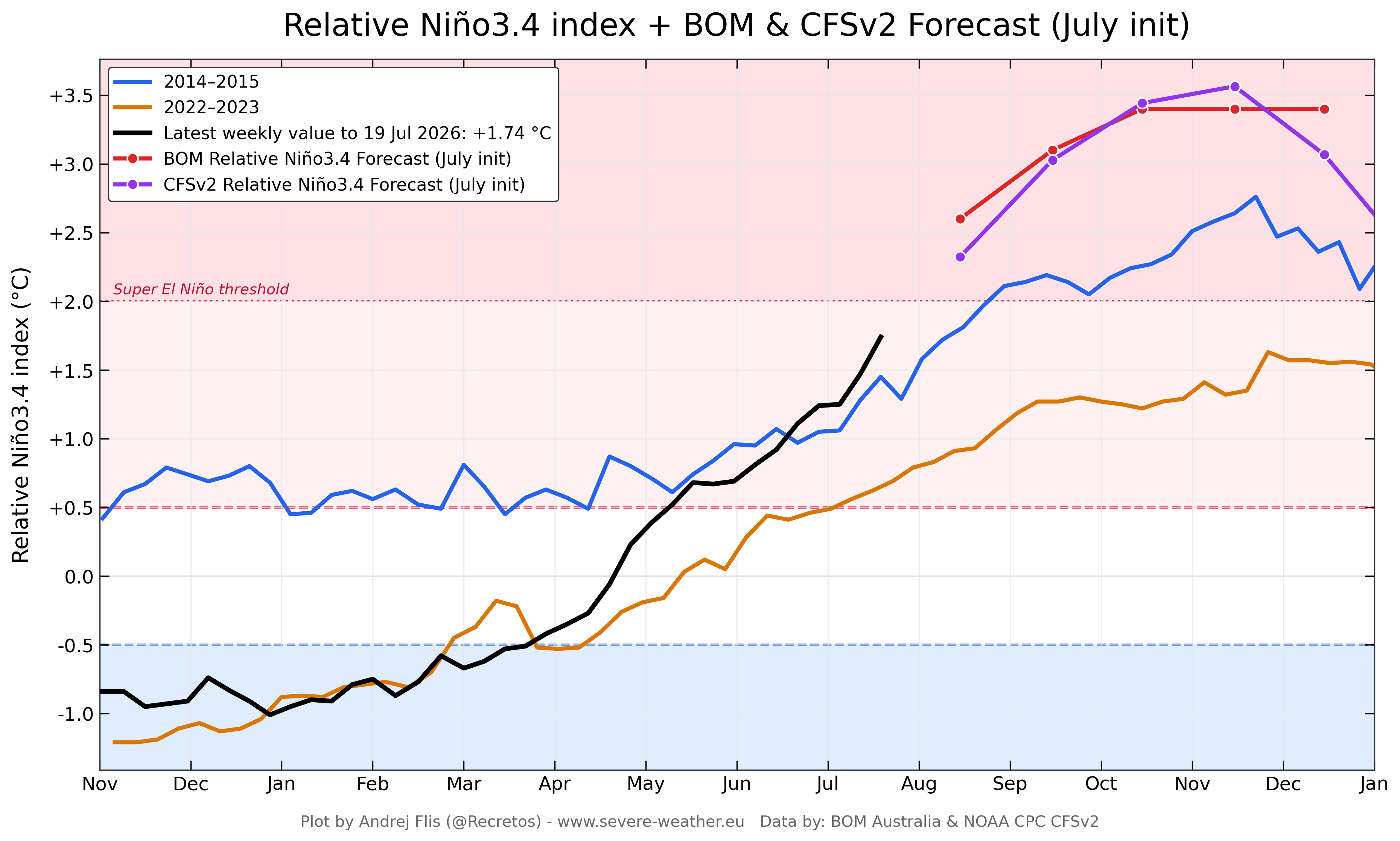
An El Niño represents the warm phase of the El Niño-Southern Oscillation (ENSO), a naturally occurring climate cycle characterized by fluctuations in ocean temperatures across the equatorial Pacific. While standard El Niño events occur every few years with moderate environmental impacts, a "Super El Niño" is a rare, high-energy anomaly. Scientifically, an event is classified as a Super El Niño when sea surface temperature anomalies in the core ENSO region sustainably exceed +2.0°C above the long-term average.
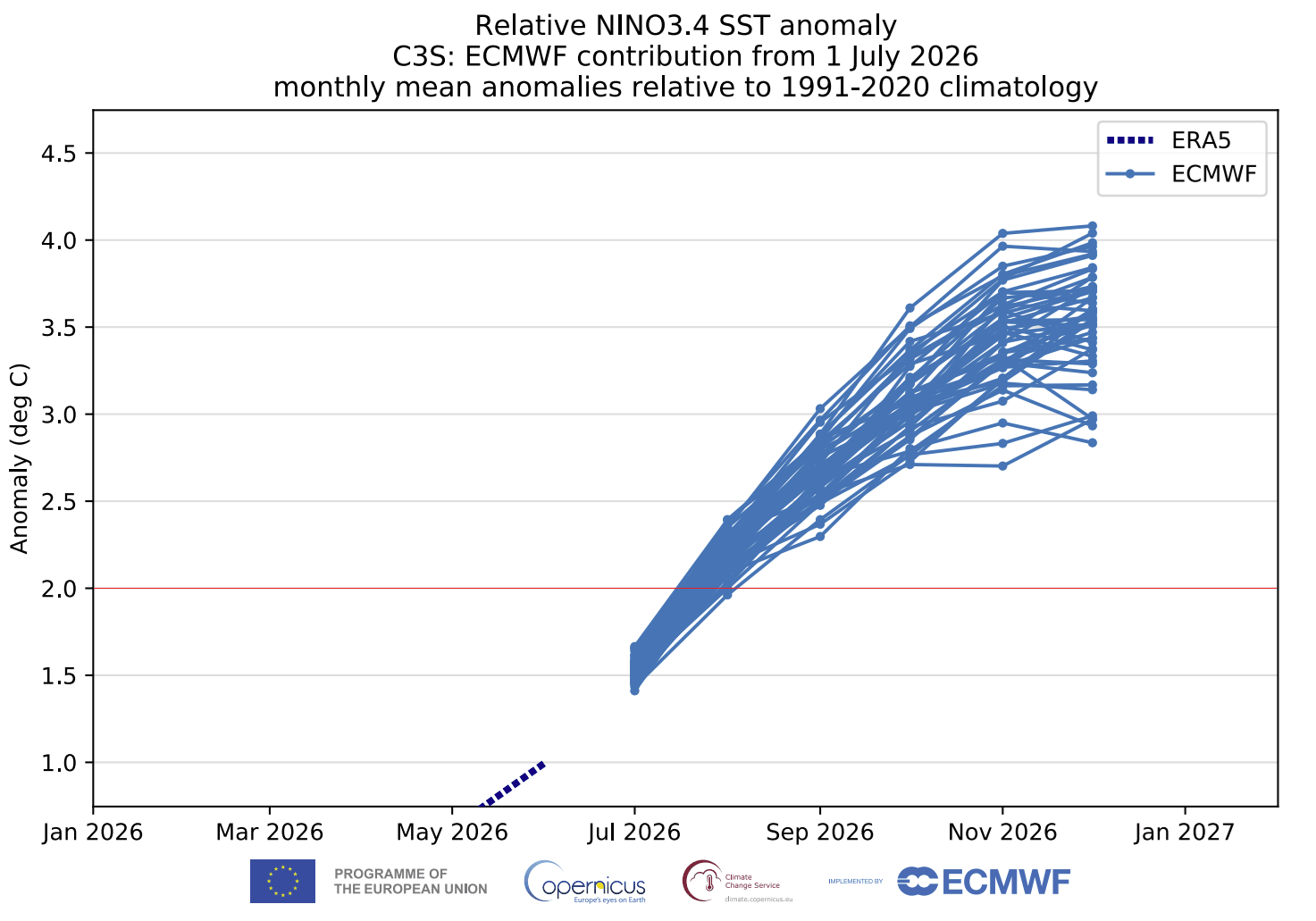
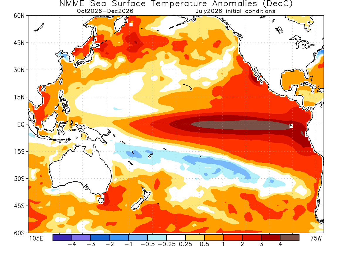
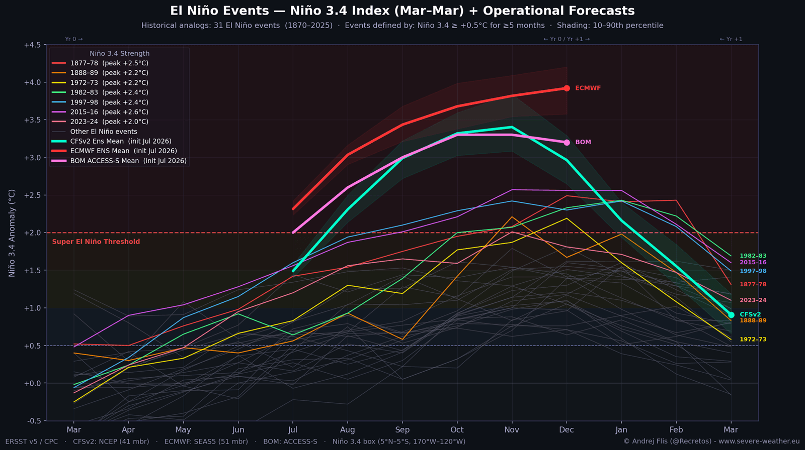
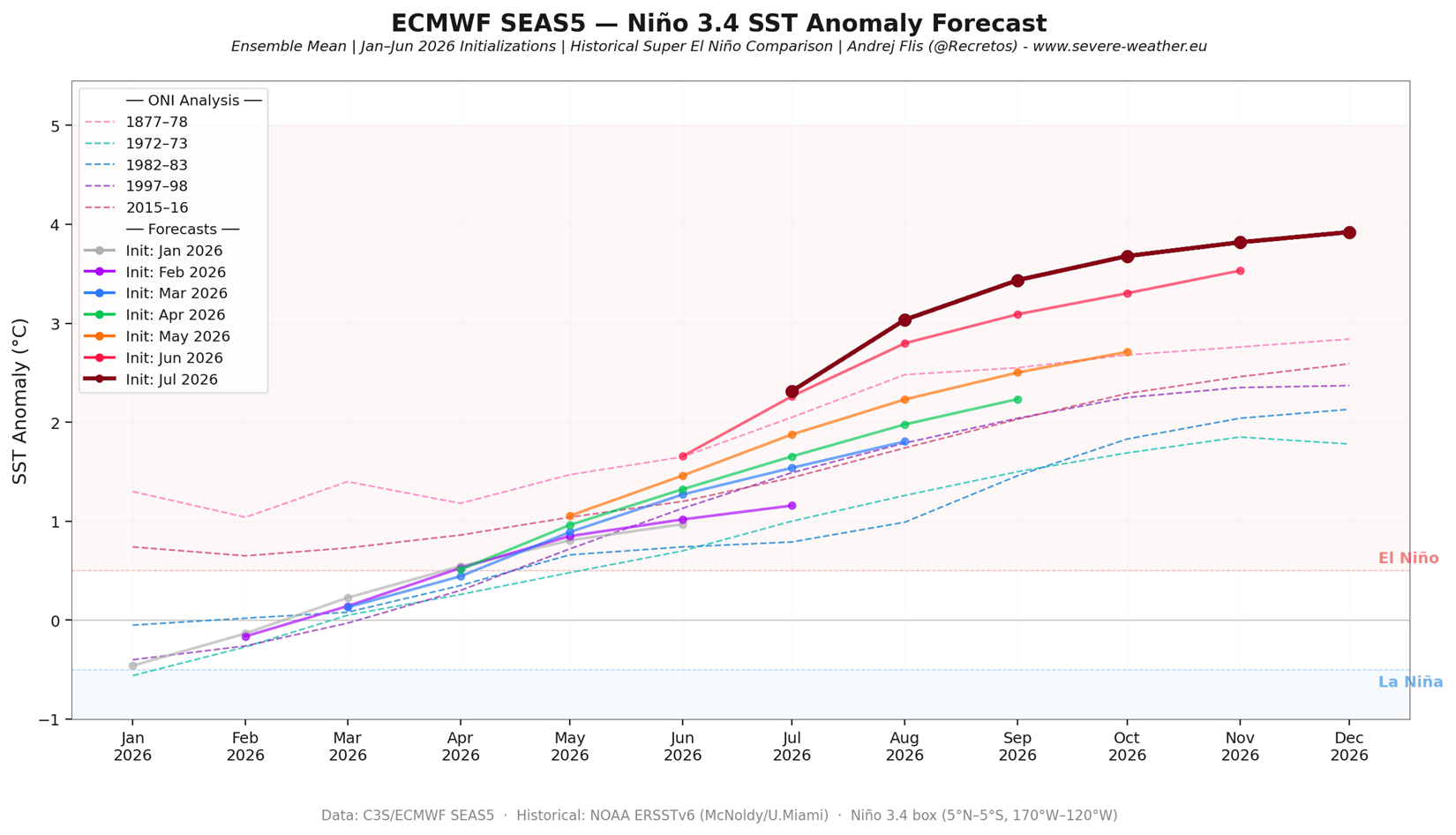
The unfolding 2026 event is rewriting expectations entirely. Current forecasts indicate anomalies could peak near or above +3.0°C to +4.0°C, positioning this cycle to eclipse the benchmark set by the legendary 2015/2016 Super El Niño.
Key Drivers of the 2026 Event:
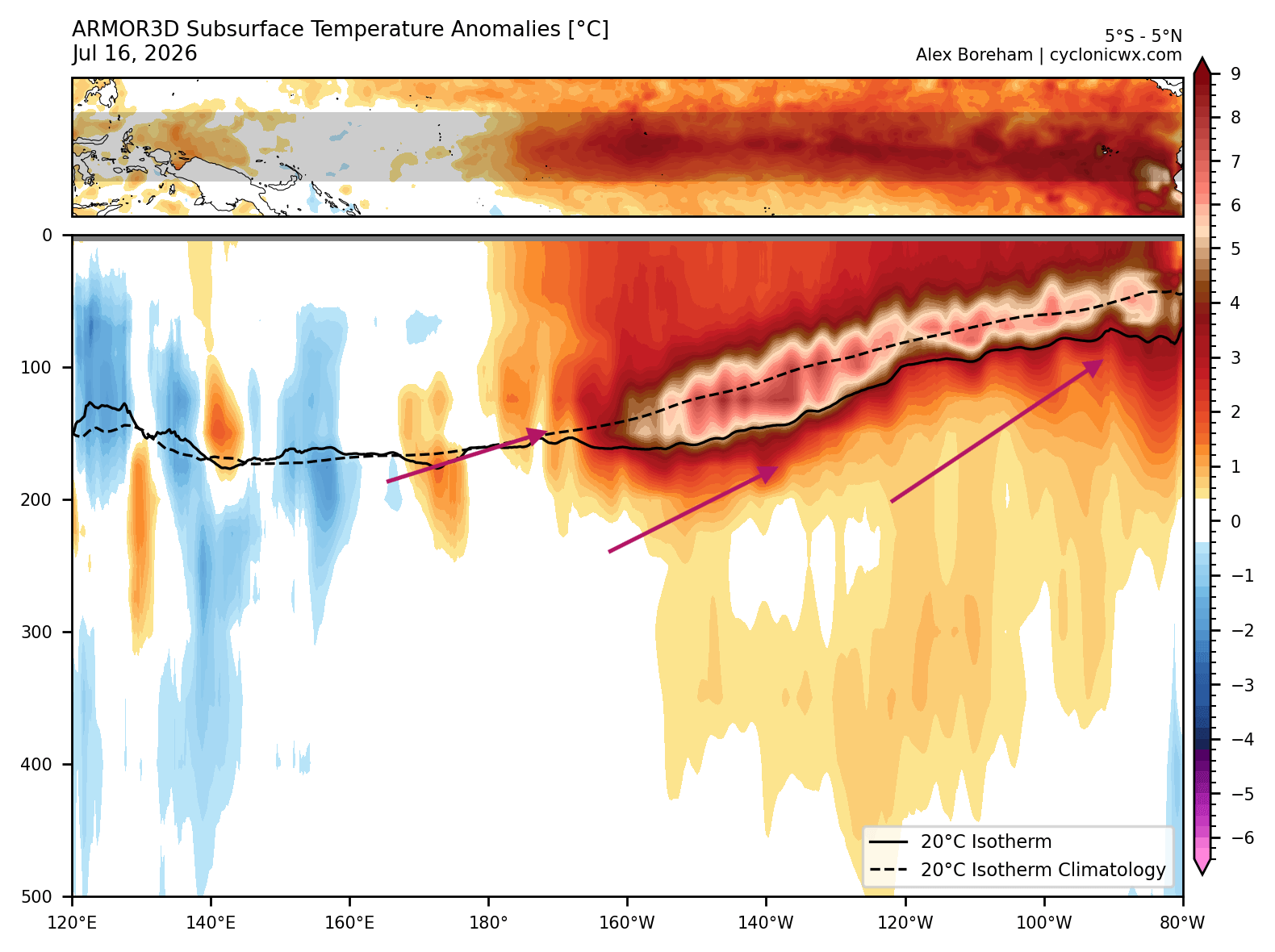
- Subsurface Kelvin Waves: Deep ocean analysis reveals a massive core of warm water—reaching over 7°C above normal—surging eastward in the top 500 meters of the equatorial Pacific.
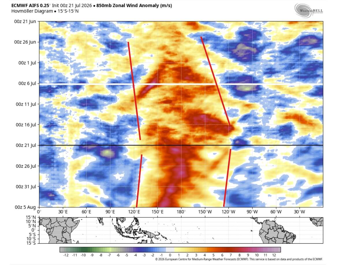
- Westerly Wind Bursts: Unusually strong westerly wind bursts in the tropics are aggressively driving subsurface heat to the surface, creating a powerful feedback loop between the ocean and the atmosphere.
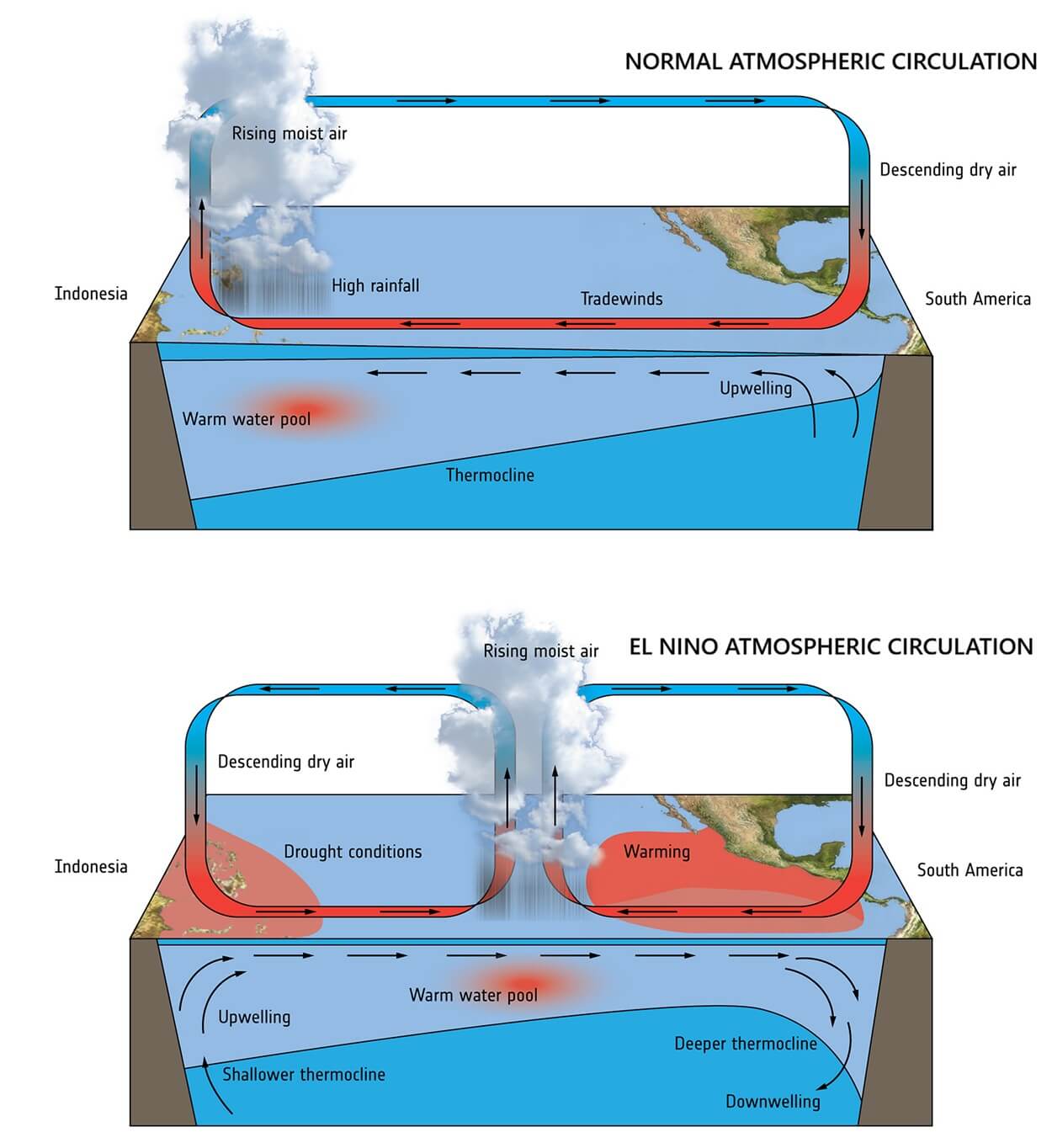
- Global Standing Waves: The disruption of the Walker Circulation has locked the global atmosphere into an El Niño configuration, establishing a permanent area of low pressure and rising air over the central and eastern Pacific.
Chronology of Development: From Early Summer Signals to Record-Breaking Forecasts
The trajectory of the 2026/2027 El Niño has caught forecasters off guard due to its unprecedented rate of intensification.
- Late Spring 2026: Early signs of subsurface warming begin appearing in the western Pacific, though models initially project a standard, moderate-strength event.
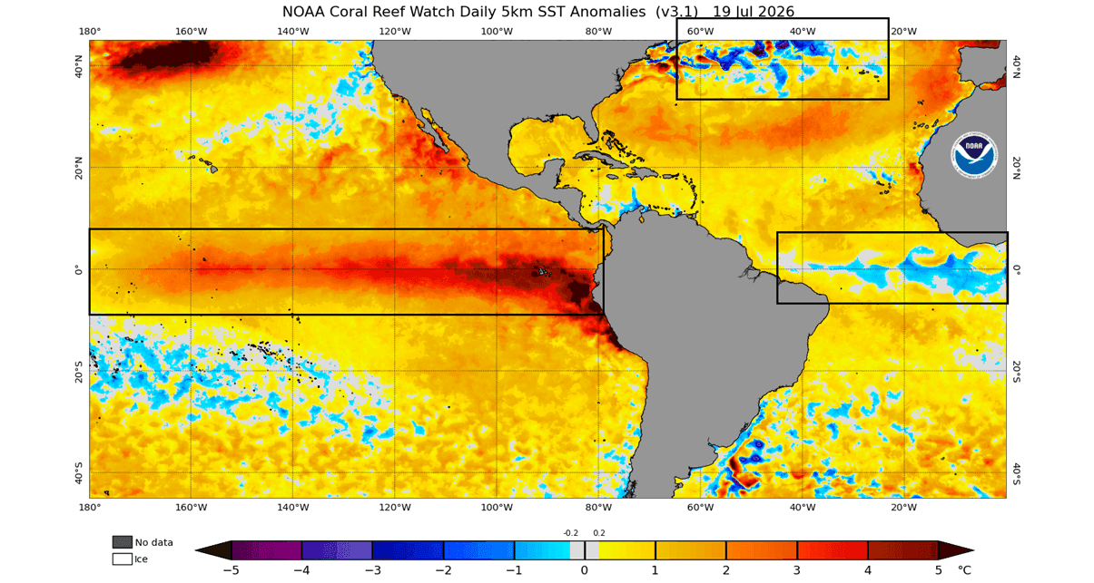
- June–July 2026: Westerly wind bursts intensify dramatically, propelling a colossal Kelvin wave toward the eastern Pacific. Surface temperatures in the central ENSO regions jump by 3°C to 4°C above normal much earlier in the calendar year than historically observed.
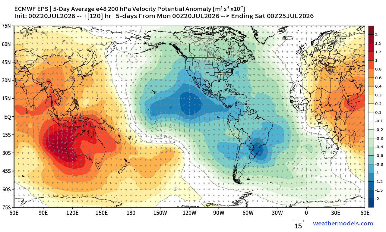
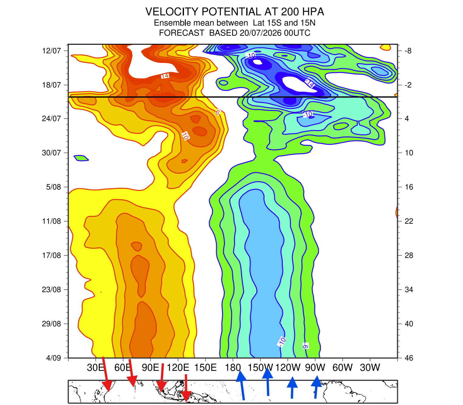
- August 2026: Multi-model consensus from NOAA, ECMWF, and BOM converges on a historic outcome. Successive model runs show the event outpacing the 2015/2016 peak anomaly curve. Global atmospheric parameters, including velocity potential anomalies, confirm that the planetary circulation has locked firmly into "El Niño mode."
- Fall to Winter 2026/2027 (Projected): Forecasters anticipate the event to reach its mature peak between November and December 2026, directly dictating the hemispheric pressure configurations for the heart of the winter season.
Supporting Data & Modeling Consensus
The credibility of this historic forecast rests on cross-verified modeling from the world’s leading meteorological institutions. When comparing current observations against historical archives spanning 155 years, the trajectory of the 2026 event stands alone.
Model Intercomparisons
- NOAA CFSv2 (United States): Projects a sustained, high-amplitude peak through late autumn, confirming extensive positive sea-level pressure anomalies across the Pacific basin.
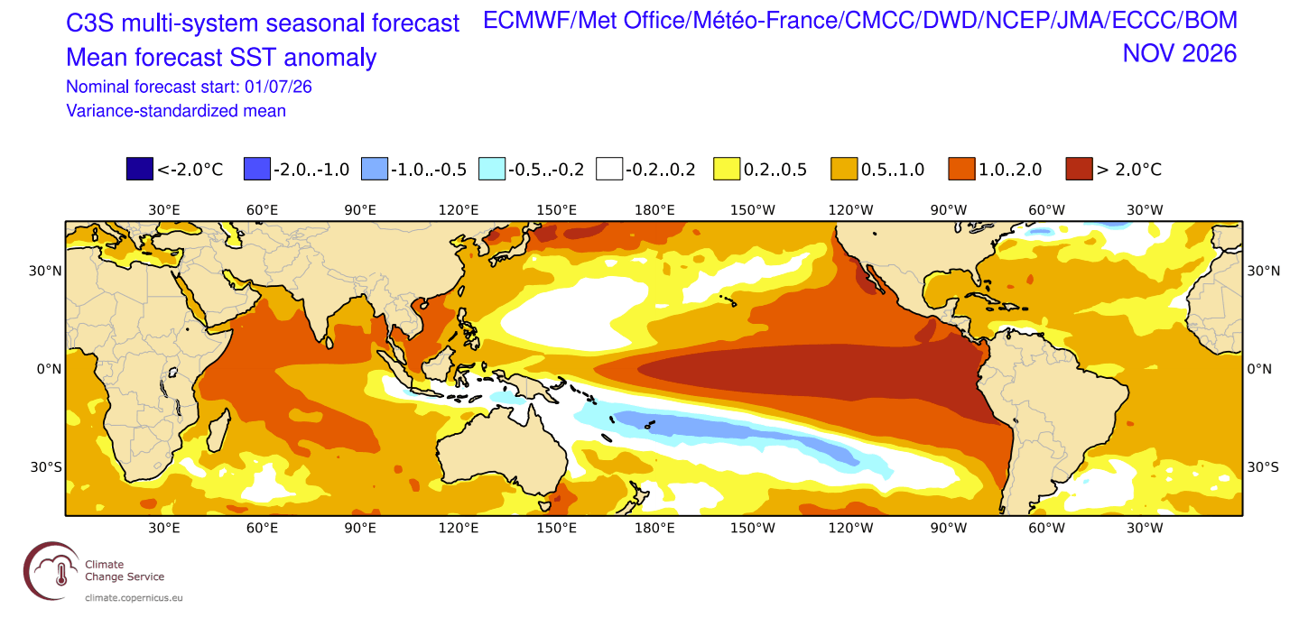
- ECMWF (Europe): Continues to push ensemble mean forecasts higher with each consecutive model run, pointing to a sprawling warm anomaly that covers more than 10% of the global ocean surface by November.
- BOM (Australia): Validates the extreme eastern Pacific temperature departures, noting stark contrasts with cooler-than-average anomalies emerging in parts of the North Atlantic and tropical corridors.
This multi-model agreement eliminates the likelihood of a statistical outlier. The atmosphere has already registered the systemic shift: the Walker Circulation cell—the planetary engine governing tropical convection—has locked into a stationary wave structure that will dictate weather patterns well into Spring 2027.
Implications for North America and Europe
As the planetary circulation locks into this high-amplitude state, regional weather impacts are coming into sharp focus for the upcoming winter season.
North America: The Energized Southern Jet Stream
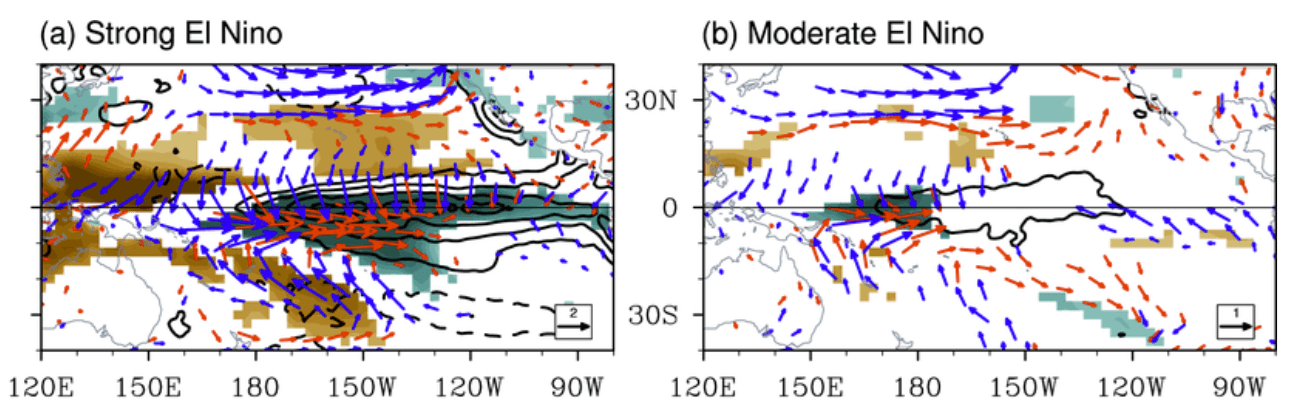
During a typical strong El Niño winter, a persistent low-pressure center establishes itself in the North Pacific, forcing the polar jet stream northward and bringing mild conditions to western Canada and the northern United States. However, the sheer magnitude of the 2026/2027 Super El Niño threatens to supercharge these textbook patterns.
- Canada and the Northern U.S.: High-pressure blocking anomalies are projected to anchor over Canada, deflecting the polar jet stream and promoting milder-than-average winter conditions across large swaths of the country.
- The Southern and Eastern U.S.: An energized, moisture-rich southern Pacific jet stream will take hold. CFSv2 and ECMWF January and February trends indicate frequent, heavy precipitation events stretching from California and Texas across the Gulf Coast and into the Mid-Atlantic.
- Winter Storm Potential: Where this active southern storm track intersects with cold air intrusions made possible by Canadian blocking, the potential for major winter storms, ice events, and heavy snowfall increases substantially across the Central and Eastern United States.
Europe: A Less Certain, High-Ridge Response
Unlike North America, Europe does not sit downstream of the direct tropical Pacific atmospheric bridge. Consequently, European winter responses to El Niño are notoriously more variable. Current mid-winter model projections for January 2027 suggest a sprawling high-pressure ridge extending from the south, though competing model runs leave room for northwest tracking low-pressure zones that could introduce intermittent northerly cold air flows to the UK and Ireland.
The Wildcard: Polar Vortex Disruption Risks
Perhaps one of the most critical implications of a Super El Niño is its capacity to disrupt the stratospheric Polar Vortex.
The Polar Vortex acts as a massive circulating band of cold air high above the Arctic. A strong, stable vortex keeps polar air securely locked away, while a weakened or disrupted vortex allows frigid Arctic air to spill southward into mid-latitude population centers.
Historical data demonstrates a strong statistical correlation between El Niño winters and an increased frequency of Sudden Stratospheric Warming (SSW) events—particularly during December and January. Simulations analyzing the mechanical impact of El Niño strength indicate that a Super event exerts immense pressure on the stratosphere, significantly decelerating zonal winds in the polar regions.
The latest ECMWF seasonal ensemble forecasts highlight a pronounced wind-drop signal for January, signaling a heightened risk of a major Polar Vortex disruption. If a full stratospheric wind reversal or collapse materializes, it could unlock a severe "Polar Express" weather pattern, unleashing intense, multi-week cold outbreaks across parts of North America and Europe that override standard seasonal outlooks.
Official Responses and Outlook
National weather services and disaster preparedness agencies are closely monitoring the unfolding data. Emergency management sectors across North America are being advised to factor the enhanced risk of heavy southern precipitation, atmospheric blocking, and potential mid-winter freeze events into their seasonal logistics.
As the scientific community tracks the final months of ocean-atmosphere coupling leading up to the autumn peak, researchers emphasize that public vigilance will be essential. With the planet stepping into uncharted meteorological territory, continuous updates will be required to track how this record-shattering Super El Niño shapes the global climate in the months ahead.
