

Every autumn, as the northern hemisphere dips toward the winter solstice, a familiar narrative grips weather forums, meteorological blogs, and social media channels. The core of the theory is simple yet captivating: does a rapid, early advance of snow cover across Siberia act as a reliable crystal ball for a brutally cold, snowy winter across the United States, Canada, and Europe?
For over a decade, weather enthusiasts have treated this metric as an early warning sign for mid-latitude cold outbreaks. However, a comprehensive new evaluation of 47 years of meteorological data reveals that the famous Siberian snow theory may no longer hold up in the modern era.
Main Facts: The Siberian Snow Theory Under Scrutiny
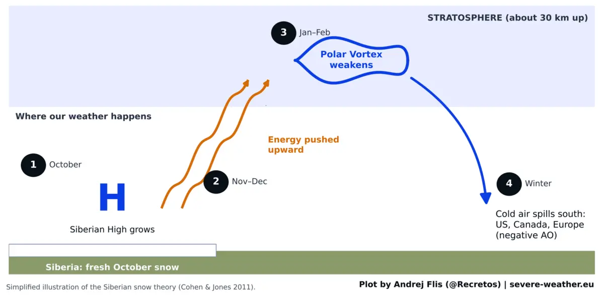
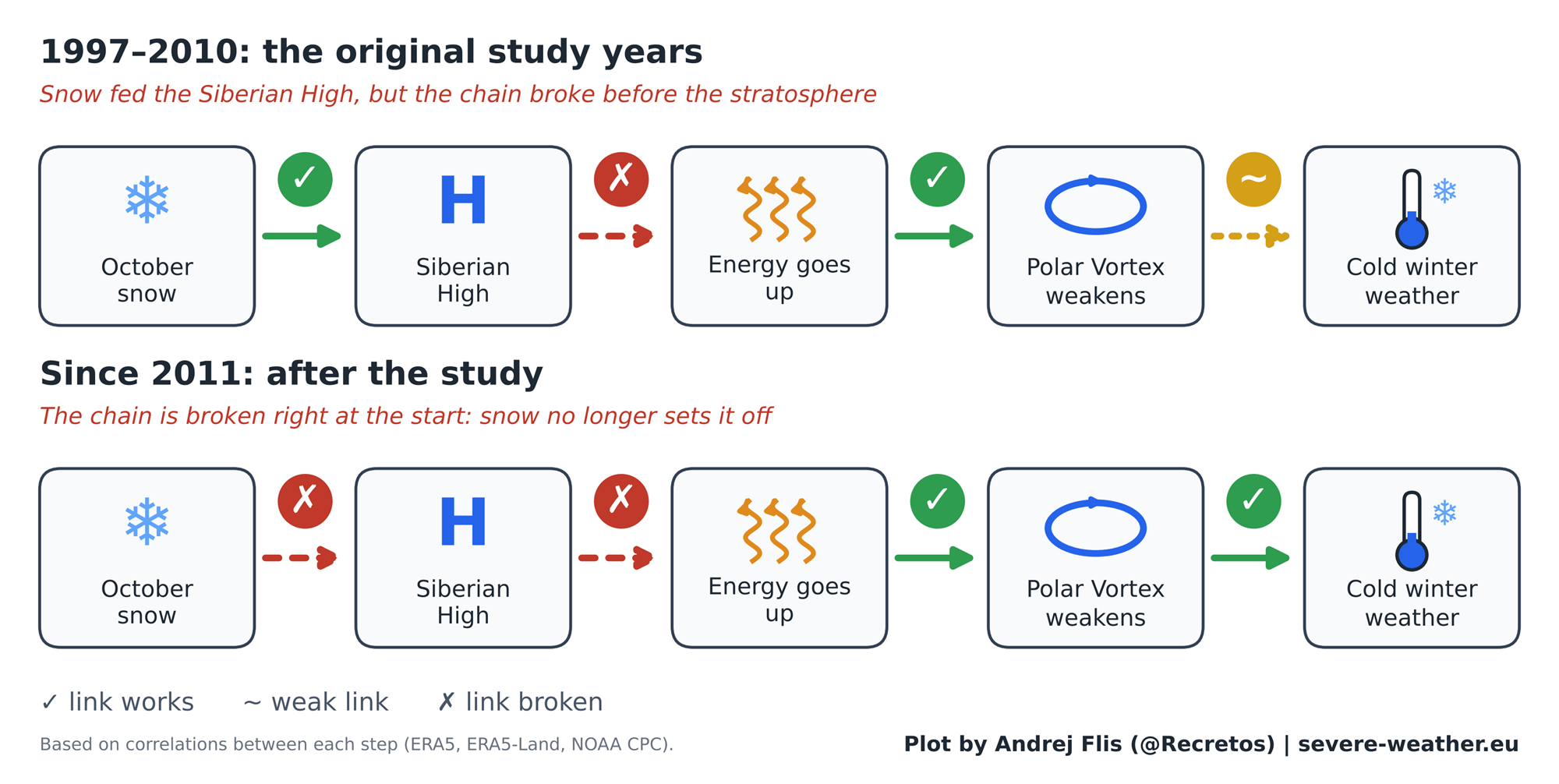
The hypothesis that October snow cover in Eurasia dictates the severity of the upcoming winter traces its roots to a widely cited 2011 scientific study by researchers Judah Cohen and Justin Jones. The foundational premise is built on a complex atmospheric chain reaction:
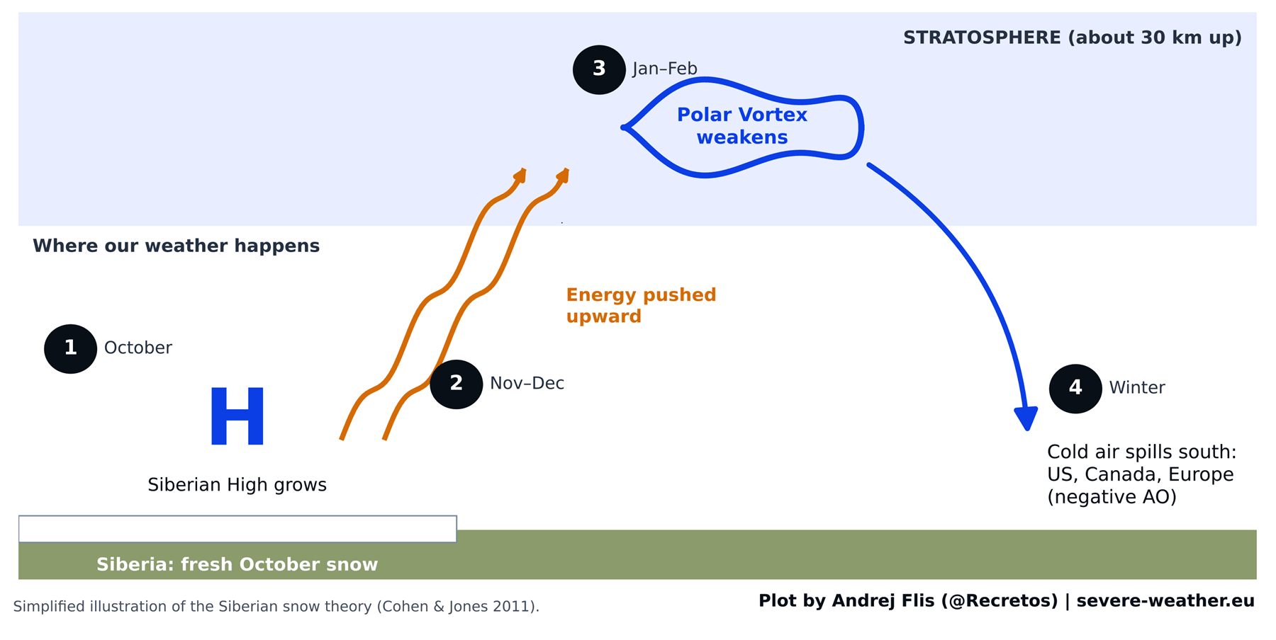
- Surface Cooling: A rapid accumulation of fresh snow cools the underlying ground and reinforces the Siberian High, a sprawling zone of dense, cold air over northern Asia.
- Stratospheric Disruption: This intensified surface high-pressure system forces excess wave energy vertically into the stratosphere, traveling roughly 30 kilometers (18.5 miles) above the Earth’s surface.
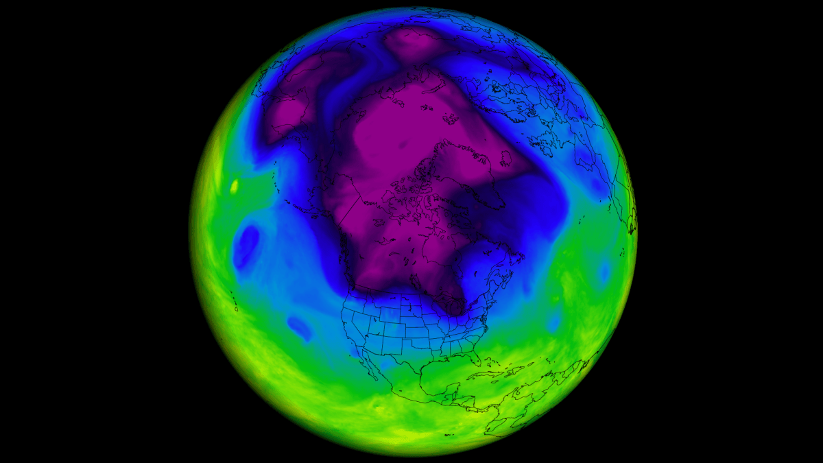
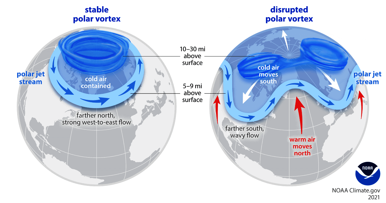
- The Polar Vortex Connection: The incoming energy disrupts the Polar Vortex—the circular band of stratospheric winds that normally locks the bitterest Arctic air near the pole. When the vortex weakens, stretches, or collapses, lobes of frigid air break away and spill southward into North America and Europe.
- The Modern Reality Check: Analyzing 47 winters of data (1979–2025) across four distinct snow datasets reveals that while the physical mechanics of the stratosphere remain sound, the predictive link between October Siberian snow and winter weather has effectively dissolved.
Chronology: The Rise, Fall, and Evolution of a Winter Signal
1997–2010: The Golden Age of the Snow Theory
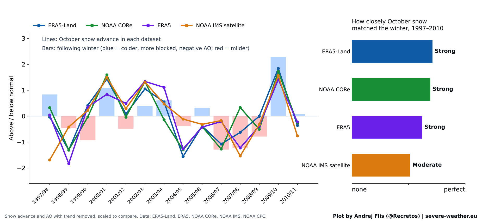
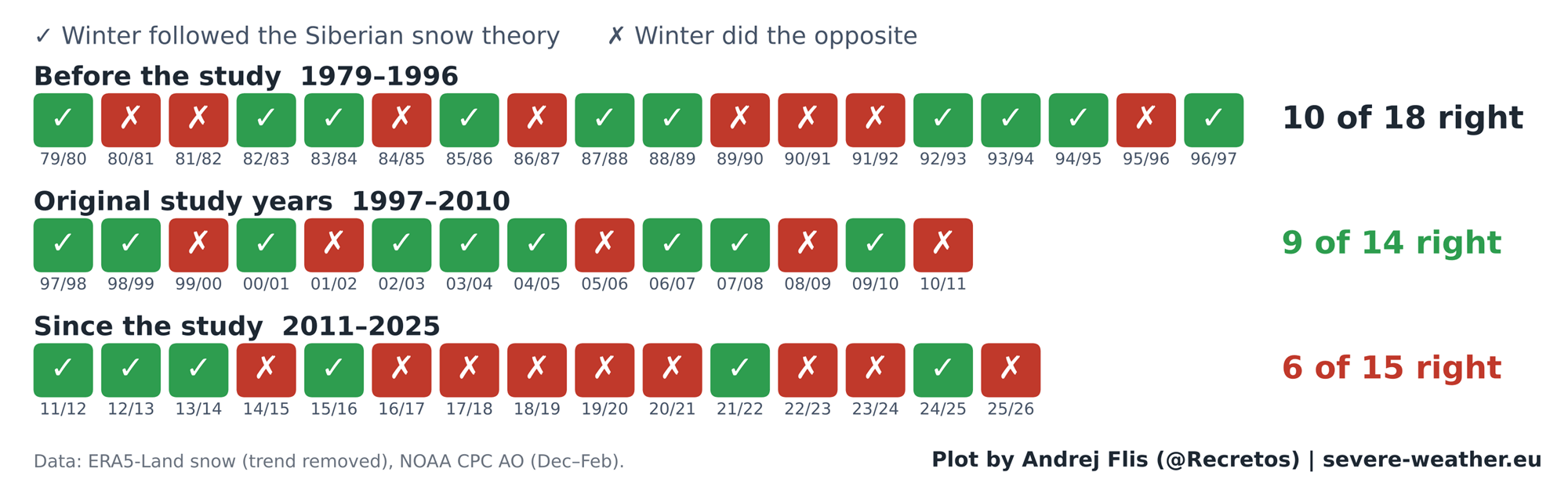
When the foundational research was published in 2011, it relied on daily satellite snow maps beginning in 1997, providing researchers with a 14-year baseline. During this window, the correlation was remarkably strong.
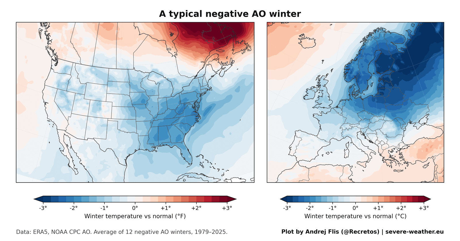
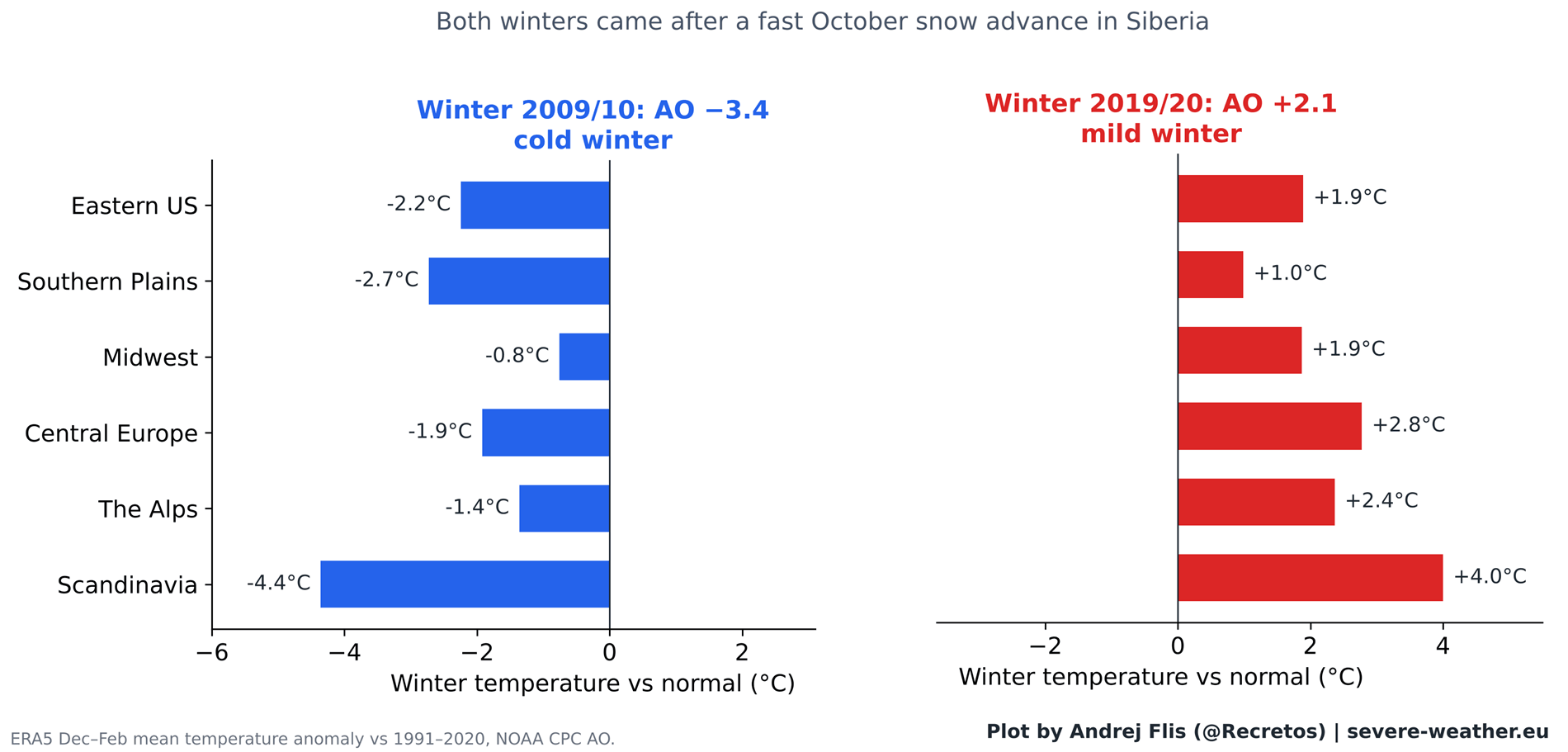
The theory received its ultimate validation during the winter of 2009/2010. Following one of the fastest October snow advances on record, that winter delivered a historically negative Arctic Oscillation (AO) index, spawning severe cold across Europe and legendary snowstorms across the Eastern United States in February 2010. This high-profile event cemented the theory in the public consciousness.
2011–Present: The Fading Signal
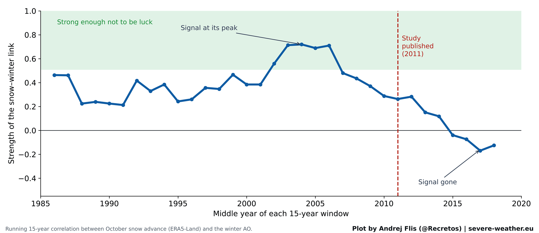
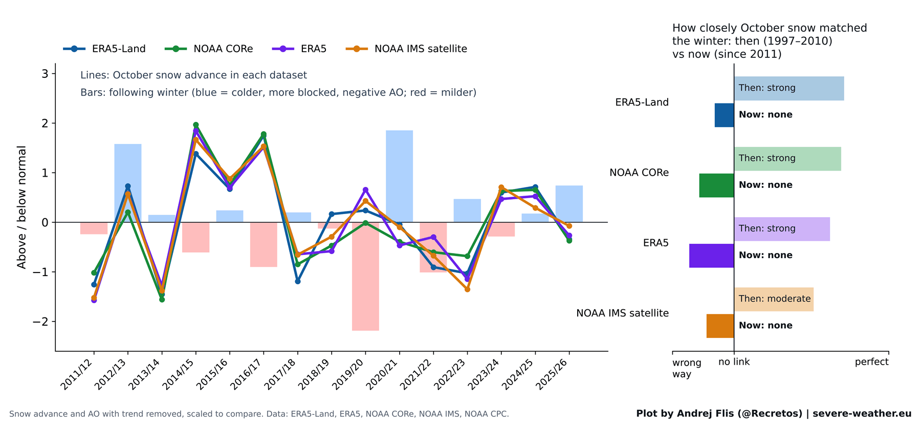
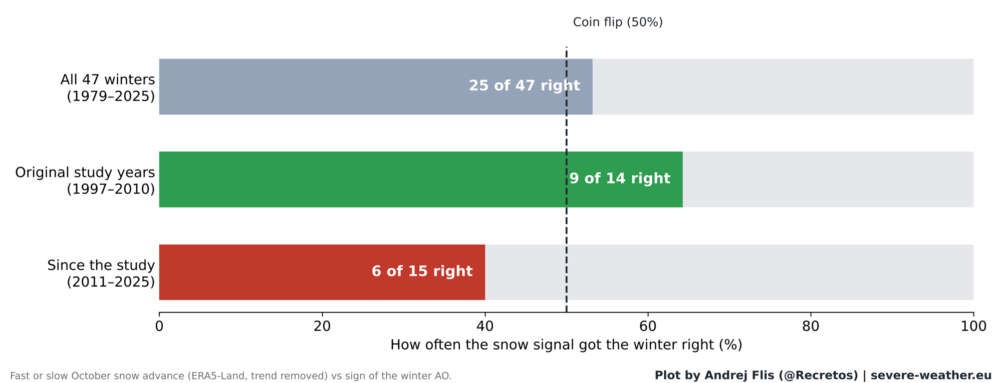
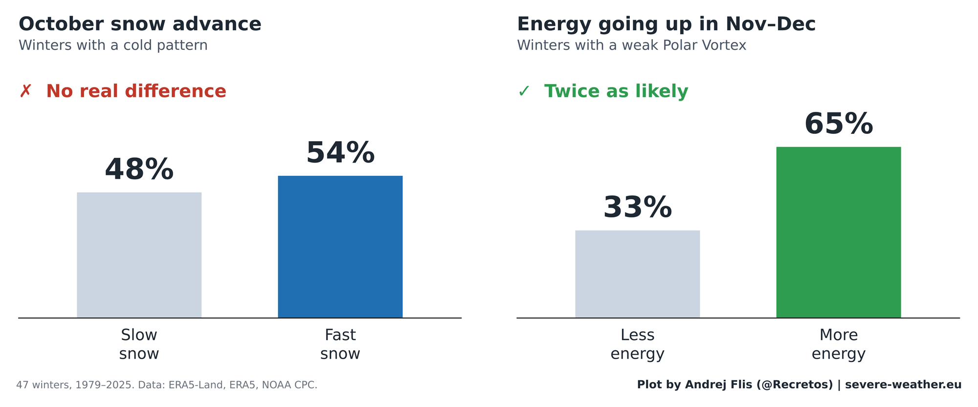
When tested against the 15 winters that have elapsed since the study’s publication, the predictive signal completely breaks down. Out of 47 total winters evaluated, the snow index successfully anticipated the winter pattern 25 times and failed 22 times—performing essentially as a coin flip.
Worse still, in the years following 2011, the signal has been accurate in only 6 out of 15 winters, falling well below random chance. Conversely, winters like 2019/2020 experienced rapid October snow advances yet resulted in remarkably mild, positive-AO conditions across Europe and North America.
Supporting Data: Dissecting Four Decades of Observations
To ensure absolute scientific rigor, the recent analysis utilized four independent snow datasets, ranging from modern weather reanalysis models to raw satellite observations.
Breaking Down the Chain Reaction
By tracing the chain reaction step-by-step, researchers found where the atmospheric linkage breaks down:
- The Upper-Level Link Remains: If anomalous energy enters the stratosphere in November and December, the Polar Vortex consistently weakens in January and February. This fundamental fluid dynamic remains robust.
- The Surface Link Fails: The missing link lies at the very beginning of the sequence. While October snow was once thought to reliably intensify the Siberian High and pump energy upward, that surface-to-stratosphere pathway has become erratic.
- Regional Breakdown: Out of 44 regional checks across North America and Europe for the post-2011 era, only a single region (Western Canada) showed even a faint long-term correlation—far too weak to be operationally useful for forecasting.
Official Responses and Changing Atmospheric Dynamics
Why has a once-reliable indicator lost its predictive power? Meteorologists and climatologists point to several structural shifts in the global climate system over recent decades:
- Arctic Amplification: Rapid sea-change losses, vanishing Arctic sea ice, and warmer global ocean baselines have fundamentally altered how the high-latitude atmosphere responds to early-season snow cover.
- The El Niño Factor: Researchers note that rapid October snow advances have historically coincided with developing El Niño phases. However, overlapping climate oscillations can mask or override regional surface signals.
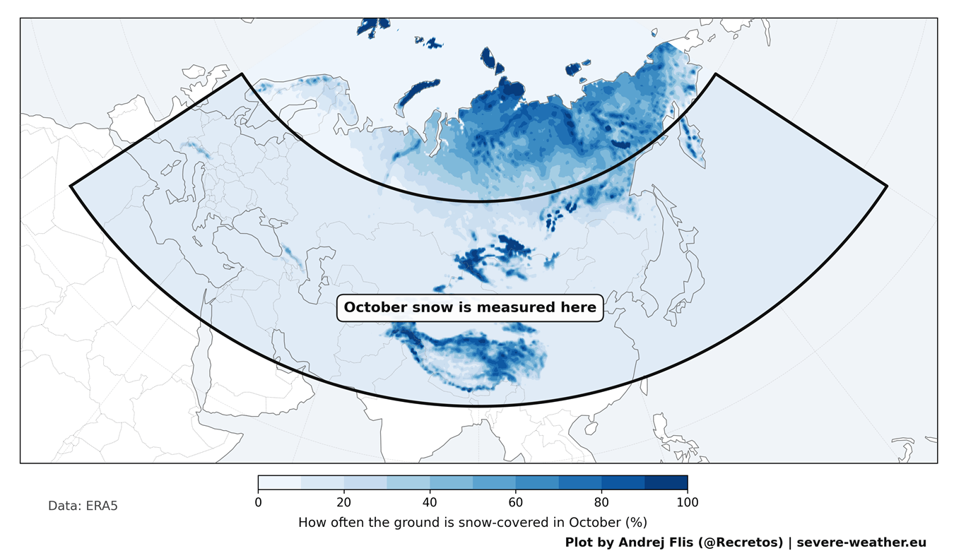
- Data Reanalysis Anomalies: Technical reviews of long-term datasets also uncovered hidden artifacts; for instance, the standard ERA5 reanalysis dataset exhibits an unexplained 40% drop in Eurasian October snow cover around 2004 due to shifts in satellite assimilation methods. While auxiliary datasets confirmed the broader conclusions, such findings underscore the complexity of multi-decadal climate tracking.
Implications for Winter 2026/2027: Enter the Super El Niño
As meteorologists look ahead to the winter season, the focus is shifting away from Siberian snow cover and toward more dominant global drivers.
The October 2026 Snow Outlook
Eurasian snow cover experienced a slow start during the first week of October. While ECMWF forecasts indicate a sharp snow surge later in the month—potentially placing it in the top 15% for early-season accumulation rates—historical analogs suggest this metric offers little clarity on its own. Past years with similar October snow surges have yielded wildly divergent winter outcomes, ranging from heavily negative to strongly positive AO profiles.
The True Driver: A Record-Breaking Super El Niño
Instead of Siberian snow, Winter 2026/2027 will be heavily dictated by an active Super El Niño currently dominating the Pacific basin.
- Stratospheric Deceleration: Modern modeling and historical studies demonstrate that strong El Niño events exert a powerful deceleration force on the stratospheric Polar Vortex during mid-to-late winter.
- Probability of Sudden Stratospheric Warming (SSW): ECMWF zonal wind forecasts indicate a pronounced slowdown of stratospheric winds heading into January 2027, with numerous ensemble members signaling a complete wind reversal—the textbook signature of a Sudden Stratospheric Warming event.
- Surface Weather Impacts: When a mid-winter vortex collapse occurs under a Super El Niño regime, historical templates and current seasonal forecasts point toward an amplified Pacific jet stream. This configuration favors persistent cooler anomalies and active storm tracks across the central, southern, and eastern United States, while northern Europe largely escapes the direct descent of polar air.
Summary
The folklore of the Siberian snow advance served weather forecasters well during the 2000s, but empirical data proves it is no longer a dependable indicator of winter severity. As we navigate Winter 2026/2027, forecasters will bypass surface snow anomalies in favor of real-time stratospheric monitoring and the powerful atmospheric teleconnections driven by the Pacific’s Super El Niño.
