

Every autumn, as the first chills of winter begin to sweep across the Northern Hemisphere, a familiar narrative dominates weather forums, meteorological blogs, and social media platforms: Is snow spreading rapidly across Siberia? For over a decade, a large segment of the weather enthusiast community—and even some long-range forecasters—has operated under the assumption that an early, fast-paced October snow advance across Eurasia serves as a reliable harbinger of a harsh, snowy winter across the United States, Canada, and Europe.
This widespread theory traces its roots to a seminal 2011 scientific study. However, with another rapid snow surge forecast for October, meteorologists have begun questioning whether this paradigm still holds true in the modern era. By analyzing 47 winters of data spanning from 1979 to 2025 across four distinct snow datasets—including the precise satellite metrics utilized in the original research—experts have uncovered surprising results that fundamentally challenge how we interpret October snow cover.
Main Facts: Deconstructing the Eurasian Snow Advance Theory
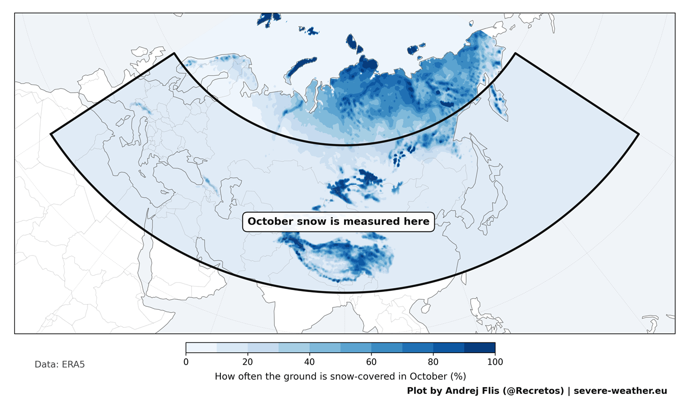
The premise that a snowy October dictates mid-latitude winter weather rests on a fascinating geophysical chain reaction. In 2011, researchers Judah Cohen and Justin Jones identified a statistical link between the rate of Eurasian snow cover expansion during October and the subsequent behavior of the winter atmosphere, specifically tracked via the Arctic Oscillation (AO).
The Physical Mechanism
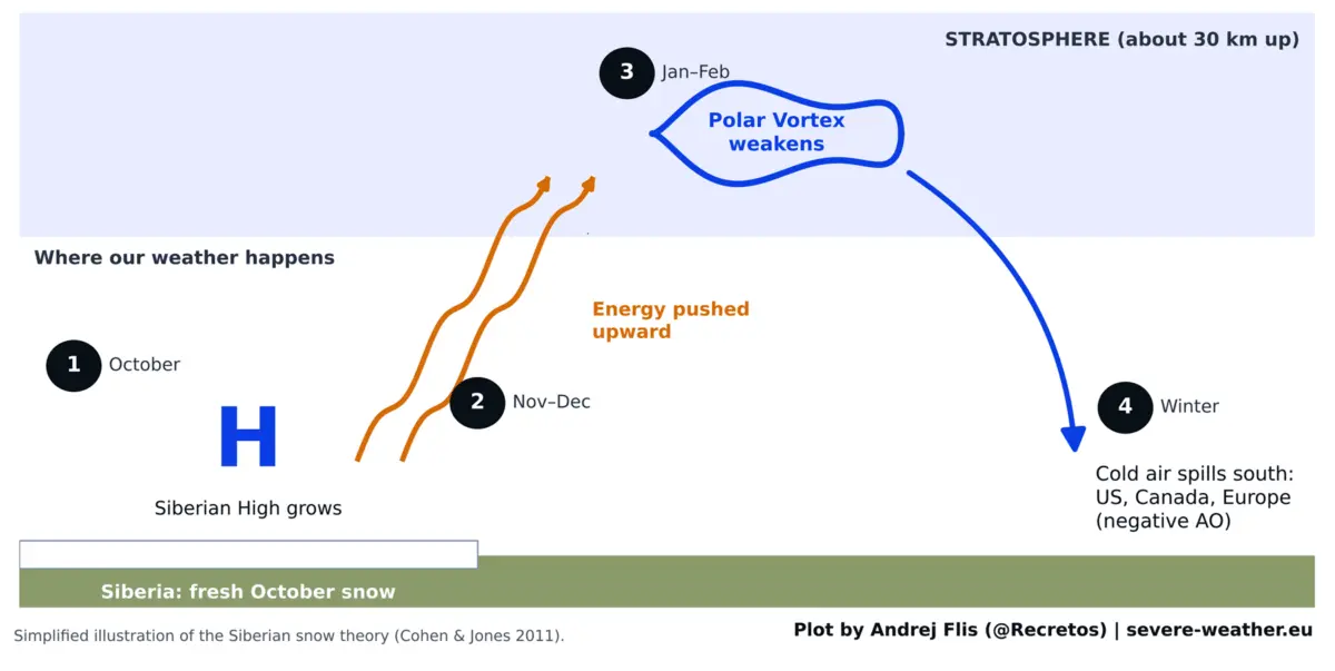
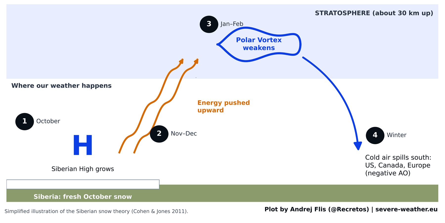
In theory, the chain reaction operates through several distinct steps:
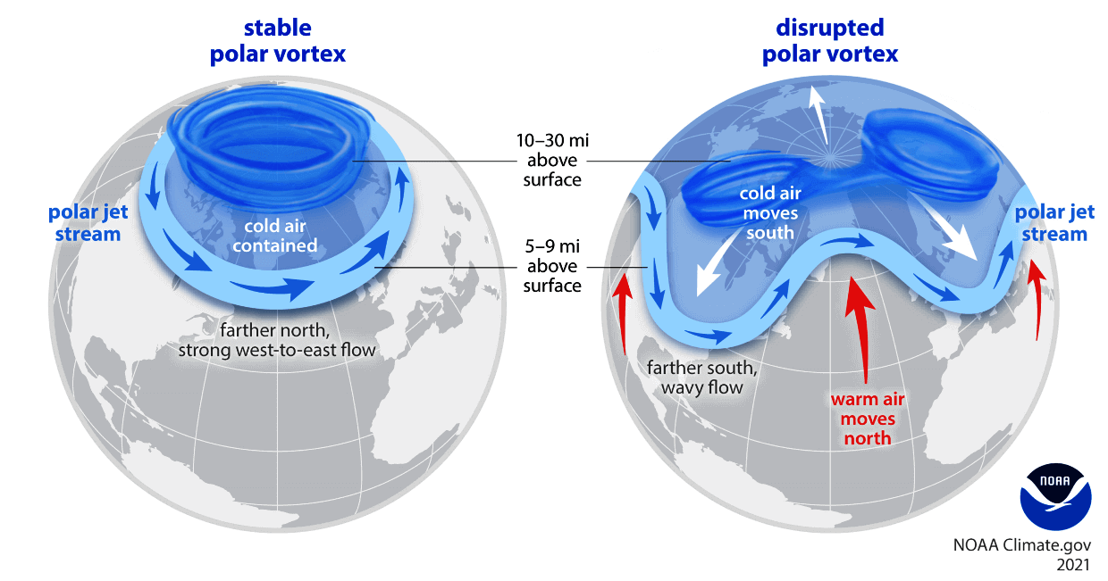
- Surface Cooling: Fresh, extensive snow cover rapidly cools the overlying ground and enhances the development of the Siberian High—a formidable area of cold, dense pressure over northern Asia.
- Stratospheric Ascent: This intense high-pressure anomaly pumps excess wave energy upward into the stratosphere, roughly 30 kilometers (18.5 miles) above the Earth’s surface.
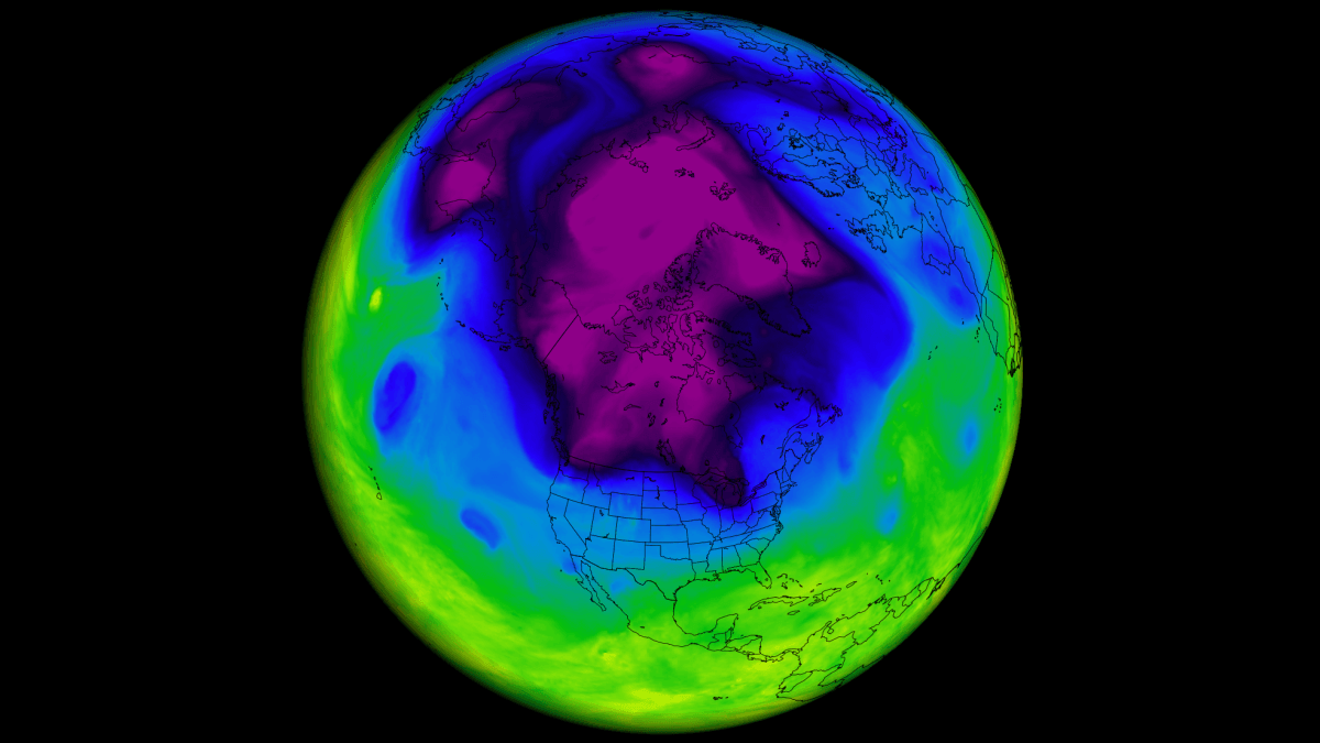
- Polar Vortex Disruption: The influx of energy destabilizes and weakens the Polar Vortex—the massive ring of westerly winds that normally locks the coldest Arctic air tightly over the North Pole.
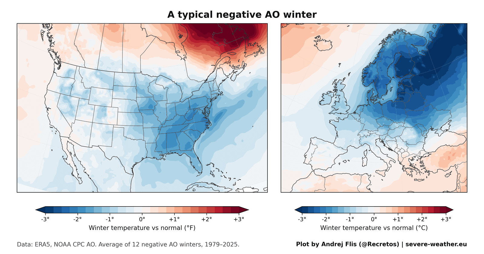
- The Negative Arctic Oscillation (AO): When the vortex stretches, wobbles, or collapses, lobes of frigid Arctic air break away and spill southward into the mid-latitudes, resulting in a negative AO index that favors heavy snow and severe cold outbreaks in North America and Europe.
Despite this elegant physical logic, a rigorous re-examination of nearly half a century of data reveals that the predictability once attributed to October Siberian snow has significantly deteriorated.
Chronology and Evolution: From a Breakthrough Discovery to a Fading Signal
To understand how the Eurasian snow theory gained such immense traction, it is helpful to examine its historical timeline and subsequent performance data.
1997–2010: The Golden Era of the Theory
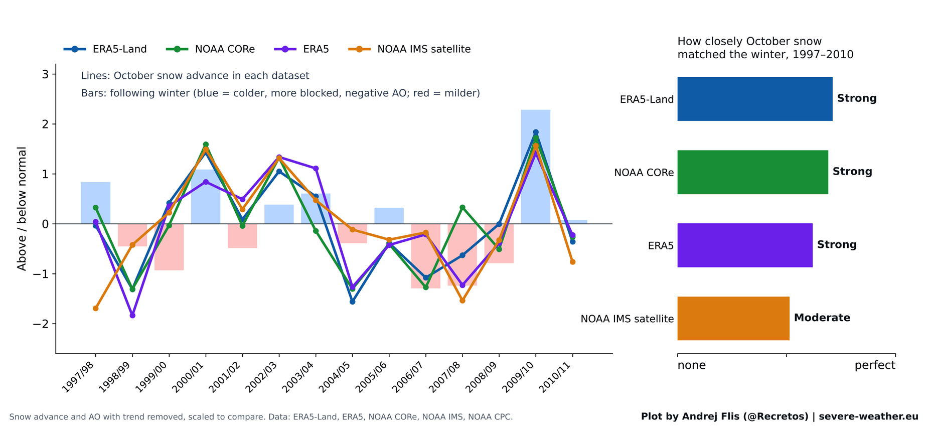
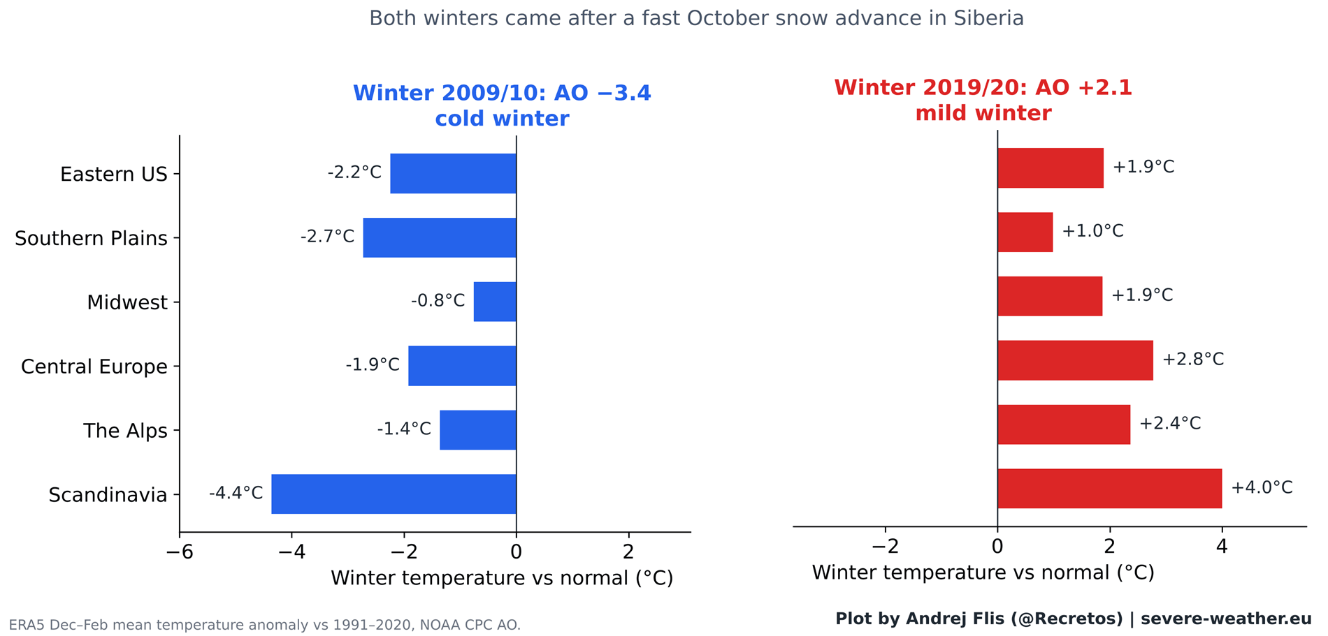
When Cohen and Jones published their findings in 2011, daily satellite snow mapping was a relatively young science, meaning their baseline was restricted to the 14 winters between 1997 and 2010. During this specific window, the correlation was remarkably robust. The index successfully anticipated several notable winter patterns, most famously the historic winter of 2009/2010, which featured a deeply negative AO, crippling blizzards in the Eastern United States, and brutal cold across northern Europe. This single, highly publicized winter acted as a powerful anchor for the theory, making the snow-advance signal look virtually infallible.
Post-2011: The Breakdown of the Signal
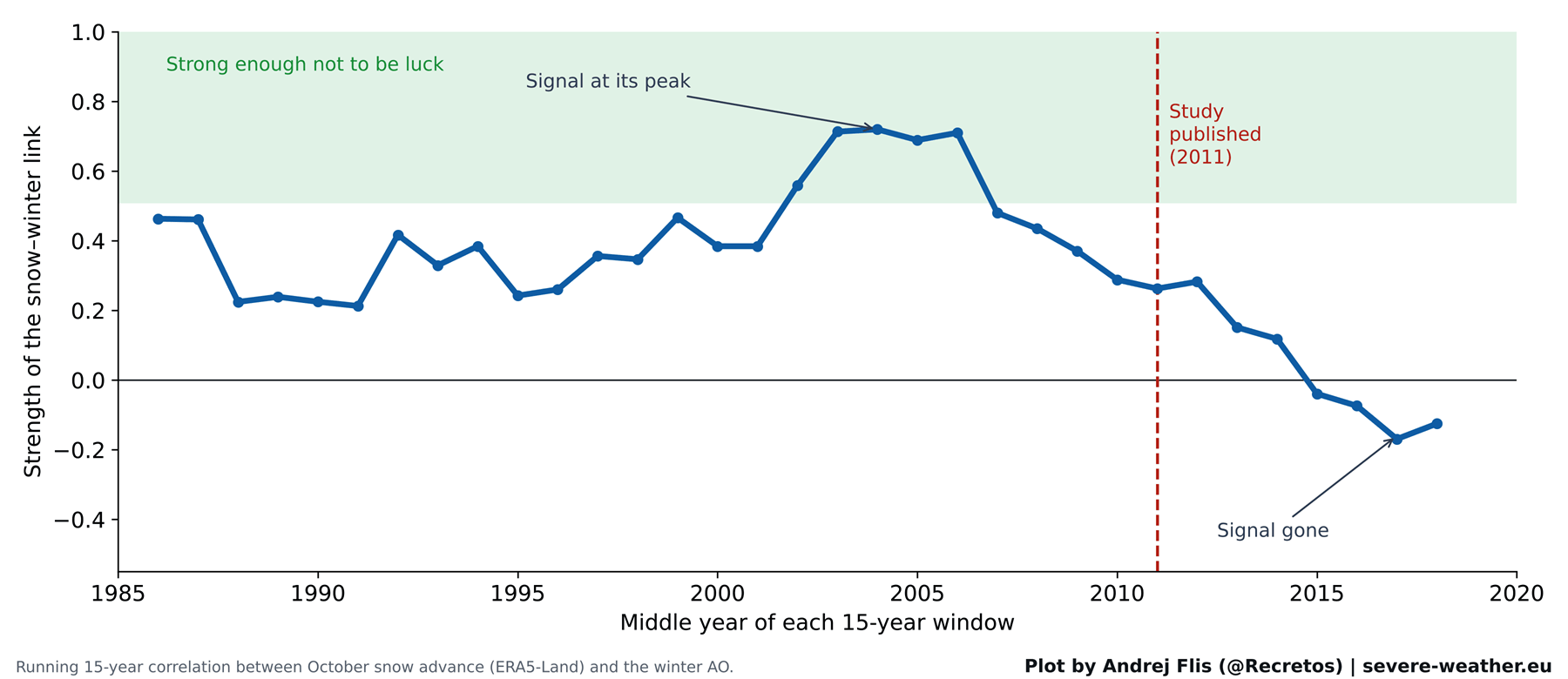
When tested against the 15 winters that have elapsed since the study’s publication, however, the predictive power vanishes. Across all four independent snow datasets, the correlation between October snow and the subsequent winter AO has essentially flatlined.
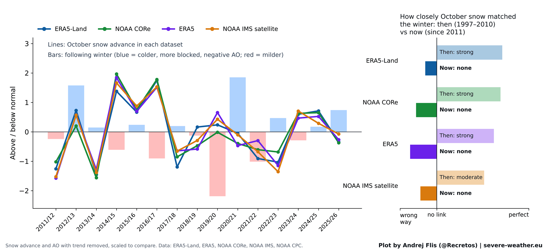
When looking at the entire 47-year dataset (1979–2025):
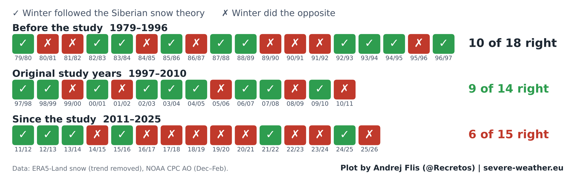
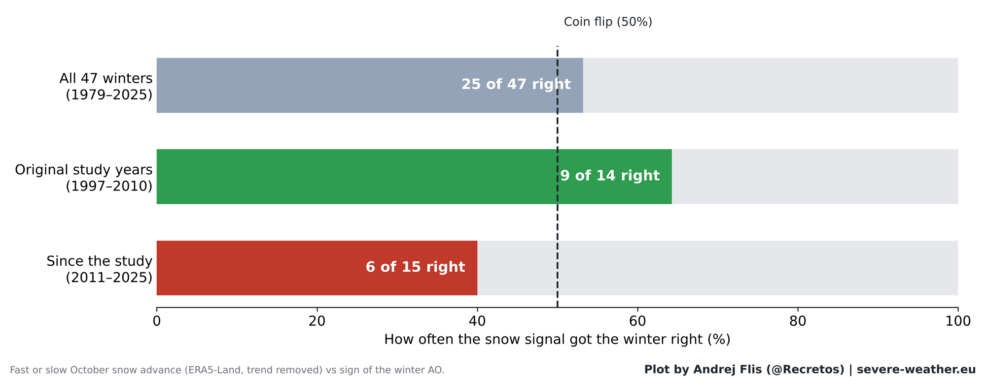
- Overall Score: The snow signal correctly predicted the winter outcome 25 times and failed 22 times—rendering it statistically indistinguishable from a random coin flip.
- Modern Era Score: In the 15 winters since 2011, the signal has been correct only 6 times, performing worse than random chance.
A prime example of this decoupling occurred during the 2019/2020 winter season. Despite a rapid and expansive October snow advance across Siberia, the subsequent winter featured one of the strongest positive AO phases on record. It resulted in exceptionally mild, snow-starved conditions across most of Europe and large parts of the United States, diametrically opposed to what the traditional theory predicted.
Supporting Data: What the Comprehensive 47-Year Analysis Reveals
To ensure absolute scientific rigor, researchers cross-verified observations using four separate data streams: NOAA IMS satellite snow data, NOAA CORe datasets, ERA5 reanalysis, and ERA5-Land parameters.
Step-by-Step Chain Verification
When breaking down the atmospheric chain reaction step-by-step, data shows that the upper-level link still functions perfectly: if excess energy successfully propagates into the stratosphere during November and December, the Polar Vortex will weaken in January and February, and surface weather anomalies will follow.
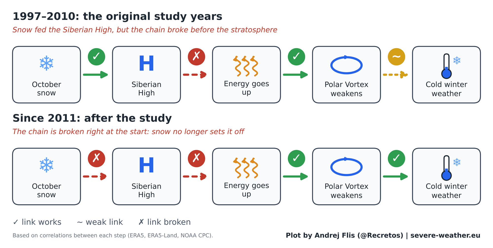
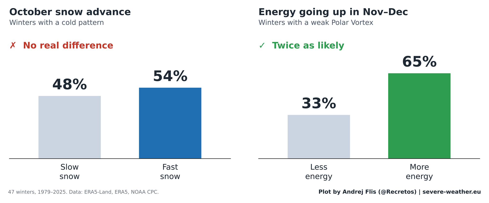
The breakdown occurs at the very beginning of the chain. While October snow was once thought to reliably trigger the Siberian High and send that crucial pulse of energy upward, that surface-to-stratosphere linkage has broken down in recent decades. Modern analyses indicate that rapid October snow advance changes the statistical odds of a cold mid-latitude winter by virtually zero percent, whereas actual November-December stratospheric wave activity still doubles the odds of a disrupted vortex.
Regional Impacts across North America and Europe
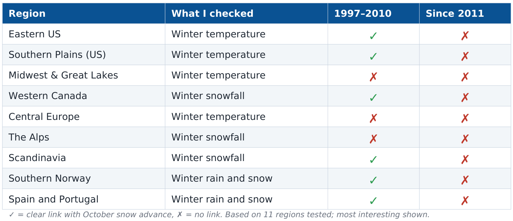
The deterioration of the signal is equally visible on a regional level. During the 1997–2010 baseline study period, fast snow advances showed clear statistical alignment with colder winters in the eastern United States and distinct precipitation patterns in Europe. However, out of 44 regional checks conducted for the years following 2011, only a single weak correlation lingered in Western Canada—far too fragile to be utilized for operational forecasting.
Official Responses and Perspectives from the Meteorological Community
Atmospheric scientists and long-range forecasters have increasingly urged caution when relying on single-parameter autumn indicators like Siberian snow cover. While acknowledging the brilliance of the 2011 study, contemporary meteorologists point to several macro-scale environmental changes that may have disrupted the old teleconnection:
- Arctic Amplification and Sea Ice Loss: The rapid decline of Arctic sea ice and warming ocean temperatures over the past two decades have fundamentally altered surface-atmosphere dynamics. The baseline state of the Arctic is vastly different today than it was in the late 1990s and 2000s.
- The El Niño Factor: Researchers have noted that rapid October snow advances historically tend to occur slightly more frequently during developing El Niño years, suggesting that Pacific Ocean teleconnections may have historically convoluted or enhanced the perceived snow signal.
- Data Artifacts in Reanalysis: In-depth technical audits of weather reanalysis models also uncovered a notable technical quirk: in the standard ERA5 dataset, Eurasian October snow cover drops by roughly 40% abruptly in 2004 due to changes in satellite data ingestion. While independent datasets confirmed that the overarching climate conclusions remain valid, it highlights the historical complexities of tracking high-latitude snow cover accurately.
Implications for Winter 2026/2027: The Super El Niño Takes Center Stage
As the meteorological community evaluates the impending winter season, attention has shifted away from Siberian snow and onto more dominant climatic drivers.
The October 2026 Snow Outlook
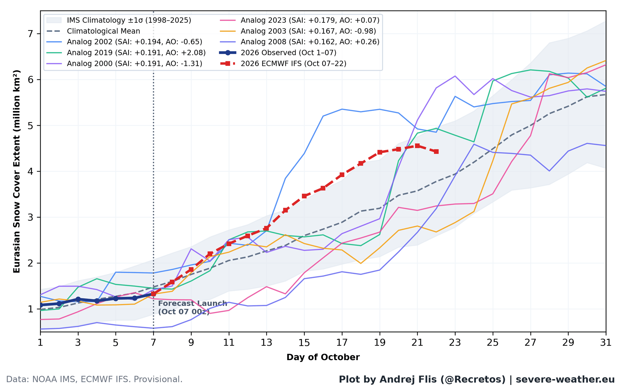
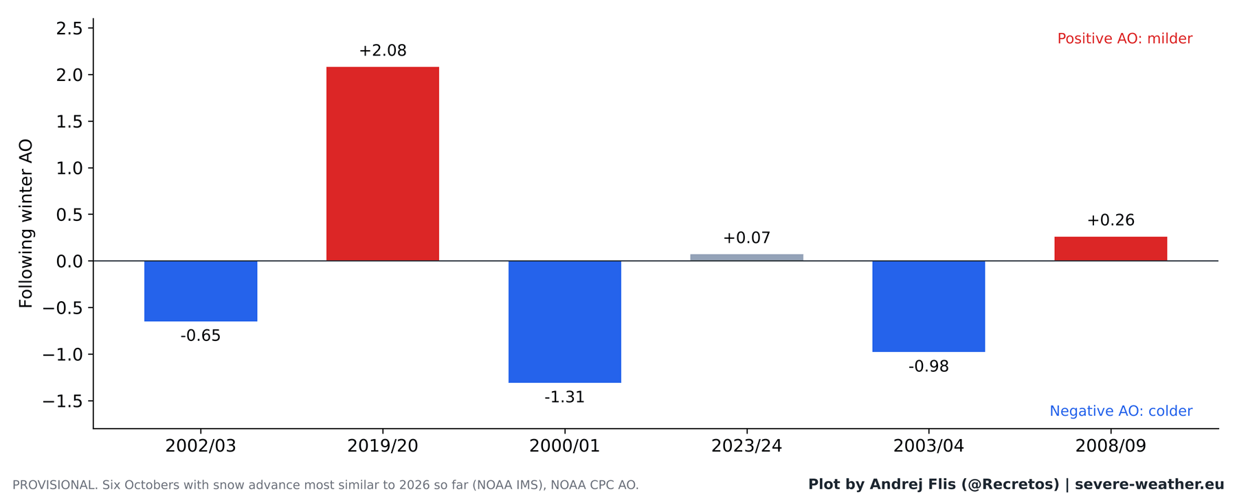
Current satellite observations and ECMWF ensemble forecasts for October indicate a somewhat slow start to the month, followed by a projected surge of snow cover across Eurasia over the final two weeks. If this forecast verifies, it will place October 2026 within the top 15% of fastest snow advances over the past three decades. Historically, similar Octobers have preceded a mixed bag of winter outcomes (three negative AO winters, one neutral, and two positive). Therefore, on its own, this impending snow surge offers no reliable guarantee of a harsh winter.
The Real Driver: A Record-Breaking Super El Niño
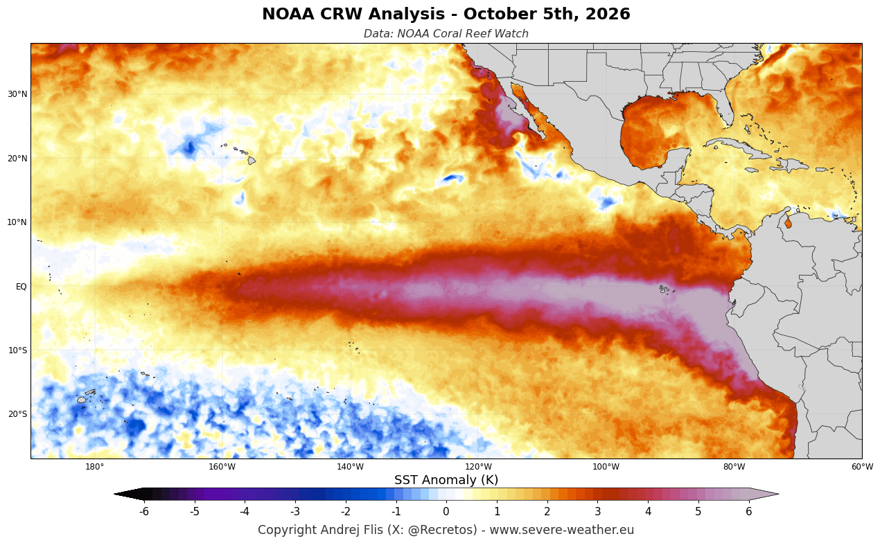
Instead of looking to Siberia, long-range forecasters are focusing heavily on the active Super El Niño currently dominating the Pacific basin. Comprehensive ocean temperature analyses reveal profound positive thermal anomalies in the tropical Pacific, which are poised to exert a dominant control over the Northern Hemisphere jet stream and storm tracks for Winter 2026/2027.
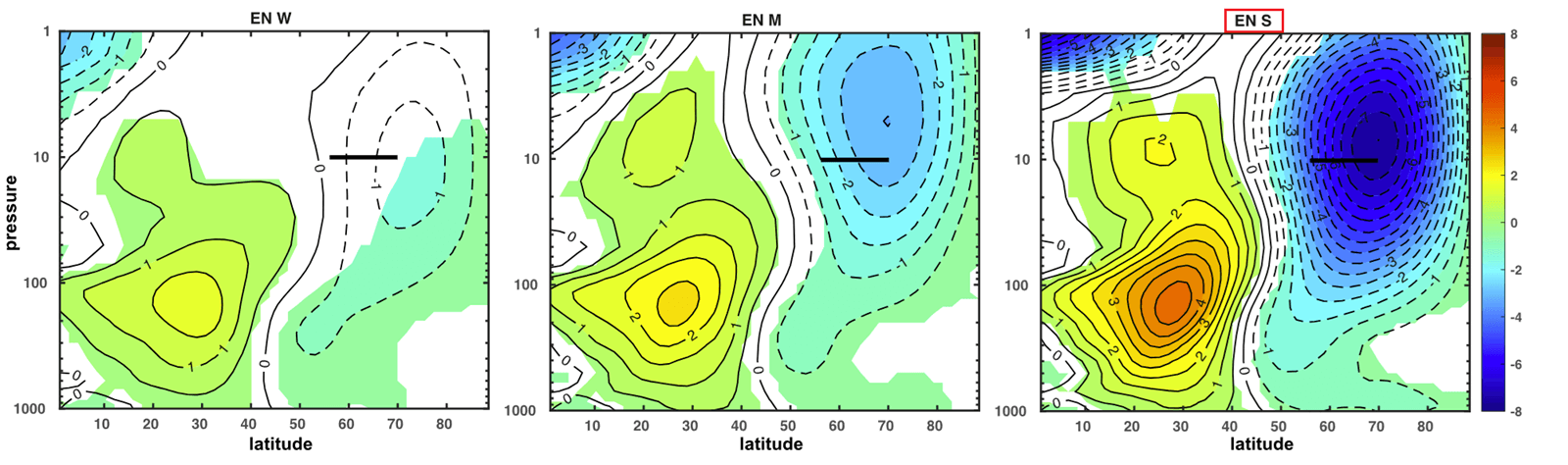
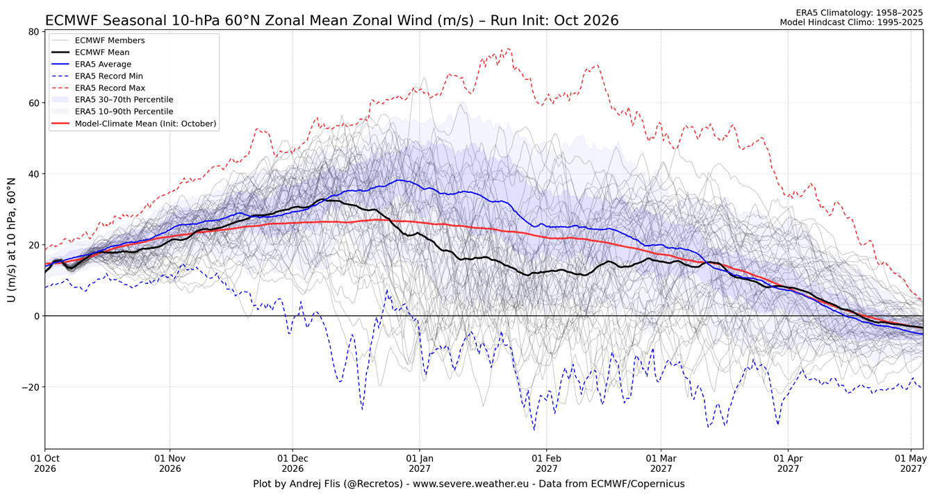
Furthermore, model simulations and ECMWF seasonal forecasts tracking stratospheric zonal winds at the 10mb level indicate a pronounced deceleration of the Polar Vortex heading into January 2027. This points toward an elevated risk of a Sudden Stratospheric Warming (SSW) event or a major vortex collapse during mid-to-late winter.
What This Means for Regional Weather
- United States: If the anticipated stratospheric deceleration materializes, historical analogues and current ECMWF temperature projections suggest a classic Super El Niño response pattern. Persistent cloud cover and an amplified southern jet stream are expected to maintain cooler-than-average anomalies across the central, southern, and eastern United States, while northern regions trend milder.
- Europe: Current medium-to-late winter forecasts for Europe lean toward a predominantly mild Atlantic flow into the continent, with substantive cold air anomalies largely restricted to far northern Scandinavia. Unlike North America, Europe does not currently display the classic surface temperature response to the projected weak Polar Vortex state.
Ultimately, while the Siberian snow theory captured the imagination of weather enthusiasts worldwide and provided a valuable stepping stone in stratospheric research, modern data proves it is no longer a dependable forecasting tool. For Winter 2026/2027, forecasters will continue to monitor the skies—not for the snow falling across the Siberian lowlands, but for the energy propagating upward into the stratosphere and the massive oceanic footprint of the Super El Niño below.
