

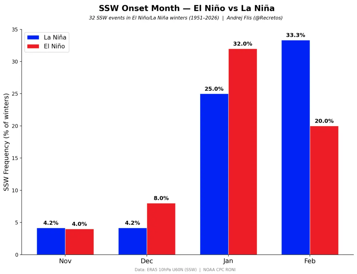
As meteorologists and long-range forecasters cast their eyes toward the horizon for the upcoming Winter 2026/2027, early atmospheric and oceanic indicators suggest a highly dynamic and potentially volatile season for the United States, Canada, and Europe. Long-range stratigraphic data emerging in late 2026 points to a pronounced weakening signal in the stratosphere as early as January.
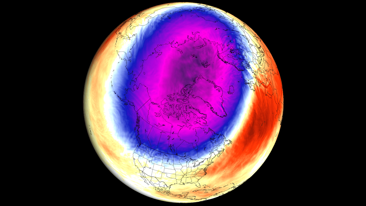
While a disrupted Polar Vortex does not guarantee widespread, persistent cold and snow for every region in the mid-latitudes, it drastically increases the statistical probability of severe Arctic air breakouts. Driven by a rare convergence of global climate anomalies—namely a surging Super El Niño, tropical stratospheric wind shifts, and diminished Arctic sea ice—scientists are closely monitoring what could be a high-impact winter season.
Main Facts
- Stratospheric Disruption Signals: Long-range ensemble models indicate a notable stratospheric weakening trend slated for January 2027, raising the likelihood of a displaced or disrupted Polar Vortex.
- The Super El Niño Factor: A rapidly developing warm-phase ENSO event in the equatorial Pacific is projected to peak well above the threshold, acting as a primary atmospheric wave driver.
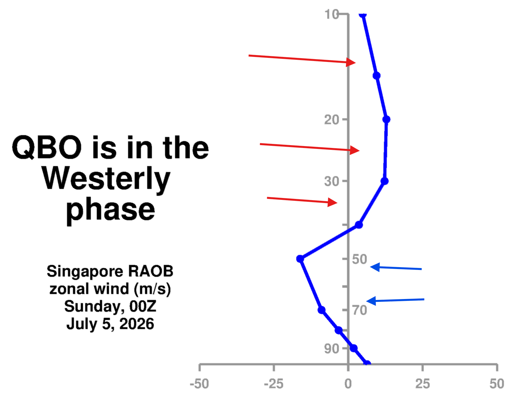
- QBO and Wind Patterns: The Quasi-Biennial Oscillation (QBO) is currently in a westerly phase, creating a complex interplay with El Niño that favors mid-to-late-winter disruptions.
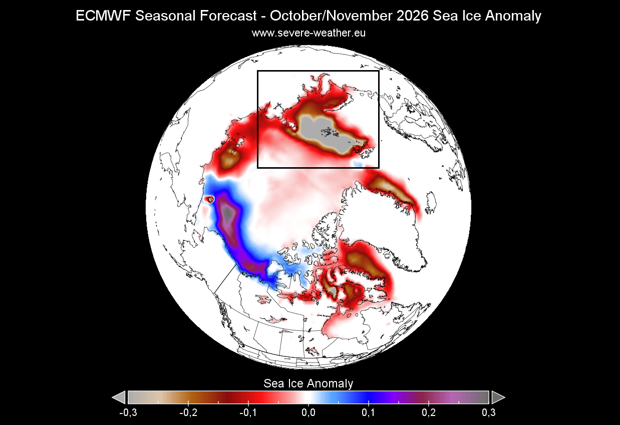
- Arctic Sea Ice Deficits: Pronounced ice loss in key sectors, particularly the Barents-Kara Sea, is aligning to weaken the upper-level atmospheric barrier, allowing thermal energy to leak into the stratosphere.
- Geographic Impacts: If a major Sudden Stratospheric Warming (SSW) or polar collapse occurs, historical analogues point toward increased risks of severe cold outbreaks and heightened snowfall anomalies across parts of North America and Europe.
Chronology of Developing Indicators
The path toward a winter forecast begins months in advance, tracking the slow-moving ocean and atmospheric cycles that dictate global weather patterns.
Summer to Early Fall 2026: Oceanic and Ice Baselines Established
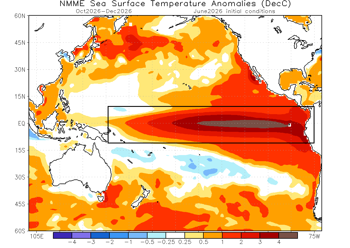
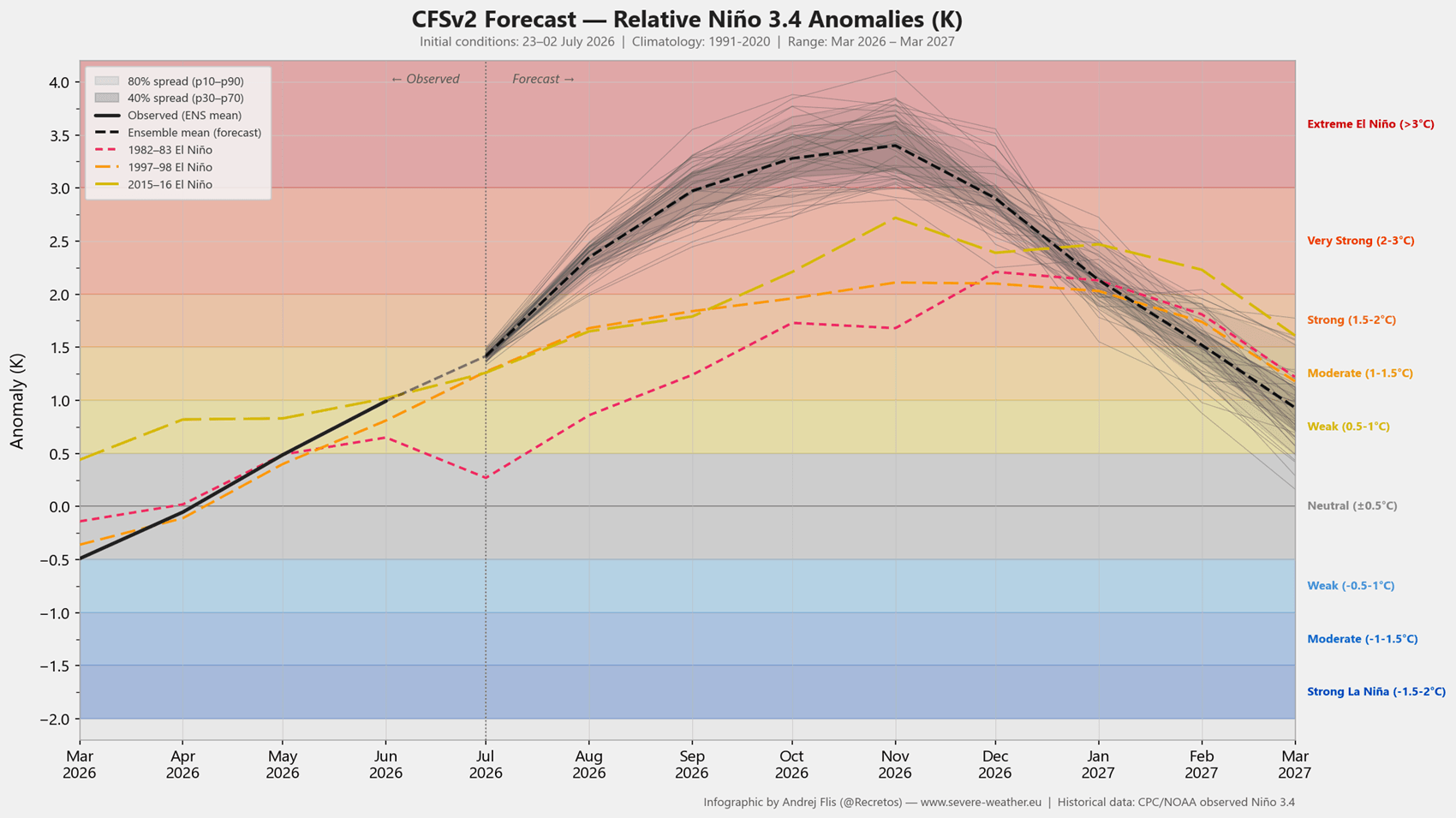
By mid-2026, climate models from the National Multi-Model Ensemble (NMME) and the NCEP CFSv2 began highlighting an aggressive warming trend in the equatorial Pacific Ocean. Sea surface temperature anomalies in the ENSO regions crossed the threshold required to classify the emerging event as a Super El Niño, with peak seasonal anomalies forecast to reach over 4 degrees Celsius above normal. Simultaneously, high-latitude monitoring revealed a severe summer and early fall melt season across the Arctic, setting up critical sea-ice deficits in the Barents and Kara seas.
August 2026: Early Stratospheric Anomalies Identified
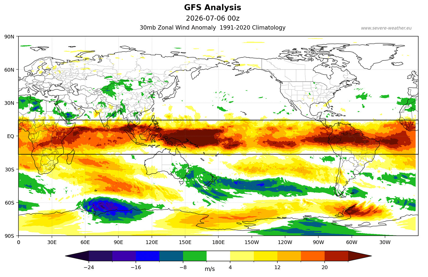
By August 6, 2026, long-range meteorologists formally highlighted the compounding effect of these oceanic anomalies on the winter stratosphere. Observational data from NASA radiosondes and global forecasting systems confirmed that the tropical stratospheric winds (QBO) had locked into an active westerly phase, while long-range numerical weather prediction models began hinting at anomalous wave energy propagation toward the North Pole.
Late Fall 2026: The Convergence of Global Drivers
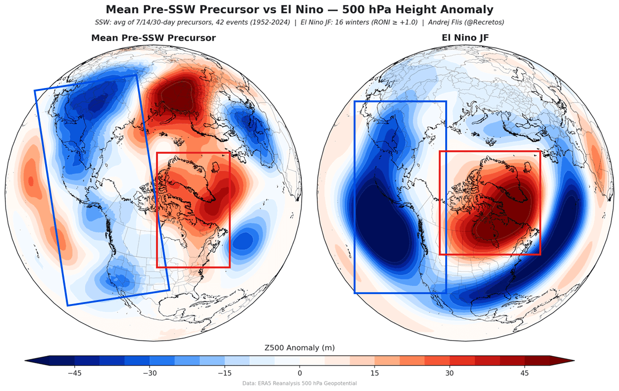
As autumn transitions into winter, the atmospheric stage is set. Planetary pressure waves generated by the Super El Niño—characterized by low-pressure anomalies over the North Pacific and Aleutians coupled with high-pressure ridging over Greenland and northern Canada—begin sending massive pulses of wave energy upward into the stratosphere.
January to February 2027 (Forecasted): Potential Polar Vortex Disruption
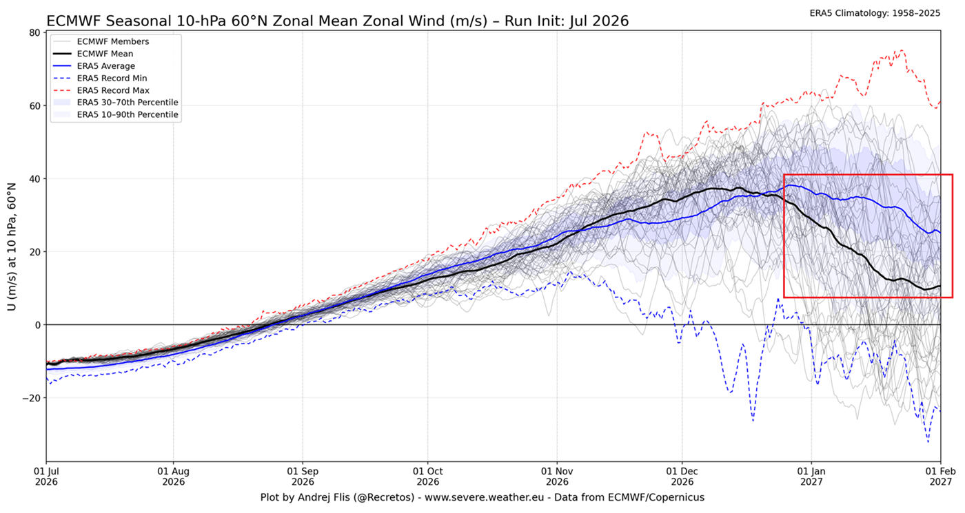
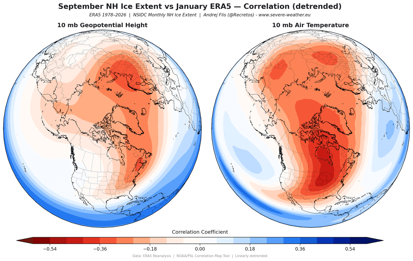
According to recent ECMWF seasonal ensemble forecasts released in late 2026, the zonal wind speeds at the 10mb stratospheric level (roughly 30km or 18.5 miles high) are projected to plunge far below long-term climatic averages. This stark drop indicates a high probability of a January Polar Vortex disruption, setting the stage for potential mid-to-late winter weather extremes across the Northern Hemisphere.
Supporting Data and Meteorological Mechanics
To understand why forecasters are raising flags for Winter 2026/2027, one must examine the intricate mechanics linking the Earth’s surface to the stratosphere.
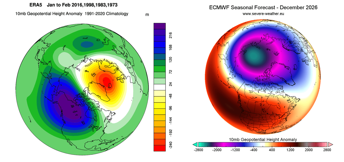
The Anatomy of the Polar Vortex
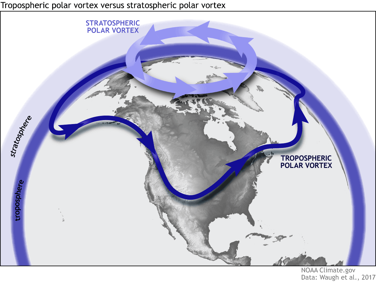
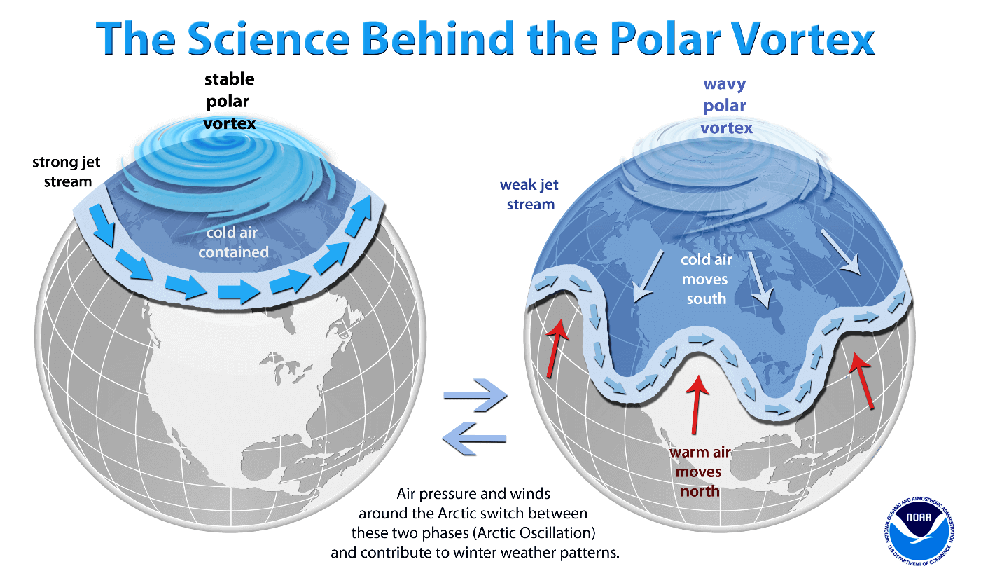
The Polar Vortex is a massive, spinning blanket of cold air situated high above the polar regions, spanning from the troposphere into the stratosphere. A stable Polar Vortex acts as an atmospheric containment wall, locking frigid Arctic air safely at the pole and maintaining relatively mild conditions across the mid-latitudes of the United States and Europe.
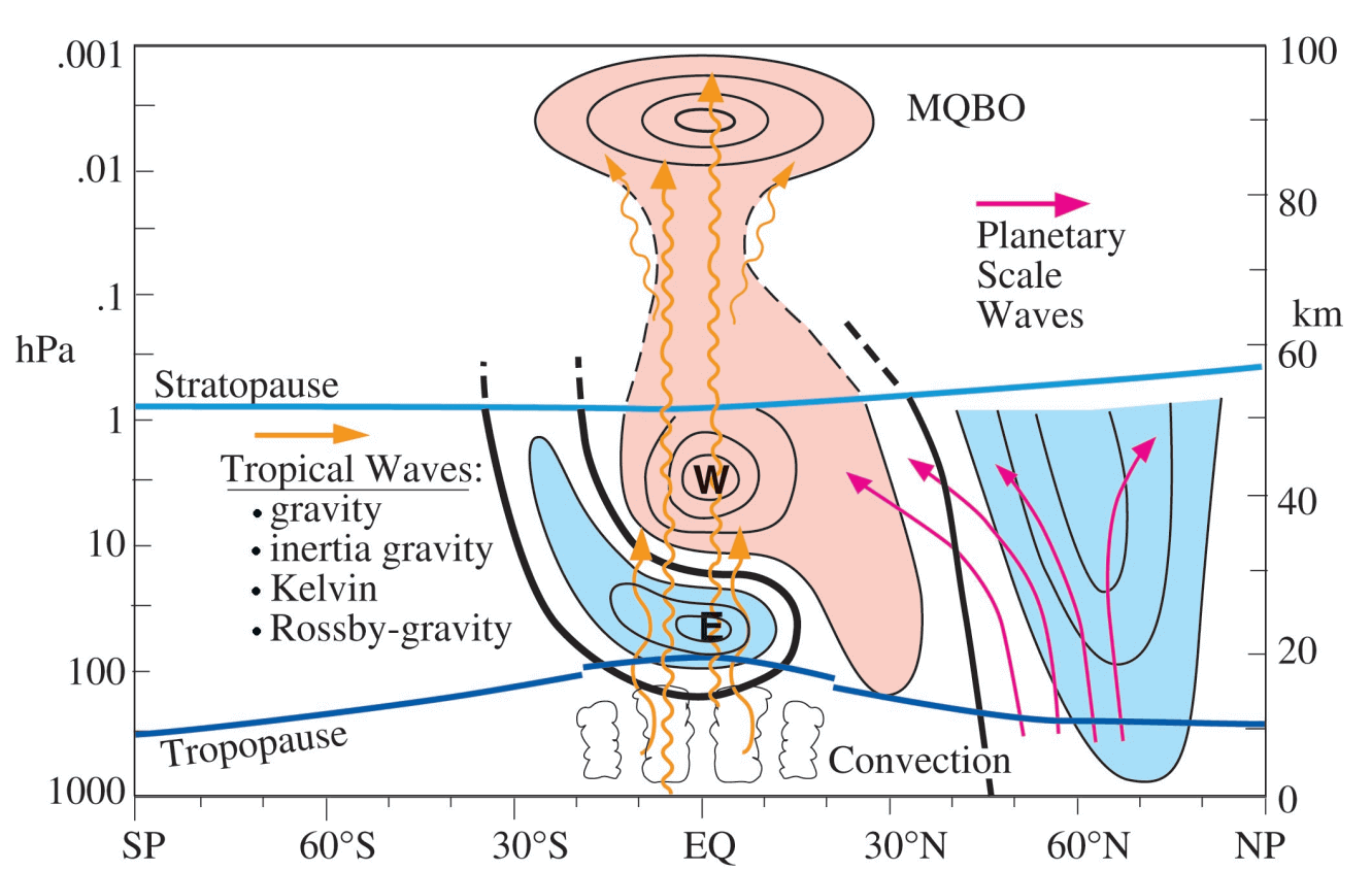
However, when planetary Rossby waves—large-scale atmospheric undulations—inject immense amounts of energy into the stratosphere, they can decelerate, displace, or even split the Polar Vortex. This phenomenon is frequently associated with a Sudden Stratospheric Warming (SSW) event, where temperatures in the stratosphere spike by tens of degrees in a matter of days.
The Super El Niño Influence
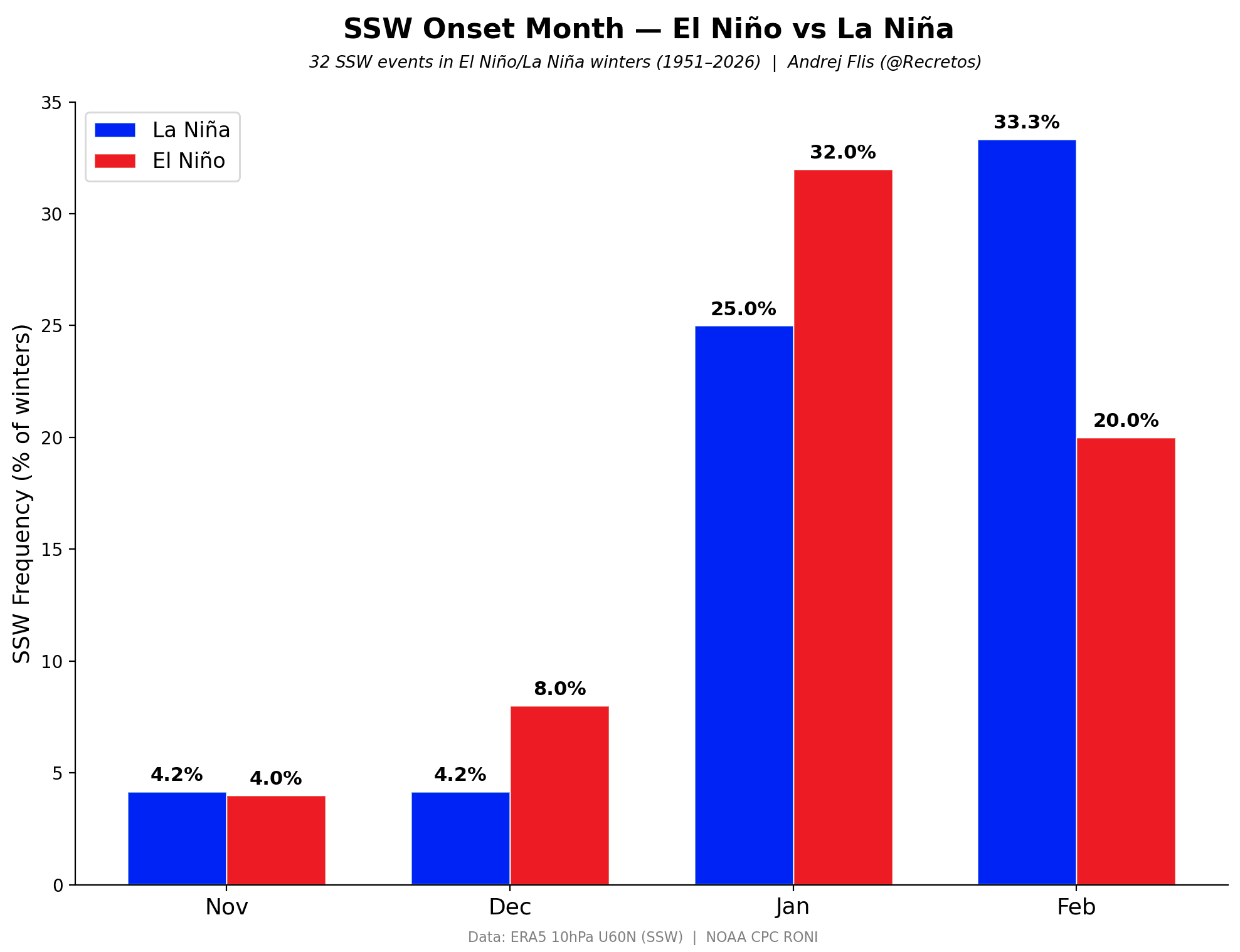
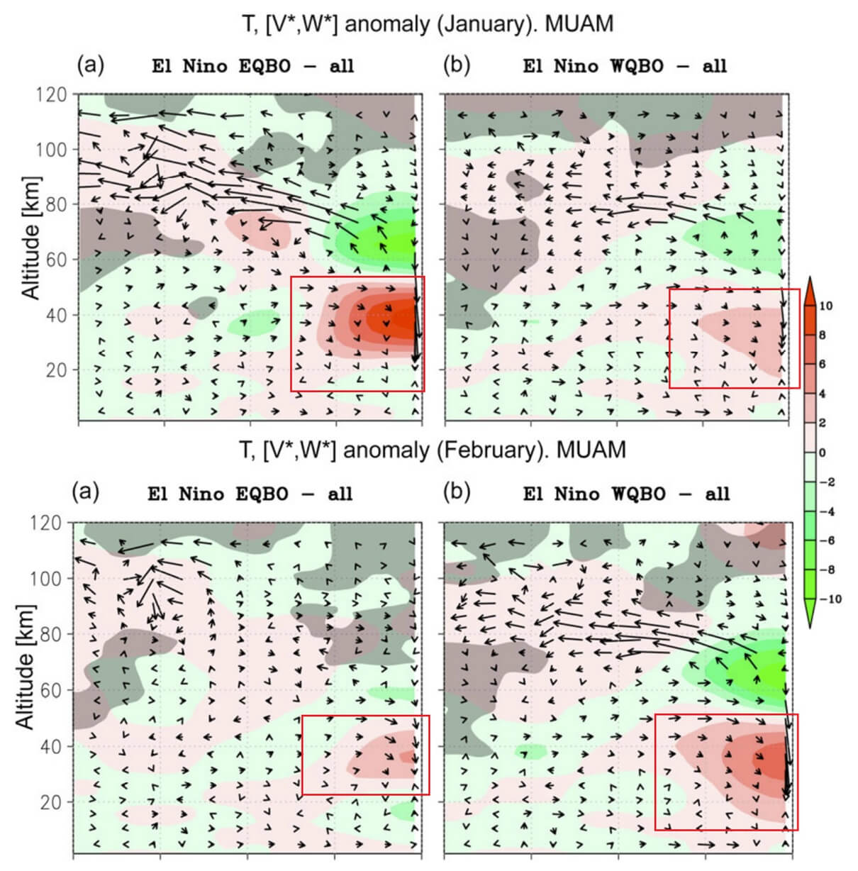
Historically, El Niño events have a statistically higher correlation with mid-winter Polar Vortex disruptions compared to La Niña phases. A Super El Niño amplifies the planetary wave pattern:
- Wave Generation: Warm waters in the Pacific create deep convective anomalies.
- Energy Propagation: These anomalies alter tropospheric pressure fields, sending upward energy waves toward the pole.
- Vortex Displacement: The influx of energy destabilizes the stratospheric vortex, causing it to elongate, stretch, or split, thereby opening the door for southward Arctic air spills.
Tropical Winds (QBO) and Stratospheric Dynamics
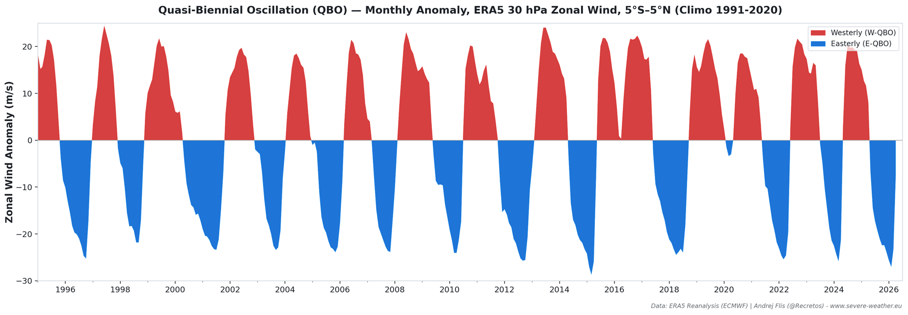
The Quasi-Biennial Oscillation (QBO) acts as the heartbeat of the tropical stratosphere, cycling between easterly and westerly wind regimes roughly every 17 months. Currently, the atmosphere is exhibiting an active west QBO phase. While a west QBO typically provides a degree of stabilization to the Polar Vortex early in the season, its interaction with an aggressive Super El Niño creates a complex dynamic. Research indicates that while the vortex may initially resist disruption, the overwhelming wave forcing from a Super El Niño can ultimately overcome this stability, priming the system for a dramatic weakening phase by January or February.
Arctic Sea Ice Feedbacks
Not all regions of the Arctic impact the stratosphere equally. Recent cryospheric studies emphasize a critical dichotomy:
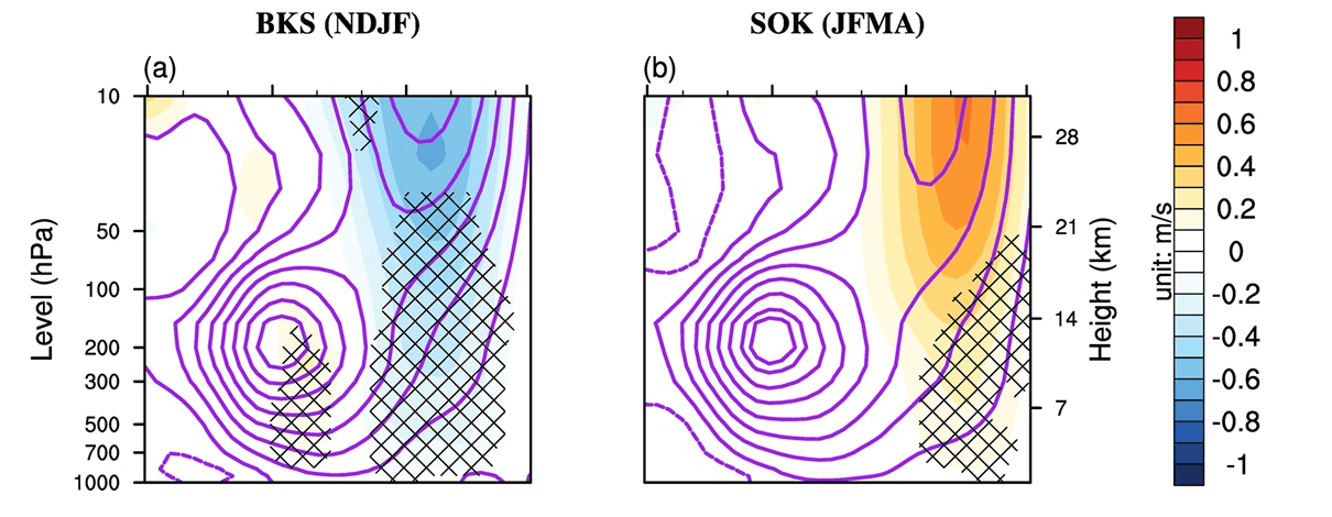
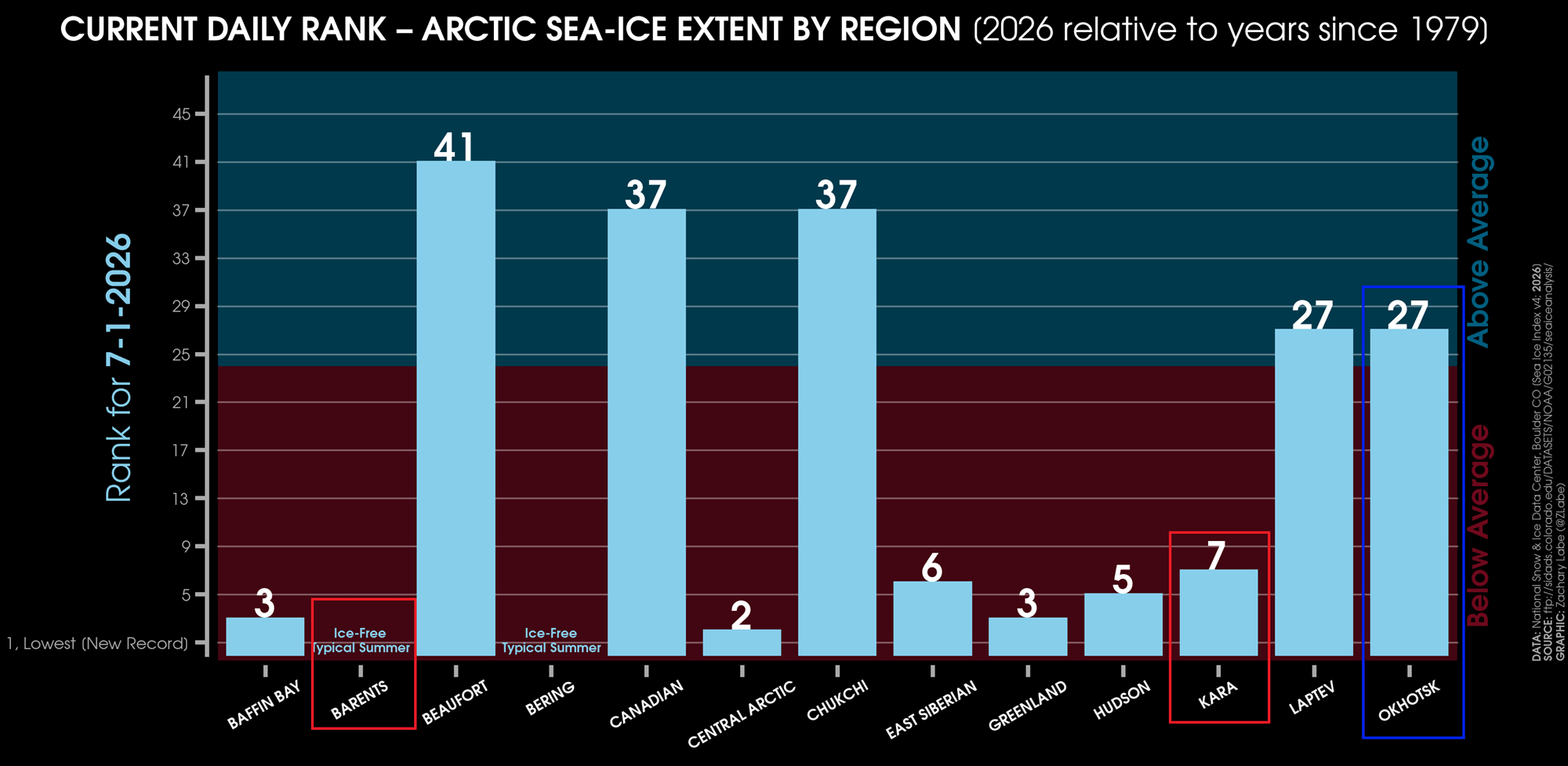
- Barents-Kara Sea (BKS): Low ice extent in this sector reduces surface friction and enhances turbulent heat fluxes, promoting upward wave energy that weakens the Polar Vortex.
- Sea of Okhotsk (SOK): Conversely, ice conditions here can influence wave propagation differently, often supporting a stronger vortex.
For Winter 2026/2027, observational data compiled by researchers such as Dr. Zachary Labe shows ice-free conditions in the Barents and Kara seas alongside above-normal sea-ice extent in the Okhotsk region. This specific geographic configuration acts as a textbook accelerator for a disrupted upper-level circulation.
Implications for North America and Europe
A weakened or collapsed Polar Vortex does not manifest uniformly across the globe; rather, it fundamentally alters jet stream configurations, resulting in high-impact regional weather anomalies 0 to 30 days after a major stratospheric event.
Surface Pressure and Jet Stream Breakdown
When stratospheric warming occurs, high pressure builds directly over the polar cap at the surface, effectively destroying the traditional "polar walls." This forces the jet stream to buckle into high-amplitude, meandering patterns—often described by meteorologists as establishing the "Polar Express" pattern.
Regional Weather Impacts
- United States and Canada: Historically, following significant stratospheric disruptions, cold air is channeled directly out of the Canadian Arctic down into the central and eastern United States. This frequently results in persistent cold-air outbreaks, sub-freezing temperatures extending deep into the mid-latitudes, and heightened winter storm risks.
- Europe: Northern and central European nations similarly experience increased chances of blocking high-pressure systems establishing over the Atlantic or Scandinavia. This setup allows bitter continental easterly or northerly flows to sweep across the continent, bringing prolonged cold snaps.
- Snowfall Anomalies: Climatological data following SSW events shows a strong signal for above-average snowfall depth anomalies across the eastern half of the United States, the Midwest, southeastern Canada, and northern/central Europe. The collision of southward-plunging Arctic air masses with active moisture tracks from the Atlantic and Pacific provides the necessary ingredients for substantial winter precipitation.
Official Responses and Outlook Monitoring
Global meteorological centers—including the National Oceanic and Atmospheric Administration (NOAA), the European Centre for Medium-Range Weather Forecasts (ECMWF), and NASA—continue to process incoming daily radiosonde data, satellite observations, and complex ensemble simulations.
While long-range forecasting inherently carries a degree of uncertainty regarding the exact timing and geographic placement of surface cold snaps, the convergence of three major global signals (Super El Niño, a shifting QBO, and extreme Arctic sea ice anomalies) provides a unified narrative. Forecasters emphasize that Winter 2026/2027 carries a significantly elevated risk of high-latitude blocking and dramatic weather shifts compared to neutral or La Niña years.
Meteorological agencies and emergency management organizations advise residents across the Northern Hemisphere to monitor updated seasonal forecasts as autumn progresses into winter. As the atmospheric transition zones approach, forecasters will gain higher-resolution visibility into whether the early January weakening signal will culminate in a minor displacement or a full-scale stratospheric breakdown.
