

Every autumn, as the first chills of the approaching cold season sweep across the Northern Hemisphere, a familiar discussion dominates weather forums, meteorological blogs, and social media platforms. Weather enthusiasts and amateur forecasters alike turn their gaze toward the vast expanses of northern Asia, asking a single, recurring question: Is snow spreading rapidly across Siberia?
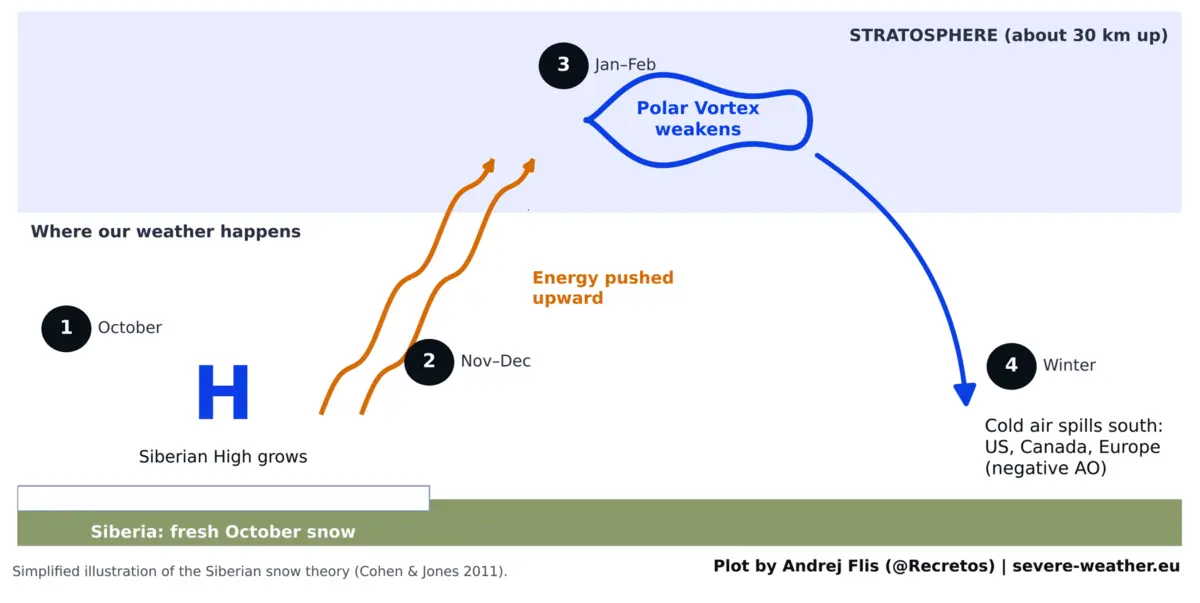
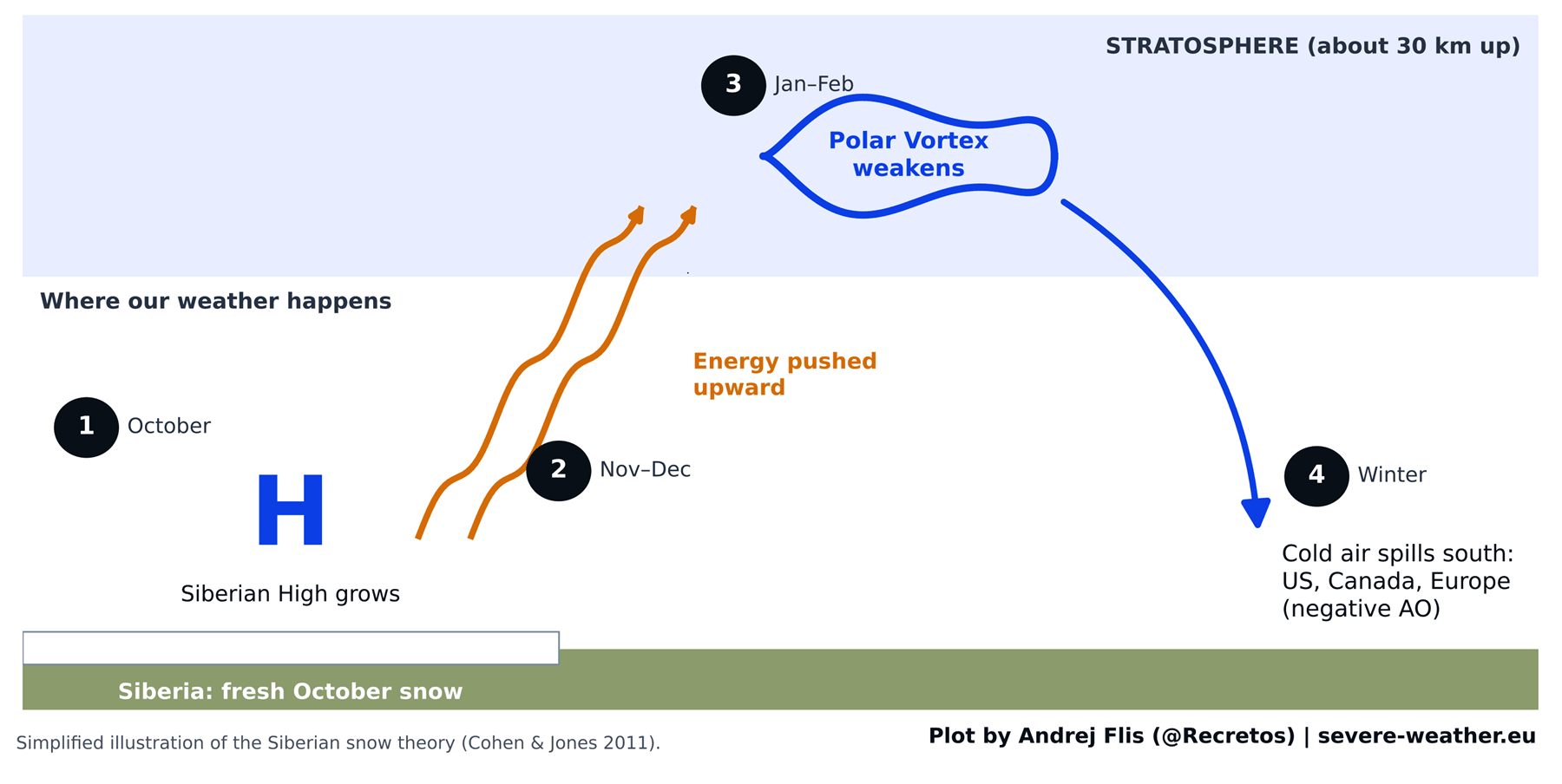
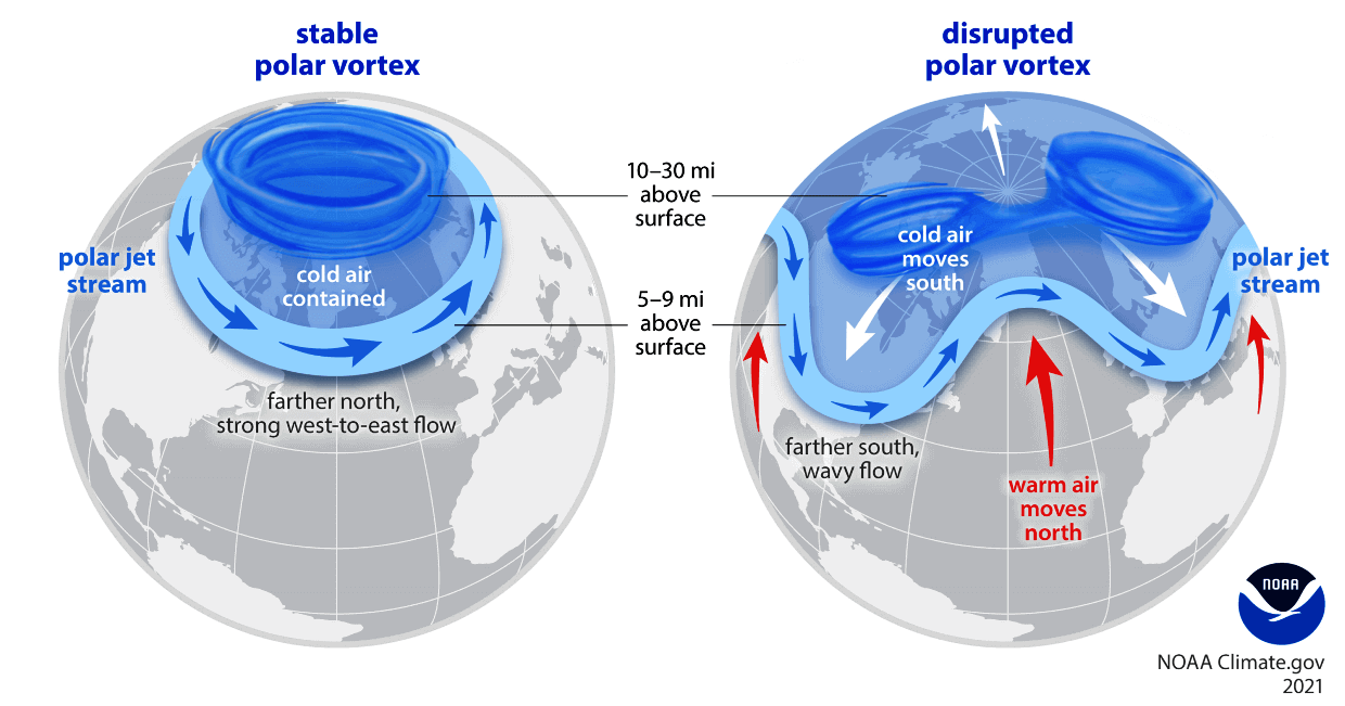
For over a decade, conventional meteorological lore has held that a swift October snow advance across Eurasia serves as a reliable early warning sign for a harsh, freezing winter across the United States, Canada, and Europe. This hypothesis traces its roots to a widely cited 2011 scientific study by researchers Judah Cohen and Justin Jones. The foundational concept was simple yet compelling: heavy early-season snow chills the soil, fortifies the Siberian High, and sends energy pulsing into the stratosphere. There, it disrupts the Polar Vortex—the massive, spinning ring of high-altitude winds that normally traps bitter Arctic air near the pole—forcing lobes of extreme cold to spill southward into the mid-latitudes.
With another aggressive Siberian snow surge forecast for October, meteorologists are increasingly questioning whether this long-cherished paradigm still holds true in the modern era. To find out, a comprehensive analysis of 47 winters of data spanning from 1979 to 2025 was conducted using four distinct snow datasets, including the exact satellite observations utilized in the original 2011 research. The results challenge decades of winter forecasting convention, offering a critical look at how atmospheric indicators evolve, fail, or get replaced by much larger global drivers like a record-breaking Super El Niño.
Chronology of a Paradigm: From Discovery to Modern Erosion
To understand how the Eurasian snow advance theory became a cornerstone of long-range winter forecasting, one must look back at the timeline of its development and subsequent empirical challenges.
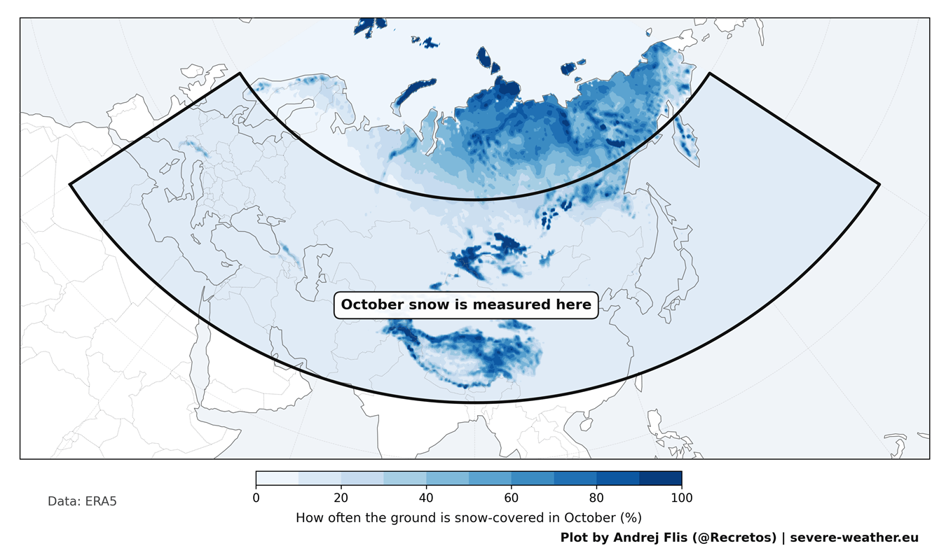
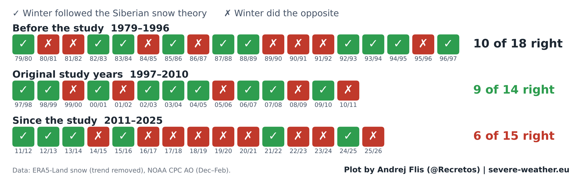
- 2011 (The Discovery): Scientists Judah Cohen and Justin Jones publish groundbreaking research linking October Eurasian snow cover extent to the winter Arctic Oscillation (AO). Utilizing daily satellite data tracking back to 1997, they establish a statistically significant correlation across 14 winters, capturing the imagination of the global meteorological community.
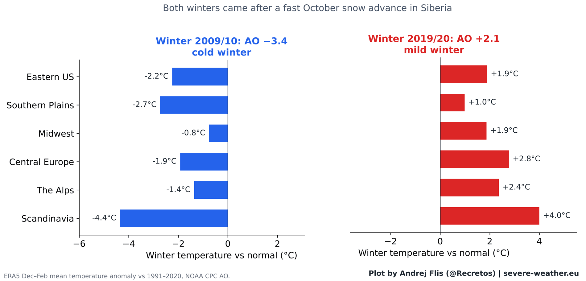
- The 2000s–Early 2010s (Peak Reliability): The theory achieves legendary status following extreme winter events, most notably the 2009/2010 season. That winter followed one of the fastest recorded October snow advances in Siberia and culminated in a heavily negative Arctic Oscillation, bringing historic snowstorms to the Eastern United States and paralyzing parts of Europe.
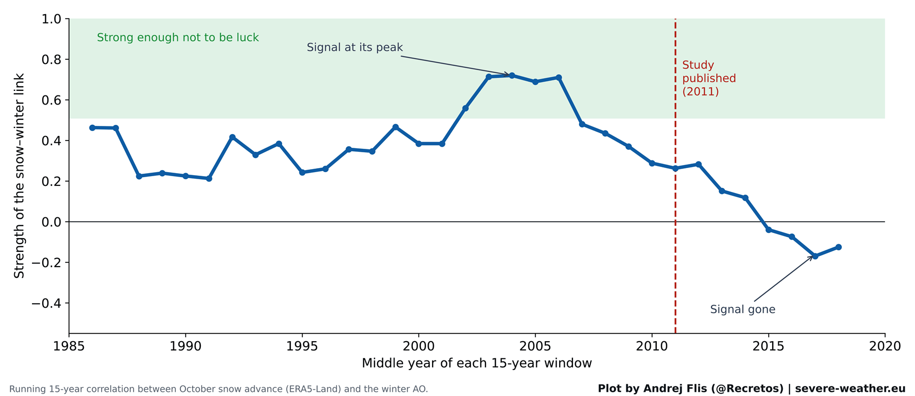
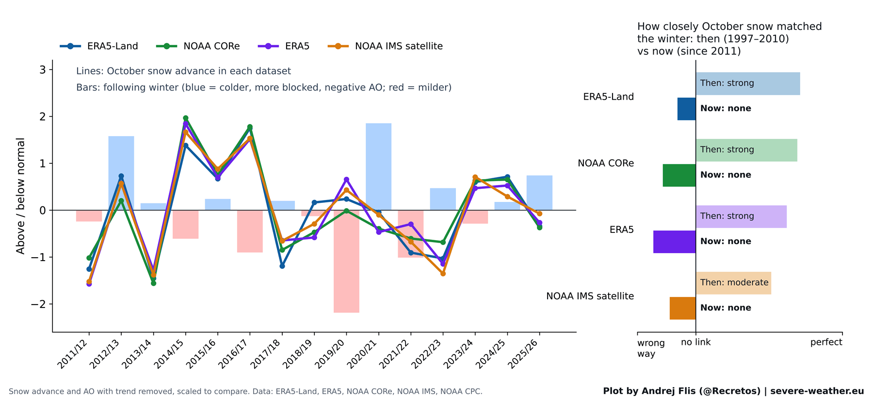
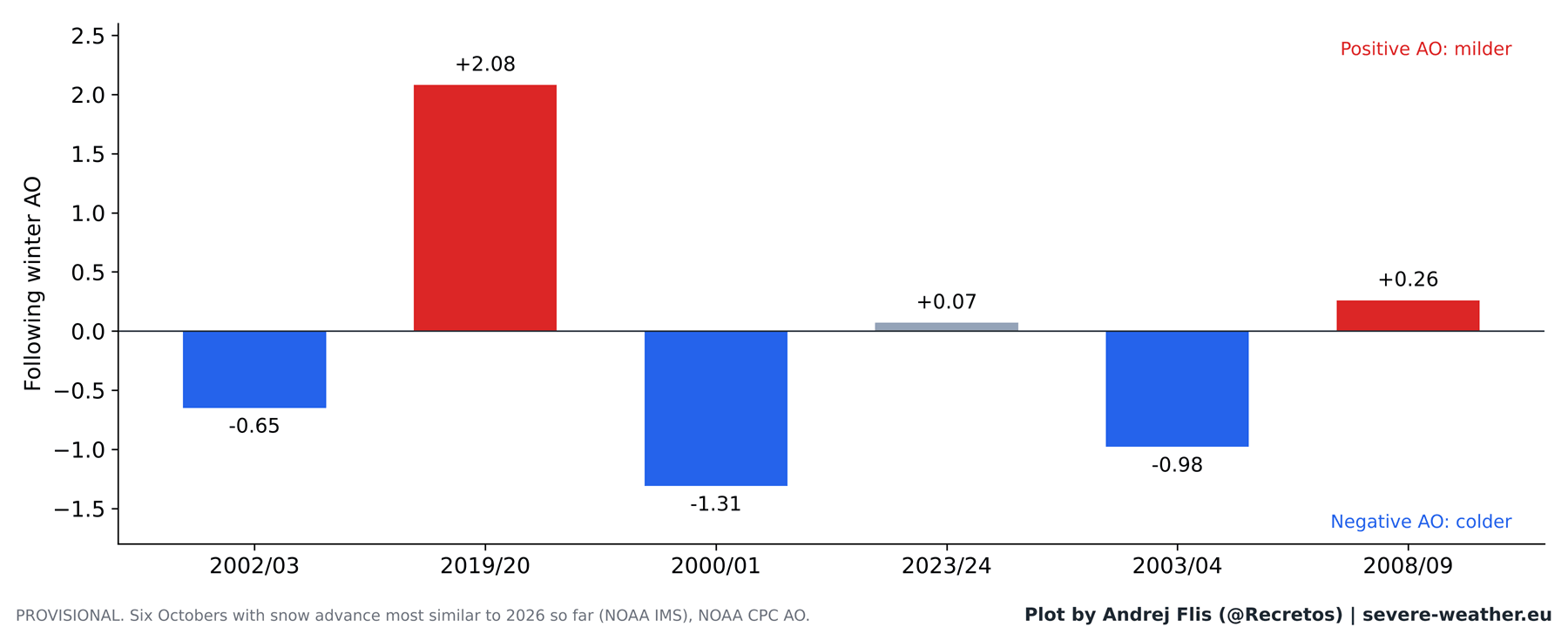
- Post-2011 (The Fading Signal): As more winters pass, the predictive power of the snow index begins to degrade. The strong linear relationship observed in the 2000s flattens out. In some years, such as the exceptionally mild and positive-AO winter of 2019/2020, rapid October snow cover fails entirely to produce the expected cold outbreak.
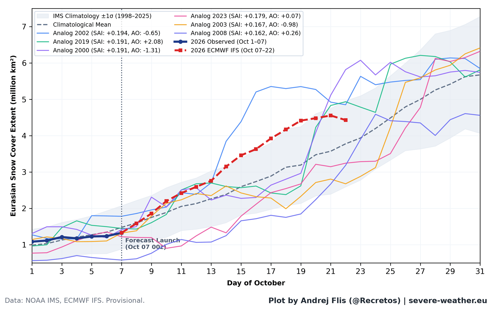
- October 2026 (The Latest Test): Current ECMWF forecasts indicate a late-month snow surge across Siberia that will place 2026 in the top 15% of historical October snow advances. However, modern analytical models suggest this autumn anomaly will play second fiddle to a dominant Super El Niño when dictating the actual character of Winter 2026/2027.
Supporting Data: What 47 Winters Reveal About the Siberian Signal
The core limitation of the original 2011 study was its sample size. Confined by the availability of daily satellite snow mapping at the time, the researchers based their conclusions on just 14 winters. To rigorously test the hypothesis, independent researchers expanded the baseline across 47 winters (1979–2025) and examined four separate datasets: ERA5 reanalysis, ERA5-Land, NOAA IMS 24 km satellite observations, and NOAA CORe datasets.
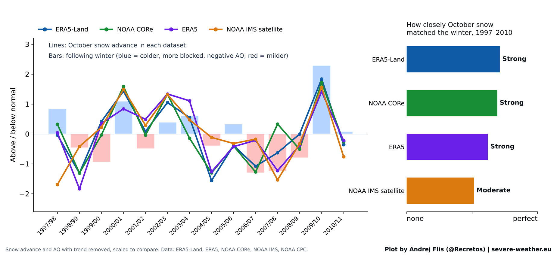
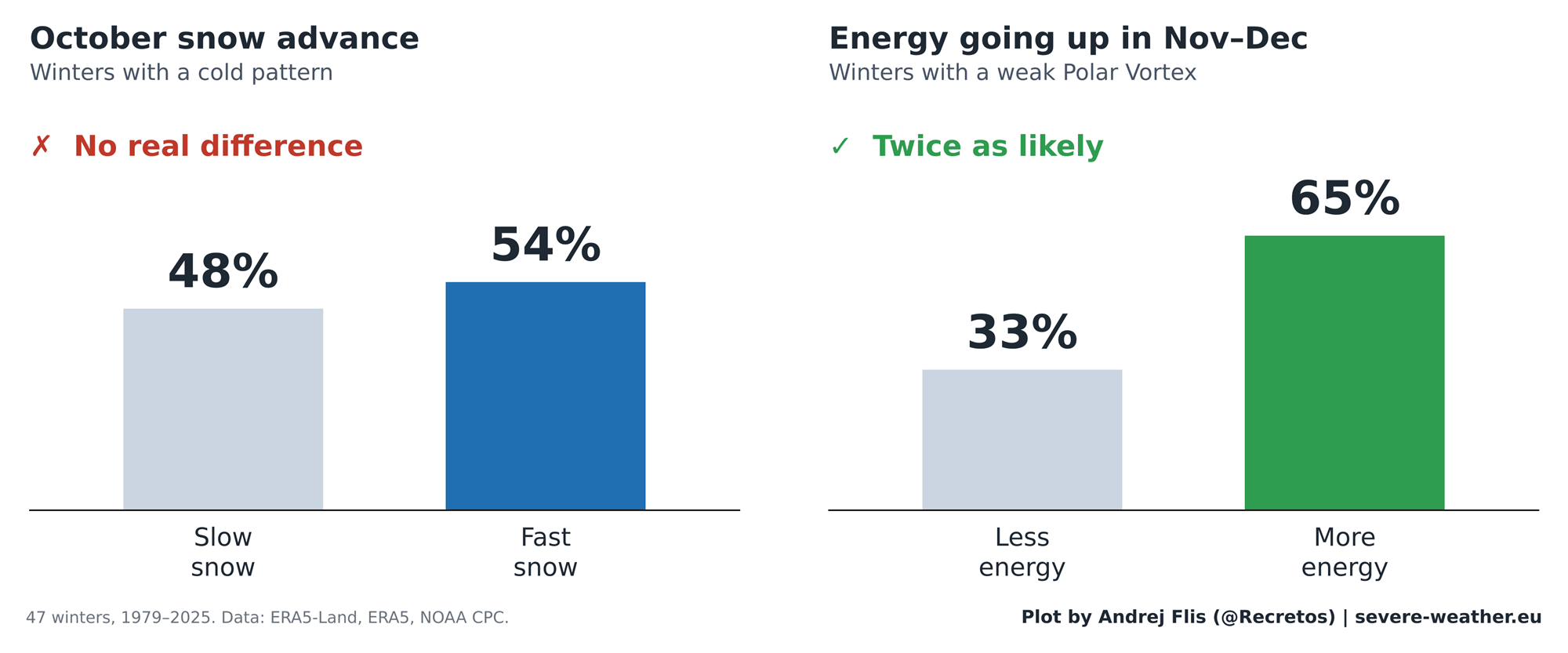
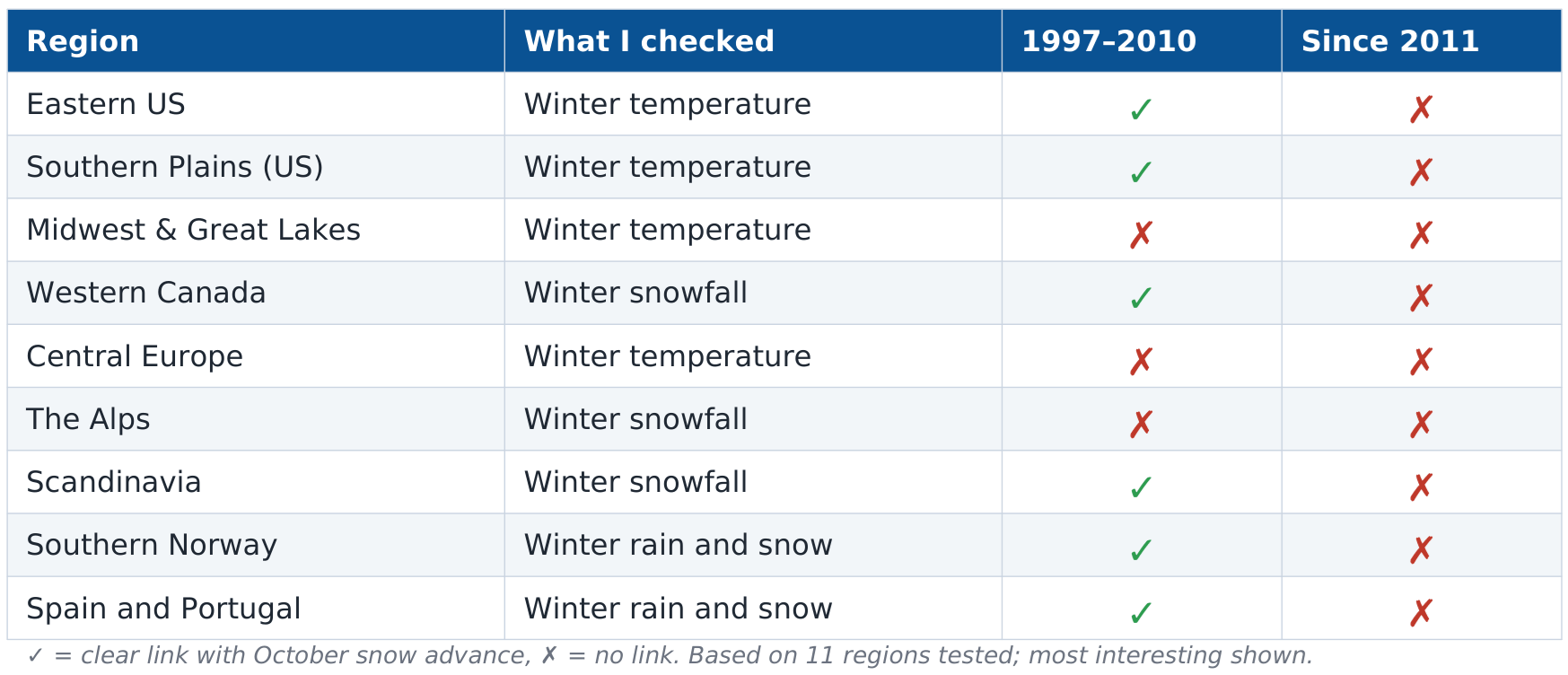
When applied to the original study period (1997–2010), all four datasets confirmed the validity of the original findings; the data was sound, and the statistical link between October snow and the winter AO was undeniable. However, when tested against the 15 winters that followed the study’s publication, the predictive signal completely vanished.
+-----------------------------------+--------------------+--------------------+
| Evaluation Period                 | Correct Predictions| Incorrect/Opposite |
+-----------------------------------+--------------------+--------------------+
| Original Study Era (1997–2010)    | 9 out of 14        | 5 out of 14        |
| Post-Study Era (2011–Present)     | 6 out of 15        | 9 out of 15        |
| Full 47-Winter Dataset (1979–2025)| 25 out of 47       | 22 out of 47       |
+-----------------------------------+--------------------+--------------------+
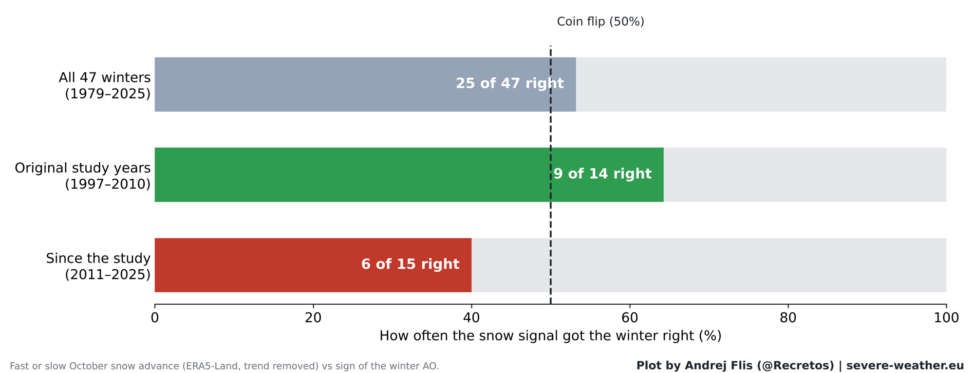
As the scorecard indicates, across nearly five decades of data, the Siberian snow signal achieved a success rate of 25 out of 47 winters—virtually indistinguishable from a random coin flip. In the years since 2011, it scored correctly only 6 out of 15 times, performing worse than random chance.
Breaking Down the Chain Reaction
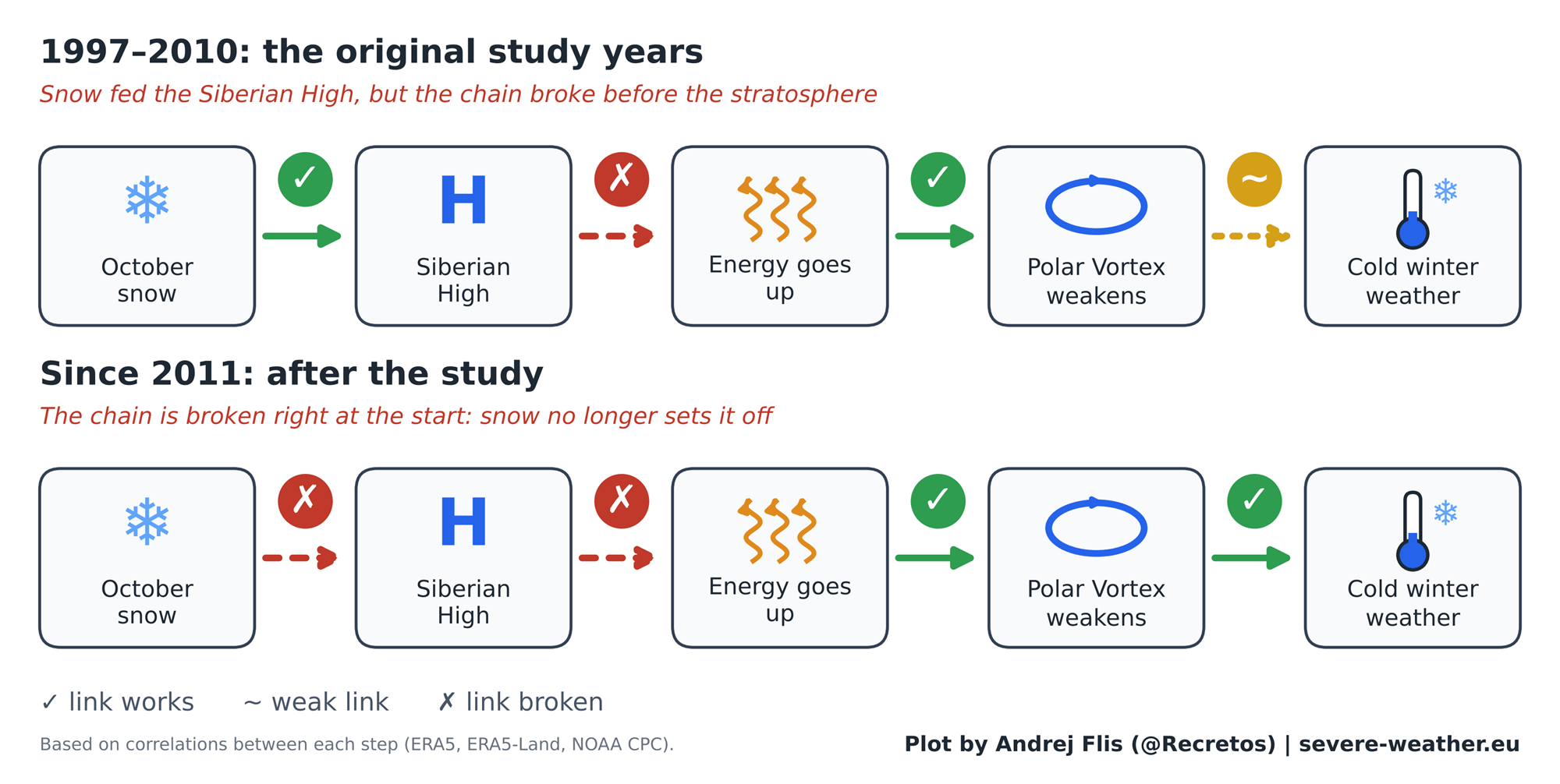
The physical mechanism proposed in 2011 relied on a step-by-step chain reaction:
- Rapid October snow advances across Siberia.
- The Siberian High-pressure system strengthens at the surface.
- Upward wave energy propagates into the stratosphere during November and December.
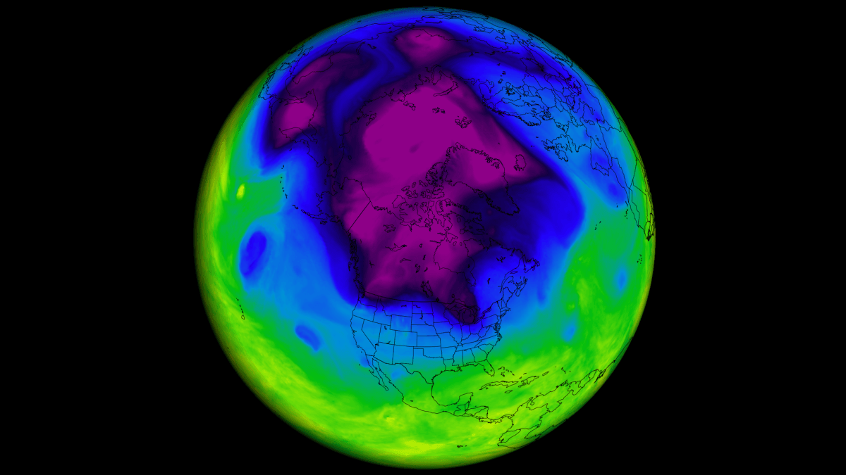
- The stratospheric Polar Vortex weakens or collapses in January and February.
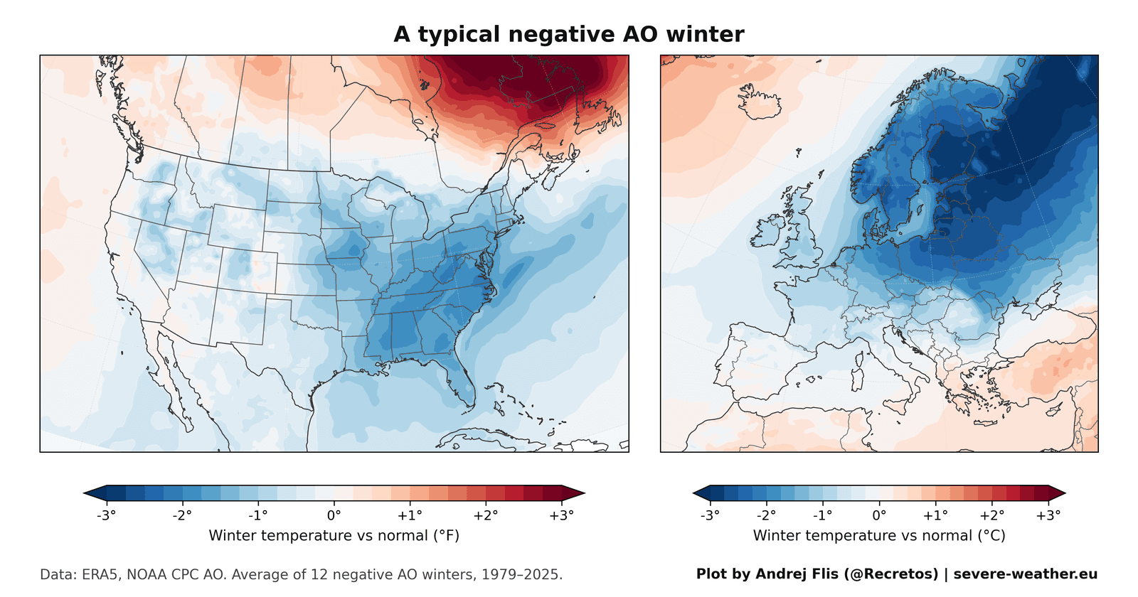
- Negative Arctic Oscillation (AO) phases drive cold outbreaks into North America and Europe.
A step-by-step audit of this chain reveals where the process breaks down. While the latter half of the chain remains physically robust—when sufficient energy flows into the stratosphere in November and December, the Polar Vortex does consistently weaken—the initial link between October Siberian snow and that upward energy transfer has eroded. Siberian snow no longer reliably commands the stratospheric response it once did.
Official Responses and Perspectives from the Meteorological Community
Professional climatologists and long-range forecasting centers have increasingly shifted away from treating single-factor autumn indicators as holy grails. While organizations like NOAA and the European Centre for Medium-Range Weather Forecasts (ECMWF) continue to monitor Eurasian snow cover as part of a holistic suite of boundary conditions, institutional consensus emphasizes multi-variable teleconnections.
Recent research published in late 2026 by prominent atmospheric scientists—including Songmiao Fan and Judah Cohen—acknowledges that while general snow-cover anomalies may still subtly bias the Polar Vortex toward "stretched" configurations rather than direct disruptions, the simplistic linear indexing of October snow extent has been heavily confounded by external climate pressures.
Furthermore, data anomalies uncovered within major reanalysis products have urged caution among researchers. For instance, the standard ERA5 dataset features an artificial 40% drop in Eurasian snow cover in 2004 due to the integration of early satellite mapping products over Siberian lowlands. While auxiliary checks against NOAA CORe and satellite observations proved that this data glitch did not invalidate overall climatological trends, it underscored the necessity of cross-referencing multiple observational platforms before drawing sweeping conclusions about climate feedbacks.
Implications for Winter 2026/2027: Enter the Super El Niño
With October 2026 tracking toward a significant late-month snow surge across Siberia, winter weather enthusiasts might naturally brace for an impending freeze. However, modern seasonal forecasts dictate a much more nuanced reality.
The Dominance of Pacific Teleconnections
While the Siberian snow index offers little clarity for Winter 2026/2027, the Pacific Ocean is dictating a much more powerful narrative. An ongoing, record-breaking Super El Niño is currently active, reshaping global sea surface temperature anomalies and steering the jet stream in ways that dwarf the localized influence of Asian snow cover.
Model simulations from ECMWF examining stratospheric winds at the 10mb level reveal a pronounced deceleration of the Polar Vortex heading into January and February 2027. Unlike the unreliable snow-to-stratosphere pathway, a strong El Niño is historically proven to induce significant stratospheric warming and deceleration in the second half of winter.
Regional Weather Outlooks
Because a weakened Polar Vortex behaves differently depending on background oceanic forcing, the anticipated impacts for Winter 2026/2027 favor specific regional anomalies:
- United States: The ECMWF temperature outlook points toward a classic Super El Niño signature. Persistent cloud cover, active storm tracks, and an amplified southern jet stream are projected to keep the central, southern, and eastern United States cooler than normal due to enhanced precipitation and anchored cloud cover. Conversely, northern sectors and parts of southern Canada lean milder.
- Europe: Current medium-to-late-winter projections suggest a predominantly mild westerly flow across much of continental Europe, with true cold anomalies largely restricted to extreme northern regions such as Scandinavia. Unlike North America, Europe’s current forecast does not yet reflect a direct surface cooling response to the anticipated stratospheric disruptions.
Conclusion
The era of relying on a single October snow index to forecast the entire winter season has officially passed. While the physical mechanics of the stratosphere remain critical to predicting mid-winter cold snaps, forecasters looking toward Winter 2026/2027 must look past the snowdrifts of Siberia and focus instead on the titanic atmospheric signals being driven by the Pacific’s Super El Niño and the evolving dynamics of the Polar Vortex.
